Signs Tagged With Big Green Sign
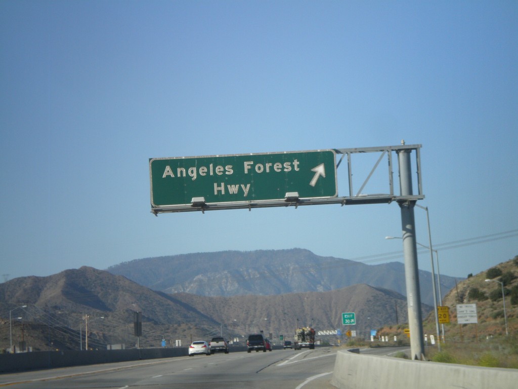
CA-14 South - Exit 30
CA-14 south at Exit 30 - Angeles Forest Highway.
Taken 05-05-2012
 Vincent
Los Angeles County
California
United States
Vincent
Los Angeles County
California
United States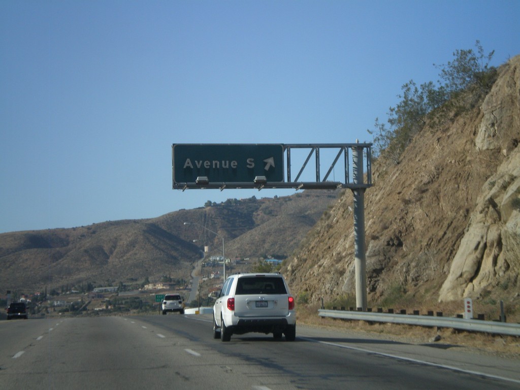
CA-14 South - Exit 33
CA-14 south at Exit 33 - Avenue S.
Taken 05-05-2012
Palmdale
Los Angeles County
California
United States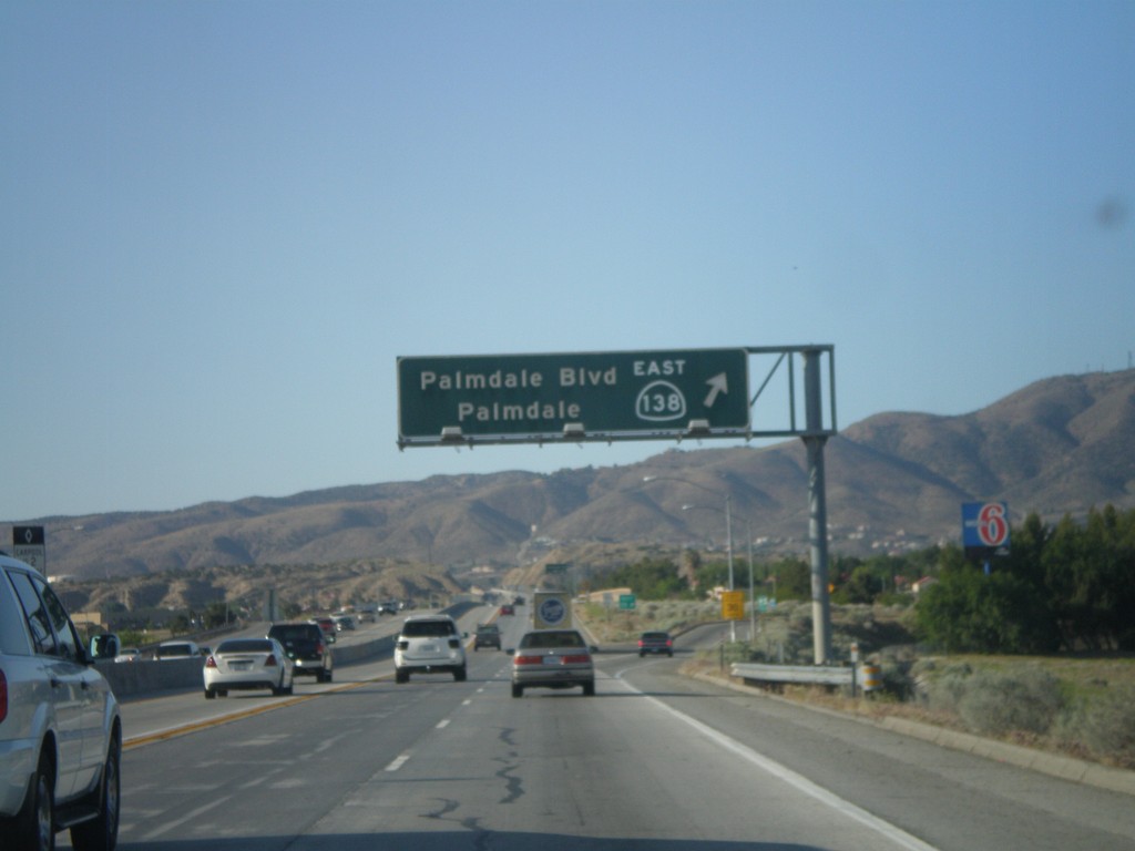
CA-14 South/CA-138 East - Exit 35
CA-14 South/CA-138 East at Exit 35 - CA-138 East/Palmdale/Palmdale Blvd. CA-138 west joins CA-14 north through Lancaster. South of this junction, CA-14 is known as the Antelope Valley Freeway. North of this junction CA-14 is known as the Aerospace Highway.
Taken 05-05-2012
 Palmdale
Los Angeles County
California
United States
Palmdale
Los Angeles County
California
United States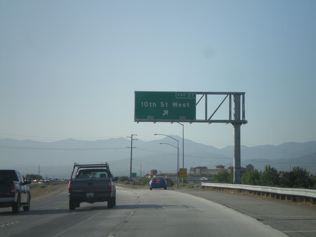
CA-14 South/CA-138 East - Exit 37
CA-14 South/CA-138 East at Exit 37 - 10th St. West.
Taken 05-05-2012
Palmdale
Los Angeles County
California
United States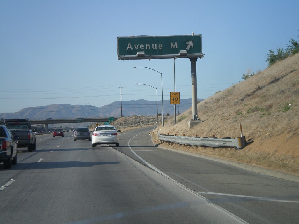
CA-14 South/CA-138 East - Exit 40
CA-14 South/CA-138 East at Exit 40 - Avenue M.
Taken 05-05-2012
Lancaster
Los Angeles County
California
United States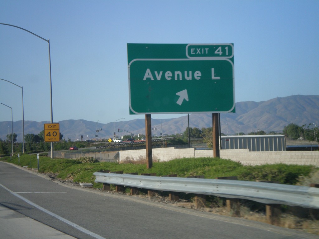
CA-14 South/CA-138 East - Exit 41
CA-14 South/CA-138 East at Exit 41 - Avenue L.
Taken 05-05-2012
Lancaster
Los Angeles County
California
United States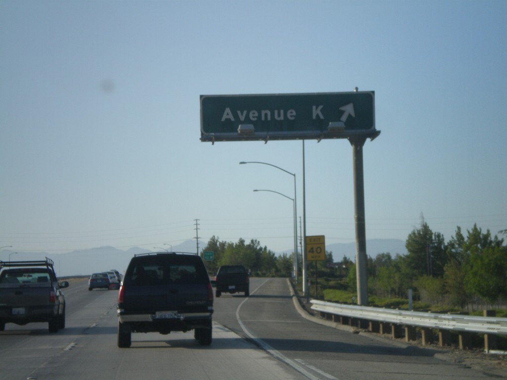
CA-14 South/CA-138 East - Exit 42
CA-14 South/CA-138 East at Exit 42 - Avenue K.
Taken 05-05-2012
Lancaster
Los Angeles County
California
United States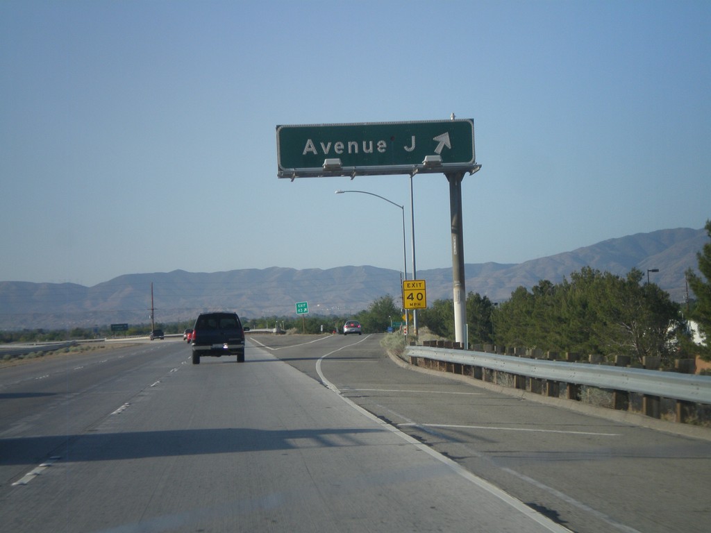
CA-14 South/CA-138 East - Exit 43
CA-14 South/CA-138 East at Exit 43 - Avenue J.
Taken 05-05-2012
Lancaster
Los Angeles County
California
United States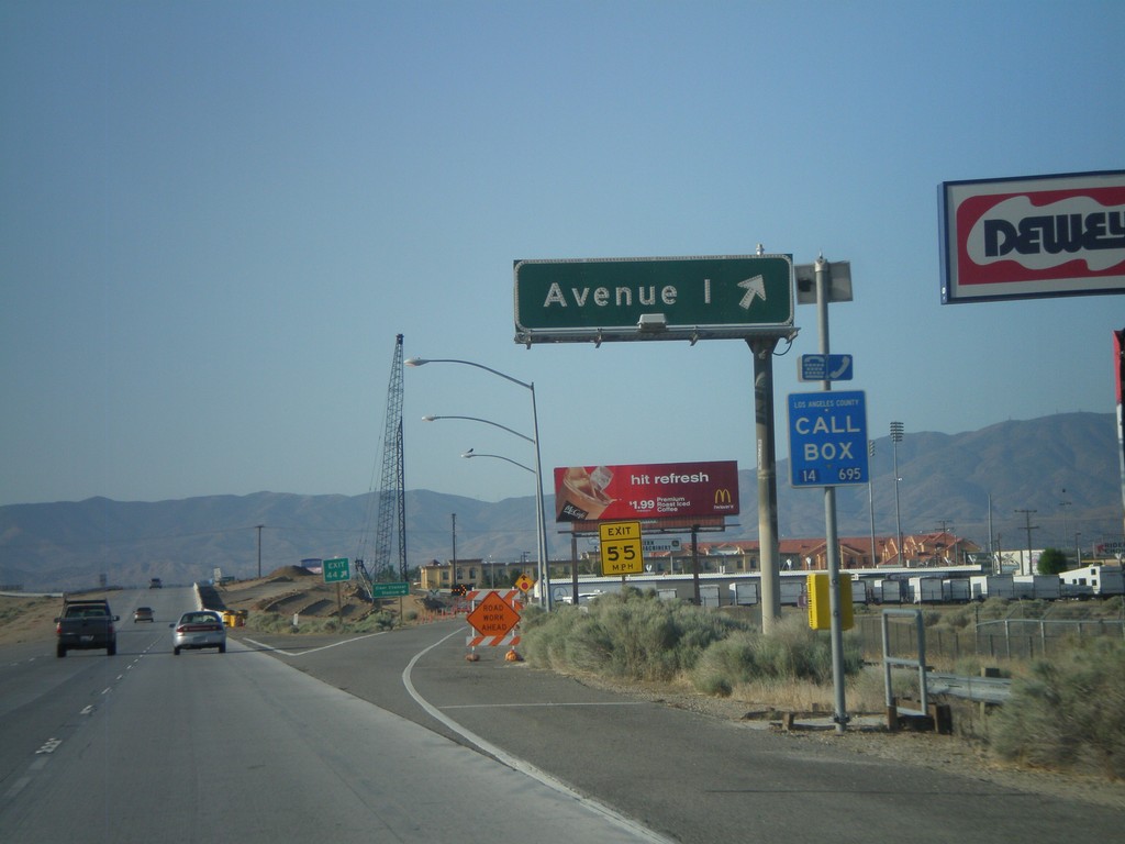
CA-14 South/CA-138 East - Exit 44
CA-14 South/CA-138 East at Exit 44 - Avenue I.
Taken 05-05-2012
Lancaster
Los Angeles County
California
United States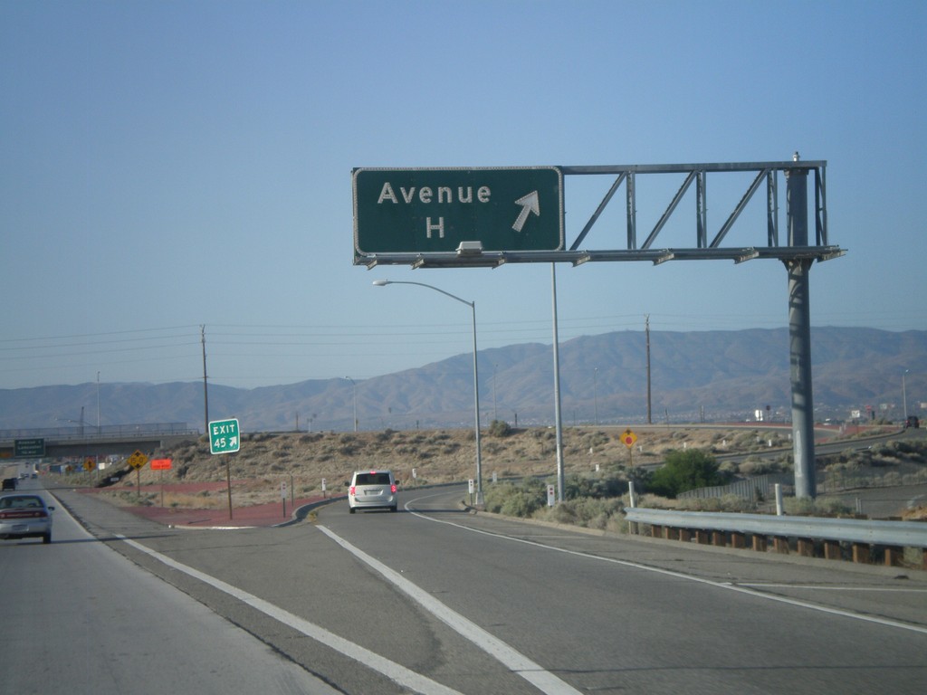
CA-14 South/CA-138 East - Exit 45
CA-14 South/CA-138 East at Exit 45 - Avenue H.
Taken 05-05-2012
Lancaster
Los Angeles County
California
United States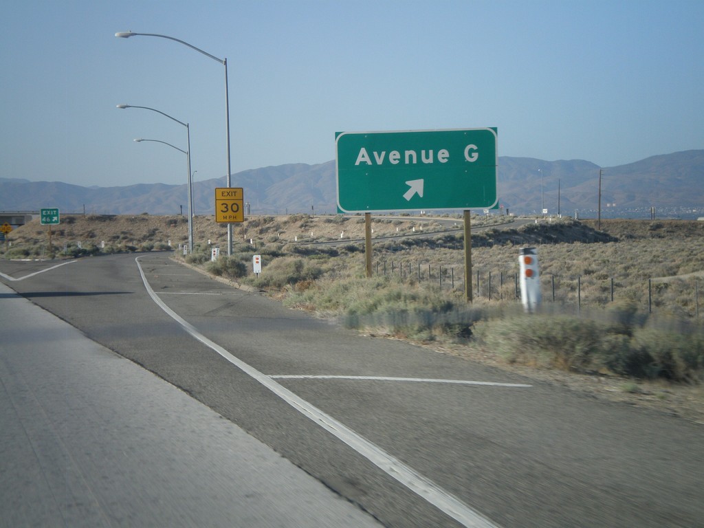
CA-14 South/CA-138 East - Exit 46
CA-14 South/CA-138 East at Exit 46 - Avenue G.
Taken 05-05-2012
Lancaster
Los Angeles County
California
United States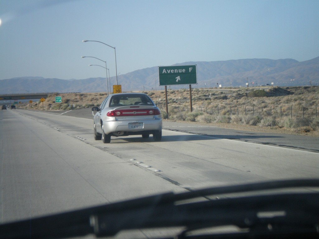
CA-14 South/CA-138 East - Exit 47
CA-14 South/CA-138 East at Exit 47 - Avenue F.
Taken 05-05-2012
Lancaster
Los Angeles County
California
United States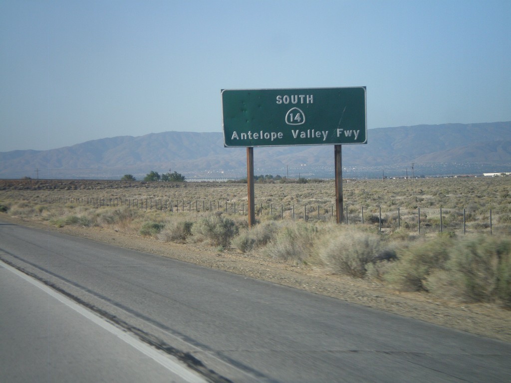
CA-14 South - Antelope Valley Freeway
CA-14 South (and CA-138 East) - Antelope Valley Freeway.
Taken 05-05-2012
Lancaster
Los Angeles County
California
United States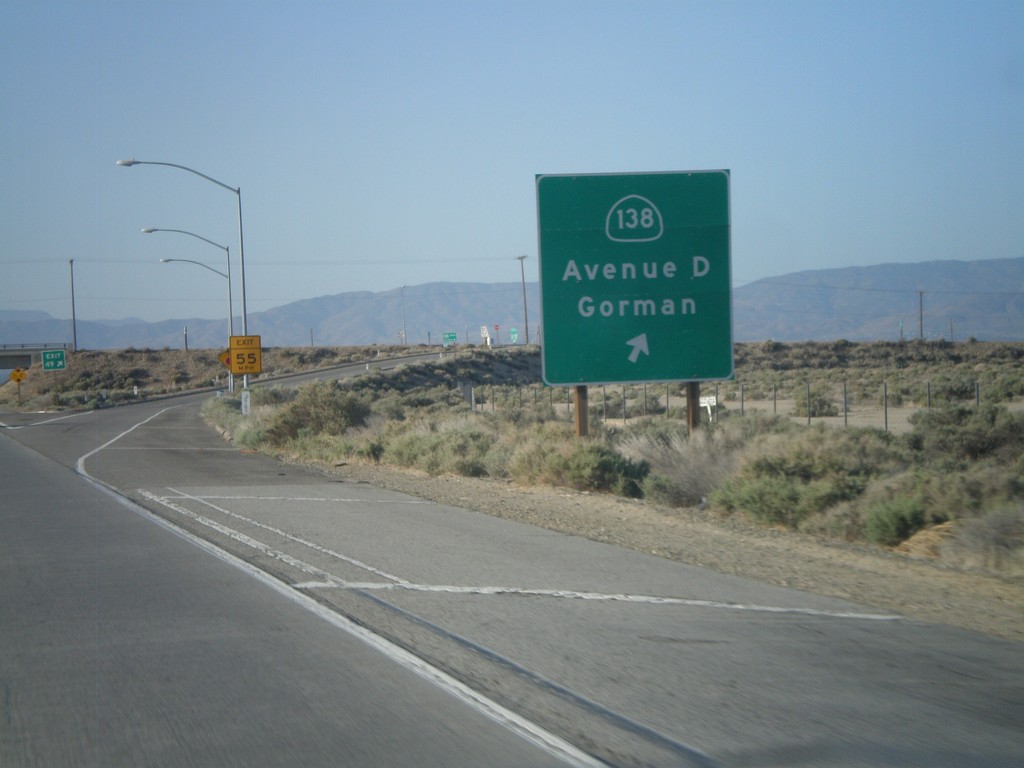
CA-14 South - Exit 49
CA-14 south at Exit 49 - CA-138 West/Avenue D/Gorman. CA-138 east joins CA-14 south to Palmdale.
Taken 05-05-2012
Lancaster
Los Angeles County
California
United States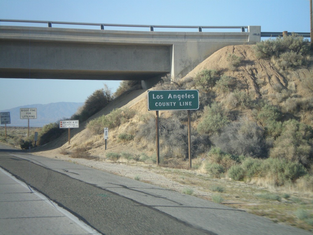
CA-14 South - Los Angeles County Line
Los Angeles County Line on CA-14 south. Los Angeles County is the most populous county in the United States according to the 2010 US Census.
Taken 05-05-2012
Rosamond
Los Angeles County
California
United States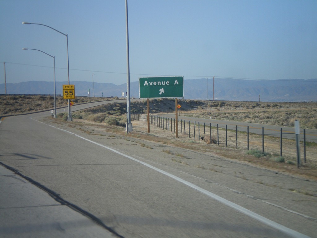
CA-14 South - Exit 52
CA-14 south at Exit 52 - Avenue A. Avenue A runs along the county line between Kern and Los Angeles counties.
Taken 05-05-2012
Rosamond
Kern County
California
United States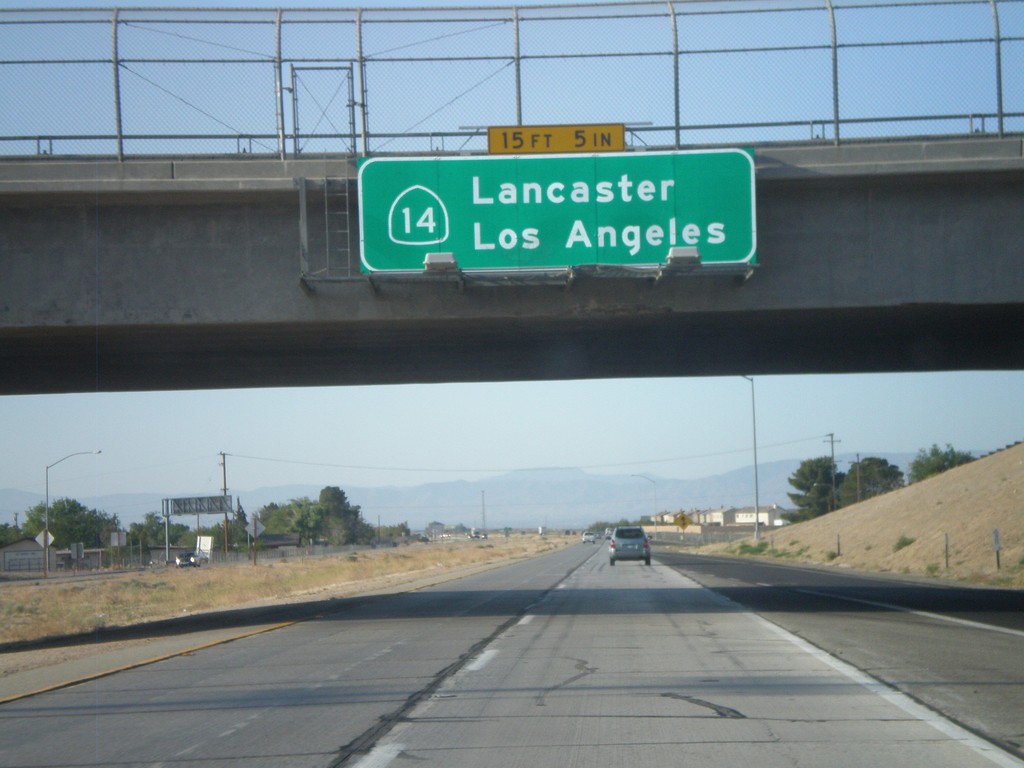
CA-14 South - Lancaster/Los Angeles
CA-14 south to Lancaster and Los Angeles. Posted on the Rosamond Blvd. interchange.
Taken 05-05-2012
Rosamond
Kern County
California
United States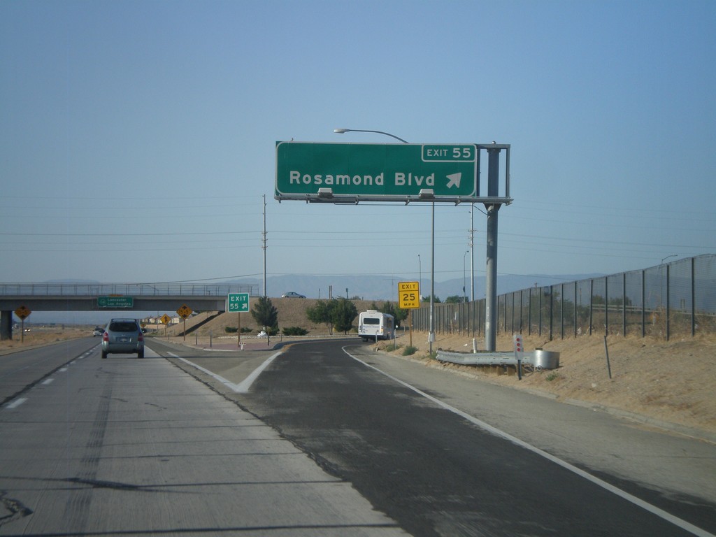
CA-14 South - Exit 55
CA-14 south at Exit 55 - Rosamond Blvd.
Taken 05-05-2012
Rosamond
Kern County
California
United States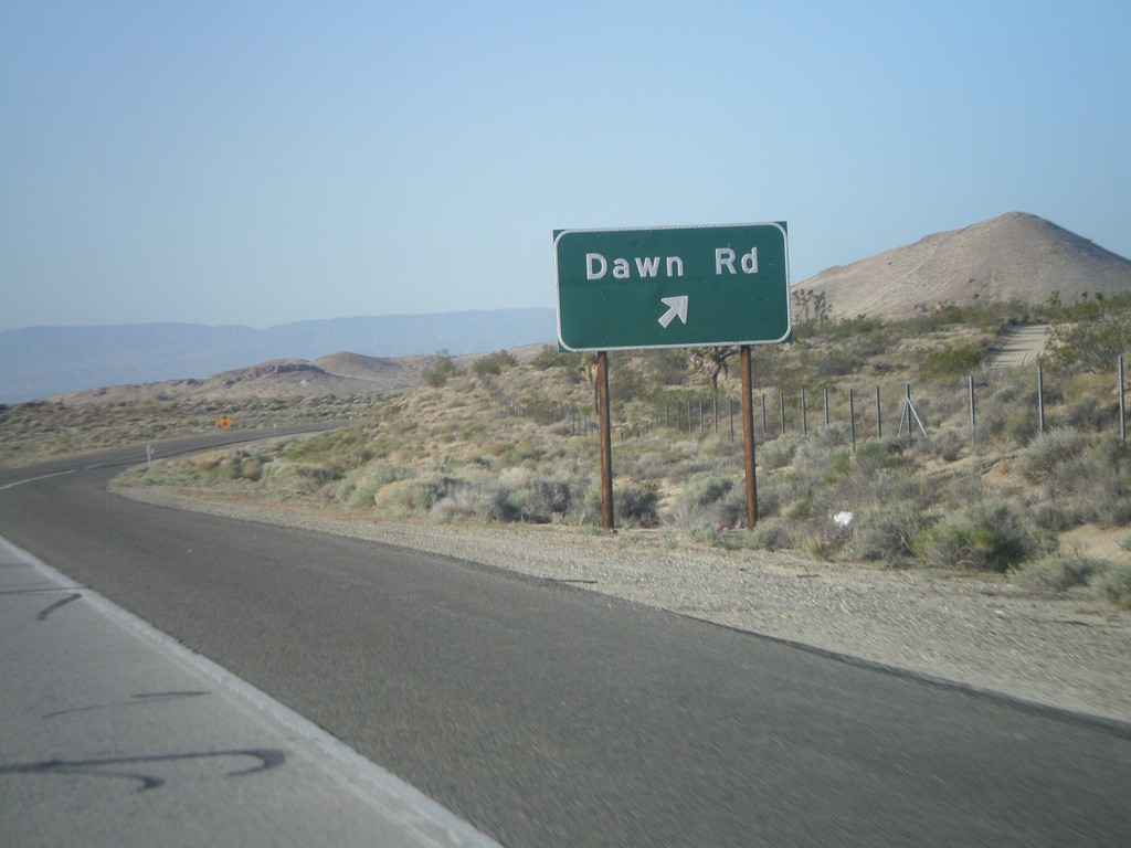
CA-14 South - Exit 58
CA-14 south at Exit 58 - Dawn Road.
Taken 05-05-2012
Mojave
Kern County
California
United States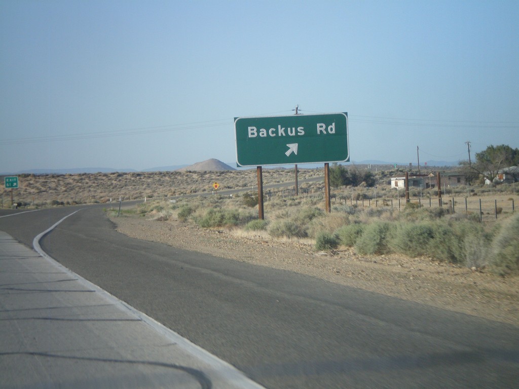
CA-14 South - Exit 61
CA-14 south at Exit 61 - Backus Road.
Taken 05-05-2012
Mojave
Kern County
California
United States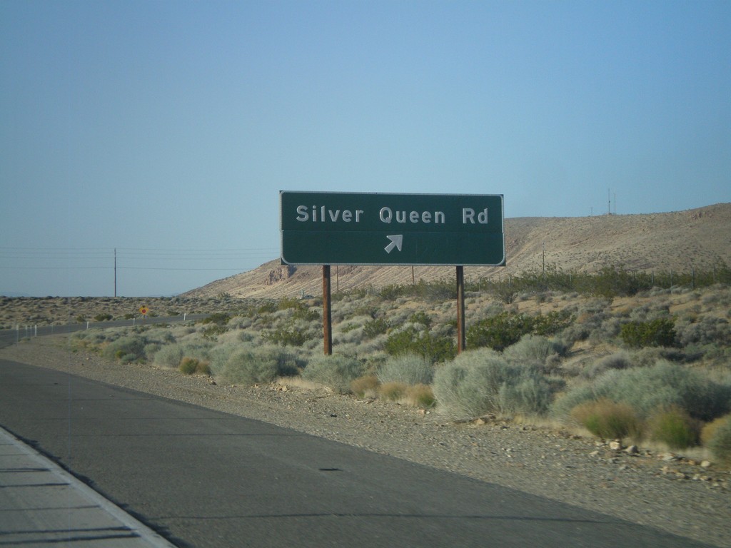
CA-14 South - Exit 64
CA-14 south at Exit 64 - Silver Queen Road. This is the first interchange on the CA-14 freeway south of Mojave.
Taken 05-05-2012
Mojave
Kern County
California
United States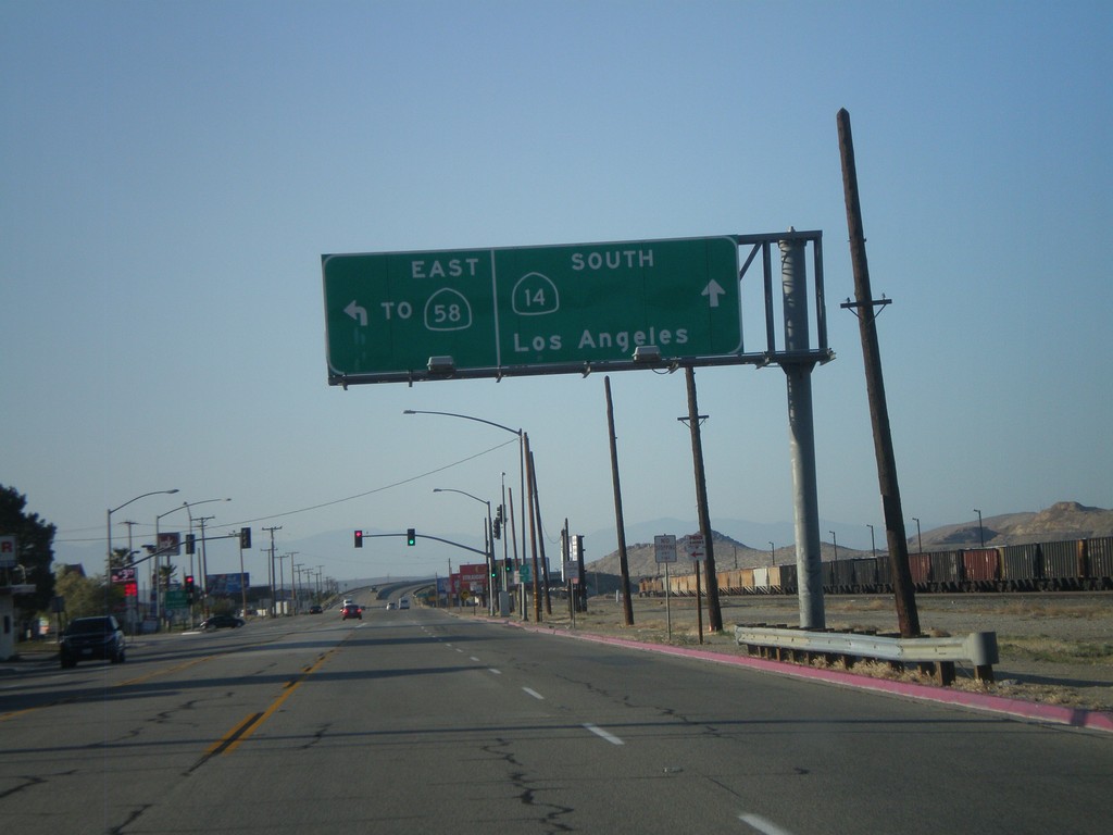
CA-14 South/Bus. CA-58 East at Split
CA-14 South/Bus. CA-58 East at split on south side of Mojave. Turn left for Bus. CA-58 East To CA-58. Continue ahead for CA-14 south to Los Angeles.
Taken 05-05-2012

 Mojave
Kern County
California
United States
Mojave
Kern County
California
United States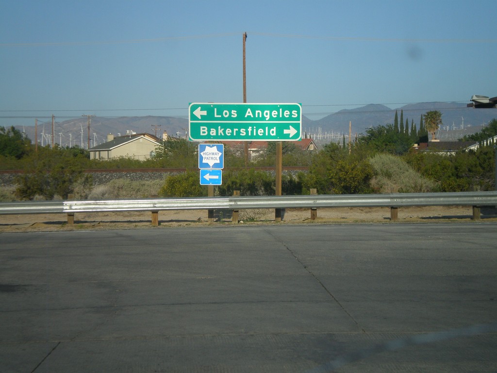
CA-14 South at Bus. CA-58
CA-14 south at Bus. CA-58 in Mojave. Turn right for Bus. CA-58 west towards Bakersfield. Turn left to continue south on CA-14 and Bus. CA-58 east towards Los Angeles.
Taken 05-05-2012
Mojave
Kern County
California
United States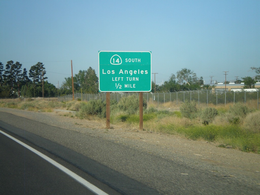
CA-14 South Approaching Bus. CA-58
CA-14 South approaching Bus. CA-58. To continue south on CA-14 towards Los Angeles, turn left at intersection.
Taken 05-05-2012
Mojave
Kern County
California
United States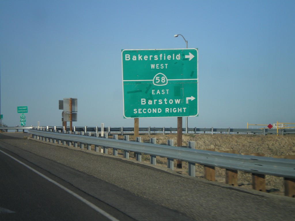
CA-14 South at CA-58
CA-14 south at CA-58. Turn right for CA-58 west to Bakersfield. Continue over overpass and take second right for CA-58 east to Barstow.
Taken 05-05-2012
California City
Kern County
California
United States