Signs Tagged With Big Green Sign
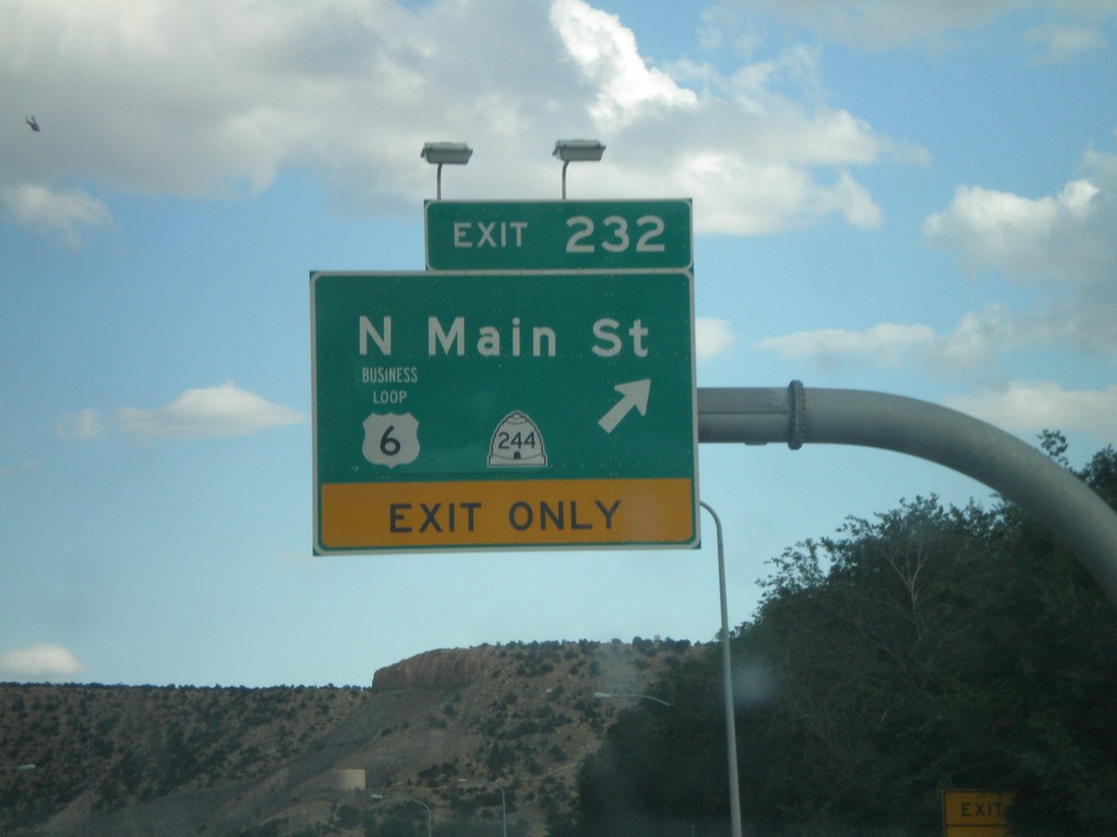
US-6 East/US-191 South - Exit 232
US-6 East/US-191 South at Exit 232 - Business US-6/UT-244/N. Main St. This is the western end of the Helper business loop.
Taken 10-01-2011


 Helper
Carbon County
Utah
United States
Helper
Carbon County
Utah
United States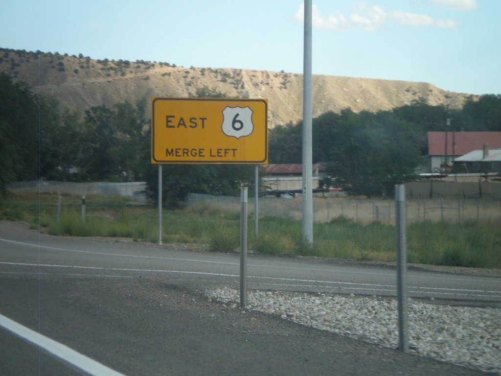
Merge Left For US-6 East
Merge left for US-6 east on US-6 East/US-191 South in Helper. The right lane becomes an exit only lane for Exit 232.
Taken 10-01-2011
Helper
Carbon County
Utah
United States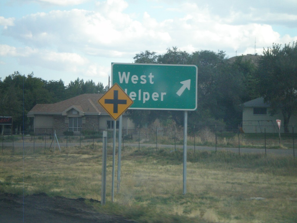
US-6 East/US-191 South - West Helper
US-6 East/US-191 South at West Helper Interchange.
Taken 10-01-2011
Helper
Carbon County
Utah
United States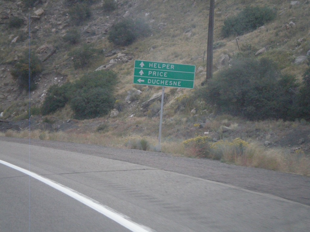
US-6 East at US-191
US-6 East at US-191 junction. Turn left for US-191 north to Duchesne. Continue ahead for US-6 East/US-191 South towards Helper and Price. US-191 joins US-6 east to the junction with I-70 near Green River. Thence from there US-191 follows I-70 and US-6 east to Crescent Junction.
Taken 10-01-2011
Helper
Carbon County
Utah
United States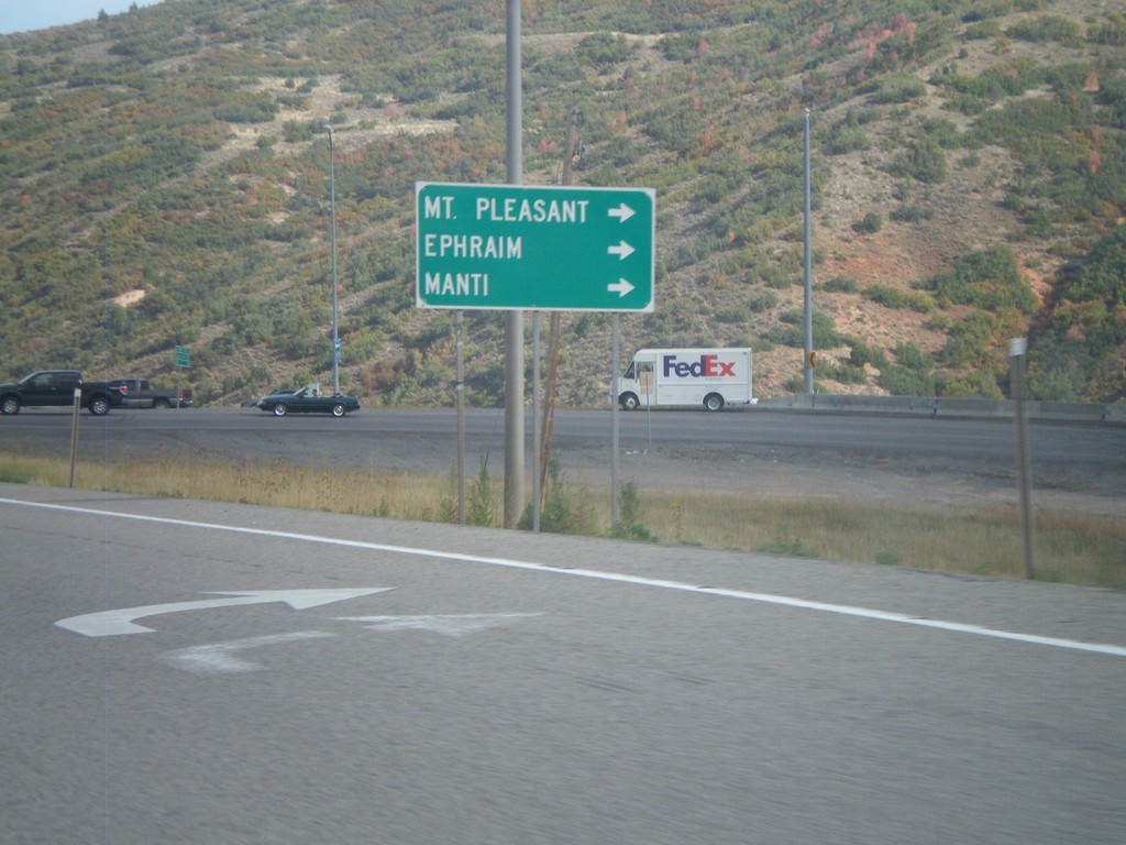
US-6 East/US-89 South at US-89 South
US-6 East/US-89 South at US-89 South split. Turn right for US-89 south to Mt Pleasant, Ephriam, and Manti.
Taken 10-01-2011
 Spanish Fork
Utah County
Utah
United States
Spanish Fork
Utah County
Utah
United States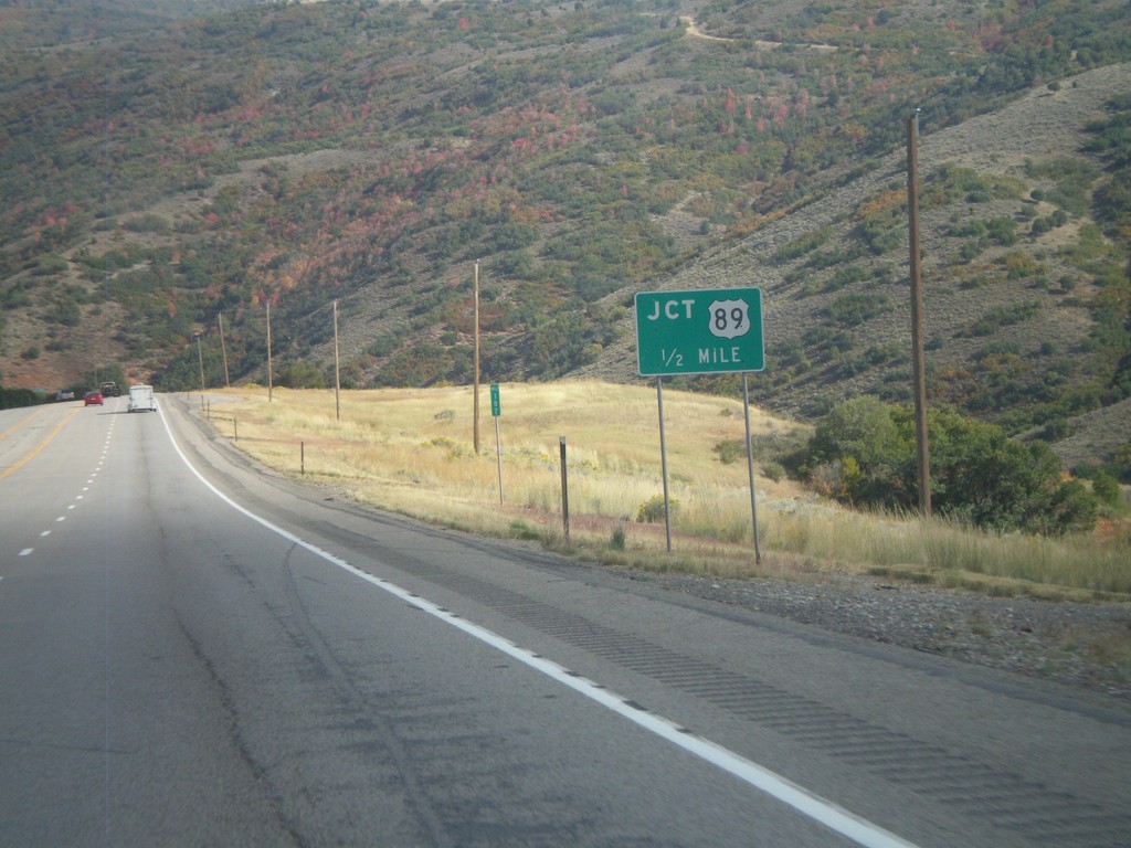
US-6 East/US-89 South Approaching Split
US-6 East/US-89 South Approaching US-6/US-89 split in Utah County.
Taken 10-01-2011
Spanish Fork
Utah County
Utah
United States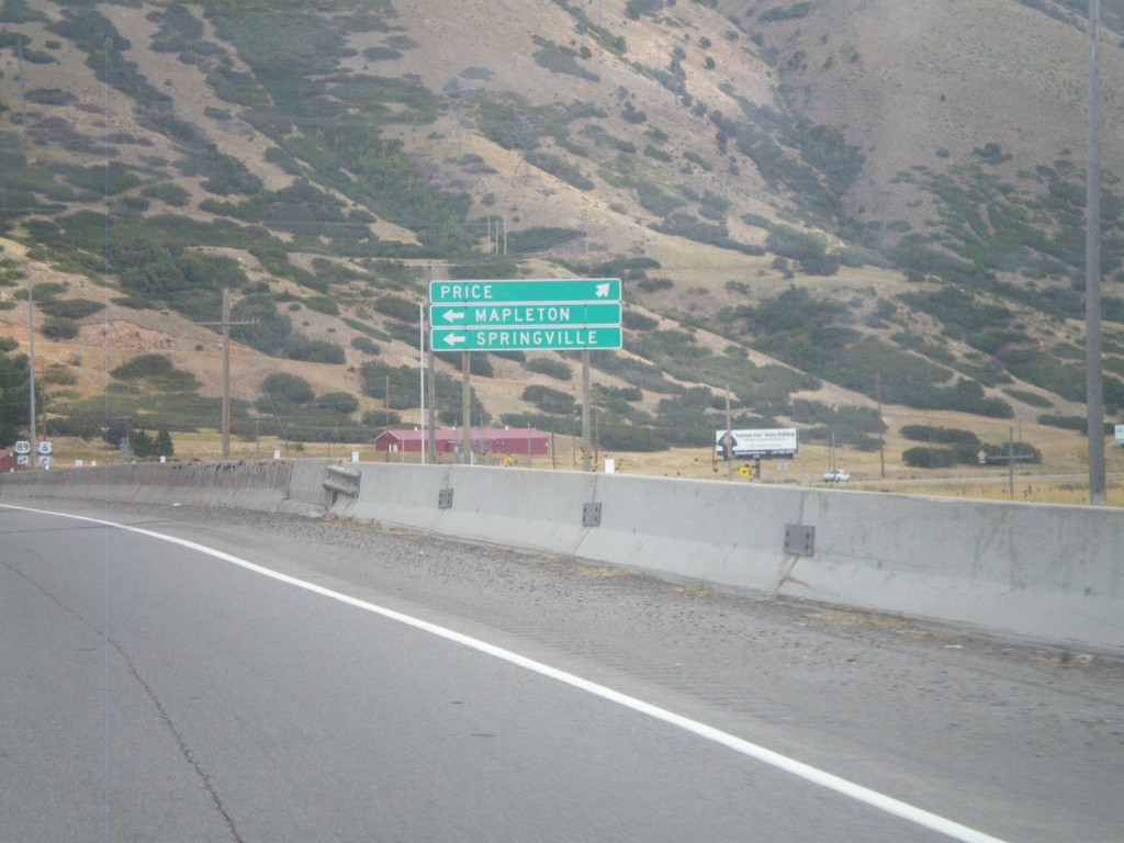
US-6 East Approaching US-89
US-6 East approaching US-89. Use US-89 north for Mapleton and Springville. Continue ahead on US-6 east/US-89 south for Price.
Taken 10-01-2011
Spanish Fork
Utah County
Utah
United States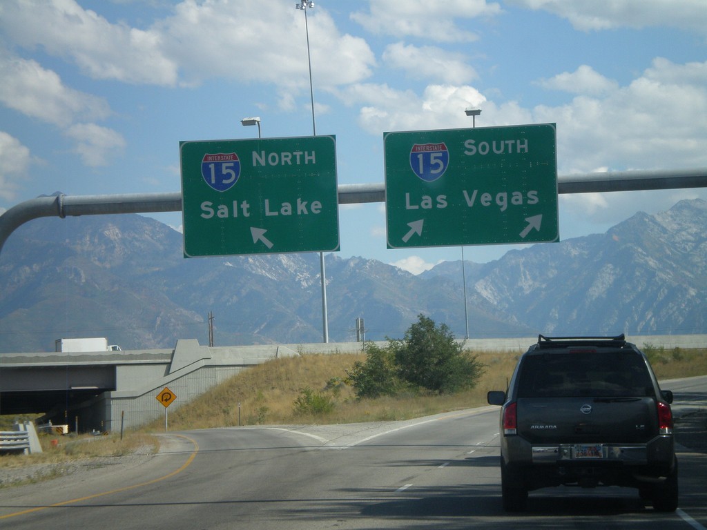
I-215 South at I-15 Split
I-215 south at I-15. Use right lane for I-15 South/Las Vegas; left lane for I-15 North/Salt Lake.
Taken 10-01-2011

 Murray
Salt Lake County
Utah
United States
Murray
Salt Lake County
Utah
United States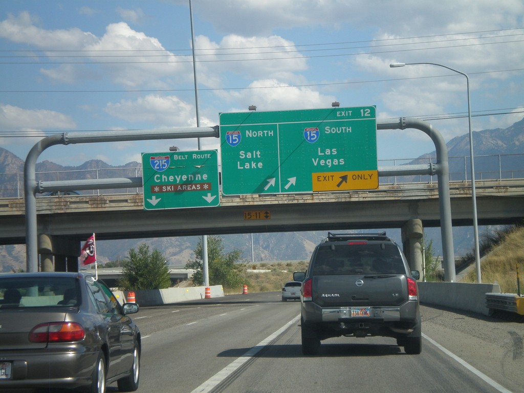
I-215 South - Exit 12
I-215 south at Exit 12 - I-15 North/Salt Lake; I-15 South/Las Vegas. Continue on the I-215 Belt Route for Cheyenne (Wyoming) and Ski Areas.
Taken 10-01-2011
Murray
Salt Lake County
Utah
United States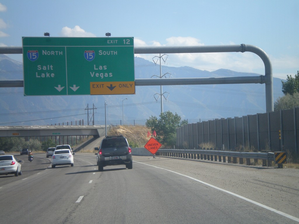
I-215 South - Exit 12
I-215 South approaching Exit 12 - I-15 South/Las Vegas;I-15 North/Salt Lake.
Taken 10-01-2011
Murray
Salt Lake County
Utah
United States
UT-68 South (Redwood Road) at I-215 East
UT-68 South (Redwood Road) at I-215 east onramp in Taylorsville. This is the southern intersection of I-215 with UT-68.
Taken 10-01-2011
 Taylorsville
Salt Lake County
Utah
United States
Taylorsville
Salt Lake County
Utah
United States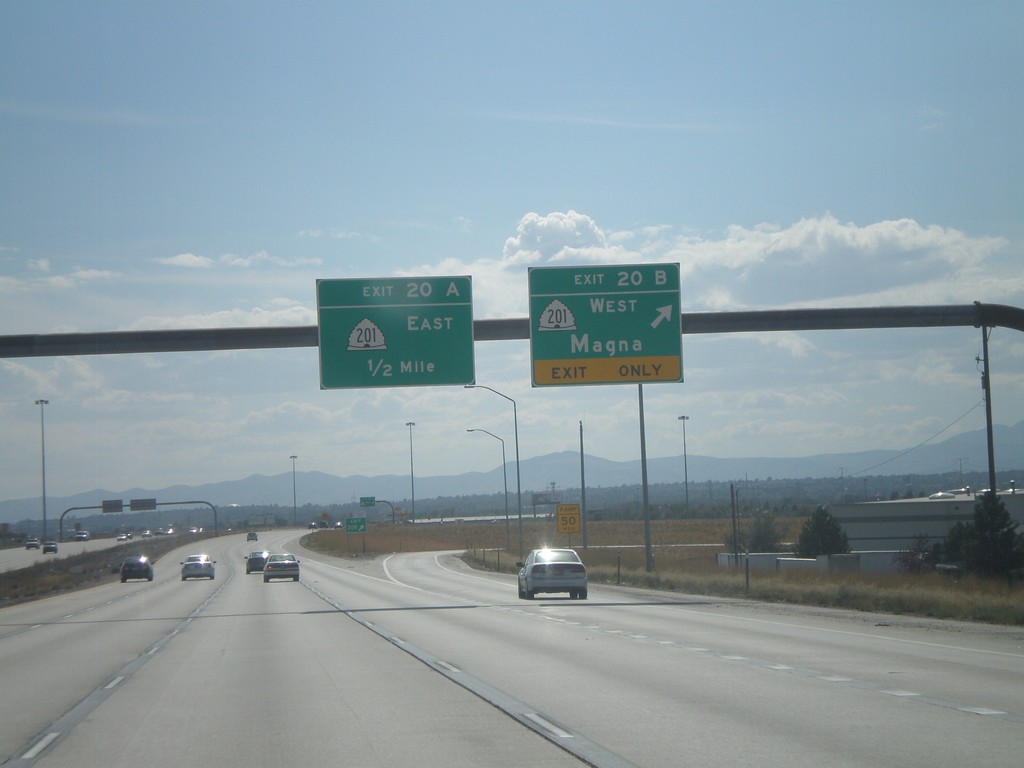
I-215 South - Exits 20B and 20A
I-215 south at Exit 20B - UT-201 West/Magna; approaching Exit 20A - UT-201 East.
Taken 10-01-2011
 Salt Lake City
Salt Lake County
Utah
United States
Salt Lake City
Salt Lake County
Utah
United States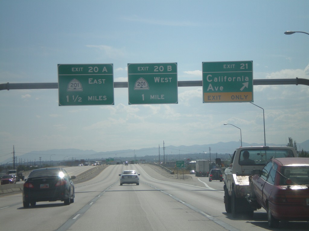
I-215 South - Exits 21, 20B, 20A
I-215 South at Exit 21 - California Ave. Approaching Exit 20B - UT-201 West, and Exit 20A - UT-201 East.
Taken 10-01-2011
Salt Lake City
Salt Lake County
Utah
United States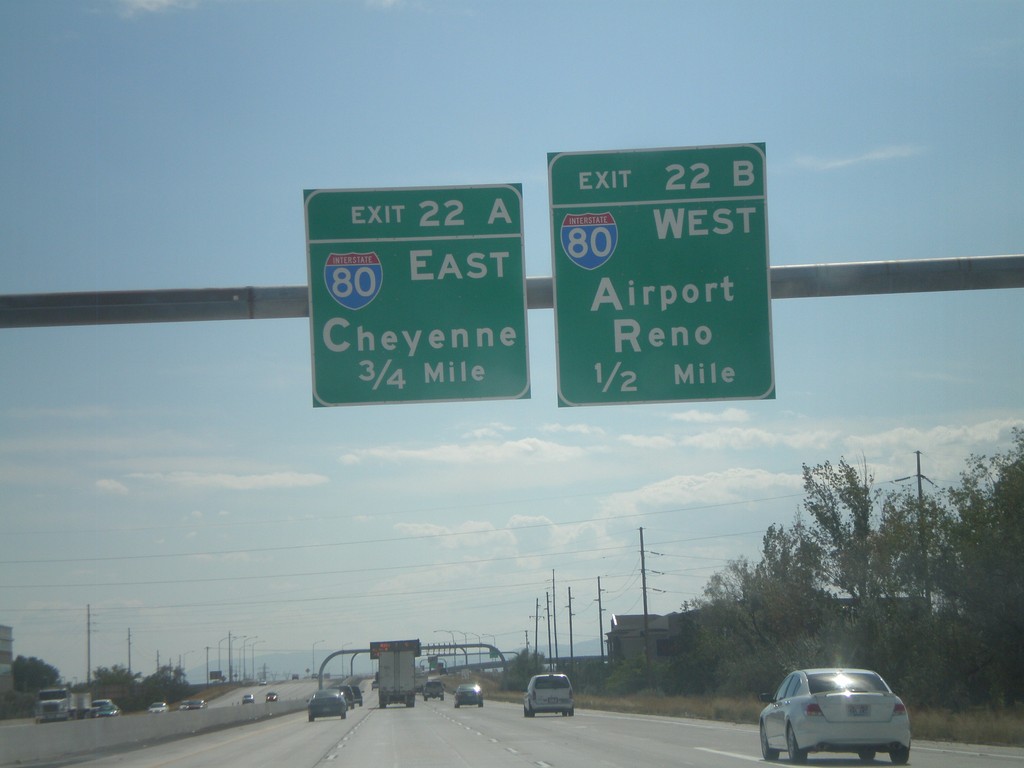
I-215 South - Exits 22B and 22A
I-215 south approaching Exit 22B - I-80 West/Airport/Reno. Approaching Exit 22A - I-80 East/Cheyenne (Wyoming).
Taken 10-01-2011
 Salt Lake City
Salt Lake County
Utah
United States
Salt Lake City
Salt Lake County
Utah
United States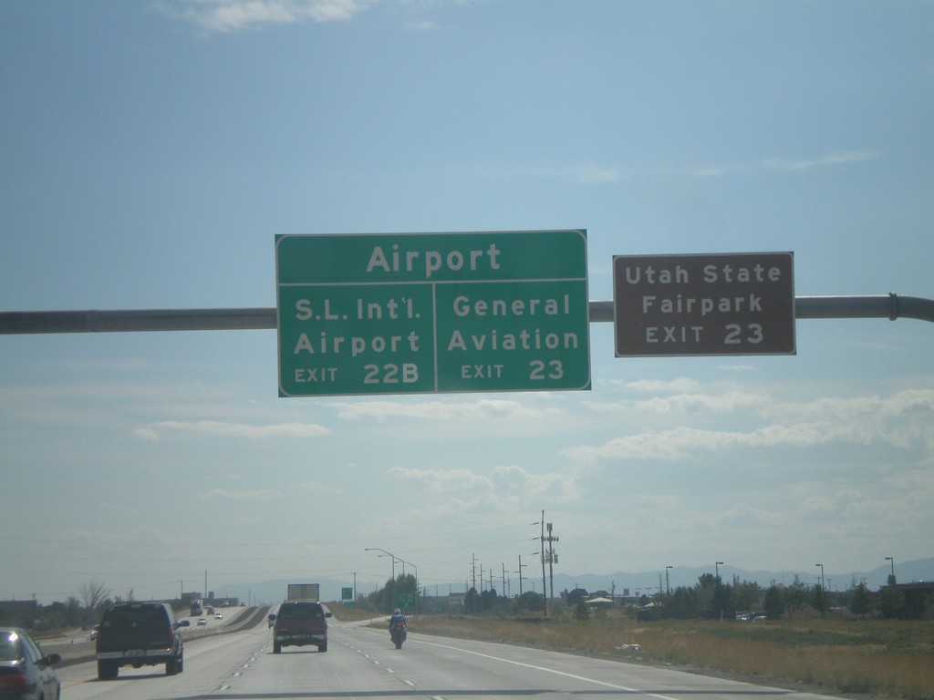
I-215 South - Salt Lake City International Airport Exits
Salt Lake City International Airport exits on I-215 south. For General Aviation, use Exit 23. For Salt Lake City International Airport , use Exit 22B. For the Utah State Fairpark use Exit 23.
Taken 10-01-2011
Salt Lake City
Salt Lake County
Utah
United States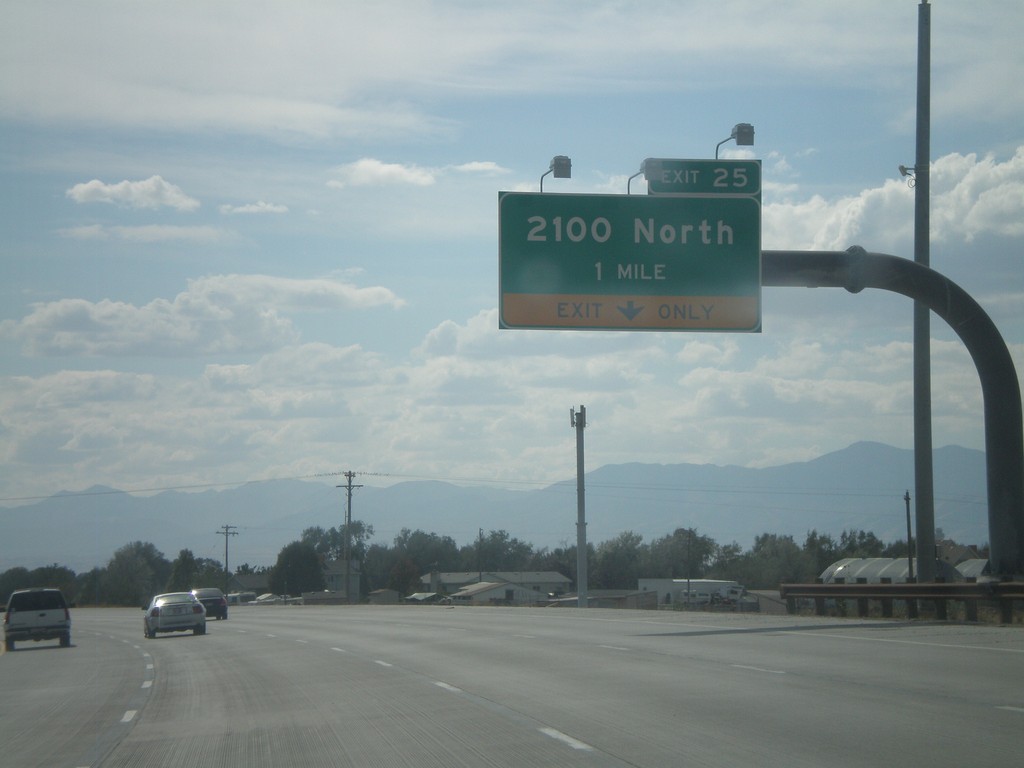
I-215 South - Exit 25
I-215 south at Exit 25 - 2100 North.
Taken 10-01-2011
Salt Lake City
Salt Lake County
Utah
United States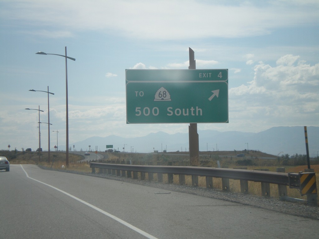
UT-67 South - Exit 4
UT-67 south at Exit 4 - To UT-68/500 South.
Taken 10-01-2011
 Woods Cross
Davis County
Utah
United States
Woods Cross
Davis County
Utah
United States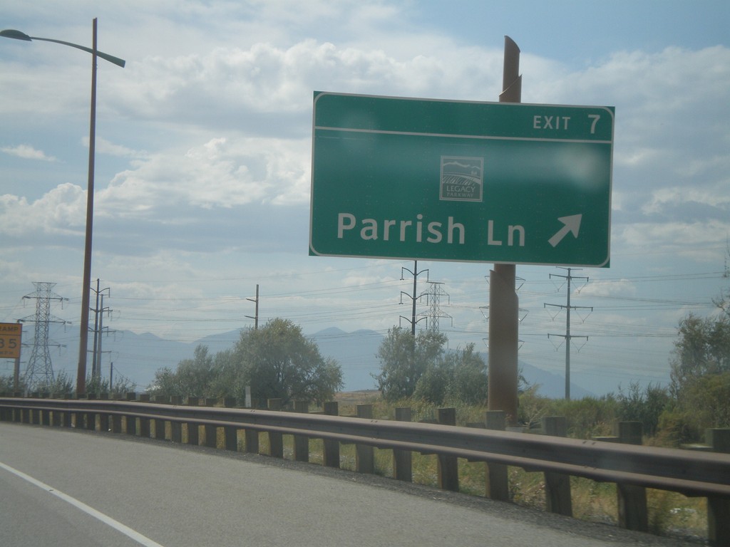
UT-67 South - Exit 7
UT-67 south (Legacy Parkway) at Exit 7 - Parrish Lane. The logo above the Parrish Lane text is for Legacy Parkway.
Taken 10-01-2011
Centerville
Davis County
Utah
United States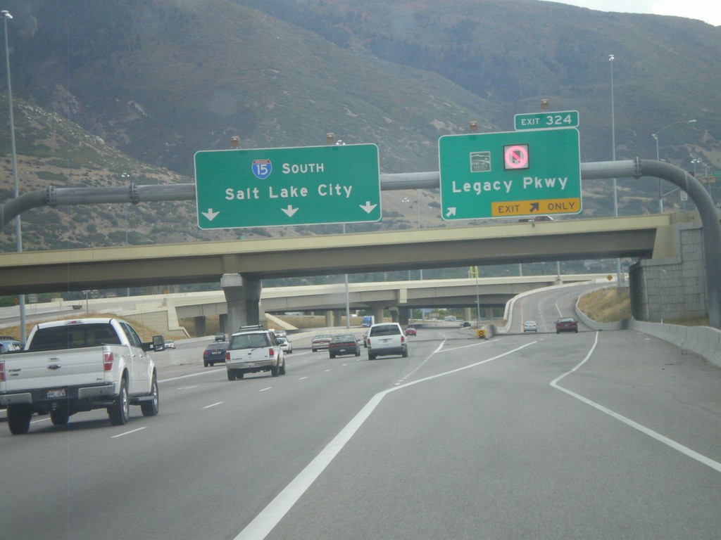
I-15 South - Exit 324
I-15 south at Exit 324 - (UT-67)/Legacy Parkway. Continue south on I-15 for Salt Lake City. The red light on the sign is for no trucks
Taken 10-01-2011
Farmington
Davis County
Utah
United States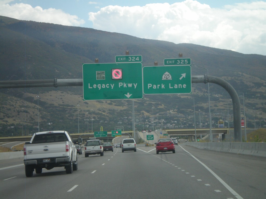
I-15 South - Exits 325 and 324
I-15 south at Exit 325 - UT-225/Park Lane. Approaching Exit 324 - (UT-67)/Legacy Parkway.
Taken 10-01-2011
 Farmington
Davis County
Utah
United States
Farmington
Davis County
Utah
United States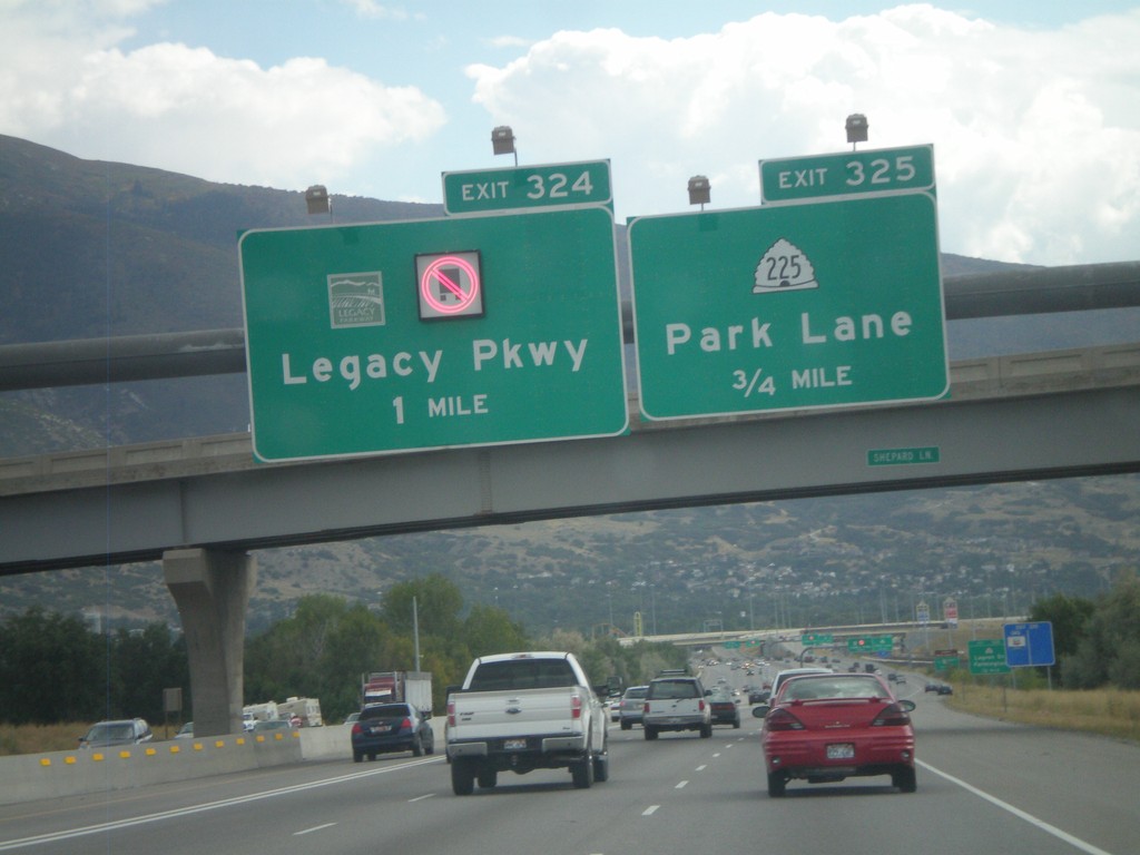
I-15 South - Exits 325 and 324
I-15 south approaching Exit 325 - UT-225/Park Lane. Also approaching Exit 325 - (UT-67)/Legacy Parkway.
Taken 10-01-2011
Farmington
Davis County
Utah
United States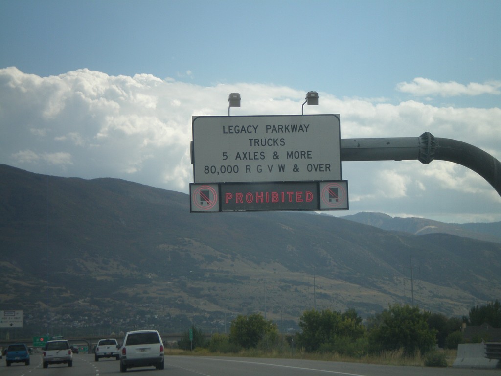
I-15 South Approaching Legacy Parkawy
I-15 south approaching Legacy Parkway. Trucks with more than 5 axles or greater than 80,000 pounds are prohibited for using Legacy Parkway.
Taken 10-01-2011
Kaysville
Davis County
Utah
United States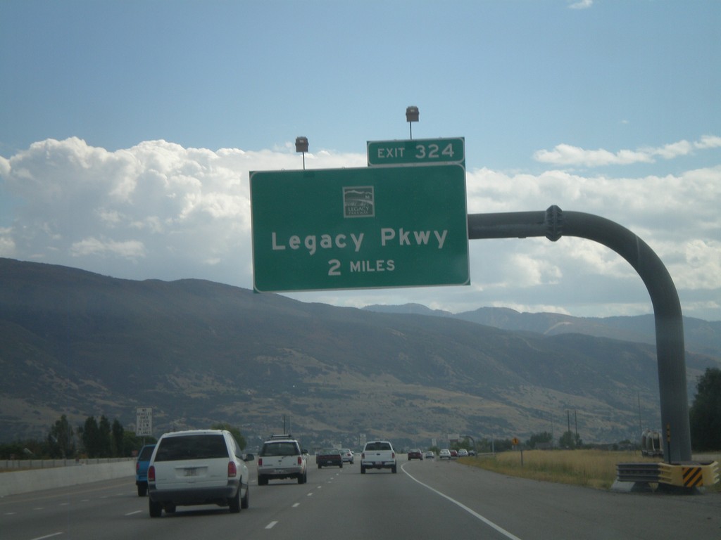
I-15 South - Exit 325
I-15 south approaching Exit 325 - (UT-67)/Legacy Parkway.
Taken 10-01-2011
Kaysville
Davis County
Utah
United States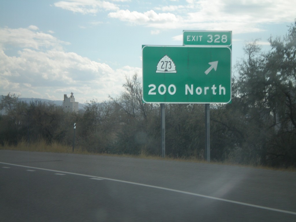
I-15 South - Exit 328
I-15 south at Exit 328 - UT-273/200 North.
Taken 10-01-2011
 Kaysville
Davis County
Utah
United States
Kaysville
Davis County
Utah
United States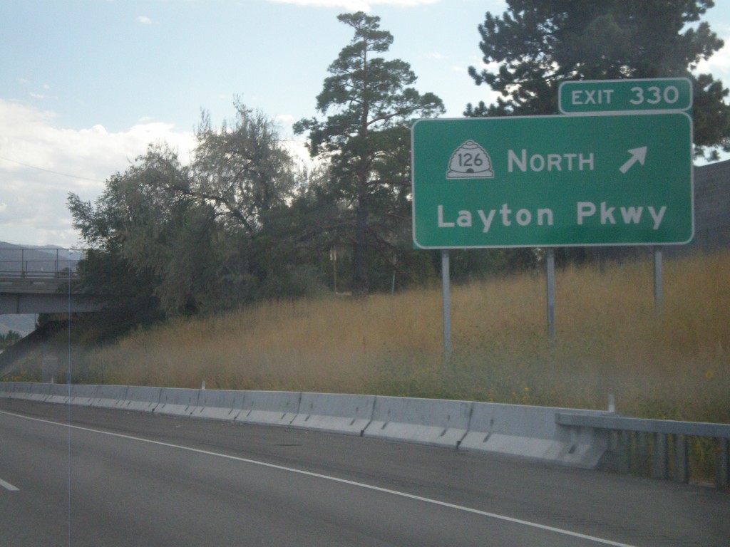
I-15 South - Exit 330
I-15 south at Exit 330 - UT 126 North/Layton Parkway.
Taken 10-01-2011
 Layton
Davis County
Utah
United States
Layton
Davis County
Utah
United States