Signs Tagged With Big Green Sign
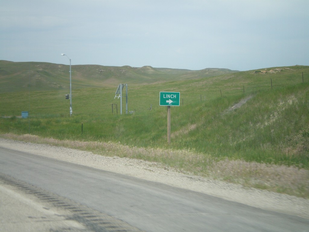
WY-387 South at WY-192
WY-387 South at WY-192. Use WY-192 north for Linch.
Taken 07-04-2011
 Linch
Johnson County
Wyoming
United States
Linch
Johnson County
Wyoming
United States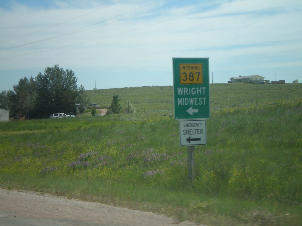
WY-59 North At WY-387 South
WY-59 North at WY-387 South. Use WY-387 south for Midwest and Wright.
Taken 07-04-2011
 Wright
Campbell County
Wyoming
United States
Wright
Campbell County
Wyoming
United States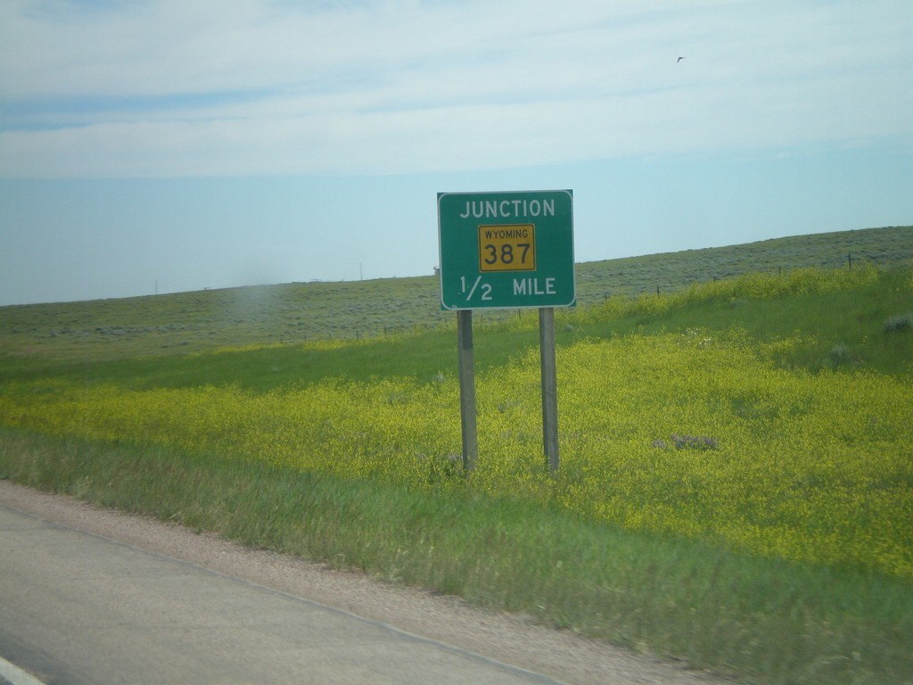
WY-59 North Approaching WY-387
WY-59 north approaching WY-387 south.
Taken 07-04-2011
 Wright
Campbell County
Wyoming
United States
Wright
Campbell County
Wyoming
United States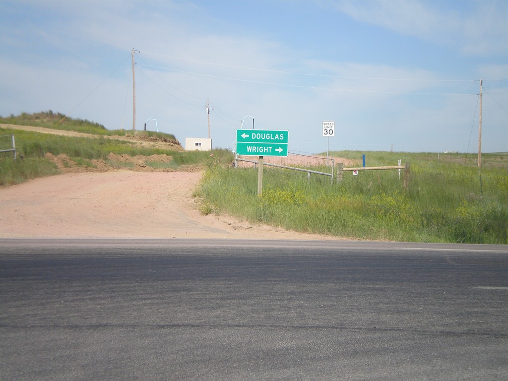
End WY-450 West at WY-59
End WY-450 West at WY-59. Use WY-59 south for Douglas; use WY-59 north for Wright.
Taken 07-04-2011
Gillette
Campbell County
Wyoming
United States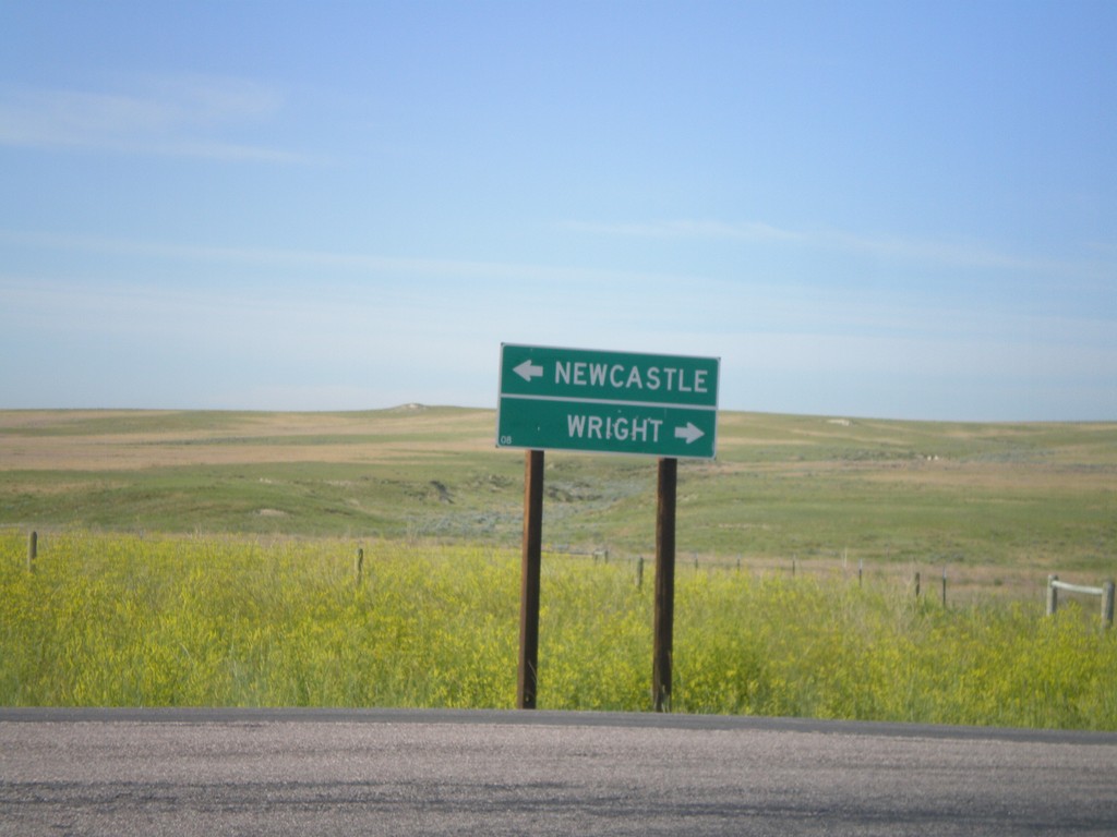
End WY-116 South at WY-450
End WY-116 South at WY-450. Use WY-450 east for Newcastle; WY-450 west for Wright.
Taken 07-04-2011
 Newcastle
Weston County
Wyoming
United States
Newcastle
Weston County
Wyoming
United States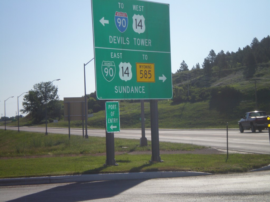
WY-116 North at BL-90/US-14
WY-116 north at BL-90/US-14. Turn right on BL-90/US-14 East for WY-585 and Sundance (City Center). Turn left for US-14 West to I-90 and Devils Tower.
Taken 07-04-2011


 Sundance
Crook County
Wyoming
United States
Sundance
Crook County
Wyoming
United States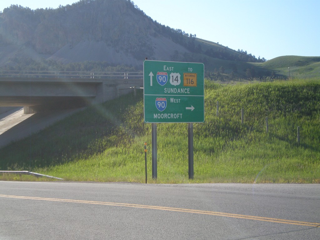
US-14 East at I-90 West (Exit 185)
US-14 east at I-90 West (Exit 185). Use I-90 west for Moorcroft. Continue east on US-14 for I-90 East, WY-116 and Sundance (City Center). The is the beginning of the I-90 Business Loop in Sundance.
Taken 07-04-2011
Sundance
Crook County
Wyoming
United States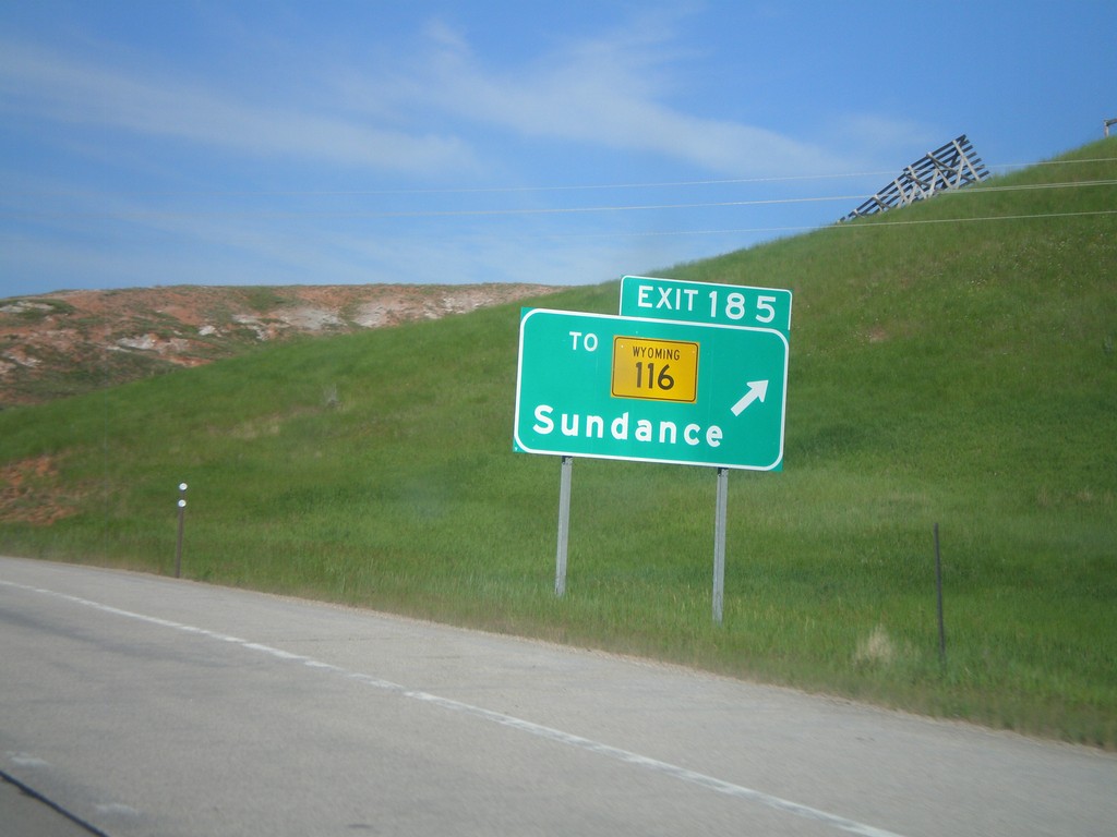
I-90 West - Exit 185
I-90 west at Exit 185 - To WY-116/Sundance.
Taken 07-04-2011
Sundance
Crook County
Wyoming
United States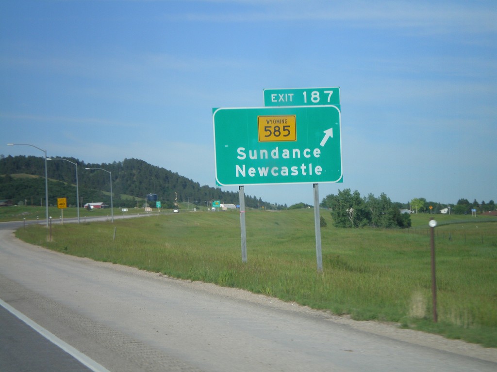
I-90 West - Exit 187
I-90 west at Exit 187 - WY-585/Sundance/Newcastle.
Taken 07-04-2011
Sundance
Crook County
Wyoming
United States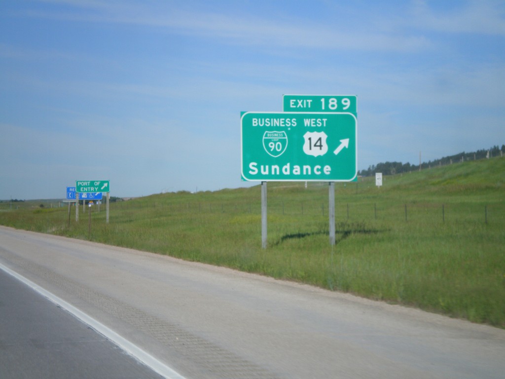
I-90 West - Exit 189
I-90/US-14 West at Exit 189 - BL-90/US-14 West/Sundance. US-14 leaves I-90 here and heads northwest to the Devils Tower National Monument. This is the eastern end of the Sundance business loop.
Taken 07-04-2011
Sundance
Crook County
Wyoming
United States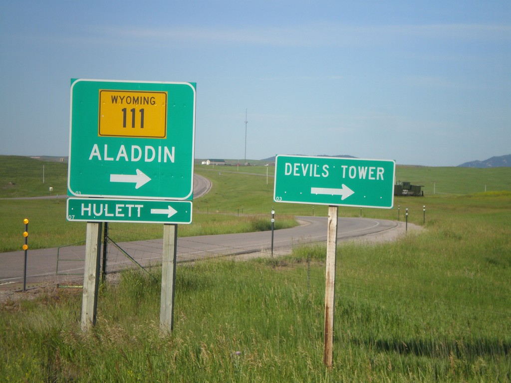
I-90 West at WY-111
I-90 west offramp (Exit 199) at WY-111. Use WY-111 north for Alladin, Heulett, and Devils Tower (National Monument).
Taken 07-04-2011
 Farrall
Crook County
Wyoming
United States
Farrall
Crook County
Wyoming
United States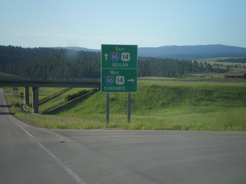
End WY-111 South at I-90 (Exit 199)
WY-111 south at I-90/US-14 (Exit 199). Use I-90/US-14 East for Beulah; west for Sundance.
Taken 07-04-2011
Farrall
Crook County
Wyoming
United States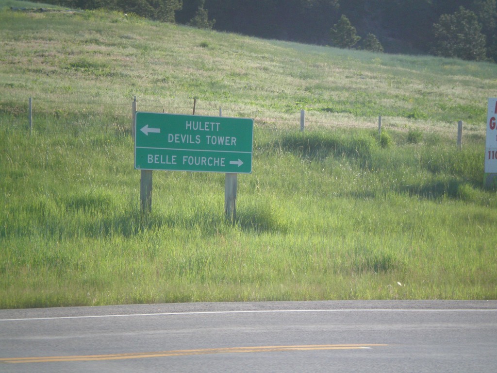
End WY-111 North at WY-24
End WY-111 north at WY-24. Use WY-24 west for Heulett and Devils Tower (National Monument). Use WY-24 east for Belle Fourche (South Dakota).
Taken 07-04-2011
 Aladdin
Crook County
Wyoming
United States
Aladdin
Crook County
Wyoming
United States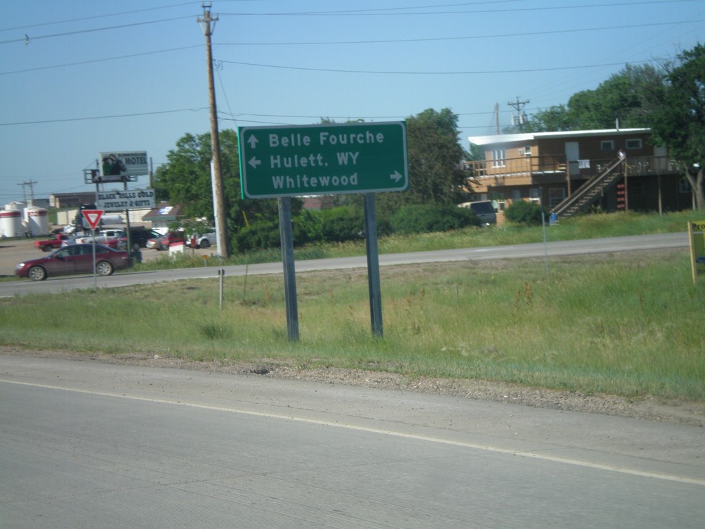
US-85 North at SD-34
US-85 north at SD-34. Use SD-34 west for Heulett, WY; SD-34 east for Whitewood; US-85 north for Belle Fourche.
Taken 07-03-2011

 Belle Fourche
Butte County
South Dakota
United States
Belle Fourche
Butte County
South Dakota
United States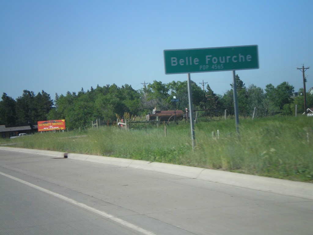
US-85 North - Belle Fourche
Entering Belle Fourche on US-85 north. Population 4,565. Belle Fourche is the county seat of Butte County, South Dakota.
Taken 07-03-2011
Belle Fourche
Butte County
South Dakota
United States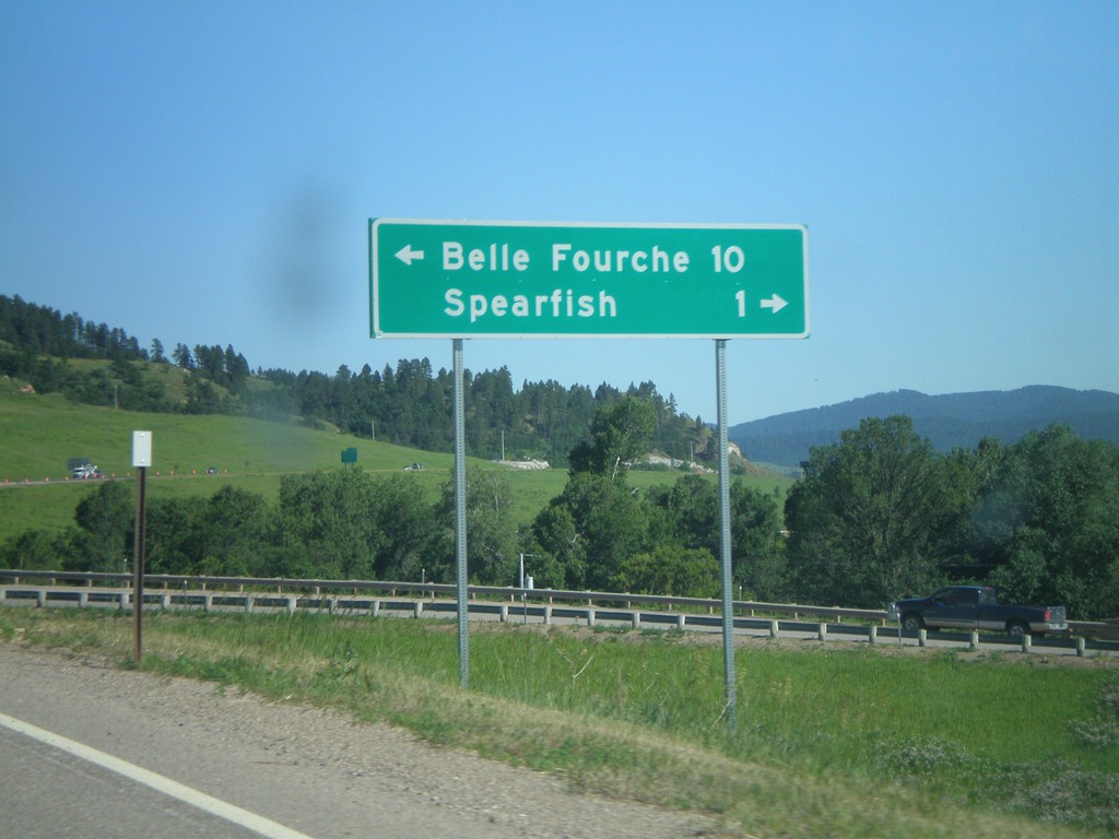
I-90/US-14 East at US-85
I-90/US-14 East (Exit 10) at US-85. Turn left for US-85 North to Belle Fourche. Turn right for BL-90 to Spearfish.
Taken 07-03-2011
Spearfish
Lawrence County
South Dakota
United States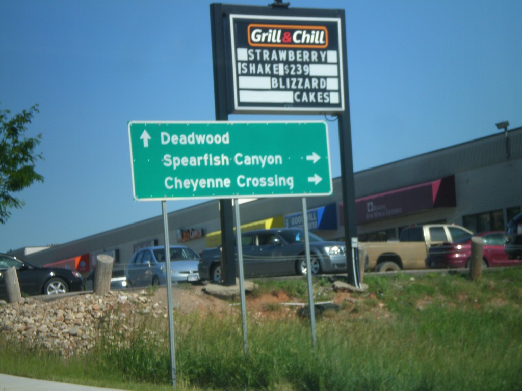
BL-90 East at US-14A
BL-90 East at US-14A. Turn right for US-14 East to Spearfish Canyon and Cheyenne Crossing. Continue ahead for BL-90 east for Deadwood. Deadwood is not directly assessable via BL-90 or I-90, but is the preferred route from Spearfish.
Taken 07-03-2011
 Spearfish
Lawrence County
South Dakota
United States
Spearfish
Lawrence County
South Dakota
United States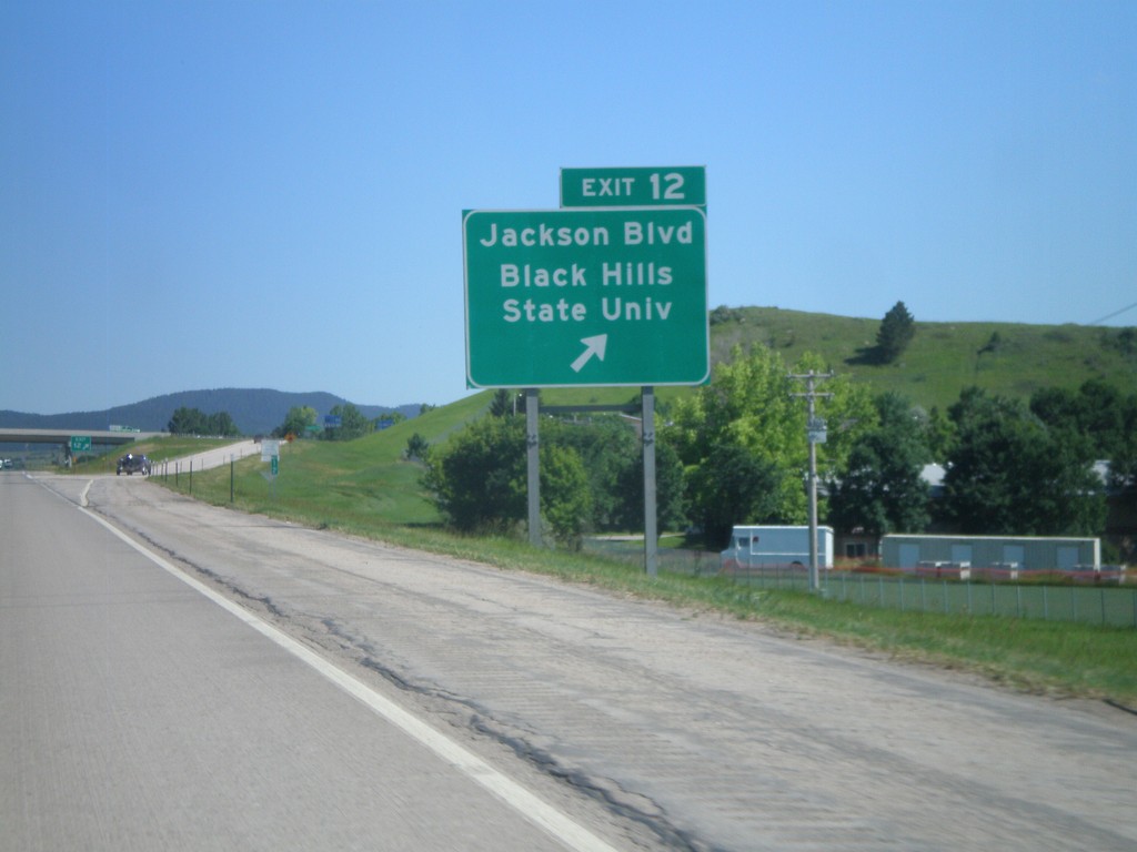
I-90 East - Exit 12
I-90 East at Exit 12 - Jackson Blvd/Black Hills State University.
Taken 07-03-2011
Spearfish
Lawrence County
South Dakota
United States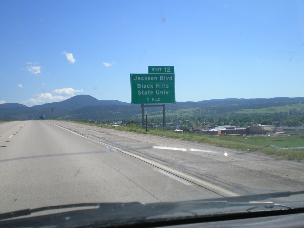
I-90 East Approaching Exit 12
I-90 East approaching Exit 12 - Jackson Blvd/Black Hills State University.
Taken 07-03-2011
Spearfish
Lawrence County
South Dakota
United States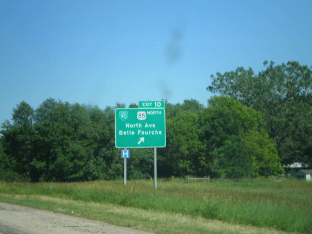
I-90 East - Exit 10
I-90 East at Exit 10 - BL-90/US-85 North/North Ave./Belle Fourche. US-85 joins I-90 east through Spearfish.
Taken 07-03-2011
Spearfish
Lawrence County
South Dakota
United States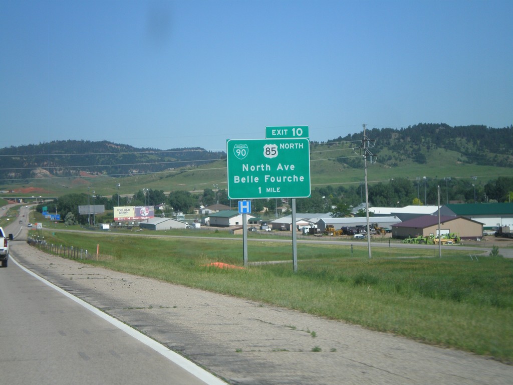
I-90 East Approaching Exit 10
I-90 East approaching Exit 10 - BL-90/US-85 North/Belle Fourche/North Ave. This is the western end of the Spearfish business loop. US-85 joins I-90 eastbound through Spearfish.
Taken 07-03-2011
Spearfish
Lawrence County
South Dakota
United States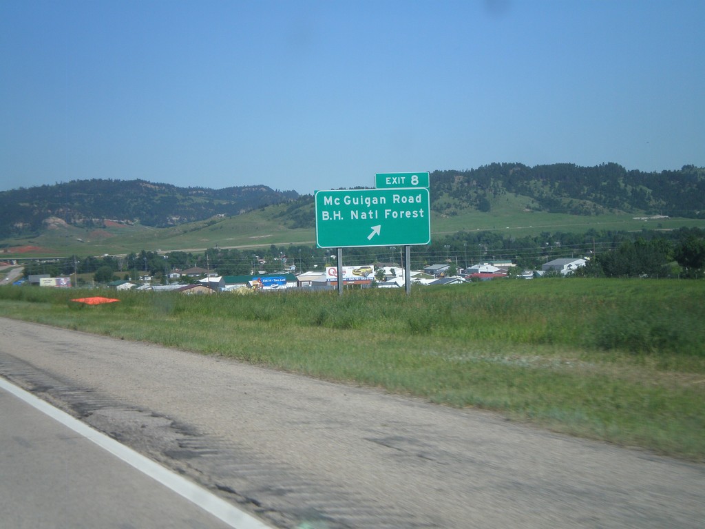
I-90 East - Exit 8
I-90 East at Exit 8 - Mc Guigan Road/Black Hills National Forest.
Taken 07-03-2011
Spearfish
Lawrence County
South Dakota
United States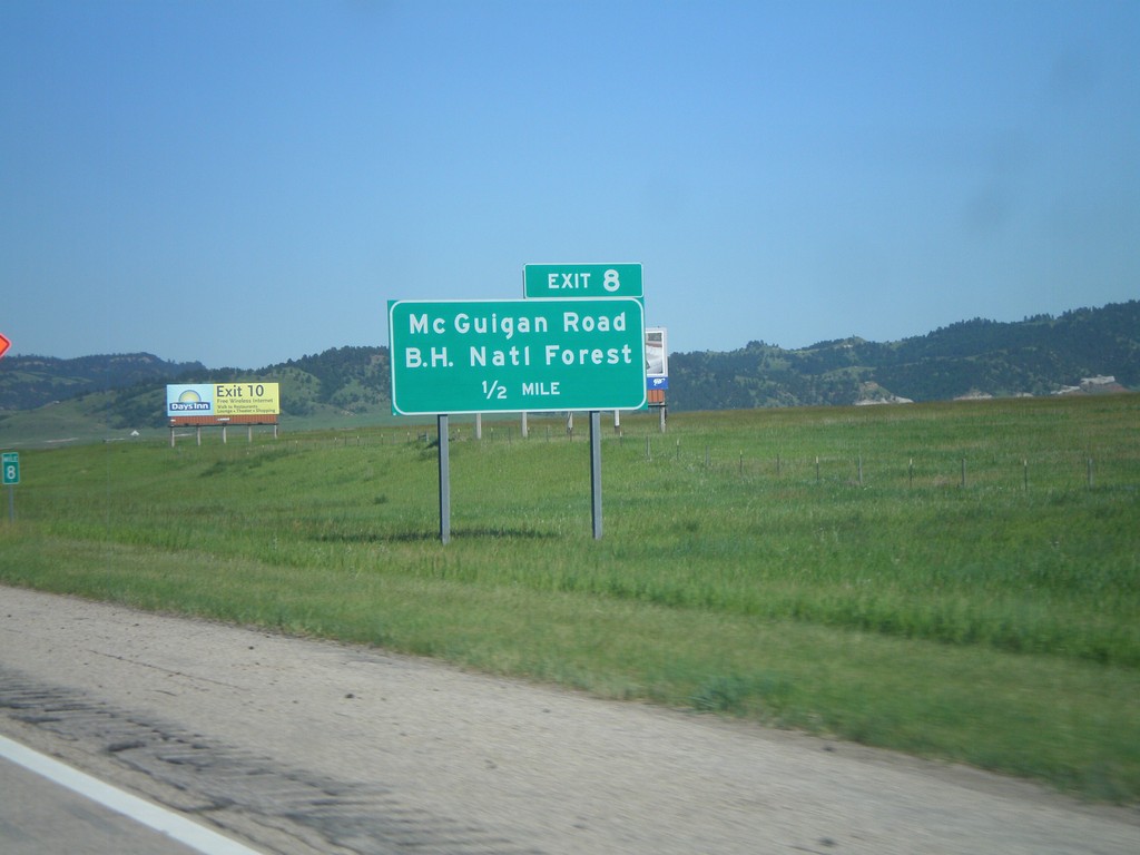
I-90 East - Exit 8
I-90 east approaching Exit 8 - Mc Guigan Road/Black Hills National Forest. The Black Hills are in the background of the picture.
Taken 07-03-2011
Spearfish
Lawrence County
South Dakota
United States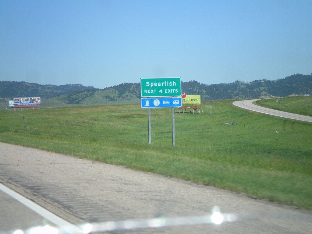
I-90/US-14 East - Spearfish Exits
Spearfish - Next 4 Exits on I-90/US-14 East.
Taken 07-03-2011
Spearfish
Lawrence County
South Dakota
United States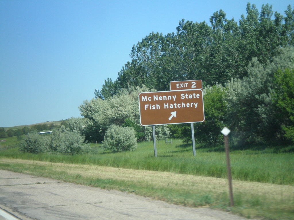
I-90 East - Exit 2
I-90 East at Exit 2 Mc Nenny State Fish Hatchery. This is the first exit eastbound on I-90 in South Dakota.
Taken 07-03-2011
North Spearfish
Lawrence County
South Dakota
United States