Signs Tagged With Big Green Sign
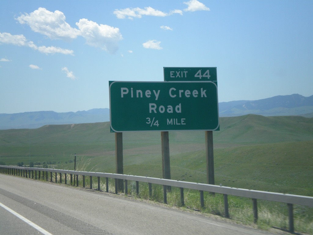
I-90 East - Exit 44
I-90 east approaching Exit 44 - Piney Creek Road. US-87 south joins I-90 east here to Buffalo.
Taken 07-03-2011

 Banner
Johnson County
Wyoming
United States
Banner
Johnson County
Wyoming
United States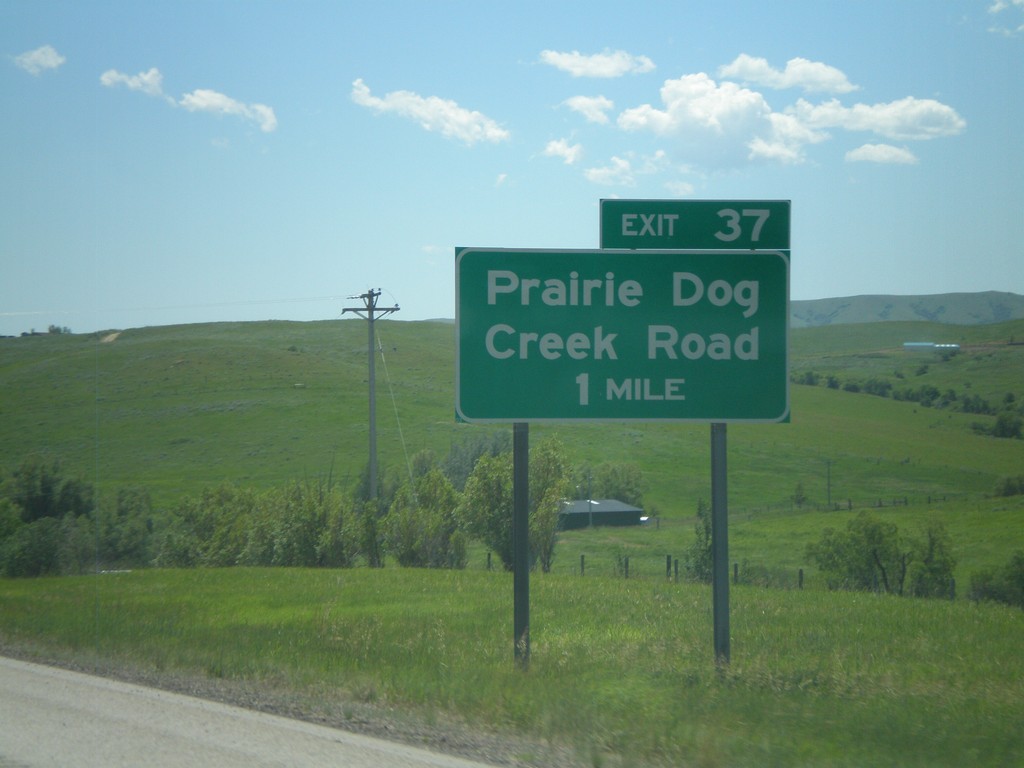
I-90 East - Exit 37
I-90 east approaching Exit 37 - Prairie Dog Creek Road.
Taken 07-03-2011
Banner
Sheridan County
Wyoming
United States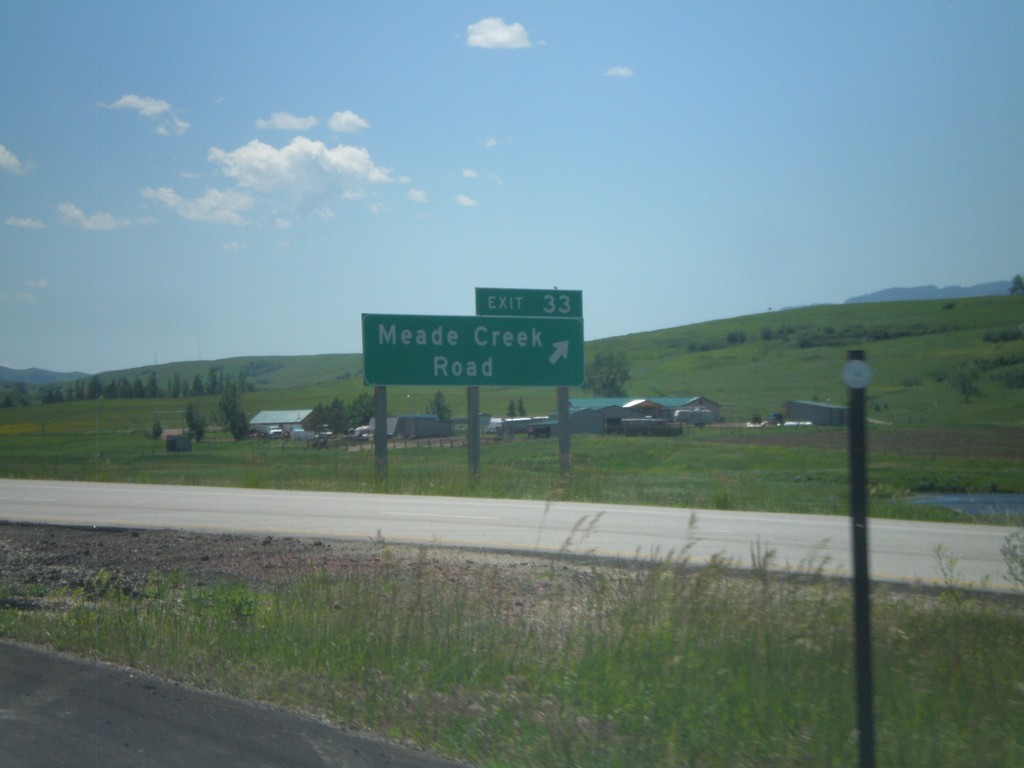
I-90 East - Exit 33
I-90 east at Exit 33 - Meade Creek Road. Use Exit 33 for WY-342 (unsigned).
Taken 07-03-2011
 Big Horn
Sheridan County
Wyoming
United States
Big Horn
Sheridan County
Wyoming
United States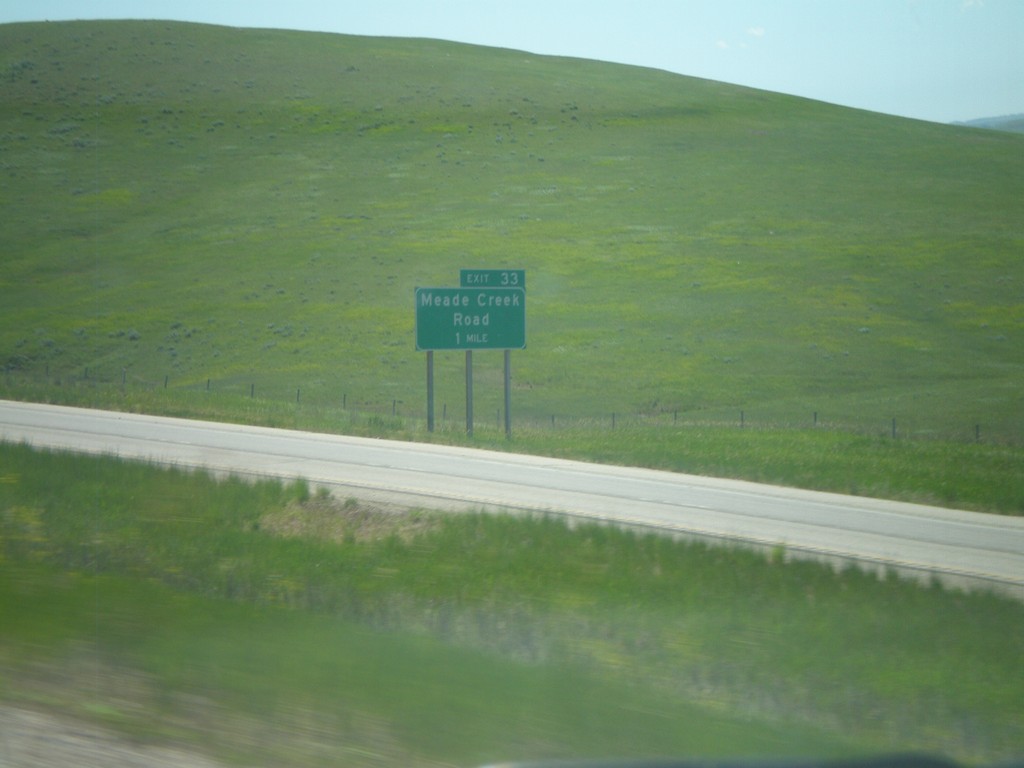
I-90 East - Exit 33
I-90 east approaching Exit 33 - Meade Creek Road.
Taken 07-03-2011
Sheridan
Sheridan County
Wyoming
United States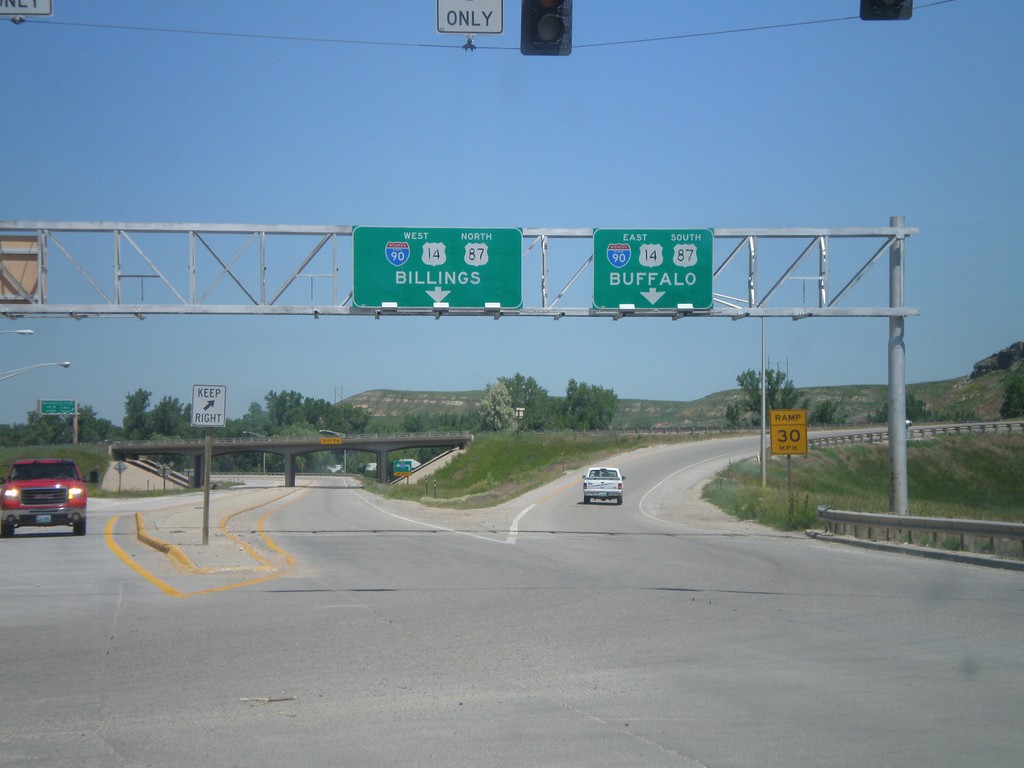
End BL-90 West at I-90/US-14/US-87
End BL-90/Bus. US-14 West/Bus. US-87 North at I-90/US-14/US-87. Use I-90/US-14 West/US-87 north for Billings (Montana); use I-90/US-14 East/US-87 South for Buffalo. This is the western end of the Sheridan business loop.
Taken 07-03-2011


 Sheridan
 County
Wyoming
United States
Sheridan
Sheridan County
Wyoming
United States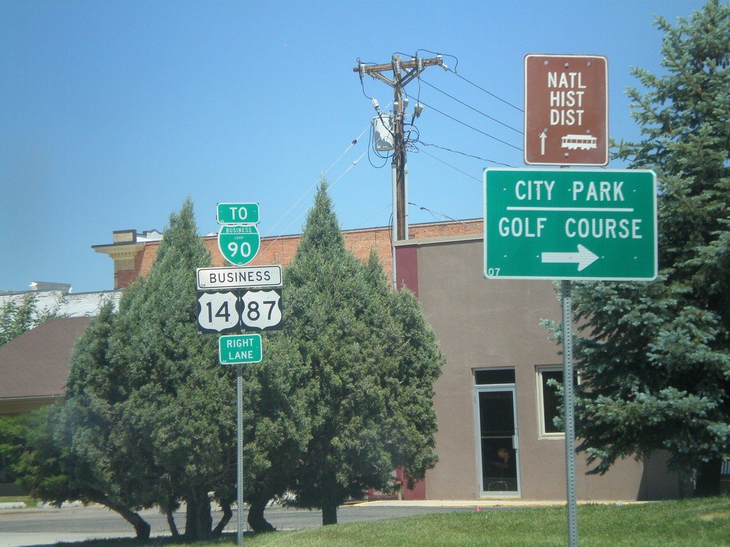
BL-90/Business US-87/Business US-14 in Sheridan
BL-90/Business US-87/Business US-14 (Coffeen Ave.) west at Main St in downtown Sheridan. Turn right on Main St. for the Sheridan City Park and Golf Course.
Taken 07-03-2011
Sheridan
Sheridan County
Wyoming
United States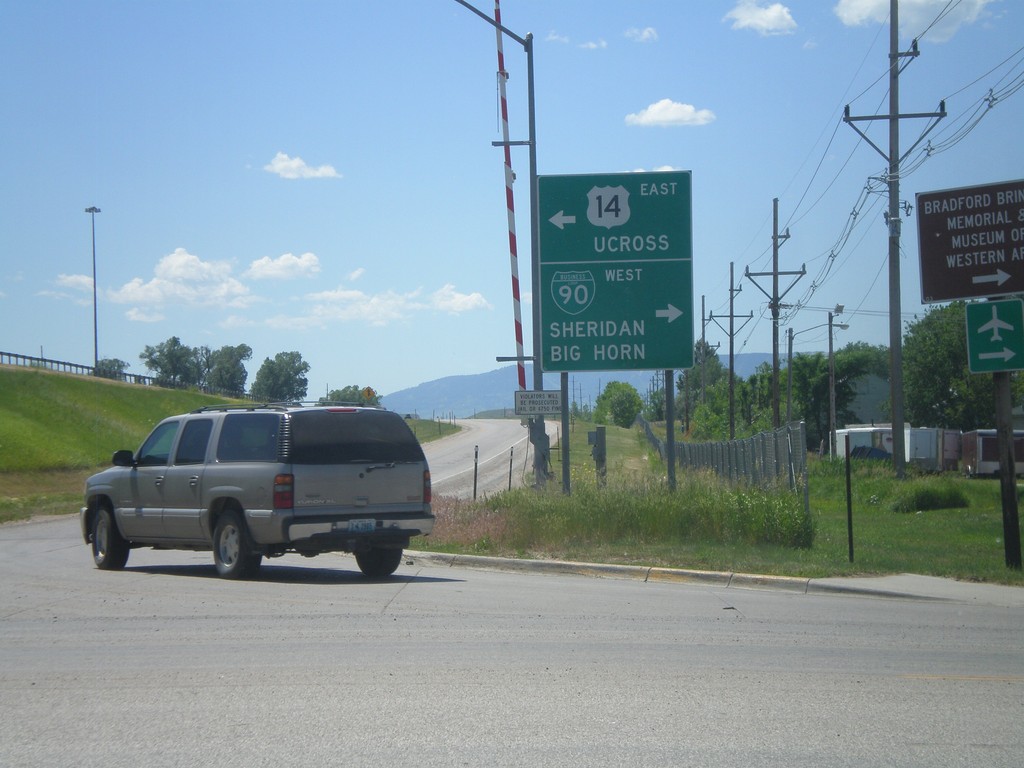
I-90 East Exit 25 Offramp at US-14/BL-90
Bottom of I-90 East, Exit 25 offramp in Sheridan. Turn right for US-14 east to Ucross; left for BL-90 for Downtown Sheridan. Also turn left for (unsigned) US-87 to Big Horn. This is the eastern end of the Sheridan business loop.
Taken 07-03-2011
Sheridan
Sheridan County
Wyoming
United States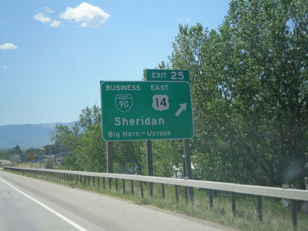
I-90 East - Exit 25
I-90 east at Exit 25 - BL-90/US-14 East/Sheridan/Big Horn/Ucross. This is the eastern end of the Sheridan business loop. US-14 leaves I-90 here and heads east towards Ucross. US-87 also leaves I-90 east here.
Taken 07-03-2011
Sheridan
Sheridan County
Wyoming
United States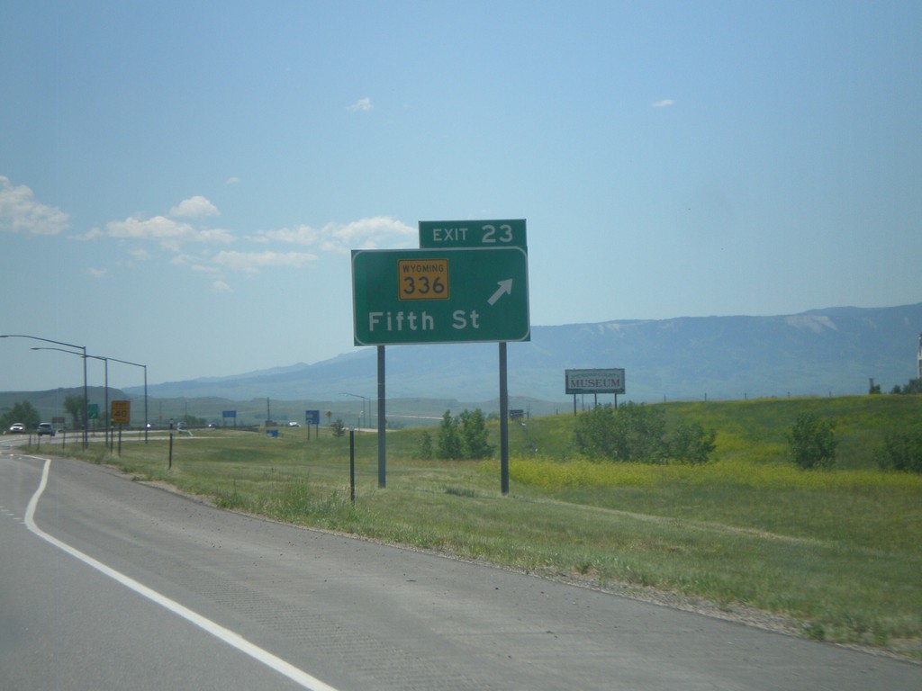
I-90 East - Exit 23
I-90 east at Exit 23 - WY-336/Main St.
Taken 07-03-2011
 Sheridan
 County
Wyoming
United States
Sheridan
Sheridan County
Wyoming
United States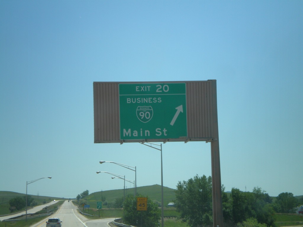
I-90 East - Exit 20
I-90 east at Exit 20 - BL-90/Main St. This is the western end of the Sheridan Business Loop. The style of this overhead is not usual in Wyoming, and looks like the type of overheads seen in California.
Taken 07-03-2011
Sheridan
Sheridan County
Wyoming
United States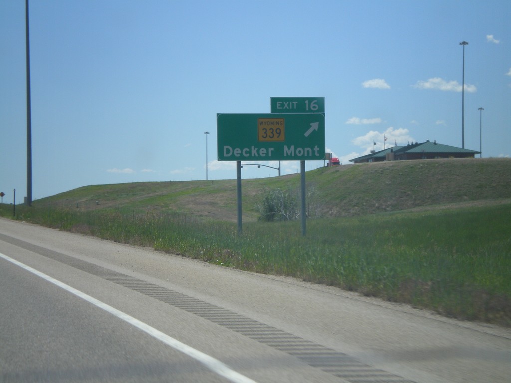
I-90 East - Exit 16
I-90 east at Exit 16 - WY-339/Decker, Mont.
Taken 07-03-2011
 Sheridan
 County
Wyoming
United States
Sheridan
Sheridan County
Wyoming
United States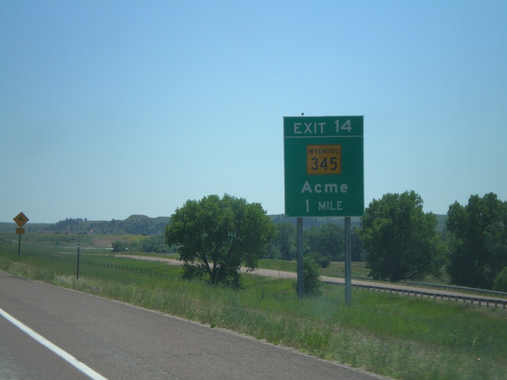
I-90 East - Exit 14
I-90 east approaching Exit 14 - WY-345/Acme.
Taken 07-03-2011
 Ranchester
Sheridan County
Wyoming
United States
Ranchester
Sheridan County
Wyoming
United States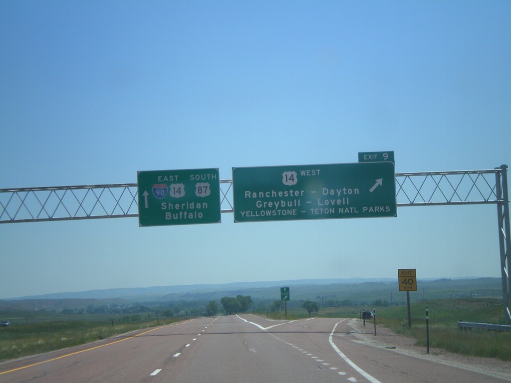
I-90 East - Exit 9
I-90 east at Exit 9 - US-14 West/Ranchester/Dayton/Greybull/Lovell/Yellowstone - Teton National Parks. I-90/US-14/US-87 continues east towards Sheridan and Buffalo. US-14 joins I-90 east to Sheridan.
Taken 07-03-2011
Ranchester
Sheridan County
Wyoming
United States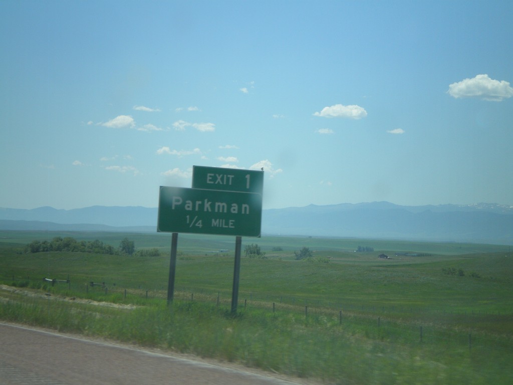
I-90 East - Exit 1
I-90 east at Exit 1 - Parkman. This is the first exit on I-90 east in Wyoming.
Taken 07-03-2011
Parkman
Sheridan County
Wyoming
United States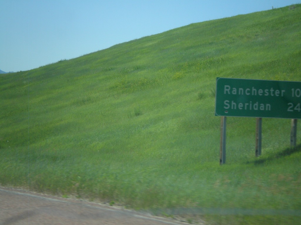
I-90 East - Distance Marker
First distance marker in Wyoming along I-90 East/US-87 South. Distance to Ranchester and Sheridan.
Taken 07-03-2011
Parkman
Sheridan County
Wyoming
United States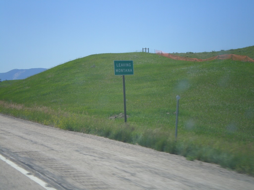
I-90 East - Leaving Montana
Leaving Montana on I-90 East/US-87 South approaching the Wyoming state line.
Taken 07-03-2011
Wyola
Big Horn County
Montana
United States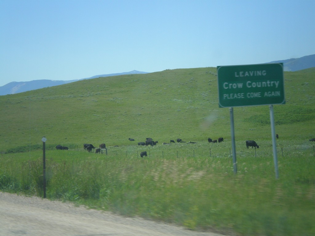
I-90 East - Leaving Crow Country
Leaving the Crow Indian Reservation on I-90 east approaching the Wyoming state line.
Taken 07-03-2011
Wyola
Big Horn County
Montana
United States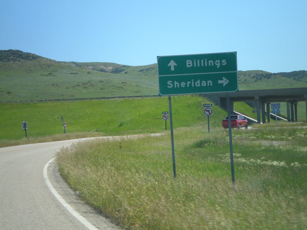
Approaching I-90 (Exit 549)
Approaching I-90 (Exit 549) on Aberdeen Road. Use I-90 east for Sheridan (Wyoming); I-90 west for Billings.
Taken 07-03-2011
Wyola
Big Horn County
Montana
United States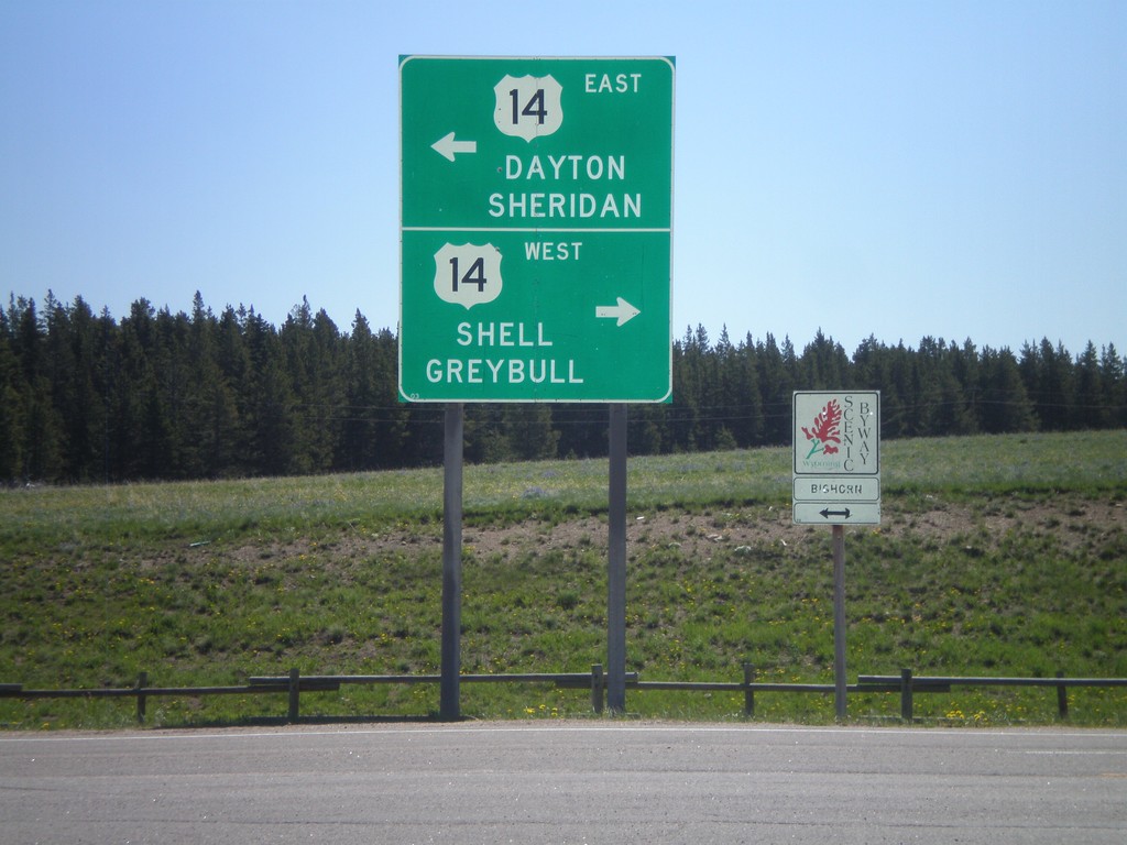
End US-14A At US-14 - Burgess Jct.
End US-14A at US-14 - Burgess Jct. Turn right for US-14 west to Shell and Greybull; turn left for US-14 east to Dayton and Sheridan. There is also a Bighorn Scenic Byway sign, of which either direction US-14 is part of.
Taken 07-03-2011
 Dayton
Sheridan County
Wyoming
United States
Dayton
Sheridan County
Wyoming
United States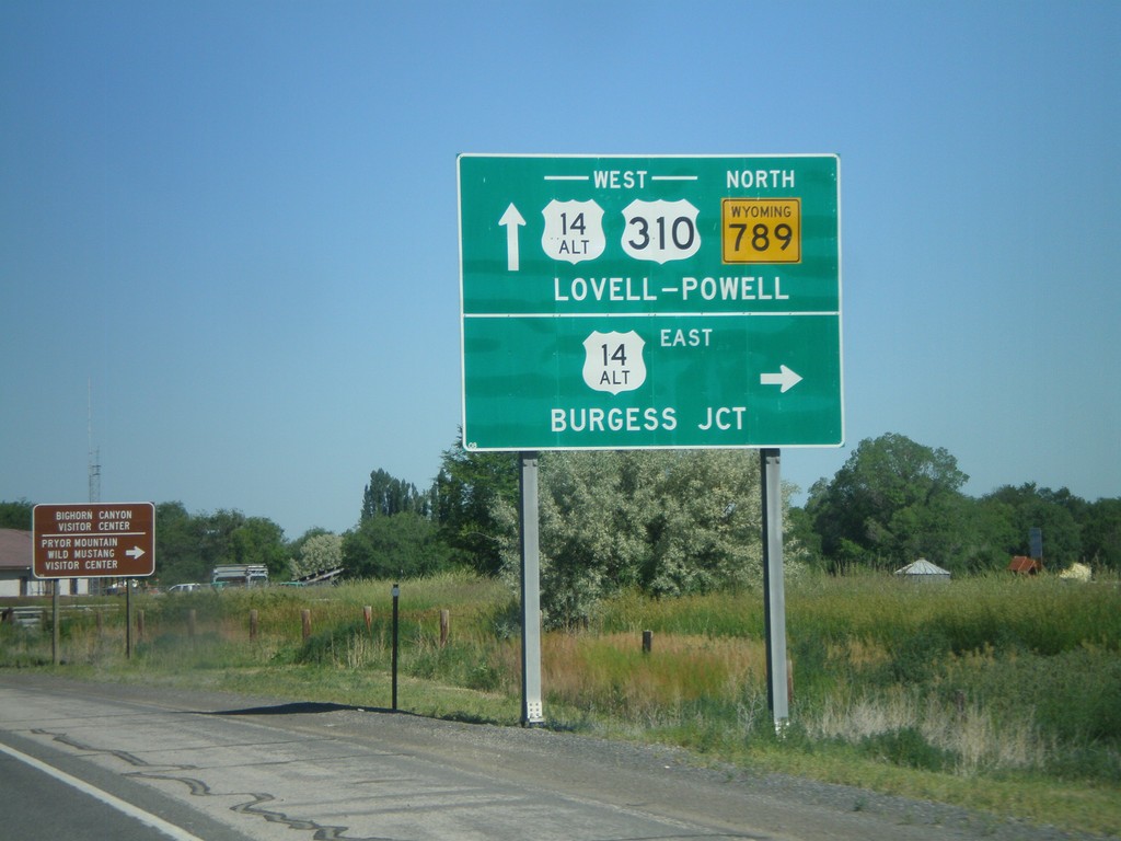
US-310 West/WY-789 North at US-14A
US-310 West/WY-789 North at US-14A in Lovell. Turn right for US-14A East to Burgess Jct.; continue ahead for US-310/US-14A West/WY-789 North to Lovell and Powell.
Taken 07-03-2011

 Lovell
Big Horn County
Wyoming
United States
Lovell
Big Horn County
Wyoming
United States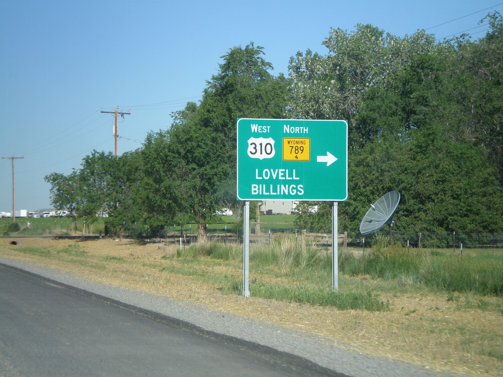
US-14/US-16/US-20 West/WY-789 North at US-310
US-14/US-16/US-20 West/WY-789 North at US-310. Turn right on US-310 West/WY-789 north for Lovell and Billings (Montana). This is the eastern end of US-310. WY-789 leaves US-14/US-16/US-20 here and turns west onto US-310.
Taken 07-03-2011

 Greybull
Big Horn County
Wyoming
United States
Greybull
Big Horn County
Wyoming
United States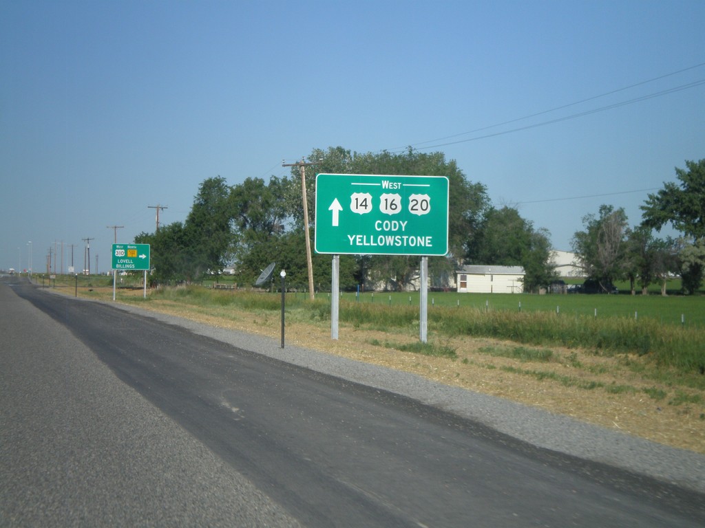
US-14/US-16/US-20 West/WY-789 at US-310/WY-789 North
US-14/US-16/US-20 West/WY-789 North at US-310/WY-789. Use US-14/US-16/US-20 West for Cody and Yellowstone. Turn right to continue north WY-789. This is the southern terminus of US-310.
Taken 07-03-2011
Greybull
Big Horn County
Wyoming
United States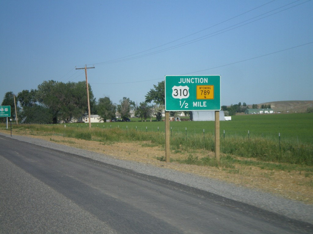
US-14/US-16/US-20 West/WY-789 North at US-310/WY-789 North
US-14/US-16/US-20 West/WY-789 North at US-310/WY-789 North. Turn right to continue on WY-789 North. This is where US-310 begins.
Taken 07-03-2011
Greybull
Big Horn County
Wyoming
United States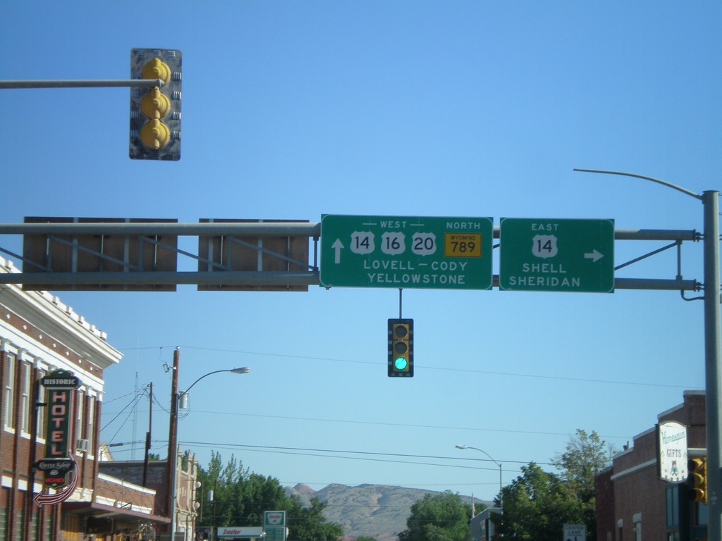
US-16/US-20 West/WY-789 North at US-14
US-16/US-20 West/WY-789 North at US-14 in Greybull. Turn right for US-14 east to Shell and Sheridan. Continue west on US-14/US-16/US-20 for Lovell, Cody, and Yellowstone.
Taken 07-03-2011
Greybull
Big Horn County
Wyoming
United States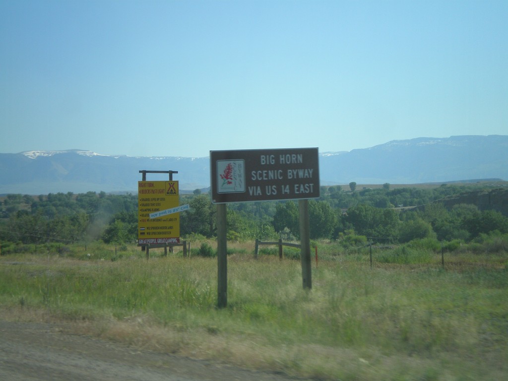
US-14 Scenic Byway Information on US-16/US-20 West/WY-789 North
Scenic Byway information for US-14 on US-16/US-20 West/WY-789 North approaching Greybull. Use US-14 East for the Big Horn Scenic Byway.
Taken 07-03-2011
Greybull
Big Horn County
Wyoming
United States