Signs Tagged With Big Green Sign
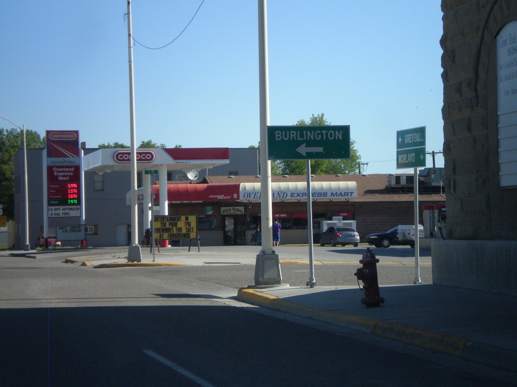
US-16/US-20 West/WY-789 North at WY-30
US-16/US-20 West/WY-789 North at WY-30. Use WY-30 west for Burlington.
Taken 07-03-2011


 Basin
Big Horn County
Wyoming
United States
Basin
Big Horn County
Wyoming
United States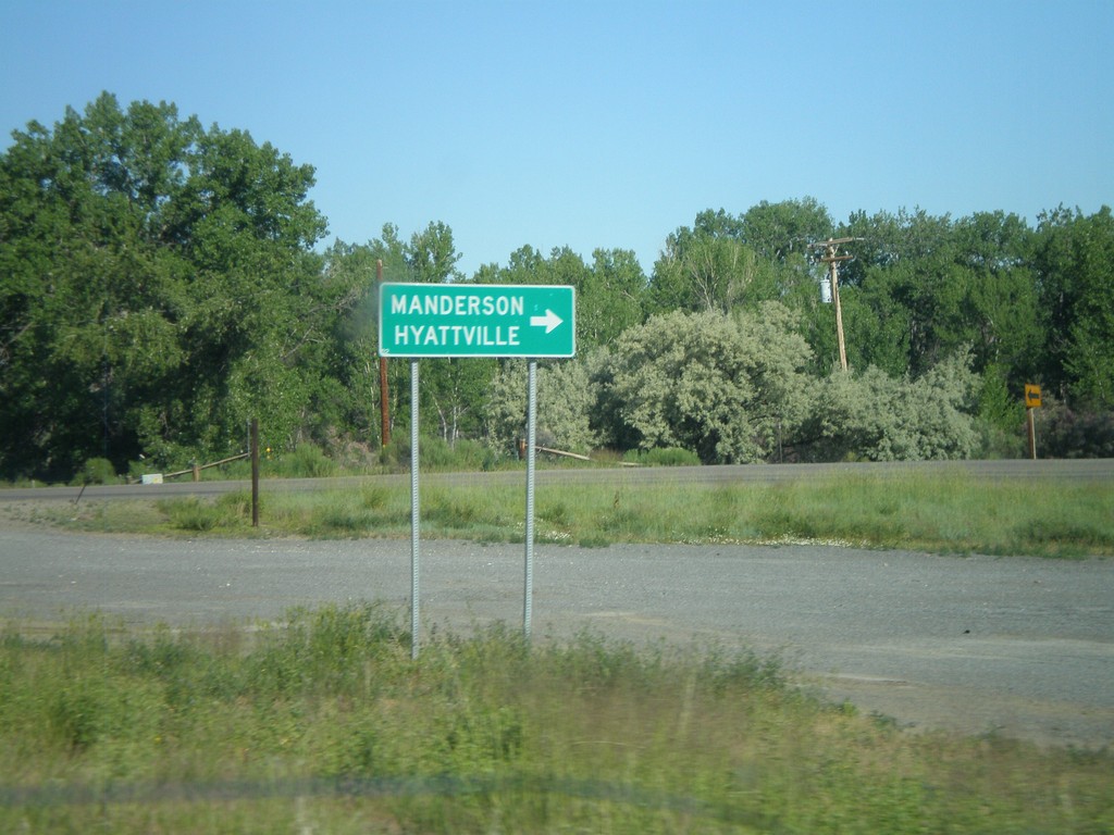
US-16/US-20 West/WY-789 North at WY-31
US-16/US-20 West/WY-789 North at WY-31 to Manderson and Hyattville.
Taken 07-03-2011
 Manderson
Big Horn County
Wyoming
United States
Manderson
Big Horn County
Wyoming
United States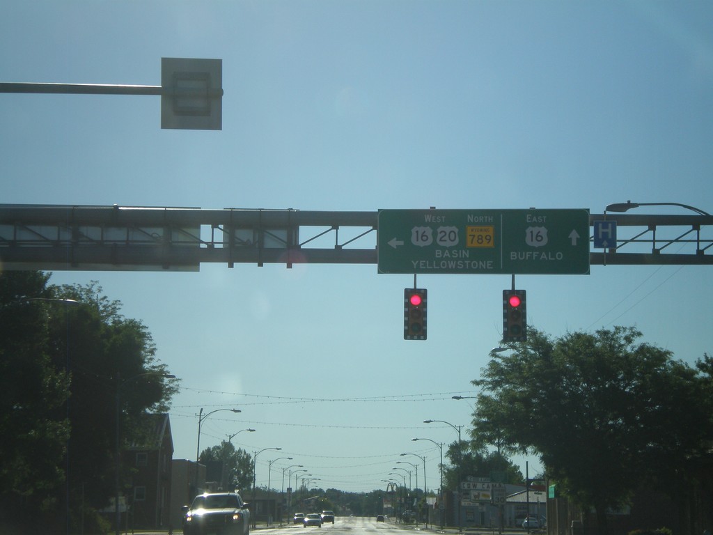
US-20 West/WY-789 North - US-16 Jct
US-20 West/WY-789 North at US-16 junction in Worland. Continue straight for US-16 east to Buffalo. Turn left for US-16/US-20 West/WY-789 North to Basin and Yellowstone (National Park).
Taken 07-03-2011
Worland
Washakie County
Wyoming
United States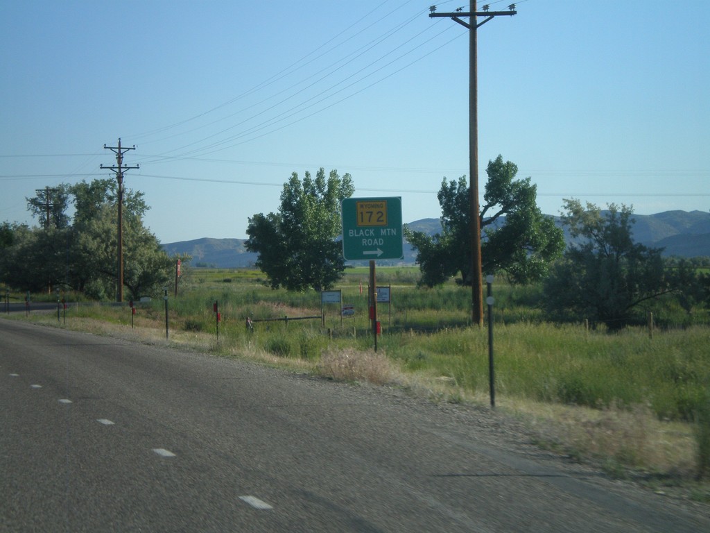
US-20 West/WY-789 North at WY-172
US-20 West/WY-789 North at WY-172 in rural Hot Springs County. Turn right for WY-172 to Black Mountain Road.
Taken 07-03-2011
 Thermopolis
Hot Springs County
Wyoming
United States
Thermopolis
Hot Springs County
Wyoming
United States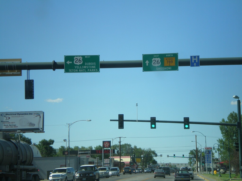
WY-789 North at US-26
WY-789 north at US-26 in Riverton. Turn left for US-26 to Dubois, and Yellowstone/Grand Teton National Parks. Continue ahead for US-26 East/WY-789 North to Shoshoni. US-26 joins WY-789 north until Shoshoni.
Taken 07-02-2011
 Riverton
Fremont County
Wyoming
United States
Riverton
Fremont County
Wyoming
United States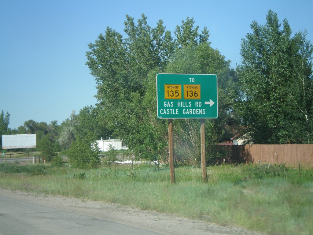
WY-789 North at WY-135/To WY-136
WY-789 North at WY-135/To WY-136. Use WY-135 east for WY-136, Gas Hills Road, and Castle Gardens.
Taken 07-02-2011

 Arapahoe
Fremont County
Wyoming
United States
Arapahoe
Fremont County
Wyoming
United States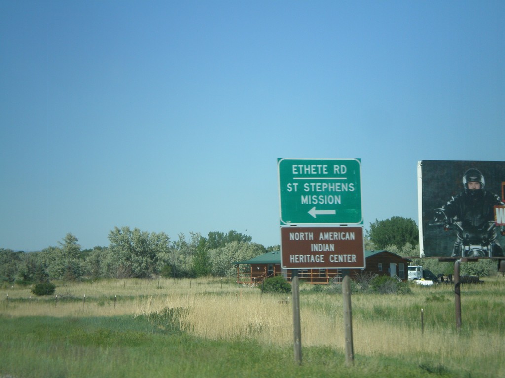
WY-789 North at WY-137
WY-789 north at WY-137/Ethete Road to St. Stephens Mission and North American Indian Hertiage Center.
Taken 07-02-2011
 Riverton
Fremont County
Wyoming
United States
Riverton
Fremont County
Wyoming
United States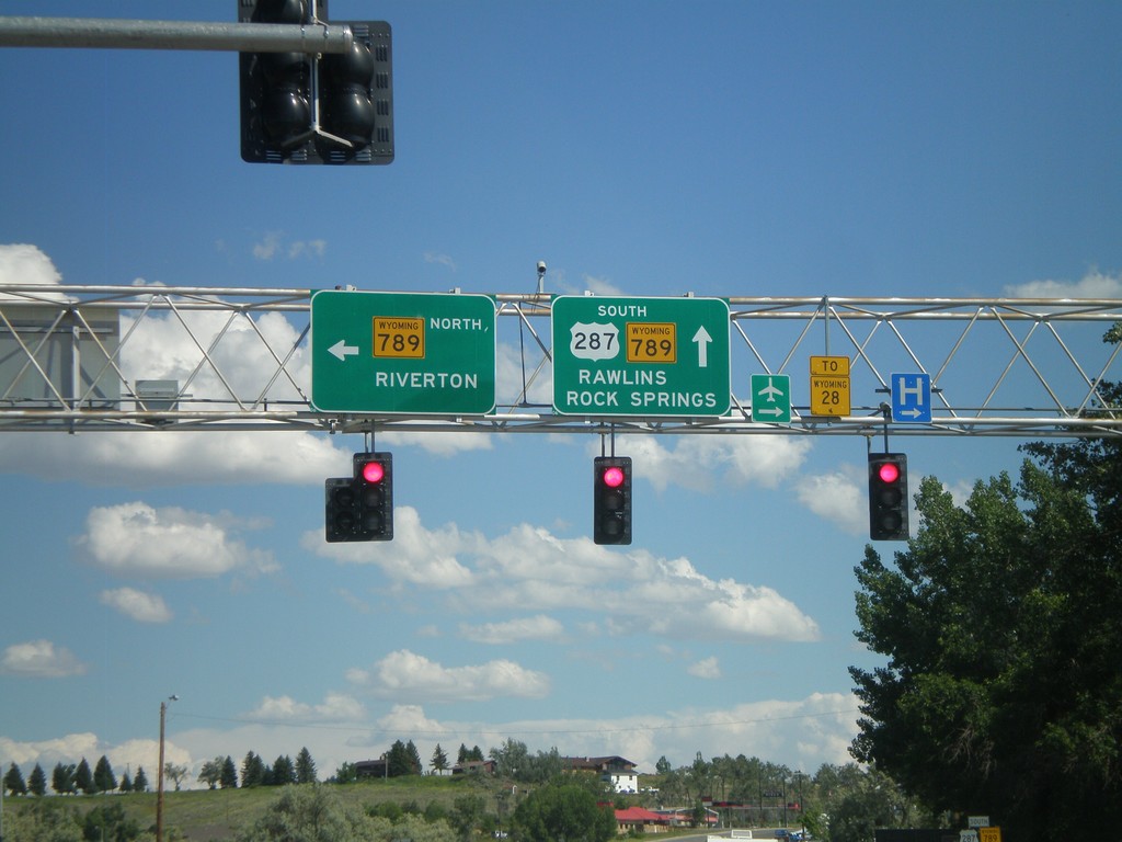
US-287 South at WY-789
US-287 South at WY-789. Turn left for WY-789 north to Riverton. Continue ahead for US-287/WY-789 South to WY-28, Rawlins, and Rock Springs.
Taken 07-02-2011

 Lander
Fremont County
Wyoming
United States
Lander
Fremont County
Wyoming
United States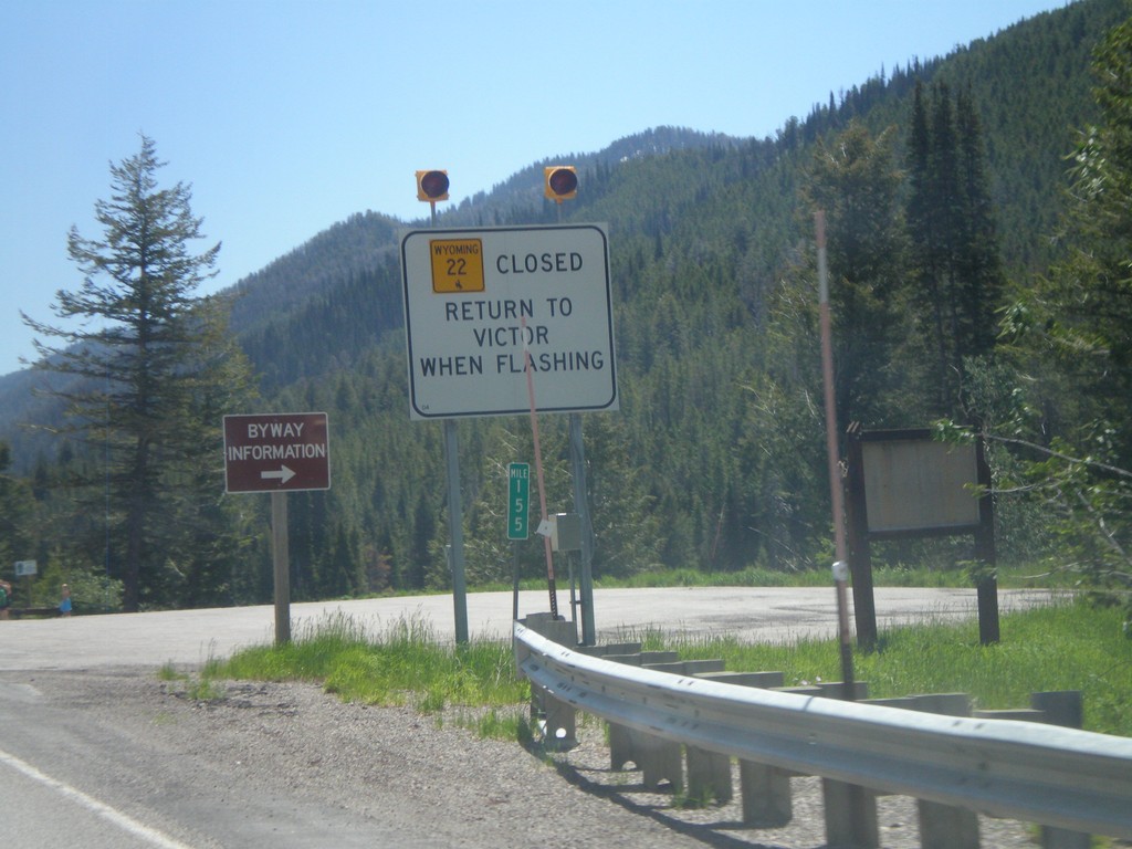
ID-33 East - WY-22 Closure Information
Teton Pass road closure information on ID-33 east approaching the Wyoming state line. When Teton Pass is closed in Wyoming, this is where the road closure starts, just inside of Idaho. All traffic must return to Victor Idaho when the road closure lights are flashing. This is one of the few instances in Idaho of a state highway shield from another state located inside Idaho.
Taken 07-02-2011

 Victor
Teton County
Idaho
United States
Victor
Teton County
Idaho
United States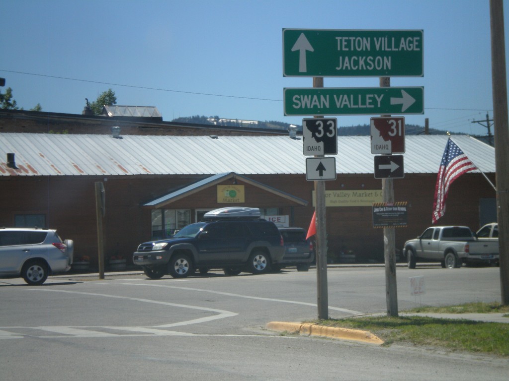
ID-33 East at ID-31
ID-33 East at ID-31 in Victor. Turn right on ID-31 south for Swan Valley. Continue ahead on ID-33 for Teton Village and Jackson (both in Wyoming). Teton Scenic Byway leaves ID-33 here and follows ID-31 south.
Taken 07-02-2011
 Victor
Teton County
Idaho
United States
Victor
Teton County
Idaho
United States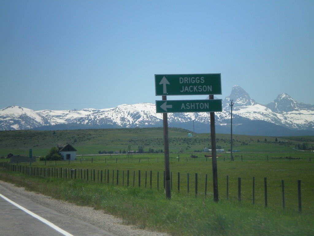
ID-33 East at ID-32
ID-33 east at ID-32 north to Ashton. Continue east on ID-33 for Driggs and Jackson (Wyoming). The Teton Mountain Range are in the background. The Teton Scenic Byway follows ID-32 south and turns east onto ID-33 east here.
Taken 07-02-2011
 Tetonia
Teton County
Idaho
United States
Tetonia
Teton County
Idaho
United States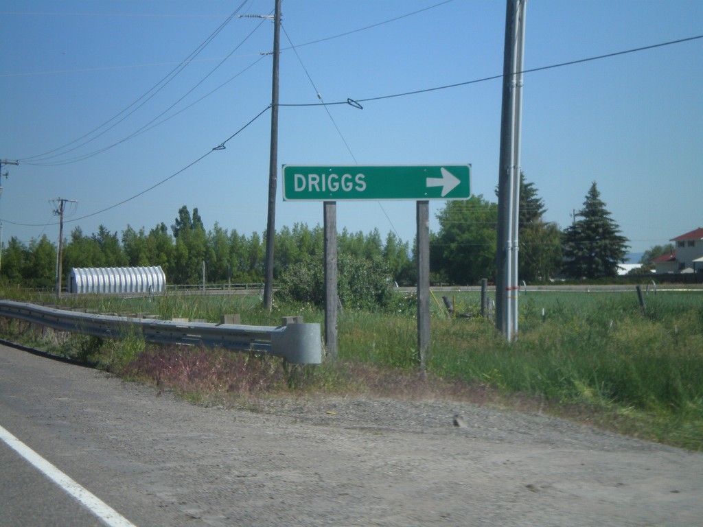
ID-33 East at US-20 Access Road
ID-33 east at access road that connects ID-33 and US-20. Turn right to continue on ID-33 east towards Driggs.
Taken 07-02-2011
Sugar City
Madison County
Idaho
United States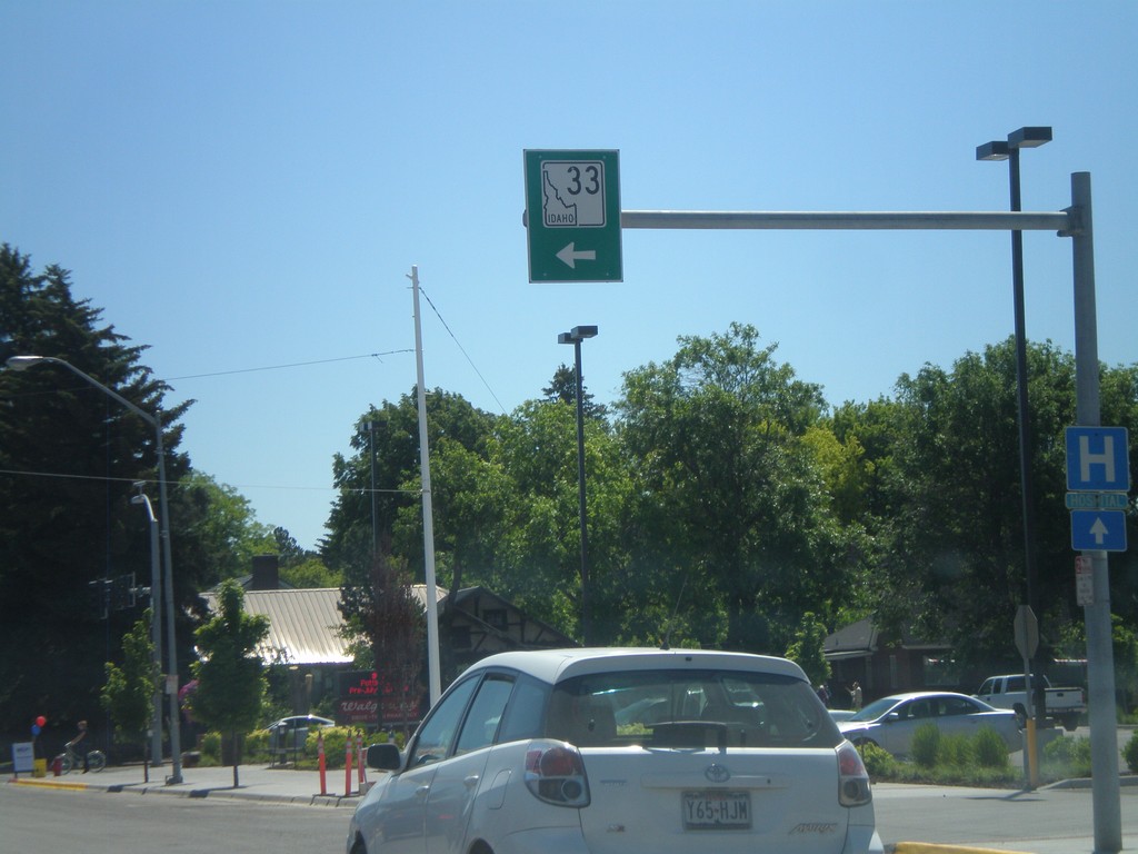
ID-33 East - Rexburg
ID-33 east in downtown Rexburg. Turn left on N 2nd St. to continue on ID-33.
Taken 07-02-2011
Rexburg
Madison County
Idaho
United States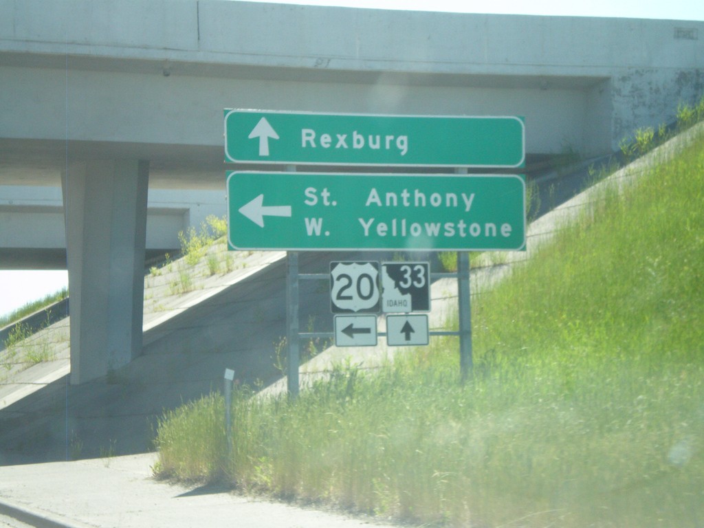
ID-33 East at US-20 East
ID-33 east at US-20 east. Use US-20 east for St. Anthony and West Yellowstone (Montana). Continue east on ID-33 for downtown Rexburg.
Taken 07-02-2011
Rexburg
Madison County
Idaho
United States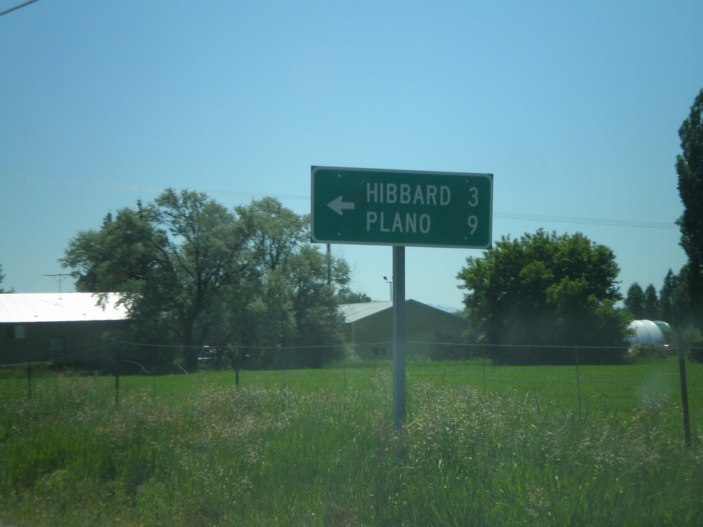
ID-33 East at N 3000 West
ID-33 east at N 3000 West to Hibbard and Plano.
Taken 07-02-2011
Rexburg
Madison County
Idaho
United States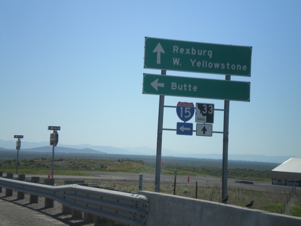
ID-33 East at I-15 North
ID-33 East at I-15 North (Exit 143). Use I-15 North for Butte (Montana). Continue east on ID-33 for Rexburg and West Yellowstone (Montana).
Taken 07-02-2011
 Roberts
Jefferson County
Idaho
United States
Roberts
Jefferson County
Idaho
United States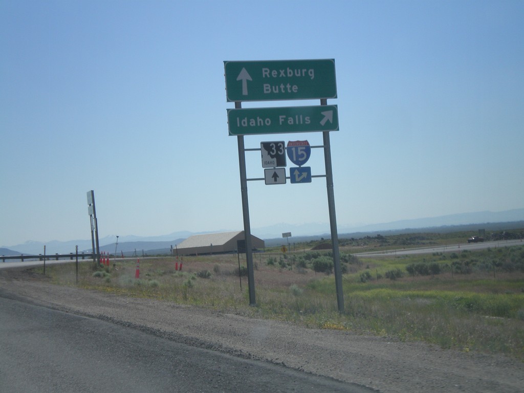
ID-33 East at I-15 South
ID-33 east at I-15 south to Idaho Falls. Continue over overpass for I-15 north onramp to Butte (Montana). Continue east on ID-33 for Rexburg.
Taken 07-02-2011
Sage Junction
Jefferson County
Idaho
United States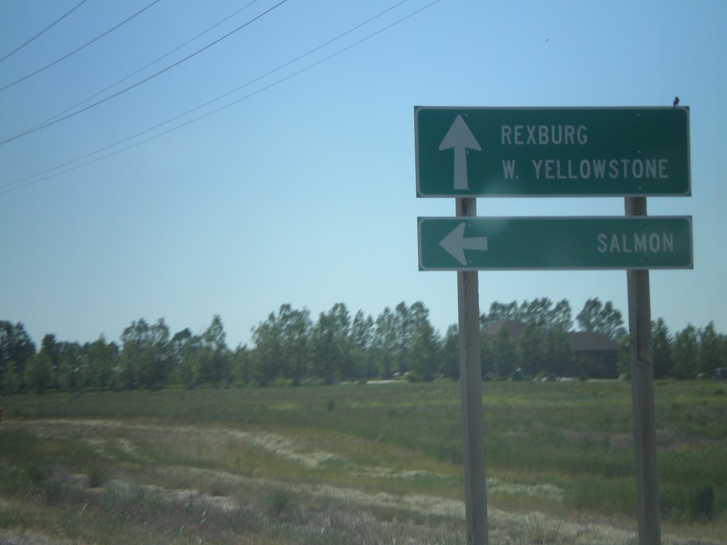
ID-33 East at ID-28
ID-33 east at ID-28 north to Salmon. Continue east on ID-33 for Rexburg and West Yellowstone (Montana). This is the southern end of ID-33. The Sacajawea Historic Byway turns from ID-28 to ID-33 east here.
Taken 07-02-2011
 Mud Lake
Jefferson County
Idaho
United States
Mud Lake
Jefferson County
Idaho
United States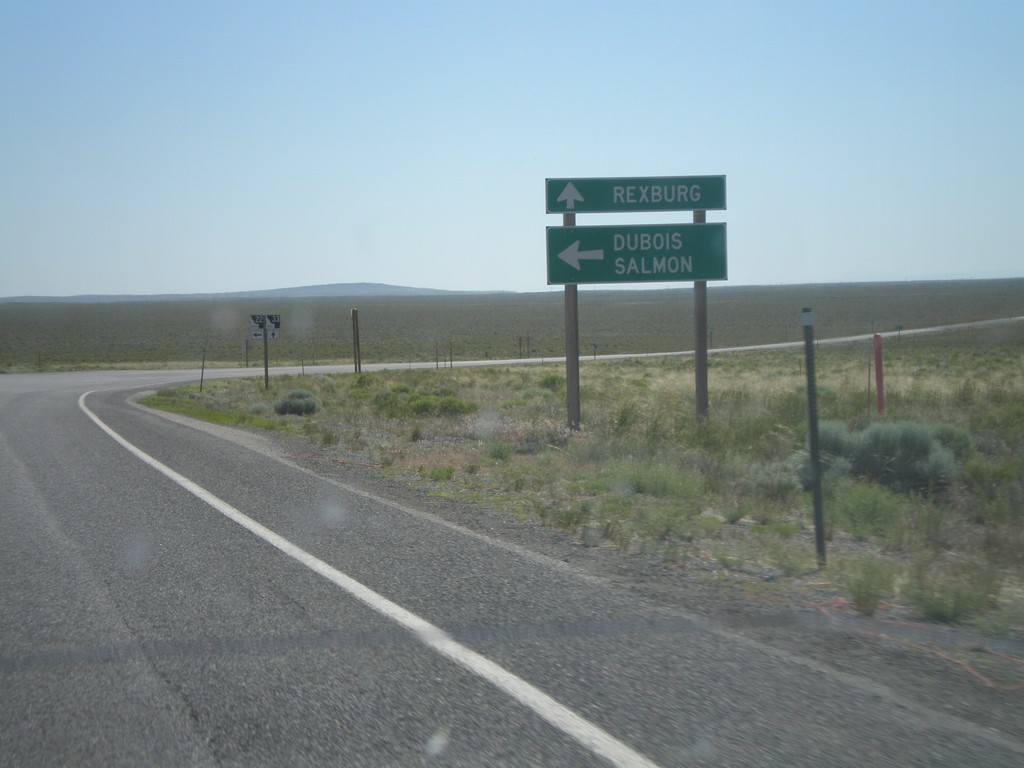
ID-33 East at ID-22 East
ID-33 east at ID-22 east to Dubois and Salmon. Continue east on ID-33 for Rexburg.
Taken 07-02-2011
 Howe
Butte County
Idaho
United States
Howe
Butte County
Idaho
United States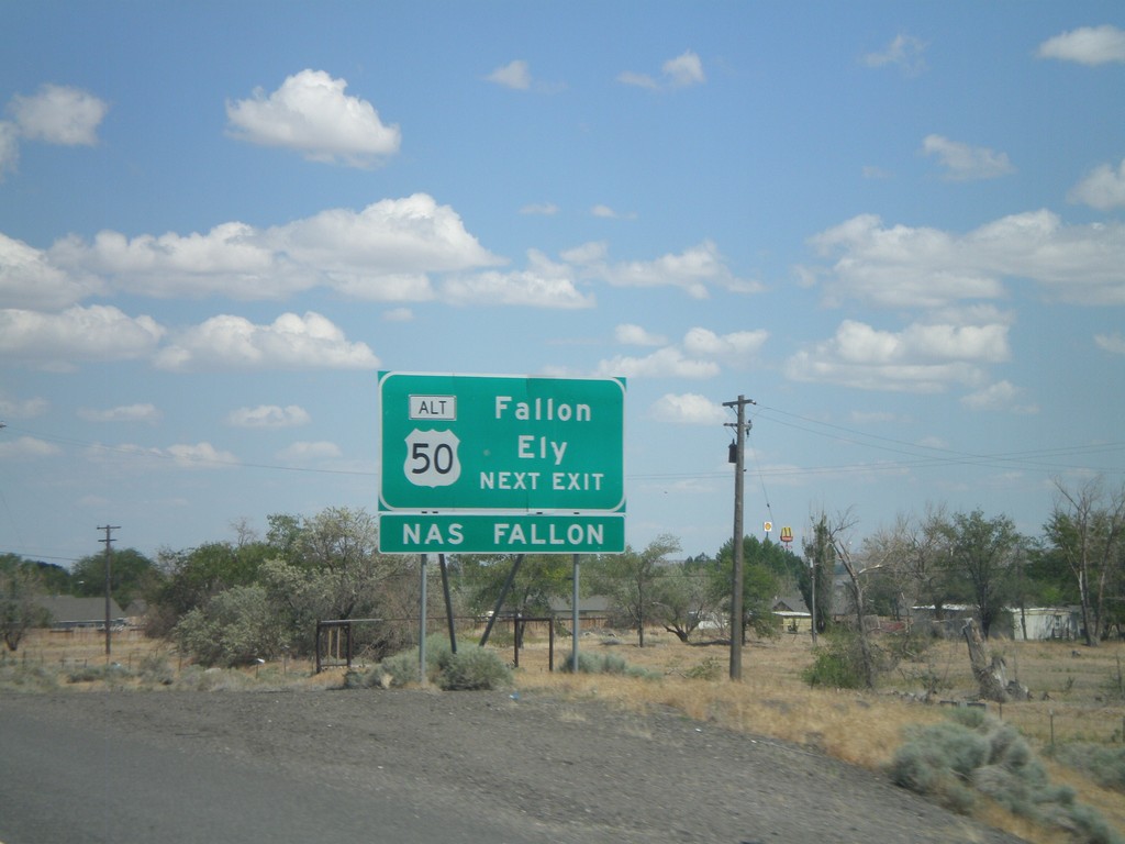
I-80 East Approaching Exit 48
I-80 east approaching Exit 48. Use Exit 48 for Fallon and Ely via Alt. US-50 east.
Taken 06-13-2011


 Fernley
Lyon County
Nevada
United States
Fernley
Lyon County
Nevada
United States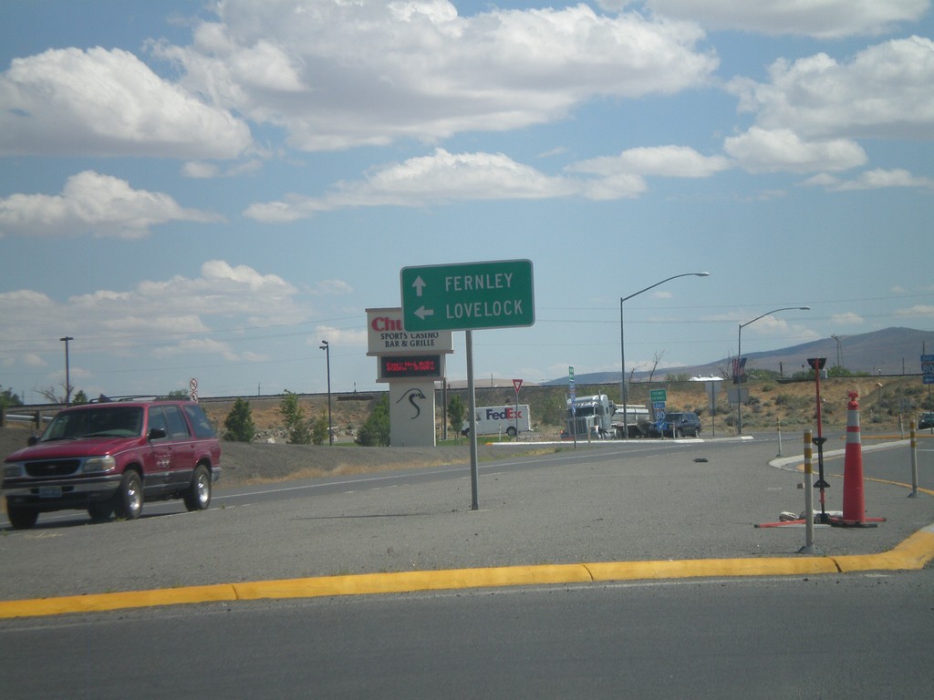
NV-427 South at I-80 East
NV-427 south at I-80 east to Lovelock. Continue south on NV-427/BL-80 into downtown Fernley.
Taken 06-13-2011

 Fernley
Lyon County
Nevada
United States
Fernley
Lyon County
Nevada
United States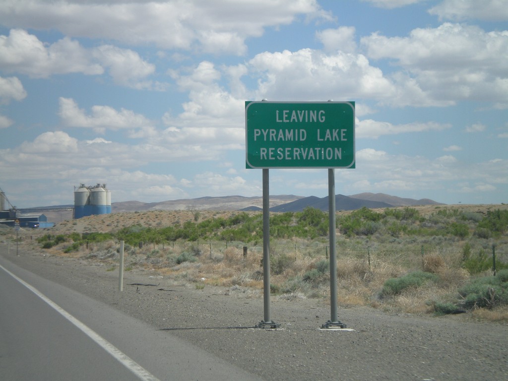
NV-427 South - Leaving Pyramid Lake Indian Reservation
Leaving the Pyramid Lake Indian Reservation on NV-427 south. The Pyramid Lake Indian Reservation is home to the Pyramid Lake Paiute Tribe.
Taken 06-13-2011
Fernley
Lyon County
Nevada
United States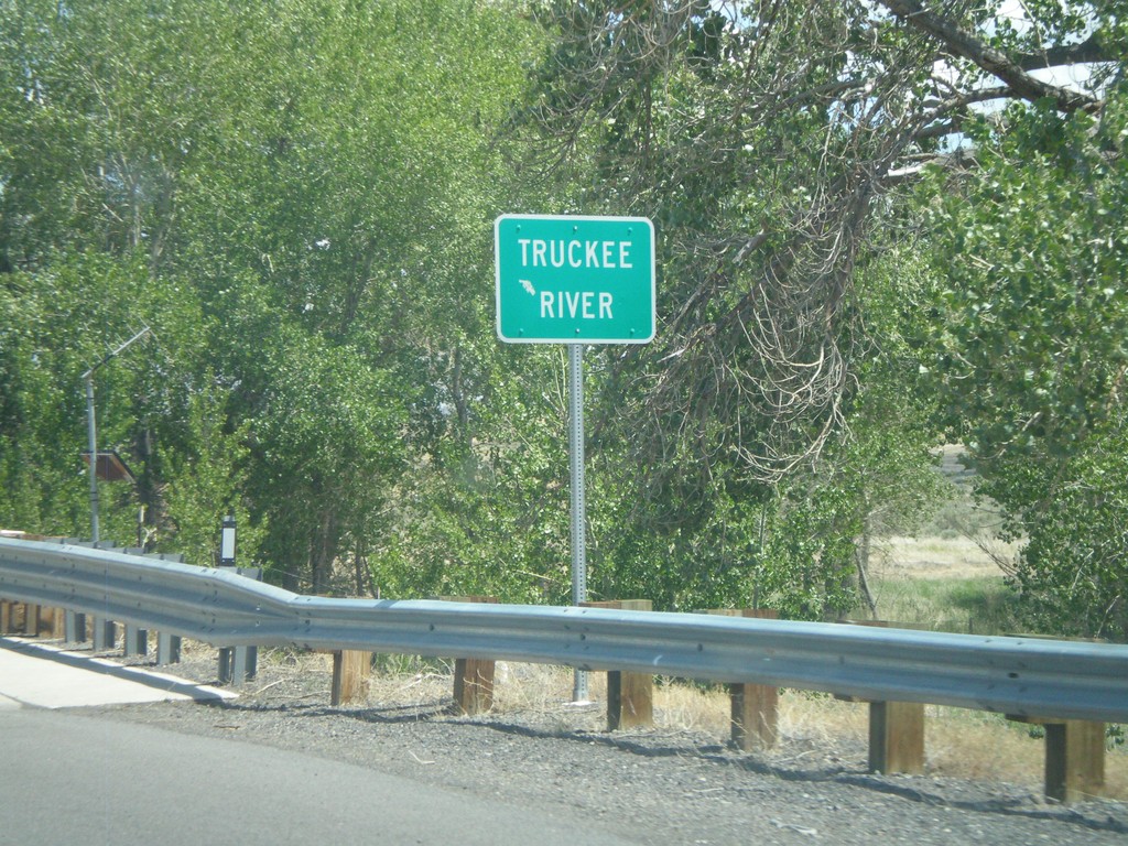
NV-427 South - Truckee River
NV-427 south crossing the Truckee River in Wadsworth.
Taken 06-13-2011
Sparks
Washoe County
Nevada
United States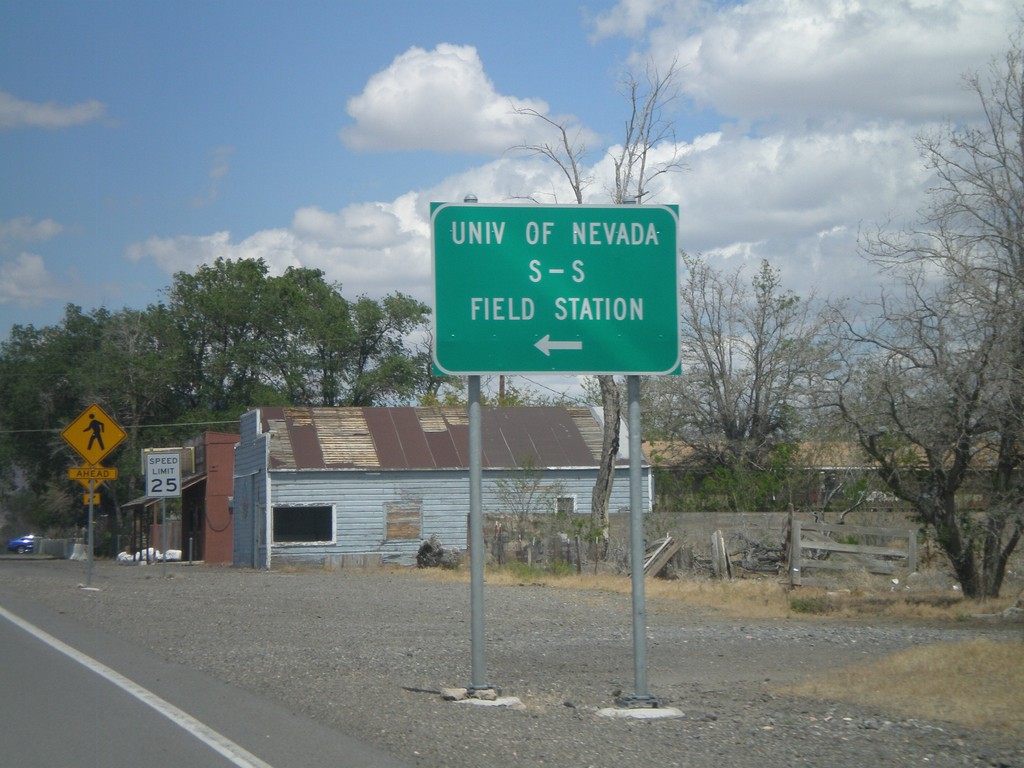
NV-427 East at NV-447 North
NV-427 East at NV-447 North to the University of Nevada S-S Field Station and Pyramid Lake.
Taken 06-13-2011
 Wadsworth
Washoe County
Nevada
United States
Wadsworth
Washoe County
Nevada
United States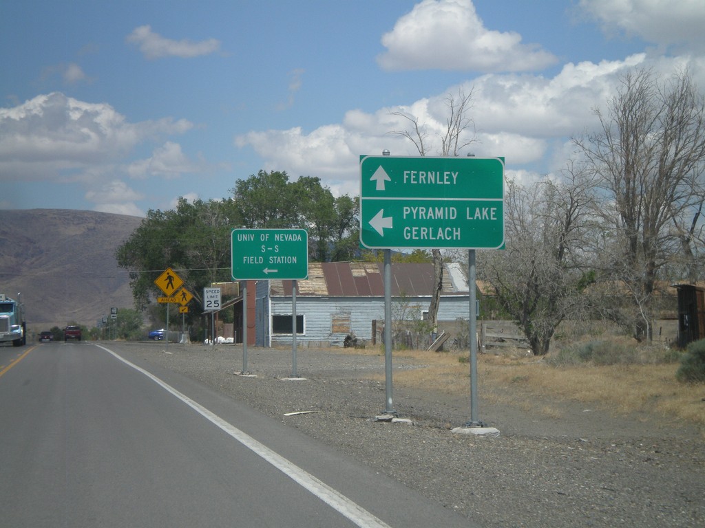
NV-427 East at NV-447
NV-427 east at NV-447 north. Use NV-447 north for Pyramid Lake and Gerlach. Continue east on NV-427 for Fernley.
Taken 06-13-2011
Wadsworth
Washoe County
Nevada
United States