Signs Tagged With Big Green Sign
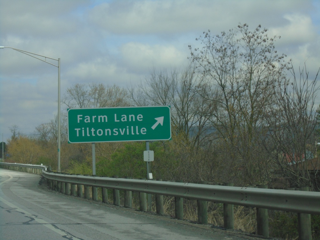
OH-7 North - Tiltonsville Interchange
OH-7 north at Farm Lane/Tiltonsville interchange.
Taken 04-01-2024
 Tiltonsville
Jefferson County
Ohio
United States
Tiltonsville
Jefferson County
Ohio
United States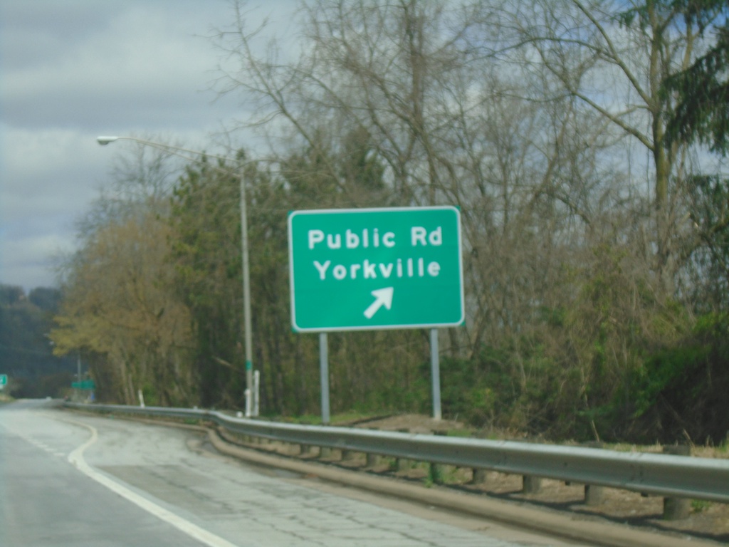
OH-7 North - Yorkville Interchange
OH-7 north at Public Road/Yorkville interchange.
Taken 04-01-2024
Yorkville
Belmont County
Ohio
United States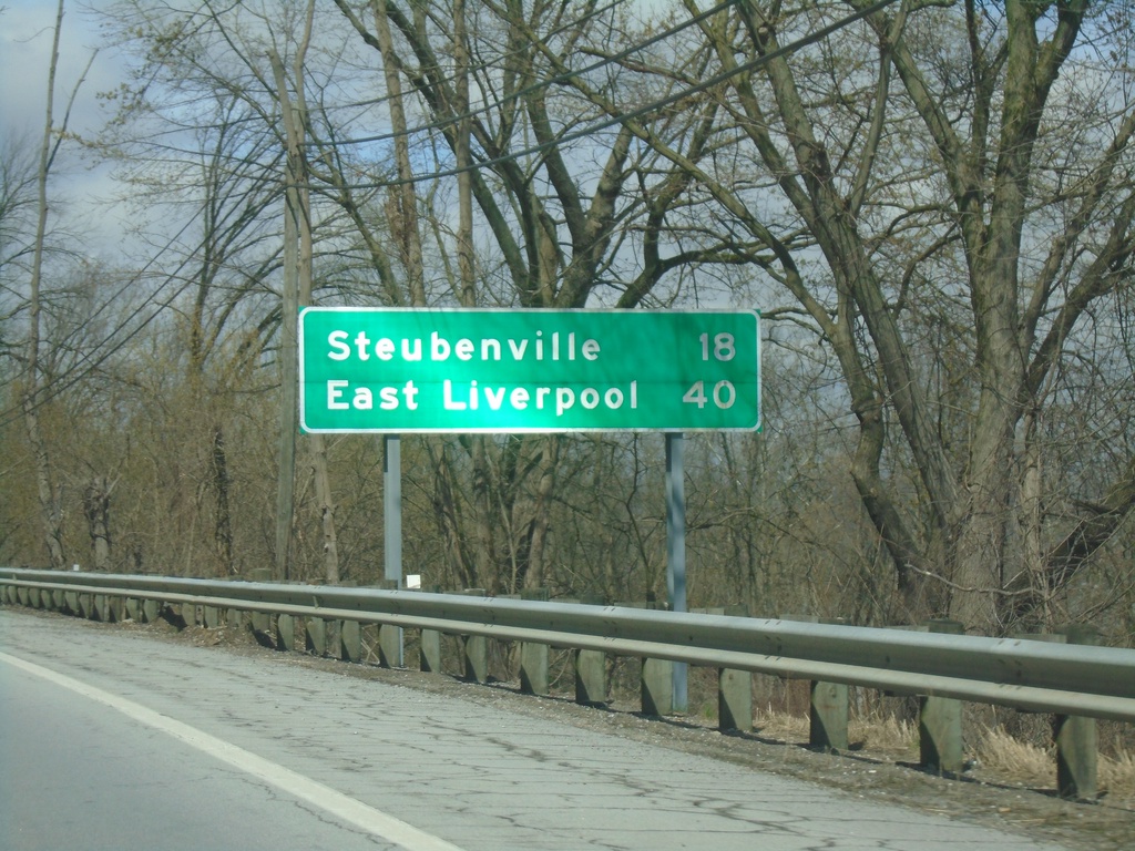
OH-7 North - Distance Marker
Distance marker on OH-7 north. Distance to Steubenville and East Liverpool.
Taken 04-01-2024
Martins Ferry
Belmont County
Ohio
United States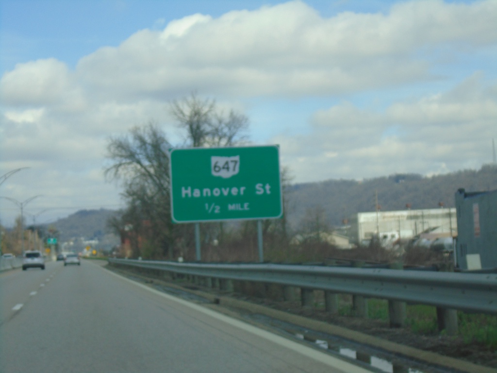
OH-7 North Approaching OH-647
OH-7 North Approaching OH-647/Hannover St.
Taken 04-01-2024
 Martins Ferry
Belmont County
Ohio
United States
Martins Ferry
Belmont County
Ohio
United States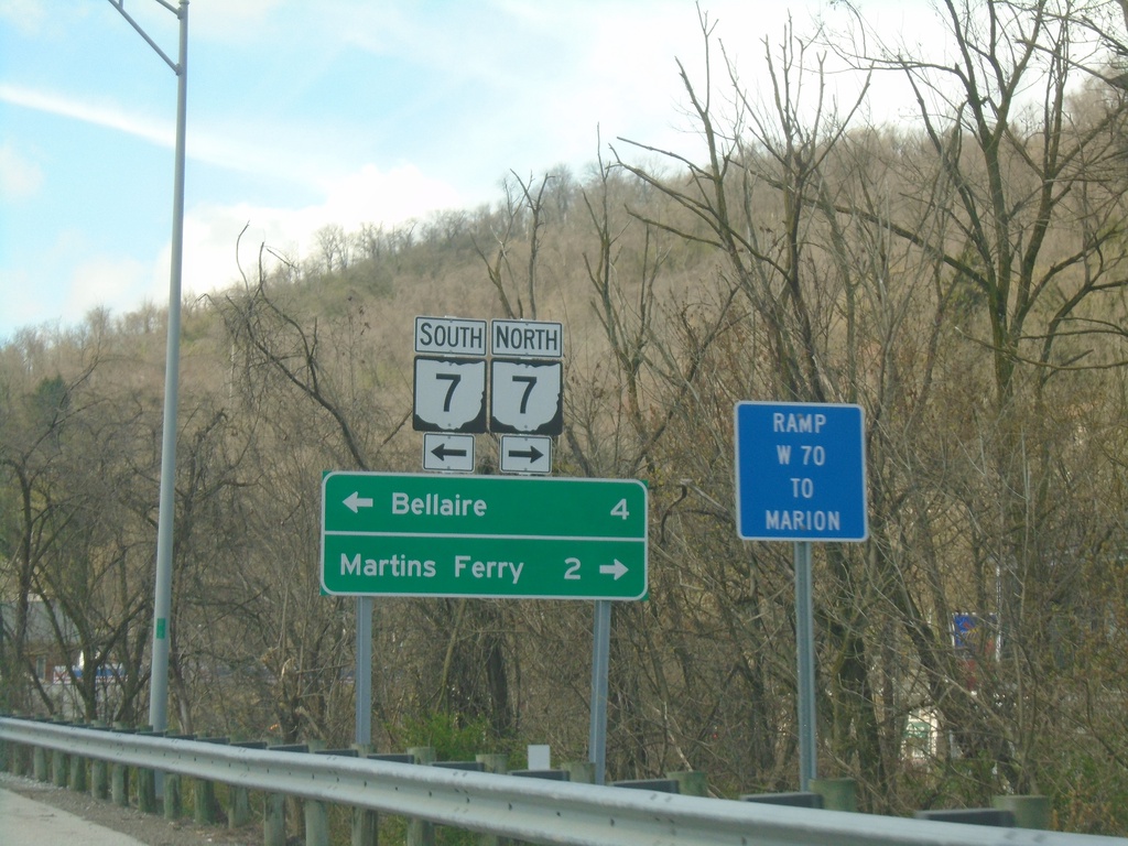
I-70 West - Exit 225 Offramp
I-70 West - Exit 225 offramp at access road to OH-7. Turn right for OH-7 North to Martins Ferry; left for OH-7 South to Bellaire.
Taken 04-01-2024
 Bridgeport
Belmont County
Ohio
United States
Bridgeport
Belmont County
Ohio
United States
I-70 West - Exit 225 / Welcome To Ohio
I-70 west at Exit 225 - OH-7/Bridgeport. Welcome To Ohio - The Heart of It All.
Taken 04-01-2024
Bridgeport
Belmont County
Ohio
United States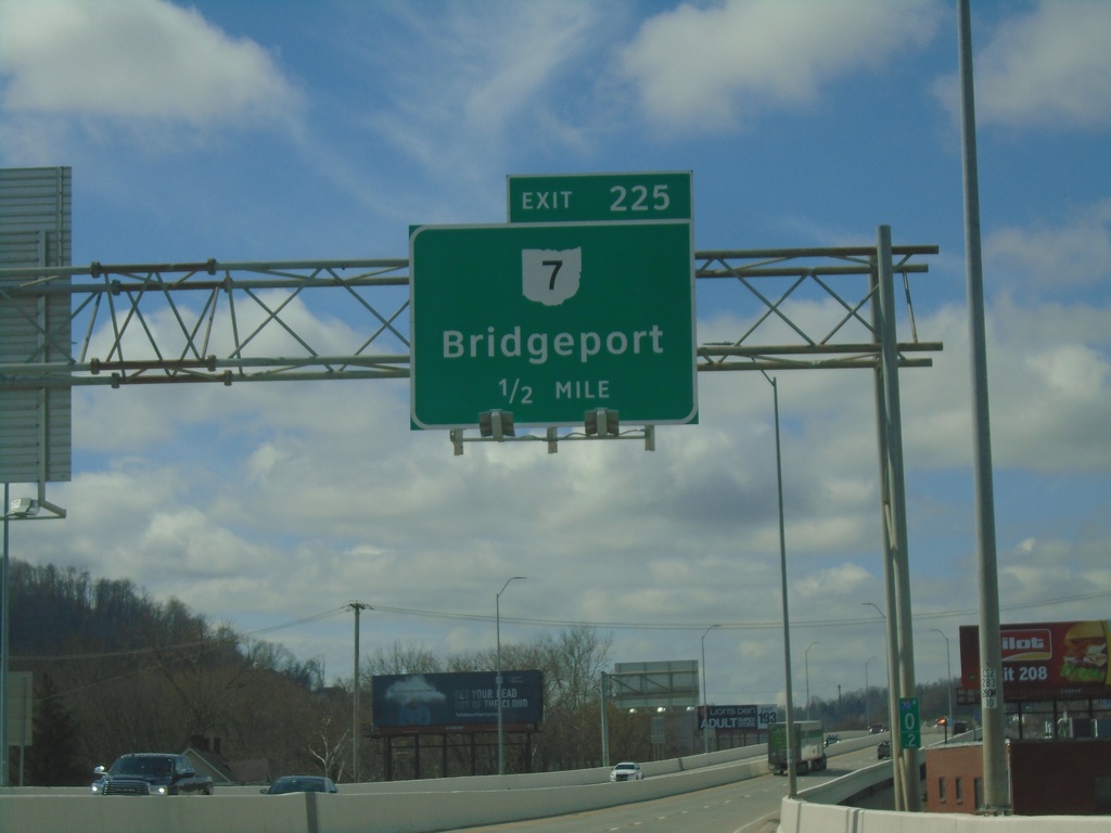
I-70 West - Exit 225
I-70 west approaching Ohio Exit 225 - OH-7/Bridgeport.
Taken 04-01-2024
Wheeling
Ohio County
West Virginia
United States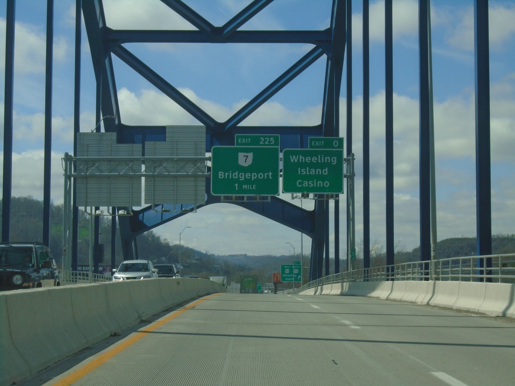
I-70 West - Exits 0 and 225
I-70 west approaching Exit 0 - Wheeling Island Casino and Exit 225 - OH-7/Bridgeport. Taken on the bridge over the Ohio River between Wheeling and Wheeling Island.
Taken 04-01-2024

 Wheeling
Ohio County
West Virginia
United States
Wheeling
Ohio County
West Virginia
United States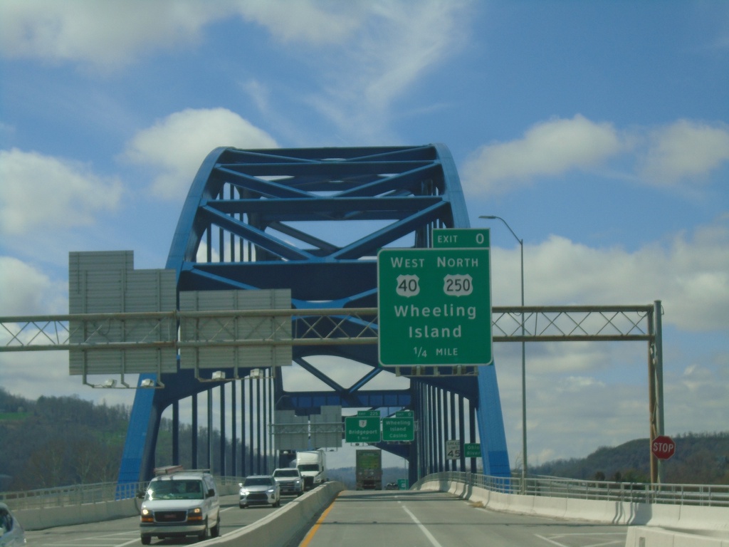
I-70 West - Exit 0
I-70/US-40/US-250 West approaching Exit 0 - US-40 West/US-250 North/Wheeling Island. On the bridge over the Ohio River between Wheeling and Wheeling Island. This is the last exit westbound on I-70 in West Virginia.
Taken 04-01-2024
Wheeling
Ohio County
West Virginia
United States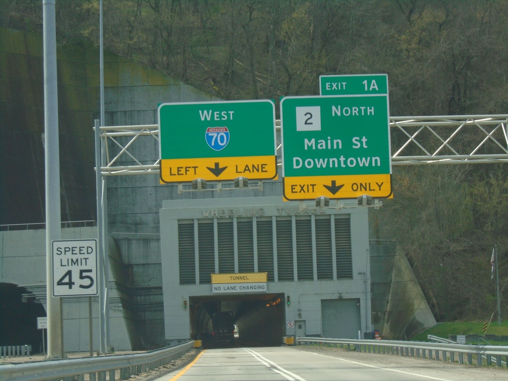
I-70/US-250 West - Exit 1A
I-70/US-250 West approaching Exit 1A - WV-2 North/Main St./Downtown (Wheeling). Approaching Wheeling Tunnel.
Taken 04-01-2024
 Wheeling
Ohio County
West Virginia
United States
Wheeling
Ohio County
West Virginia
United States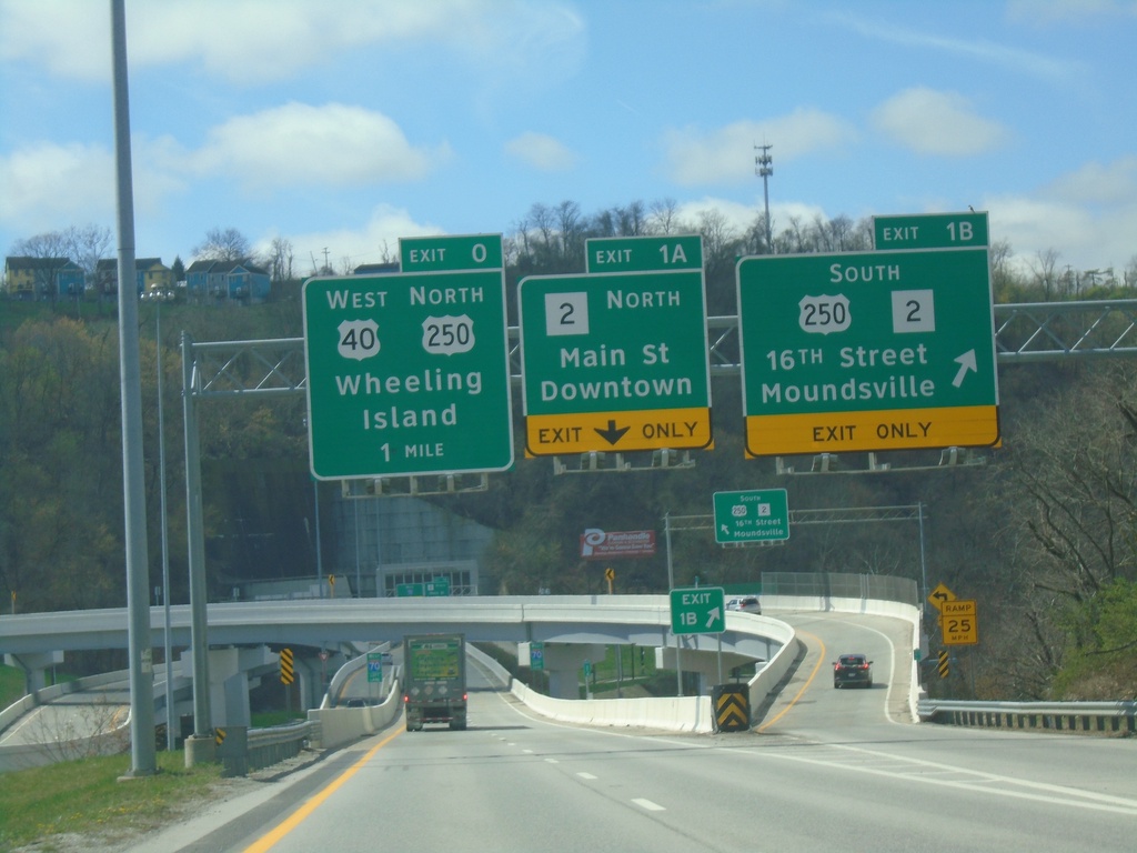
I-70 West - Exits 1B, 1A, and 0
I-70 west at Exit 1B - US-250/WV-2 South/16th St./Moundsville. Approaching Exit 1A - WV-2 North/Main St./Downtown (Wheeling). Approaching Exit 0 - US-250 North/US-40 West/Wheeling Island.
Taken 04-01-2024
Wheeling
Ohio County
West Virginia
United States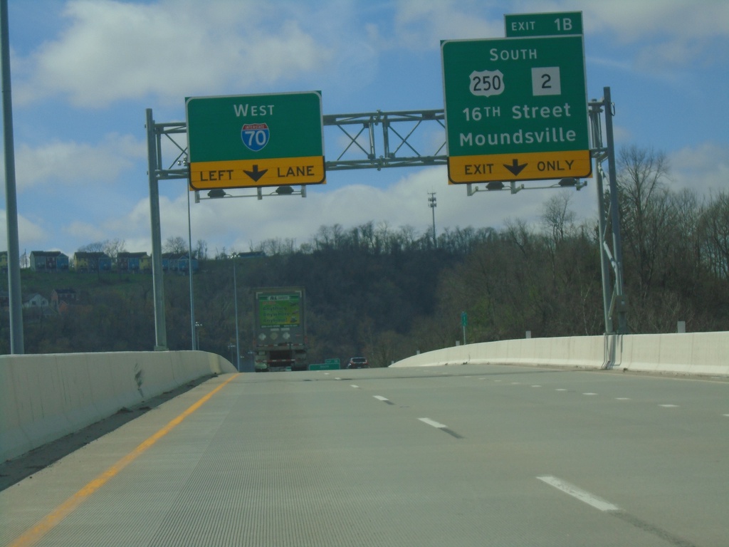
I-70 West Approaching Exit 1B
I-70 west approaching Exit 1B - US-250/WV-2 South/16th St./Moundsville. US-250 West joins I-70 westbound through downtown Wheeling. I-70 narrows to one lane at the Wheeling Tunnel.
Taken 04-01-2024
Wheeling
Ohio County
West Virginia
United States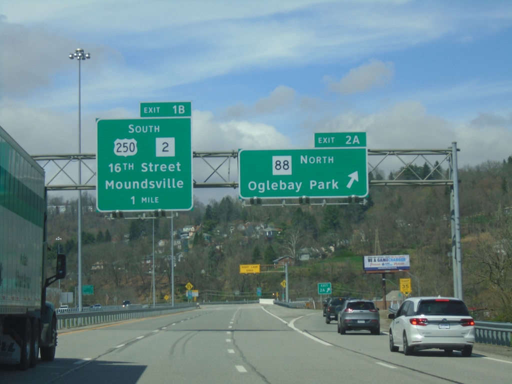
I-70 West - Exits 2A and 1B
I-70 west at Exit 2A - WV-88 North/Oglebay Park. Approaching Exit 1B - US-250/WV-2 South/16th St./Moundsville.
Taken 04-01-2024
 Wheeling
Ohio County
West Virginia
United States
Wheeling
Ohio County
West Virginia
United States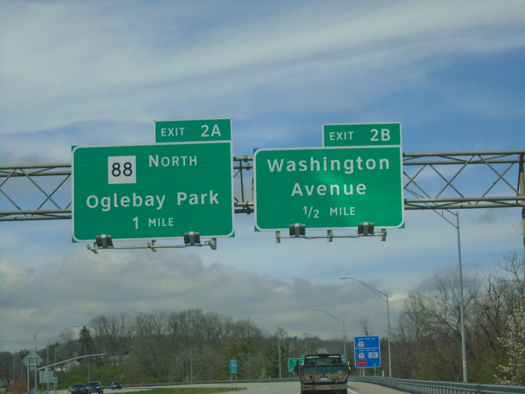
I-70 West - Exits 2B and 2A
I-70 west approaching Exit 2B - Washington Ave. Approaching Exit 2A - WV-88 North/Oglebay Park.
Taken 04-01-2024
Wheeling
Ohio County
West Virginia
United States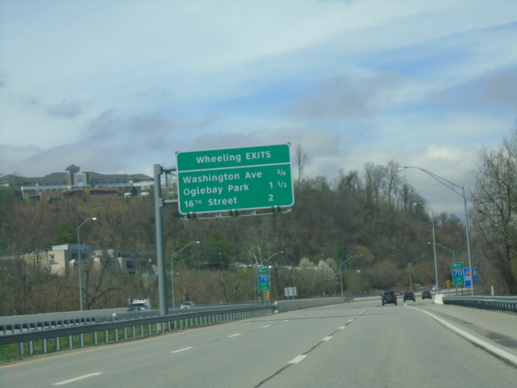
I-70 West - Wheeling Exits
Wheeling Exits on I-70: Washington Ave., Oglebay Park, and 16th ST.
Taken 04-01-2024
Wheeling
Ohio County
West Virginia
United States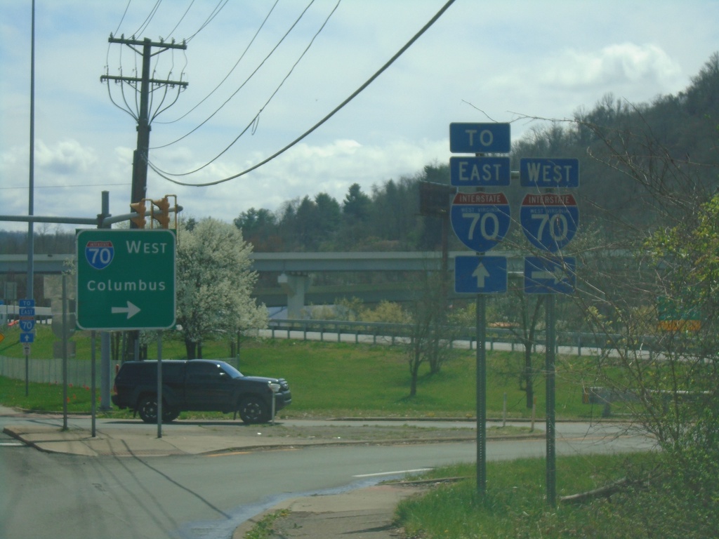
US-40 East at I-70 West
US-40 East at I-70 West to Columbus (OH).
Taken 04-01-2024
Wheeling
Ohio County
West Virginia
United States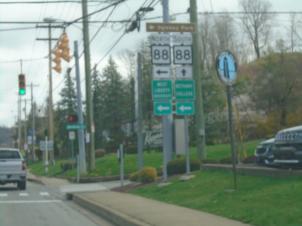
US-40 East at WV-88 in Wheeling
US-40 East at WV-88 in Wheeling. Use WV-88 North (Bethany Pike) to Ogelbay Park, Bethany College, and West Liberty University.
Taken 04-01-2024
Wheeling
Ohio County
West Virginia
United States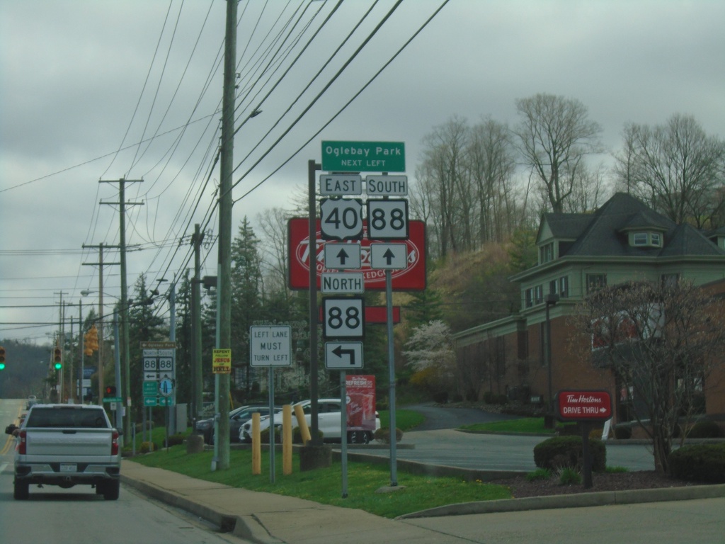
US-40 East at WV-88 East
US-40 East at WV-88 East (Bethany Pike) to Ogelbay Park.
Taken 04-01-2024
Wheeling
Ohio County
West Virginia
United States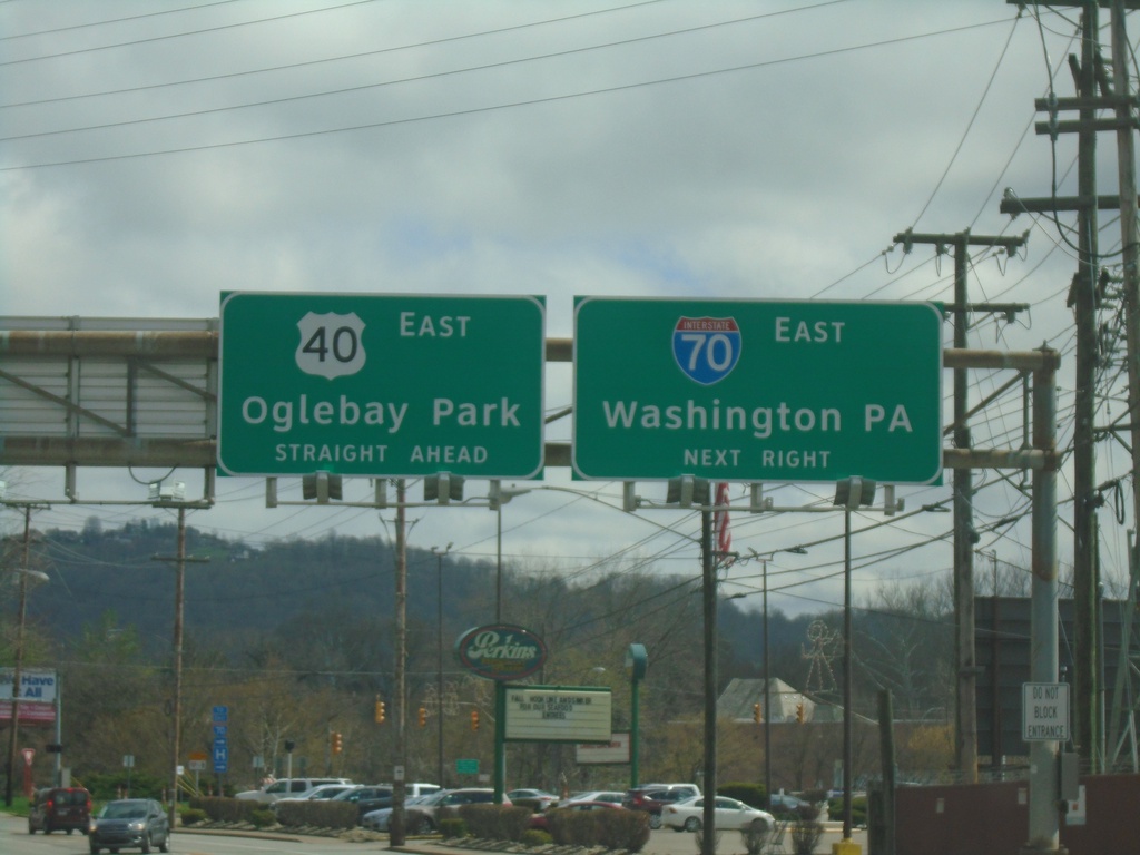
US-40 East at I-70
US-40 East at I-70 East to Washington (PA). Continue east on US-40 to Oglebay Park.
Taken 04-01-2024
Wheeling
Ohio County
West Virginia
United States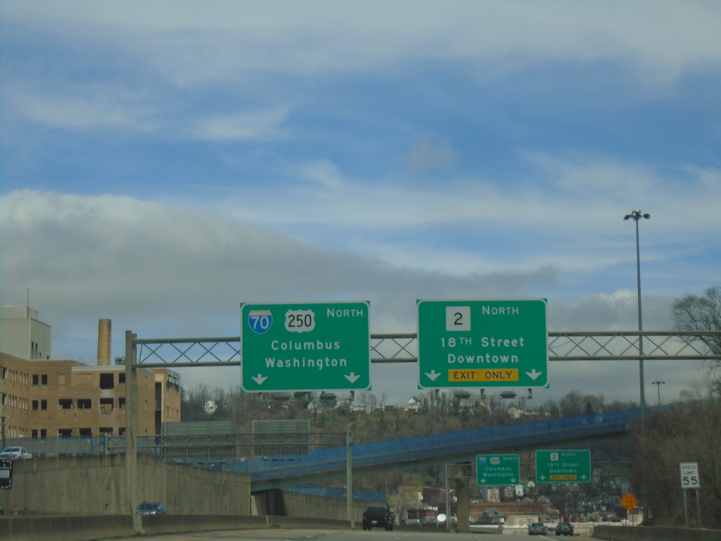
WV-2 North/US-250 West Approaching WV-2/US-250 Split
WV-2 North/US-250 West Approaching WV-2/US-250 split. Use WV-2 North/18th St./Downtown (Wheeling). Continue west on US-250 for I-70 to Columbus (OH) and Washington (PA).
Taken 04-01-2024
Wheeling
Ohio County
West Virginia
United States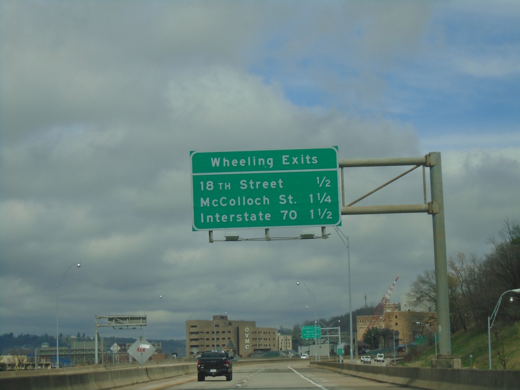
US-250 West/WV-2 North - Wheeling Exits
Wheeling Exits on US-250 West/WV-2 North: 18th St., McColloch St., and I-70.
Taken 04-01-2024
Wheeling
Ohio County
West Virginia
United States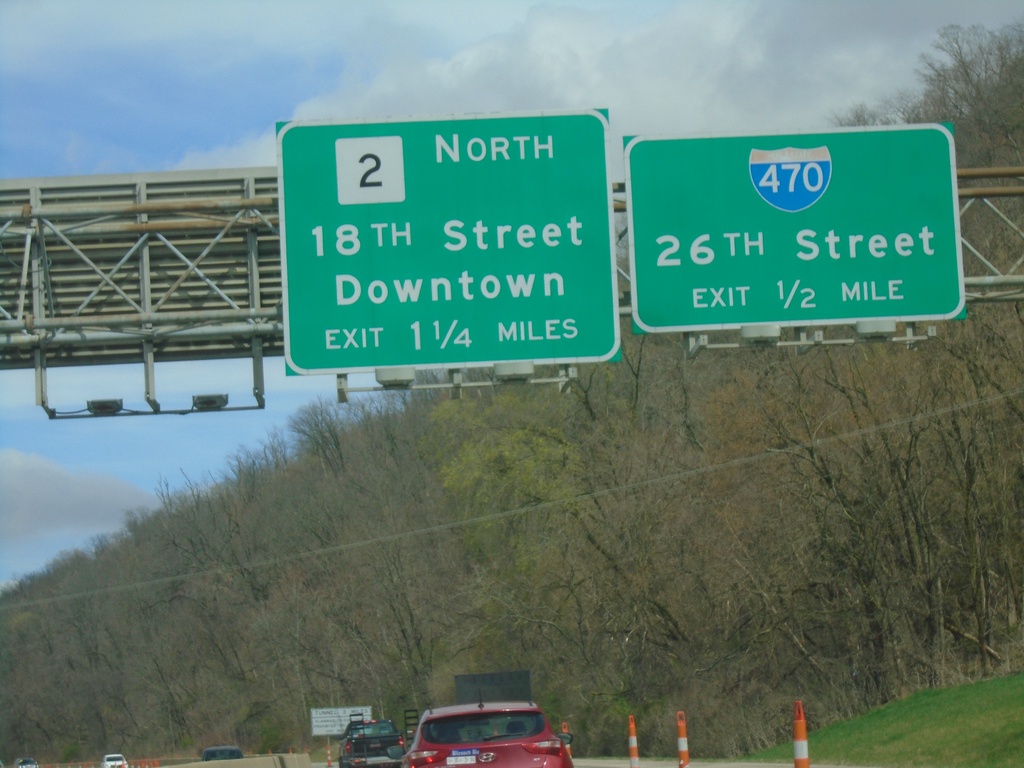
WV-2 North/US-250 West Approaching I-470
WV-2 North/US-250 West approaching I-470/26th St. Approaching WV-2/18th St./Downtown (Wheeling) exit.
Taken 04-01-2024
 Wheeling
Ohio County
West Virginia
United States
Wheeling
Ohio County
West Virginia
United States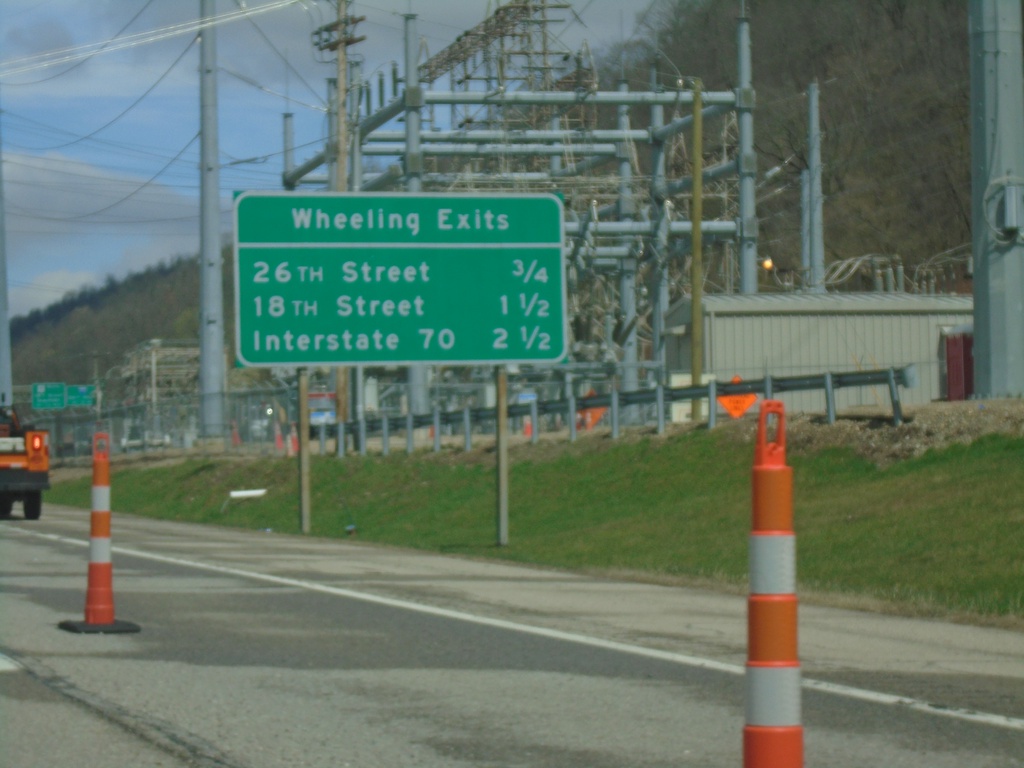
WV-2 North/US-250 West - Wheeling Exits
Wheeling Exits on WV-2 North/US-250 West. 26th St., 18th St., and I-70.
Taken 04-01-2024
Wheeling
Ohio County
West Virginia
United States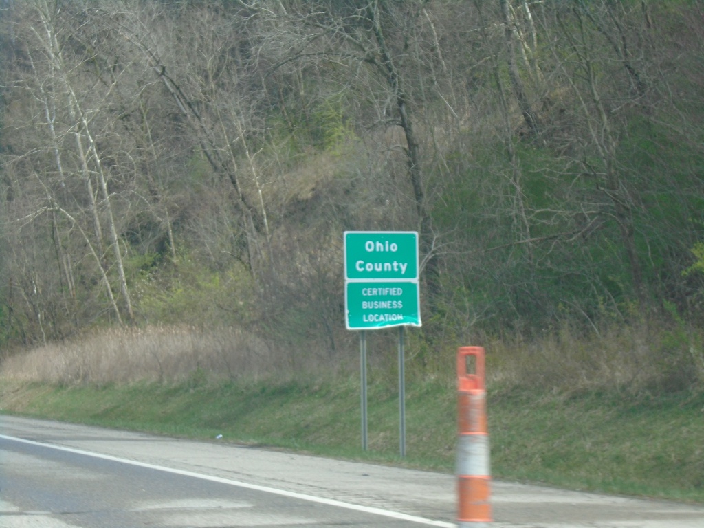
US-250 West/WV-2 North - Ohio County
Entering Ohio County on US-250 West/WV-2 North.
Taken 04-01-2024
Wheeling
Ohio County
West Virginia
United States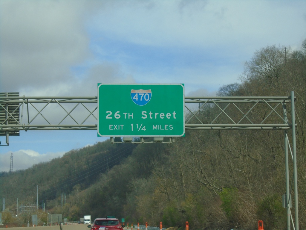
US-250 West/WV-2 North Approaching I-470
US-250 West/WV-2 North approaching I-470/26th St. interchange
Taken 04-01-2024
Benwood
Marshall County
West Virginia
United States