Signs Tagged With Big Green Sign
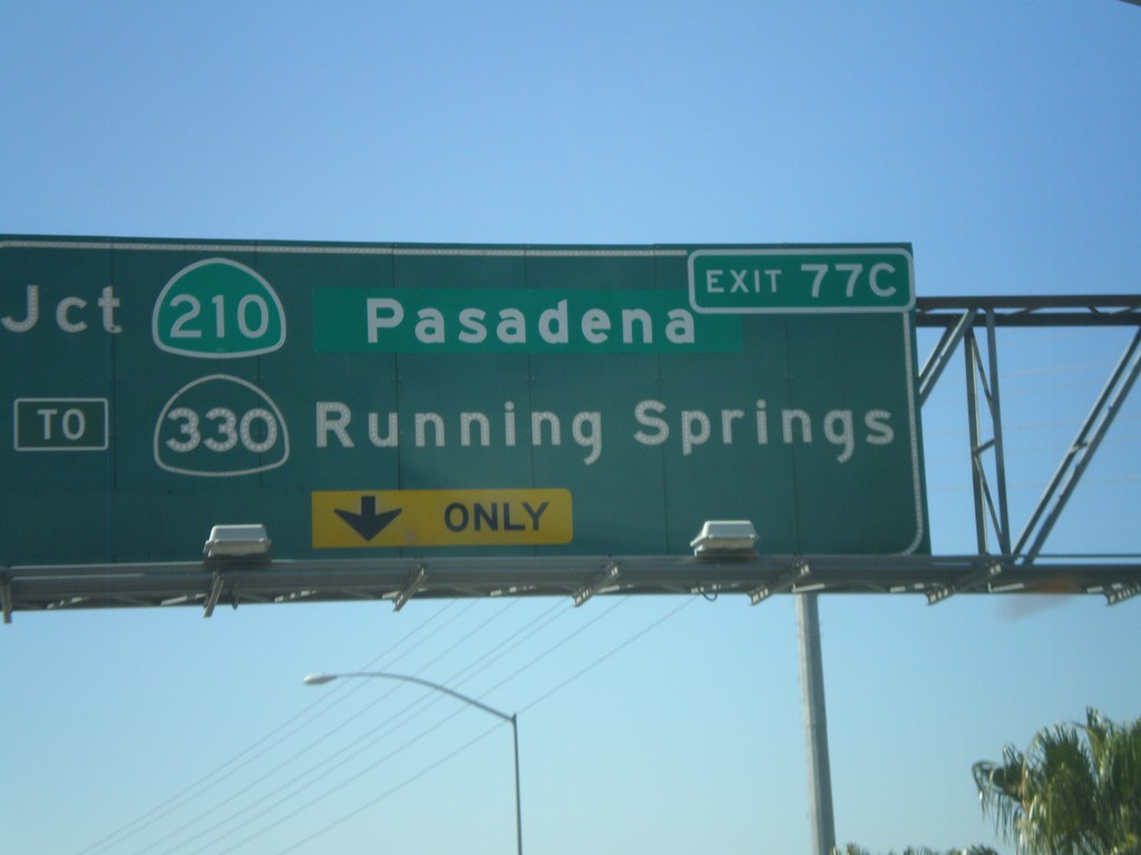
I-10 West Approaching Exit 77C
I-10 west approaching Exit 77C - Jct. CA-210/Pasadena/To CA-330/Running Springs.
Taken 02-28-2011


 Redlands
San Bernardino County
California
United States
Redlands
San Bernardino County
California
United States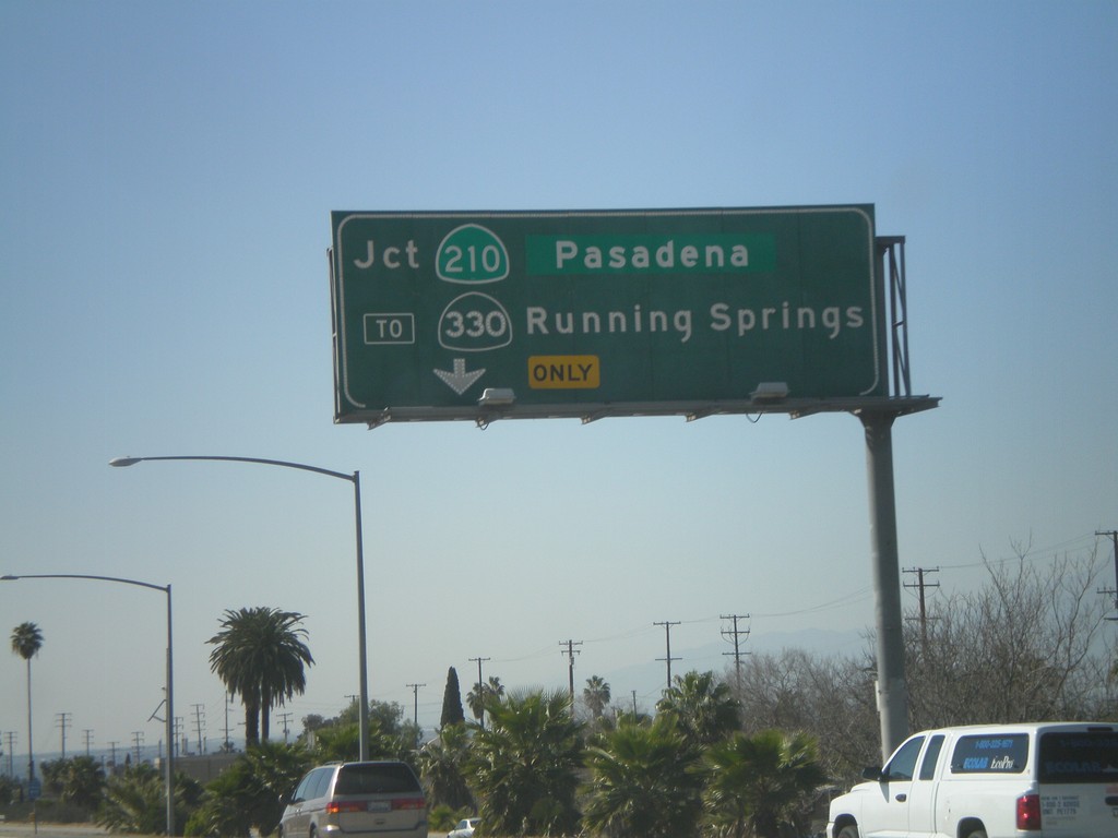
I-10 West - Exit 77C
I-10 west approaching Exit 77C - CA-210/Pasadena/To CA-330/Running Springs.
Taken 02-28-2011
Redlands
San Bernardino County
California
United States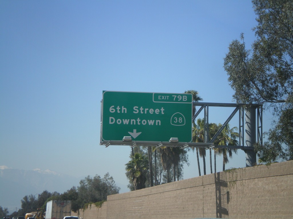
I-10 West - Exit 79B
I-10 west at Exit 79B - CA-38/6th St./Downtown.
Taken 02-28-2011
 Redlands
San Bernardino County
California
United States
Redlands
San Bernardino County
California
United States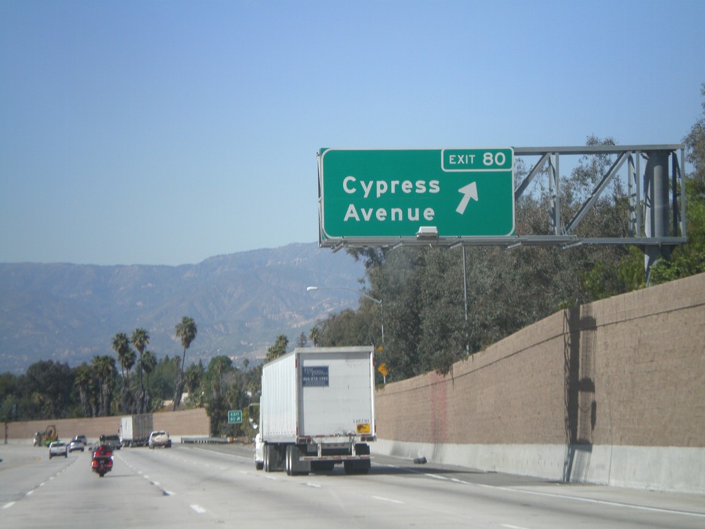
I-10 West - Exit 80
I-10 west at Exit 80 - Cypress Ave.
Taken 02-28-2011
Redlands
San Bernardino County
California
United States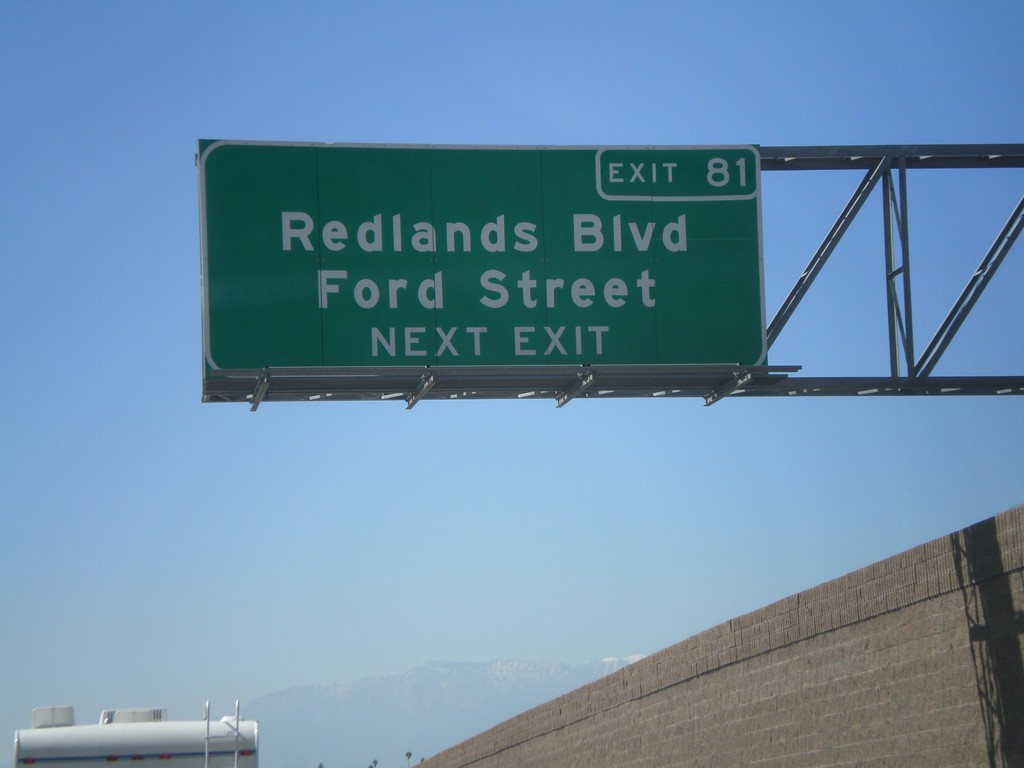
I-10 West Approaching Exit 82
I-10 west approaching Exit 81 - Redlands Blvd./Ford St.
Taken 02-28-2011
Redlands
San Bernardino County
California
United States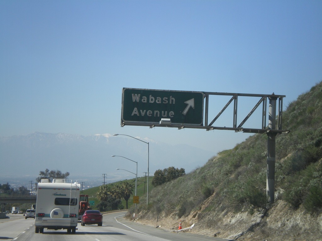
I-10 West - Exit 82
I-10 west at Exit 82 - Wabash Ave.
Taken 02-28-2011
Redlands
San Bernardino County
California
United States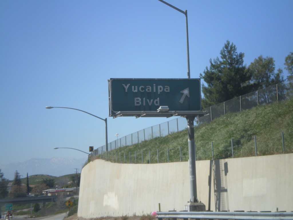
I-10 West - Exit 83
I-10 west at Exit 83 - Yucaipa Blvd.
Taken 02-28-2011
Yucaipa
San Bernardino County
California
United States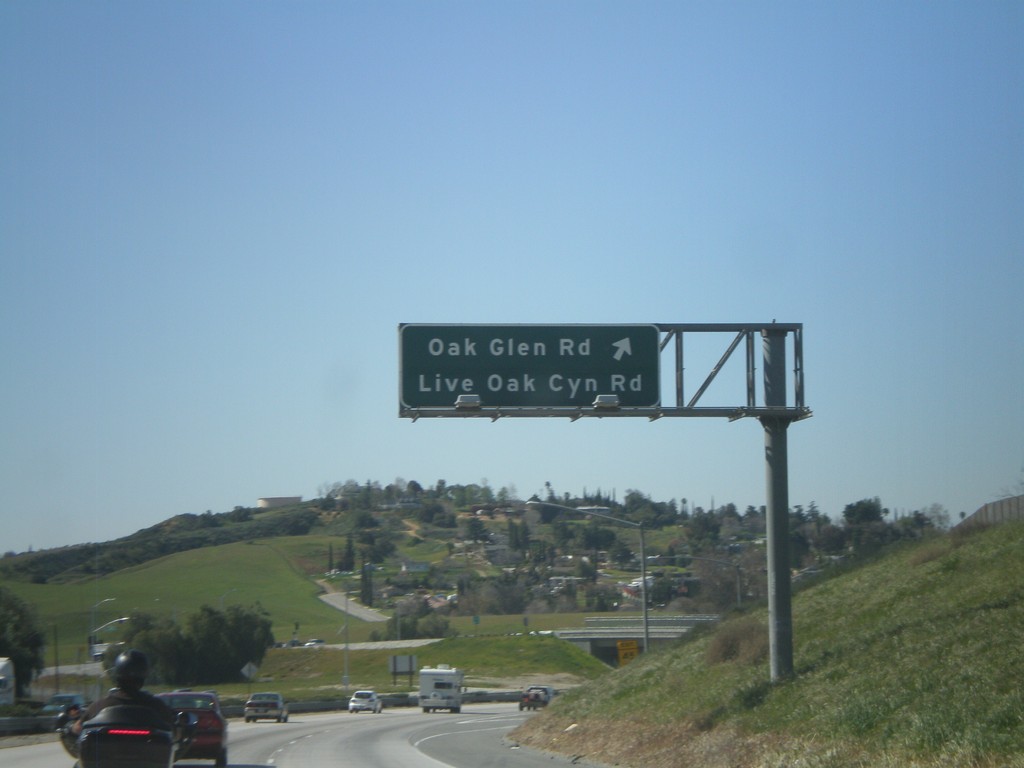
I-10 West - Exit 85
I-10 west at Exit 85 - Oak Glen Road/Live Oak Canyon Road.
Taken 02-28-2011
Yucaipa
San Bernardino County
California
United States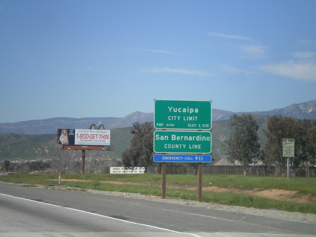
I-10 West - San Bernardino County Line
I-10 west at San Bernardino County Line, and Yucaipa City Limits.
Taken 02-28-2011
Calimesa
San Bernardino County
California
United States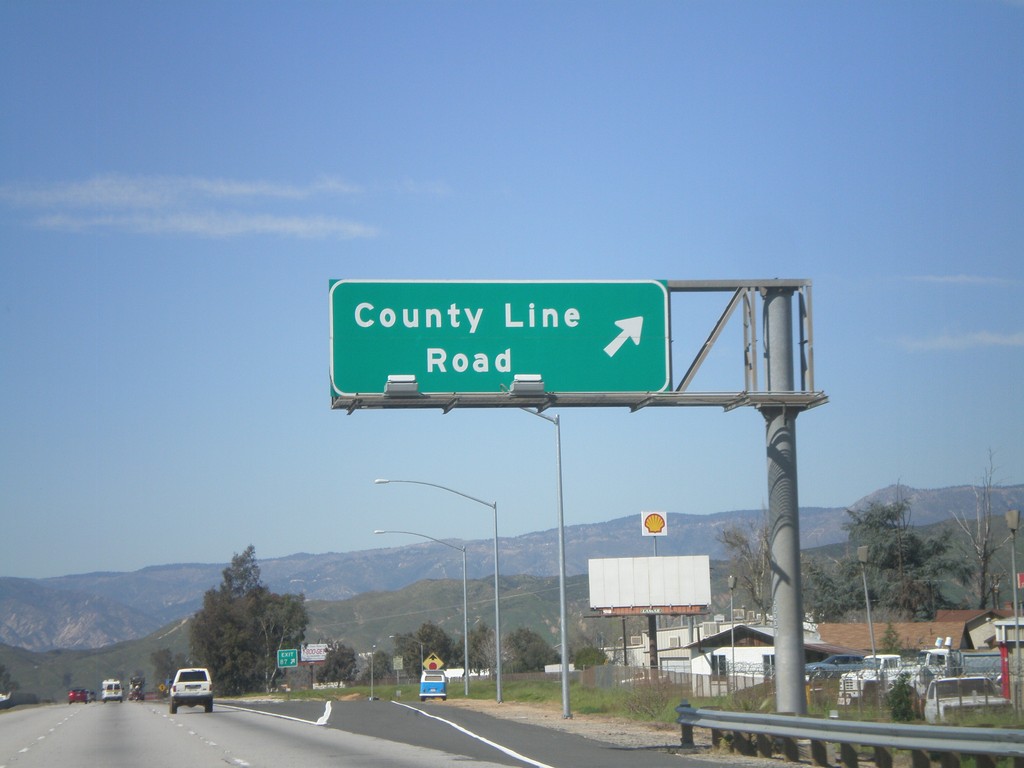
I-10 West - Exit 87
I-10 west at Exit 87 - County Line Road.
Taken 02-28-2011
Calimesa
Riverside County
California
United States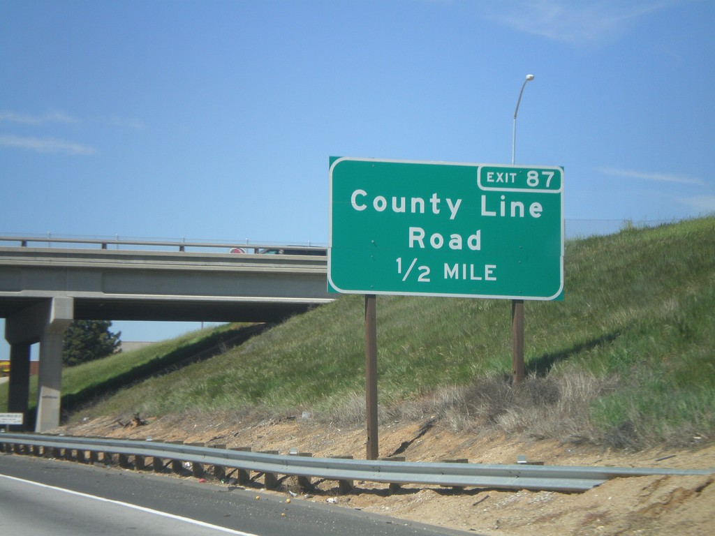
I-10 West Approaching Exit 87
I-10 west approaching Exit 87 - County Line Road.
Taken 02-28-2011
Calimesa
Riverside County
California
United States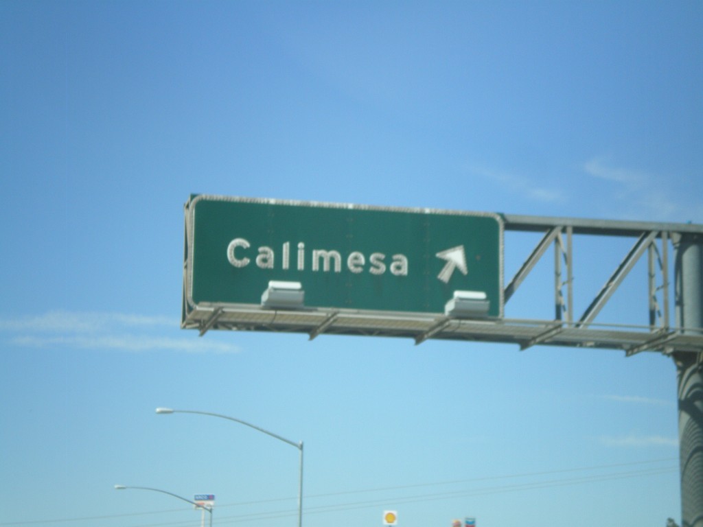
I-10 West - Exit 88
I-10 west at Exit 88 - Calimesa.
Taken 02-28-2011
Calimesa
Riverside County
California
United States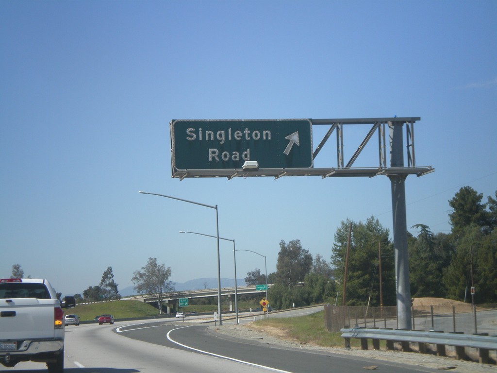
I-10 West - Exit 89
I-10 west at Exit 89 - Singleton Road.
Taken 02-28-2011
Calimesa
Riverside County
California
United States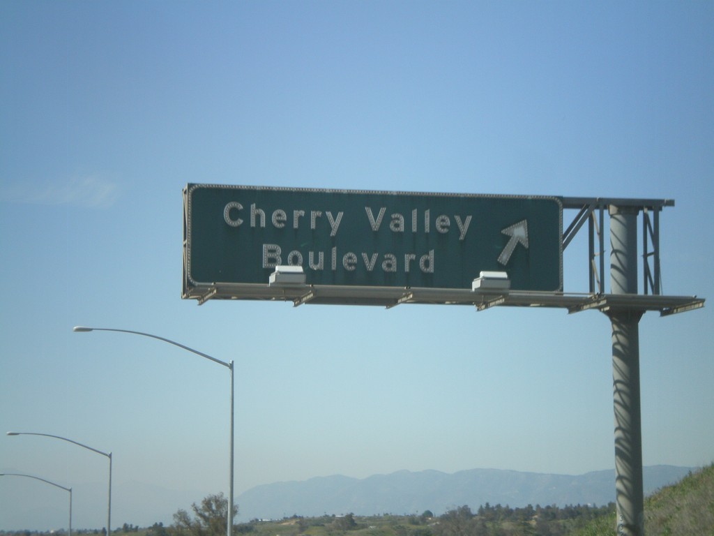
I-10 West - Exit 90
I-10 west at Exit 90 - Cherry Valley Blvd.
Taken 02-28-2011
Calimesa
Riverside County
California
United States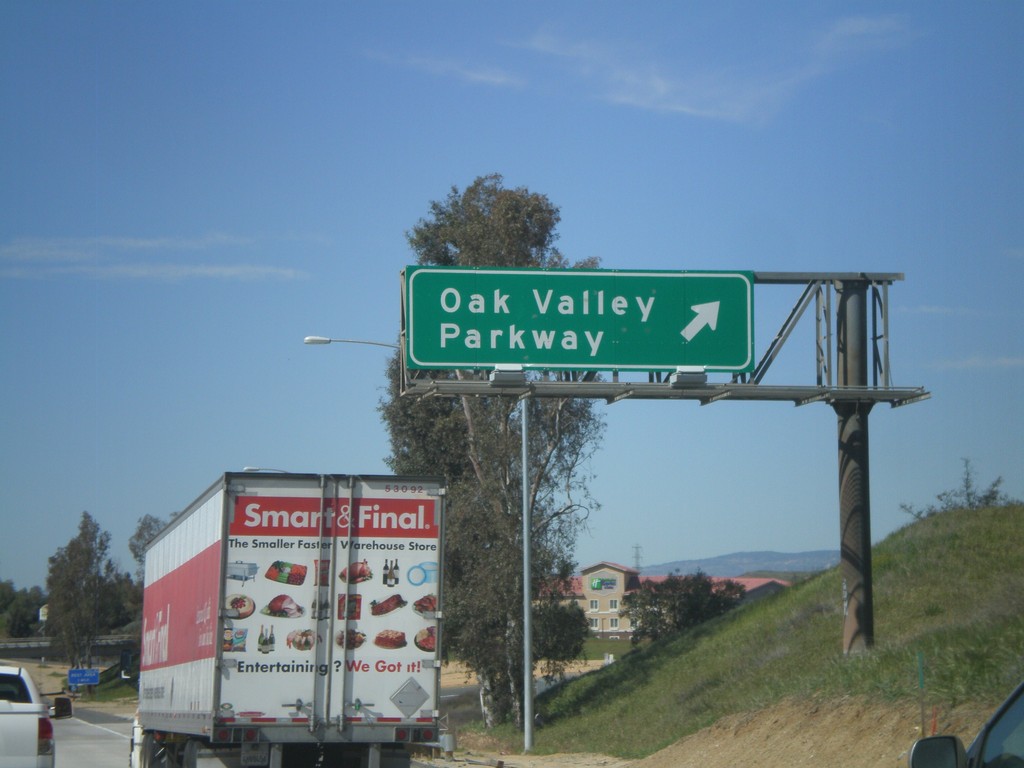
I-10 West - Exit 92
I-10 west at Exit 92 - Oak Valley Parkway.
Taken 02-28-2011
Beaumont
Riverside County
California
United States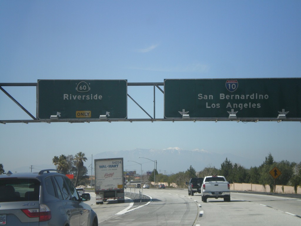
I-10 West - Exit 93
I-10 west at Exit 93 - CA-60/Riverside. I-10 continues west towards San Bernardino and Los Angeles. CA-60 parallels I-10 to the south into Los Angeles. Although the sign does not mention it, either route can be used for Los Angeles. An old US-60 shield can be sign peeking out from behind the CA-60 shield.
Taken 02-28-2011
 Beaumont
Riverside County
California
United States
Beaumont
Riverside County
California
United States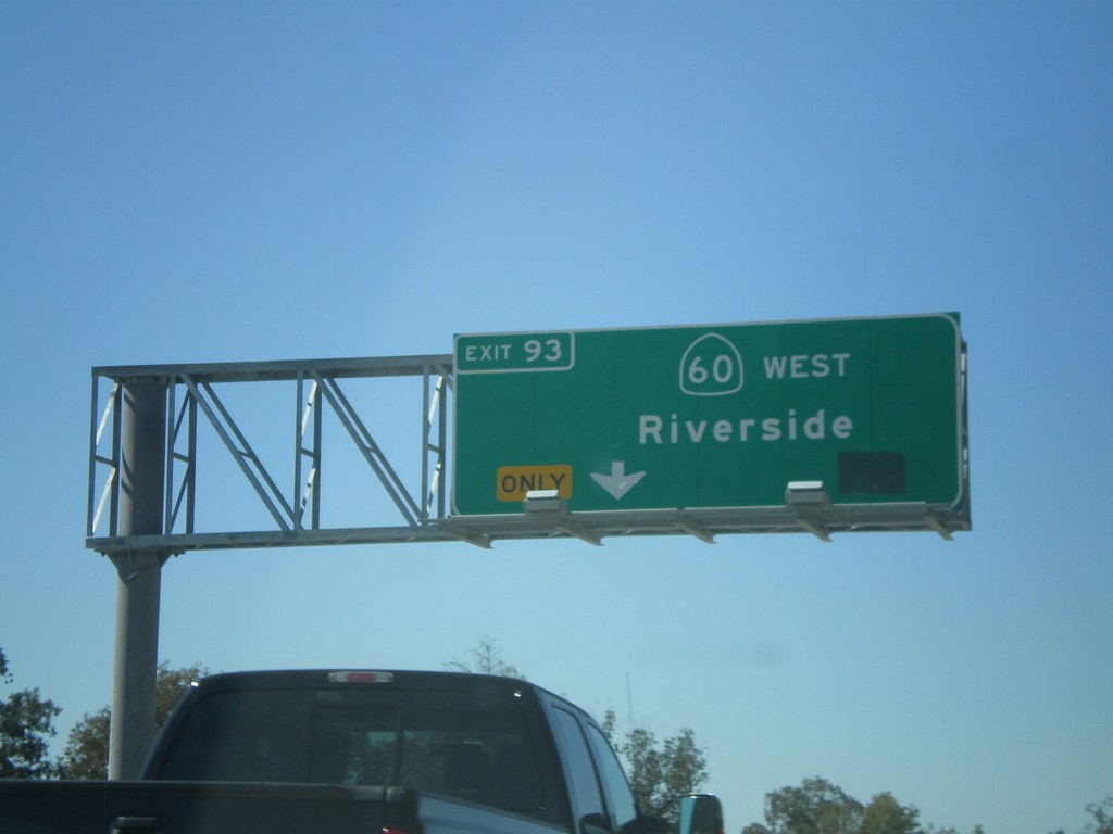
I-10 West Approaching CA-60
I-10 west approaching Exit 93 - CA-60/Riverside. Exit 93 exits from the left lanes.
Taken 02-28-2011
Beaumont
Riverside County
California
United States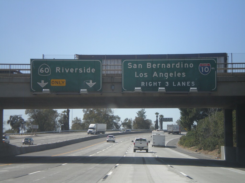
I-10 West Approaching Exit 93
I-10 west approaching Exit 93 - CA-60/Riverside. Use right 3 lanes for I-10 towards San Bernardino and Los Angeles.
Taken 02-28-2011
Beaumont
Riverside County
California
United States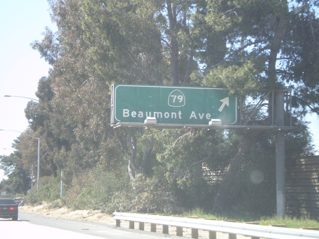
I-10 West - Exit 94
I-10 west at Exit 94 - CA-79/Beaumont Ave.
Taken 02-28-2011
 Beaumont
Riverside County
California
United States
Beaumont
Riverside County
California
United States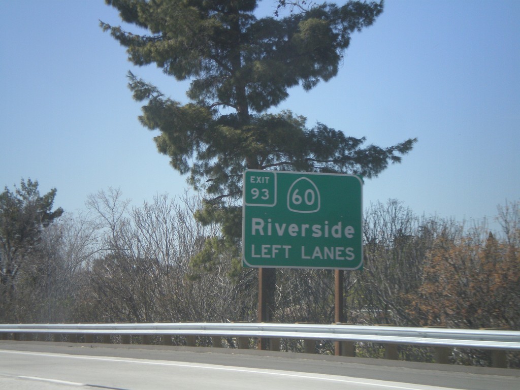
I-10 West Approaching Exit 93
I-10 west approaching Exit 93 - CA-60/Riverside. Use left lanes for CA-60 exit.
Taken 02-28-2011
Beaumont
Riverside County
California
United States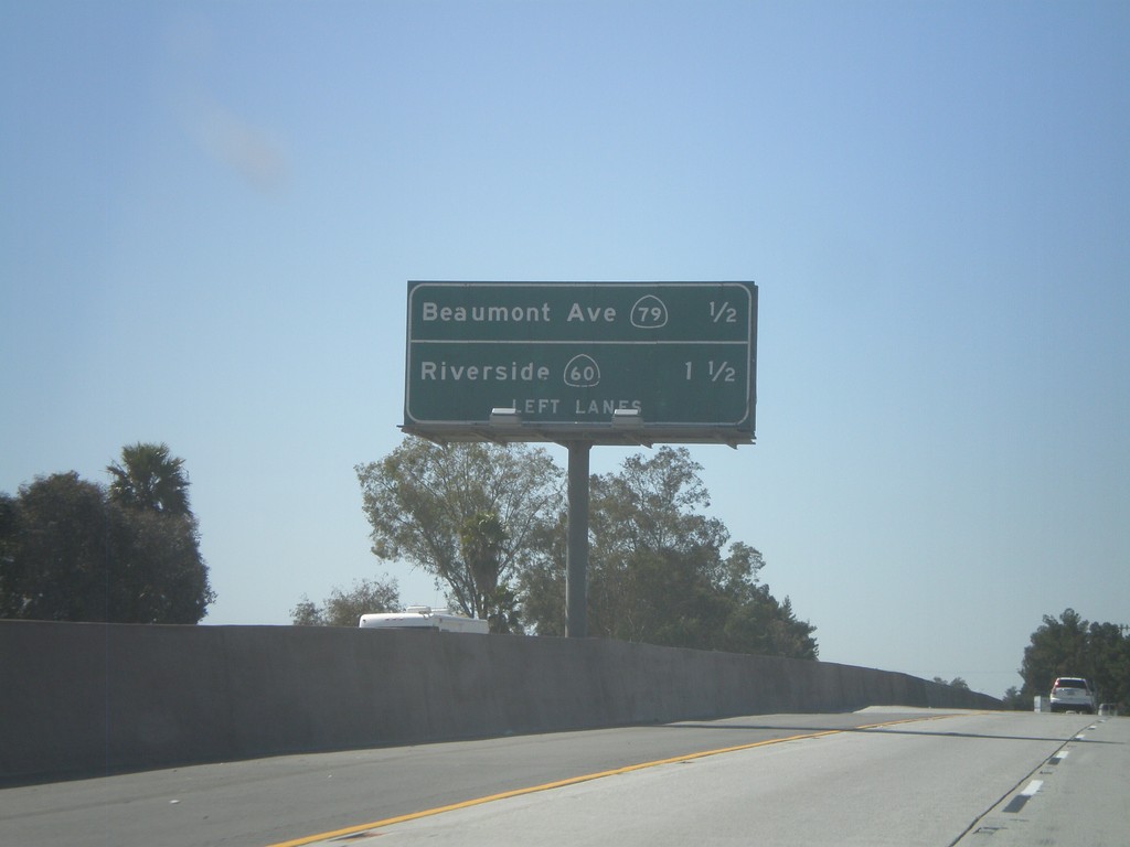
I-10 West - Next 2 Beaumont Exits
Next 2 exits on I-10 west in Beaumont: CA-79/Beaumont Ave and Riverside/CA-60.
Taken 02-28-2011
Beaumont
Riverside County
California
United States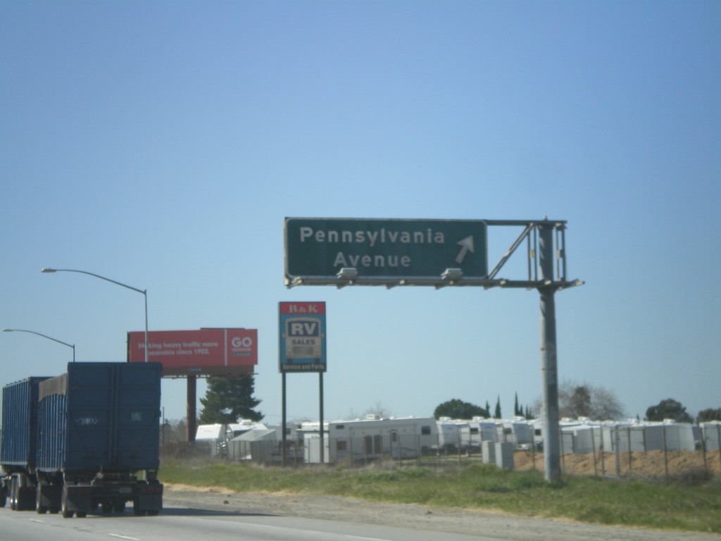
I-10 West - Exit 95
I-10 west at Exit 95 - Pennsylvania Ave.
Taken 02-28-2011
Riverside
Riverside County
California
United States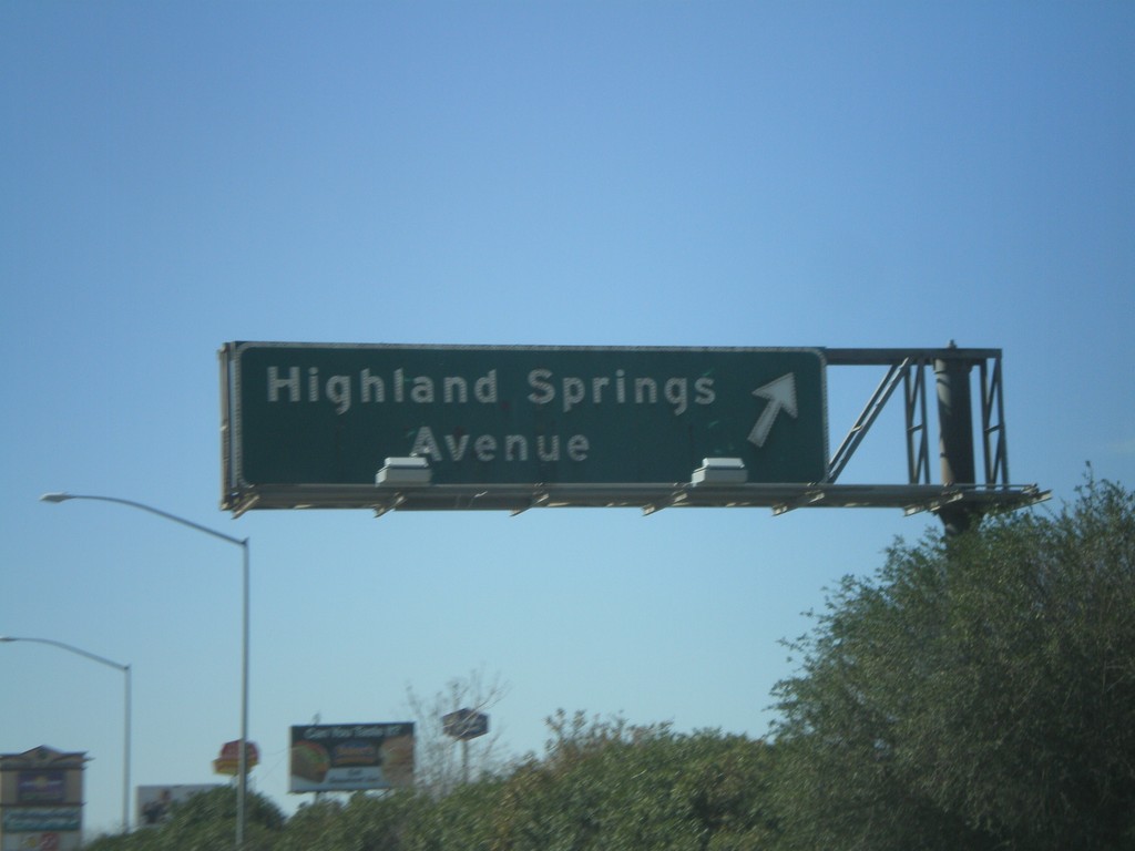
I-10 West - Exit 96
I-10 west at Exit 96 - Highland Springs Ave.
Taken 02-28-2011
Banning
Riverside County
California
United States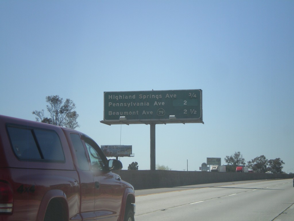
I-10 West - Banning/Beaumont Exits
Banning and Beaumont exits on I-10 west - Highland Springs Ave., Pennsylvania Ave., and CA-79/Beaumont Ave.
Taken 02-28-2011
Banning
Riverside County
California
United States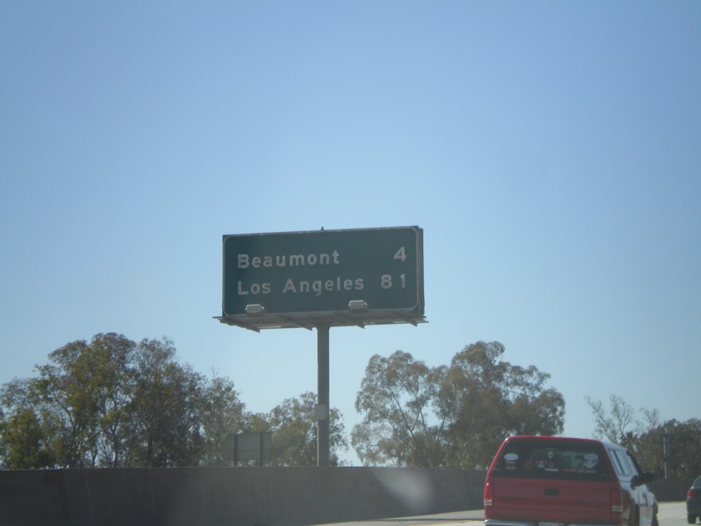
I-10 West - Distance Marker
Distance marker on I-10 west to Beaumont, and Los Angeles.
Taken 02-28-2011
Banning
Riverside County
California
United States