Signs Tagged With Big Green Sign
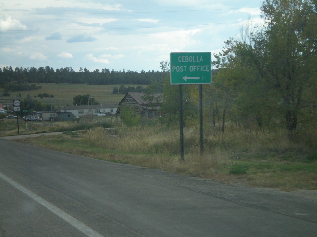
US-84 South at Cebolla Post Office Jct.
US-84 South at junction to Cebolla Post Office.
Taken 10-02-2011

 Cebolla
Rio Arriba County
New Mexico
United States
Cebolla
Rio Arriba County
New Mexico
United States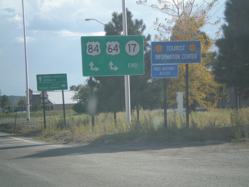
End NM-17 South at US-64/US-84
End NM-17 South at US-64/US-84 in Chama. Turn right for US-64 West/US-84 North to Dulce and Pagosa Springs (Colorado); continue ahead for US-64 East/US-84 South to Tierra Amarilla and Española.
Taken 10-02-2011

 Chama
Rio Arriba County
New Mexico
United States
Chama
Rio Arriba County
New Mexico
United States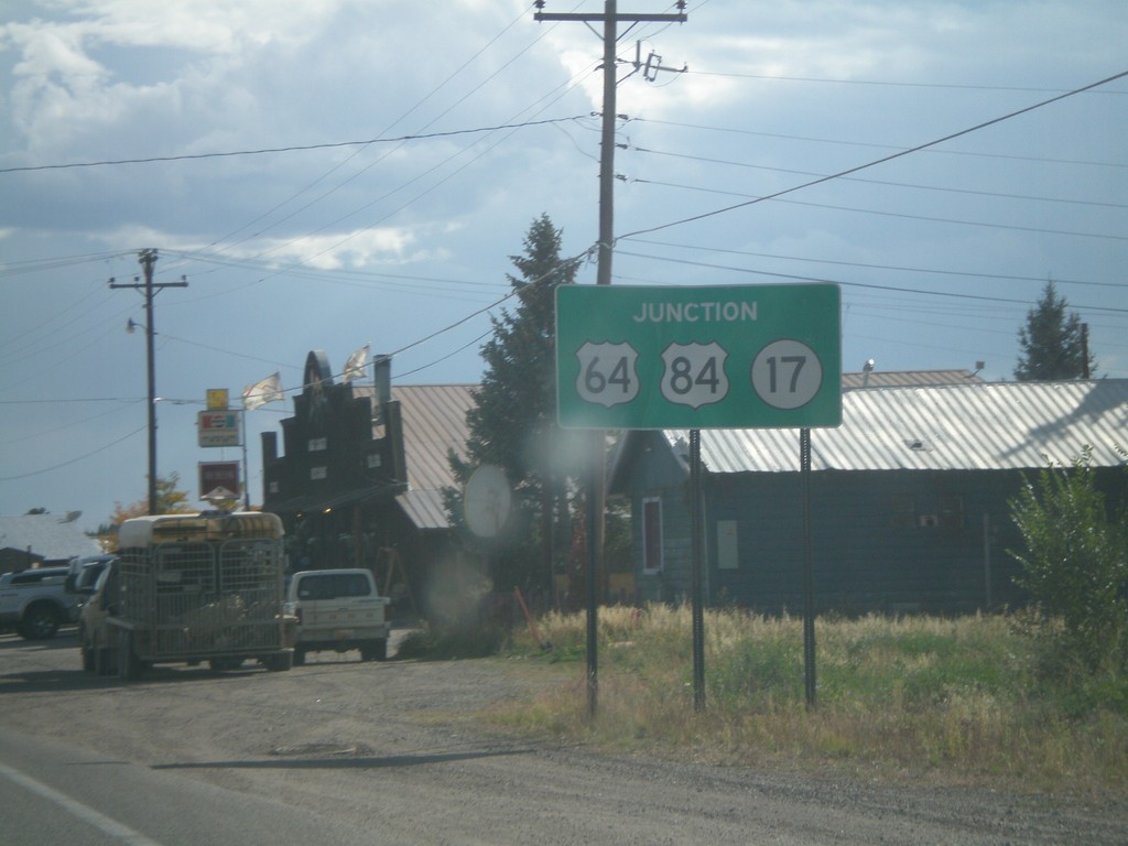
End NM-17 South at US-64/US-84
NM-17 South approaching US-64/US-84 in Chama.
Taken 10-02-2011
Chama
Rio Arriba County
New Mexico
United States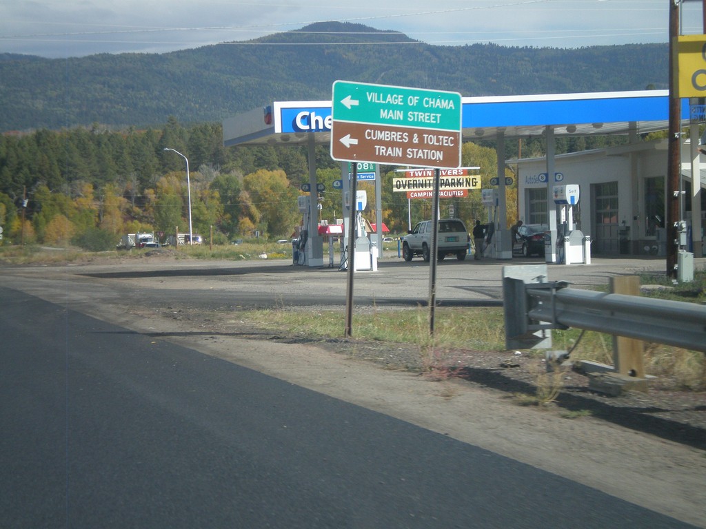
US-84 South/US-64 East at NM-17
US-84 South/US-64 East at NM-17. Use NM-17 north for Village of Chama Main St. and Cumbres and Toltec Train Station
Taken 10-02-2011
Chama
Rio Arriba County
New Mexico
United States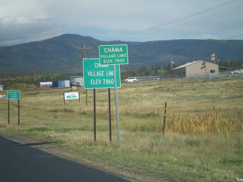
US-64 East/US-84 South - Village of Chama
US-64 East/US-84 South - Village of Chama (Elevation 7800 Feet).
Taken 10-02-2011
Chama
Rio Arriba County
New Mexico
United States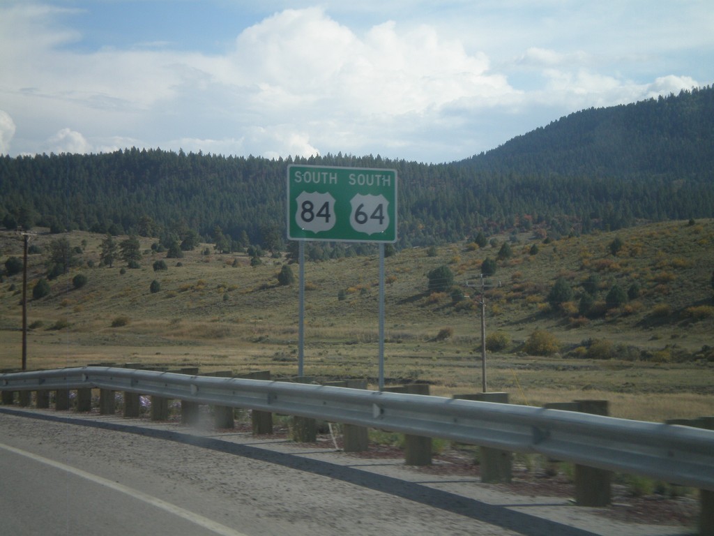
US-64 East/US-84 South
US-64 East/US-84 South in Rio Arriba County.
Taken 10-02-2011
Chama
Rio Arriba County
New Mexico
United States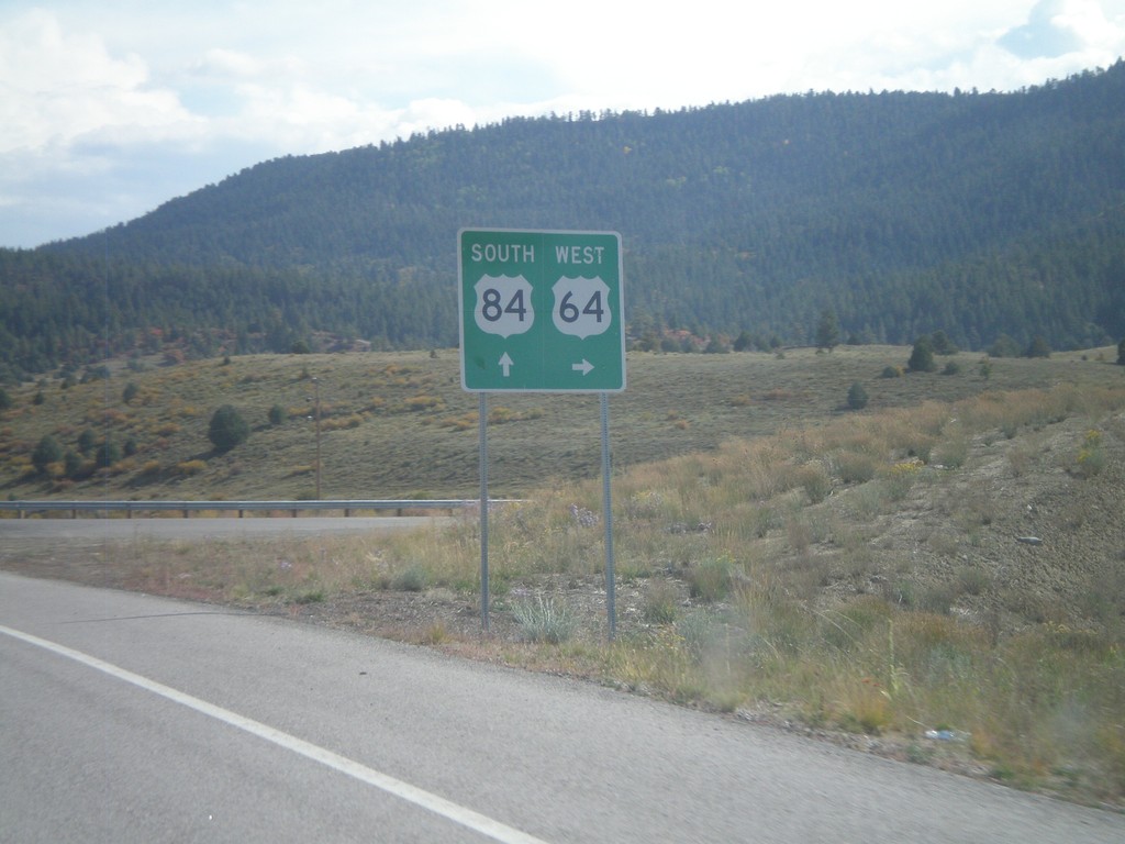
US-84 South at US-64
US-84 south at US-64 junction in Rio Arriba County. Turn left for US-64 west; continue ahead for US-84 South/US-64 east. US-64 joins US-84 through Tierra Amarilla.
Taken 10-02-2011
Chama
Rio Arriba County
New Mexico
United States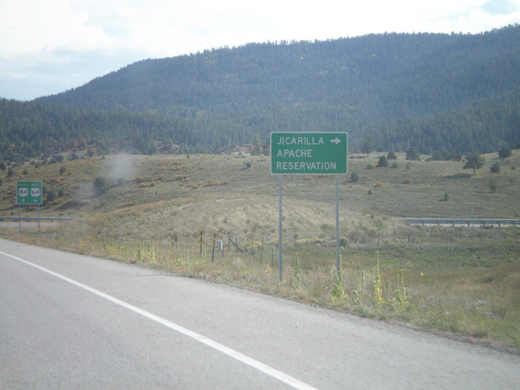
US-84 South at US-64
US-84 south at US-64 west to Jicarilla Apache Reservation. US-64 joins US-84 through Tierra Amarilla.
Taken 10-02-2011
Chama
Rio Arriba County
New Mexico
United States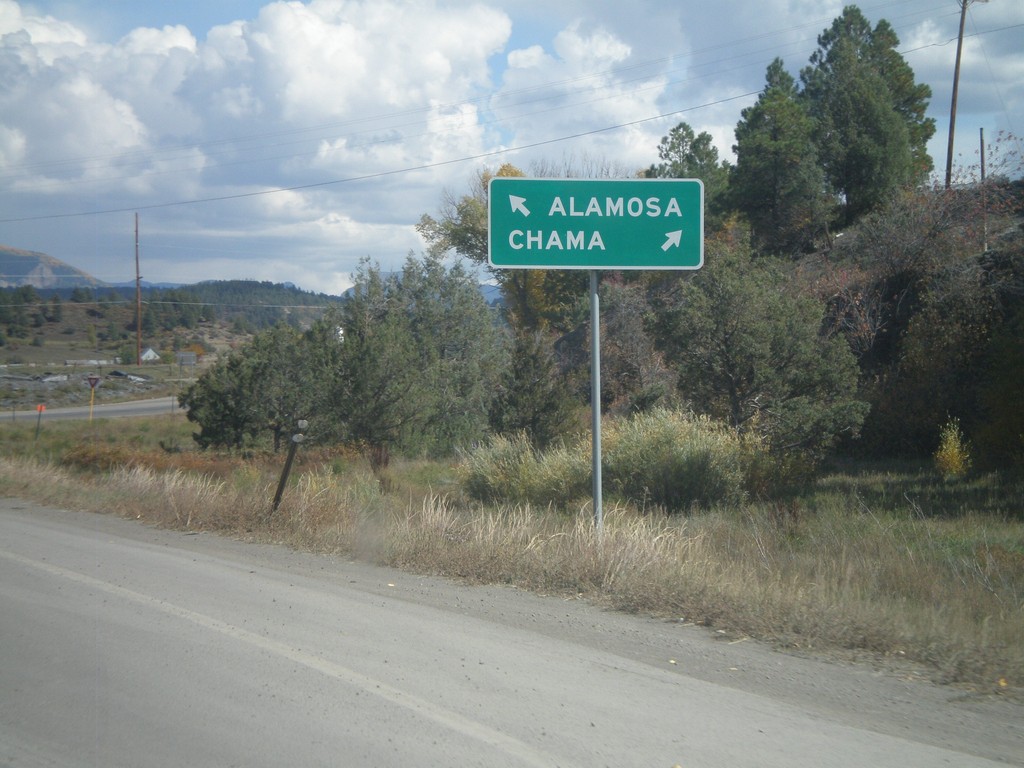
US-160 East at Begin US-84 East
US-160 East at Begin US-84 East in Pagosa Springs. Use US-84 east for Chama (New Mexico); continue east on US-160 for Alamosa.
Taken 10-02-2011
 Pagosa Springs
Archuleta County
Colorado
United States
Pagosa Springs
Archuleta County
Colorado
United States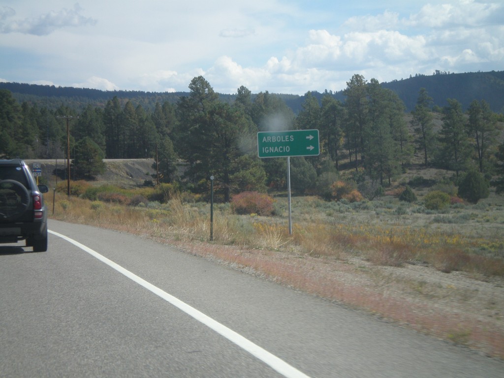
US-160 East Approaching CO-151
US-160 East approaching CO-151 to Arboles and Ignacio.
Taken 10-02-2011
 Chimney Rock
Archuleta County
Colorado
United States
Chimney Rock
Archuleta County
Colorado
United States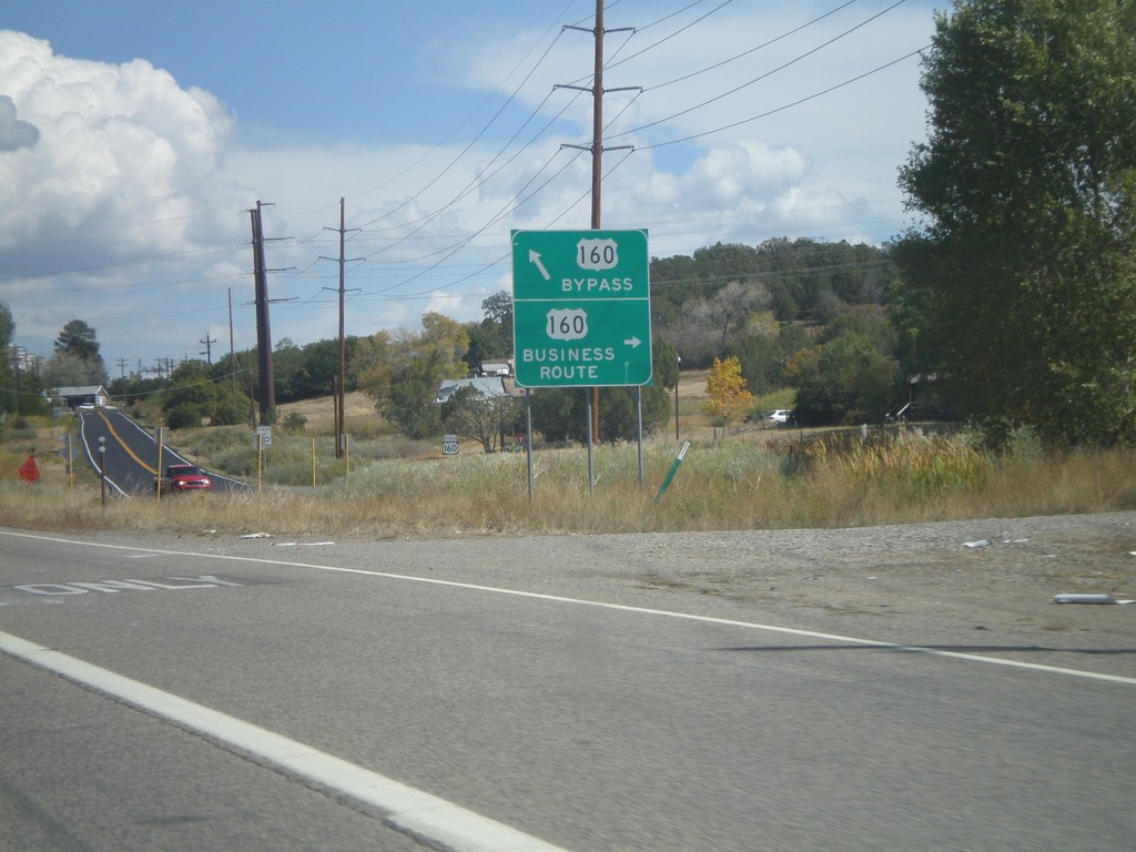
US-160 East at Bayfield Business Loop
US-160 East at Bayfield Business Loop. Turn right for Business US-160 into Bayfield; continue ahead for the Bayfield Bypass.
Taken 10-02-2011
 Bayfield
La Plata County
Colorado
United States
Bayfield
La Plata County
Colorado
United States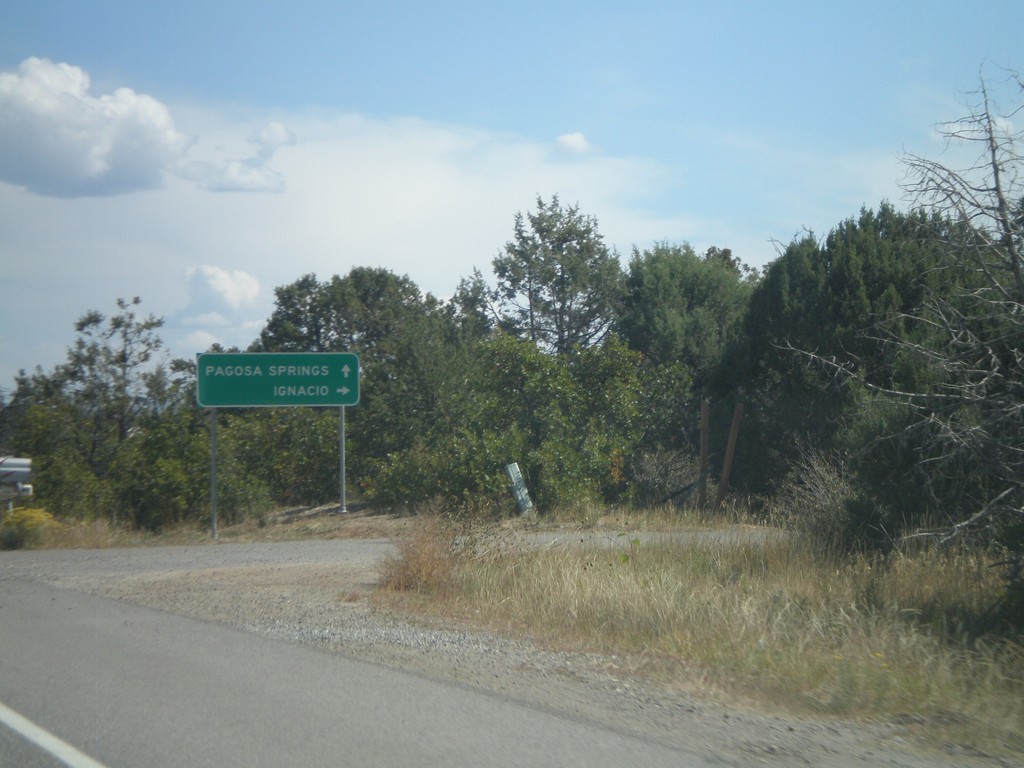
US-160 East Approaching CO-172/CH-234
US-160 East approaching CO-172/CH-234. Use CO-172 south for Ignacio; continue east on US-160 for Pagosa Springs.
Taken 10-02-2011

 Durango
La Plata County
Colorado
United States
Durango
La Plata County
Colorado
United States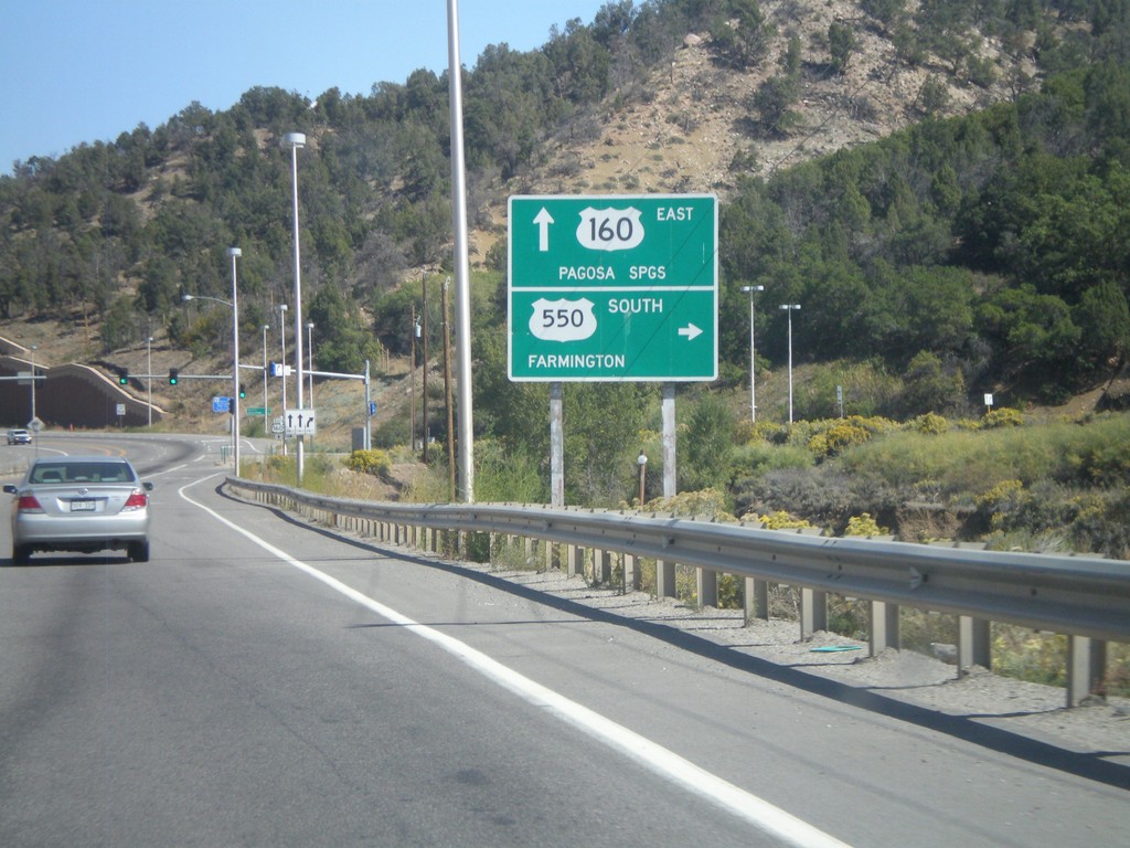
US-160 East/US-550 South at US-550 South
US-160 East/US-550 South at US-550 South. Turn right on US-550 for Farmington (New Mexico). Continue ahead on US-160 for Pagosa Springs.
Taken 10-02-2011
 Durango
La Plata County
Colorado
United States
Durango
La Plata County
Colorado
United States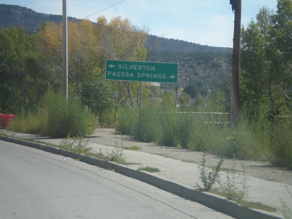
US-160 East at US-550
US-160 East at US-550. Turn right for US-550 North to Silverton; left for US-550 South/US-160 East to Pagosa Springs.
Taken 10-02-2011
Durango
La Plata County
Colorado
United States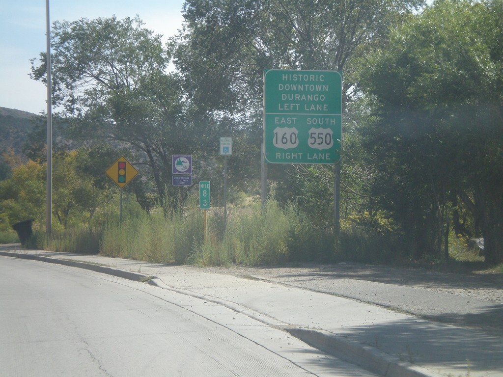
US-160 East Approaching US-550
US-160 East approaching US-550. Turn right for US-160 East/US-550 South; left for Historic Downtown Durango.
Taken 10-02-2011
Durango
La Plata County
Colorado
United States
US-160 East at CO-140 South
US-160 East at CO-140 South to Hesperus and Farmington (New Mexico). Continue east on US-160 for Durango.
Taken 10-02-2011
 Hesperus
La Plata County
Colorado
United States
Hesperus
La Plata County
Colorado
United States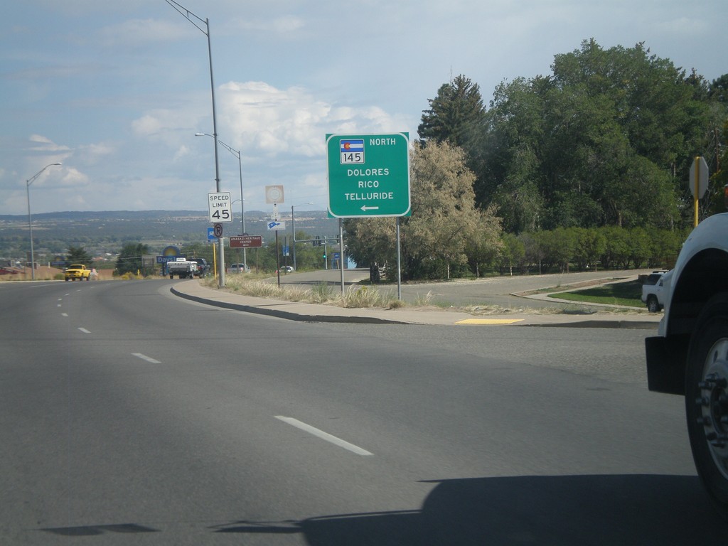
US-160 East at CO-145 North
US-160 east at CO-145 north to Dolores, Rico, and Telluride in Cortez.
Taken 10-02-2011
 Cortez
Montezuma County
Colorado
United States
Cortez
Montezuma County
Colorado
United States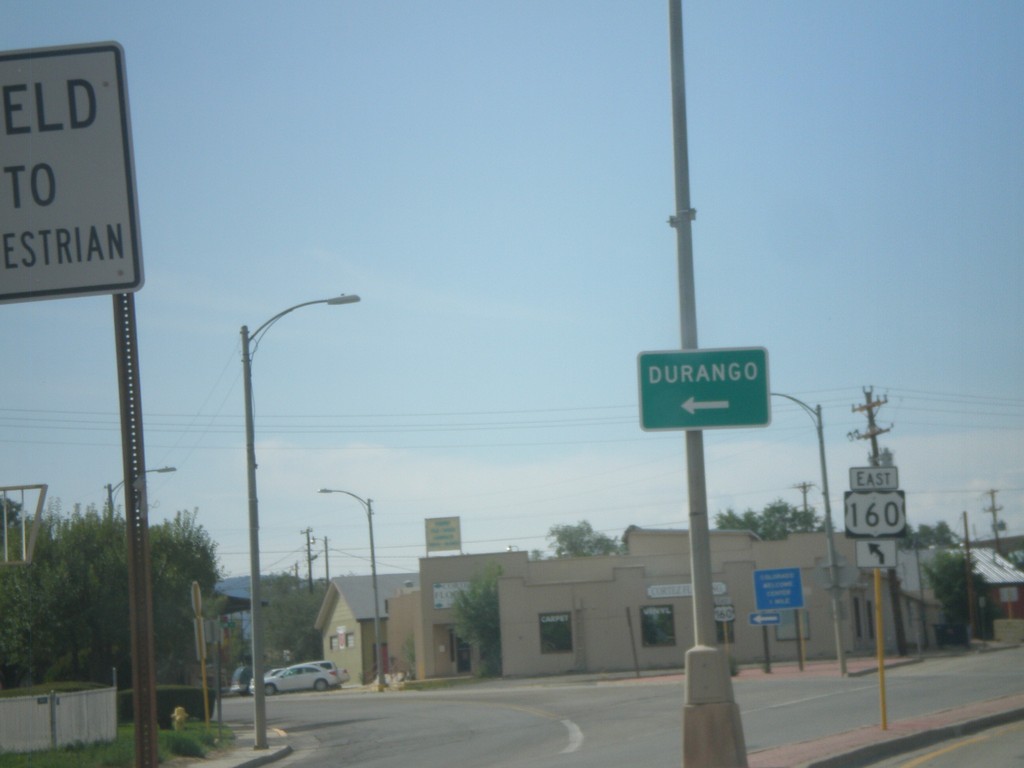
US-491 South at US-160 East
US-491 South at US-160 East to Durango.
Taken 10-02-2011
 Cortez
Montezuma County
Colorado
United States
Cortez
Montezuma County
Colorado
United States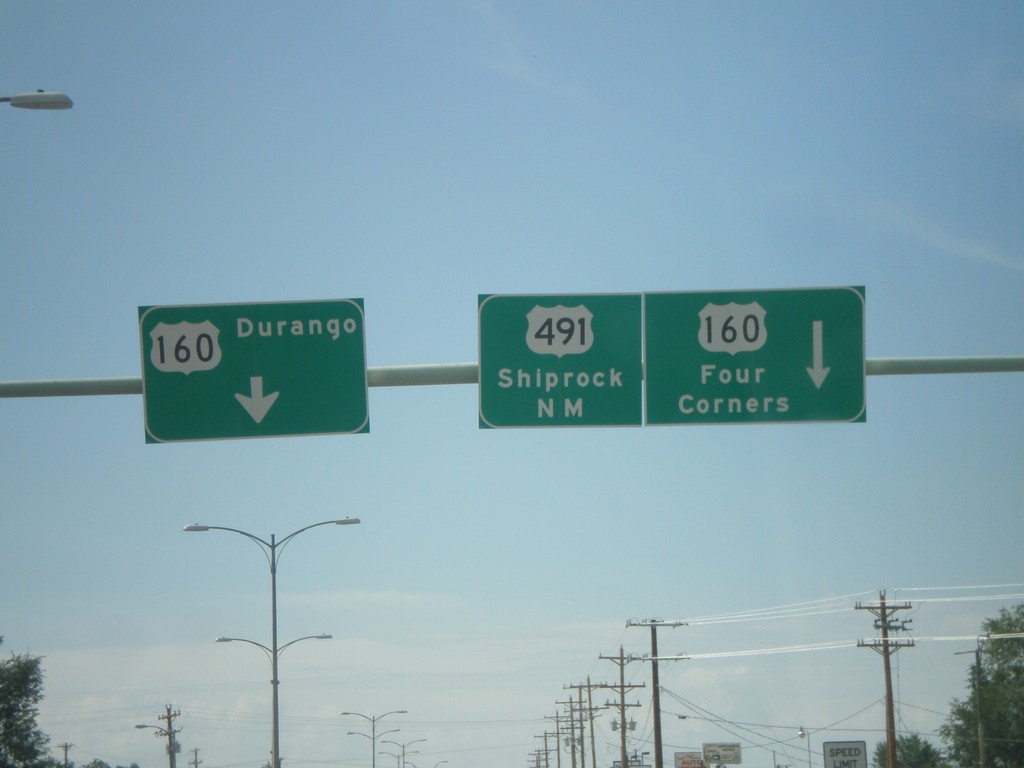
US-491 South at US-160
US-491 south at US-160. Turn left for US-160 east to Durango. Continue ahead for US-160 West/US-491 South. Use US-160 west for Four Corners; use US-491 south for Shiprock, New Mexico. US-160 west joins US-491 southbound to the Four Corners area.
Taken 10-02-2011
Cortez
Montezuma County
Colorado
United States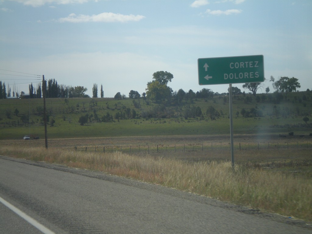
US-491 South at CO-184
US-491 south at CO-184 east to Dolores. Continue south on US-491 to Cortez.
Taken 10-02-2011
 Lewis
Montezuma County
Colorado
United States
Lewis
Montezuma County
Colorado
United States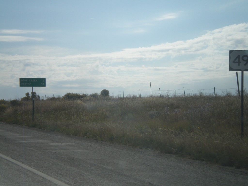
US-491 South - Distance Marker
Distance marker on US-491 south just past the CO-141 junction. Distance to Dove Creek and Cortez.
Taken 10-02-2011
Dove Creek
Dolores County
Colorado
United States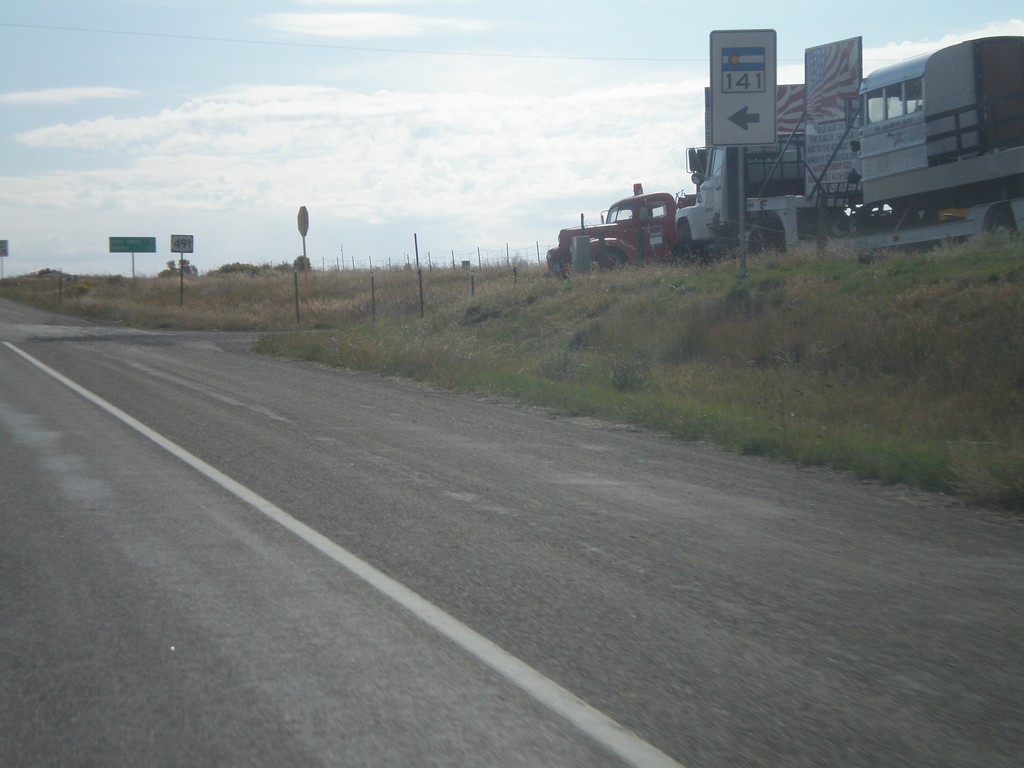
US-491 South at CO-141 North
US-491 South at CO-141 North in Dolores County.
Taken 10-02-2011
 Dove Creek
Dolores County
Colorado
United States
Dove Creek
Dolores County
Colorado
United States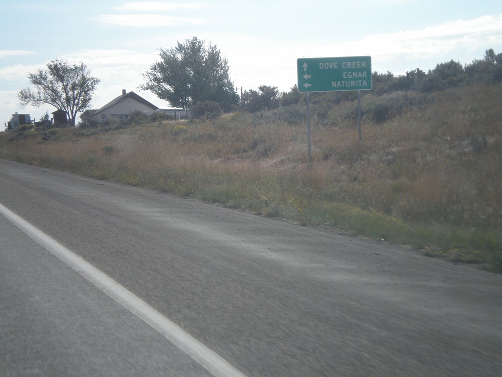
US-491 South Approaching CO-141
US-491 South approaching CO-141 north to Egnar and Naturita. Continue south on US-491 for Dove Creek.
Taken 10-02-2011
Dove Creek
Dolores County
Colorado
United States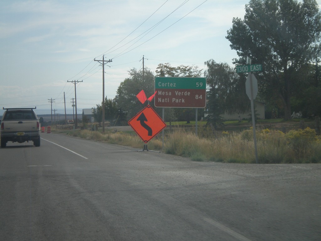
US-491 South - Distance Marker
Distance marker on US-491 south. Distance to Cortez and Mesa Verde National Park (both in Colorado). Taken on the east side of Monticello.
Taken 10-02-2011
Monticello
San Juan County
Utah
United States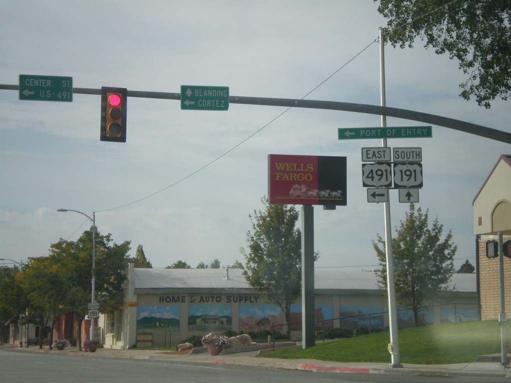
US-191 South at US-491
US-191 South at US-491. Use US-491 east for Cortez (Colorado); continue south on US-191 for Blanding. This is the northern end of US-491. Also US-491 east for the (Utah) Port of Entry.
Taken 10-02-2011
 Monticello
San Juan County
Utah
United States
Monticello
San Juan County
Utah
United States