Signs Tagged With Big Green Sign
I-40 West - Needles Exits
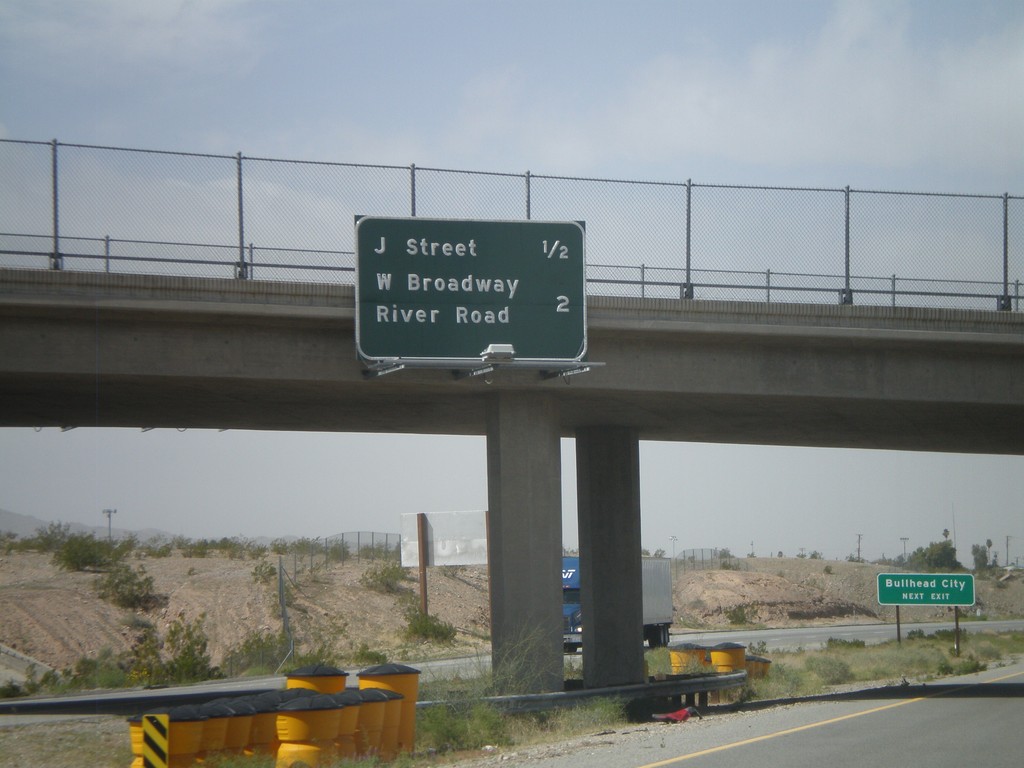
Needles Exits on I-40 west. The next two exits are J St. and West Broadway/River Road. Sign in background directs Bullhead City (Arizona) traffic to use the J St. exit.
Taken 02-25-2011

 Needles
San Bernardino County
California
United States
Needles
San Bernardino County
California
United States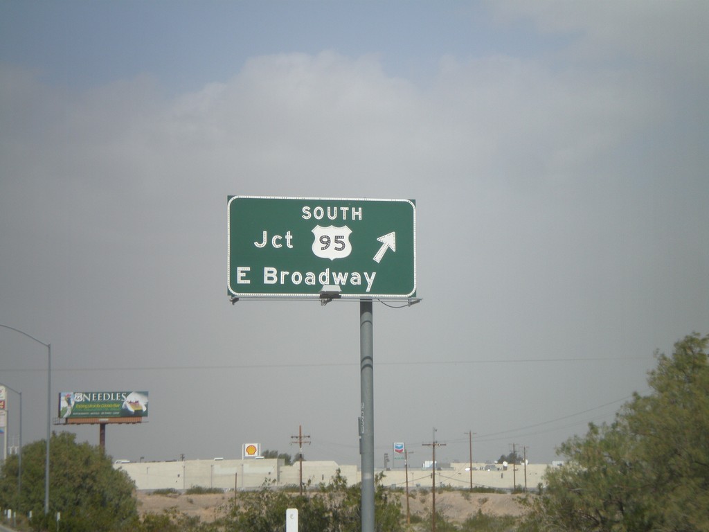
I-40 West - Exit 143
I-40 west at Exit 143 - US-95 South/E. Broadway. US-95 north joins I-40 west through Needles. This is the eastern end of the Needles business loop.
Taken 02-25-2011
 Needles
San Bernardino County
California
United States
Needles
San Bernardino County
California
United States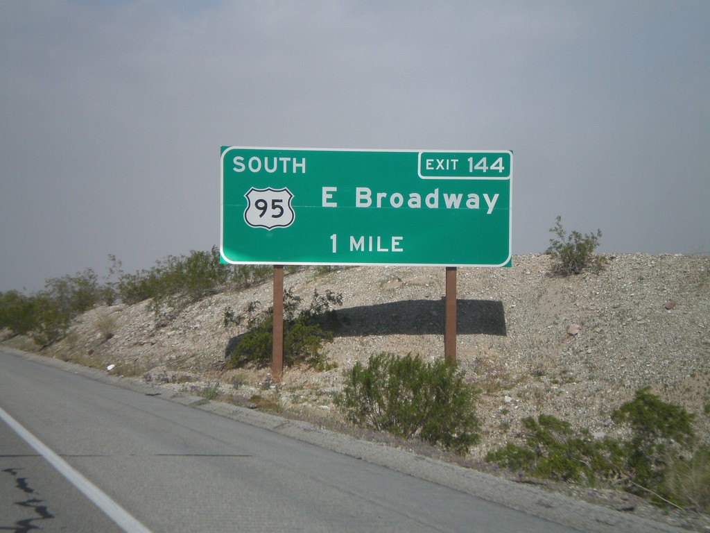
I-40 West Approaching Exit 144
I-40 west approaching Exit 144 - US-95 South/East Broadway.
Taken 02-25-2011
Needles
San Bernardino County
California
United States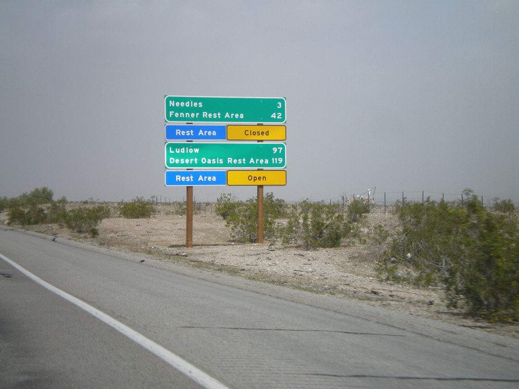
I-40 West - Mojave Desert Services
Services in the Mojave Desert along I-40 west between here and Newberry Springs. Both Needles and Ludlow have services. Also, distance to the next Rest Areas and their status.
Taken 02-25-2011
Needles
San Bernardino County
California
United States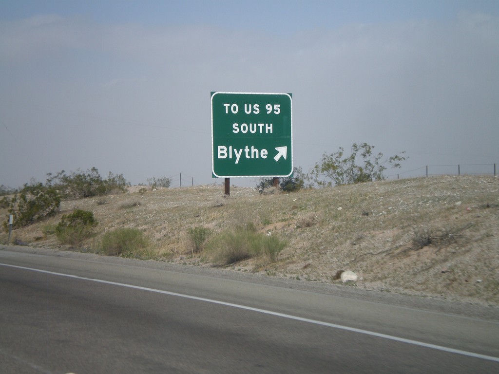
I-40 West - Exit 148
I-40 west at Exit 148 - To US-95 South/Blythe. The US-95 shield is displayed as text on this sign. This exit serves File Mile Road, and provides a cutoff between I-40 and US-95 south.
Taken 02-25-2011
Needles
San Bernardino County
California
United States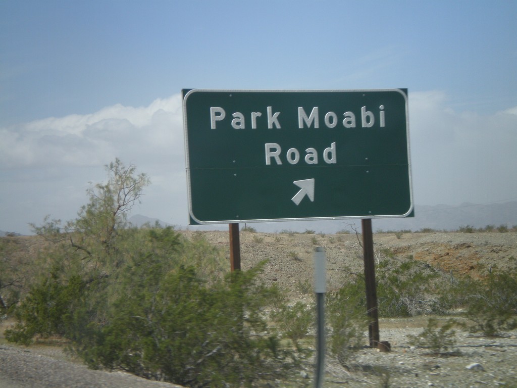
I-40 West - Exit 153
I-40 west at Exit 153 - Park Moabi Road. First California exit on I-40 west.
Taken 02-25-2011
Needles
San Bernardino County
California
United States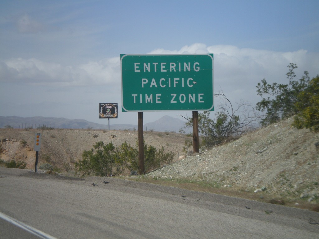
I-40 West - Entering Pacific Time
Entering Pacific Time on I-40 west. Arizona does not observe daylight savings time, so during the summer months Arizona and California are on the same time.
Taken 02-25-2011
Needles
San Bernardino County
California
United States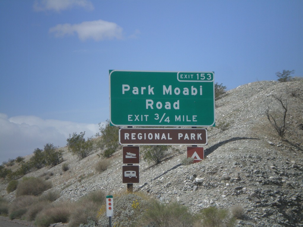
I-40 West Approaching Exit 153
I-40 west approaching Exit 153 - Park Moabi Road. This is the first exit on I-40 inside California westbound.
Taken 02-25-2011
Needles
San Bernardino County
California
United States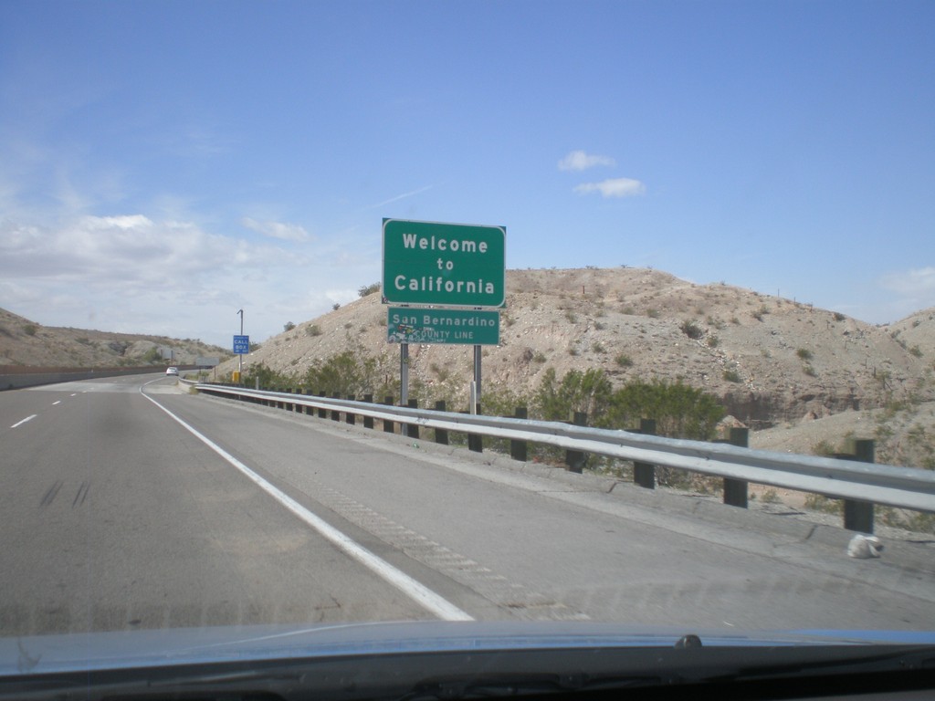
Welcome To California - I-40 West
Welcome to California on I-40 west at the Arizona-California state line crossing the Colorado River. San Bernardino County line.
Taken 02-25-2011
Needles
San Bernardino County
California
United States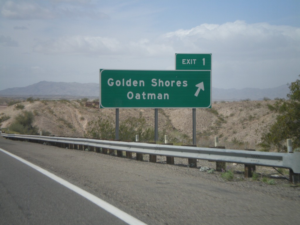
I-40 West - Exit 1
I-40 west at Exit 1 - Golden Shores/Oatman. This is the last exit in Arizona on I-40 westbound.
Taken 02-25-2011
Catfish Paradise
Mohave County
Arizona
United States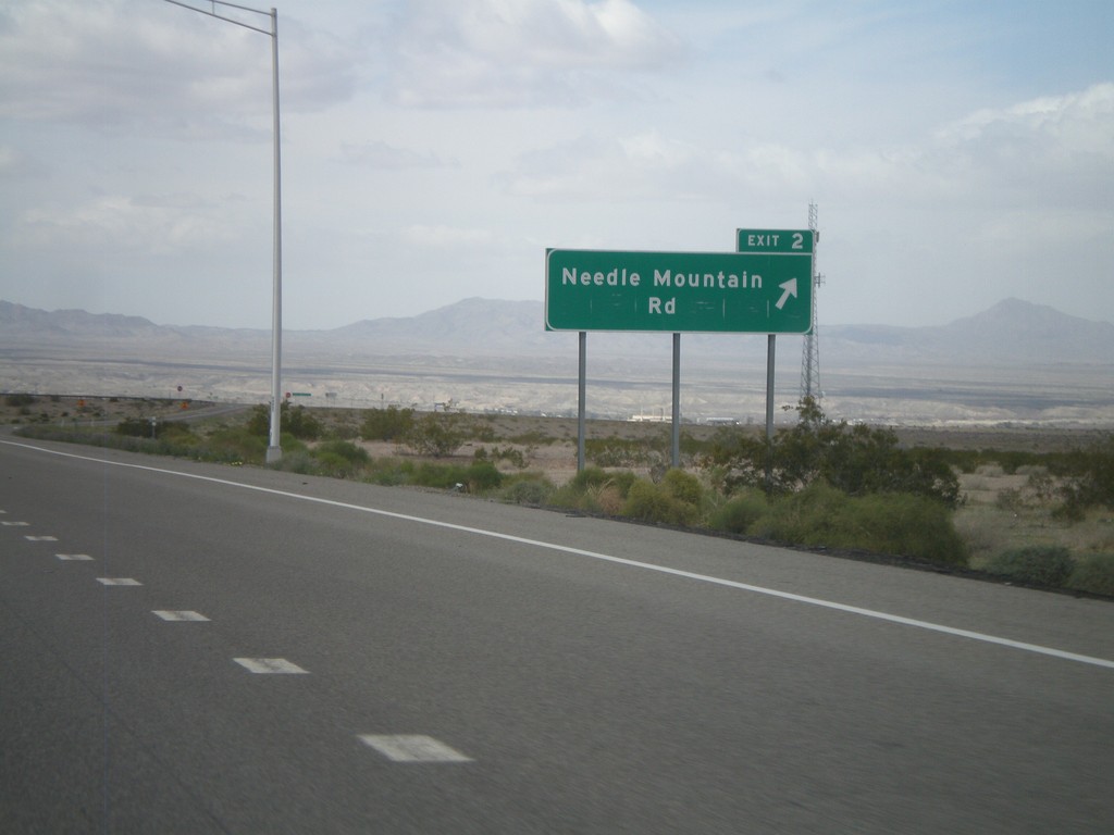
I-40 West - Exit 2
I-40 west at Exit 2 - Needle Mountain Road.
Taken 02-25-2011
Powell
Mohave County
Arizona
United States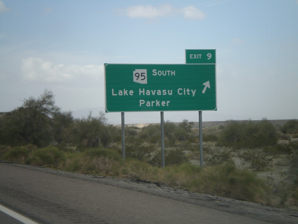
I-40 West - Exit 9
I-40 west at Exit 9 - AZ-95 South/Lake Havasu City/Parker.
Taken 02-25-2011
 Franconia
Mohave County
Arizona
United States
Franconia
Mohave County
Arizona
United States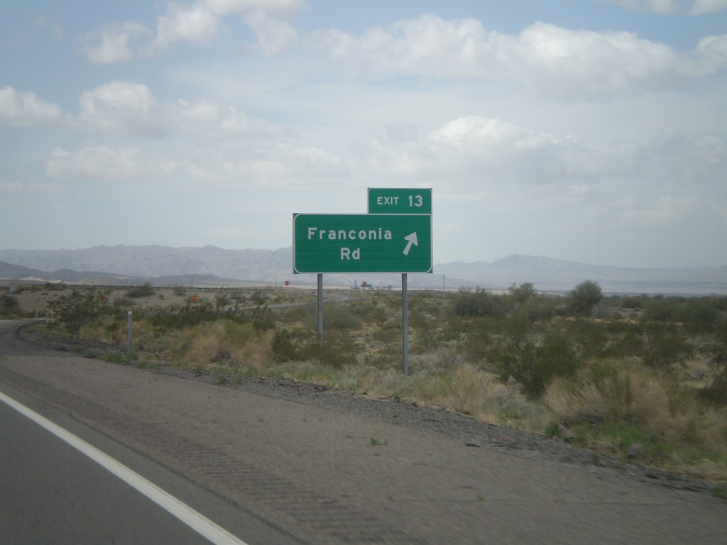
I-40 West - Exit 13
I-40 west at Exit 13 - Franconia Road.
Taken 02-25-2011
Topock
Mohave County
Arizona
United States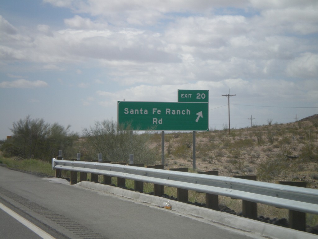
I-40 West - Exit 20
I-40 west at Exit 20 - Santa Fe Ranch Road
Taken 02-25-2011
Haviland
Mohave County
Arizona
United States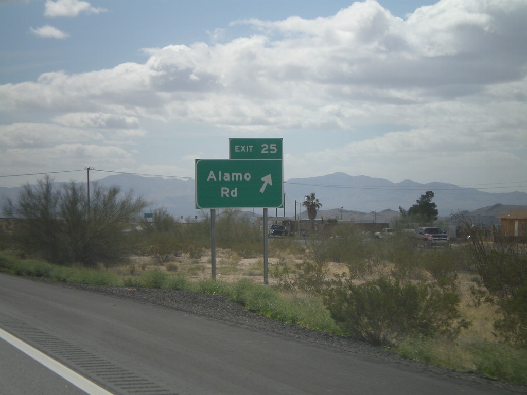
I-40 West - Exit 25
I-40 west at Exit 25 - Alamo Road.
Taken 02-25-2011
Yucca
Mohave County
Arizona
United States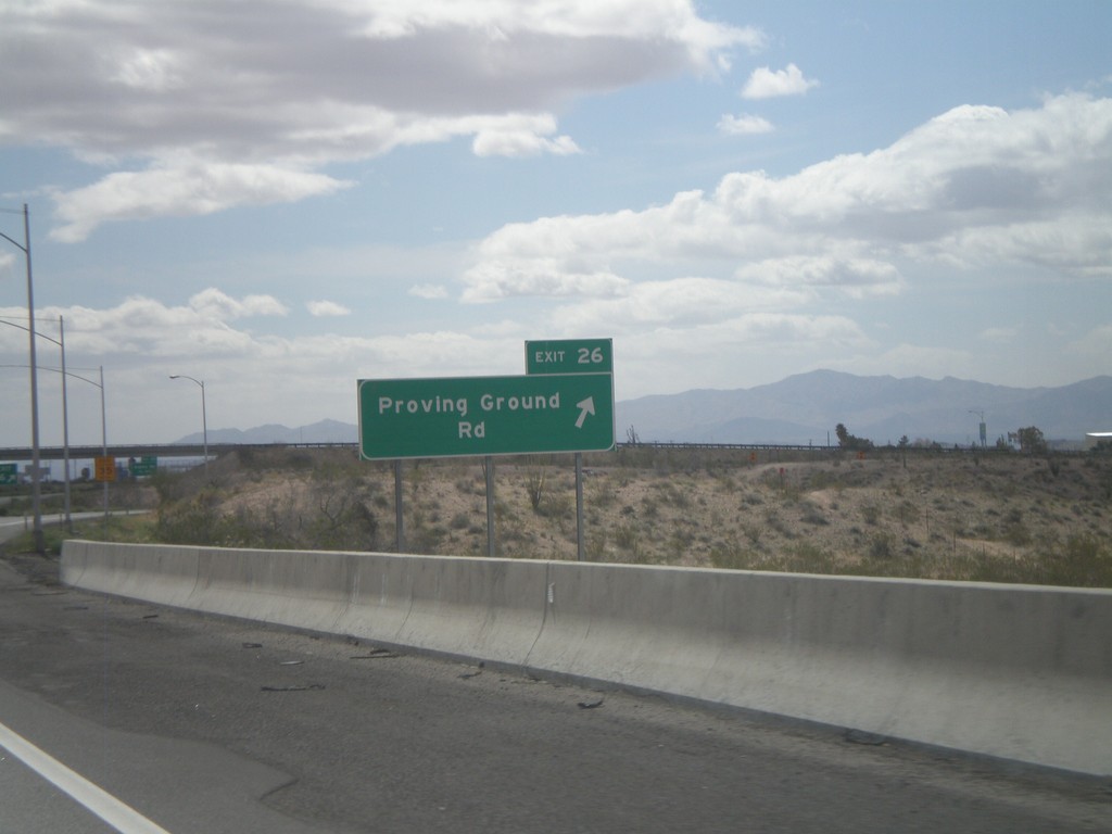
I-40 West - Exit 26
I-40 west at Exit 26 - Proving Ground Road
Taken 02-25-2011
Yucca
Mohave County
Arizona
United States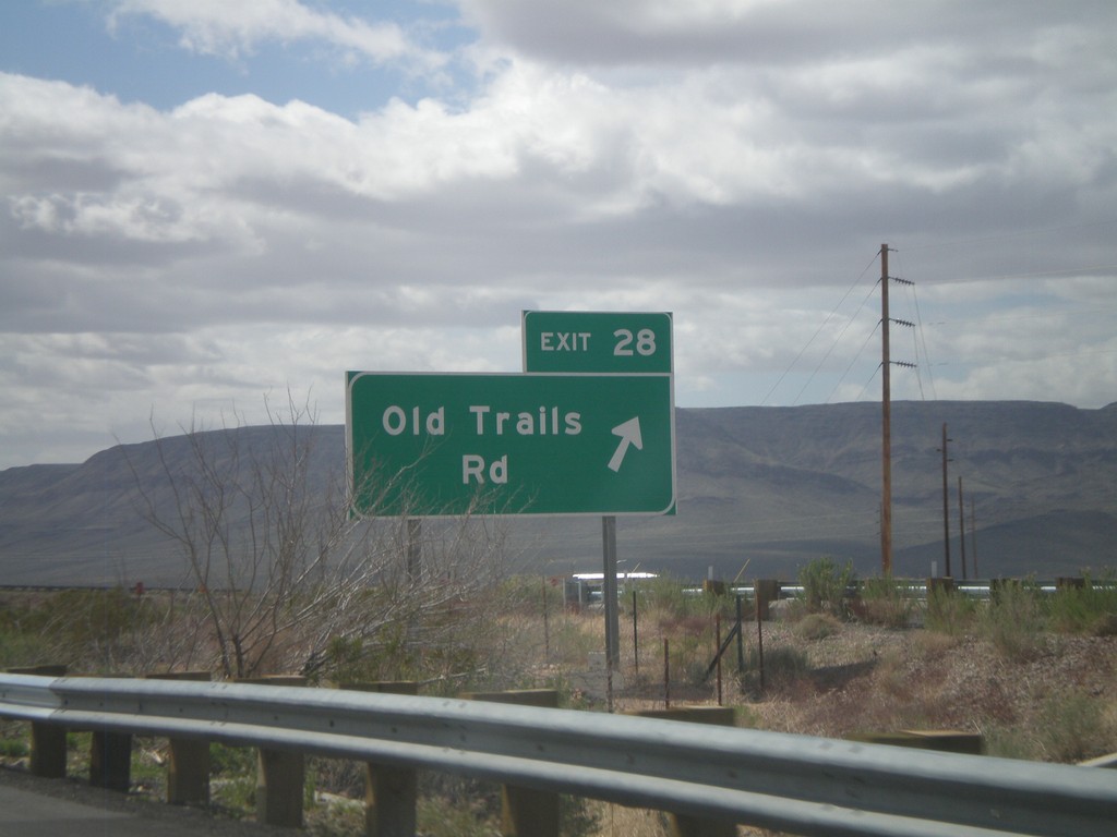
I-40 West - Exit 28
I-40 west at Exit 28 - Old Trails Road.
Taken 02-25-2011
Yucca
Mohave County
Arizona
United States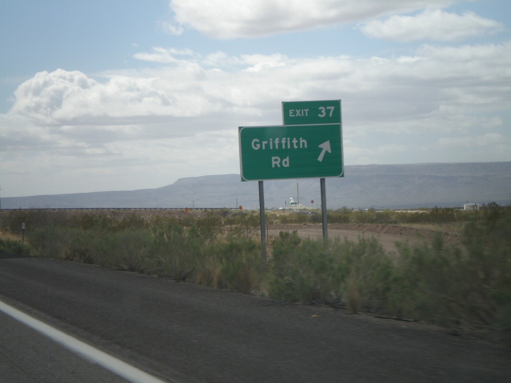
I-40 West - Exit 37
I-40 west at Exit 37 - Griffith Road.
Taken 02-25-2011
Drake
Mohave County
Arizona
United States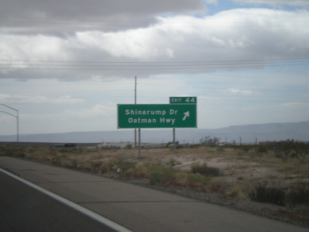
I-40 West - Exit 44
I-40 west at Exit 44 - Shinarump Drive/Oatman Hwy
Taken 02-25-2011
McConnico
Mohave County
Arizona
United States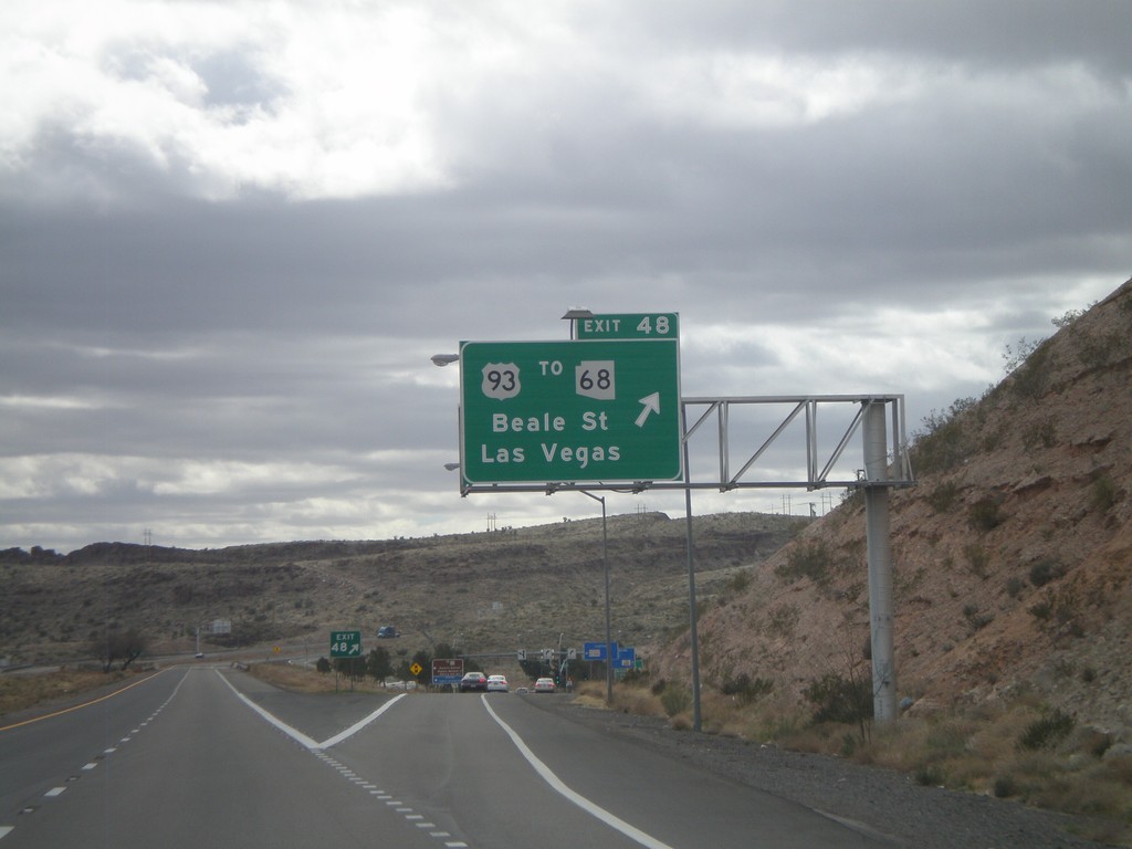
I-40 West - Exit 48
I-40 west at Exit 48 - US-93/To AZ-68/Las Vegas/Beale St. US-93 north leaves I-40 westbound and turns towards Las Vegas. Eastbound, US-93 south joins I-40 through Kingman.
Taken 02-25-2011

 Kingman
Mohave County
Arizona
United States
Kingman
Mohave County
Arizona
United States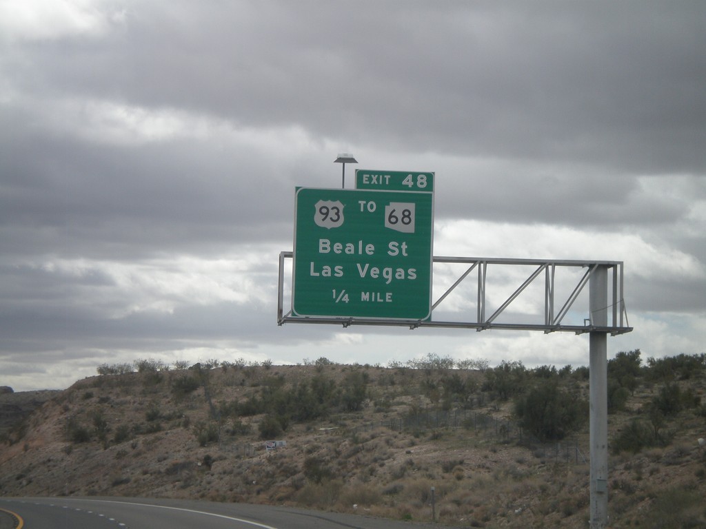
I-40 West Approaching Exit 48
I-40 west approaching Exit 48 - US-93/To AZ-68/Beale st./Las Vegas. AZ-68 leaves US-93 north of Kingman and connects to Bullhead City, Arizona and Laughlin, Nevada.
Taken 02-25-2011
New Kingman-Butler
Mohave County
Arizona
United States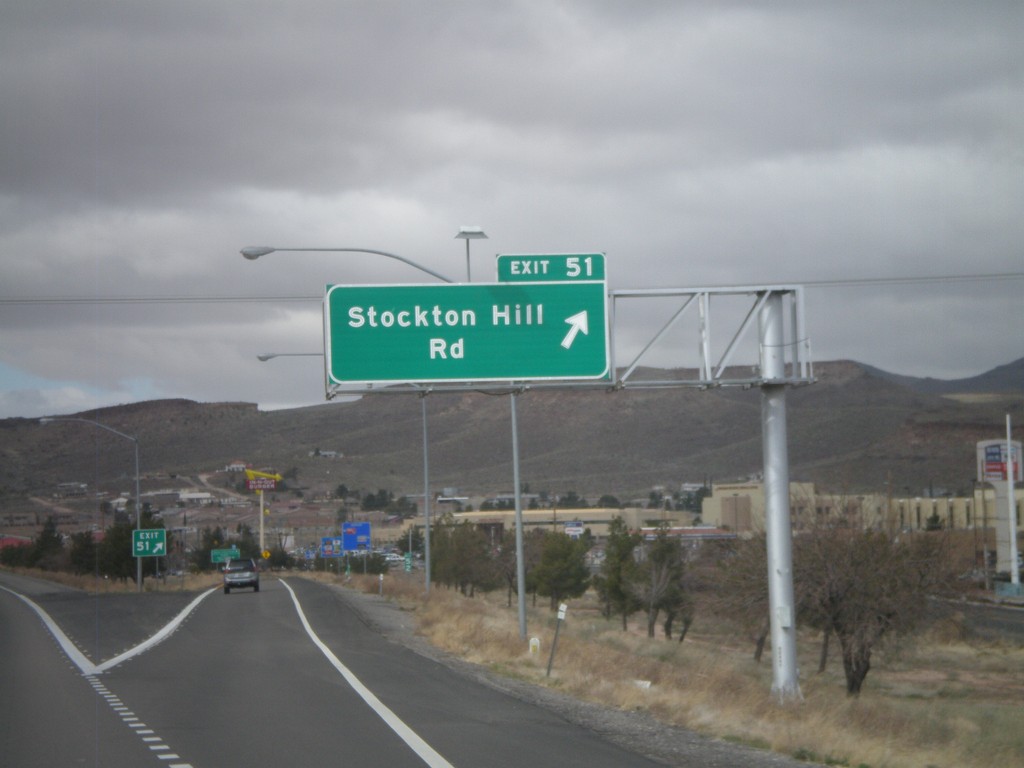
I-40 West - Exit 51
I-40 west at Exit 51 - Stockton Hill Road.
Taken 02-25-2011
Kingman
Mohave County
Arizona
United States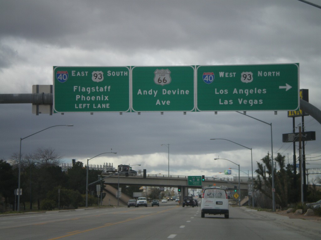
End AZ-66 West At I-40/US-93
End AZ-66 west at I-40/US-93 jct. Use I-40 West/US-93 North for Los Angeles and Las Vegas. Use I-40 East/US-93 South for Phoenix and Flagstaff. Continue straight for Andy Devine Avenue and Historic Loop US-66.
Taken 02-25-2011

 Kingman
Mohave County
Arizona
United States
Kingman
Mohave County
Arizona
United States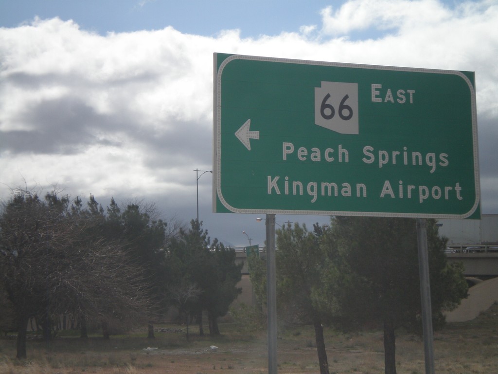
I-40 West at AZ-66
I-40 west at AZ-66 (and Historic Loop US-66) at Exit 53 onramp. Use AZ-66 east for Peach Springs and Kingman Airport.
Taken 02-25-2011
Kingman
Mohave County
Arizona
United States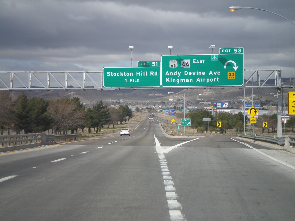
I-40 West - Exits 53 and 51
I-40 west at Exit 53 - Historic Loop US-66/AZ-66 East/Andy Devine Ave./Kingman Airport. Approaching Exit 51 - Stockton Hill Road.
Taken 02-25-2011
Kingman
Mohave County
Arizona
United States