Signs Tagged With Big Green Sign
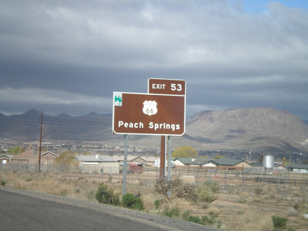
For Historic US-66 Use Exit 53
For Historic US-66 to Peach Springs use Exit 53. The Arizona Scenic Byway symbol is on the top left of this sign. Historic US-66 through Arizona between Topock and Ash Fork is called the Historic Route 66 National Scenic Byway.
Taken 02-25-2011


 Kingman
Mohave County
Arizona
United States
Kingman
Mohave County
Arizona
United States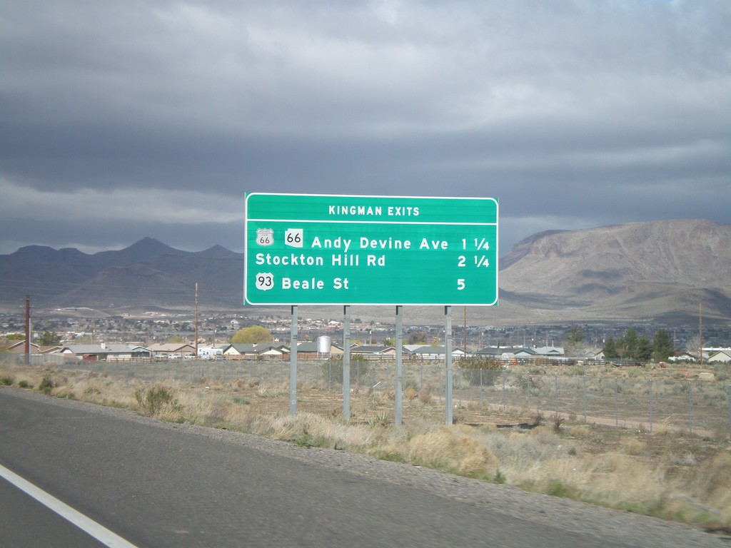
I-40 West - Kingman Exits
Kingman exits on I-40 west: Historic Loop US-66/AZ-66/Andy Devine Ave., Stockton Hill Road, US-93 Beale St.
Taken 02-25-2011
Kingman
Mohave County
Arizona
United States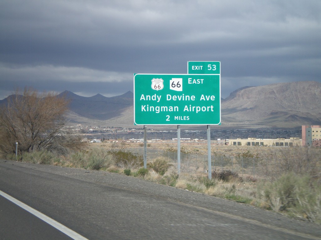
I-40 West Approaching Exit 53
I-40 west approaching Exit 53 - Historic Loop US-66/AZ-66 East/Andy Devine Ave./Kingman Airport.
Taken 02-25-2011
Kingman
Mohave County
Arizona
United States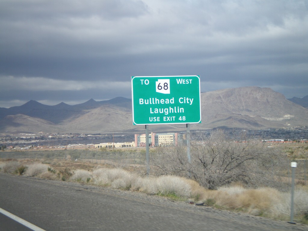
I-40 West - AZ-68 Traffic Use Exit 48
AZ-68 traffic for Bullhead City, and Laughlin (Nevada), use Exit 48. This sign is posted on the east end of Kingman approaching Exit 53.
Taken 02-25-2011
 Kingman
Mohave County
Arizona
United States
Kingman
Mohave County
Arizona
United States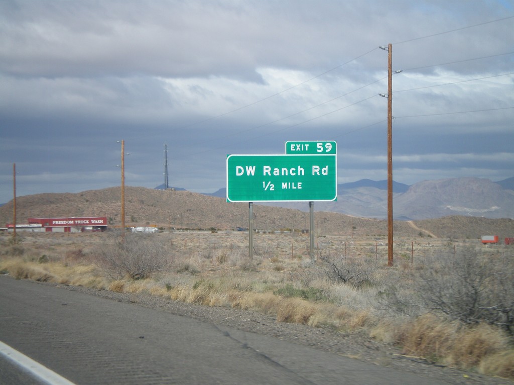
I-40 West Approaching Exit 59
I-40 west approaching Exit 59 - DW Ranch Road.
Taken 02-25-2011
Kingman
Mohave County
Arizona
United States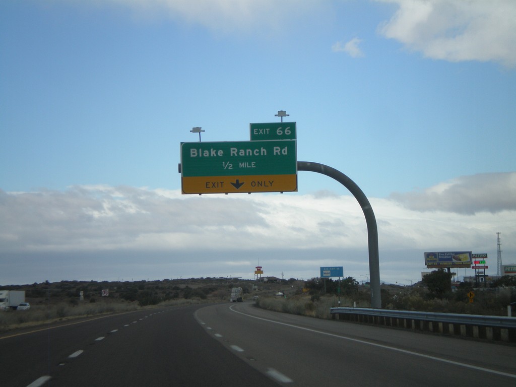
I-40 West Approaching Exit 66
I-40 west approaching Exit 66 - Blake Ranch Road.
Taken 02-25-2011
Kingman
Mohave County
Arizona
United States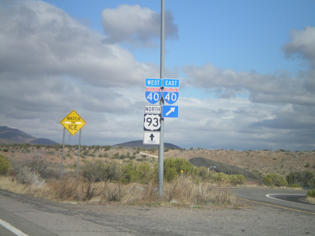
US-93 North at I-40
US-93 north at I-40. US-93 north joins I-40 west through Kingman.
Taken 02-25-2011
Kingman
Mohave County
Arizona
United States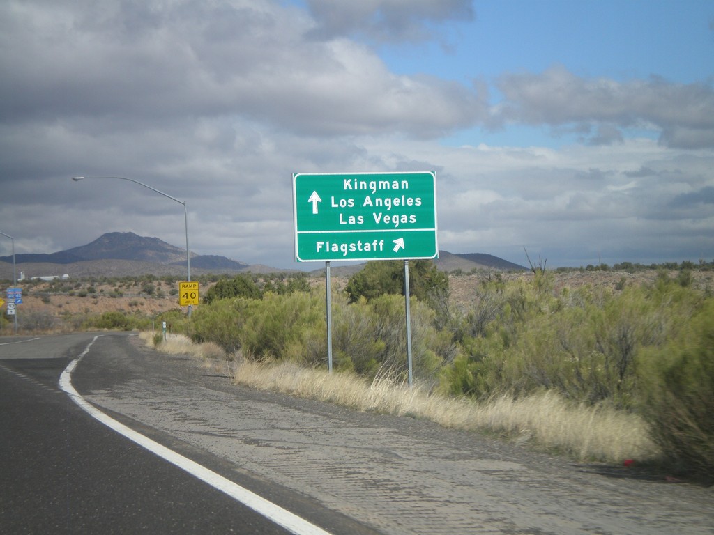
US-93 North at I-40
US-93 north at I-40. Use I-40 West/US-93 north for Kingman/Los Angeles/Las Vegas. Use I-40 east for Flagstaff. US-93 north joins I-40 west through Kingman.
Taken 02-25-2011
Kingman
Mohave County
Arizona
United States
US-93 North Approaching I-40
US-93 north approaching I-40, one-half mile.
Taken 02-25-2011
Kingman
Mohave County
Arizona
United States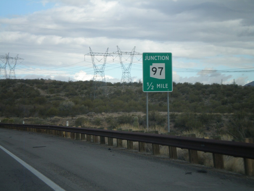
US-93 North Approaching AZ-97
US-93 north approaching AZ-97.
Taken 02-25-2011
 Bagdad
Yavapai County
Arizona
United States
Bagdad
Yavapai County
Arizona
United States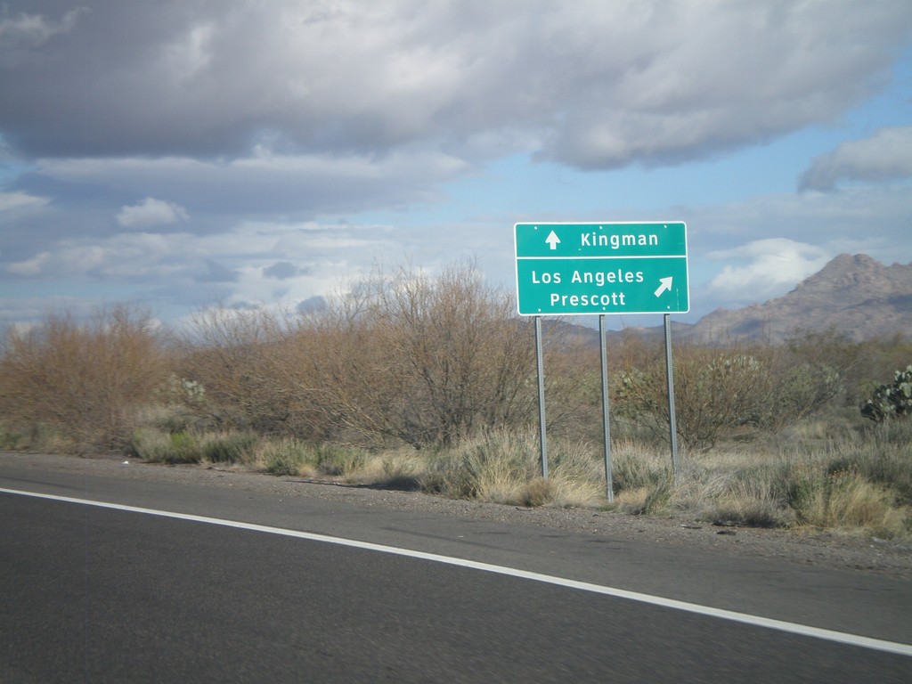
US-93 North at AZ-71
US-93 north at AZ-71 to Los Angeles and Prescott. Continue north on US-93 for Kingman.
Taken 02-25-2011
 Congress
Yavapai County
Arizona
United States
Congress
Yavapai County
Arizona
United States
US-93 North Approaching AZ-71
US-93 north approaching AZ-71.
Taken 02-25-2011
Congress
Yavapai County
Arizona
United States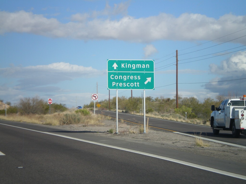
US-93 North at AZ-89 North
US-93 north at AZ-89 north. Use AZ-89 for Congress and Prescott. Continue north on US-93 for Kingman.
Taken 02-25-2011
 Wickenburg
Yavapai County
Arizona
United States
Wickenburg
Yavapai County
Arizona
United States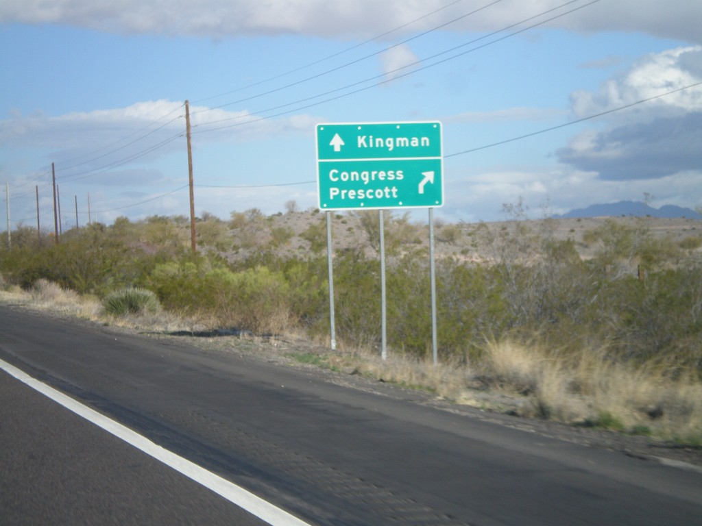
US-93 North Approaching AZ-89 North
US-93 north approaching AZ-89 north. Use AZ-89 north for Congress and Prescott. Continue north on US-93 for Kingman.
Taken 02-25-2011
Wickenburg
Maricopa County
Arizona
United States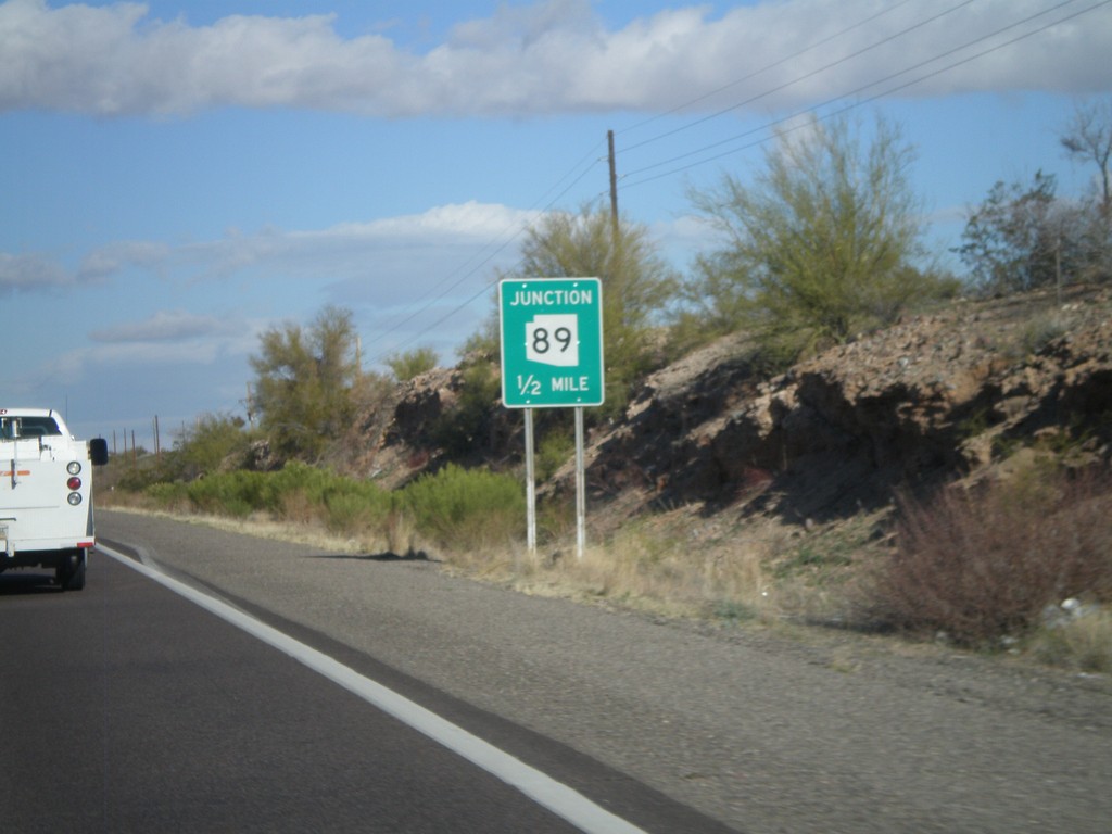
US-93 North Approaching AZ-89
US-93 north approaching AZ-89 north.
Taken 02-25-2011
Wickenburg
Yavapai County
Arizona
United States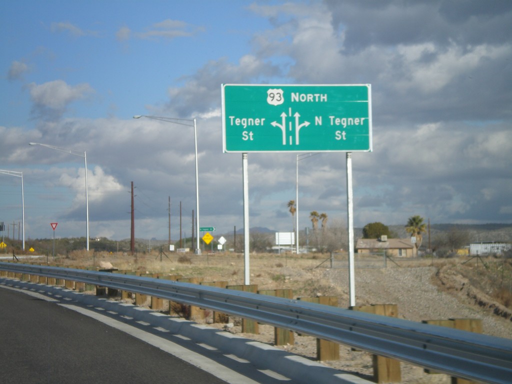
US-93 North - Tegner St. Roundabout
US-93 north at the Tegner St. roundabout. US-93 used to follow Tegner St. into downtown Wickenburg, until the bypass was completed in 2009.
Taken 02-25-2011
Wickenburg
Maricopa County
Arizona
United States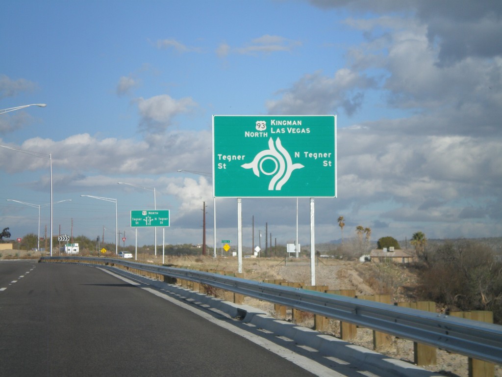
US-93 North Approaching Tegner St.
US-93 north approaching Tegner St. roundabout. Continue north on US-93 for Kingman and Las Vegas.
Taken 02-25-2011
Wickenburg
Maricopa County
Arizona
United States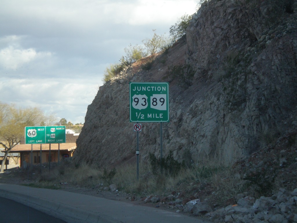
US-60 West Approaching US-93
US-60 west approaching US-93, (To) AZ-89.
Taken 02-25-2011
 Wickenburg
Maricopa County
Arizona
United States
Wickenburg
Maricopa County
Arizona
United States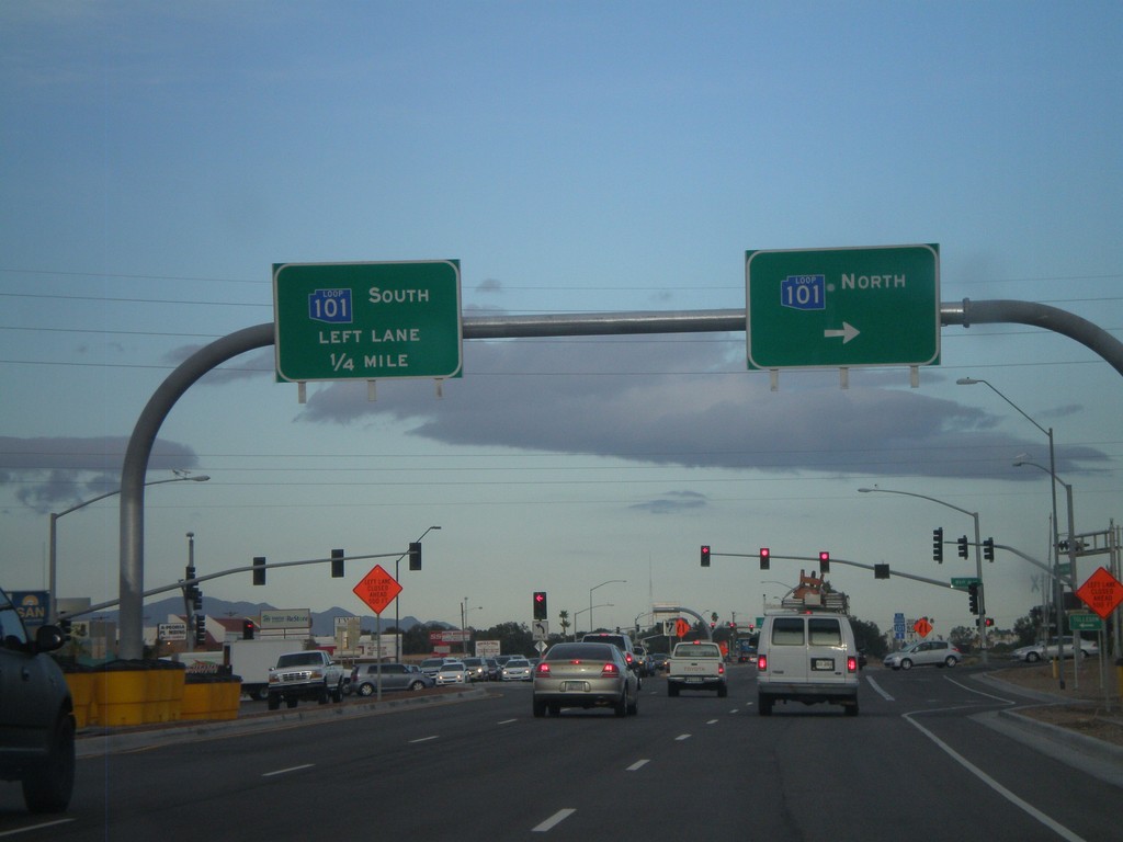
US-60 West at AZ-101 Loop
US-60 west at AZ-101 Loop. Turn right for AZ-101 Loop north. Continue ahead for AZ-101 Loop south. The AZ-101 Loop shields are blue here, although new AZ-101 Loop signs are traditional black and white.
Taken 02-25-2011
 Peoria
Maricopa County
Arizona
United States
Peoria
Maricopa County
Arizona
United States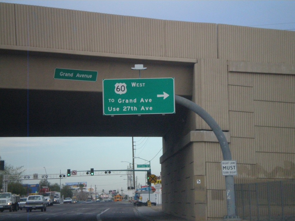
US-60 West - Thomas Road at 27th Ave.
US-60 west (Thomas Road) at 27th Ave. Turn right on 27th Ave. to continue on US-60 west.
Taken 02-25-2011
Phoenix
Maricopa County
Arizona
United States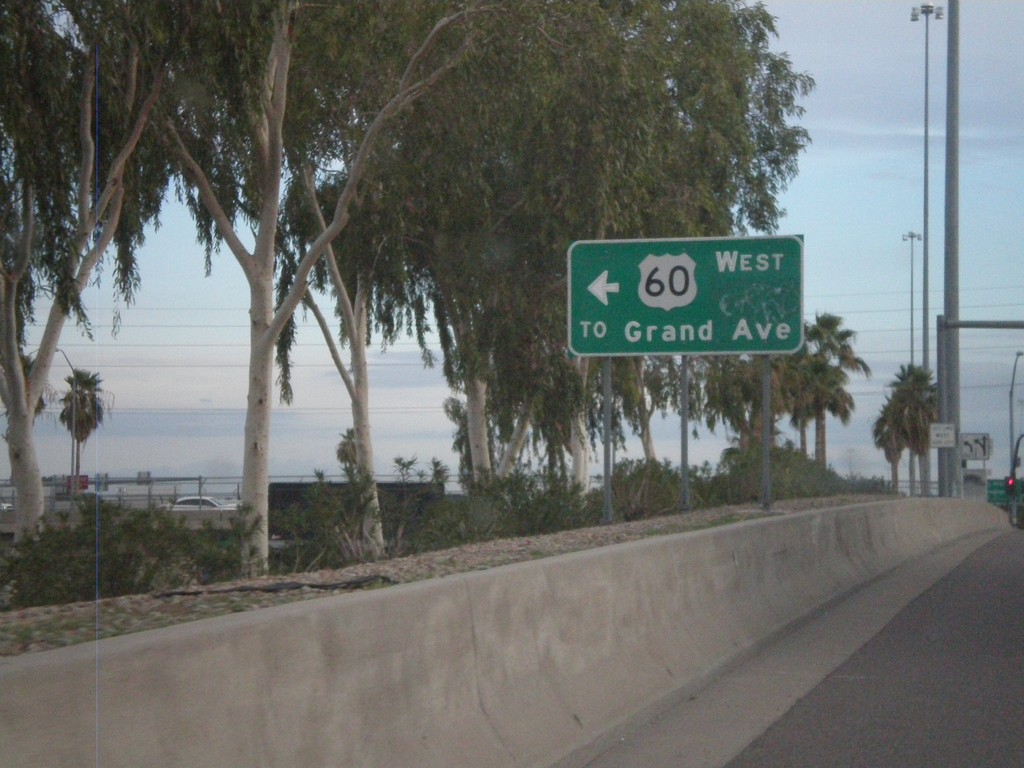
I-17 North - Exit 201 Offramp at US-60
I-17 North - Exit 201 offramp at US-60. Turn left for US-60/To Grand Ave.
Taken 02-25-2011
 Phoenix
Maricopa County
Arizona
United States
Phoenix
Maricopa County
Arizona
United States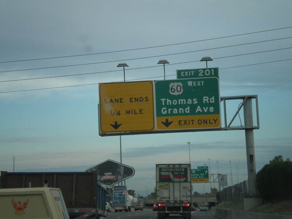
I-17 North - Exit 201
I-17 north at Exit 201 - US-60 West/Thomas Road/Grand Ave. US-60 west leaves I-17 north here.
Taken 02-25-2011
Phoenix
Maricopa County
Arizona
United States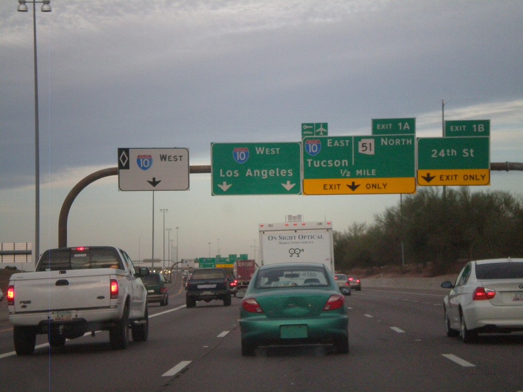
AZ-202 Loop West - Exits 1B and 1A
AZ-202 Loop west at Exit 1B - 24th St. Approaching Exit 1A - I-10 East/Tucson/AZ-51 North. Continue ahead for I-10 west for Los Angeles. The left most lane is for I-10 west HOV traffic.
Taken 02-25-2011


 Phoenix
Maricopa County
Arizona
United States
Phoenix
Maricopa County
Arizona
United States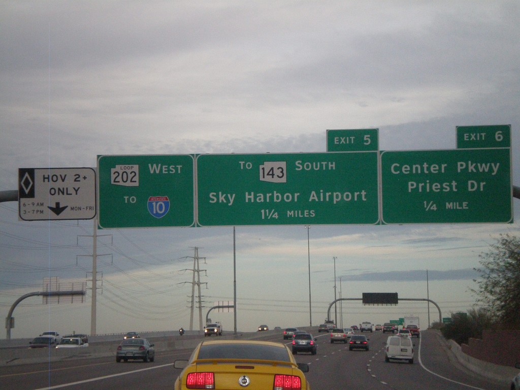
AZ-202 Loop West Approaching Exits 6 and 5
AZ-202 Loop west approaching Exit 6 - Center Parkway/Priest Drive and Exit 7 - To AZ-143 South/Sky Harbor Airport. AZ-202 Loop continues west towards I-10. The left most lane is a HOV lane.
Taken 02-25-2011
 Tempe
Maricopa County
Arizona
United States
Tempe
Maricopa County
Arizona
United States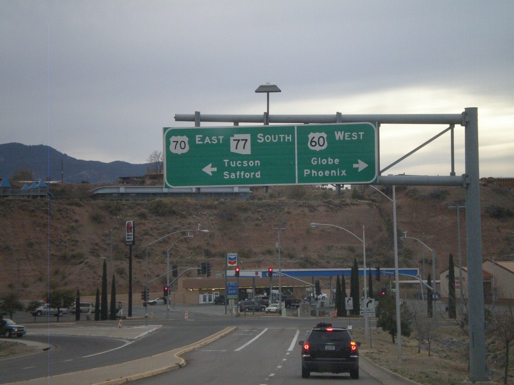
US-60 West/AZ-77 South Approaching US-70
US-60 West/AZ-77 South approaching US-70. Use US-60 west for Globe and Phoenix. Use US-70 west/AZ-77 south for Tucson (via AZ-77) and Safford (via US-70). This is the western end of US-70.
Taken 02-24-2011

 Globe
Gila County
Arizona
United States
Globe
Gila County
Arizona
United States