Signs Tagged With Big Green Sign
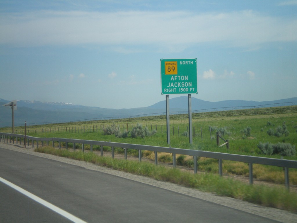
US-30 West/WY-89 North Approaching WY-89
US-30 West/WY-89 North approaching WY-89 North to Afton and Jackson.
Taken 07-05-2011

 Cokeville
Lincoln County
Wyoming
United States
Cokeville
Lincoln County
Wyoming
United States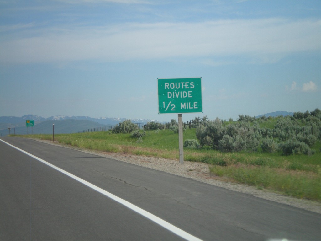
Routes Divide on US-30 West/WY-89 North
Routes Divide on US-30 West/WY-89 North approaching WY-89 North junction. The Routes Divide sign is common in Wyoming whenever a multiplexed route splits.
Taken 07-05-2011
Cokeville
Lincoln County
Wyoming
United States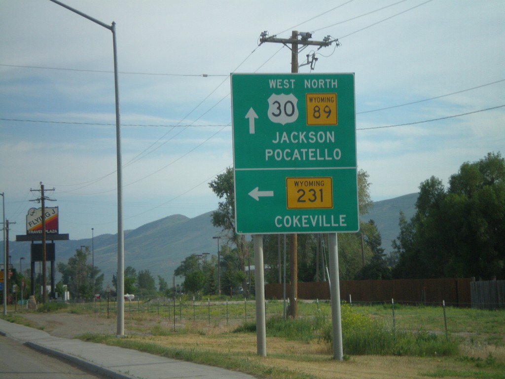
US-30 West/WY-89 North Approaching WY-231/WY-232
US-30 West/WY-89 North approaching WY-231/WY-232 (not signed). Use WY-231 for Cokeville. Continue on US-30 West/WY-89 North for Jackson and Pocatello.
Taken 07-05-2011

 Cokeville
Lincoln County
Wyoming
United States
Cokeville
Lincoln County
Wyoming
United States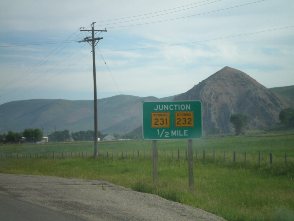
US-30 West/WY-89 North Approaching WY-231/WY-232
US-30 West/WY-89 North approaching WY-231/WY-232.
Taken 07-05-2011
Cokeville
Lincoln County
Wyoming
United States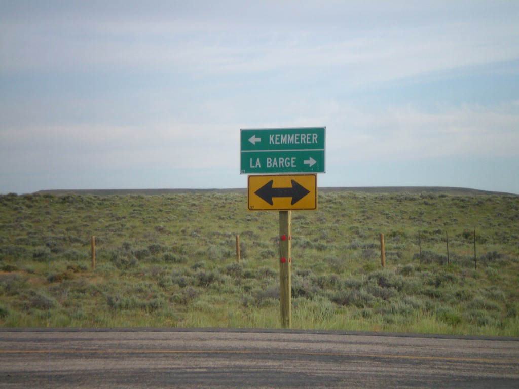
End WY-372 at US-189
End WY-372 at US-189. Use US-189 north for La Barge; use US-189 south for Kemmerer.
Taken 07-05-2011

 Fontenelle
Lincoln County
Wyoming
United States
Fontenelle
Lincoln County
Wyoming
United States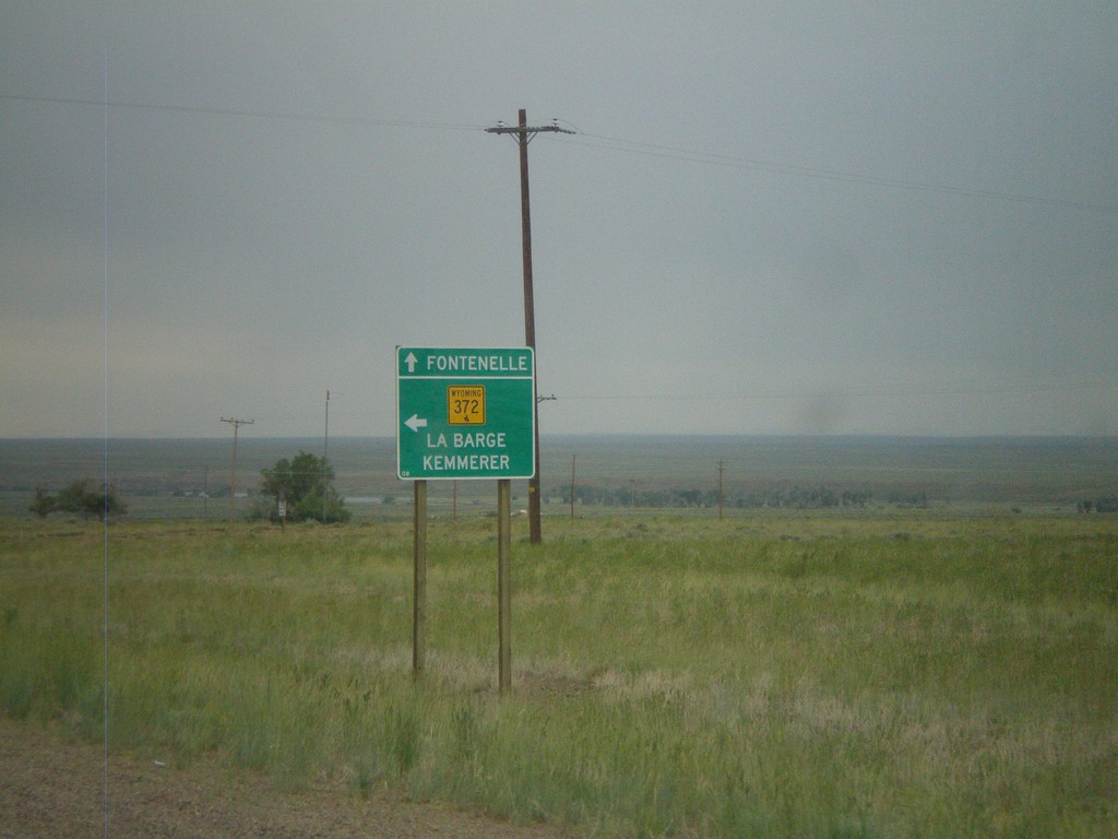
WY-372 in Fontenelle
WY-372 in Fontenelle. Turn left to continue on WY-372 towards La Barge and Kemmerer. Continue ahead for the community of Fontenelle.
Taken 07-04-2011
Fontenelle
Lincoln County
Wyoming
United States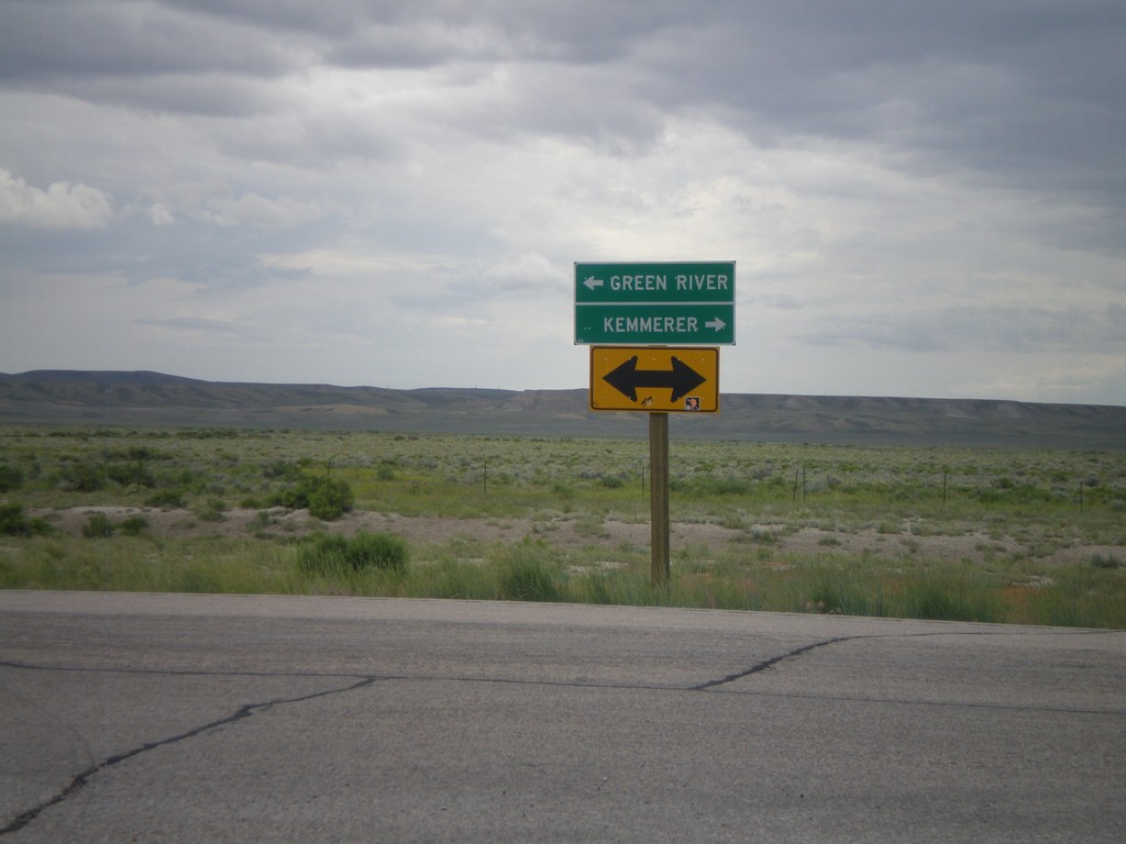
End WY-28 West at WY-372
End WY-28 west at WY-372. Use WY-372 north for Kemmerer; use WY-372 south for Green River.
Taken 07-04-2011
 Green River
Sweetwater County
Wyoming
United States
Green River
Sweetwater County
Wyoming
United States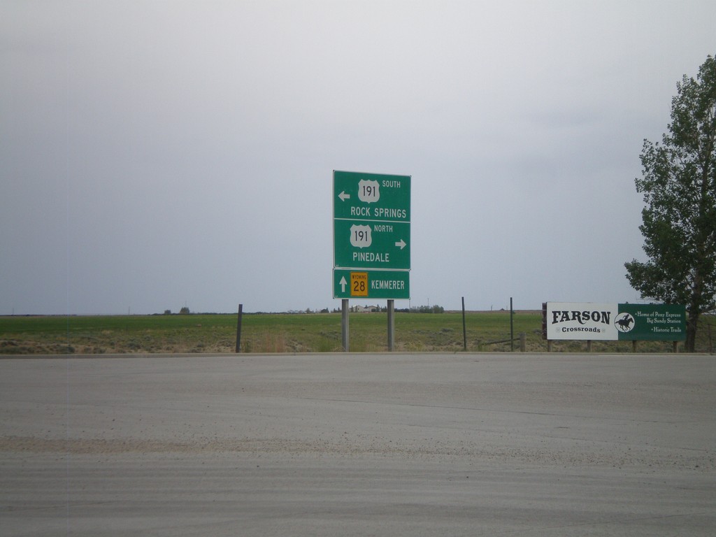
WY-28 West at US-191
WY-28 west at US-191. Use US-191 north for Pinedale; US-191 south for Rock Springs. Continue west on WY-28 for Kemmerer.
Taken 07-04-2011
 Eden
Sweetwater County
Wyoming
United States
Eden
Sweetwater County
Wyoming
United States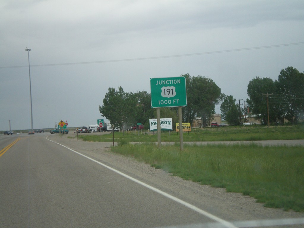
WY-28 West Approaching US-191
WY-28 west approaching US-191 in Farson.
Taken 07-04-2011
Farson
Sweetwater County
Wyoming
United States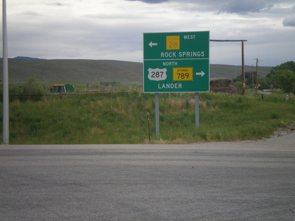
US-287/WY-789 North at WY-28
US-287 North/WY-789 North at WY-28. Turn left for WY-28 to Rock Springs; turn right for US-287/WY-789 to Lander.
Taken 07-04-2011

 Lander
Fremont County
Wyoming
United States
Lander
Fremont County
Wyoming
United States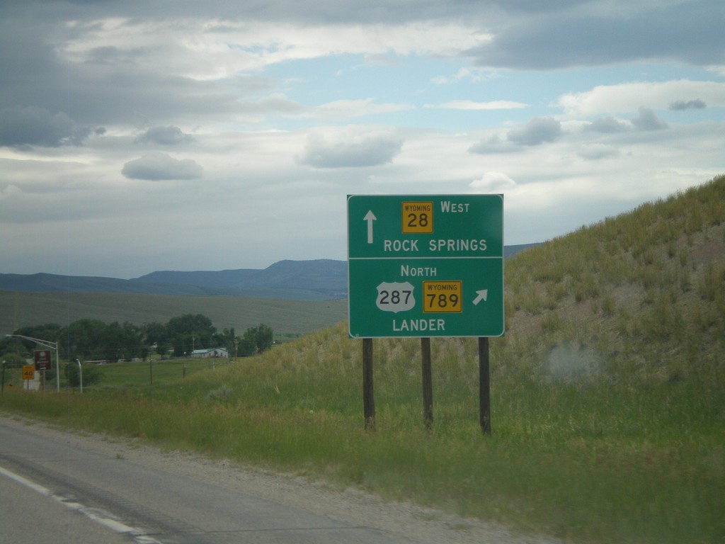
US-287/WY-789 North Approaching WY-28
US-287/WY-789 North approaching WY-28. Use US-287/WY-789 north for Lander. Use WY-28 west for Rock Springs.
Taken 07-04-2011
Kotey Place
Fremont County
Wyoming
United States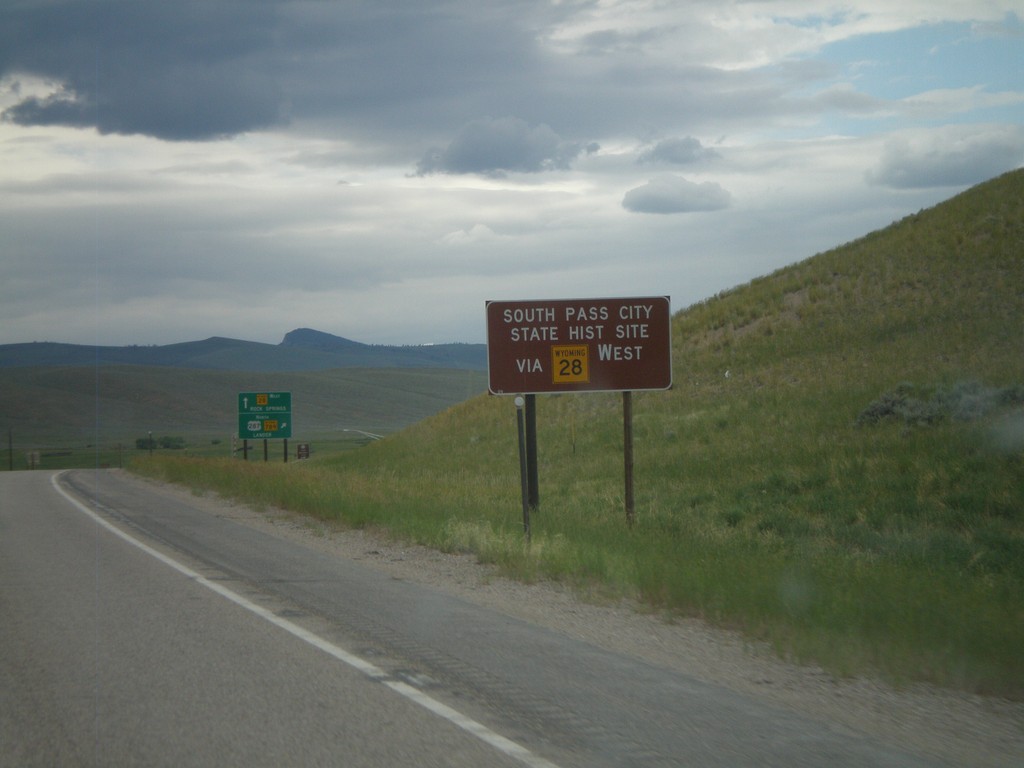
US-287/WY-789 North Approaching WY-28
US-287/WY-789 North approaching WY-28. Use WY-28 west for South Pass City State Historic Site.
Taken 07-04-2011
Kotey Place
Fremont County
Wyoming
United States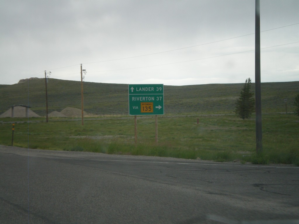
US-287/WY-789 North at WY-135
US-287/WY-789 North at WY-135 junction. Use WY-135 north for Riverton, continue on US-287/WY-789 for Lander. Taken in the community of Sweetwater Station.
Taken 07-04-2011
 Sweetwater Station
Fremont County
Wyoming
United States
Sweetwater Station
Fremont County
Wyoming
United States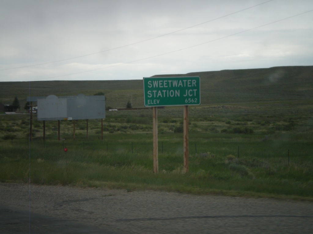
US-287/WY-789 North - Sweetwater Junction
Entering the community of Sweetwater Junction on US-287/WY-789 north. Elevation of Sweetwater Junction is 6562 Feet.
Taken 07-04-2011
Lander
Fremont County
Wyoming
United States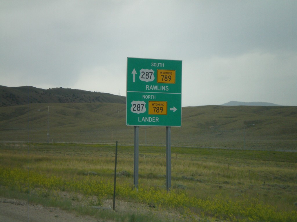
End WY-220 West At US-287/WY-789
End WY-220 West at US-287/WY-789. Use US-287/WY-789 North for Lander; use US-287/WY-789 South for Rawlins.
Taken 07-04-2011
 Rawlins
Carbon County
Wyoming
United States
Rawlins
Carbon County
Wyoming
United States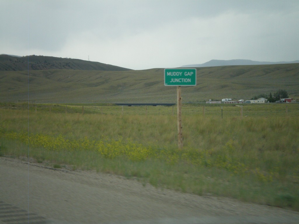
WY-220 West - Muddy Gap Junction
WY-220 West at Muddy gap Junction.
Taken 07-04-2011
Rawlins
Carbon County
Wyoming
United States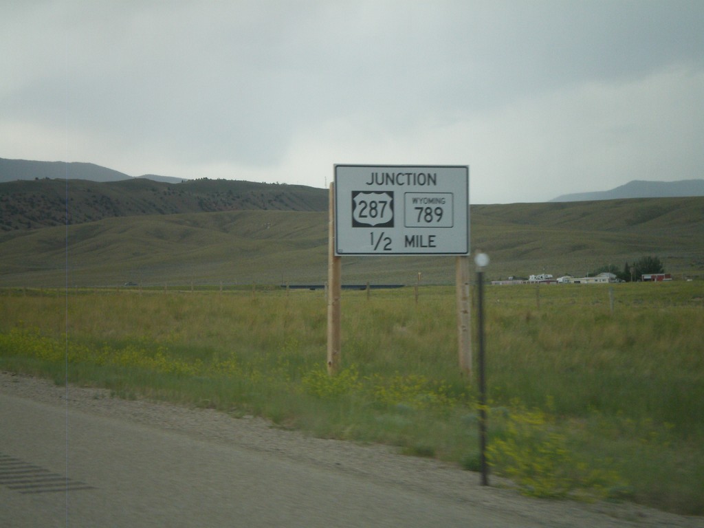
WY-220 West Approaching US-287/WY-789
WY-220 West approaching US-287/WY-789. This is a non standard Wyoming junction sign that is in black and white.
Taken 07-04-2011
Rawlins
Carbon County
Wyoming
United States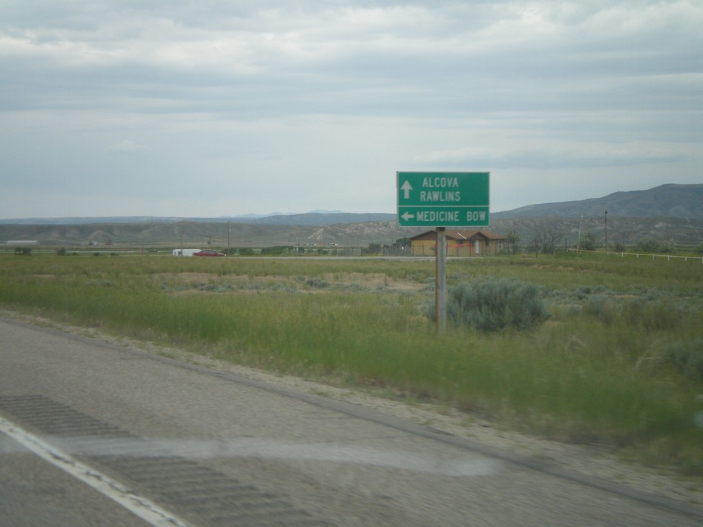
WY-220 West at WY-487
WY-220 west at WY-487 south to Medicine Bow. Continue west on WY-220 for Alcova and Rawlins.
Taken 07-04-2011
 Casper
Natrona County
Wyoming
United States
Casper
Natrona County
Wyoming
United States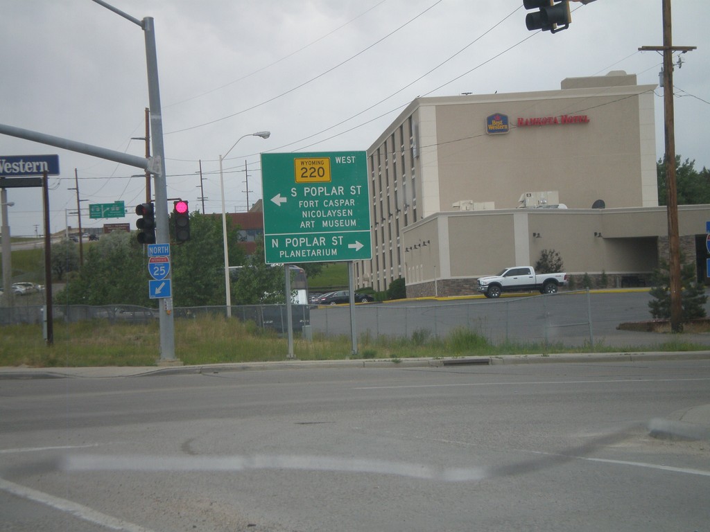
I-25 North Exit 188B at WY-220
I-25 North at Exit 188B, WY-220 Jct. Turn left for WY-220 West towards S. Poplar St., Fort Casper, and Nicolaysen Art Museum. Turn north on Poplar St. for the Casper Planetarium.
Taken 07-04-2011


 Casper
Natrona County
Wyoming
United States
Casper
Natrona County
Wyoming
United States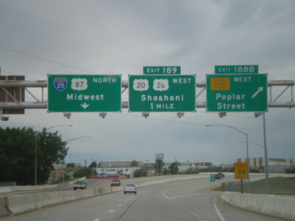
I-25 North - Exits 188B and 189
I-25 North at Exit 188B - WY-220 West/Poplar St. Approaching Exit 189 - US-20/US-26 West/Shoshoni. Continue north on I-25/US-87 North for Midwest.
Taken 07-04-2011
Casper
Natrona County
Wyoming
United States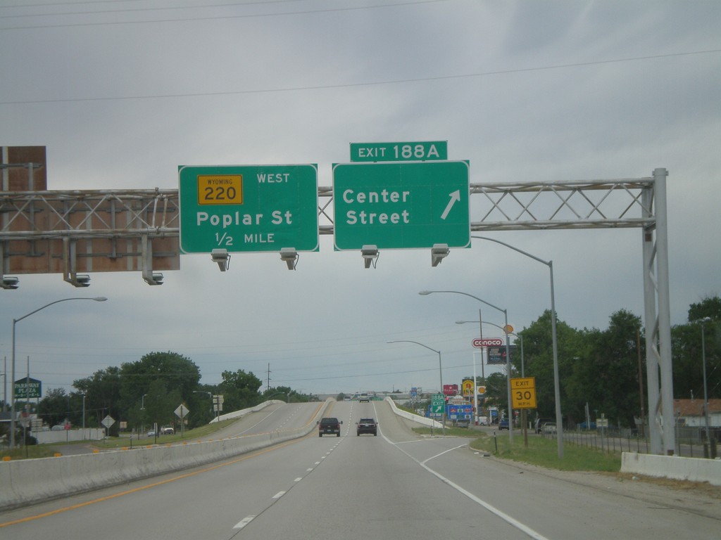
I-25 North - Exits 188A and 188B
I-25 north at Exit 188A - Center St. Approaching Exit 188B - WY-220 West/Poplar St. Center St. is the northern end of Business I-25 and Business US-87.
Taken 07-04-2011

 Casper
Natrona County
Wyoming
United States
Casper
Natrona County
Wyoming
United States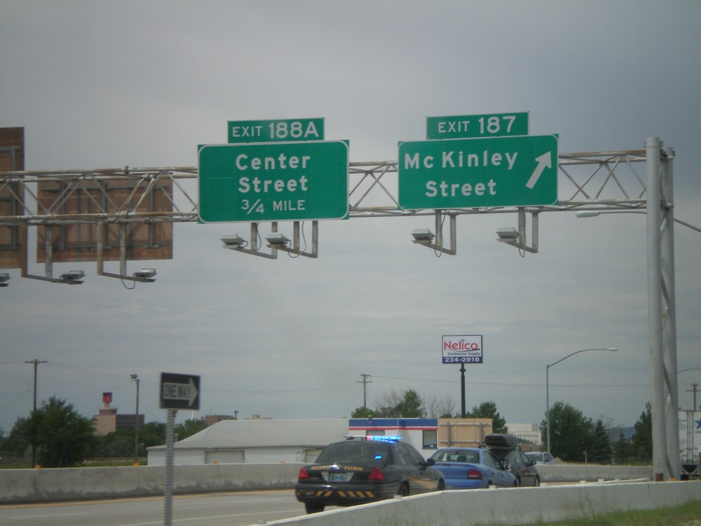
I-25 North - Exits 187 and 188A
I-25/US-87 North/US-20/US-26 West at Exit 187 - Mc Kinley St. Approaching Exit 188A - Center St.
Taken 07-04-2011
Casper
Natrona County
Wyoming
United States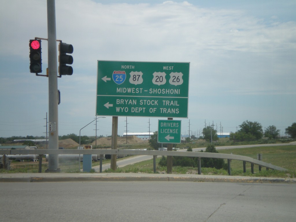
I-25 South at Bryan Stock Trail (Exit 186)
I-25 South/US-20 East/US-26 East/US-87 South at Bryan Stock Trail. US-20/US-26/US-87 leave I-25 south here. Turn left to return north on I-25 towards Midwest and Shoshoni.
Taken 07-04-2011

 Casper
Natrona County
Wyoming
United States
Casper
Natrona County
Wyoming
United States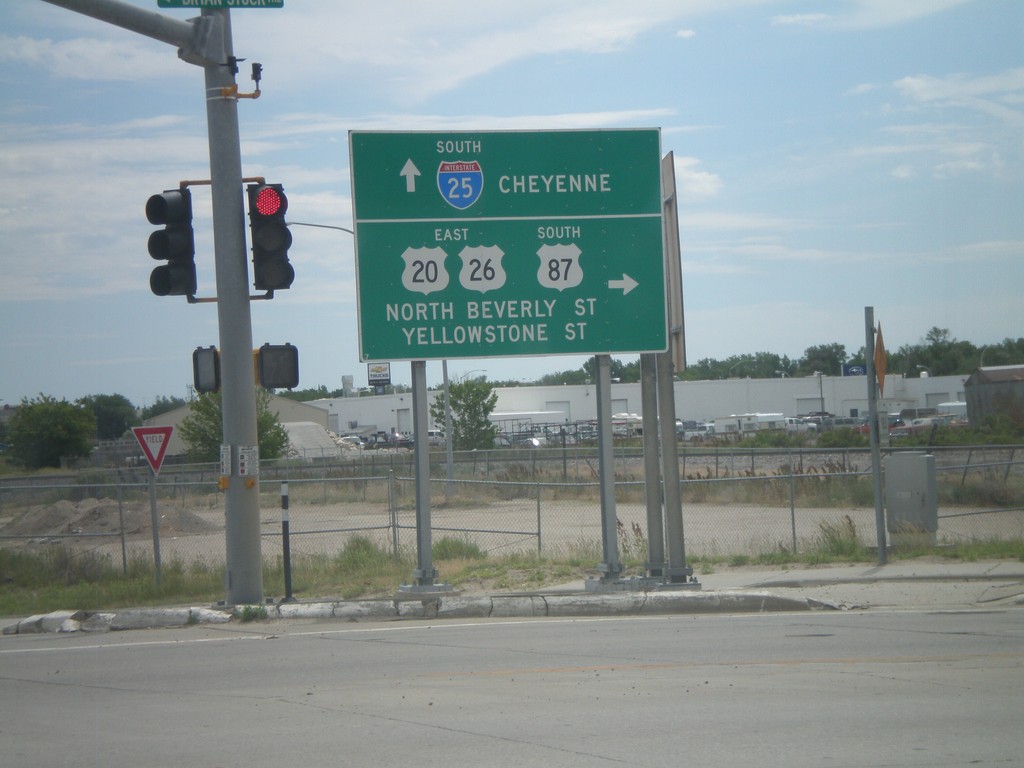
I-25 South at Bryan Stock Trail (Exit 186)
I-25 South/US-20 East/US-26 East/US-87 South at Bryan Stock Trail. US-20/US-26/US-87 leave I-25 south here. Turn right for US-20/US-26 west and US-87 south. Continue ahead for I-25 south for Cheyenne.
Taken 07-04-2011
Casper
Natrona County
Wyoming
United States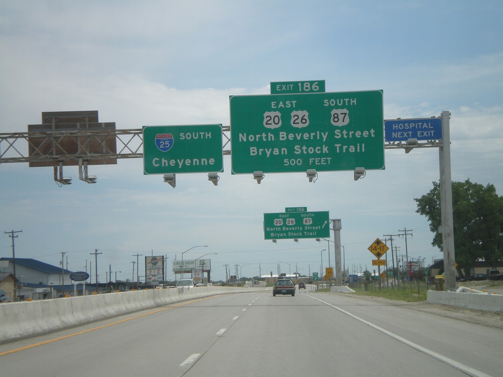
I-25 South Approaching Exit 186
I-25/US-87 South/US-20/US-26 East approaching Exit 186 - US-20/US-26 East/US-87 South/North Beverly St./Bryan Stock Trail. I-25 continues south towards Cheyenne.
Taken 07-04-2011
Casper
Natrona County
Wyoming
United States