Signs Tagged With Big Green Sign
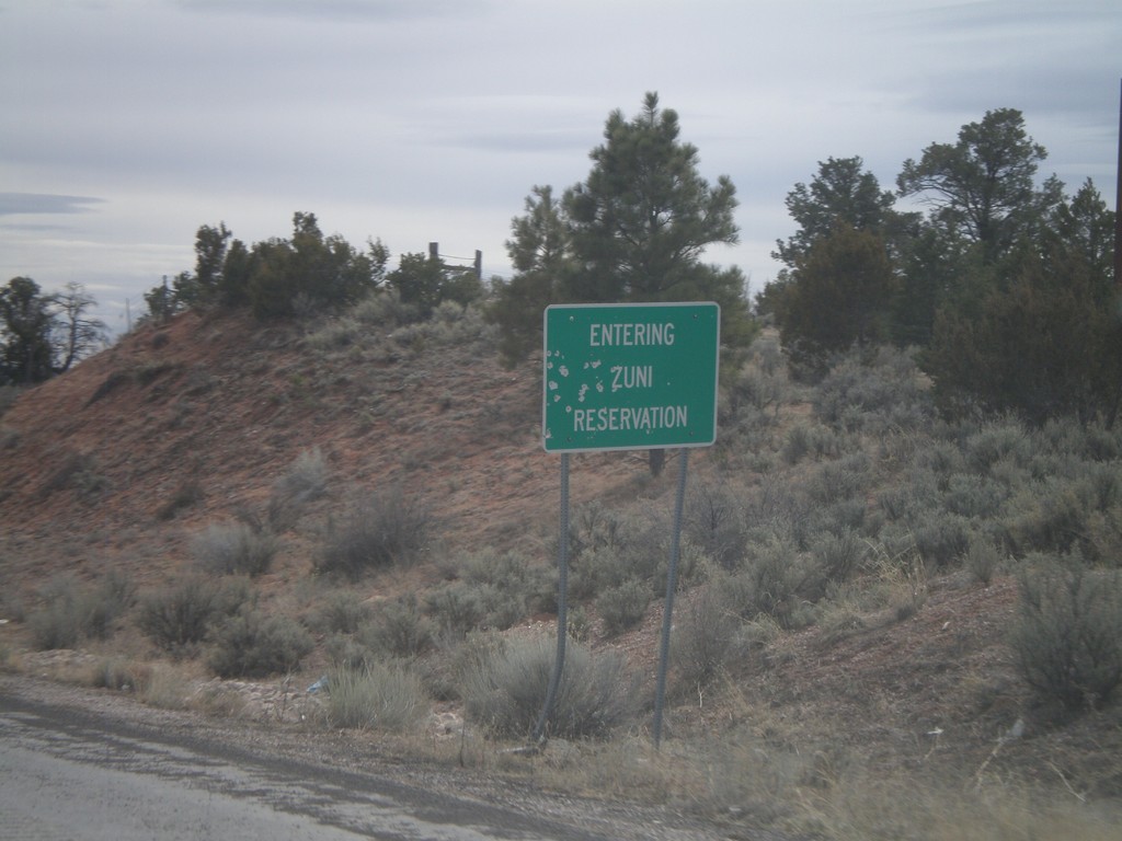
NM-602 South - Entering Zuni Reservation
Entering Zuni Reservation on NM-602 south.
Taken 02-24-2011
 Vanderwagen
McKinley County
New Mexico
United States
Vanderwagen
McKinley County
New Mexico
United States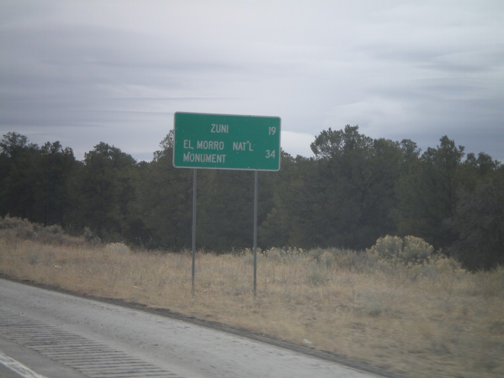
NM-602 South - Distance Marker
Distance marker on NM-602 south to Zuni, and El Morro National Monument.
Taken 02-24-2011
Vanderwagen
McKinley County
New Mexico
United States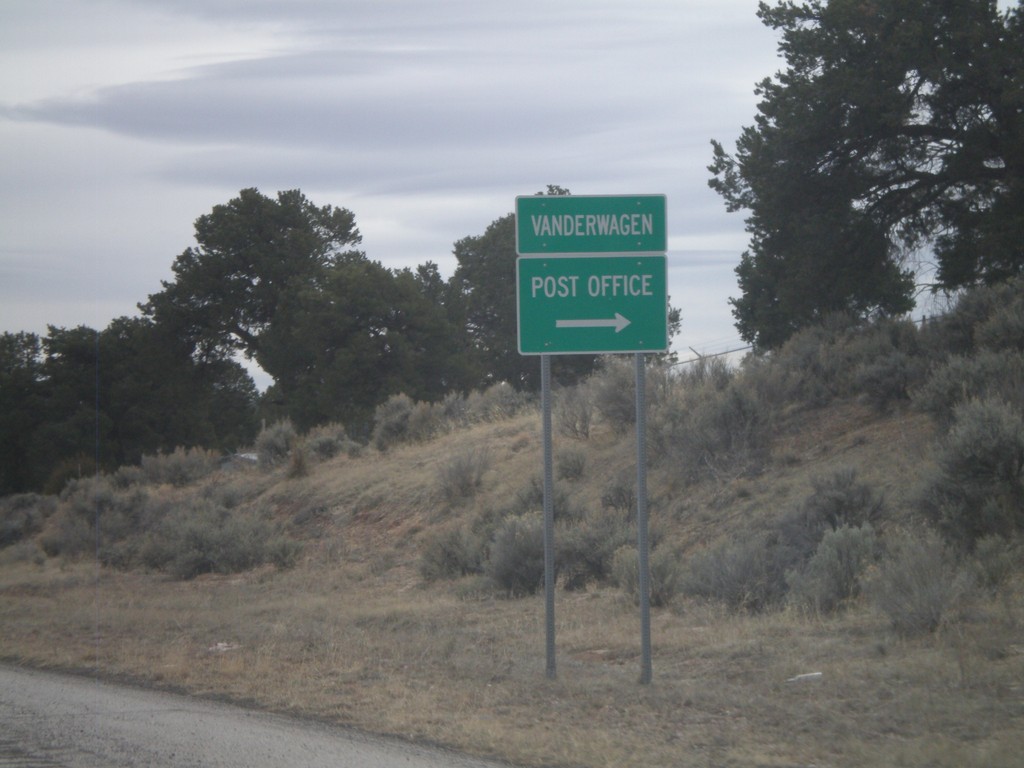
NM-602 South - Vanderwagen
NM-602 south at the small settlement of Vanderwagen. Turn right for the Post Office.
Taken 02-24-2011
Vanderwagen
McKinley County
New Mexico
United States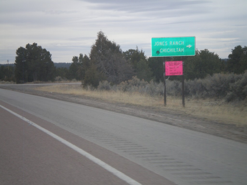
NM-602 South at Jones Ranch Road
NM-602 south at Jones Ranch Road jct. to Jones Ranch and Chichiltah.
Taken 02-24-2011
Vanderwagen
McKinley County
New Mexico
United States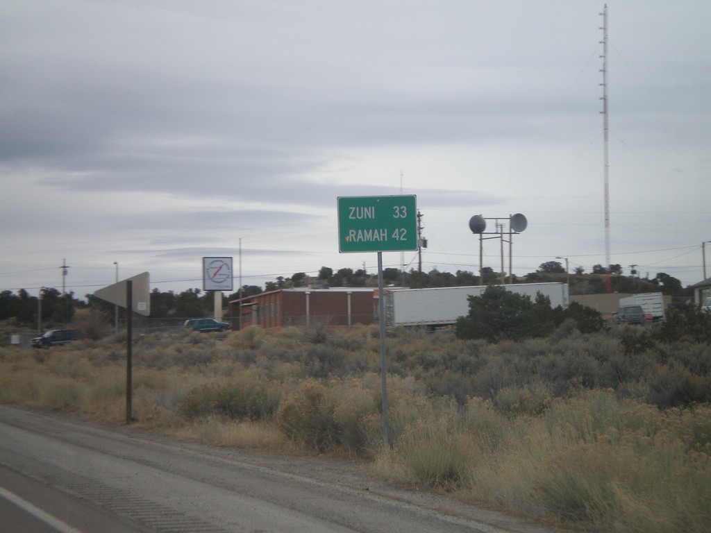
NM-602 South - Distance Marker
Distance marker on NM-602 south to Zuni, and Ramah.
Taken 02-24-2011
Gallup
McKinley County
New Mexico
United States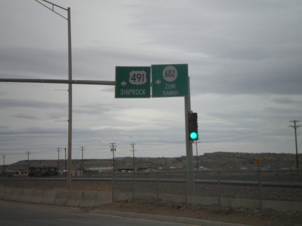
NM-118 West at NM-602/US-491
NM-118 west at Arnold St., to NM-602/Zuni/Ramah and US-491/Shiprock.
Taken 02-24-2011


 Gallup
McKinley County
New Mexico
United States
Gallup
McKinley County
New Mexico
United States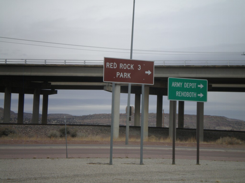
I-40 East Offramp at BL-40/NM-118
I-40 east offramp at BL-40/NM-118. Use NM-118 east for Army Depot. Rehoboth, and and Red Rock Park.
Taken 02-24-2011
 Gallup
McKinley County
New Mexico
United States
Gallup
McKinley County
New Mexico
United States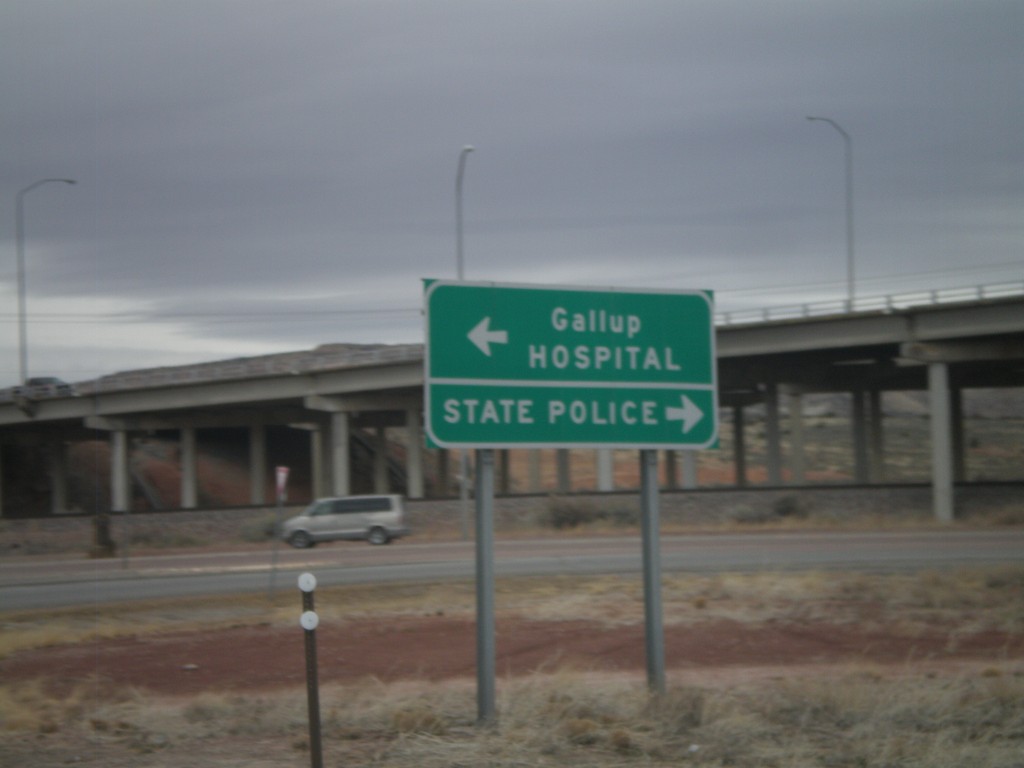
I-40 East at Exit 26 Offramp
I-40 east at Exit 26 Offramp. Turn right for State Police; turn left for Gallup and Hospital.
Taken 02-24-2011
Gallup
McKinley County
New Mexico
United States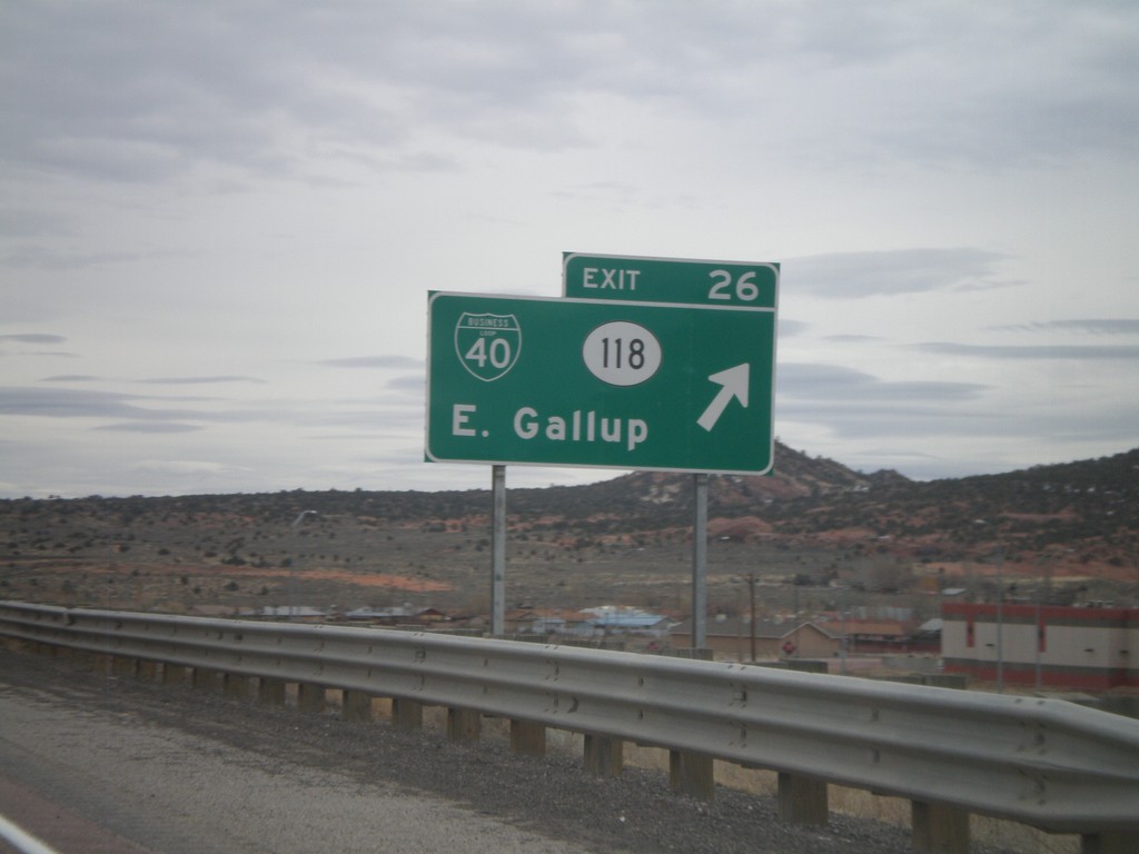
I-40 East - Exit 26
I-40 east at Exit 26 - BL-40/NM-118/East Gallup. This is the eastern end of the Gallup business loop.
Taken 02-24-2011
Gallup
McKinley County
New Mexico
United States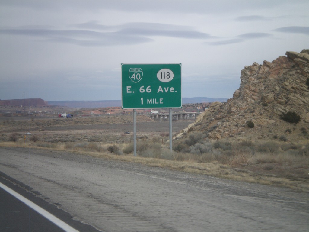
I-40 East Approaching Exit 26
I-40 east approaching Exit 26 - BL-40/NM-118/E. 66 Ave. The actual exit text is for East Gallup.
Taken 02-24-2011
Gallup
McKinley County
New Mexico
United States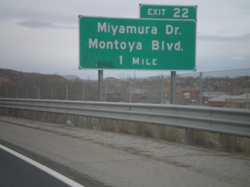
I-40 West Approaching Exit 22
I-40 west approaching Exit 22 - Miyamura Drive/Montoya Blvd.
Taken 02-24-2011
Gallup
McKinley County
New Mexico
United States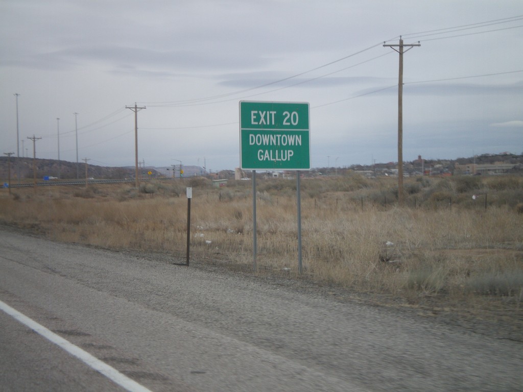
I-40 East Approaching Exit 20
I-40 east approaching Exit 20 - Downtown Gallup. The advance signs to Exit 20 are much more detailed then the actual exit name, which is Munoz Blvd.
Taken 02-24-2011
Gallup
McKinley County
New Mexico
United States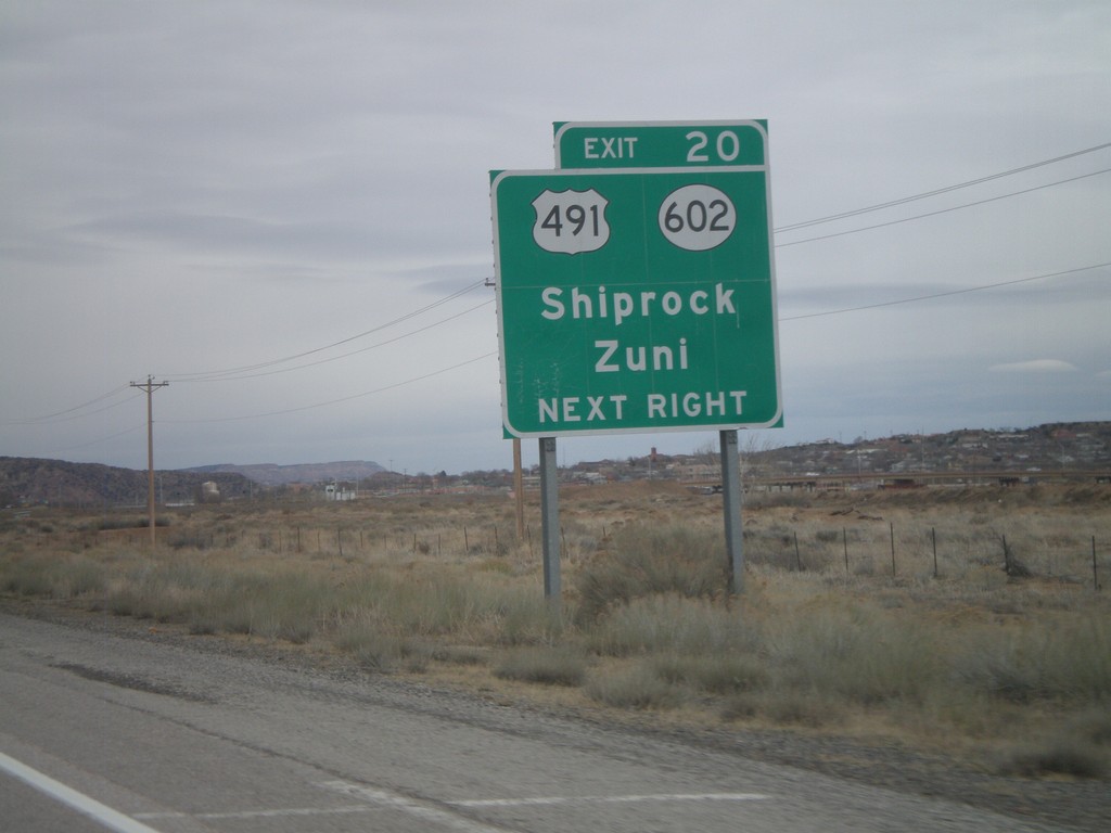
I-40 East Approaching Exit 20
I-40 east approaching Exit 20 - US-491/NM-602/Shiprock/Zuni. The advance signs to Exit 20 are much more detailed then the actual exit name, which is Munoz Blvd.
Taken 02-24-2011
Gallup
McKinley County
New Mexico
United States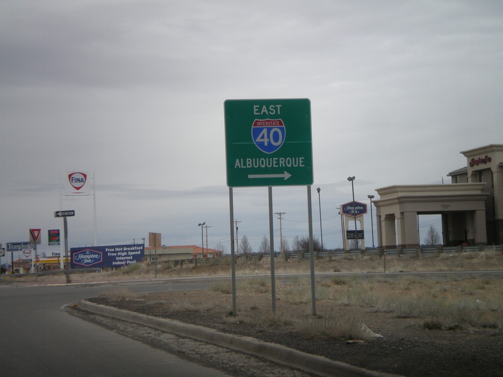
NM-118 East at I-40 East Onramp
NM-118 east at I-40 east onramp, at Exit 16. Use I-40 east for Albuquerque.
Taken 02-24-2011
Gallup
McKinley County
New Mexico
United States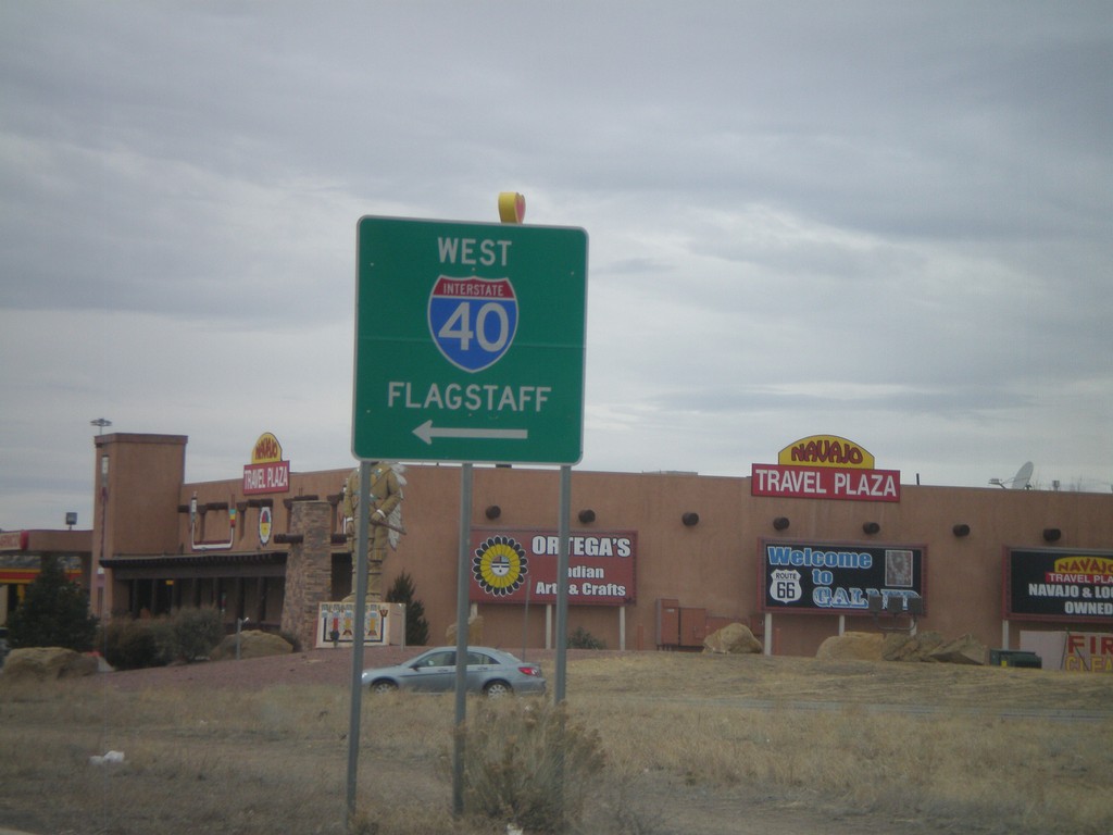
BL-40/NM-118 West at I-40 West
BL-40/NM-118 west at I-40 west to Flagstaff. This is the western end of the Gallup business loop.
Taken 02-24-2011
Gallup
McKinley County
New Mexico
United States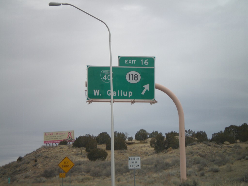
I-40 East - Exit 16
I-40 east at Exit 16 - BL-40/NM-118/West Gallup.
Taken 02-24-2011
Gallup
McKinley County
New Mexico
United States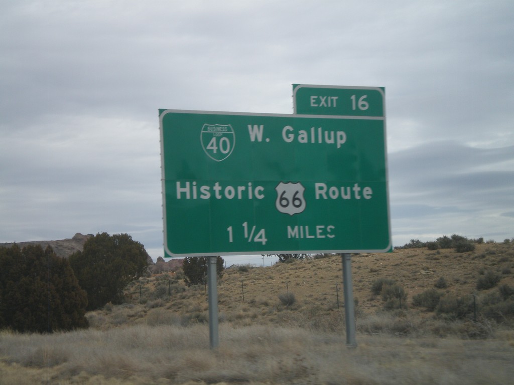
I-40 East Approaching Exit 16
I-40 east approaching Exit 16 - NM-118/BL-40/West Gallup. Use Exit 16 for BL-40/West Gallup/Historic US-66 Route.
Taken 02-24-2011
Gallup
McKinley County
New Mexico
United States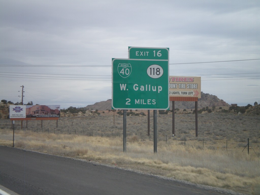
I-40 East Approaching Exit 16
I-40 east approaching Exit 16 - BL-40/NM-118/West Gallup.
Taken 02-24-2011
Gallup
McKinley County
New Mexico
United States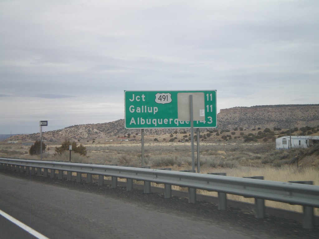
Distance Marker on I-40 East
Distance marker on I-40 east. Distance to US-491, Gallup, and Albuquerque.
Taken 02-24-2011
Gallup
McKinley County
New Mexico
United States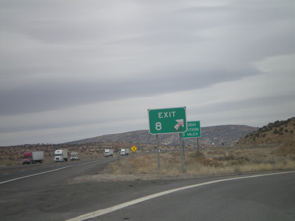
I-40 East - Exit 8
I-40 east at Exit 8. Eastbound, Exit 8 has no advanced signage, just the Exit 8 gore sign. Westbound, Exit 8 is signed as Manuelito/Defiance. Exit 8 is the first New Mexico exit eastbound on I-40. This exit connects to NM-118, which serves as a frontage road to I-40.
Taken 02-24-2011
Manuelito
McKinley County
New Mexico
United States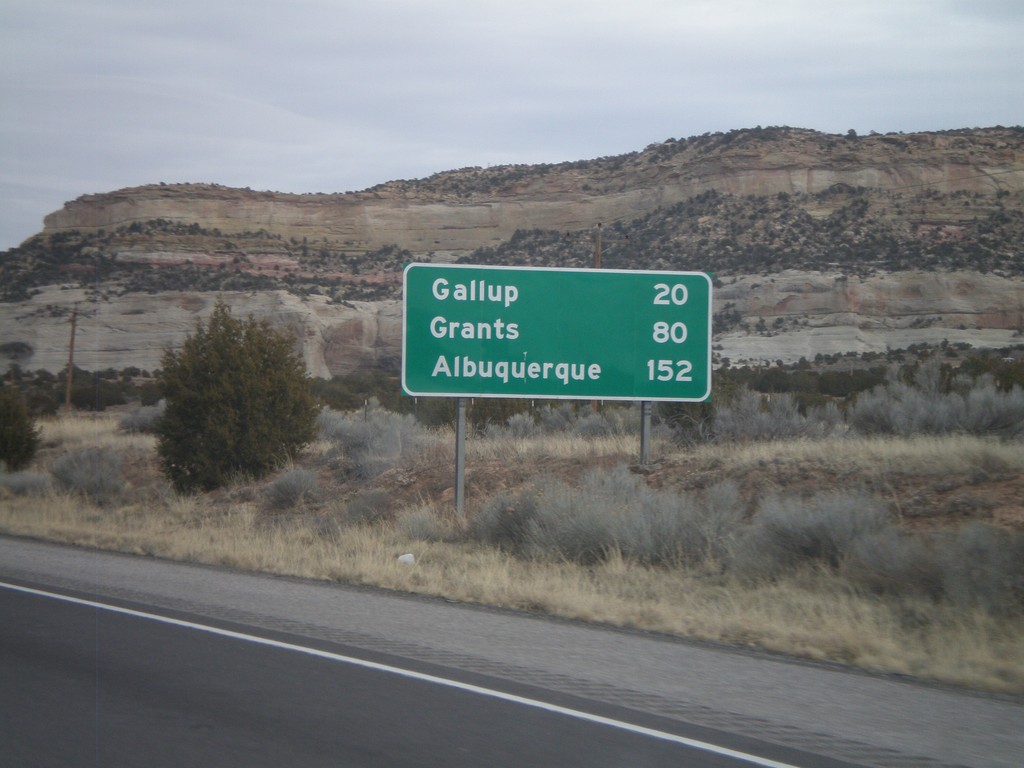
I-40 East - Distance Marker
First distance marker inside New Mexico on I-40 eastbound. Distance to Gallup, Grants, and Albuquerque.
Taken 02-24-2011
Gallup
McKinley County
New Mexico
United States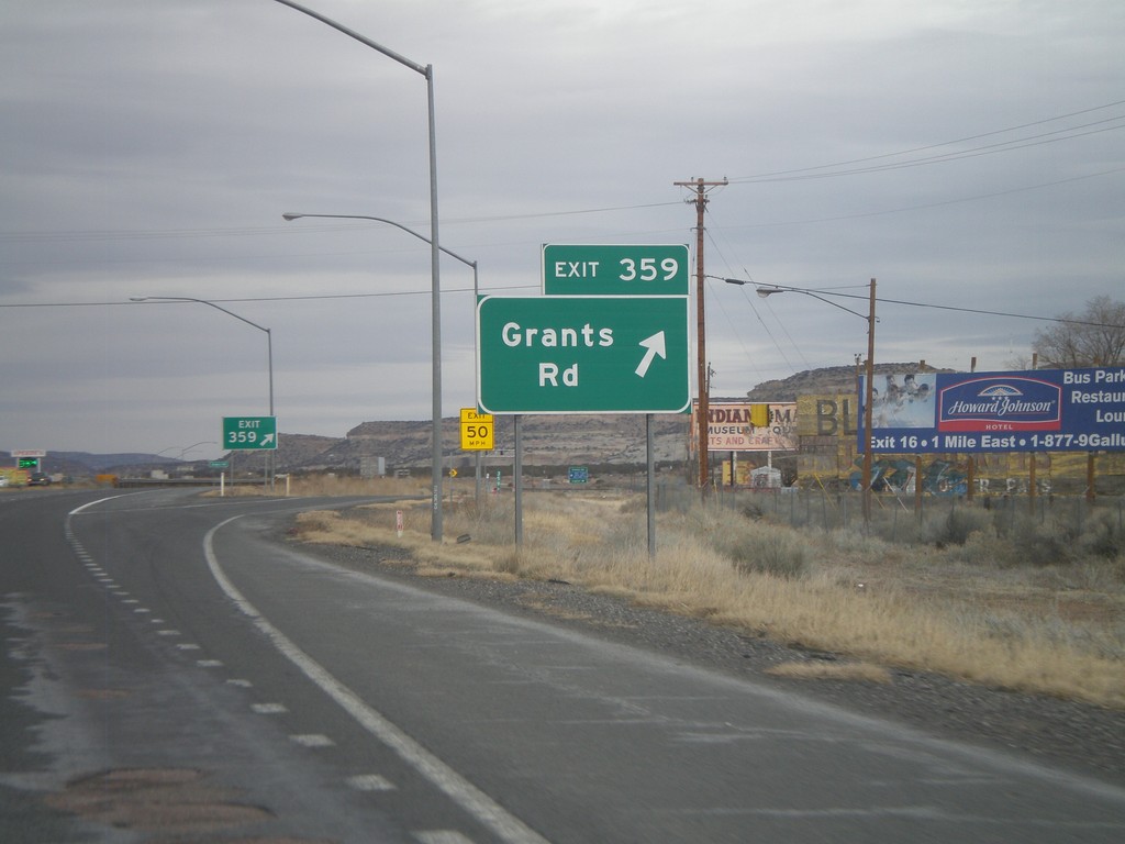
I-40 East - Exit 359
I-40 east at Exit 359 - Grants Road. This is the last Arizona exit on I-40 eastbound.
Taken 02-24-2011
Lupton
Apache County
Arizona
United States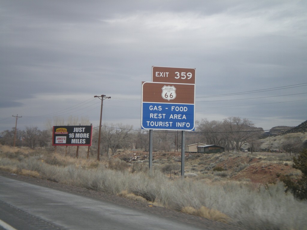
I-40 East Approaching Exit 359
I-40 east approaching Exit 359. Use Exit 359 for Historic US-66.
Taken 02-24-2011
Lupton
Apache County
Arizona
United States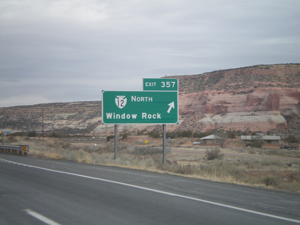
I-40 East - Exit 357
I-40 east at Exit 357 - Navajo IR-12 North/Window Rock. Window Rock is the capitol of the Navajo Nation.
Taken 02-24-2011
 Lupton
Apache County
Arizona
United States
Lupton
Apache County
Arizona
United States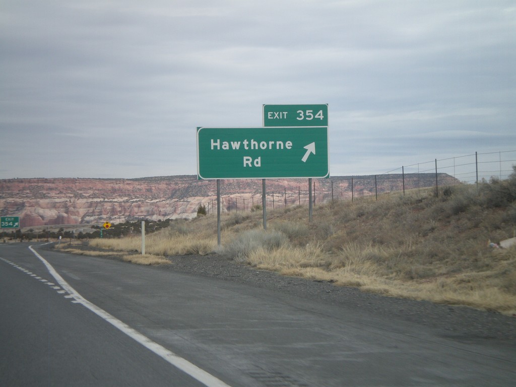
I-40 East - Exit 354
I-40 east at Exit 354 - Hawthorne Road.
Taken 02-24-2011
Houck
Apache County
Arizona
United States