Signs Tagged With Big Green Sign
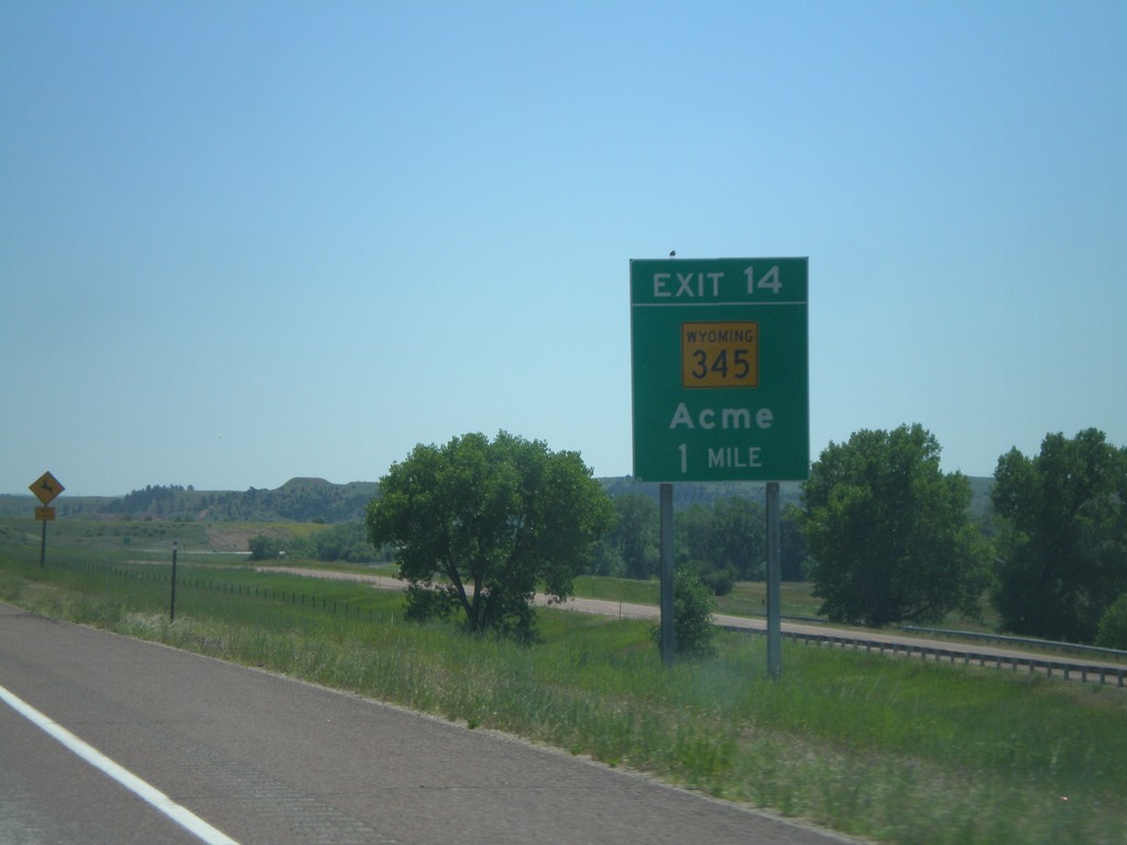
I-90 East - Exit 14
I-90 east approaching Exit 14 - WY-345/Acme.
Taken 07-03-2011


 Ranchester
Sheridan County
Wyoming
United States
Ranchester
Sheridan County
Wyoming
United States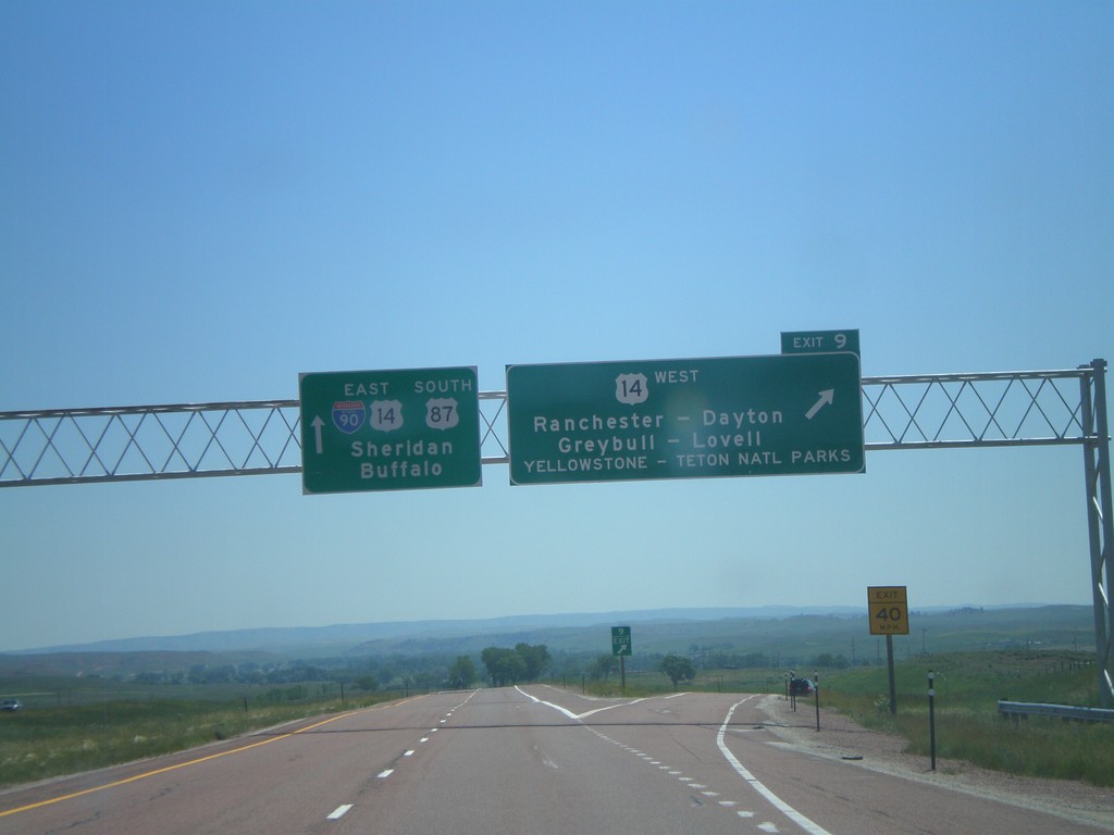
I-90 East - Exit 9
I-90 east at Exit 9 - US-14 West/Ranchester/Dayton/Greybull/Lovell/Yellowstone - Teton National Parks. I-90/US-14/US-87 continues east towards Sheridan and Buffalo. US-14 joins I-90 east to Sheridan.
Taken 07-03-2011
 Ranchester
Sheridan County
Wyoming
United States
Ranchester
Sheridan County
Wyoming
United States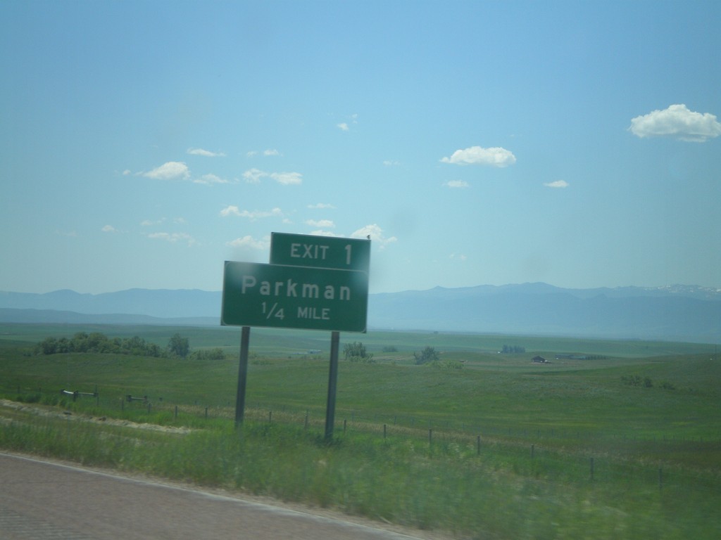
I-90 East - Exit 1
I-90 east at Exit 1 - Parkman. This is the first exit on I-90 east in Wyoming.
Taken 07-03-2011
Parkman
Sheridan County
Wyoming
United States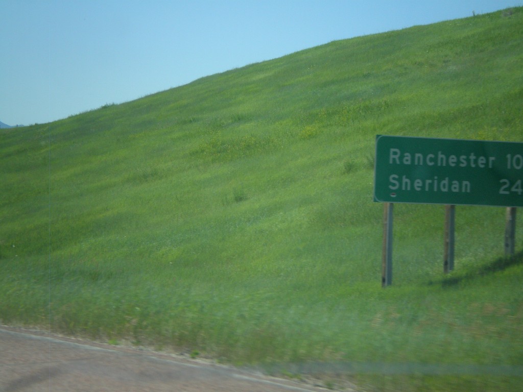
I-90 East - Distance Marker
First distance marker in Wyoming along I-90 East/US-87 South. Distance to Ranchester and Sheridan.
Taken 07-03-2011
Parkman
Sheridan County
Wyoming
United States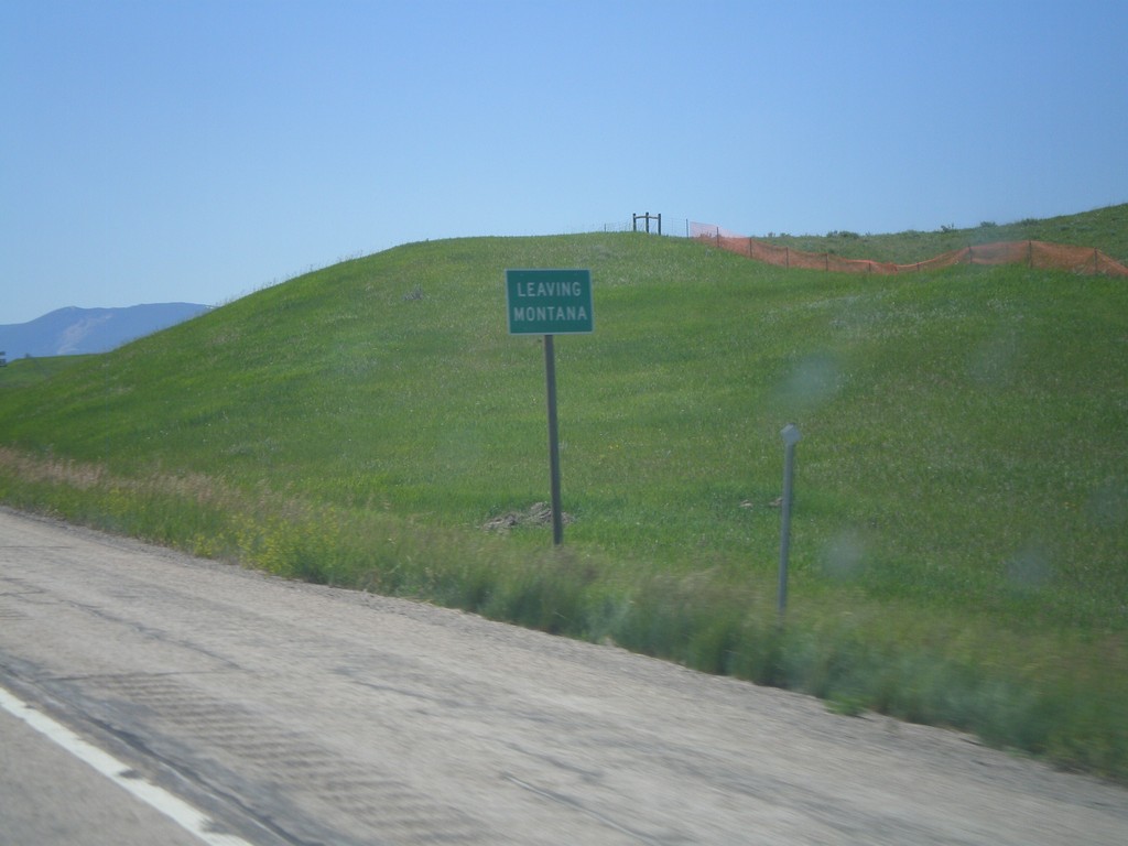
I-90 East - Leaving Montana
Leaving Montana on I-90 East/US-87 South approaching the Wyoming state line.
Taken 07-03-2011
Wyola
Big Horn County
Montana
United States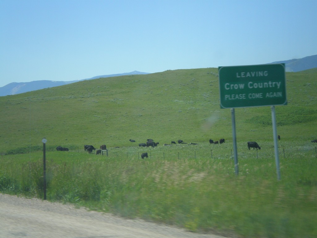
I-90 East - Leaving Crow Country
Leaving the Crow Indian Reservation on I-90 east approaching the Wyoming state line.
Taken 07-03-2011
Wyola
Big Horn County
Montana
United States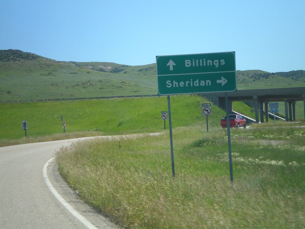
Approaching I-90 (Exit 549)
Approaching I-90 (Exit 549) on Aberdeen Road. Use I-90 east for Sheridan (Wyoming); I-90 west for Billings.
Taken 07-03-2011
Wyola
Big Horn County
Montana
United States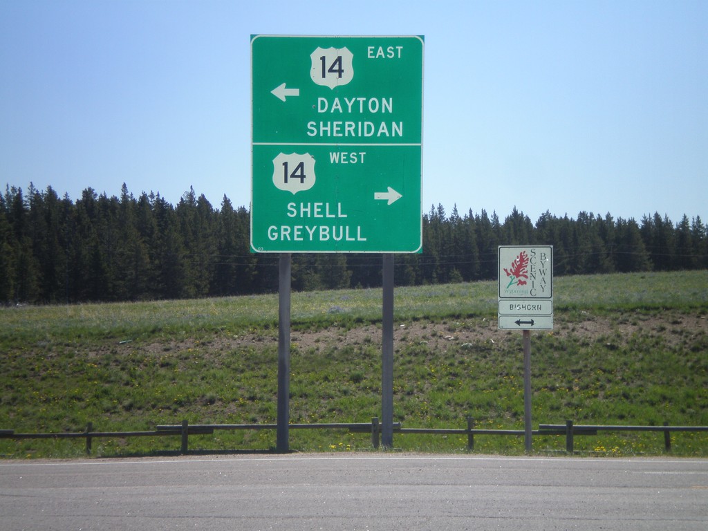
End US-14A At US-14 - Burgess Jct.
End US-14A at US-14 - Burgess Jct. Turn right for US-14 west to Shell and Greybull; turn left for US-14 east to Dayton and Sheridan. There is also a Bighorn Scenic Byway sign, of which either direction US-14 is part of.
Taken 07-03-2011
 Dayton
Sheridan County
Wyoming
United States
Dayton
Sheridan County
Wyoming
United States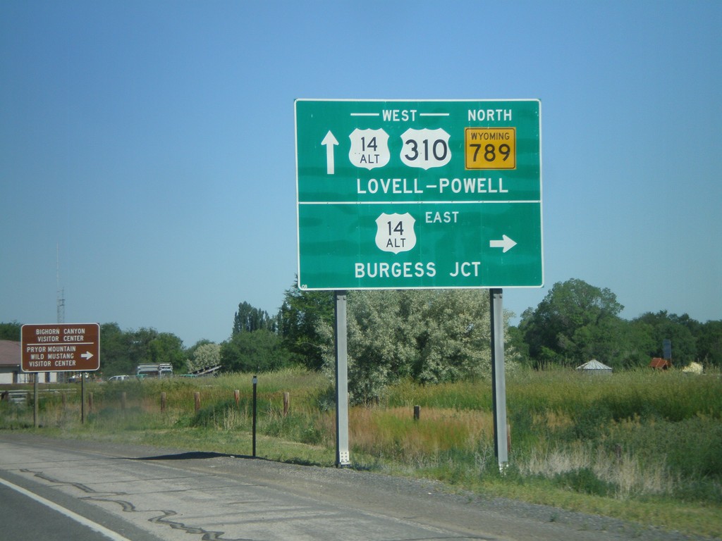
US-310 West/WY-789 North at US-14A
US-310 West/WY-789 North at US-14A in Lovell. Turn right for US-14A East to Burgess Jct.; continue ahead for US-310/US-14A West/WY-789 North to Lovell and Powell.
Taken 07-03-2011

 Lovell
Big Horn County
Wyoming
United States
Lovell
Big Horn County
Wyoming
United States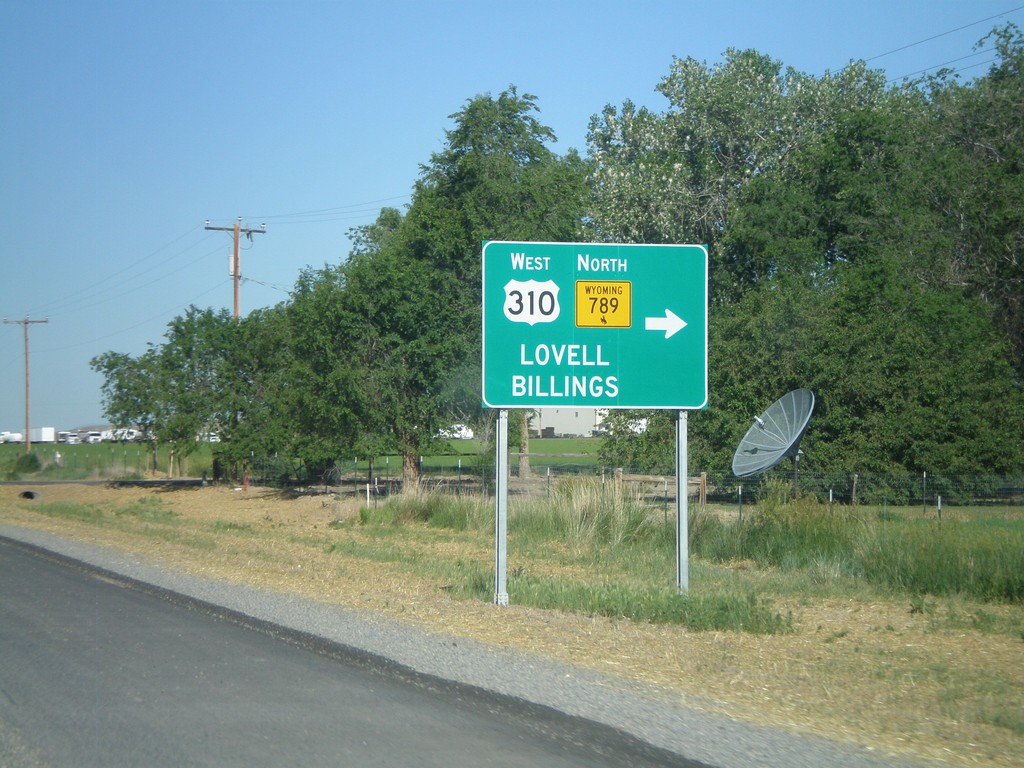
US-14/US-16/US-20 West/WY-789 North at US-310
US-14/US-16/US-20 West/WY-789 North at US-310. Turn right on US-310 West/WY-789 north for Lovell and Billings (Montana). This is the eastern end of US-310. WY-789 leaves US-14/US-16/US-20 here and turns west onto US-310.
Taken 07-03-2011

 Greybull
Big Horn County
Wyoming
United States
Greybull
Big Horn County
Wyoming
United States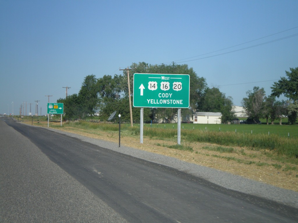
US-14/US-16/US-20 West/WY-789 at US-310/WY-789 North
US-14/US-16/US-20 West/WY-789 North at US-310/WY-789. Use US-14/US-16/US-20 West for Cody and Yellowstone. Turn right to continue north WY-789. This is the southern terminus of US-310.
Taken 07-03-2011
Greybull
Big Horn County
Wyoming
United States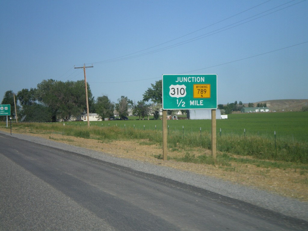
US-14/US-16/US-20 West/WY-789 North at US-310/WY-789 North
US-14/US-16/US-20 West/WY-789 North at US-310/WY-789 North. Turn right to continue on WY-789 North. This is where US-310 begins.
Taken 07-03-2011
Greybull
Big Horn County
Wyoming
United States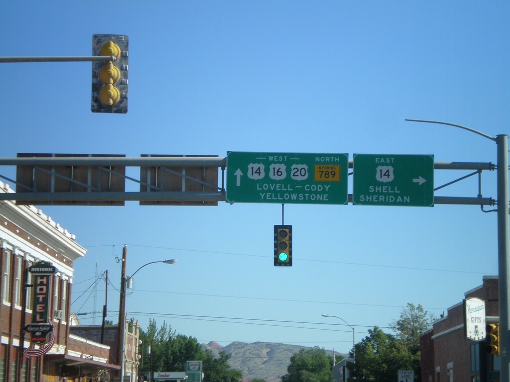
US-16/US-20 West/WY-789 North at US-14
US-16/US-20 West/WY-789 North at US-14 in Greybull. Turn right for US-14 east to Shell and Sheridan. Continue west on US-14/US-16/US-20 for Lovell, Cody, and Yellowstone.
Taken 07-03-2011
Greybull
Big Horn County
Wyoming
United States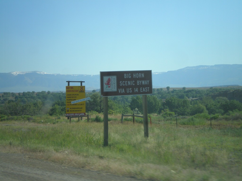
US-14 Scenic Byway Information on US-16/US-20 West/WY-789 North
Scenic Byway information for US-14 on US-16/US-20 West/WY-789 North approaching Greybull. Use US-14 East for the Big Horn Scenic Byway.
Taken 07-03-2011
Greybull
Big Horn County
Wyoming
United States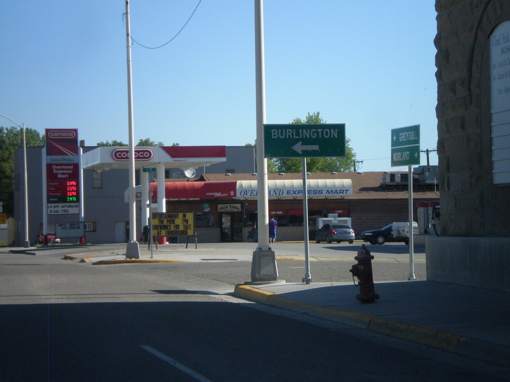
US-16/US-20 West/WY-789 North at WY-30
US-16/US-20 West/WY-789 North at WY-30. Use WY-30 west for Burlington.
Taken 07-03-2011
 Basin
Big Horn County
Wyoming
United States
Basin
Big Horn County
Wyoming
United States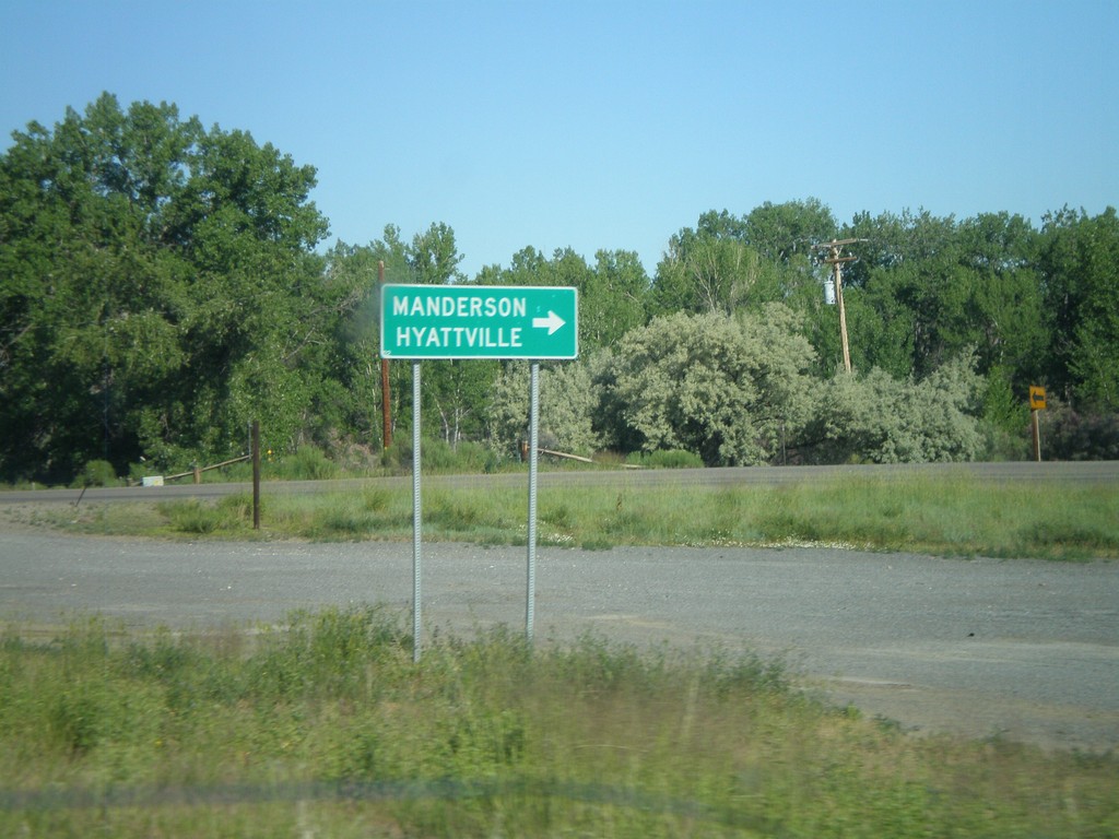
US-16/US-20 West/WY-789 North at WY-31
US-16/US-20 West/WY-789 North at WY-31 to Manderson and Hyattville.
Taken 07-03-2011
 Manderson
Big Horn County
Wyoming
United States
Manderson
Big Horn County
Wyoming
United States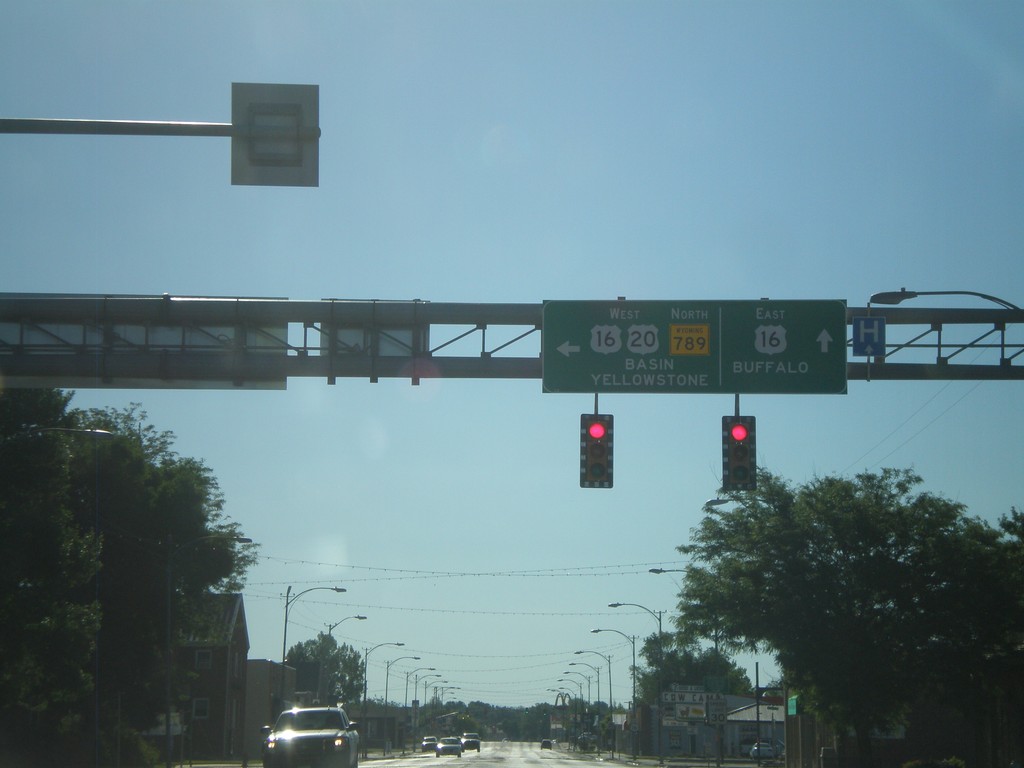
US-20 West/WY-789 North - US-16 Jct
US-20 West/WY-789 North at US-16 junction in Worland. Continue straight for US-16 east to Buffalo. Turn left for US-16/US-20 West/WY-789 North to Basin and Yellowstone (National Park).
Taken 07-03-2011
Worland
Washakie County
Wyoming
United States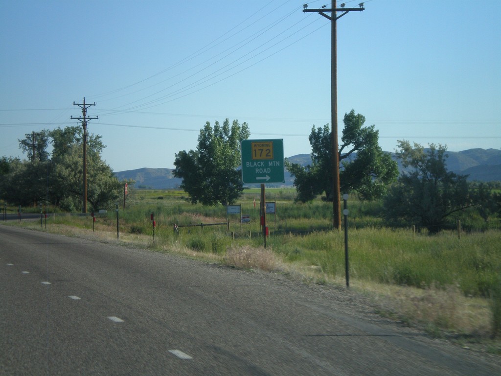
US-20 West/WY-789 North at WY-172
US-20 West/WY-789 North at WY-172 in rural Hot Springs County. Turn right for WY-172 to Black Mountain Road.
Taken 07-03-2011
 Thermopolis
Hot Springs County
Wyoming
United States
Thermopolis
Hot Springs County
Wyoming
United States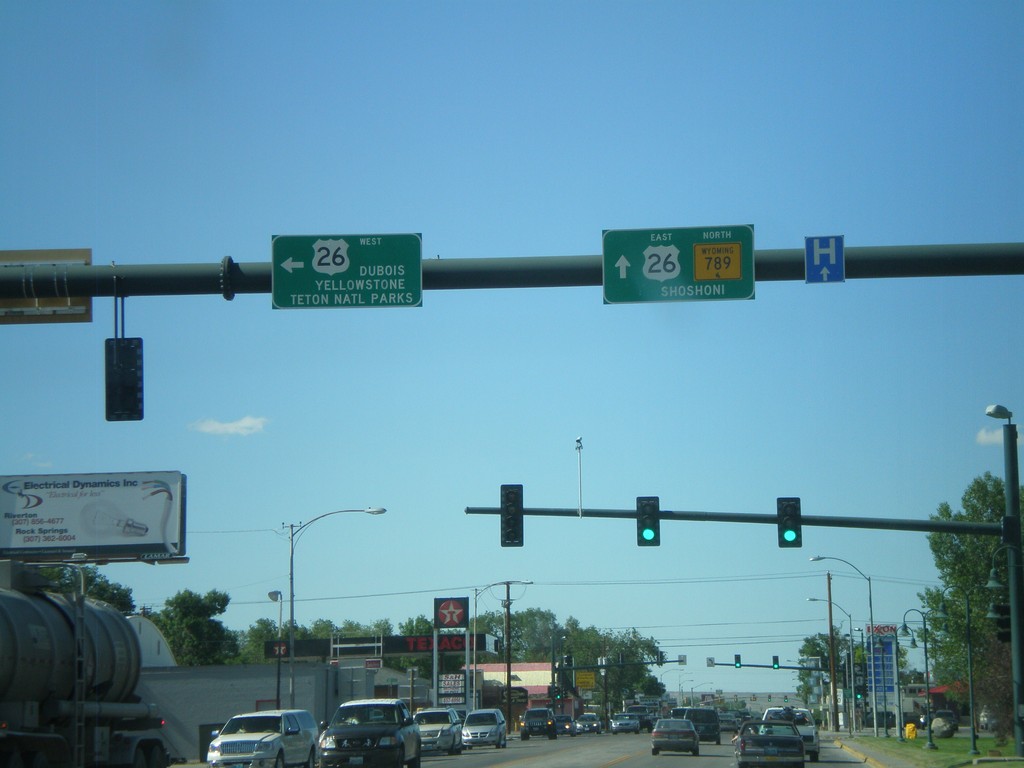
WY-789 North at US-26
WY-789 north at US-26 in Riverton. Turn left for US-26 to Dubois, and Yellowstone/Grand Teton National Parks. Continue ahead for US-26 East/WY-789 North to Shoshoni. US-26 joins WY-789 north until Shoshoni.
Taken 07-02-2011
 Riverton
Fremont County
Wyoming
United States
Riverton
Fremont County
Wyoming
United States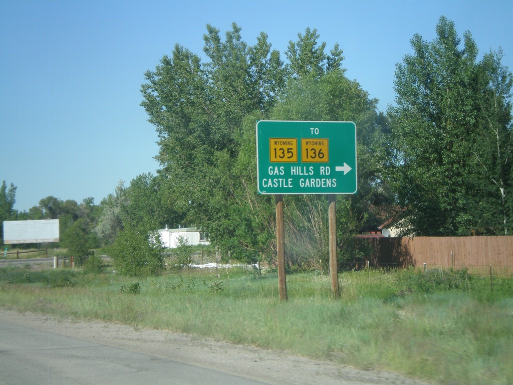
WY-789 North at WY-135/To WY-136
WY-789 North at WY-135/To WY-136. Use WY-135 east for WY-136, Gas Hills Road, and Castle Gardens.
Taken 07-02-2011

 Arapahoe
Fremont County
Wyoming
United States
Arapahoe
Fremont County
Wyoming
United States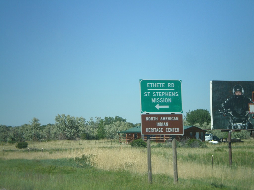
WY-789 North at WY-137
WY-789 north at WY-137/Ethete Road to St. Stephens Mission and North American Indian Hertiage Center.
Taken 07-02-2011
 Riverton
Fremont County
Wyoming
United States
Riverton
Fremont County
Wyoming
United States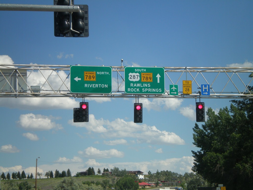
US-287 South at WY-789
US-287 South at WY-789. Turn left for WY-789 north to Riverton. Continue ahead for US-287/WY-789 South to WY-28, Rawlins, and Rock Springs.
Taken 07-02-2011

 Lander
Fremont County
Wyoming
United States
Lander
Fremont County
Wyoming
United States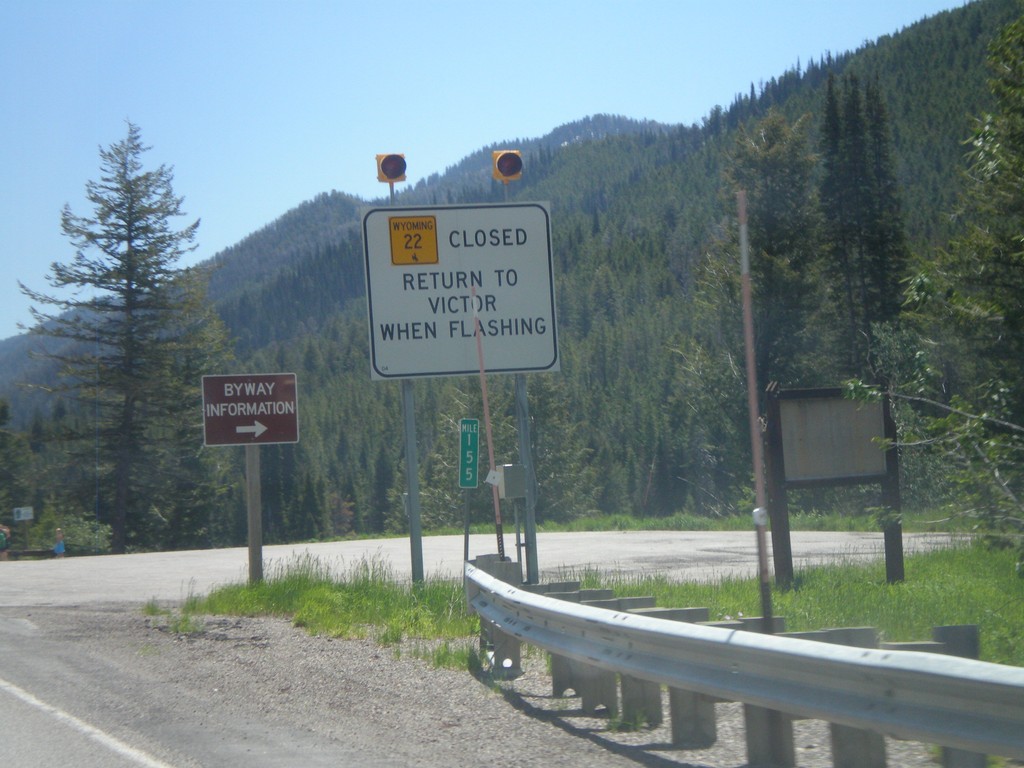
ID-33 East - WY-22 Closure Information
Teton Pass road closure information on ID-33 east approaching the Wyoming state line. When Teton Pass is closed in Wyoming, this is where the road closure starts, just inside of Idaho. All traffic must return to Victor Idaho when the road closure lights are flashing. This is one of the few instances in Idaho of a state highway shield from another state located inside Idaho.
Taken 07-02-2011

 Victor
Teton County
Idaho
United States
Victor
Teton County
Idaho
United States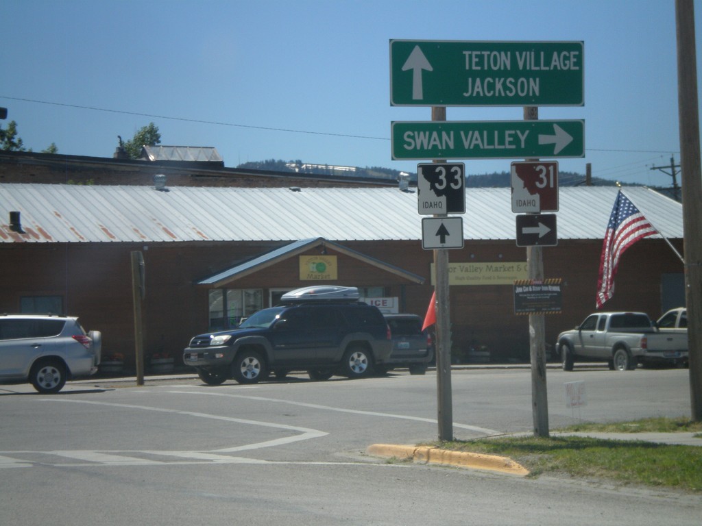
ID-33 East at ID-31
ID-33 East at ID-31 in Victor. Turn right on ID-31 south for Swan Valley. Continue ahead on ID-33 for Teton Village and Jackson (both in Wyoming). Teton Scenic Byway leaves ID-33 here and follows ID-31 south.
Taken 07-02-2011
 Victor
Teton County
Idaho
United States
Victor
Teton County
Idaho
United States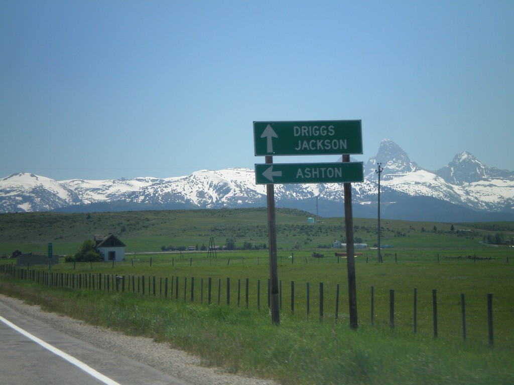
ID-33 East at ID-32
ID-33 east at ID-32 north to Ashton. Continue east on ID-33 for Driggs and Jackson (Wyoming). The Teton Mountain Range are in the background. The Teton Scenic Byway follows ID-32 south and turns east onto ID-33 east here.
Taken 07-02-2011
 Tetonia
Teton County
Idaho
United States
Tetonia
Teton County
Idaho
United States