Signs Tagged With Big Green Sign
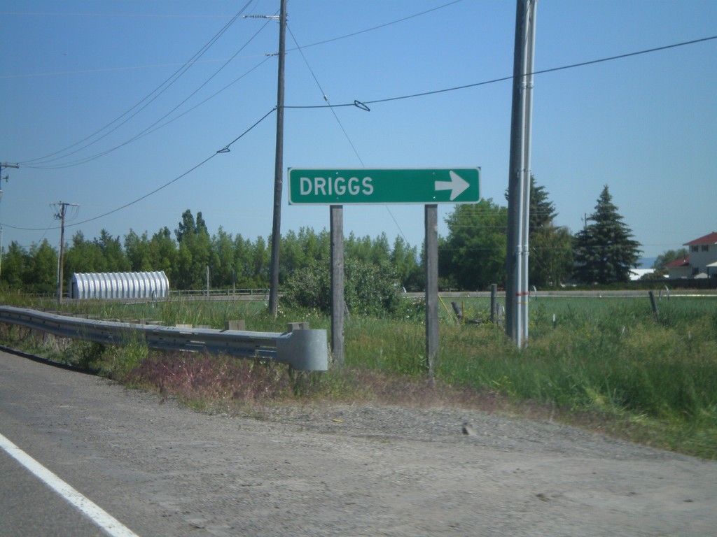
ID-33 East at US-20 Access Road
ID-33 east at access road that connects ID-33 and US-20. Turn right to continue on ID-33 east towards Driggs.
Taken 07-02-2011

 Sugar City
Madison County
Idaho
United States
Sugar City
Madison County
Idaho
United States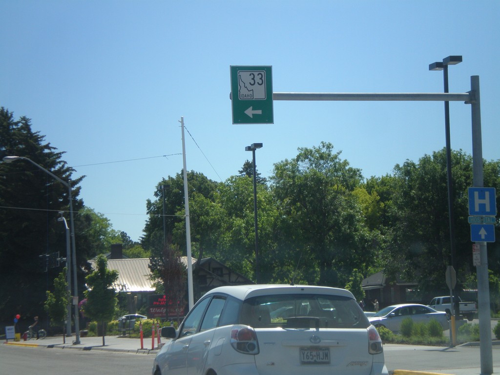
ID-33 East - Rexburg
ID-33 east in downtown Rexburg. Turn left on N 2nd St. to continue on ID-33.
Taken 07-02-2011
Rexburg
Madison County
Idaho
United States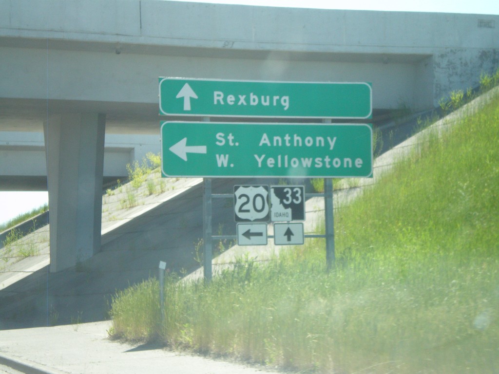
ID-33 East at US-20 East
ID-33 east at US-20 east. Use US-20 east for St. Anthony and West Yellowstone (Montana). Continue east on ID-33 for downtown Rexburg.
Taken 07-02-2011
Rexburg
Madison County
Idaho
United States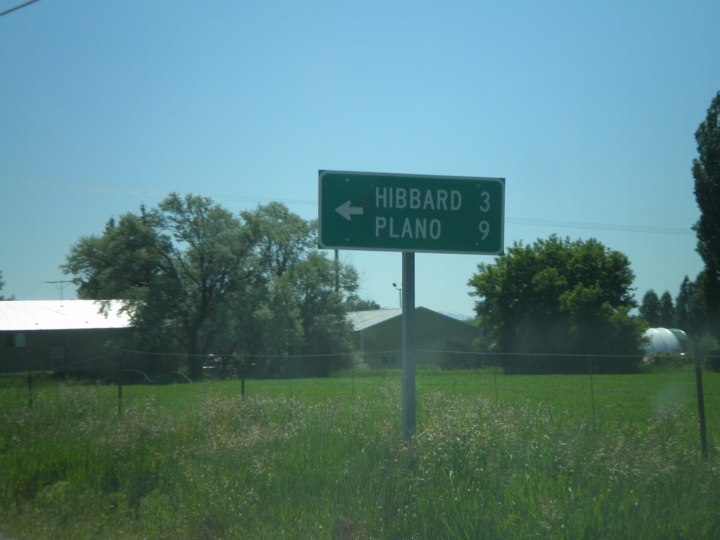
ID-33 East at N 3000 West
ID-33 east at N 3000 West to Hibbard and Plano.
Taken 07-02-2011
Rexburg
Madison County
Idaho
United States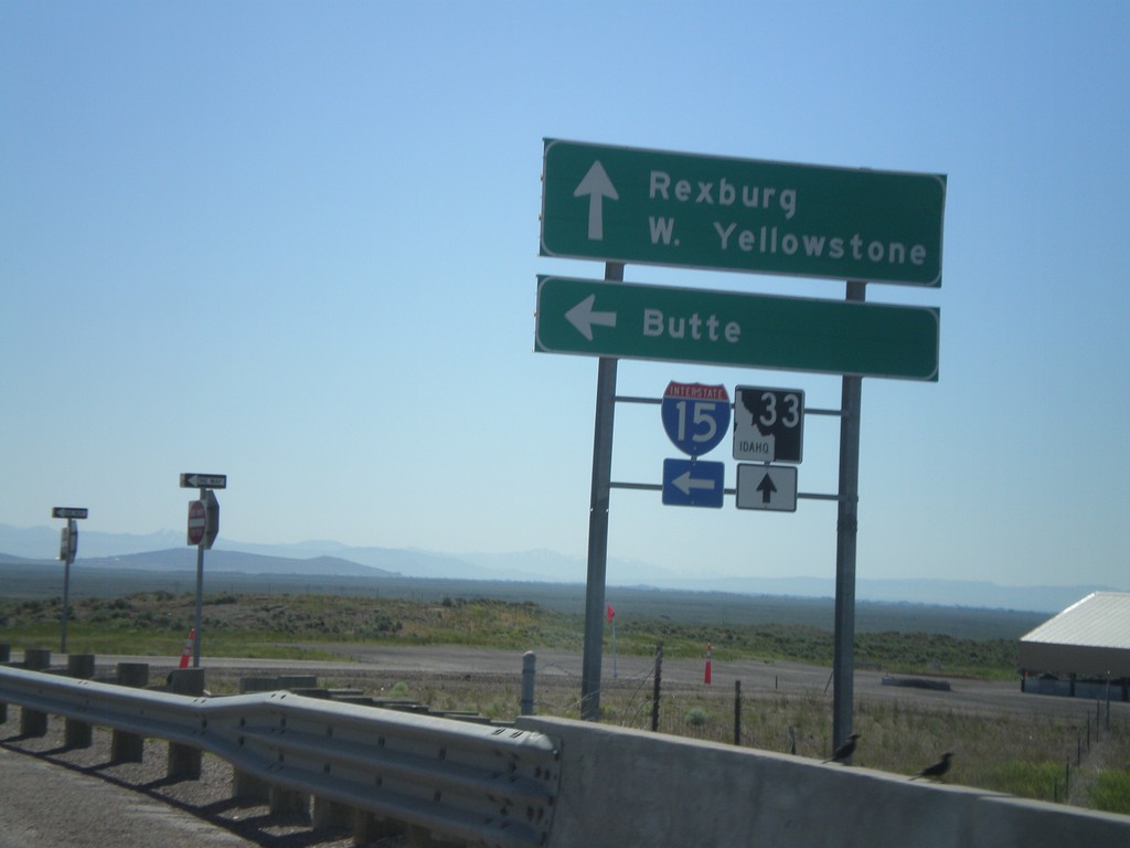
ID-33 East at I-15 North
ID-33 East at I-15 North (Exit 143). Use I-15 North for Butte (Montana). Continue east on ID-33 for Rexburg and West Yellowstone (Montana).
Taken 07-02-2011
 Roberts
Jefferson County
Idaho
United States
Roberts
Jefferson County
Idaho
United States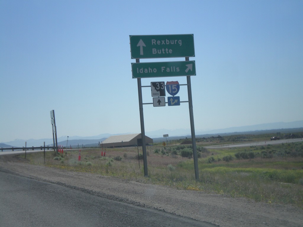
ID-33 East at I-15 South
ID-33 east at I-15 south to Idaho Falls. Continue over overpass for I-15 north onramp to Butte (Montana). Continue east on ID-33 for Rexburg.
Taken 07-02-2011
Sage Junction
Jefferson County
Idaho
United States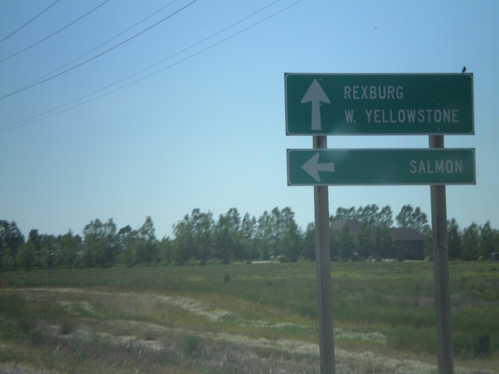
ID-33 East at ID-28
ID-33 east at ID-28 north to Salmon. Continue east on ID-33 for Rexburg and West Yellowstone (Montana). This is the southern end of ID-33. The Sacajawea Historic Byway turns from ID-28 to ID-33 east here.
Taken 07-02-2011
 Mud Lake
Jefferson County
Idaho
United States
Mud Lake
Jefferson County
Idaho
United States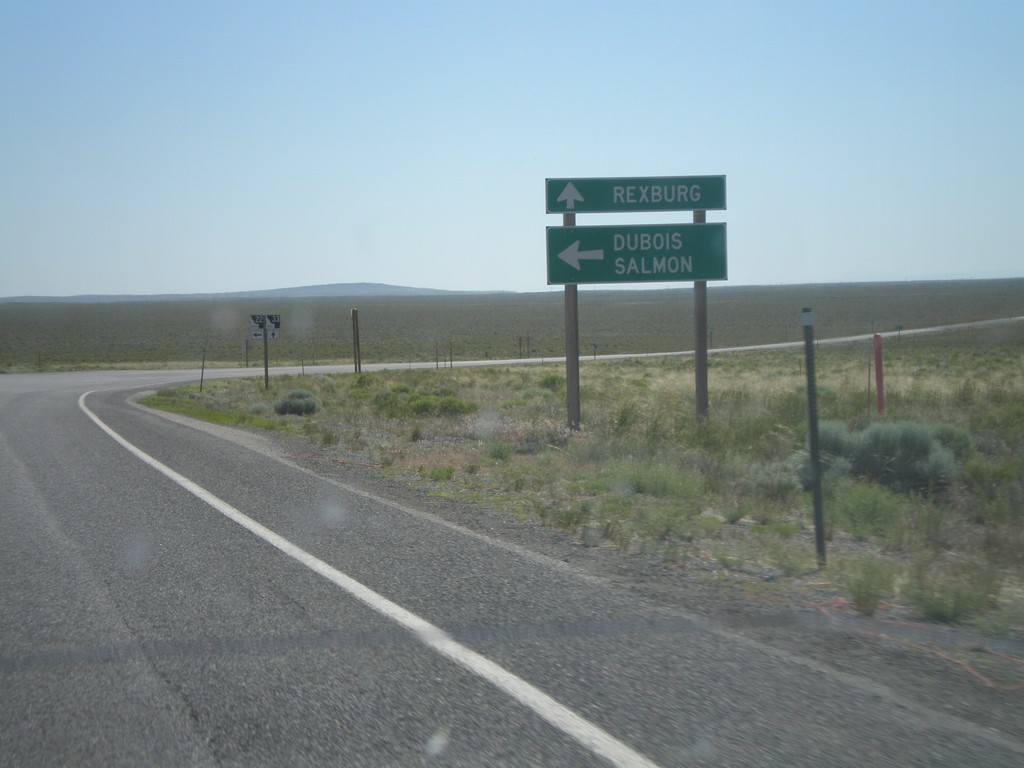
ID-33 East at ID-22 East
ID-33 east at ID-22 east to Dubois and Salmon. Continue east on ID-33 for Rexburg.
Taken 07-02-2011
 Howe
Butte County
Idaho
United States
Howe
Butte County
Idaho
United States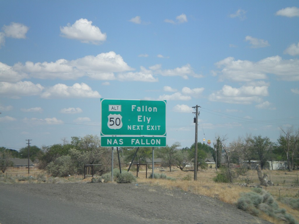
I-80 East Approaching Exit 48
I-80 east approaching Exit 48. Use Exit 48 for Fallon and Ely via Alt. US-50 east.
Taken 06-13-2011


 Fernley
Lyon County
Nevada
United States
Fernley
Lyon County
Nevada
United States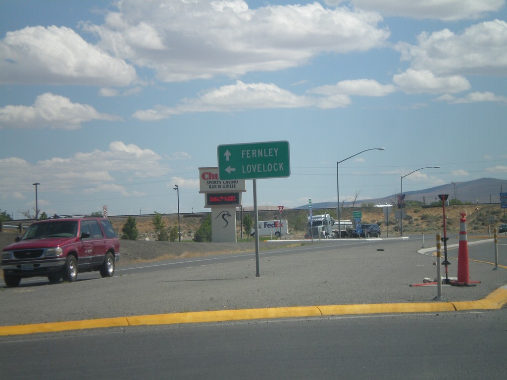
NV-427 South at I-80 East
NV-427 south at I-80 east to Lovelock. Continue south on NV-427/BL-80 into downtown Fernley.
Taken 06-13-2011

 Fernley
Lyon County
Nevada
United States
Fernley
Lyon County
Nevada
United States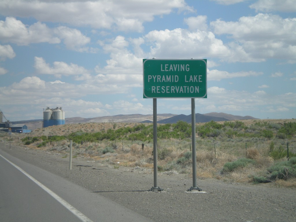
NV-427 South - Leaving Pyramid Lake Indian Reservation
Leaving the Pyramid Lake Indian Reservation on NV-427 south. The Pyramid Lake Indian Reservation is home to the Pyramid Lake Paiute Tribe.
Taken 06-13-2011
Fernley
Lyon County
Nevada
United States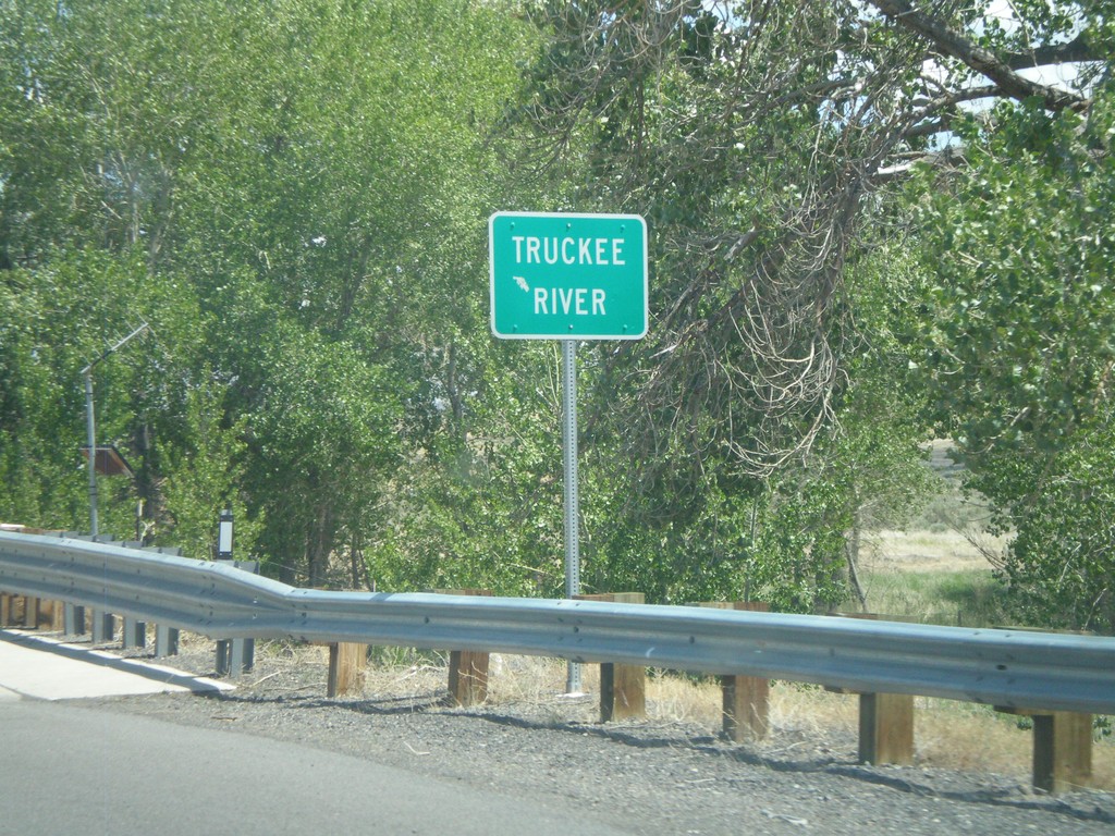
NV-427 South - Truckee River
NV-427 south crossing the Truckee River in Wadsworth.
Taken 06-13-2011
Sparks
Washoe County
Nevada
United States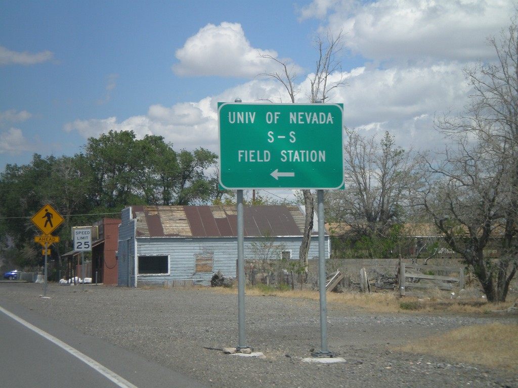
NV-427 East at NV-447 North
NV-427 East at NV-447 North to the University of Nevada S-S Field Station and Pyramid Lake.
Taken 06-13-2011
 Wadsworth
Washoe County
Nevada
United States
Wadsworth
Washoe County
Nevada
United States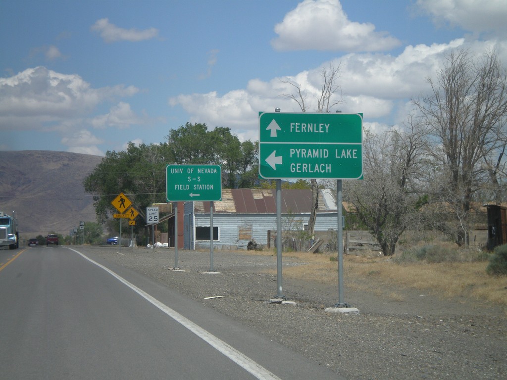
NV-427 East at NV-447
NV-427 east at NV-447 north. Use NV-447 north for Pyramid Lake and Gerlach. Continue east on NV-427 for Fernley.
Taken 06-13-2011
Wadsworth
Washoe County
Nevada
United States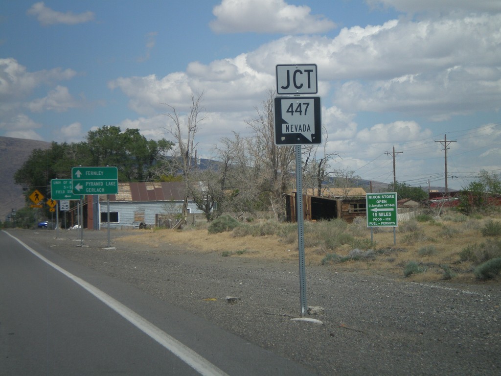
NV-427 East Approaching NV-447
NV-427 East approaching NV-447 in Wadsworth. Turn north on NV-447 for Pyramid Lake and Gerlach.
Taken 06-13-2011
Sparks
Washoe County
Nevada
United States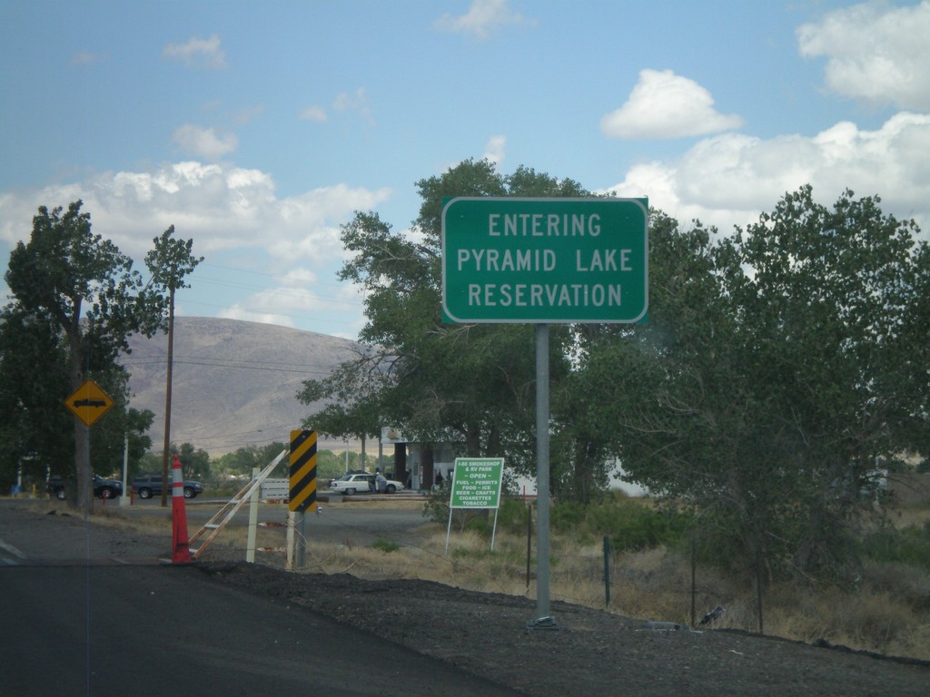
Entering Pyramid Lake Indian Reservation - NV-427 East
Entering Pyramid Lake Indian Reservation on NV-427 East. Pyramid Lake Indian Reservation is home to the Pyramid Lake Paiute Tribe.
Taken 06-13-2011
Wadsworth
Washoe County
Nevada
United States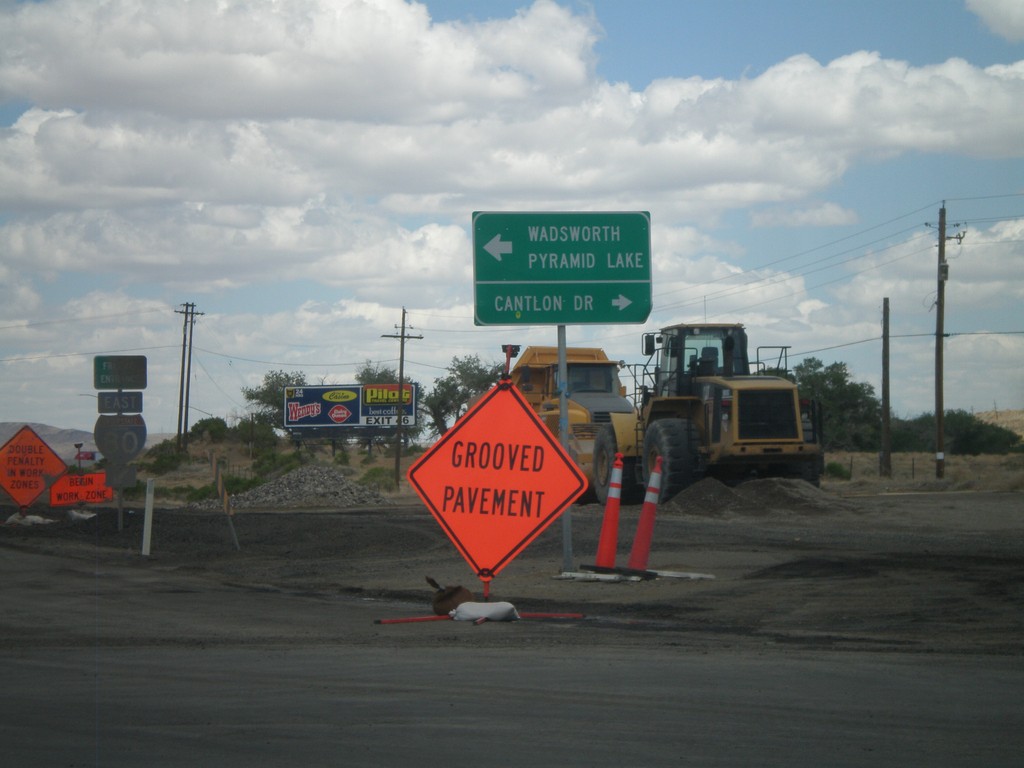
I-80 East Offramp at NV-427
I-80 East Offramp (Exit 43) at NV-427 East. Turn left for NV-427 (not signed) for Wadsworth and Pyramid Lake. Turn right for Cantlon Drive.
Taken 06-13-2011
Wadsworth
Washoe County
Nevada
United States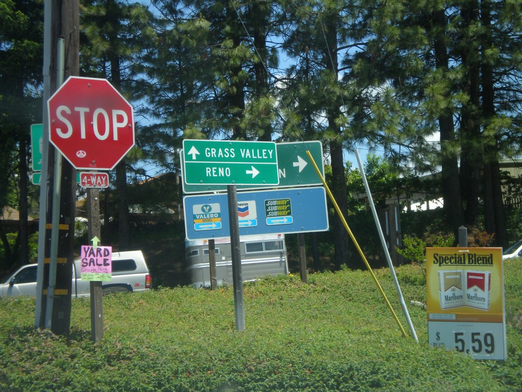
S. Auburn St. at I-80 Onramp and CA-174 Jct.
S. Auburn St. at I-80 East onramp and CA-174. Turn right for I-80 east to Reno; continue ahead for CA-174 West to Grass Valley.
Taken 06-13-2011
 Colfax
Placer County
California
United States
Colfax
Placer County
California
United States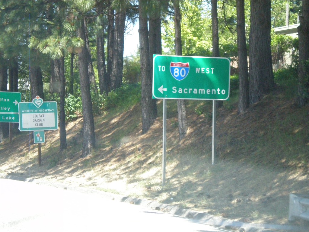
I-80 Overpass (Exit 135) at CA-174 Jct.
Overpass at I-80 Exit 135 at CA-174 jct. Turn right for CA-174; turn left for I-80 West to Sacramento.
Taken 06-13-2011
Colfax
Placer County
California
United States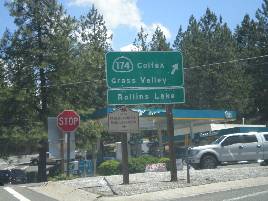
I-80 East at CA-174 (Exit 135)
I-80 east offramp at CA-174. Turn right for CA-174 West to Colfax, Grass Valley, and Rollins Lake. Also turn right for the First Transcontinental Railroad Historical Marker - Colfax.
Taken 06-13-2011
Colfax
Placer County
California
United States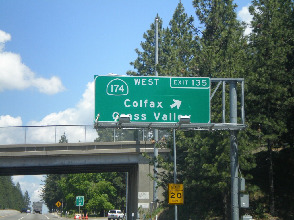
I-80 East - Exit 135
I-80 east at Exit 135 - CA-174 West/Colfax/Grass Valley.
Taken 06-13-2011
Colfax
Placer County
California
United States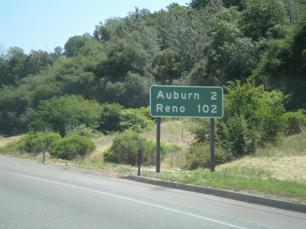
I-80 East - Distance Marker
Distance marker on I-80 east to Auburn and Reno.
Taken 06-13-2011
Newcastle
Placer County
California
United States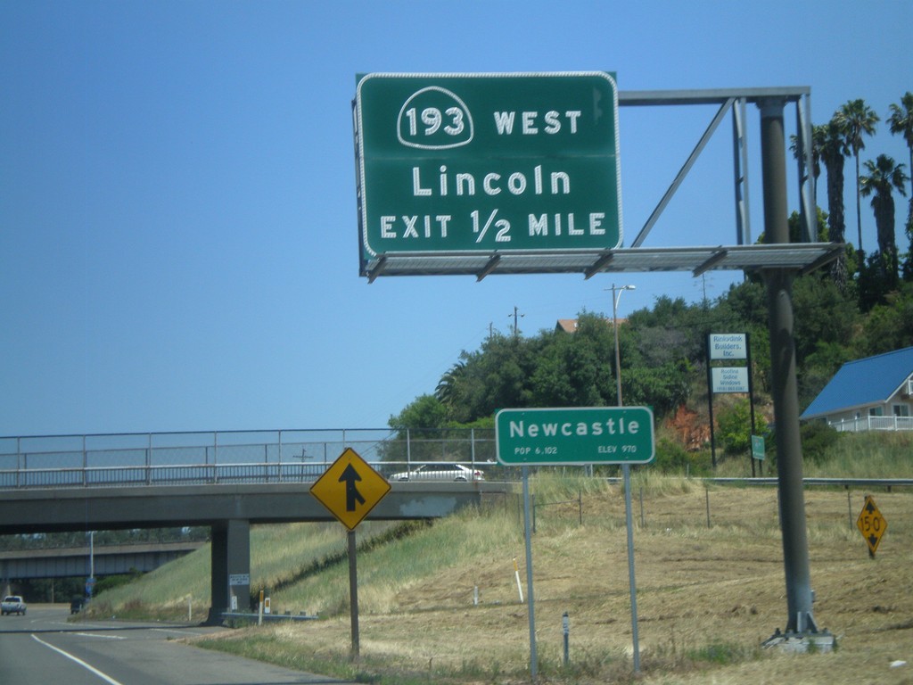
I-80 East Approaching Exit 116
I-80 East approaching Exit 116 - CA-193/Lincoln. Entering the community of Newcastle.
Taken 06-13-2011
 Newcastle
Placer County
California
United States
Newcastle
Placer County
California
United States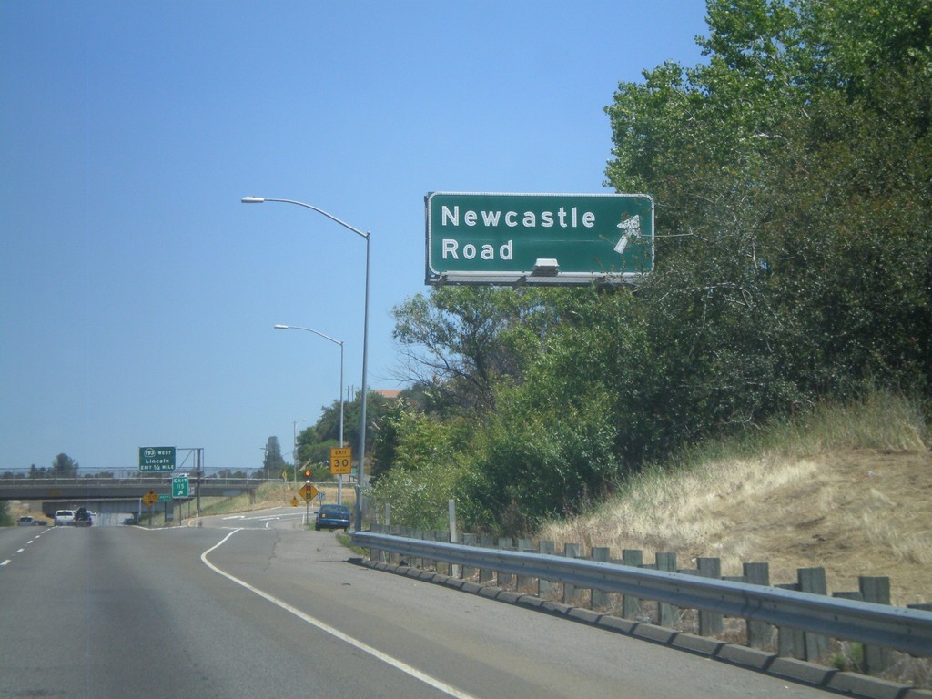
I-80 East - Exit 115
I-80 east at Exit 115 - Newcastle Road.
Taken 06-13-2011
Newcastle
Placer County
California
United States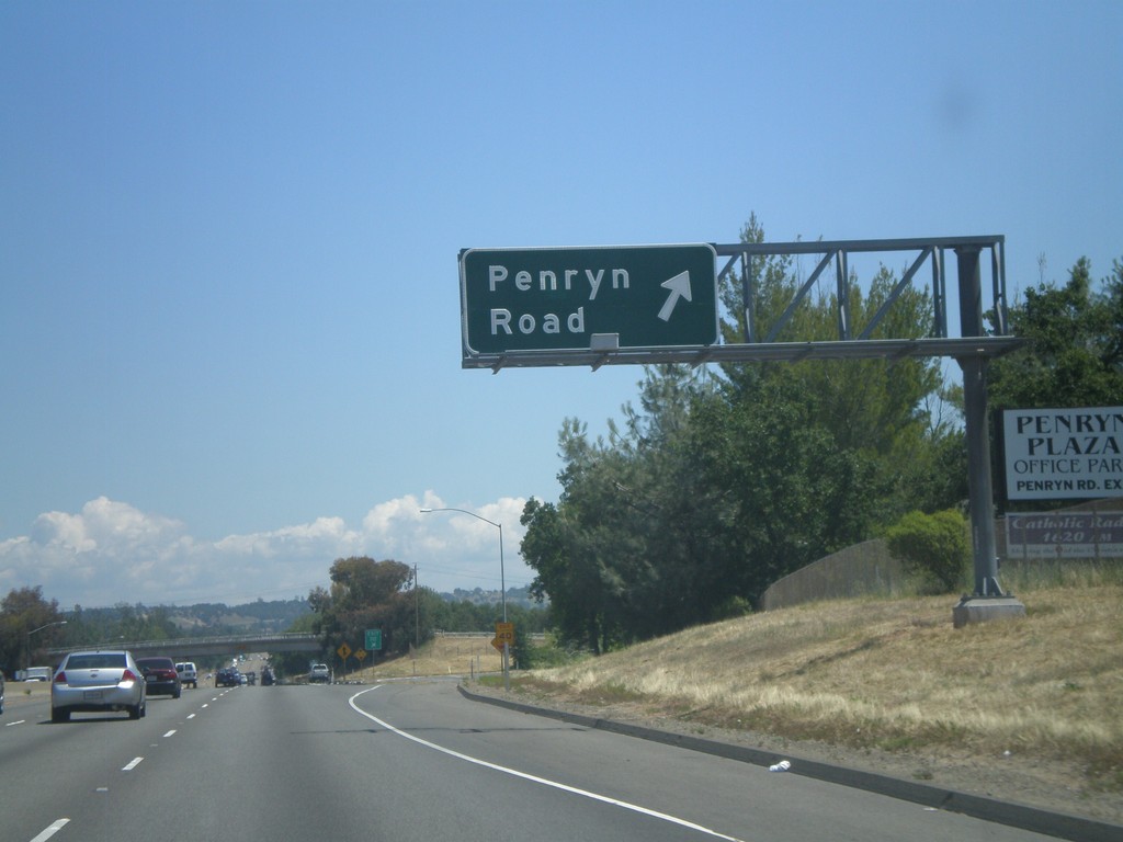
I-80 East - Exit 112
I-80 east at Exit 112 - Penryn Road.
Taken 06-13-2011
Loomis
Placer County
California
United States