Signs Tagged With Big Green Sign
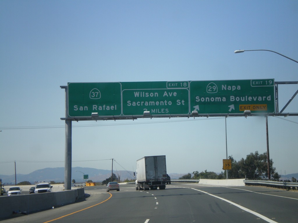
CA-37 West at Exits 19 and 18
CA-37 west at Exit 19 - CA-29/Napa/Sonoma Blvd. Approaching Exit 18 - Wilson Ave./Sacramento St. CA-37 continues west towards San Rafael.
Taken 09-30-2010

 Vallejo
Solano County
California
United States
Vallejo
Solano County
California
United States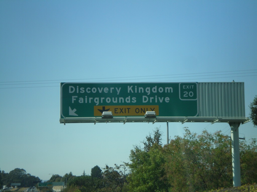
CA-37 West - Exit 20
CA-37 west approaching Exit 20 - Discovery Kingdom/Fairgrounds Drive. Use Exit 20 for the Six Flags Discovery Kingdom theme park.
Taken 09-30-2010
Vallejo
Solano County
California
United States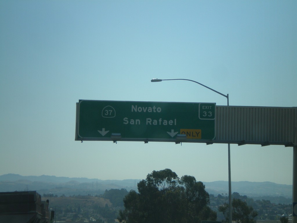
I-80 West - Exit 33
I-80 west at Exit 33 - CA-37/Novato/San Rafael. CA-37 crosses the north end of San Pablo Bay, connecting US-101 (Novato) and I-80 (Vallejo).
Taken 09-30-2010
 Vallejo
Solano County
California
United States
Vallejo
Solano County
California
United States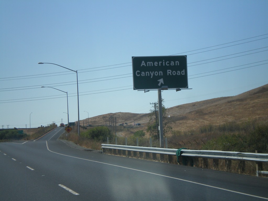
I-80 West - Exit 36
I-80 west at Exit 36 - American Canyon Road. American Canyon Road connects I-80 with CA-29 in Napa County.
Taken 09-30-2010
Vallejo
Solano County
California
United States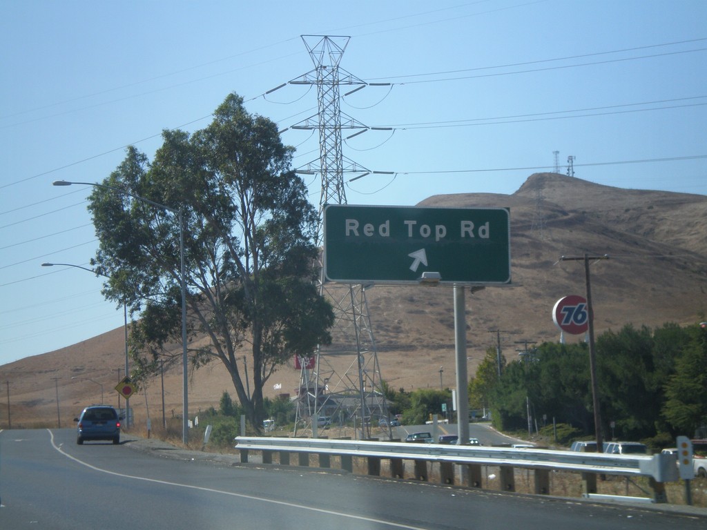
I-80 West - Exit 39A
I-80 west at Exit 39A - Red Top Road.
Taken 09-30-2010
Fairfield
Solano County
California
United States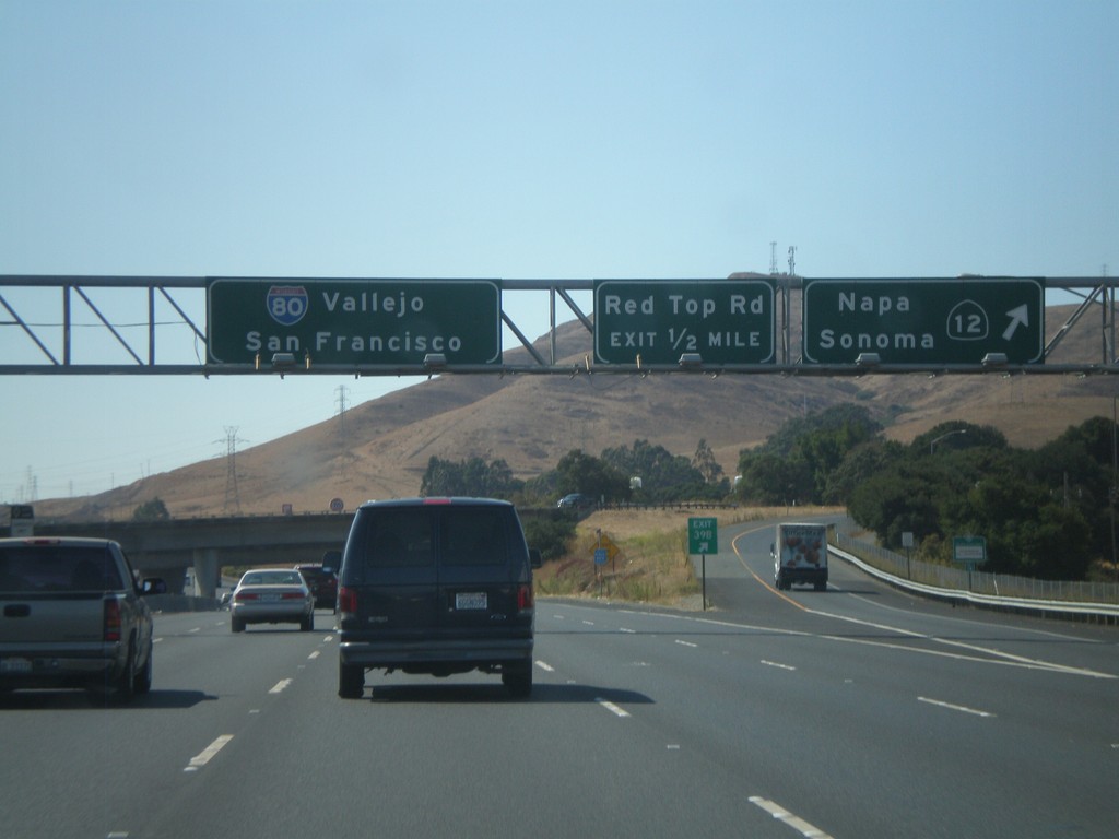
I-80 West - Exits 39B and 39A
I-80 west at Exit 39B - CA-12 West/Napa/Sonoma. Approaching Exit 39A - Red Top Road. CA-12 west leaves I-80 here, and crosses into the Napa Valley. I-80 continues west towards Vallejo and San Francisco.
Taken 09-30-2010
 Fairfield
Solano County
California
United States
Fairfield
Solano County
California
United States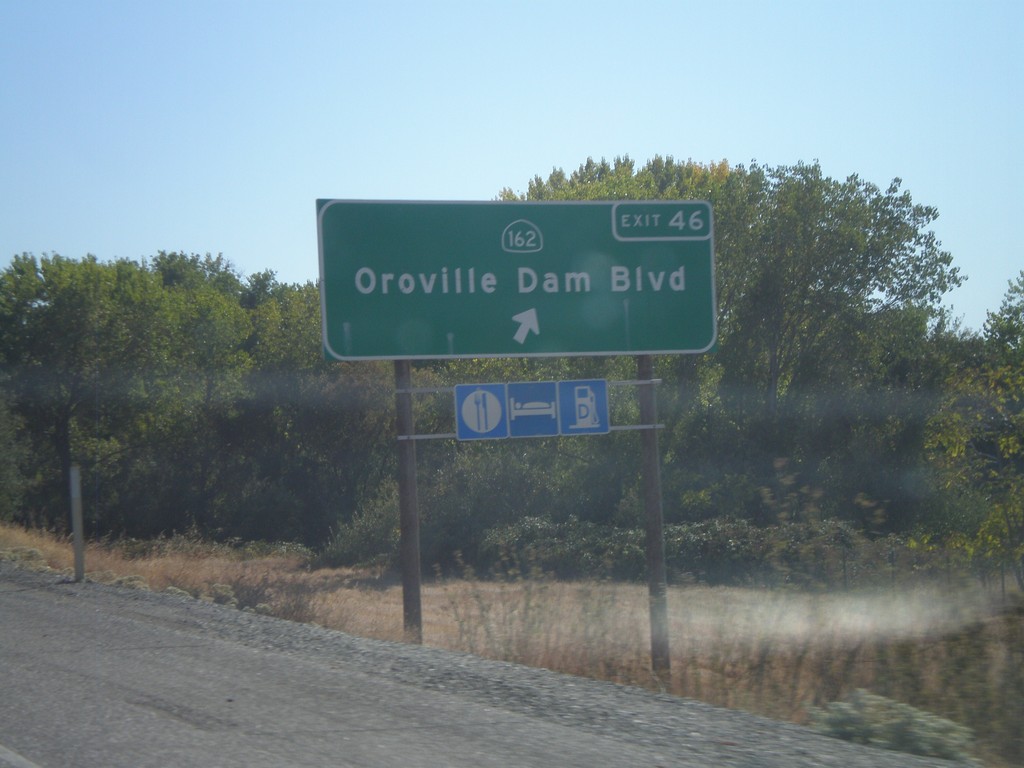
CA-70 South - Exit 46
CA-70 south at Exit 46 - CA-162/Oroville Dam Blvd.
Taken 09-25-2010

 Oroville
Butte County
California
United States
Oroville
Butte County
California
United States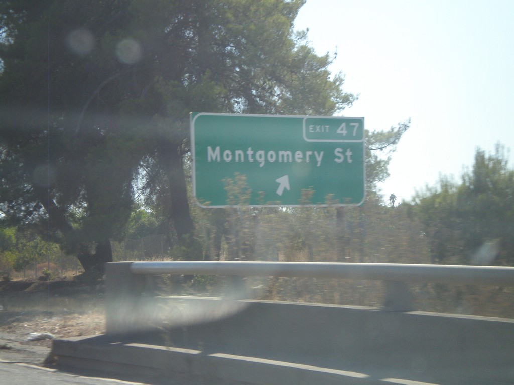
CA-70 South - Exit 47
CA-70 south at Exit 47 - Montgomery St.
Taken 09-25-2010
Oroville
Butte County
California
United States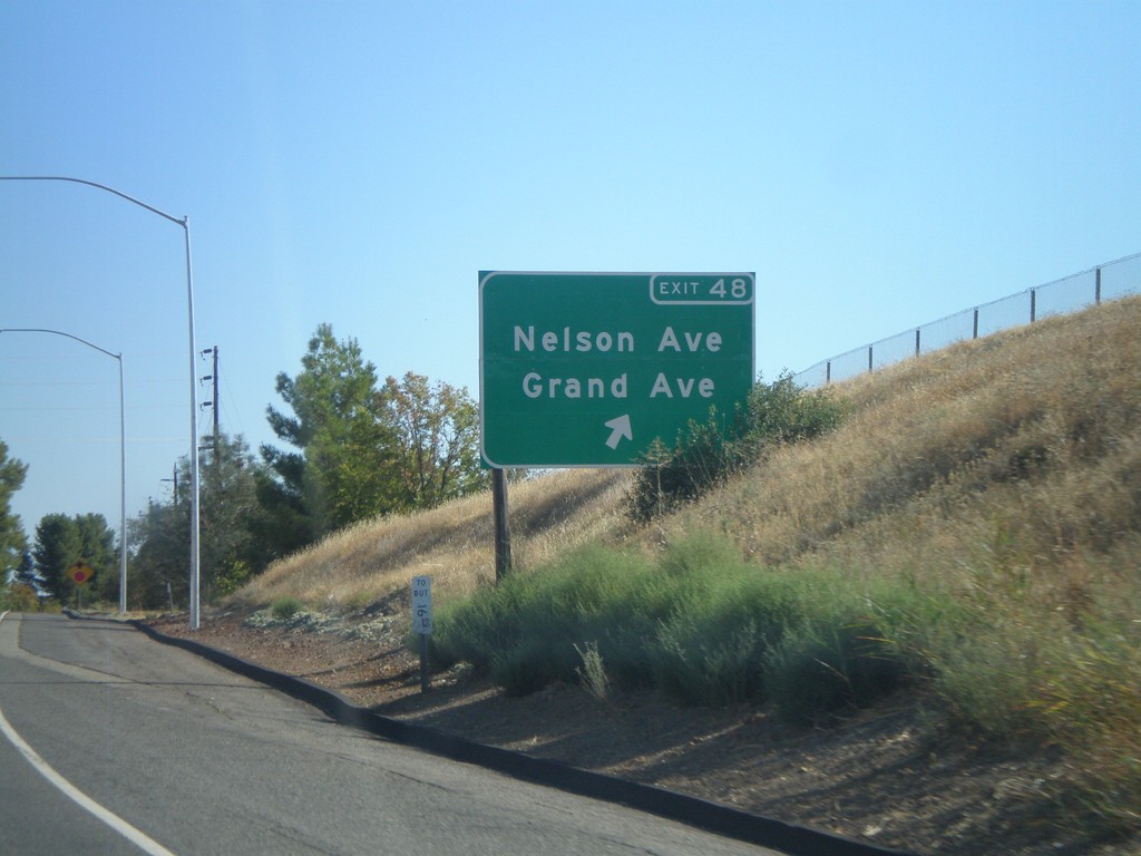
CA-70 South - Exit 48
CA-70 south at Exit 48 - Nelson Ave./Grand Ave.
Taken 09-25-2010
Oroville
Butte County
California
United States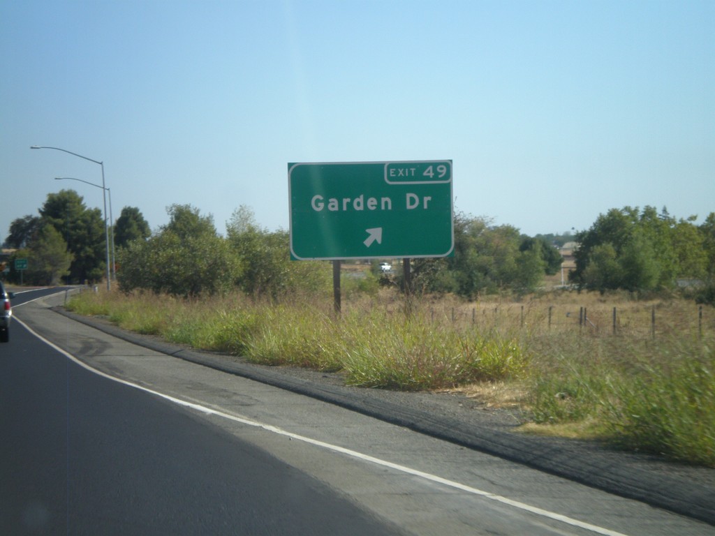
CA-70 South - Exit 49
CA-70 South at Exit 49 - Garden Drive.
Taken 09-25-2010
Oroville
Butte County
California
United States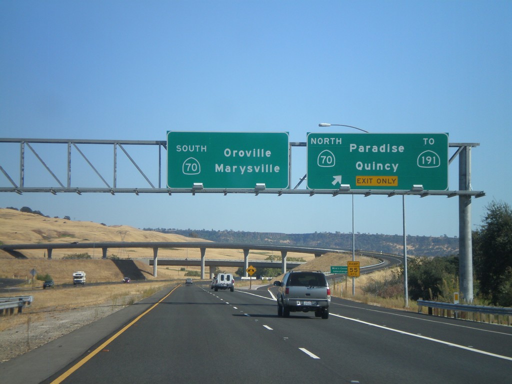
CA-149 South at CA-70
CA-149 south at CA-70. Use CA-70 north for CA-191, Paradise, and Quincy. Use CA-70 south for Oroville and Marysville. This is the southern end of CA-149.
Taken 09-25-2010

 Oroville
Butte County
California
United States
Oroville
Butte County
California
United States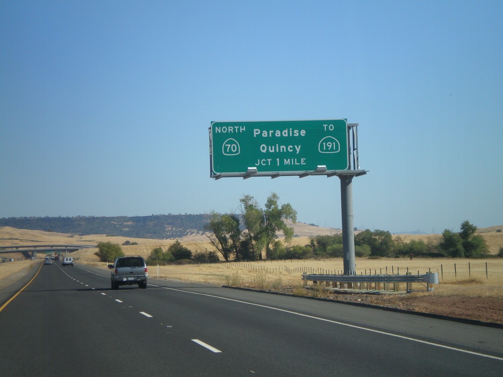
CA-149 South Approaching CA-70
CA-149 south approaching CA-70. Use CA-70 north for Paradise, Quincy, and CA-191.
Taken 09-25-2010
Oroville
Butte County
California
United States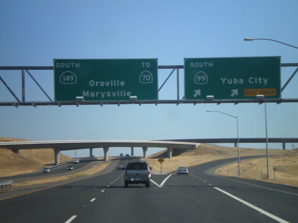
CA-99 South at CA-149
CA-99 south at CA-149. Use CA-149 south for CA-70, Oroville, and Marysville. Continue south on CA-99 for Yuba City.
Taken 09-25-2010
 Durham
Butte County
California
United States
Durham
Butte County
California
United States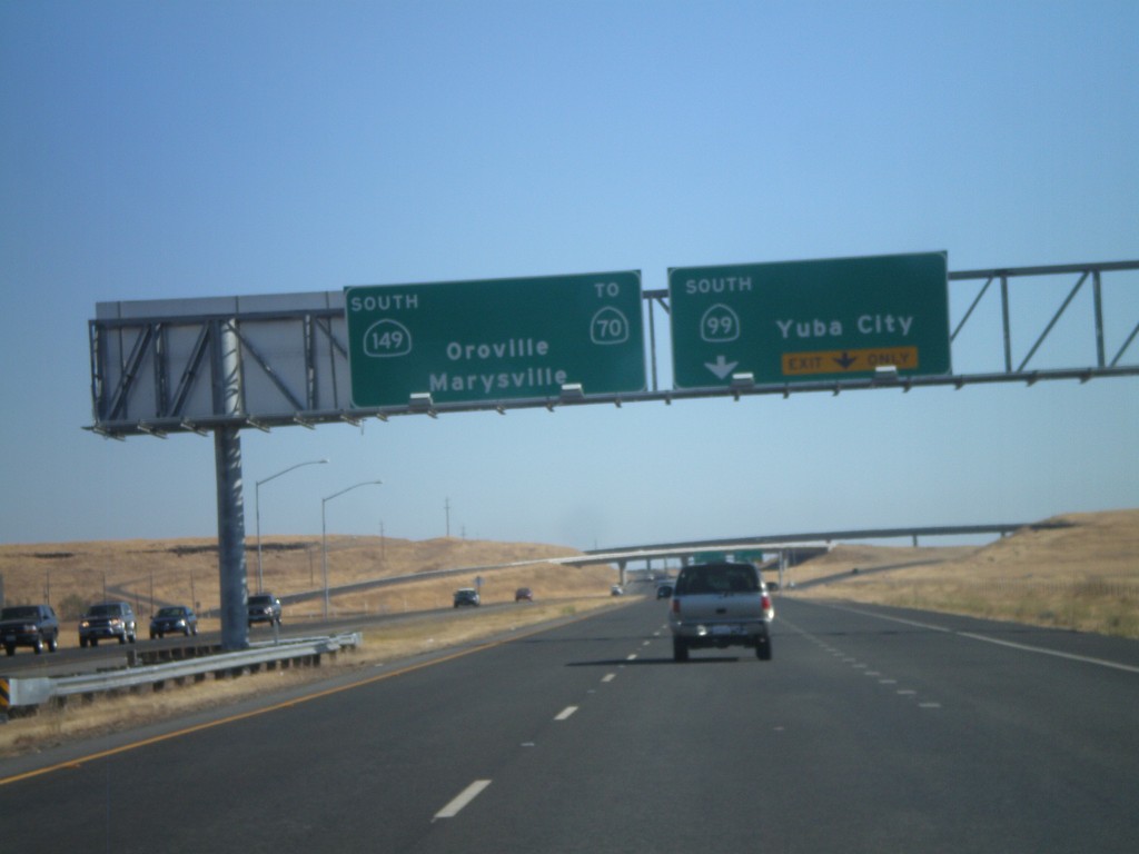
CA-99 South Approaching CA-149
CA-99 South approaching CA-149. Use CA-149 South for Oroville, Marysville, and CA-70. Continue south on CA-99 for Yuba City.
Taken 09-25-2010
Durham
Butte County
California
United States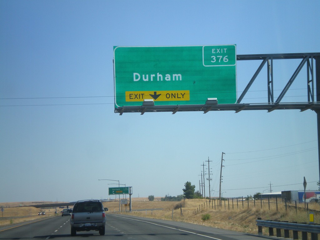
CA-99 South - Exit 376
CA-99 south approaching Exit 376 - Durham.
Taken 09-25-2010
Durham
Butte County
California
United States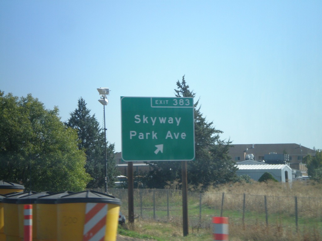
CA-99 South - Exit 383
CA-99 south at Exit 383 - Skyway/Park Ave.
Taken 09-25-2010
Chico
Butte County
California
United States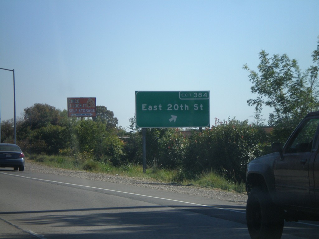
CA-99 South - Exit 384
CA-99 south at Exit 384 - East 20th St.
Taken 09-25-2010
Chico
Butte County
California
United States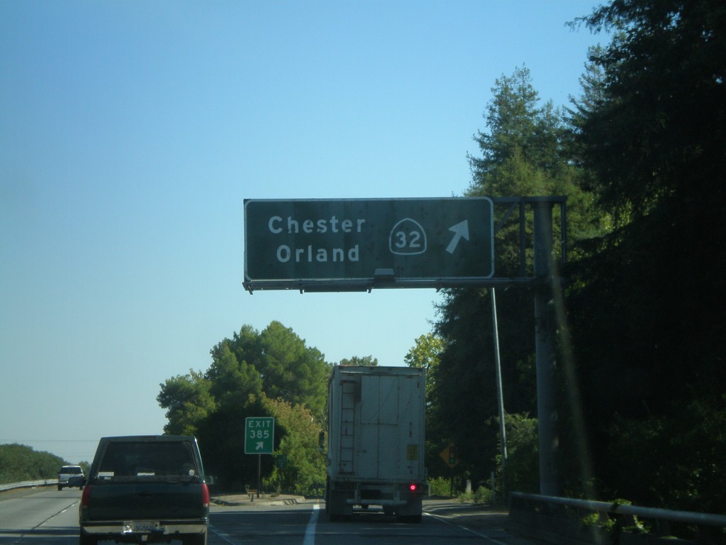
CA-99 South - Exit 385
CA-99 south at Exit 385 - CA-32/Orland/Chester.
Taken 09-25-2010
 Chico
Butte County
California
United States
Chico
Butte County
California
United States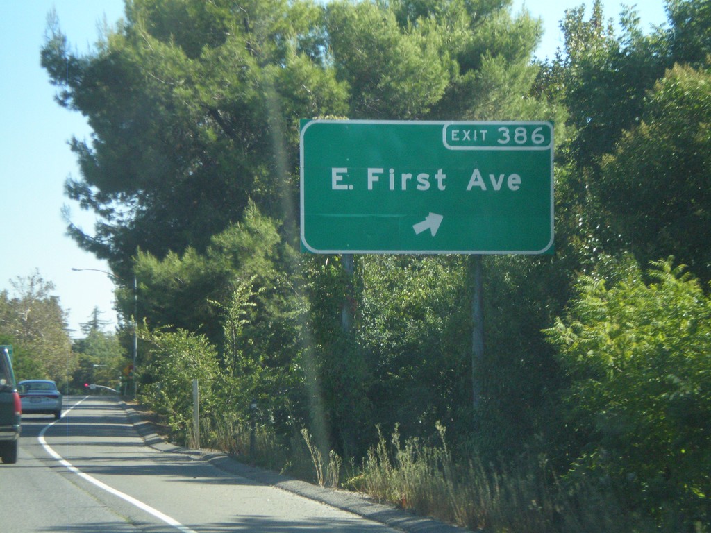
CA-99 South - Exit 386
CA-99 south at Exit 386 - E. First Ave.
Taken 09-25-2010
Chico
Butte County
California
United States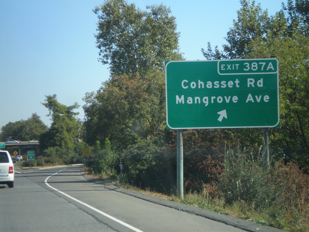
CA-99 South - Exit 387A
CA-99 south at Exit 387A - Cohasset Road/Mangrove Ave.
Taken 09-25-2010
Chico
Butte County
California
United States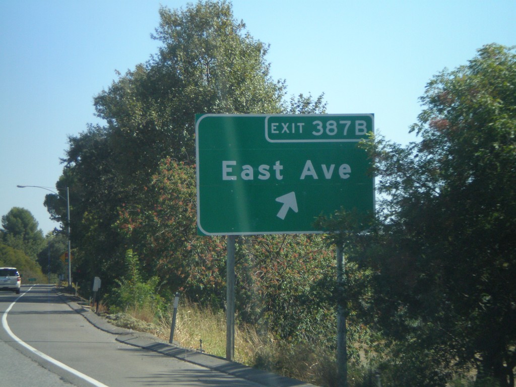
CA-99 South - Exit 387B
CA-99 south at Exit 387B - East Ave.
Taken 09-25-2010
Chico
Butte County
California
United States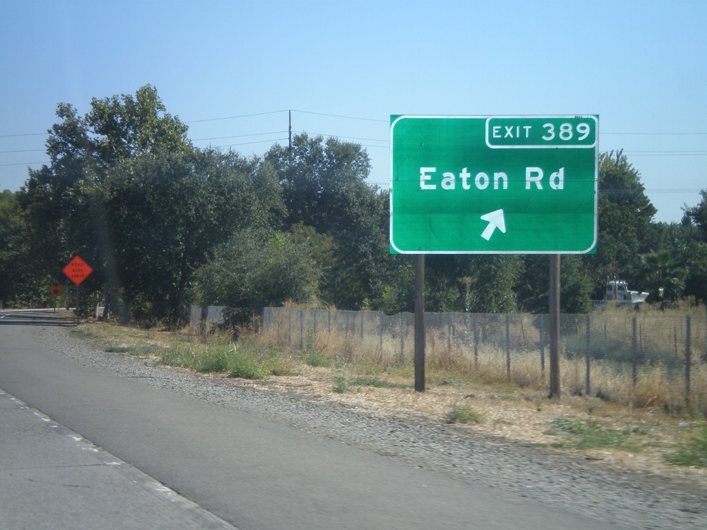
CA-99 South - Exit 389
CA-99 south at Exit 389 - Eaton Road.
Taken 09-25-2010
Chico
Butte County
California
United States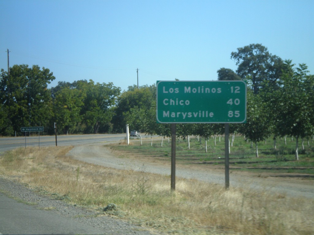
CA-99 South - Distance Marker
Distance marker on CA-99 south to Los Molinos, Chico, and Marysville.
Taken 09-25-2010
Red Bluff
Tehama County
California
United States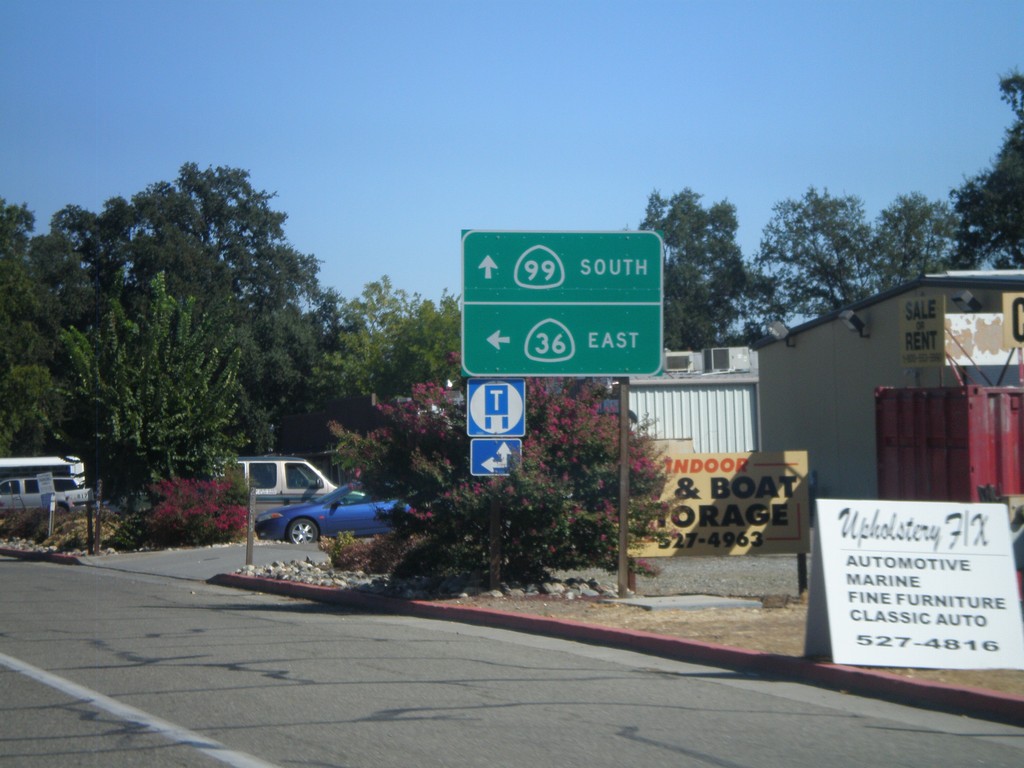
CA-36 East at CA-99
CA-36 East at CA-99. Turn left to continue east on CA-36. Continue straight ahead for CA-99.
Taken 09-25-2010
 Red Bluff
Tehama County
California
United States
Red Bluff
Tehama County
California
United States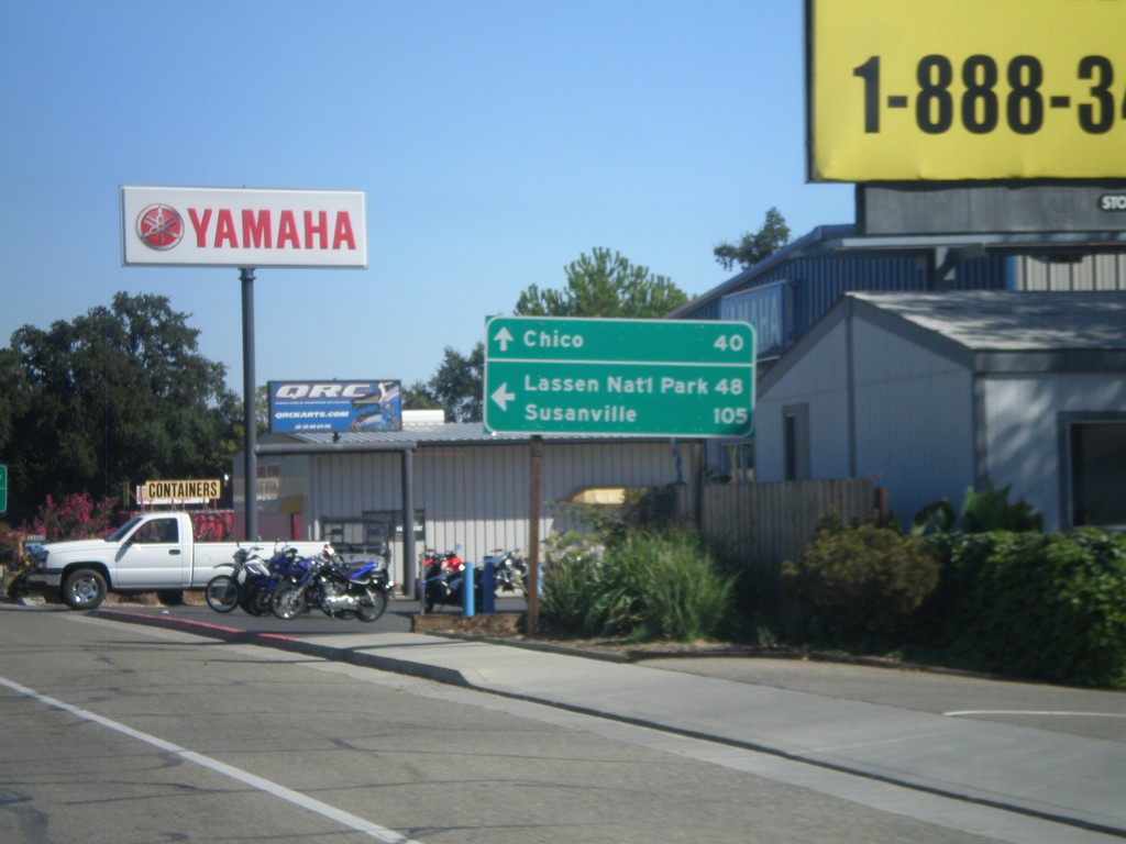
CA-36 East at CA-99
CA-36 east at CA-99. Use CA-36 east for Lassen National Park and Susanville. Continue south on CA-99 for Chico.
Taken 09-25-2010
Red Bluff
Tehama County
California
United States