Signs Tagged With Big Green Sign
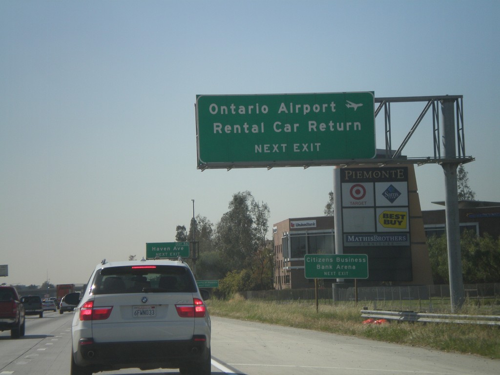
I-10 West Approaching Exit 56
I-10 west approaching Exit 56 - Haven Ave. Use Haven Ave. for Ontario Airport Rental Car Return.
Taken 02-28-2011
 Ontario
San Bernardino County
California
United States
Ontario
San Bernardino County
California
United States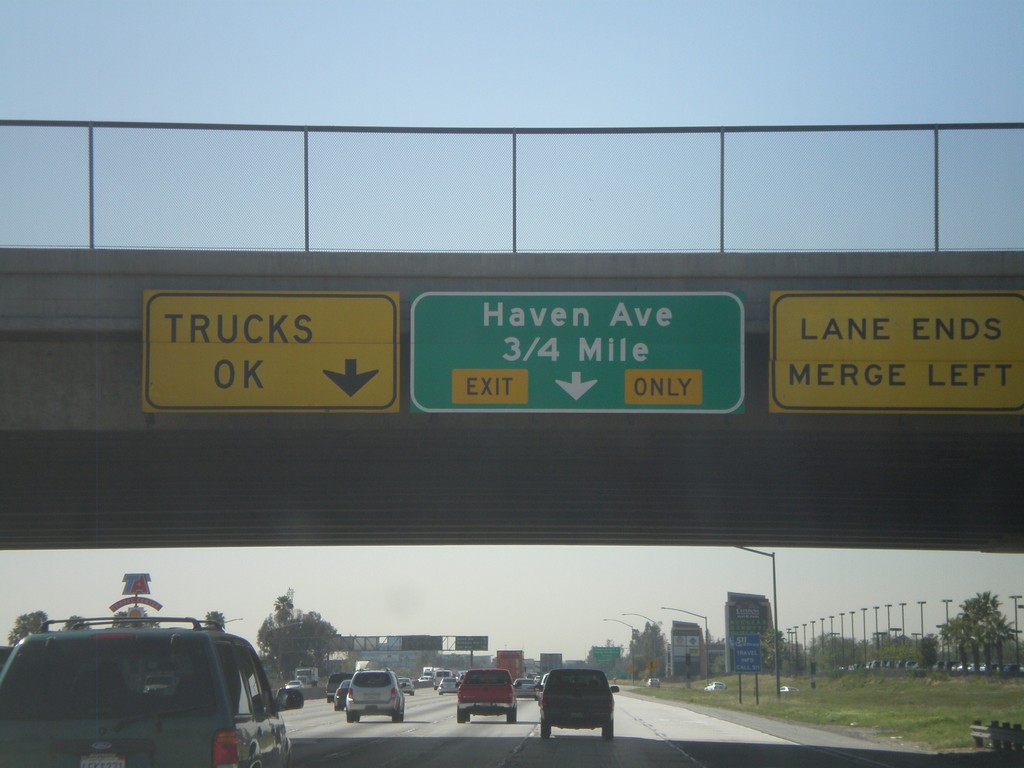
I-10 West Approaching Exit 56
I-10 west approaching Exit 56 - Haven Ave.
Taken 02-28-2011
Ontario
San Bernardino County
California
United States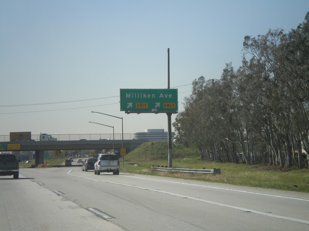
I-10 West - Exit 57
I-10 west at Exit 57 - Milliken Ave.
Taken 02-28-2011
Ontario
San Bernardino County
California
United States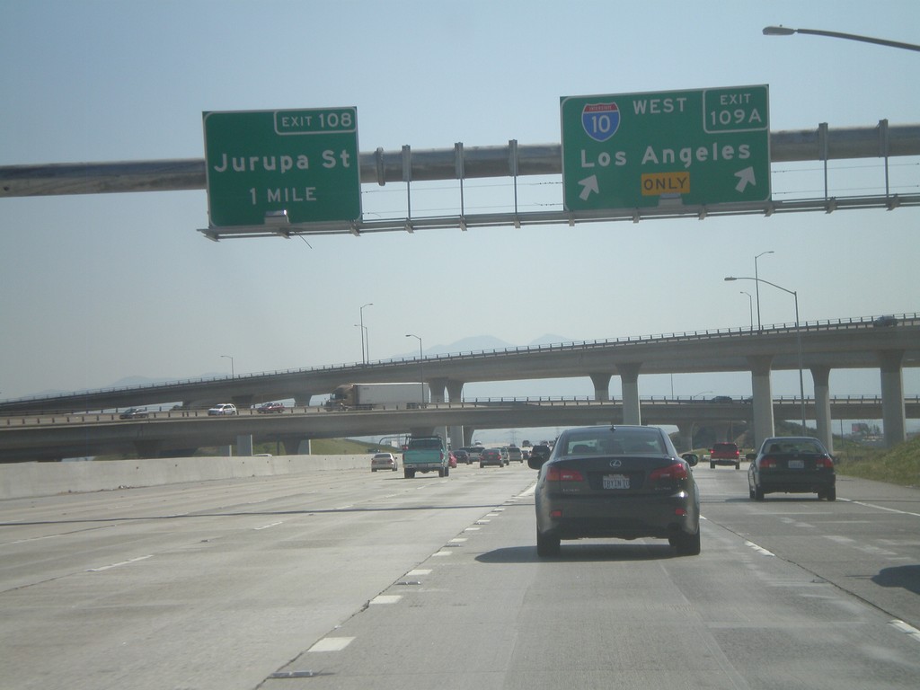
I-15 South at Exits 109A and 108
I-15 south at Exit 109A - I-10 West/Los Angeles. Approaching Exit 108 - Jurupa St.
Taken 02-28-2011
 Ontario
San Bernardino County
California
United States
Ontario
San Bernardino County
California
United States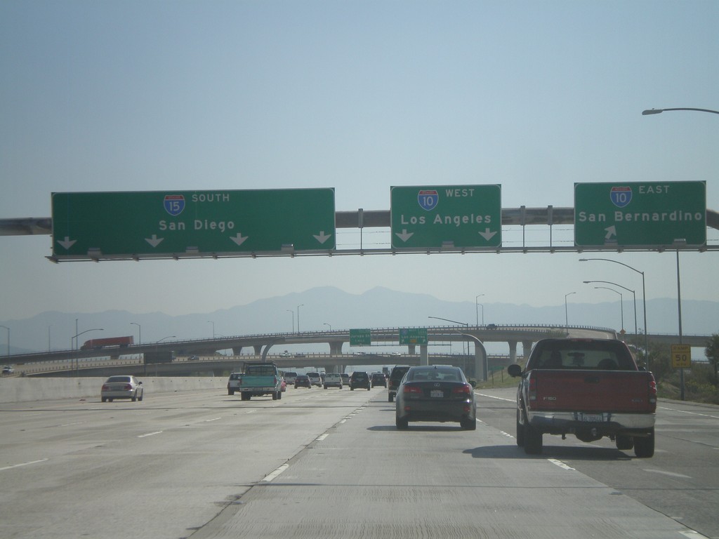
I-15 South - Exits 109B and 109A
I-15 south at Exit 109B - I-10 East/San Bernardino. Approaching Exit 109A - I-10 West/Los Angeles.
Taken 02-28-2011
Ontario
San Bernardino County
California
United States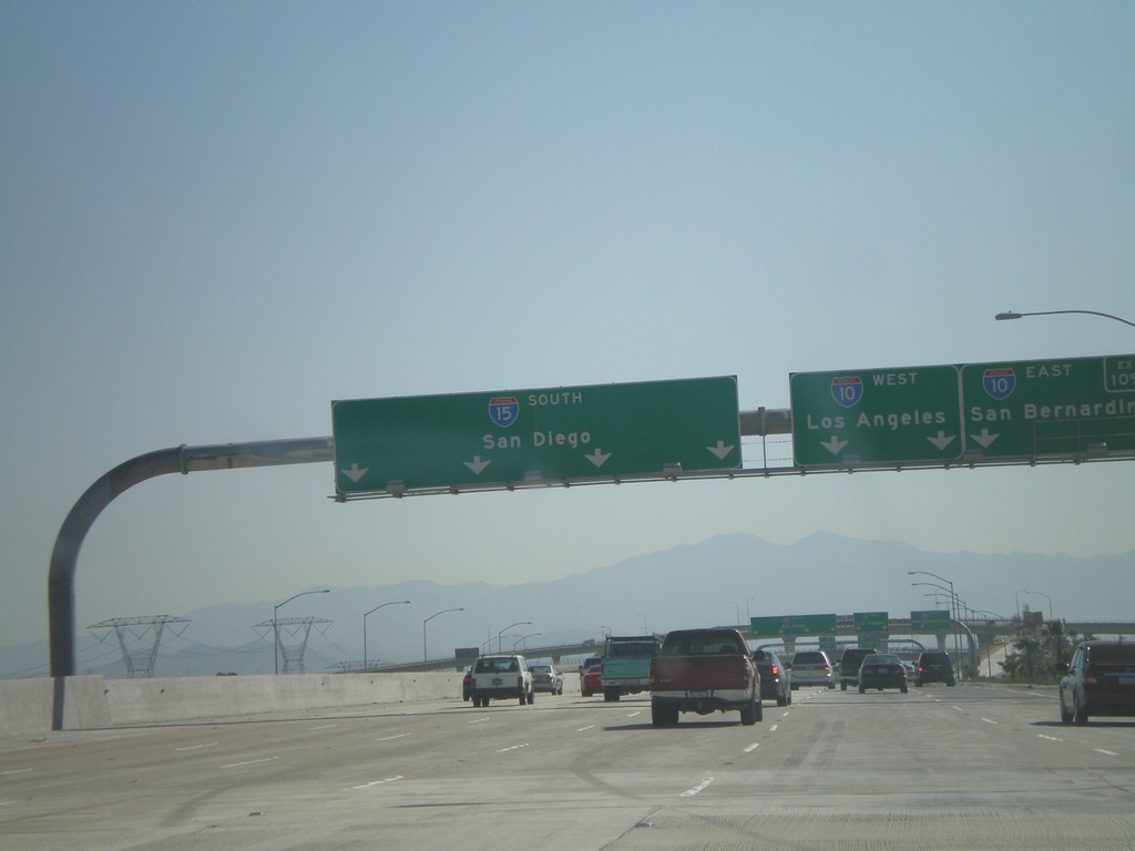
I-15 South Approaching Exit 109
I-15 south approaching Exit 109 - I-10 West/Los Angeles; I-10 East/San Bernardino. Continue on I-15 south for San Diego.
Taken 02-28-2011
Ontario
San Bernardino County
California
United States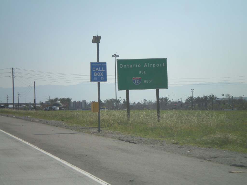
I-15 South - Use I-10 West for Ontario Airport
Use I-10 west for Ontario Airport on I-15 south.
Taken 02-28-2011
Rancho Cucamonga
San Bernardino County
California
United States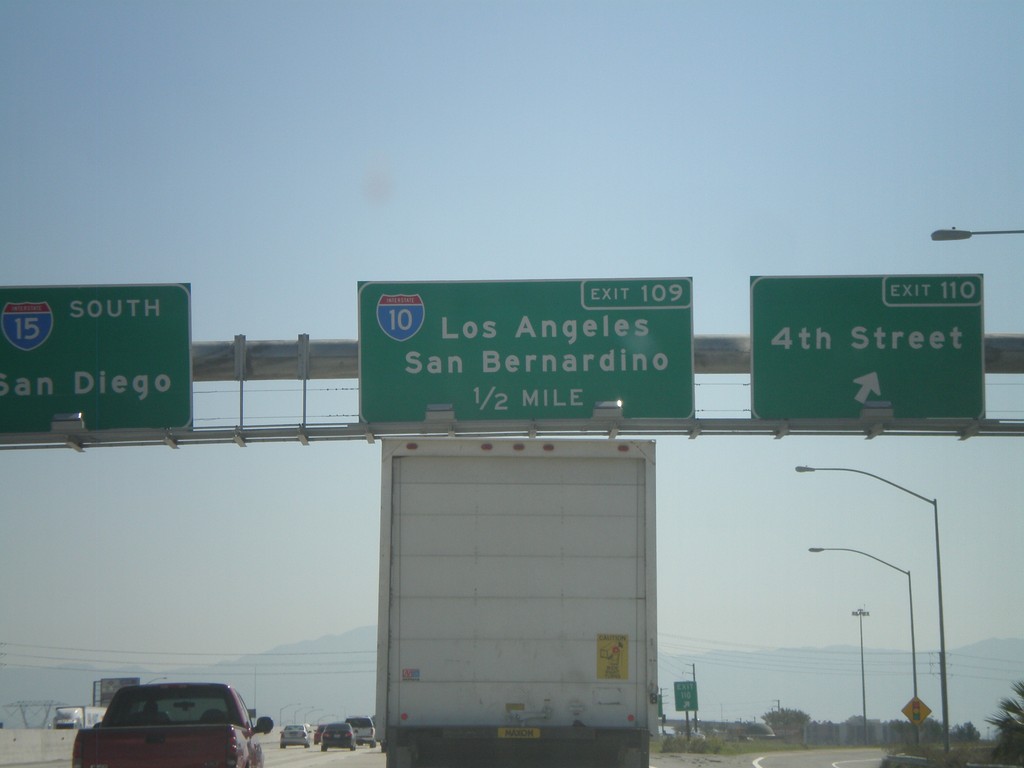
I-15 South - Exits 110 and 109
I-15 south at Exit 110 - 4th St. Approaching Exit 109 - I-10/San Bernardino/Los Angeles. I-15 continues south towards San Diego.
Taken 02-28-2011
Rancho Cucamonga
San Bernardino County
California
United States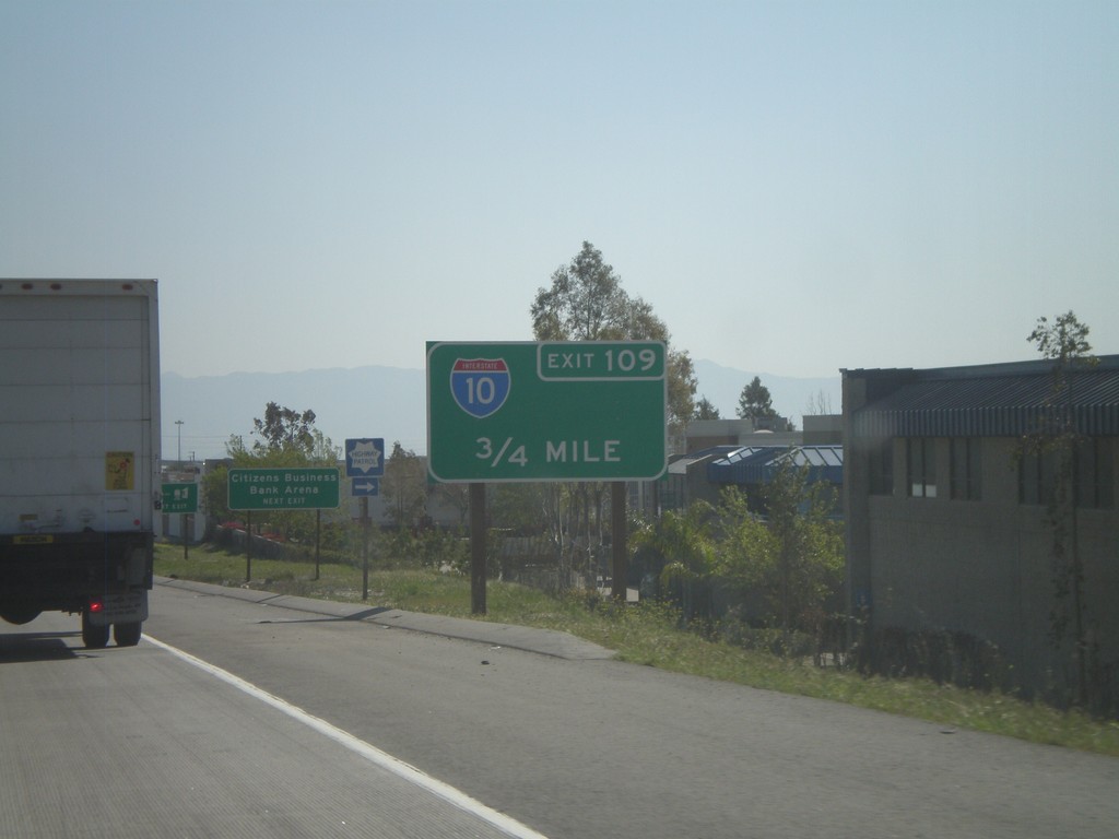
I-15 South Approaching Exit 109
I-15 south approaching Exit 109 - I-10.
Taken 02-28-2011
Rancho Cucamonga
San Bernardino County
California
United States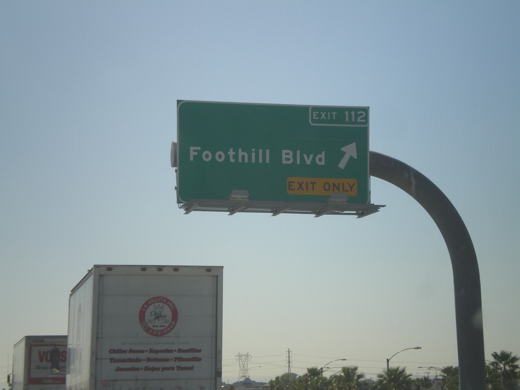
I-15 South - Exit 112
I-15 South at Exit 112 - Foothill Blvd. Foothill Blvd. is CA-66, but is not signed at this intersection. Advance signs for Foothill Blvd. show the CA-66 shield.
Taken 02-28-2011
 Rancho Cucamonga
San Bernardino County
California
United States
Rancho Cucamonga
San Bernardino County
California
United States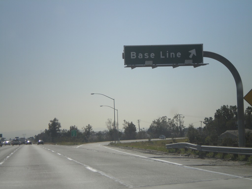
I-15 South - Exit 113
I-15 south at Exit 113 - Base Line.
Taken 02-28-2011
Rancho Cucamonga
San Bernardino County
California
United States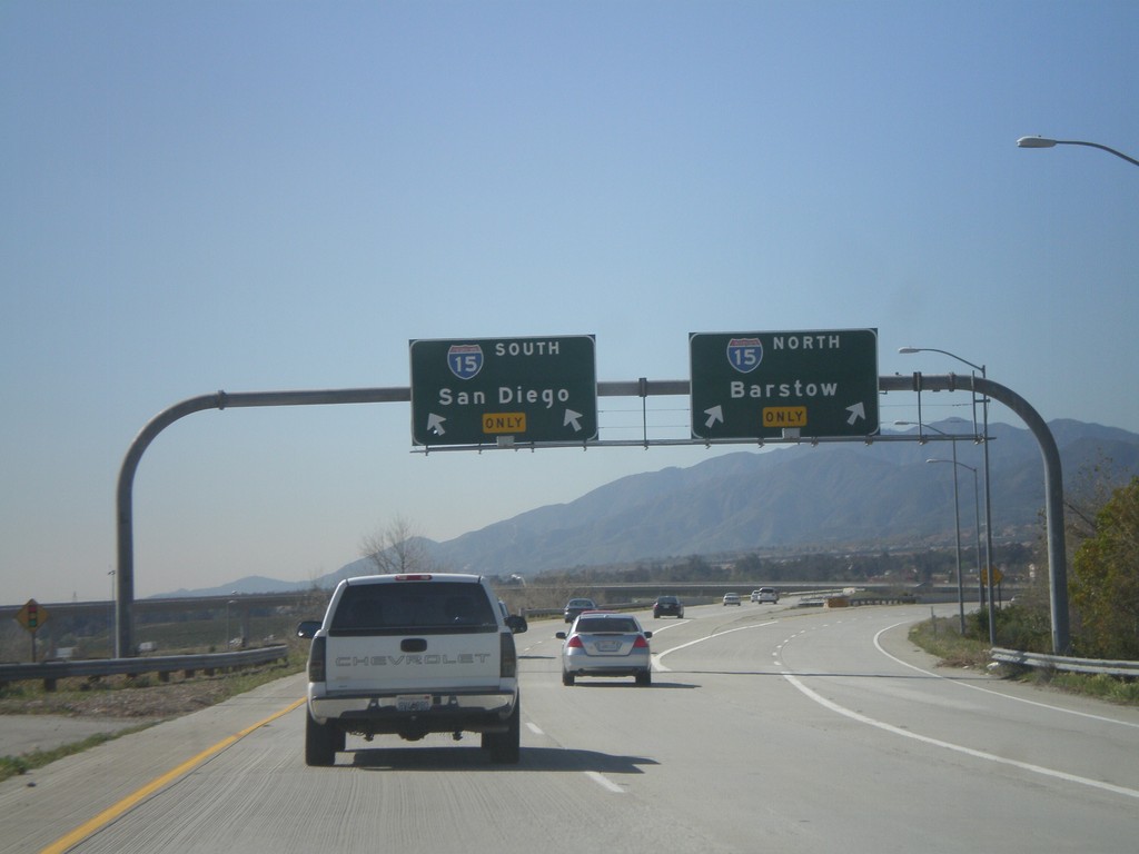
CA-210 West at I-15
CA-210 West at I-15. Use I-15 north for Barstow; use I-15 south for San Diego.
Taken 02-28-2011
 Fontana
San Bernardino County
California
United States
Fontana
San Bernardino County
California
United States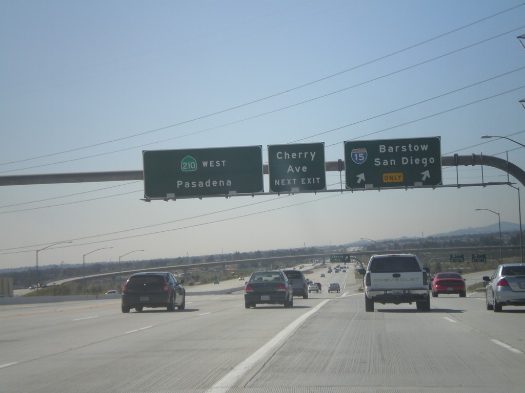
CA-210 West - Exits 65B and 64A
CA-210 west at Exit 64B - I-15/San Diego/Barstow. Approaching Exit 64A - Cherry Ave. CA-210 continues west towards Pasadena.
Taken 02-28-2011
Fontana
San Bernardino County
California
United States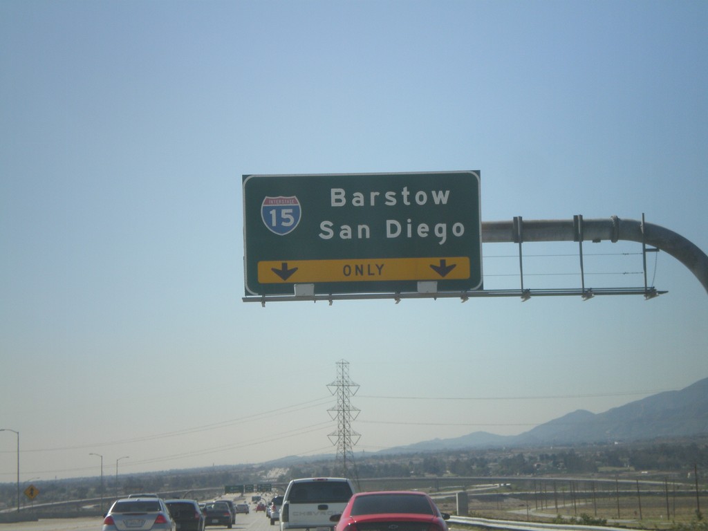
CA-210 West Approaching Exit 64A
CA-210 west approaching Exit 64A - I-15/San Diego/Barstow.
Taken 02-28-2011
Fontana
San Bernardino County
California
United States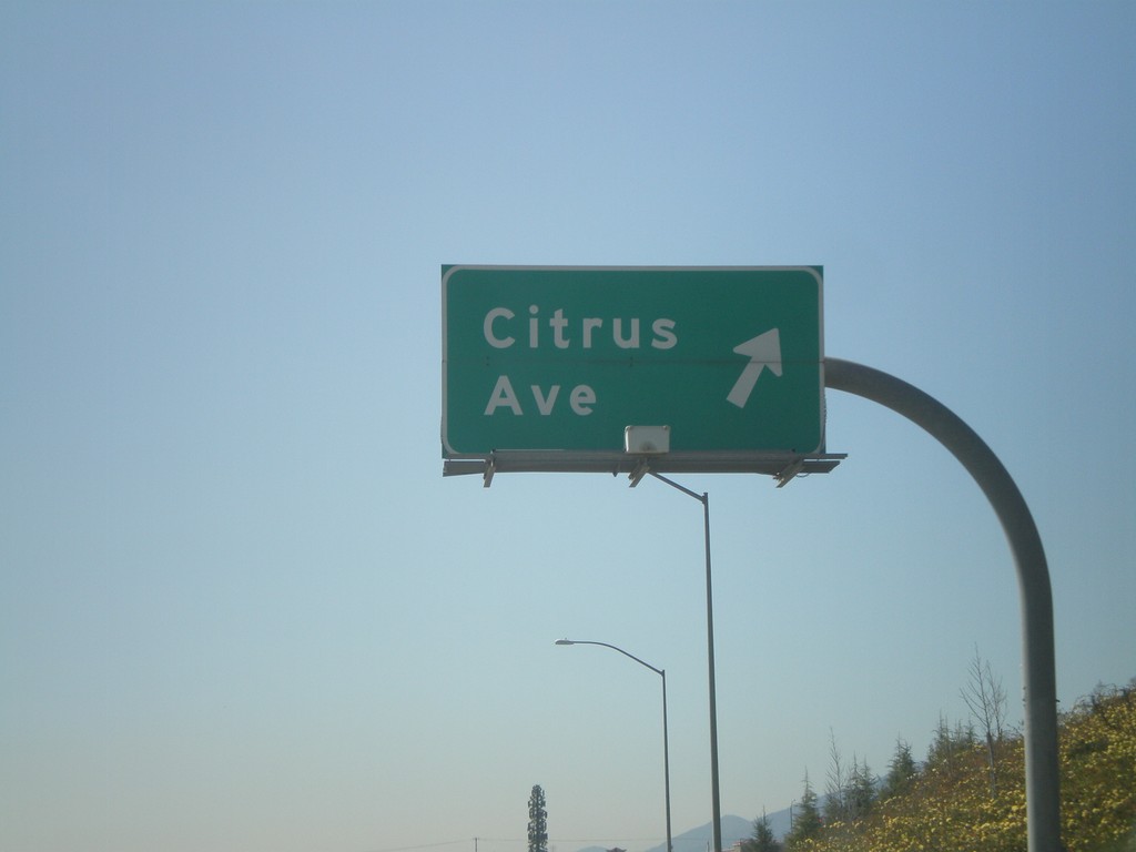
CA-210 West - Exit 66
CA-210 west at Exit 66 - Citrus Ave.
Taken 02-28-2011
Fontana
San Bernardino County
California
United States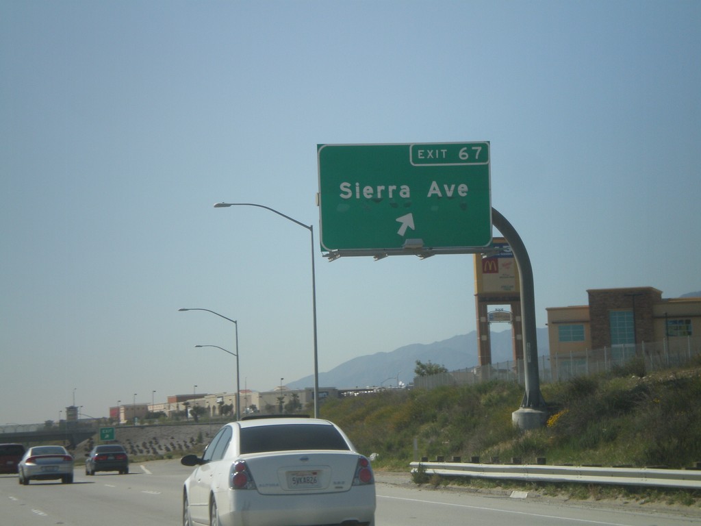
CA-210 West - Exit 67
CA-210 west at Exit 67 - Sierra Ave.
Taken 02-28-2011
Fontana
San Bernardino County
California
United States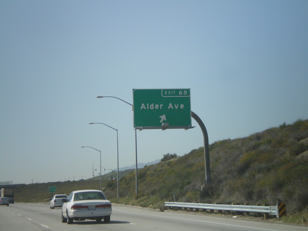
CA-210 West - Exit 68
CA-210 west at Exit 68 - Alder Ave.
Taken 02-28-2011
Rialto
San Bernardino County
California
United States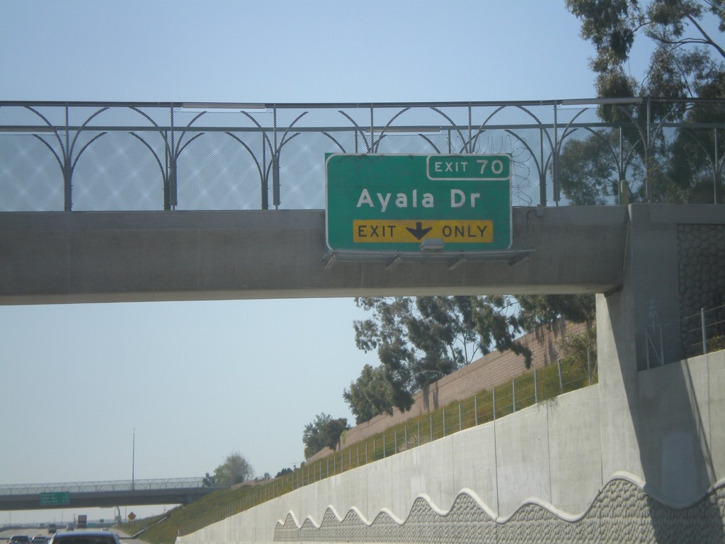
CA-210 West Approaching Exit 70
CA-210 west approaching Exit 70 - Ayala Drive.
Taken 02-28-2011
Rialto
San Bernardino County
California
United States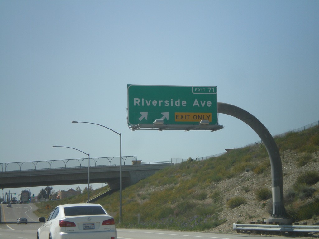
CA-210 West - Exit 71
CA-210 west at Exit 71 - Riverside Ave.
Taken 02-28-2011
Rialto
San Bernardino County
California
United States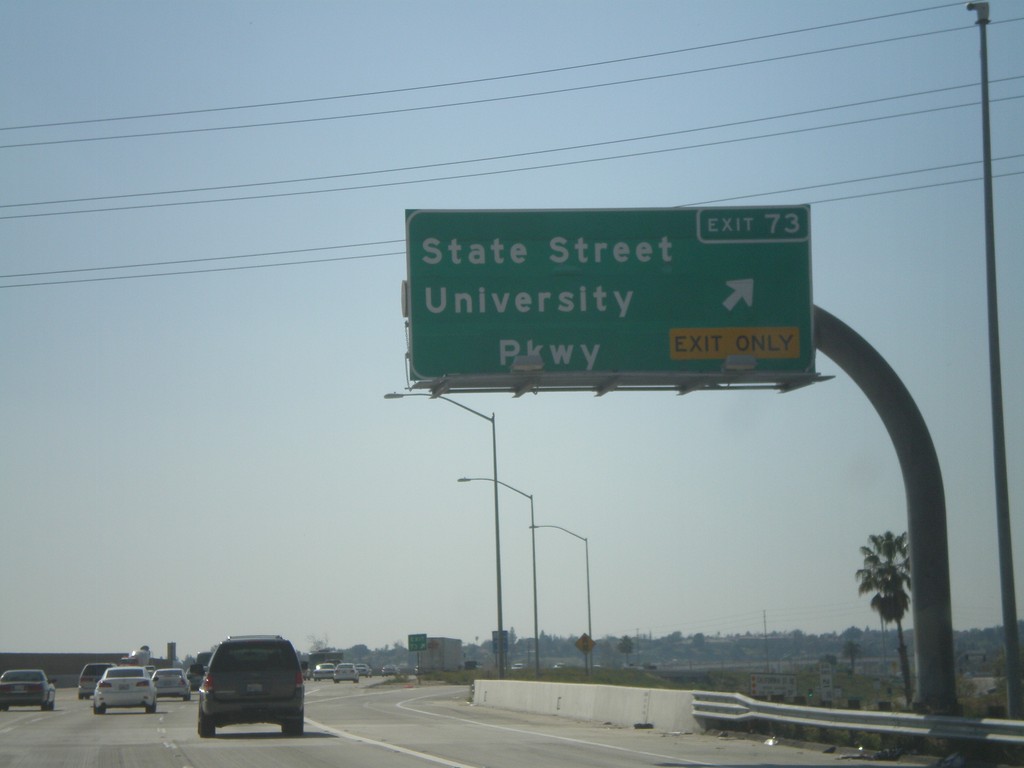
CA-210 West - Exit 73
CA-210 west at Exit 73 - State St./University Parkway.
Taken 02-28-2011
San Bernardino
San Bernardino County
California
United States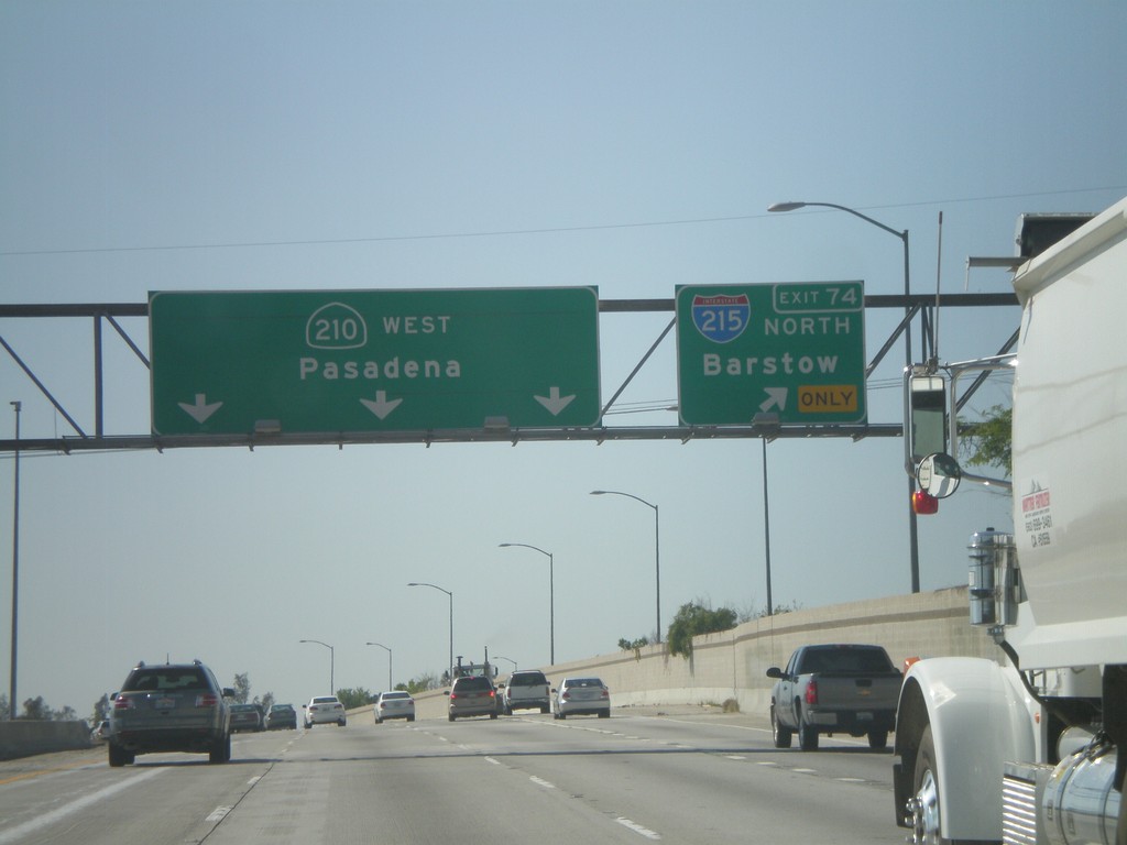
CA-210 West - Exit 74
CA-210 west at Exit 74 - I-215 North/Barstow. Continue west on CA-210 for Pasadena.
Taken 02-28-2011
 San Bernardino
 County
California
United States
San Bernardino
San Bernardino County
California
United States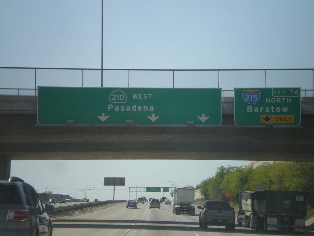
CA-210 West Approaching Exit 74
CA-210 west approaching Exit 74 - I-215 North/Barstow. CA-210 continues west towards Pasadena.
Taken 02-28-2011
San Bernardino
San Bernardino County
California
United States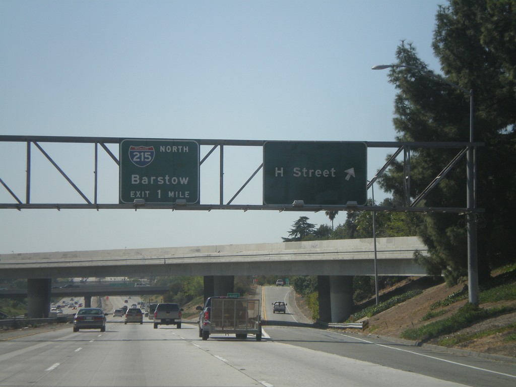
CA-210 West - Exit 75A and Exit 74
CA-210 west at Exit 75A - H St. Approaching Exit 74 - I-215 North/Barstow.
Taken 02-28-2011
San Bernardino
San Bernardino County
California
United States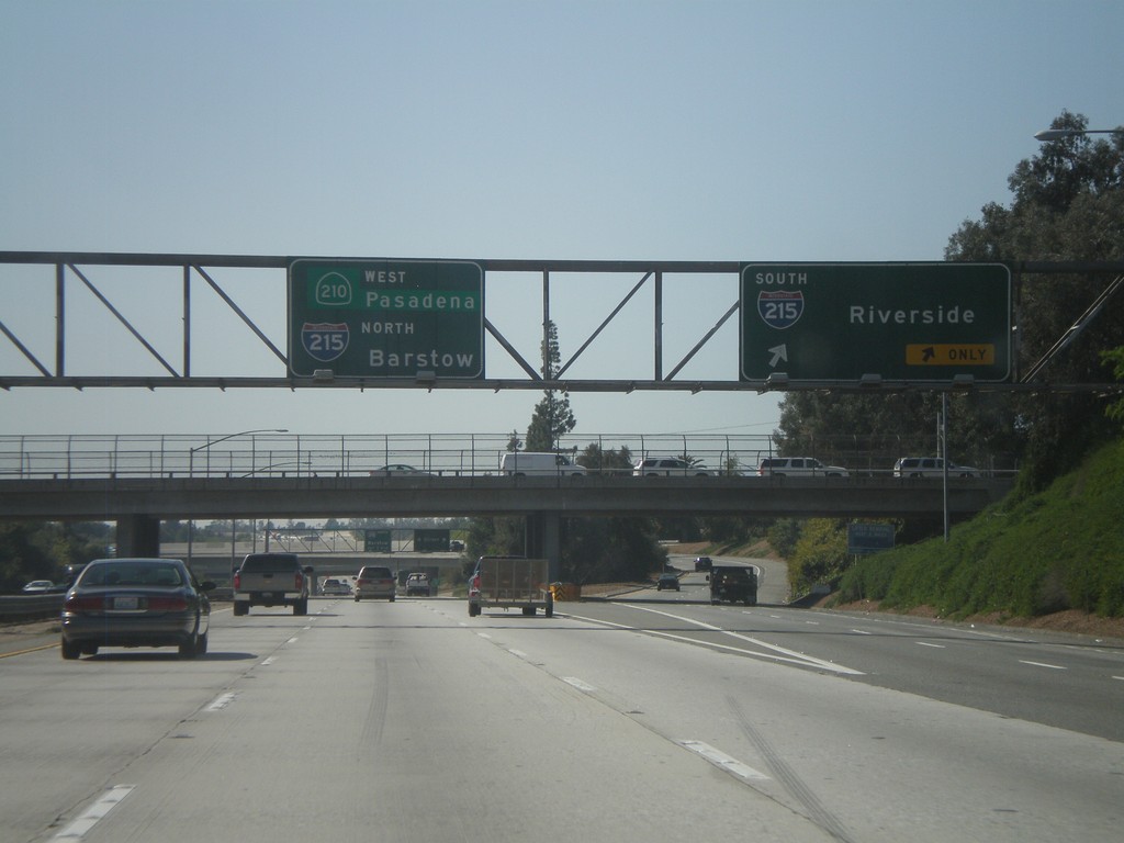
CA-210 West - Exit 75B
CA-210 West at Exit 75B - I-215 South/Riverside. Continue west on CA-210 for Pasadena, and I-215 North/Barstow Jct.
Taken 02-28-2011
San Bernardino
San Bernardino County
California
United States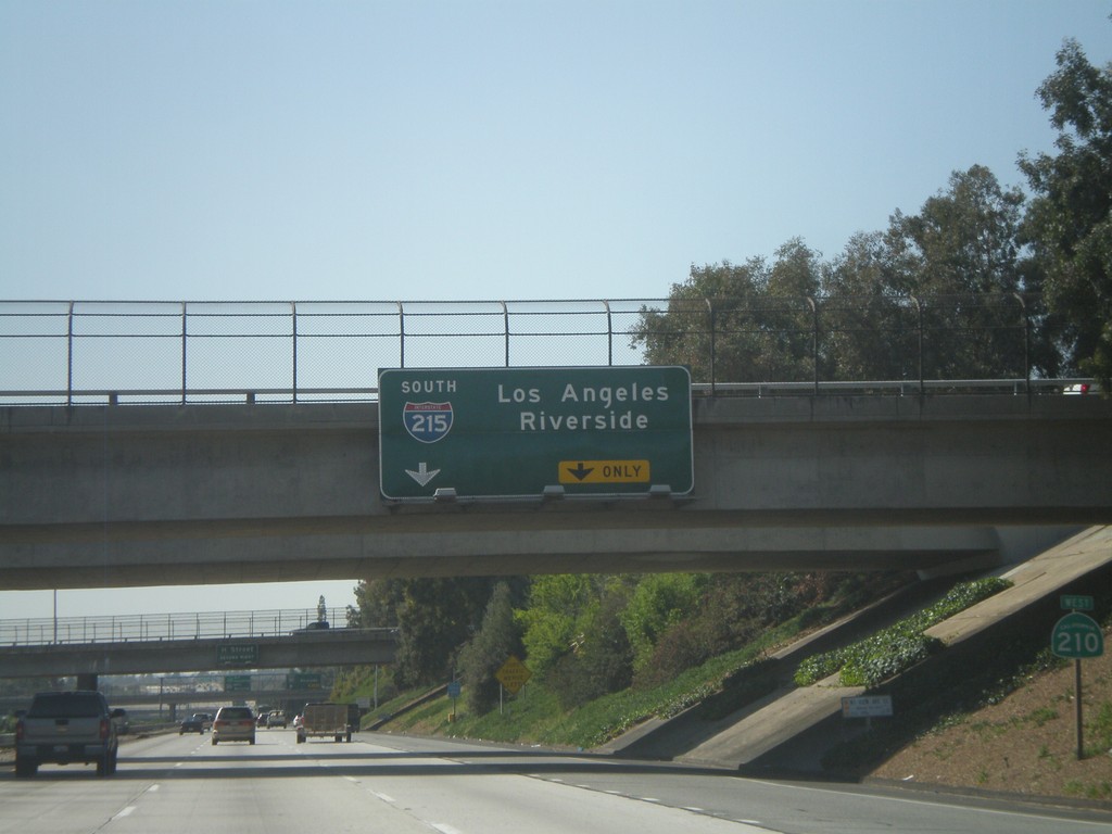
CA-210 West Approaching Exit 75B
CA-210 west approaching Exit 75B - I-215 South/Los Angeles/Riverside. CA-210 shield is on the right.
Taken 02-28-2011
San Bernardino
San Bernardino County
California
United States