Signs Tagged With Big Green Sign
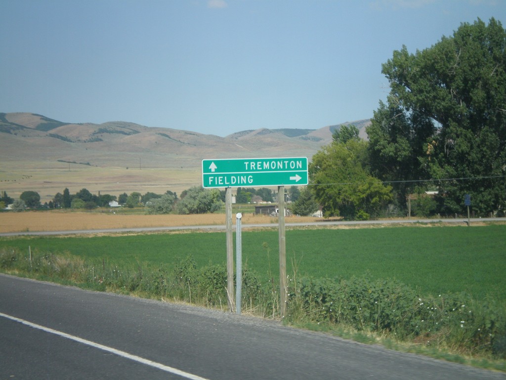
UT-30 West Approaching UT-81 North
UT-30 west approaching UT-81 north. Use UT-81 north for Fielding. Continue west on UT-30 for Tremonton.
Taken 08-02-2010

 Garland
Box Elder County
Utah
United States
Garland
Box Elder County
Utah
United States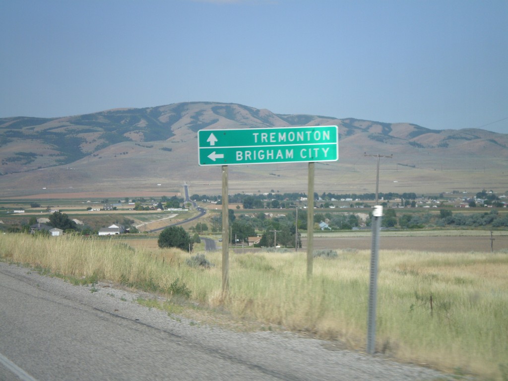
UT-30 West Approaching UT-38
UT-30 west approaching UT-38. Use UT-38 south for Brigham City. Continue west on UT-30 for Tremonton.
Taken 08-02-2010
 Collinston
Box Elder County
Utah
United States
Collinston
Box Elder County
Utah
United States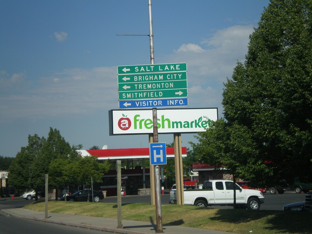
US-89 South at US-91
US-89 south at US-91. Use US-91 north for Smithfield. Use US-91 south/US-89 south for Salt Lake, Brigham City, and Tremonton. US-89 joins US-91 south to Brigham City.
Taken 08-02-2010

 Logan
Cache County
Utah
United States
Logan
Cache County
Utah
United States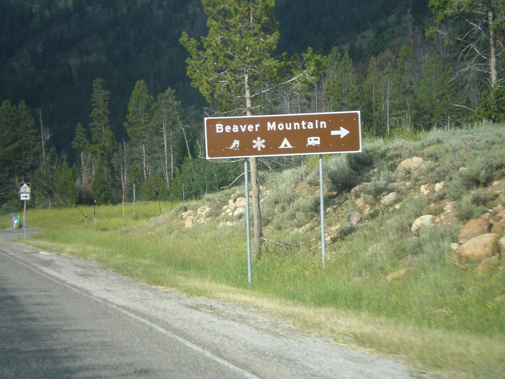
US-89 South Approaching UT-243
US-89 south approaching UT-243 towards Beaver Mountain Ski Area. Beaver Mountain Ski Area is located in the Wasatch Range just east of Logan, Utah.
Taken 08-02-2010
 Garden
Rich County
Utah
United States
Garden
Rich County
Utah
United States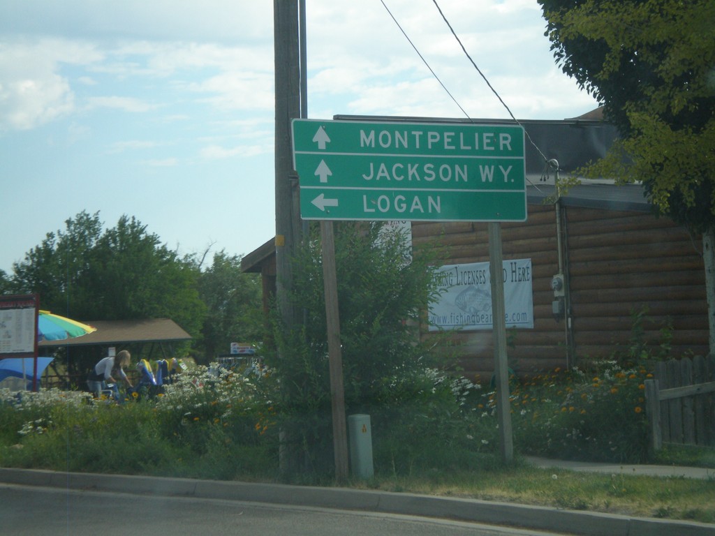
UT-30 West at US-89
UT-30 west at US-89. Use US-89 north for Montpelier (ID), and Jackson (WY). Use US-89 south for Logan.
Taken 08-02-2010
Garden City
Rich County
Utah
United States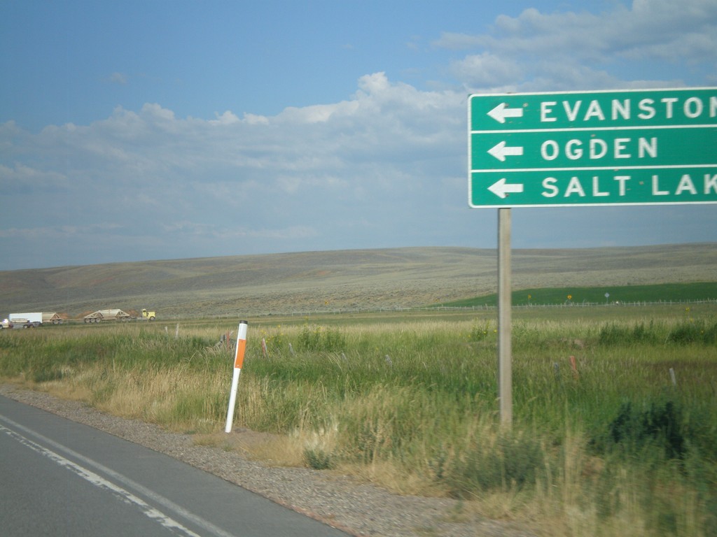
UT-30 West at UT-16 South
UT-30 west at UT-16 south. Use UT-16 south for Evanston (WY), Ogden, and Salt Lake. It is faster to go through Wyoming to reach the Salt Lake City area from this part of Utah, then to go around Bear Lake and through Logan.
Taken 08-02-2010
 Randolph
Rich County
Utah
United States
Randolph
Rich County
Utah
United States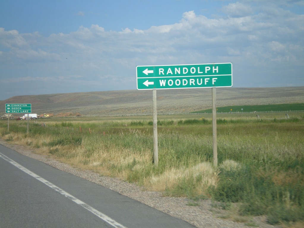
UT-30 West Approaching UT-16
UT-30 west approaching UT-16. Use UT-16 south for Randolph and Woodruff.
Taken 08-02-2010
Randolph
Rich County
Utah
United States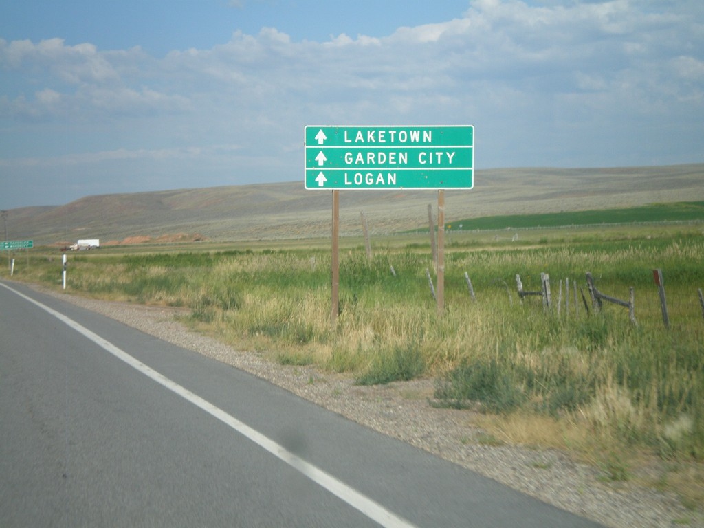
UT-30 West Approaching UT-16
UT-30 west approaching UT-16. Use UT-30 west for Laketown, Garden City, and Logan.
Taken 08-02-2010
Randolph
Rich County
Utah
United States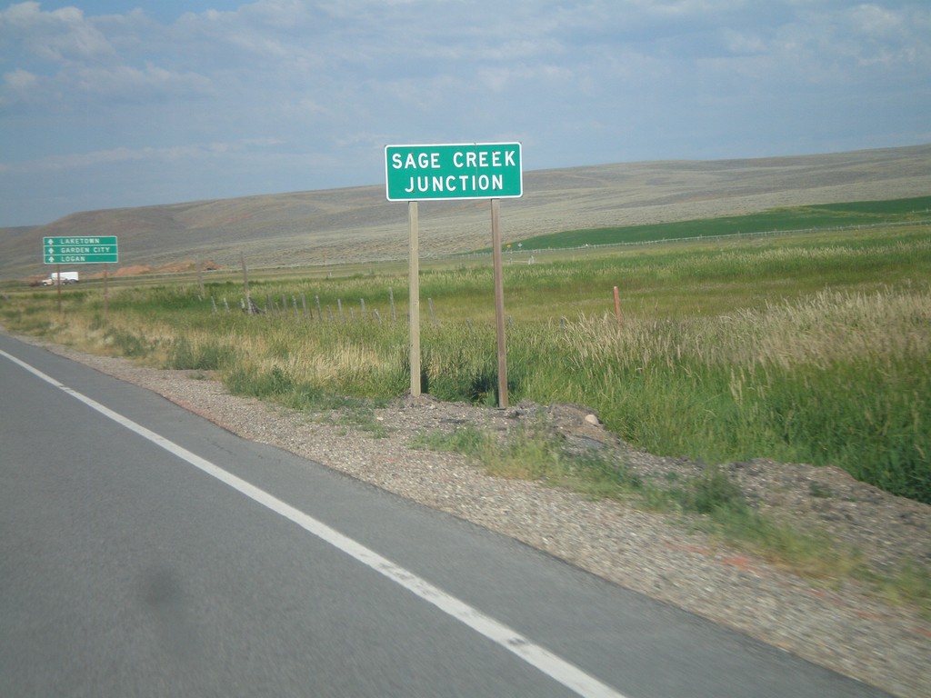
UT-30 West - Sage Creek Junction
UT-30 west at Sage Creek Junction. This is the name for the UT-30/UT-16 junction.
Taken 08-02-2010
Randolph
Rich County
Utah
United States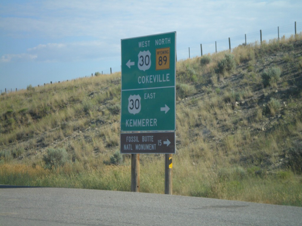
WY-89 North at US-30
WY-89 north at US-30. Use US-30 east for Kemmerer and Fossil Butte National Monument. Use US-30 West/WY-89 North for Cokeville.
Taken 08-02-2010

 Kemmerer
Lincoln County
Wyoming
United States
Kemmerer
Lincoln County
Wyoming
United States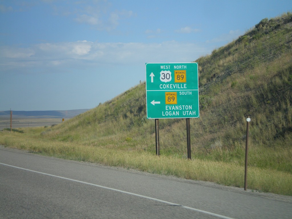
US-30 West at WY-89
US-30 west at WY-89. Use WY-89 south for Evanston and Logan, Utah. Use US-30 east/WY-89 north for Cokeville.
Taken 08-02-2010
Kemmerer
Lincoln County
Wyoming
United States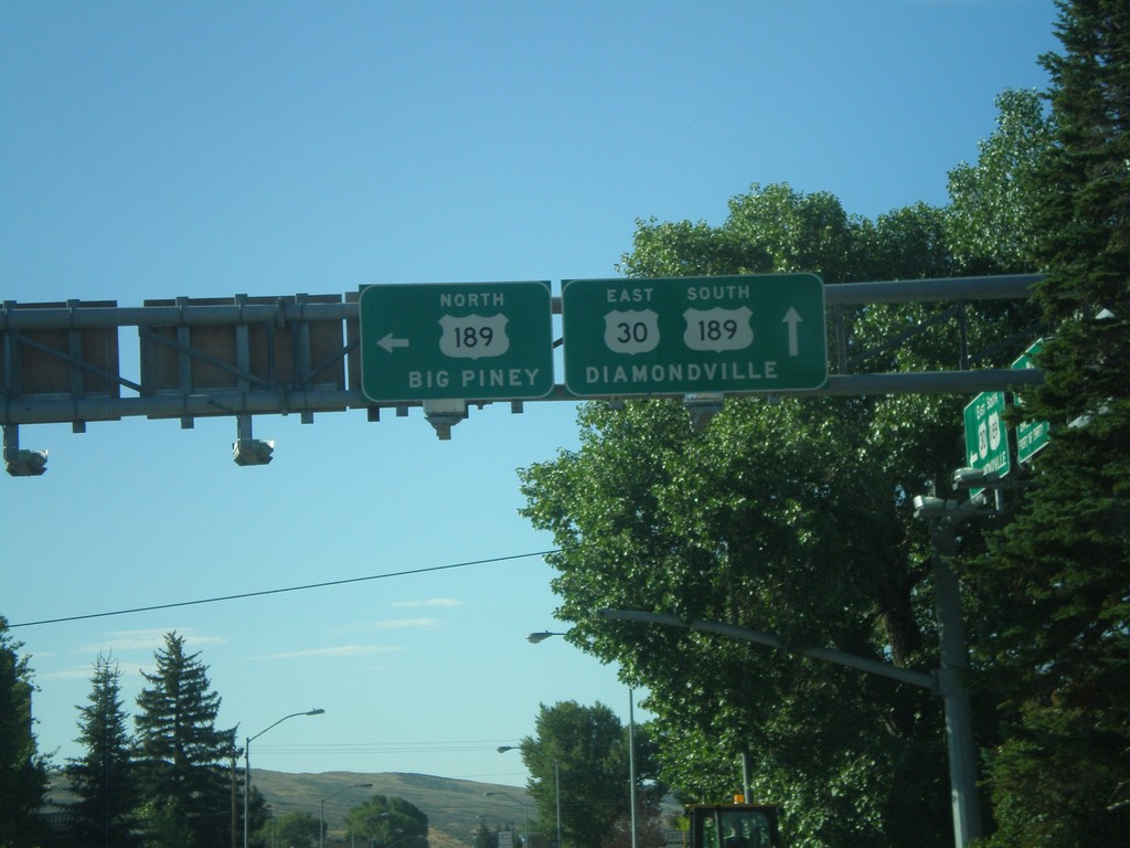
US-30 East at US-189
US-30 east at US-189 north. Use US-189 north for Big Piney. US-189 joins US-30 through Kemmerer towards Diamondville.
Taken 08-02-2010
 Kemmerer
Lincoln County
Wyoming
United States
Kemmerer
Lincoln County
Wyoming
United States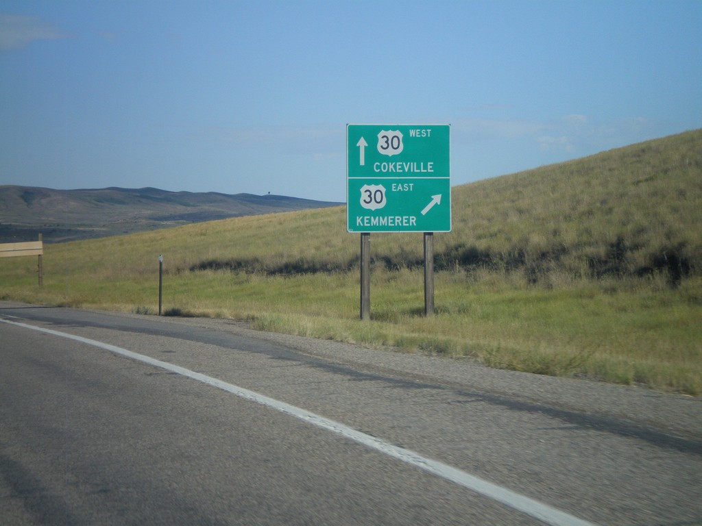
End US-30 By-Pass West at US-30
End US-30 By-Pass west at US-30. Use US-30 west for Kemmerer. Use US-30 east for Cokeville. US-30 By-Pass loops around the south side of Kemmerer and Diamondville.
Taken 08-02-2010
 Kemmerer
Lincoln County
Wyoming
United States
Kemmerer
Lincoln County
Wyoming
United States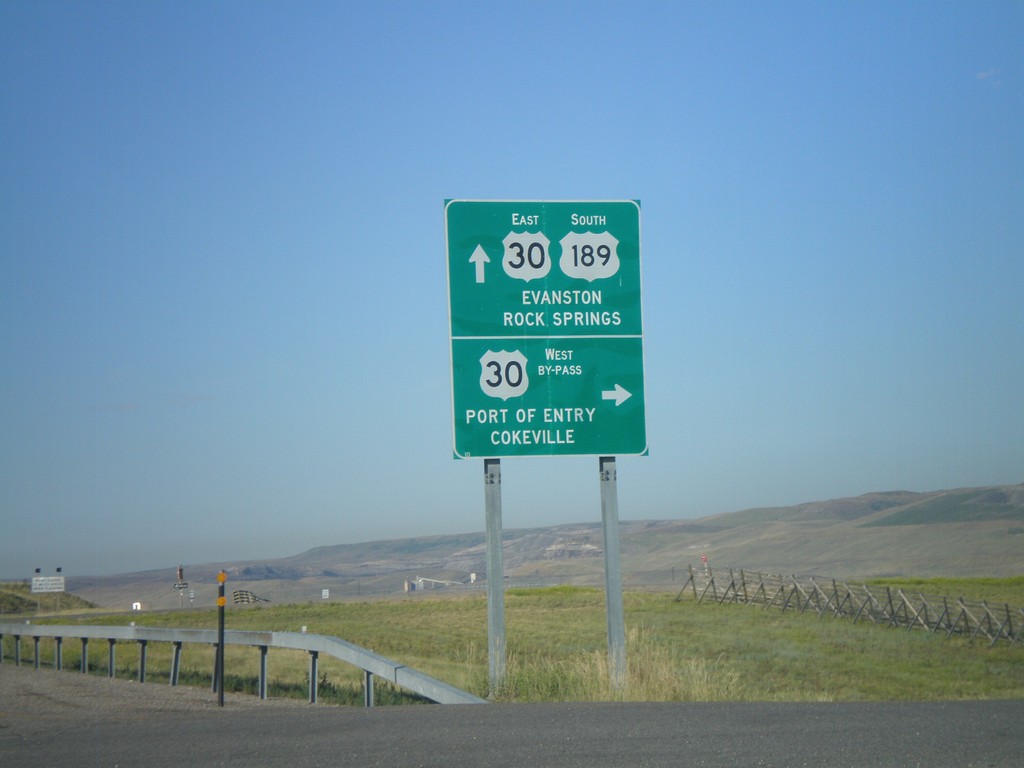
US-30 East/US-189 South at Split
US-30 East/US-189 South at US-30 By-Pass and US-30 ramps. Use US-189 South/US-30 East for Evanston. Turn right for the US-30 By-Pass West onramp for Port of Entry and Cokeville.
Taken 08-02-2010
Kemmerer
Lincoln County
Wyoming
United States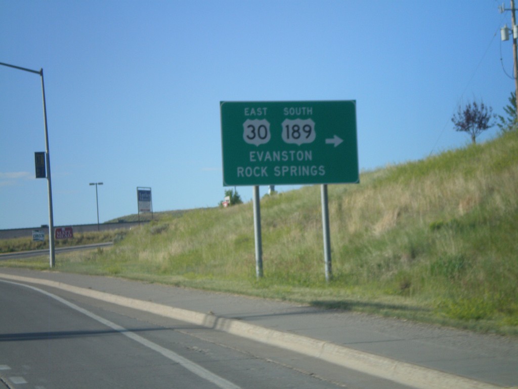
US-30 East/US-189 South - Diamondville
US-30 East/US-189 south in Diamondville. Turn right to continue on US-30 East/US-189 South. Use US-30 East/US-189 south for Evanston and Rock Springs.
Taken 08-02-2010
Kemmerer
Lincoln County
Wyoming
United States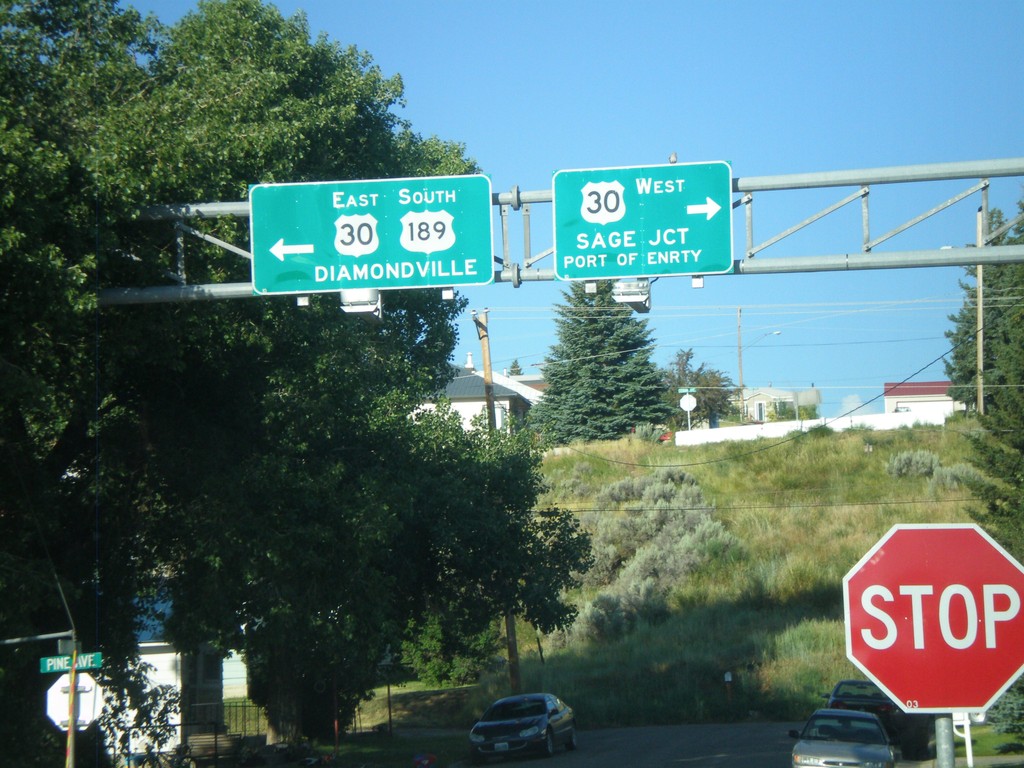
US-189 South at US-30
US-189 south at US-30. Use US-30 west for Sage Jct. and Port of Entry. Use US-30 East/US-189 South for Diamondville. US-189 joins US-30 east through the Kemmerer/Diamondville area.
Taken 08-02-2010
Kemmerer
Lincoln County
Wyoming
United States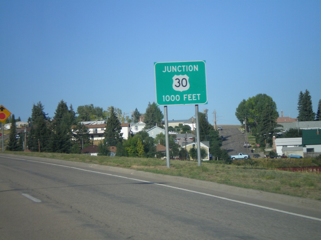
US-189 South Approaching US-30
US-189 south approaching US-30.
Taken 08-02-2010
Kemmerer
Lincoln County
Wyoming
United States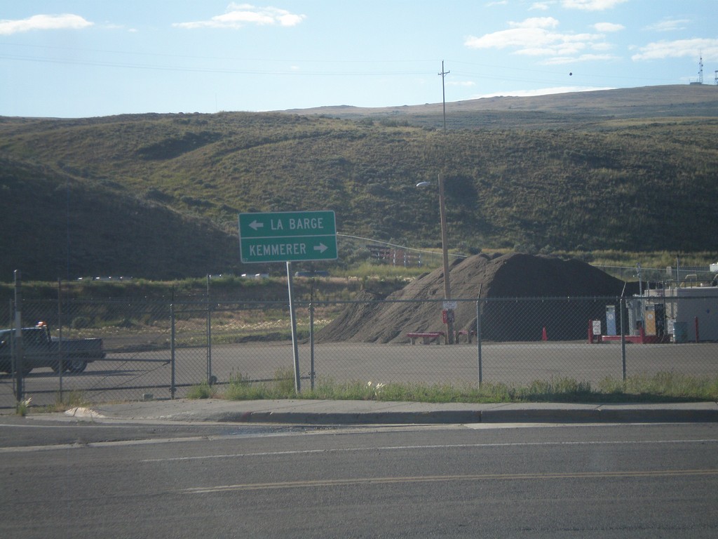
End WY-233 at US-189
End WY-233 at US-189. Turn north on US-189 for La Barge. Use US-189 south for Kemmerer.
Taken 08-02-2010
 Kemmerer
Lincoln County
Wyoming
United States
Kemmerer
Lincoln County
Wyoming
United States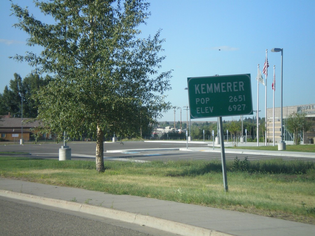
Entering Kemmerer - WY-233 South
Entering the city of Kemmerer on WY-233 south. Kemmerer is the county seat of Lincoln County.
Taken 08-02-2010
Kemmerer
Lincoln County
Wyoming
United States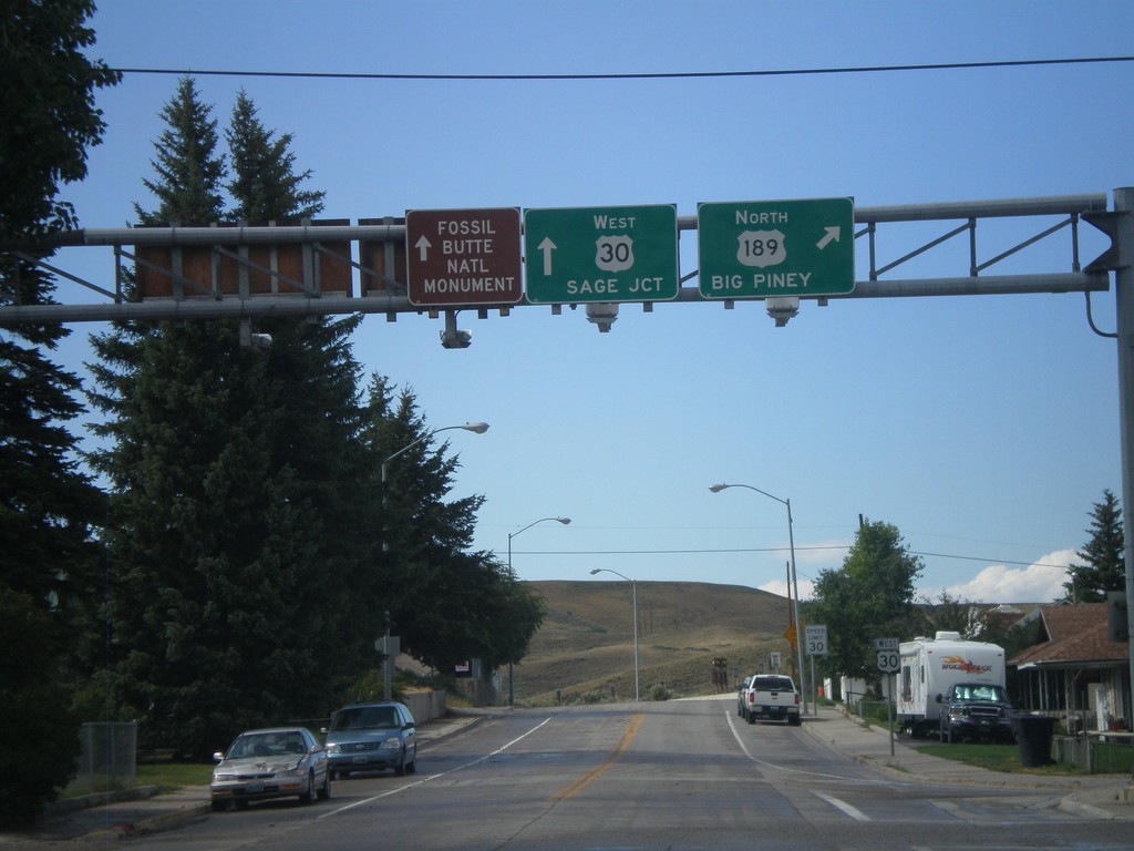
US-30 West at US-189 North
US-30 west at US-189 north. Use US-189 north for Big Piney. Continue west on US-30 for Sage Jct. and Fossil Butte National Monument.
Taken 08-01-2010
Kemmerer
Lincoln County
Wyoming
United States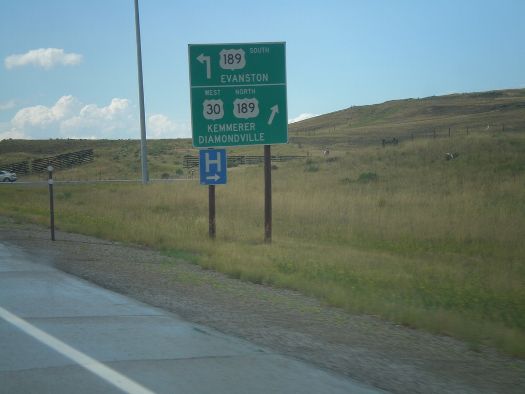
US-30 West at US-189
US-30 west at US-189. Use US-189 south for Evanston. Use US-189 North/US-30 West for Diamondville and Kemmerer. US-30 exits the freeway here, while US-30 Bypass continues west around the south side of Kemmerer.
Taken 08-01-2010
Kemmerer
Lincoln County
Wyoming
United States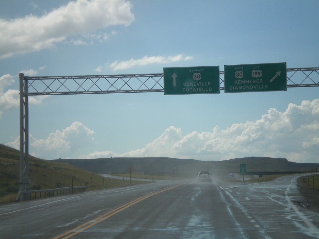
US-30 West Approaching US-189 and US-30 By-Pass
US-30 west approaching US-189 and US-30 By-Pass. Continue ahead for US-30 By-Pass towards Cokeville, and Pocatello (Idaho). Exit for US-30 West/US-189 for Kemmerer and Diamondville.
Taken 08-01-2010
Kemmerer
Lincoln County
Wyoming
United States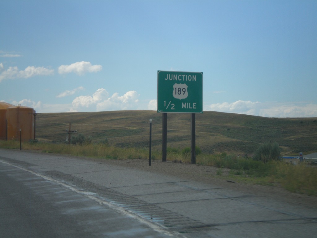
US-30 West Approaching US-189
US-30 west approaching US-189.
Taken 08-01-2010
Kemmerer
Lincoln County
Wyoming
United States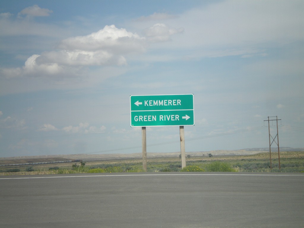
End WY-235 at US-30
End WY-235 at US-30. Use US-30 west for Kemmerer; use US-30 east for Green River.
Taken 08-01-2010
 Granger
Sweetwater County
Wyoming
United States
Granger
Sweetwater County
Wyoming
United States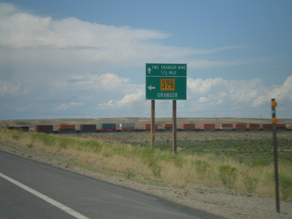
US-30 West Approaching WY-235
US-30 west approaching WY-235. Use WY-235 west for Granger. Continue west on US-30 for FMC Granger Mine.
Taken 08-01-2010
Granger
Sweetwater County
Wyoming
United States