Signs Tagged With Big Green Sign
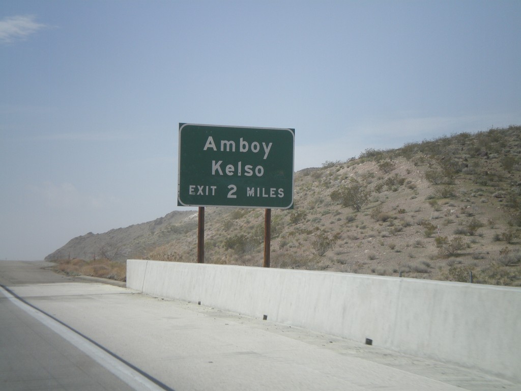
I-40 West Approaching Exit 78
I-40 west approaching Exit 78 - Amboy/Kelso. The actual text at the offramp is Kelbaker Road.
Taken 02-25-2011
 San Bernardino County
California
United States
San Bernardino County
California
United States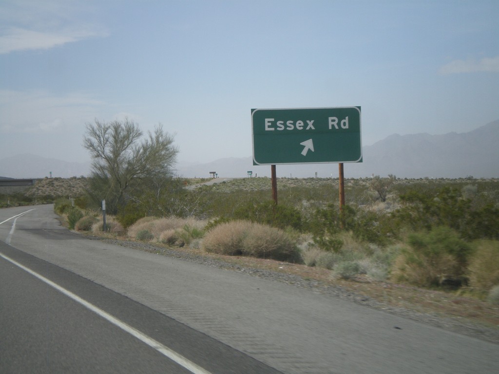
I-40 West - Exit 100
I-40 west at Exit 100 - Essex Road.
Taken 02-25-2011
Fenner
San Bernardino County
California
United States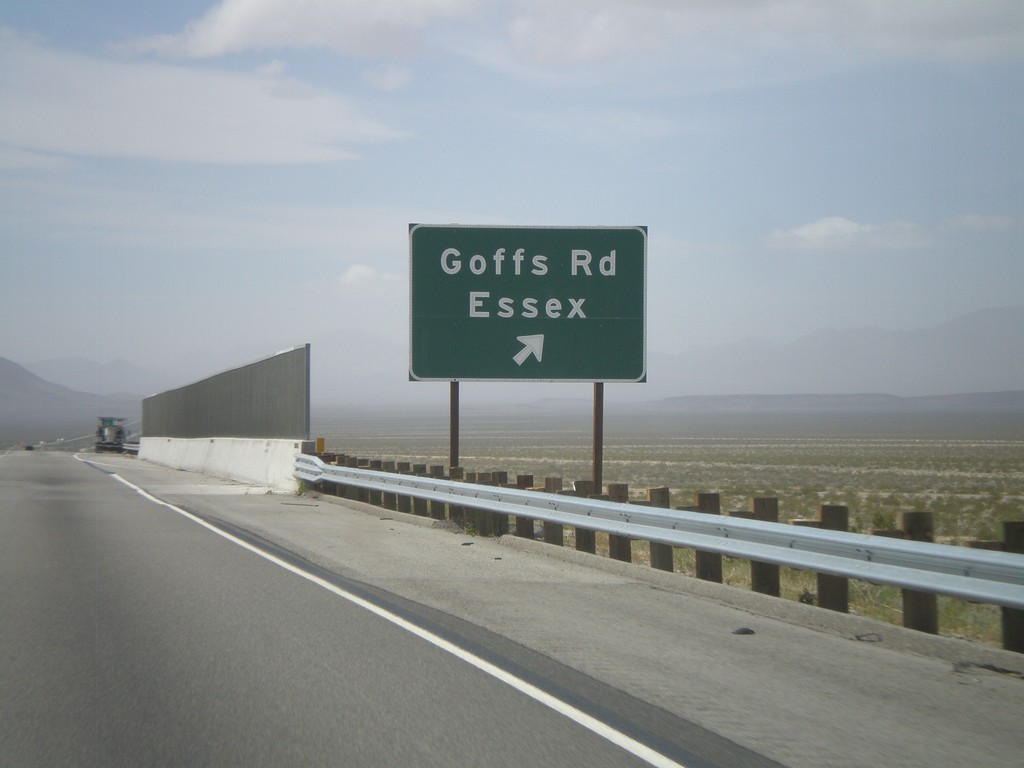
I-40 West - Exit 107
I-40 west at Exit 107 - Goffs Road/Essex.
Taken 02-25-2011
Fenner
San Bernardino County
California
United States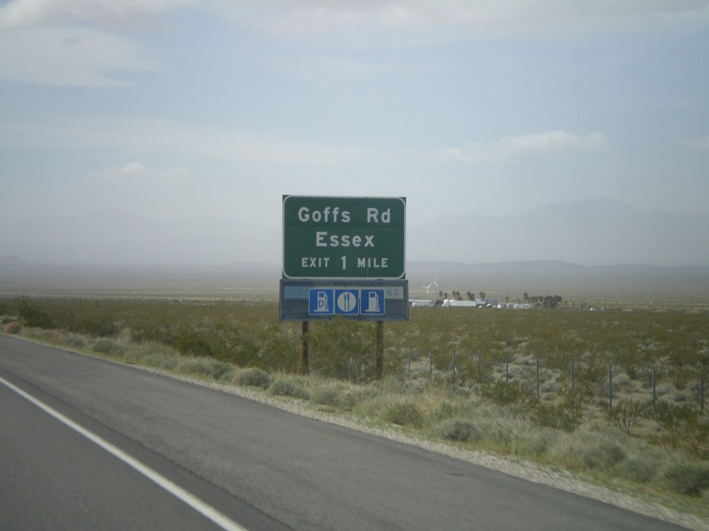
I-40 West Approaching Exit 107
I-40 west approaching Exit 107 - Goffs Road/Essex.
Taken 02-25-2011
Fenner
San Bernardino County
California
United States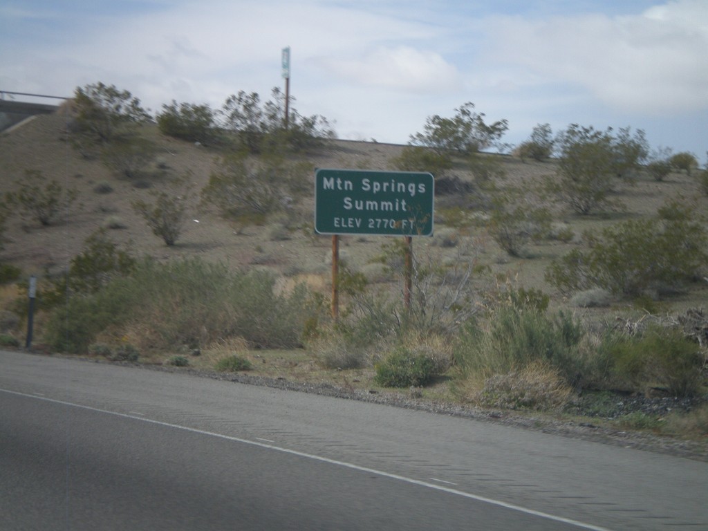
I-40 West - Mountain Springs Summit
I-40 west at Mountain Springs Summit - Elevation 2770 Feet.
Taken 02-25-2011
Goffs
San Bernardino County
California
United States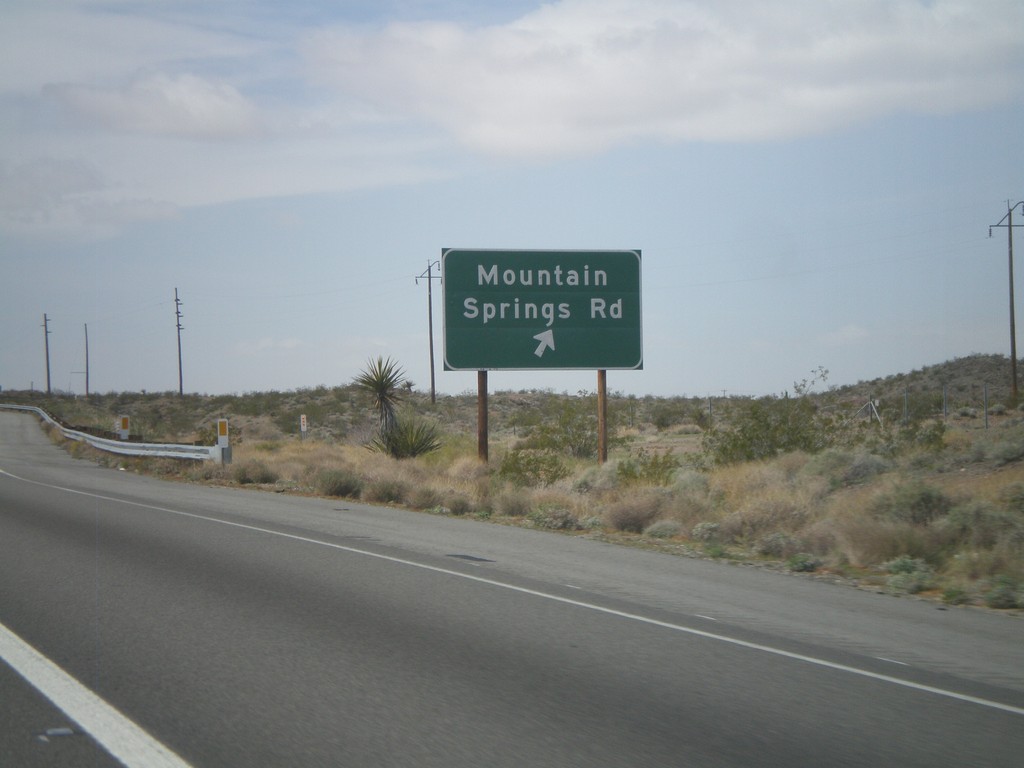
I-40 West - Exit 115
I-40 west at Exit 115 - Mountain Springs Road.
Taken 02-25-2011
Goffs
San Bernardino County
California
United States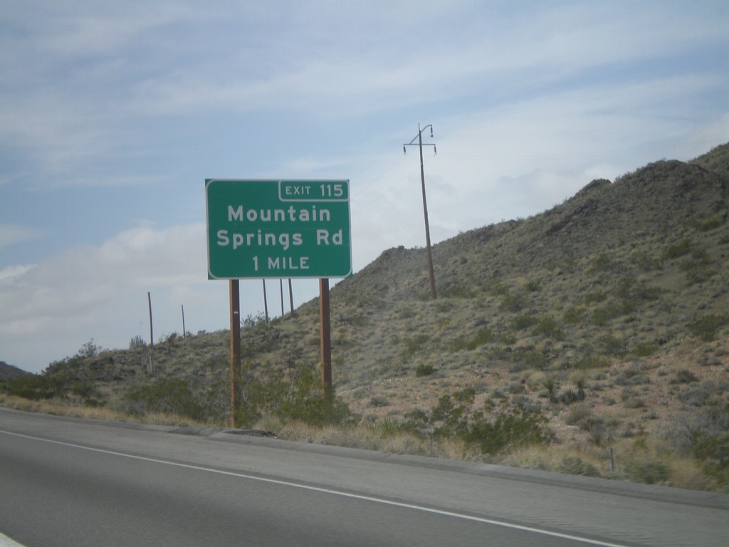
I-40 West Approaching Exit 115
I-40 west approaching Exit 115 - Mountain Springs Road.
Taken 02-25-2011
Goffs
San Bernardino County
California
United States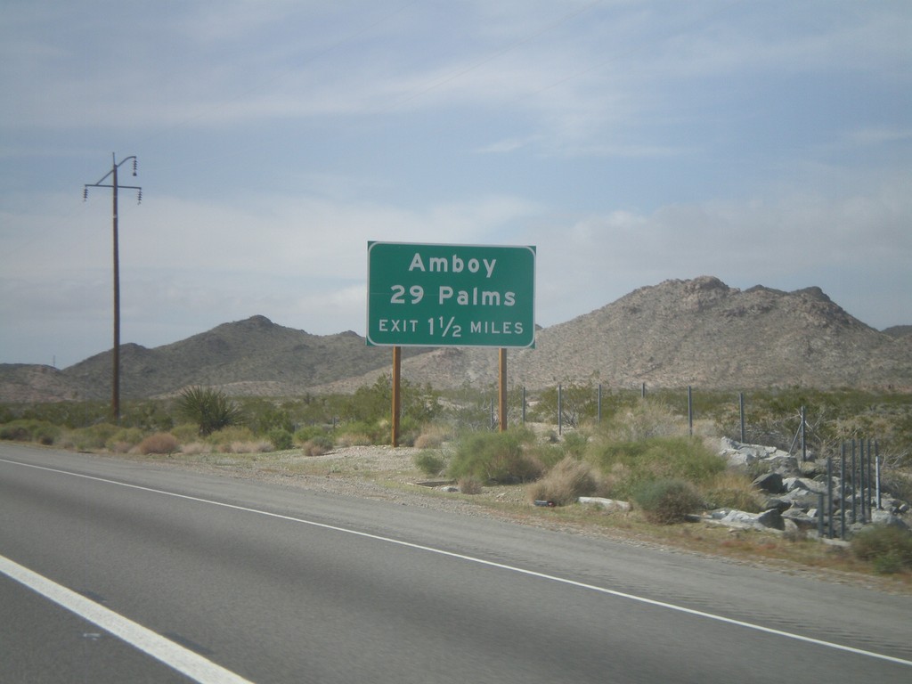
I-40 West Approaching Exit 115
I-40 west approaching Exit 115 - Amboy/29 Palms. The actual text at the offramp is Mountain Springs Road.
Taken 02-25-2011
Goffs
San Bernardino County
California
United States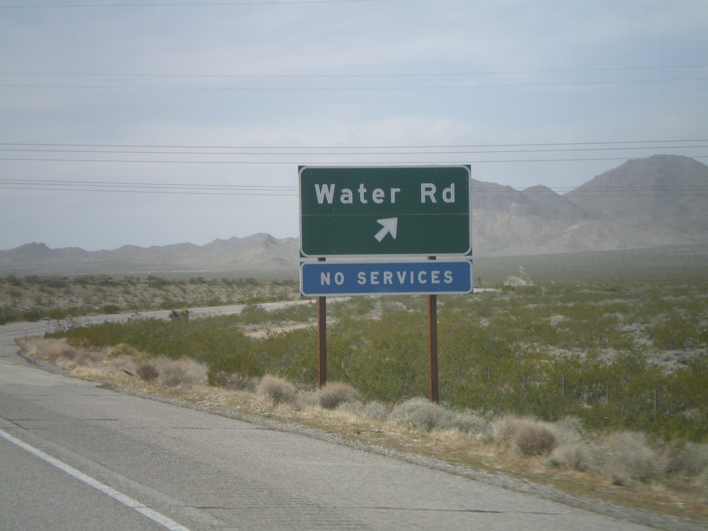
I-40 West - Exit 120
I-40 west at Exit 120 - Water Road.
Taken 02-25-2011
Homer
San Bernardino County
California
United States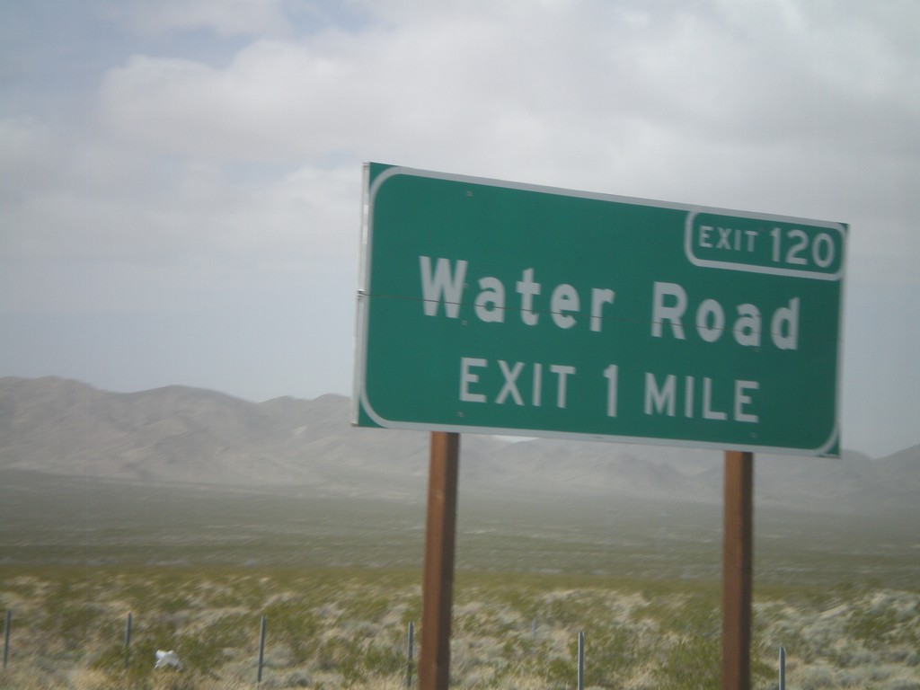
I-40 West Approaching Exit 120
I-40 west approaching Exit 120 - Water Road.
Taken 02-25-2011
Homer
San Bernardino County
California
United States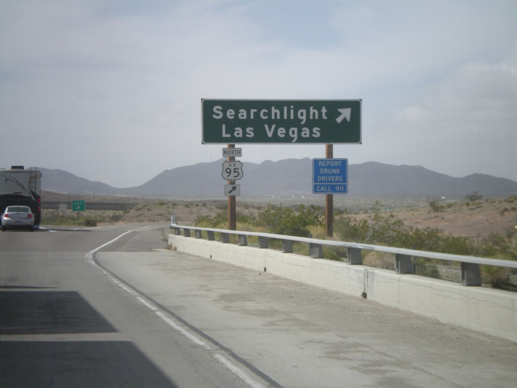
I-40 West - Exit 133
I-40 west at Exit 133 - US-95 North/Searchlight/Las Vegas. US-95 north leaves I-40 westbound here and heads north into Nevada. Eastbound, US-95 south joins I-40 through Needles.
Taken 02-25-2011
 Needles
San Bernardino County
California
United States
Needles
San Bernardino County
California
United States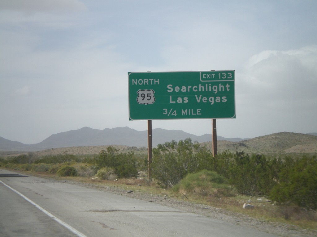
I-40 West Approaching Exit 133
I-40 west approaching Exit 133 - US-95 North/Searchlight/Las Vegas.
Taken 02-25-2011
Needles
San Bernardino County
California
United States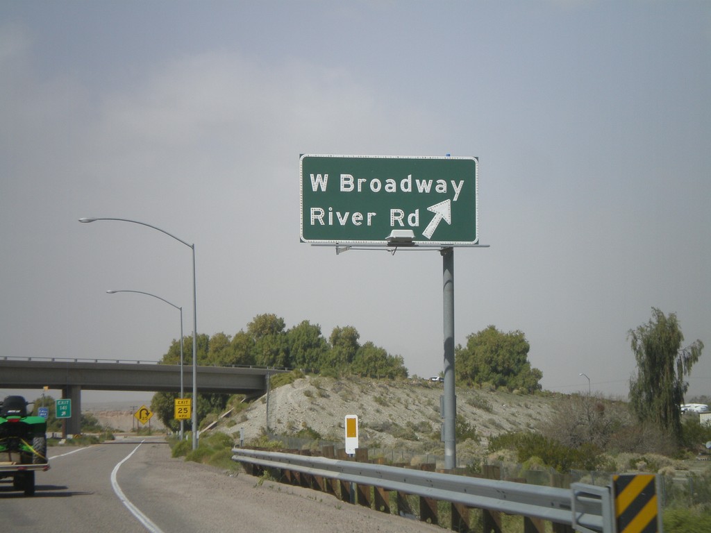
I-40 West - Exit 141
I-40 west at Exit 141 - W. Broadway/River Road. This is the eastern end of the Needles business loop.
Taken 02-25-2011
 Needles
San Bernardino County
California
United States
Needles
San Bernardino County
California
United States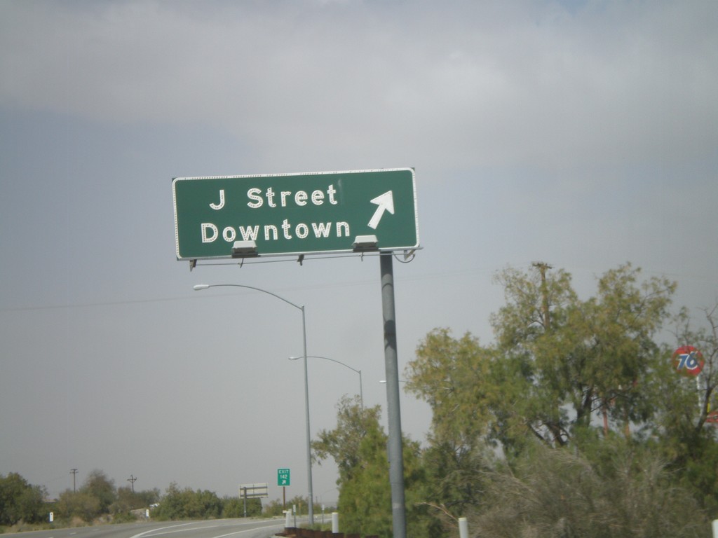
I-40 West - Exit 142
I-40 west at Exit 142 - J St./Downtown.
Taken 02-25-2011
Needles
San Bernardino County
California
United States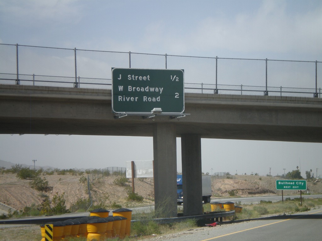
I-40 West - Needles Exits
Needles Exits on I-40 west. The next two exits are J St. and West Broadway/River Road. Sign in background directs Bullhead City (Arizona) traffic to use the J St. exit.
Taken 02-25-2011
Needles
San Bernardino County
California
United States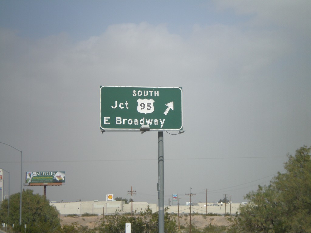
I-40 West - Exit 143
I-40 west at Exit 143 - US-95 South/E. Broadway. US-95 north joins I-40 west through Needles. This is the eastern end of the Needles business loop.
Taken 02-25-2011
Needles
San Bernardino County
California
United States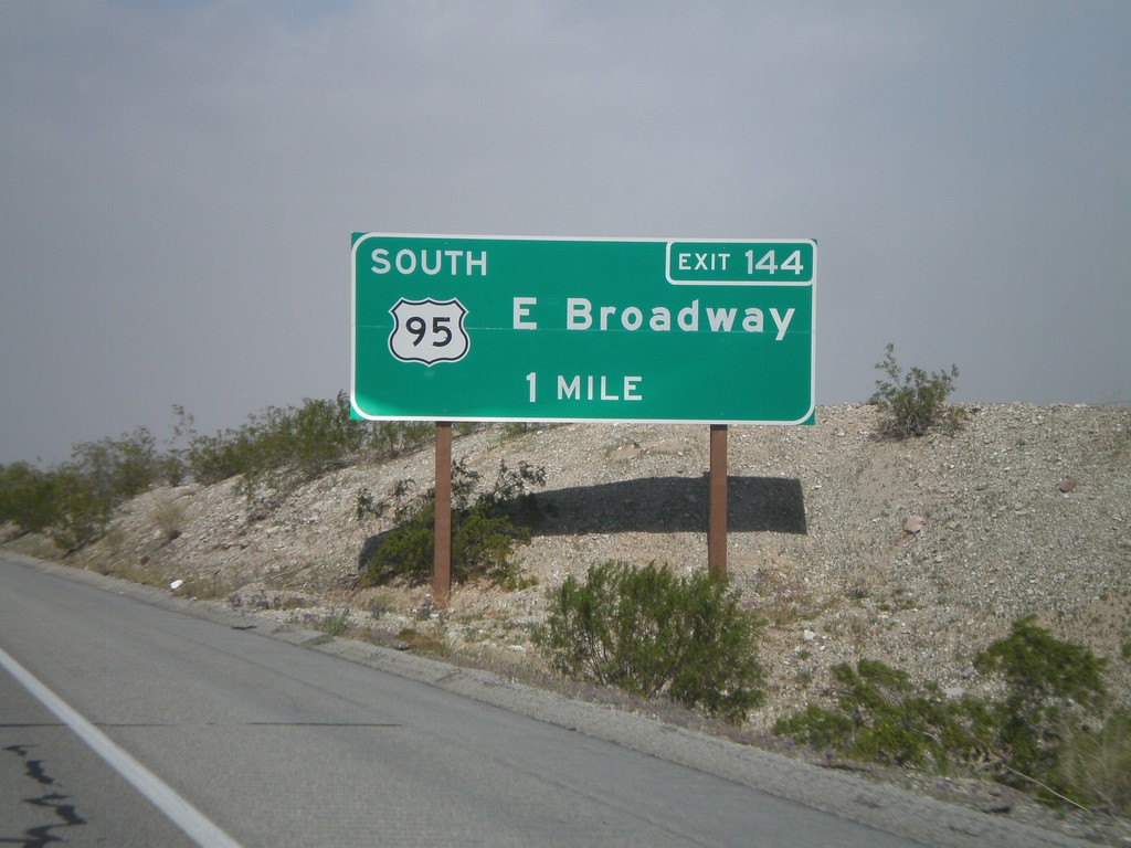
I-40 West Approaching Exit 144
I-40 west approaching Exit 144 - US-95 South/East Broadway.
Taken 02-25-2011
Needles
San Bernardino County
California
United States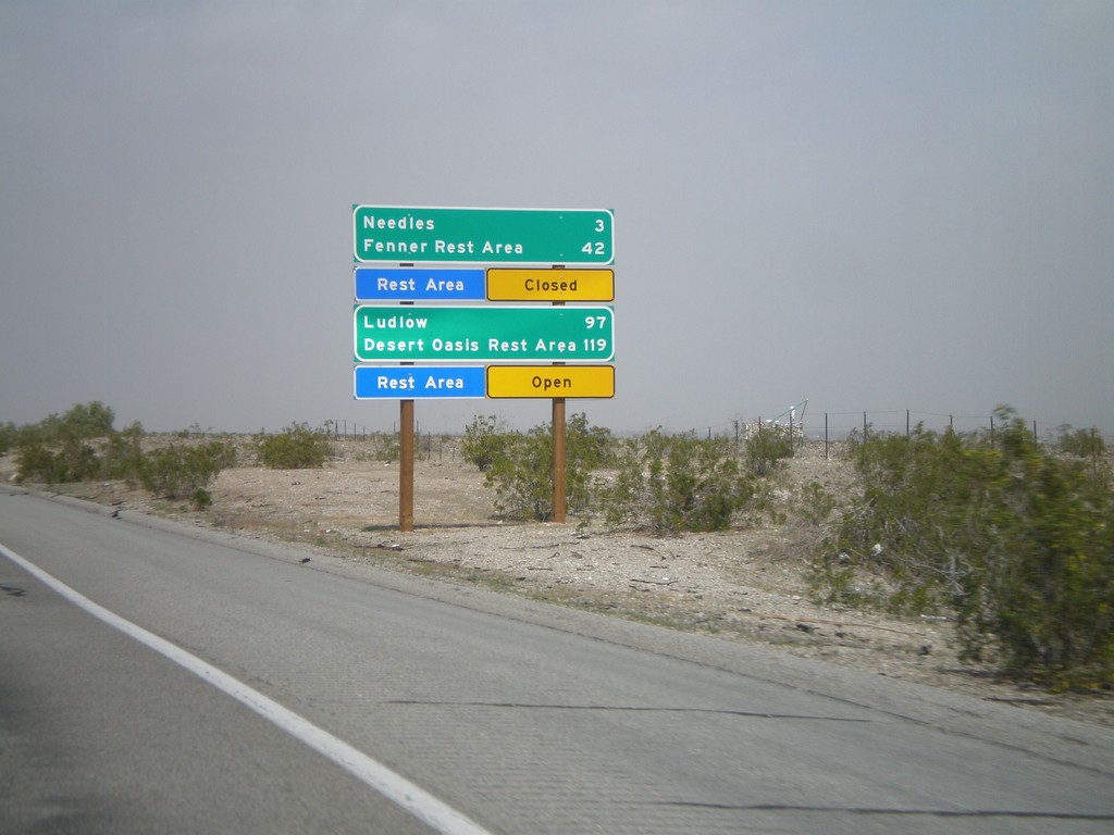
I-40 West - Mojave Desert Services
Services in the Mojave Desert along I-40 west between here and Newberry Springs. Both Needles and Ludlow have services. Also, distance to the next Rest Areas and their status.
Taken 02-25-2011
Needles
San Bernardino County
California
United States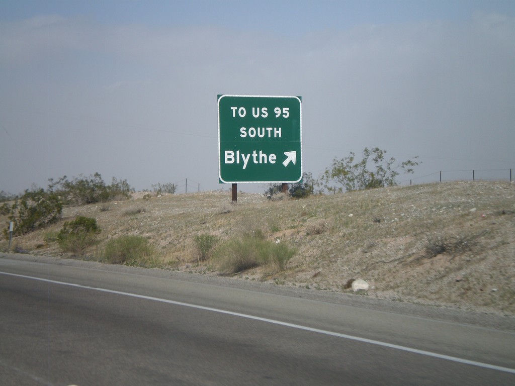
I-40 West - Exit 148
I-40 west at Exit 148 - To US-95 South/Blythe. The US-95 shield is displayed as text on this sign. This exit serves File Mile Road, and provides a cutoff between I-40 and US-95 south.
Taken 02-25-2011
Needles
San Bernardino County
California
United States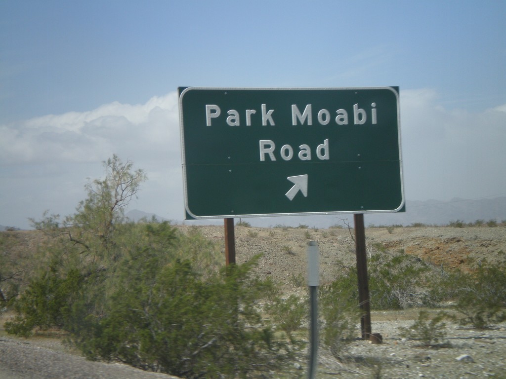
I-40 West - Exit 153
I-40 west at Exit 153 - Park Moabi Road. First California exit on I-40 west.
Taken 02-25-2011
Needles
San Bernardino County
California
United States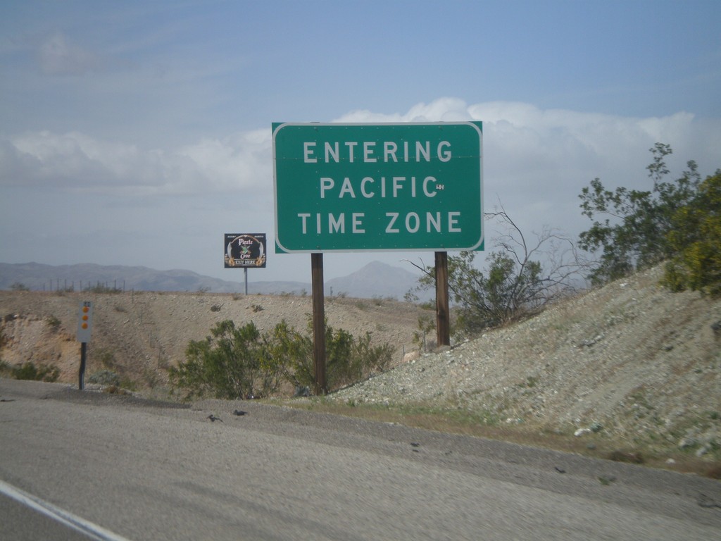
I-40 West - Entering Pacific Time
Entering Pacific Time on I-40 west. Arizona does not observe daylight savings time, so during the summer months Arizona and California are on the same time.
Taken 02-25-2011
Needles
San Bernardino County
California
United States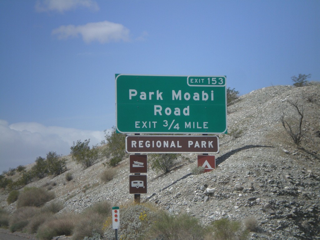
I-40 West Approaching Exit 153
I-40 west approaching Exit 153 - Park Moabi Road. This is the first exit on I-40 inside California westbound.
Taken 02-25-2011
Needles
San Bernardino County
California
United States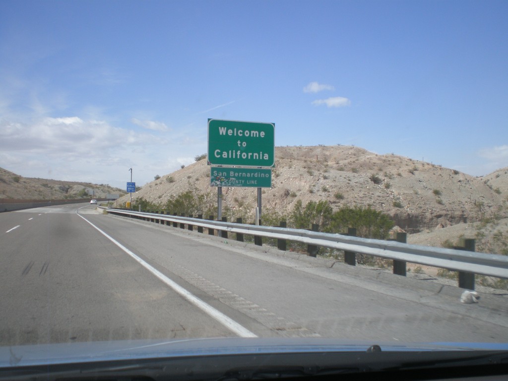
Welcome To California - I-40 West
Welcome to California on I-40 west at the Arizona-California state line crossing the Colorado River. San Bernardino County line.
Taken 02-25-2011
Needles
San Bernardino County
California
United States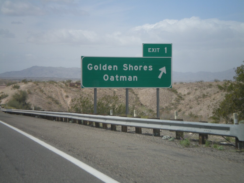
I-40 West - Exit 1
I-40 west at Exit 1 - Golden Shores/Oatman. This is the last exit in Arizona on I-40 westbound.
Taken 02-25-2011
Catfish Paradise
Mohave County
Arizona
United States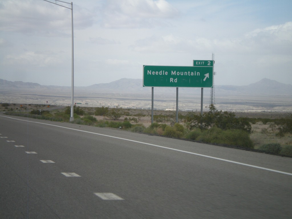
I-40 West - Exit 2
I-40 west at Exit 2 - Needle Mountain Road.
Taken 02-25-2011
Powell
Mohave County
Arizona
United States