Signs Tagged With Big Green Sign
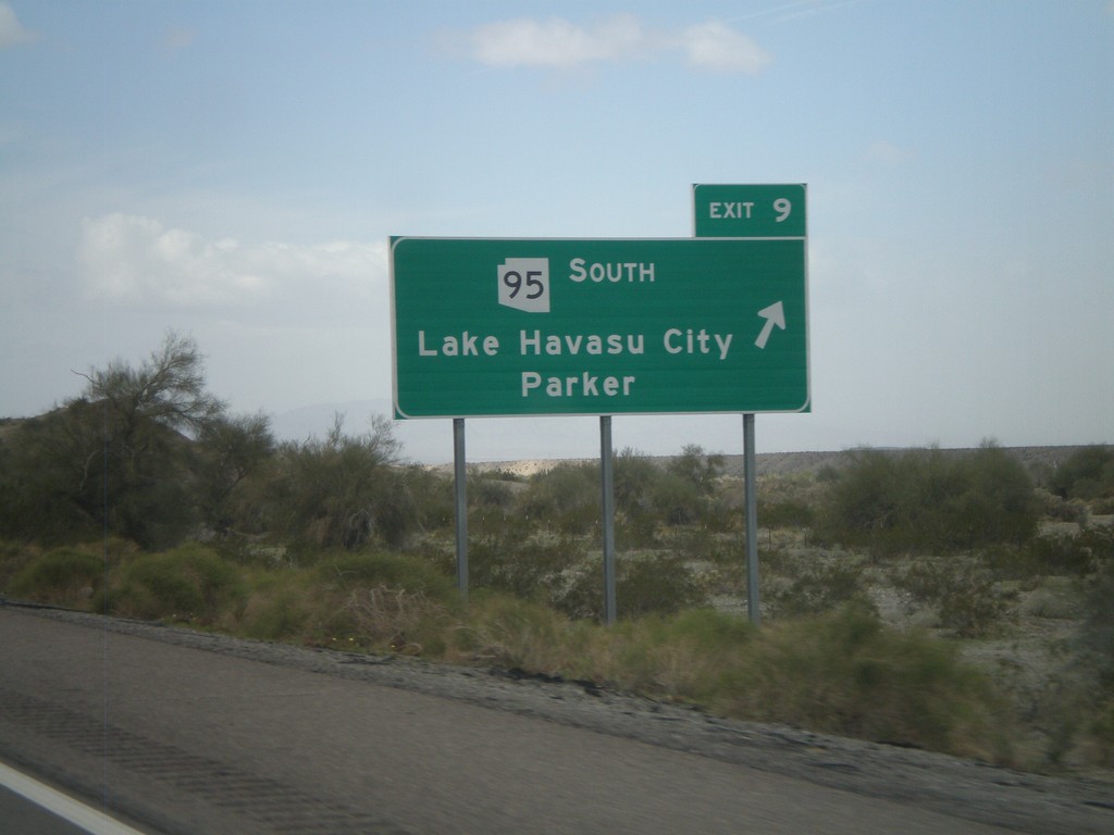
I-40 West - Exit 9
I-40 west at Exit 9 - AZ-95 South/Lake Havasu City/Parker.
Taken 02-25-2011

 Franconia
Mohave County
Arizona
United States
Franconia
Mohave County
Arizona
United States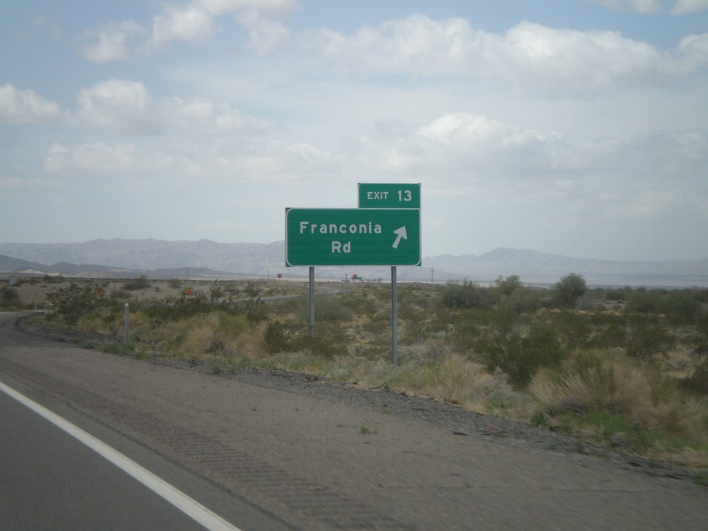
I-40 West - Exit 13
I-40 west at Exit 13 - Franconia Road.
Taken 02-25-2011
Topock
Mohave County
Arizona
United States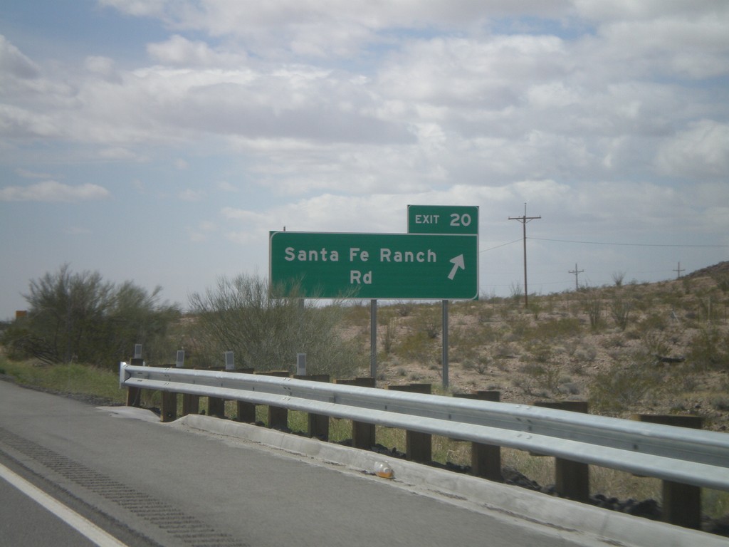
I-40 West - Exit 20
I-40 west at Exit 20 - Santa Fe Ranch Road
Taken 02-25-2011
Haviland
Mohave County
Arizona
United States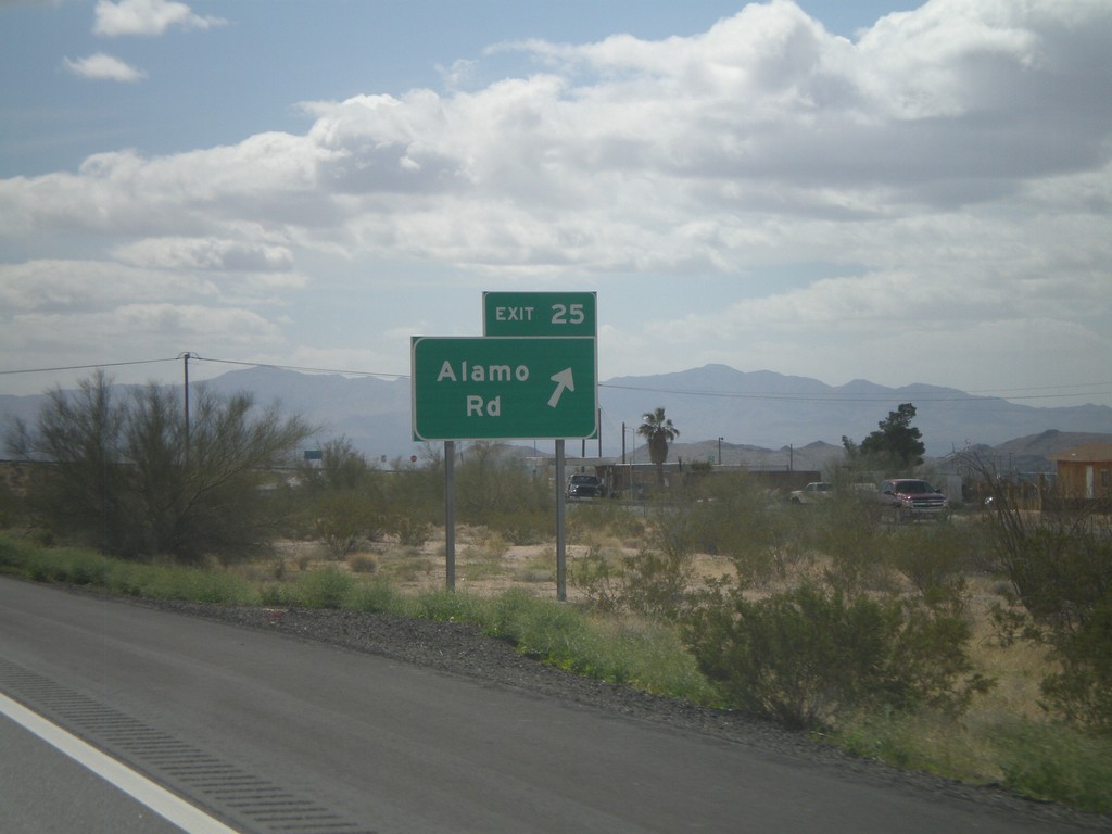
I-40 West - Exit 25
I-40 west at Exit 25 - Alamo Road.
Taken 02-25-2011
Yucca
Mohave County
Arizona
United States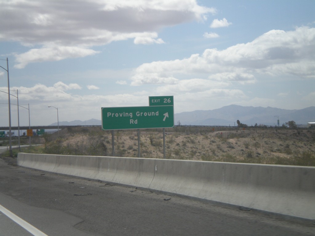
I-40 West - Exit 26
I-40 west at Exit 26 - Proving Ground Road
Taken 02-25-2011
Yucca
Mohave County
Arizona
United States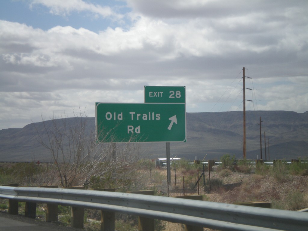
I-40 West - Exit 28
I-40 west at Exit 28 - Old Trails Road.
Taken 02-25-2011
Yucca
Mohave County
Arizona
United States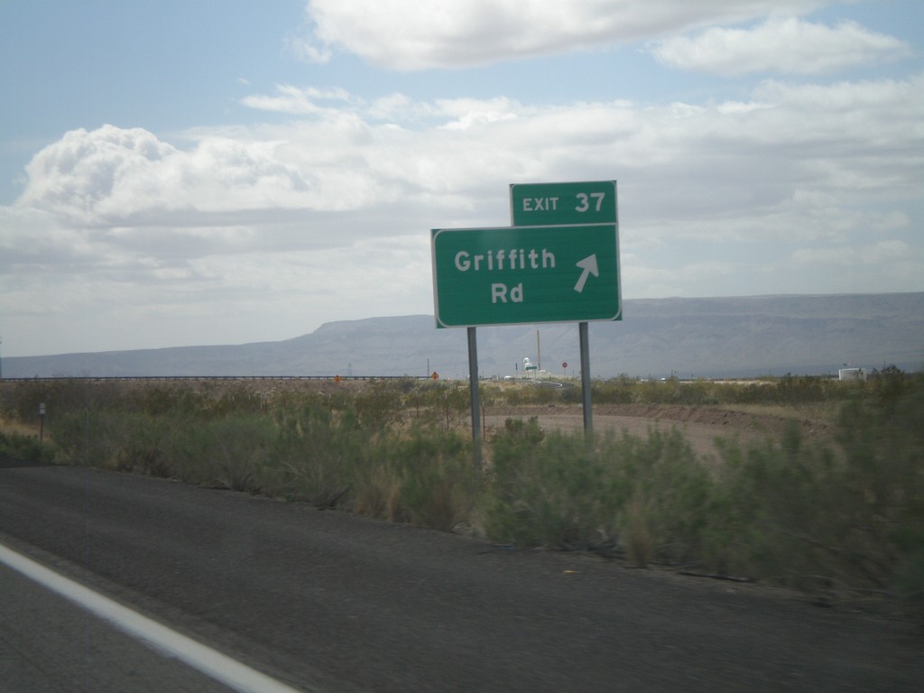
I-40 West - Exit 37
I-40 west at Exit 37 - Griffith Road.
Taken 02-25-2011
Drake
Mohave County
Arizona
United States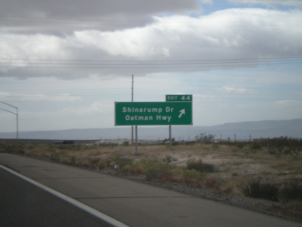
I-40 West - Exit 44
I-40 west at Exit 44 - Shinarump Drive/Oatman Hwy
Taken 02-25-2011
McConnico
Mohave County
Arizona
United States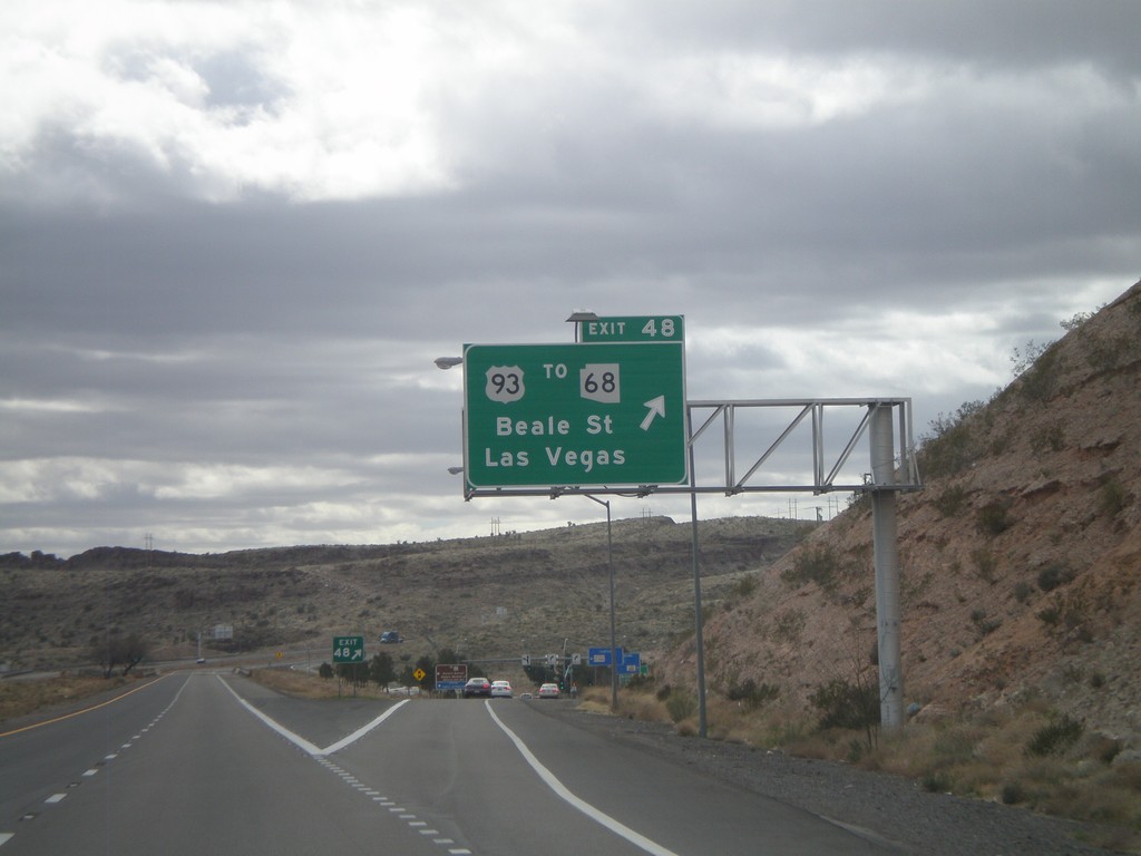
I-40 West - Exit 48
I-40 west at Exit 48 - US-93/To AZ-68/Las Vegas/Beale St. US-93 north leaves I-40 westbound and turns towards Las Vegas. Eastbound, US-93 south joins I-40 through Kingman.
Taken 02-25-2011

 Kingman
Mohave County
Arizona
United States
Kingman
Mohave County
Arizona
United States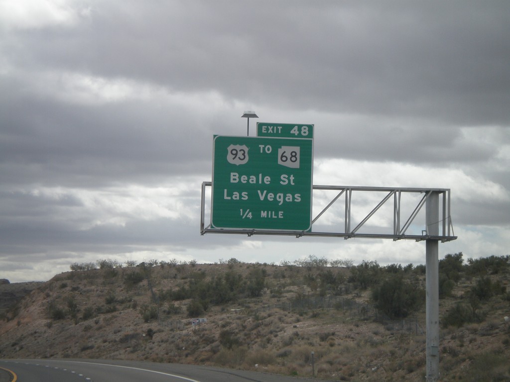
I-40 West Approaching Exit 48
I-40 west approaching Exit 48 - US-93/To AZ-68/Beale st./Las Vegas. AZ-68 leaves US-93 north of Kingman and connects to Bullhead City, Arizona and Laughlin, Nevada.
Taken 02-25-2011
New Kingman-Butler
Mohave County
Arizona
United States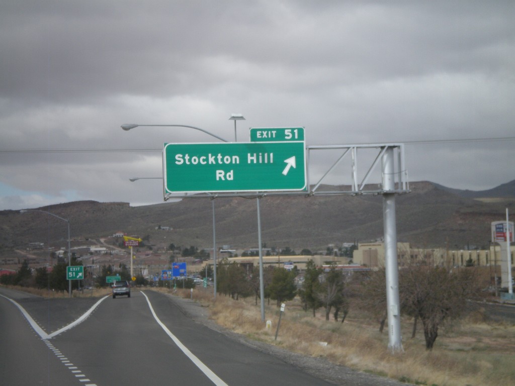
I-40 West - Exit 51
I-40 west at Exit 51 - Stockton Hill Road.
Taken 02-25-2011
Kingman
Mohave County
Arizona
United States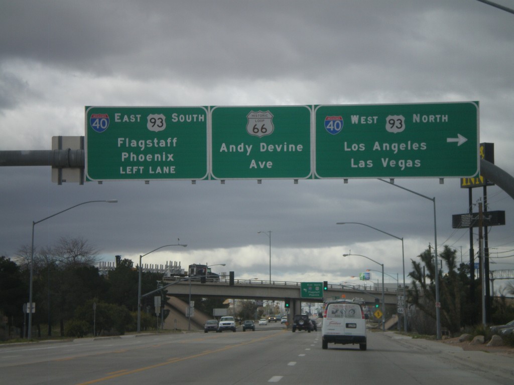
End AZ-66 West At I-40/US-93
End AZ-66 west at I-40/US-93 jct. Use I-40 West/US-93 North for Los Angeles and Las Vegas. Use I-40 East/US-93 South for Phoenix and Flagstaff. Continue straight for Andy Devine Avenue and Historic Loop US-66.
Taken 02-25-2011

 Kingman
Mohave County
Arizona
United States
Kingman
Mohave County
Arizona
United States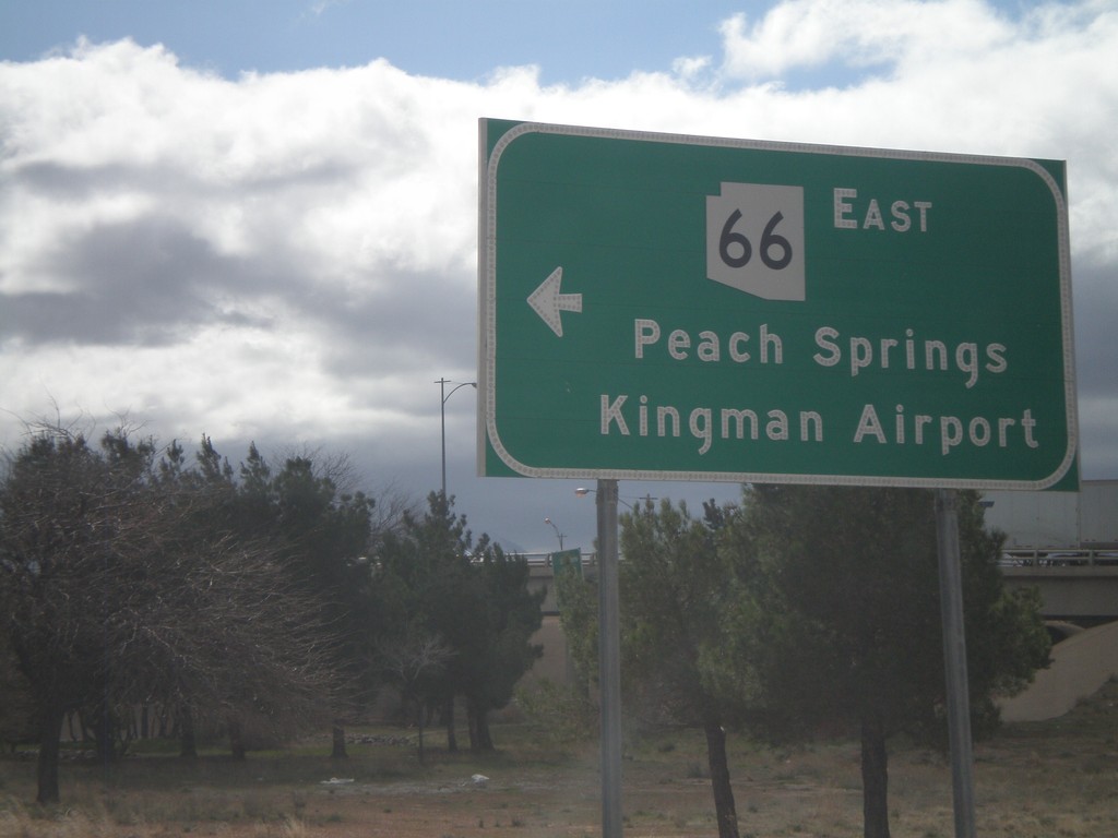
I-40 West at AZ-66
I-40 west at AZ-66 (and Historic Loop US-66) at Exit 53 onramp. Use AZ-66 east for Peach Springs and Kingman Airport.
Taken 02-25-2011
Kingman
Mohave County
Arizona
United States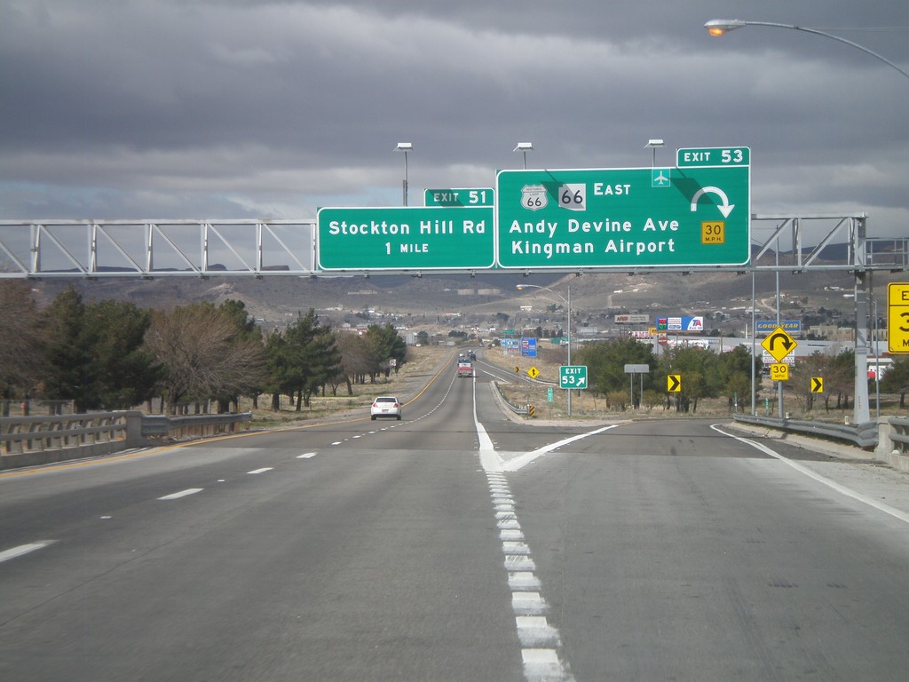
I-40 West - Exits 53 and 51
I-40 west at Exit 53 - Historic Loop US-66/AZ-66 East/Andy Devine Ave./Kingman Airport. Approaching Exit 51 - Stockton Hill Road.
Taken 02-25-2011
Kingman
Mohave County
Arizona
United States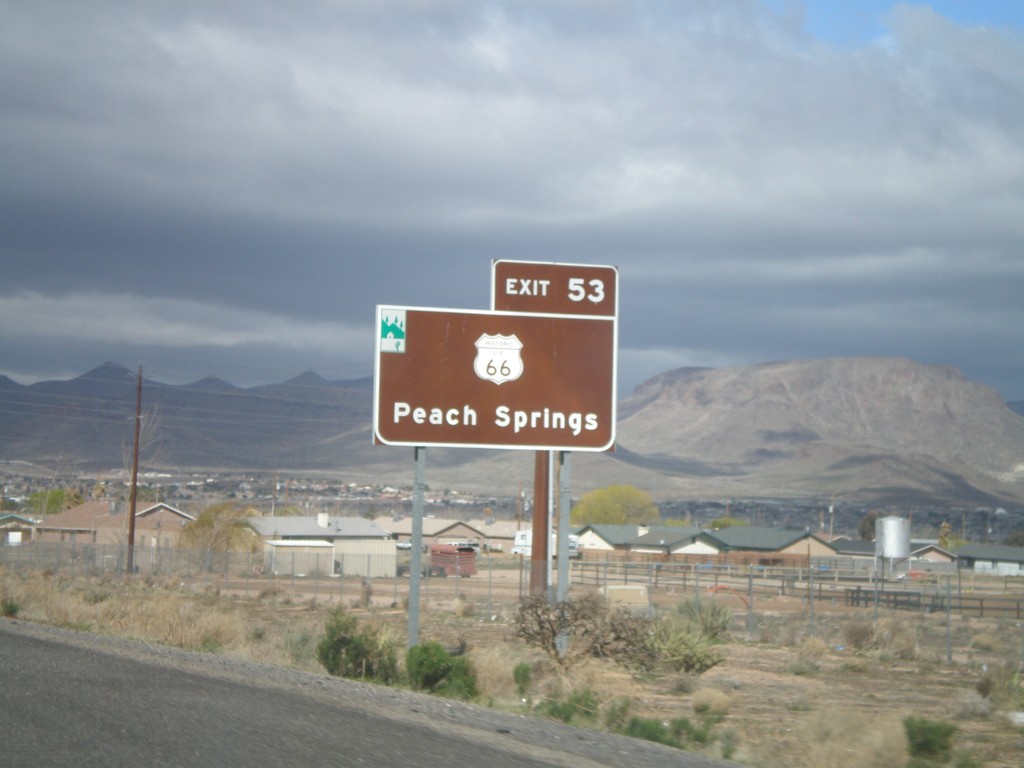
For Historic US-66 Use Exit 53
For Historic US-66 to Peach Springs use Exit 53. The Arizona Scenic Byway symbol is on the top left of this sign. Historic US-66 through Arizona between Topock and Ash Fork is called the Historic Route 66 National Scenic Byway.
Taken 02-25-2011
Kingman
Mohave County
Arizona
United States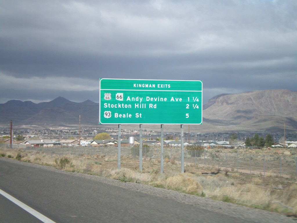
I-40 West - Kingman Exits
Kingman exits on I-40 west: Historic Loop US-66/AZ-66/Andy Devine Ave., Stockton Hill Road, US-93 Beale St.
Taken 02-25-2011
Kingman
Mohave County
Arizona
United States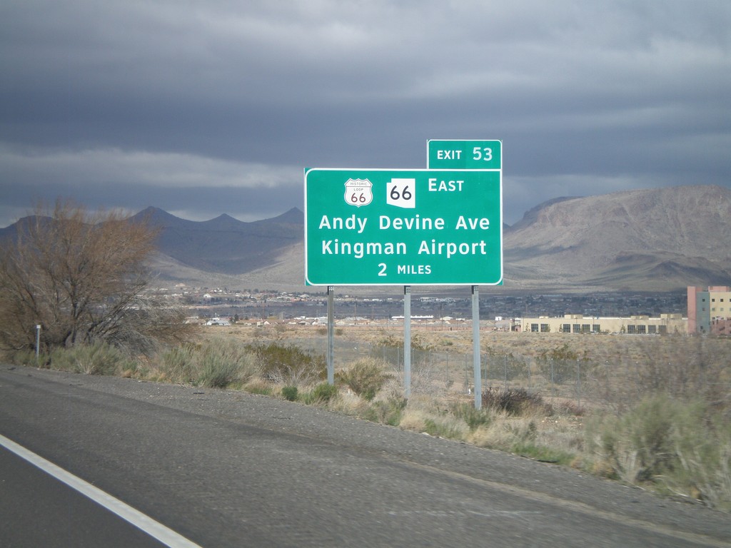
I-40 West Approaching Exit 53
I-40 west approaching Exit 53 - Historic Loop US-66/AZ-66 East/Andy Devine Ave./Kingman Airport.
Taken 02-25-2011
Kingman
Mohave County
Arizona
United States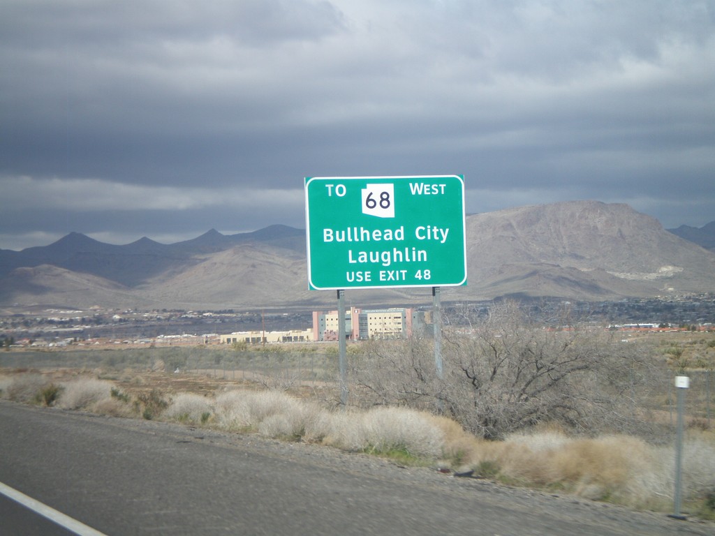
I-40 West - AZ-68 Traffic Use Exit 48
AZ-68 traffic for Bullhead City, and Laughlin (Nevada), use Exit 48. This sign is posted on the east end of Kingman approaching Exit 53.
Taken 02-25-2011
Kingman
Mohave County
Arizona
United States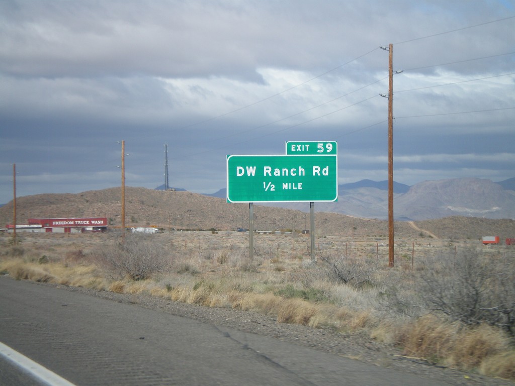
I-40 West Approaching Exit 59
I-40 west approaching Exit 59 - DW Ranch Road.
Taken 02-25-2011
Kingman
Mohave County
Arizona
United States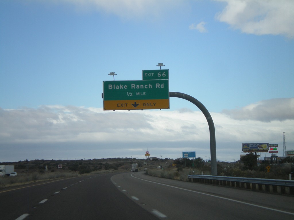
I-40 West Approaching Exit 66
I-40 west approaching Exit 66 - Blake Ranch Road.
Taken 02-25-2011
Kingman
Mohave County
Arizona
United States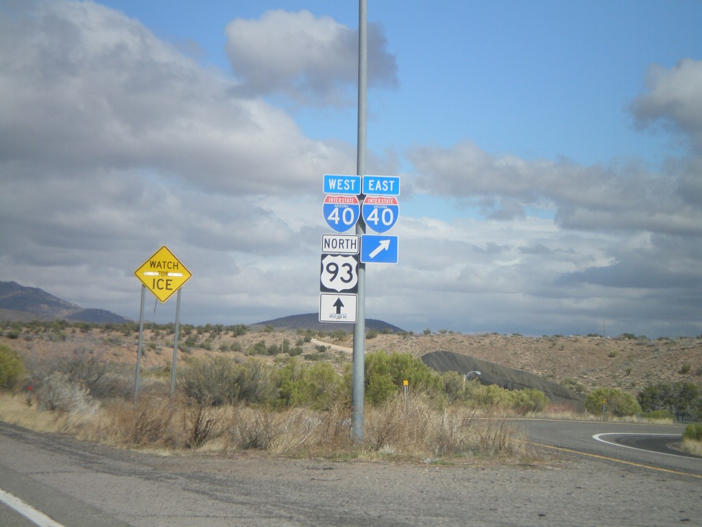
US-93 North at I-40
US-93 north at I-40. US-93 north joins I-40 west through Kingman.
Taken 02-25-2011
Kingman
Mohave County
Arizona
United States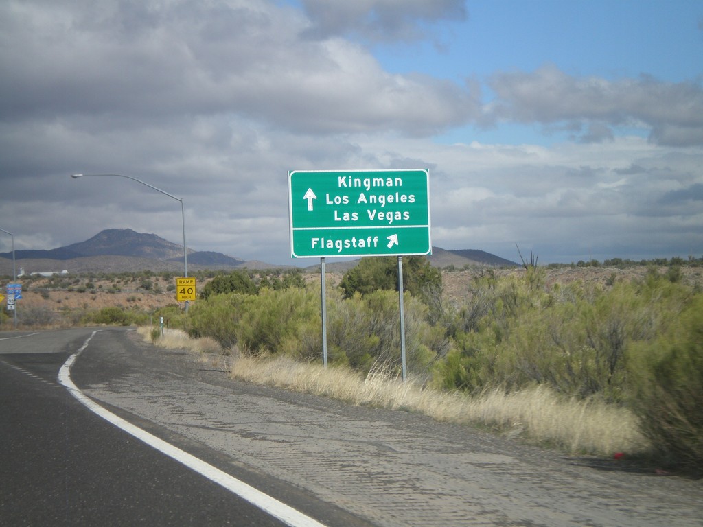
US-93 North at I-40
US-93 north at I-40. Use I-40 West/US-93 north for Kingman/Los Angeles/Las Vegas. Use I-40 east for Flagstaff. US-93 north joins I-40 west through Kingman.
Taken 02-25-2011
Kingman
Mohave County
Arizona
United States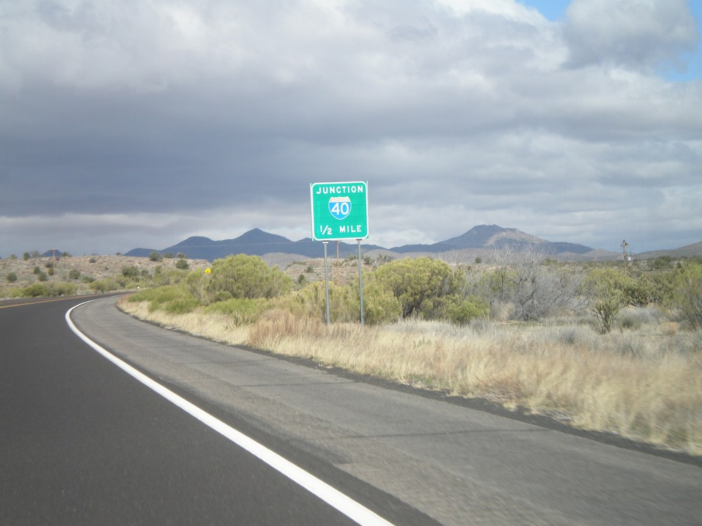
US-93 North Approaching I-40
US-93 north approaching I-40, one-half mile.
Taken 02-25-2011
Kingman
Mohave County
Arizona
United States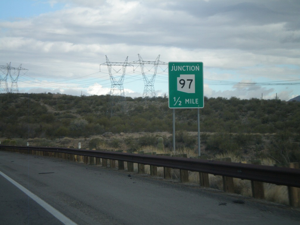
US-93 North Approaching AZ-97
US-93 north approaching AZ-97.
Taken 02-25-2011
 Bagdad
Yavapai County
Arizona
United States
Bagdad
Yavapai County
Arizona
United States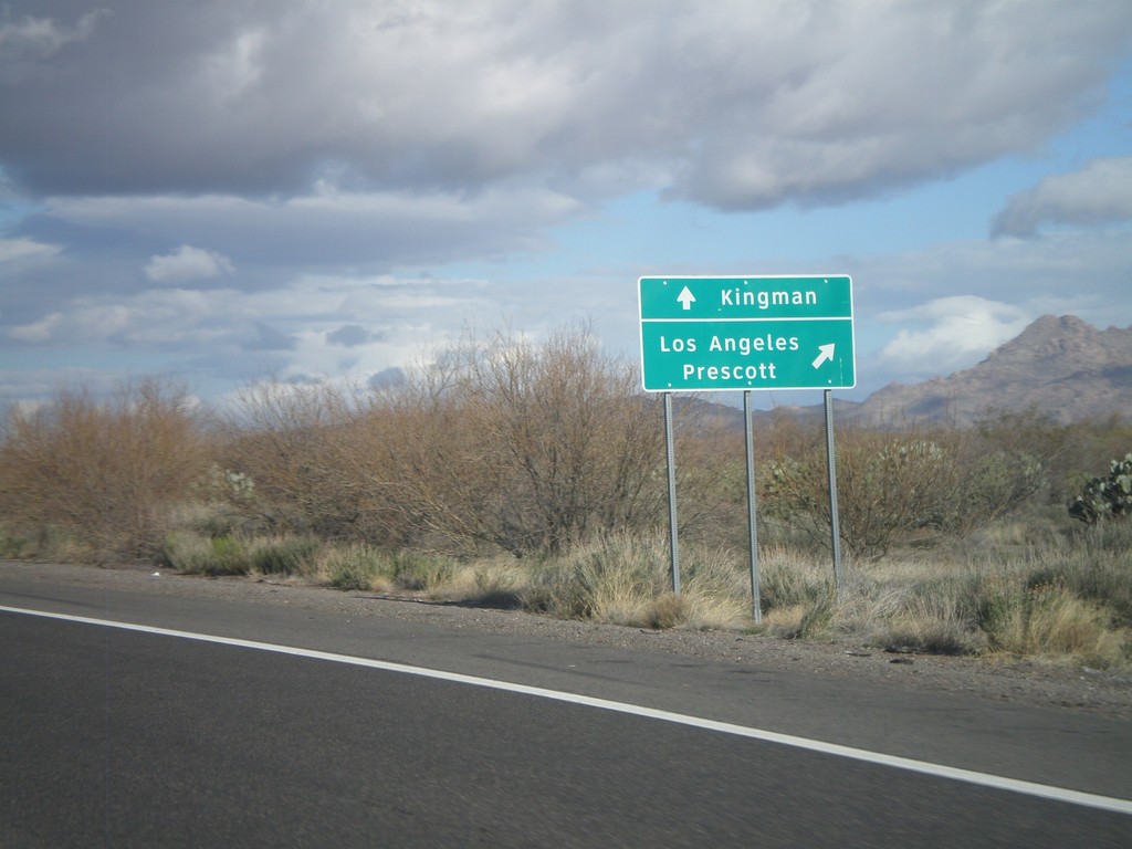
US-93 North at AZ-71
US-93 north at AZ-71 to Los Angeles and Prescott. Continue north on US-93 for Kingman.
Taken 02-25-2011
 Congress
Yavapai County
Arizona
United States
Congress
Yavapai County
Arizona
United States