Signs Tagged With Big Green Sign
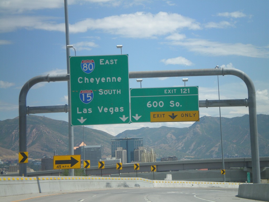
I-80 East - Exit 121
I-80 east at Exit 121 - 600 South. This exit is located on the merge between I-15 South and I-80 East. Use I-80 East for Cheyenne, and I-15 South for Las Vegas.
Taken 07-31-2010

 Salt Lake City
Salt Lake County
Utah
United States
Salt Lake City
Salt Lake County
Utah
United States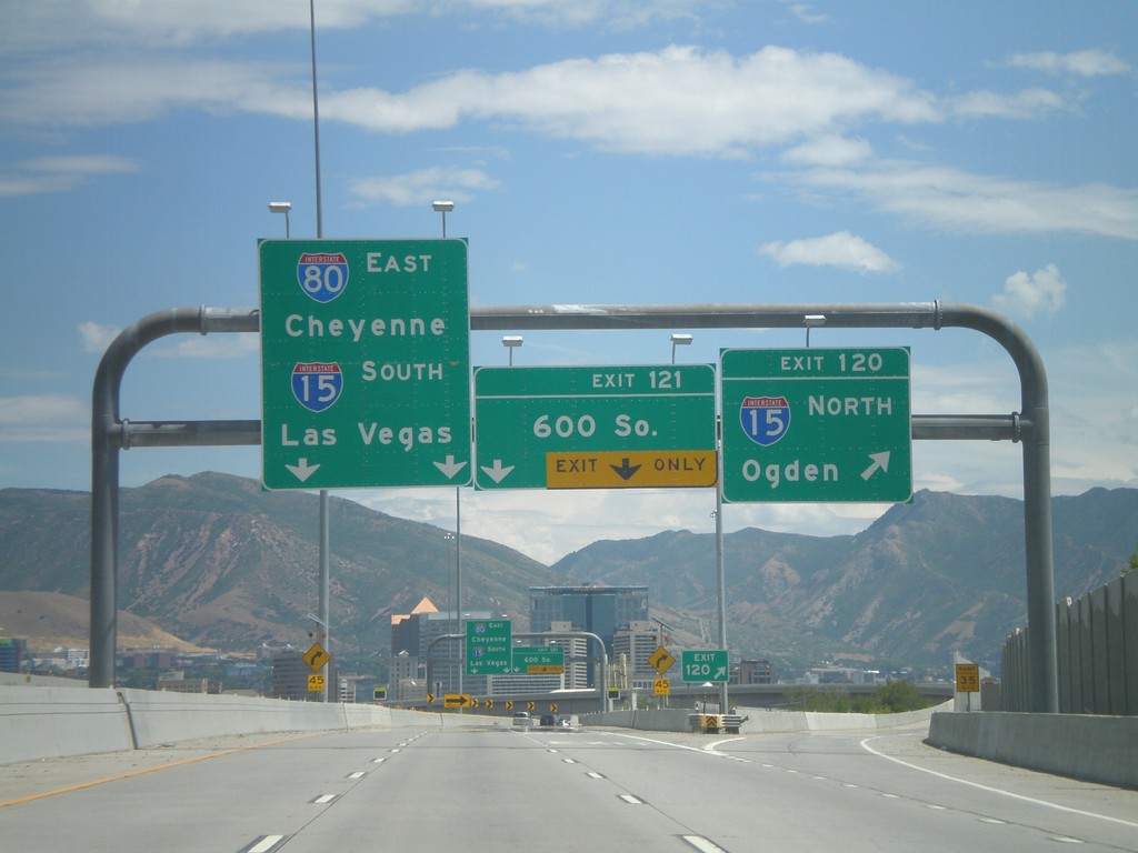
I-80 East - Exits 120 and 121
I-80 east at Exit 120 - I-15 North/Ogden. Approaching Exit 121 - 600 South. I-15 and I-80 join briefly through Salt Lake City. Continue on I-80 East for Cheyenne, and I-15 South for Las Vegas.
Taken 07-31-2010
Salt Lake City
Salt Lake County
Utah
United States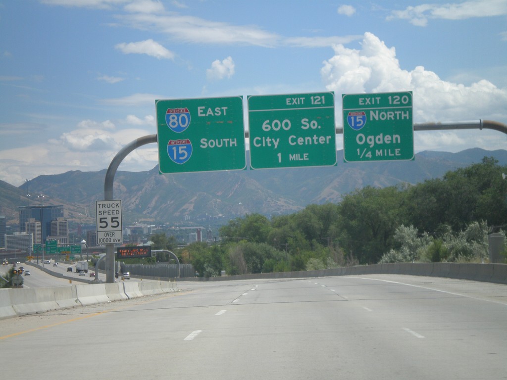
I-80 East - Exits 120 and 121
I-80 east approaching Exit 120 - I-15 North/Ogden. Also approaching Exit 121 - 600 South. Use left lanes for I-80 East and I-15 South.
Taken 07-31-2010
Salt Lake City
Salt Lake County
Utah
United States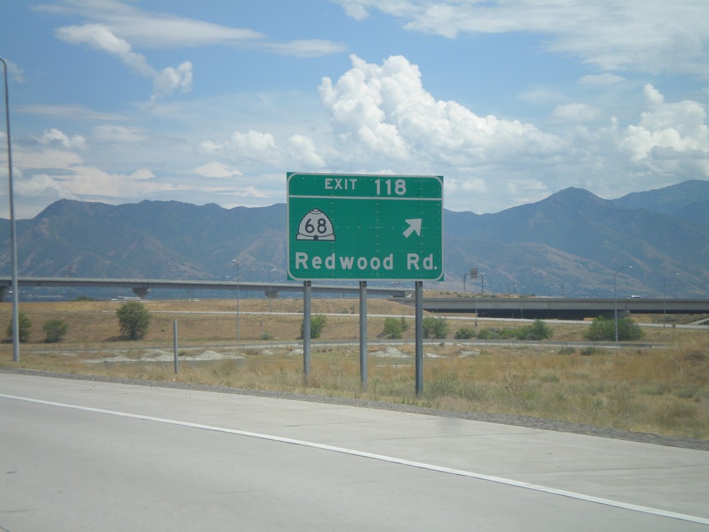
I-80 East - Exit 118
I-80 east at Exit 118 - UT-68/Redwood Road.
Taken 07-31-2010
 Salt Lake City
Salt Lake County
Utah
United States
Salt Lake City
Salt Lake County
Utah
United States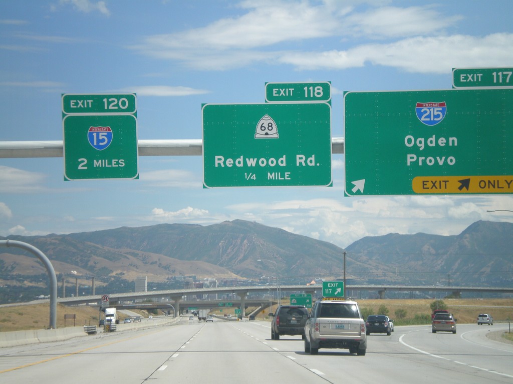
I-80 East - Exit 117. Approaching Exits 118 and 120
I-80 east at Exit 117 - I-215/Odgen/Provo. I-215 is the Salt Lake City Belt Route. Approaching Exit 118 - UT-68/Redwood Road, and Exit 120 - I-15.
Taken 07-31-2010
 Salt Lake City
Salt Lake County
Utah
United States
Salt Lake City
Salt Lake County
Utah
United States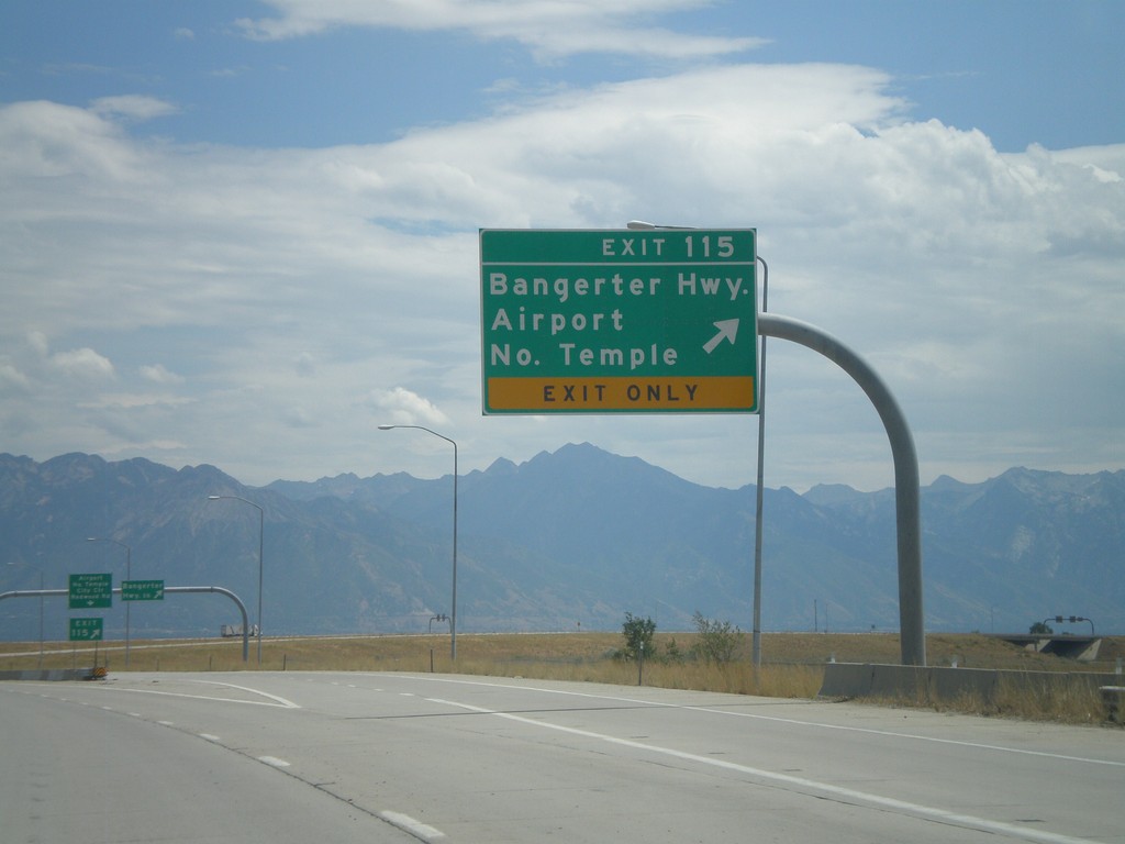
I-80 East - Exit 115
I-80 east at Exit 115 - Bangerter Highway/Airport/North Temple. Use Exit 115 for the Salt Lake City International Airport.
Taken 07-31-2010
Salt Lake City
Salt Lake County
Utah
United States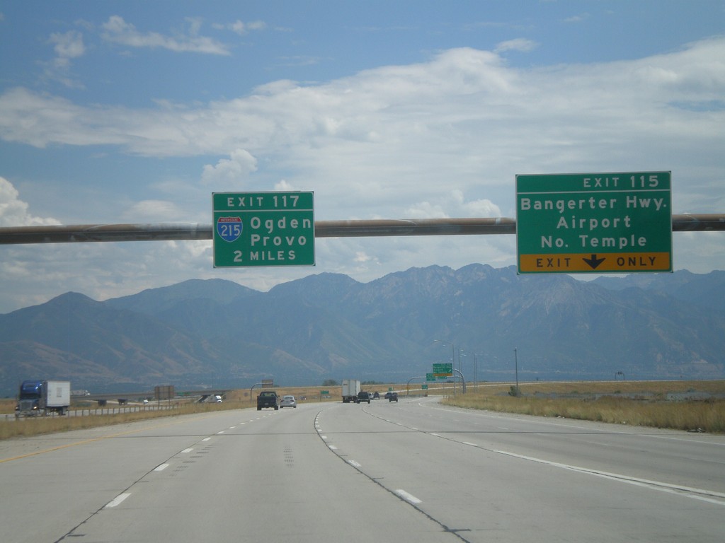
I-80 East - Exits 115 and Exit 117.
I-80 east at Exit 115 - Bangerter Highway/Airport/North Temple. Approaching Exit 117 - I-215/Ogden/Provo.
Taken 07-31-2010
Salt Lake City
Salt Lake County
Utah
United States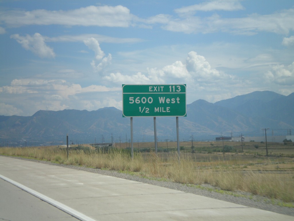
I-80 East - Exit 113
I-80 east approaching Exit 113 - 5600 West.
Taken 07-31-2010
 Salt Lake City
Salt Lake County
Utah
United States
Salt Lake City
Salt Lake County
Utah
United States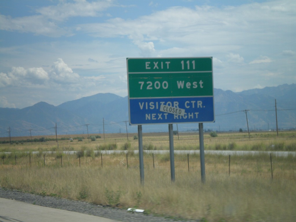
I-80 East - Exit 111
I-80 east approaching Exit 111 - 7200 West.
Taken 07-31-2010
Salt Lake City
Salt Lake County
Utah
United States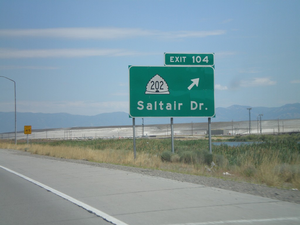
I-80 East - Exit 104
I-80 east at Exit 104 - UT-202/Saltair Drive.
Taken 07-31-2010
 Magna
Salt Lake County
Utah
United States
Magna
Salt Lake County
Utah
United States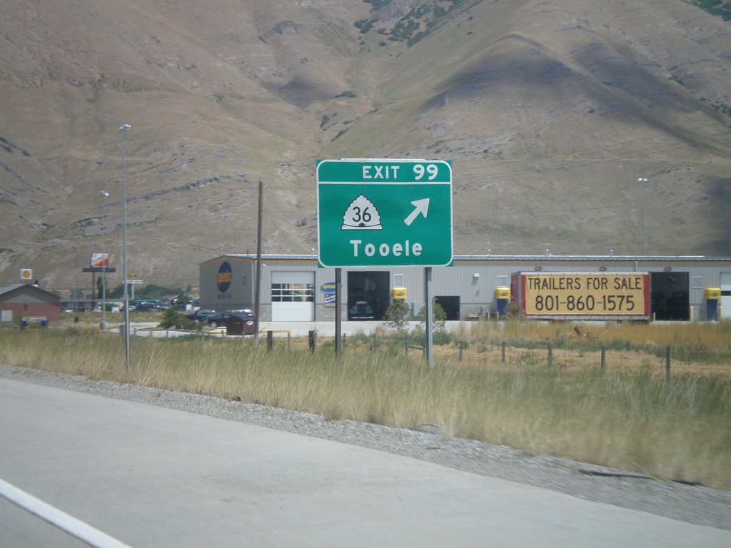
I-80 East - Exit 99
I-80 east at Exit 99 - UT-36/Tooele.
Taken 07-31-2010
 Tooele
 County
Utah
United States
Tooele
Tooele County
Utah
United States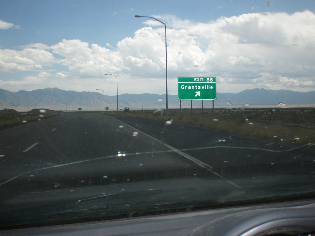
I-80 East - Exit 88
I-80 east at Exit 88 - Grantsville.
Taken 07-31-2010
Grantsville
Tooele County
Utah
United States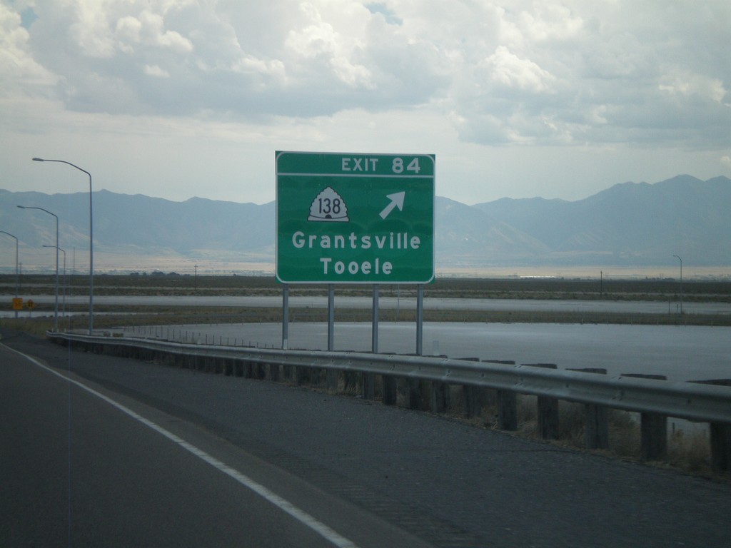
I-80 East - Exit 84
I-80 east at Exit 84 - UT-138/Grantsville/Tooele.
Taken 07-31-2010
 Grantsville
Tooele County
Utah
United States
Grantsville
Tooele County
Utah
United States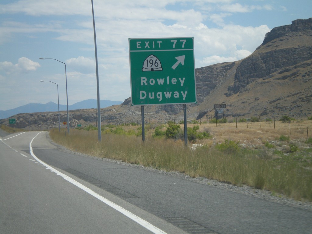
I-80 East - Exit 77
I-80 east at Exit 77 - UT-196/Rowley/Dugway.
Taken 07-31-2010
 Grantsville
Tooele County
Utah
United States
Grantsville
Tooele County
Utah
United States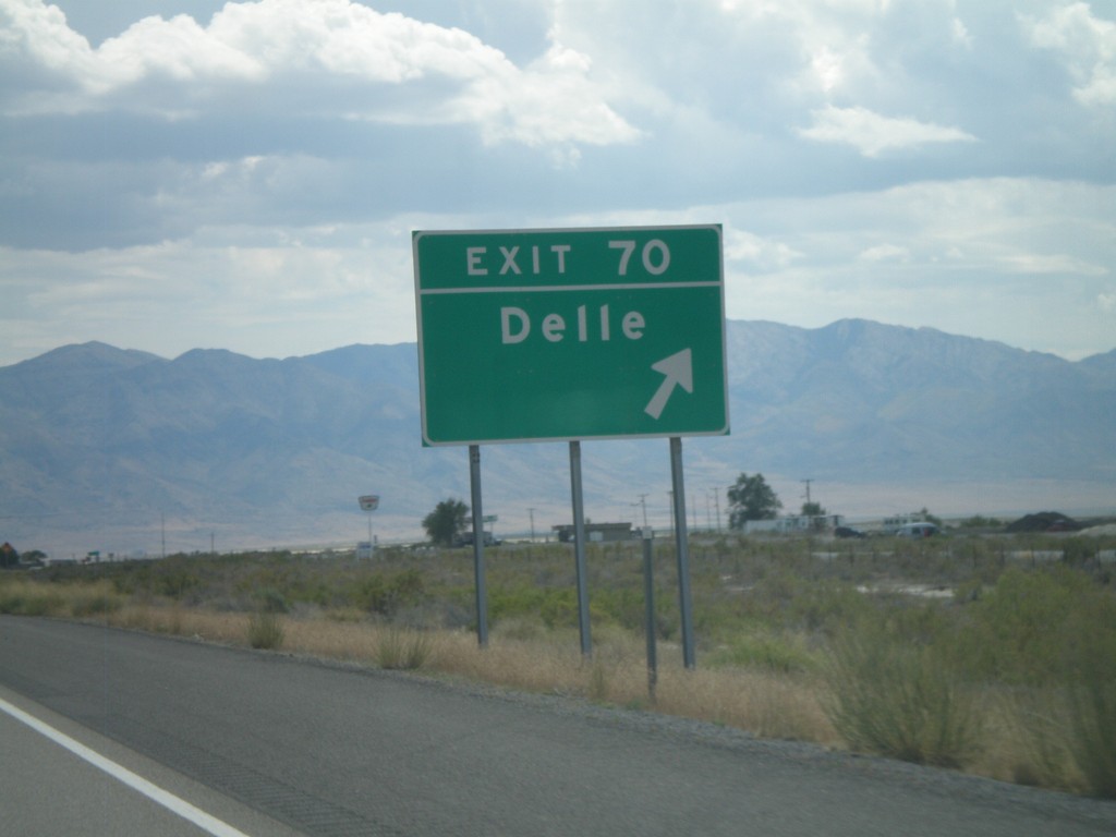
I-80 East - Exit 70
I-80 east at Exit 70 - Delle. Delle is the last fuel westbound to Wendover, in 68 miles.
Taken 07-31-2010
Grantsville
Tooele County
Utah
United States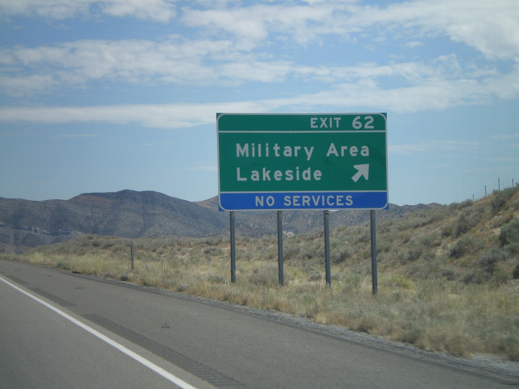
I-80 East - Exit 62
I-80 east at Exit 62 - Military Area/Lakeside.
Taken 07-31-2010
Aragonite
Tooele County
Utah
United States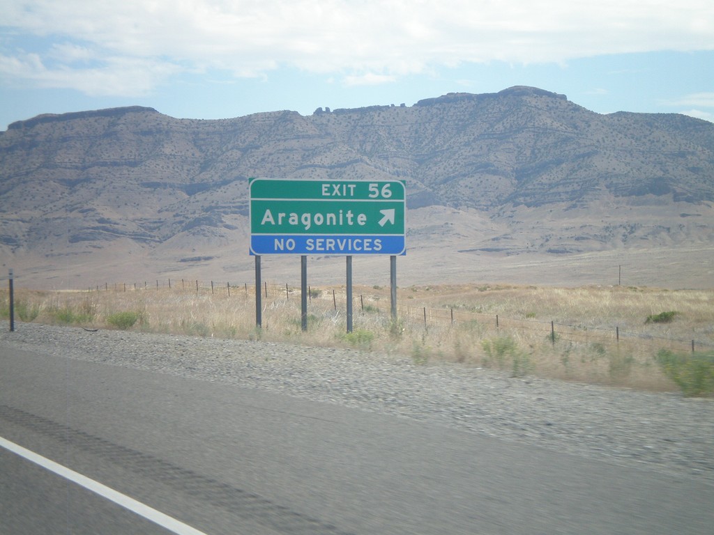
I-80 East - Exit 56
I-80 east at Exit 56 - Aragonite.
Taken 07-31-2010
Aragonite
Tooele County
Utah
United States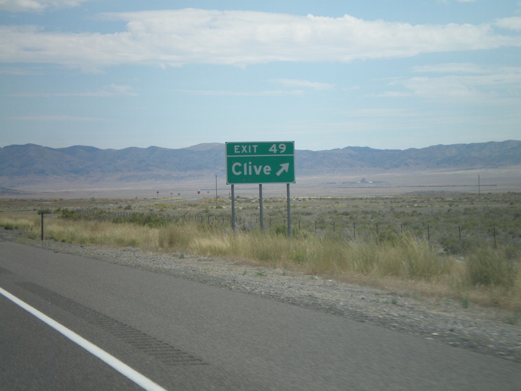
I-80 East - Exit 49
I-80 east at Exit 49 - Clive.
Taken 07-31-2010
Aragonite
Tooele County
Utah
United States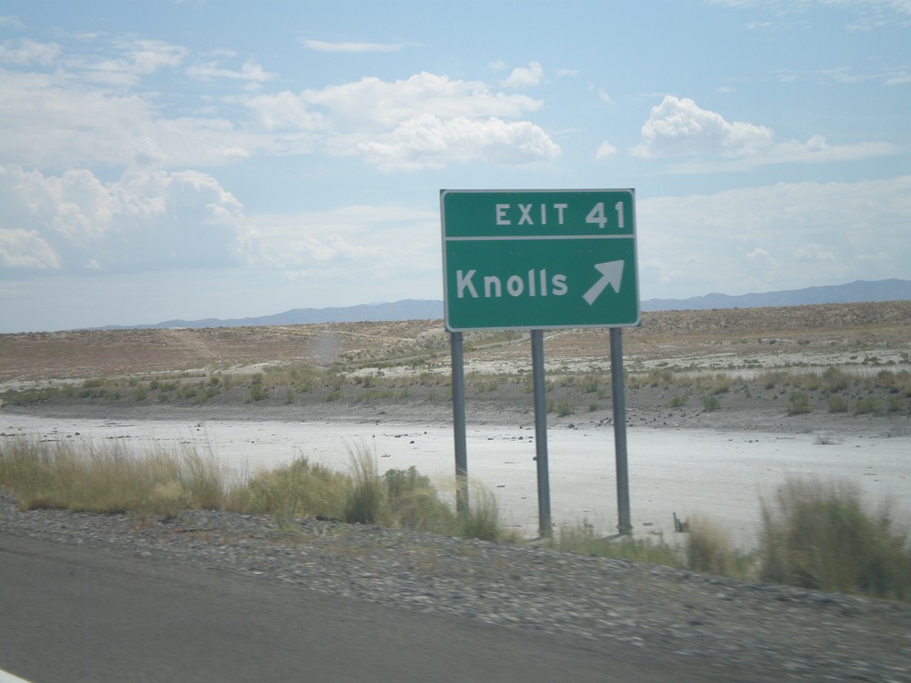
I-80 East - Exit 41
I-80 east at Exit 41 - Knolls. Knolls is at the eastern end of the Salt Flats. The next exit westbound is in 37 miles.
Taken 07-31-2010
Wendover
Tooele County
Utah
United States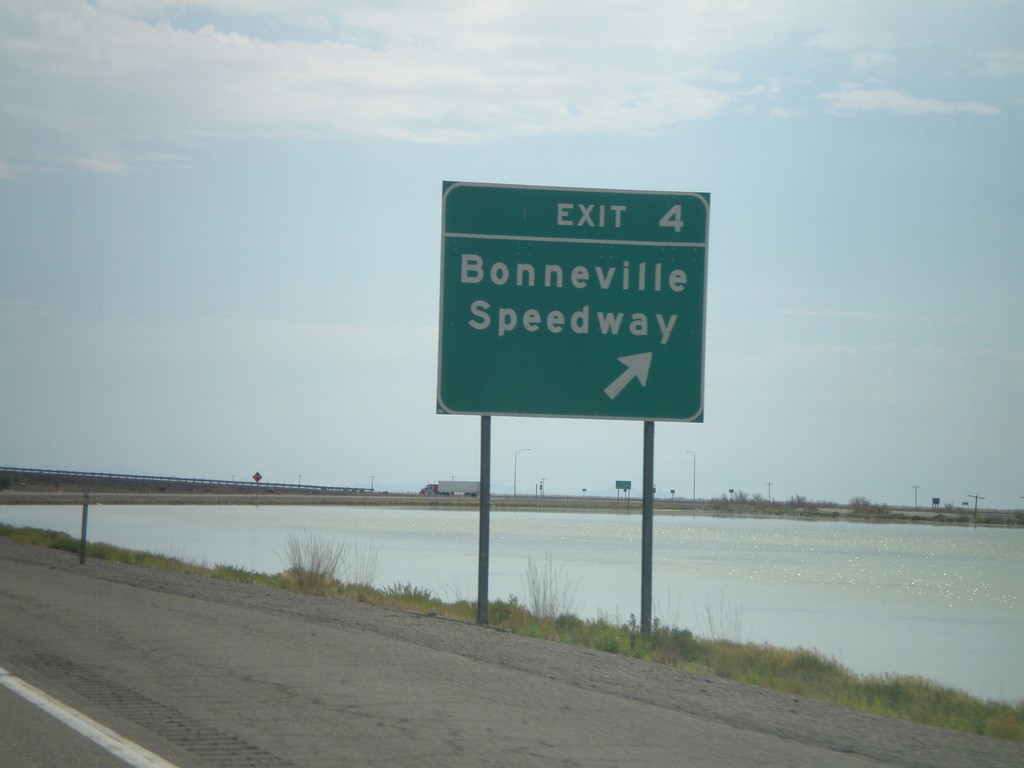
I-80 East - Exit 4
I-80 east at Exit 4 - Bonneville Speedway. The white areas in the picture is salt - this is the western edge of the Salt Flats. The next exit eastbound is in 37 miles. The next Gas eastbound is in 66 miles at Delle.
Taken 07-31-2010
Wendover
Tooele County
Utah
United States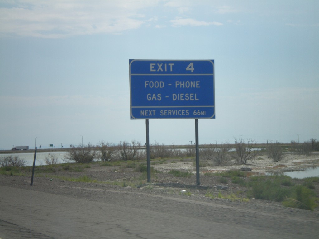
I-80 East - Exit 4 Services
Services at Exit 4. This is the last Gas for 66 miles until the Delle exit.
Taken 07-31-2010
Wendover
Tooele County
Utah
United States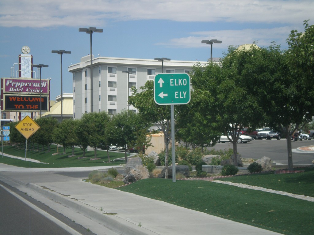
BL-80 West at Alt. US-93
BL-80 west at Alt. US-93. Use Alt. US-93 South for Ely. Alt. US-93 joins BL-80 west towards I-80 and Elko.
Taken 07-31-2010

 West Wendover
Elko County
Nevada
United States
West Wendover
Elko County
Nevada
United States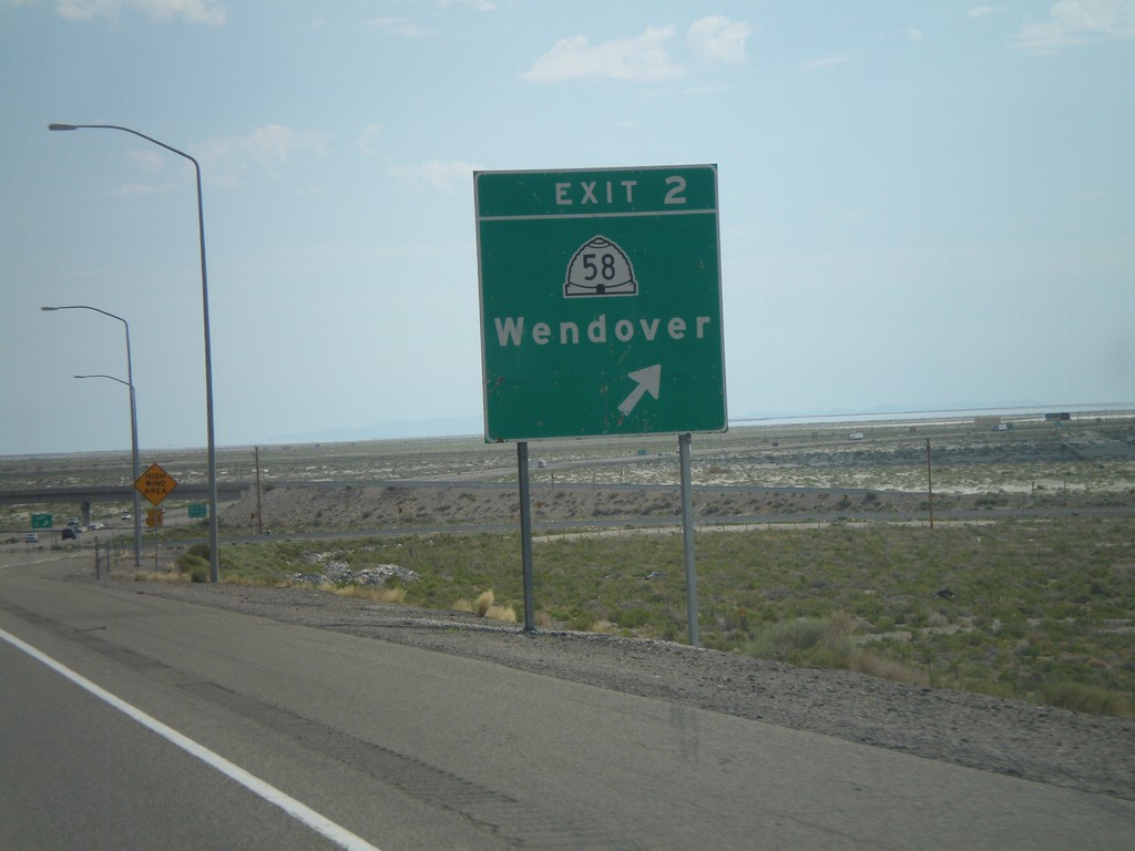
I-80 East - Exit 2
I-80 east at Exit 2 - UT-58/Wendover. This is the eastern end of the Wendover/West Wendover business loop.
Taken 07-31-2010
 Wendover
Tooele County
Utah
United States
Wendover
Tooele County
Utah
United States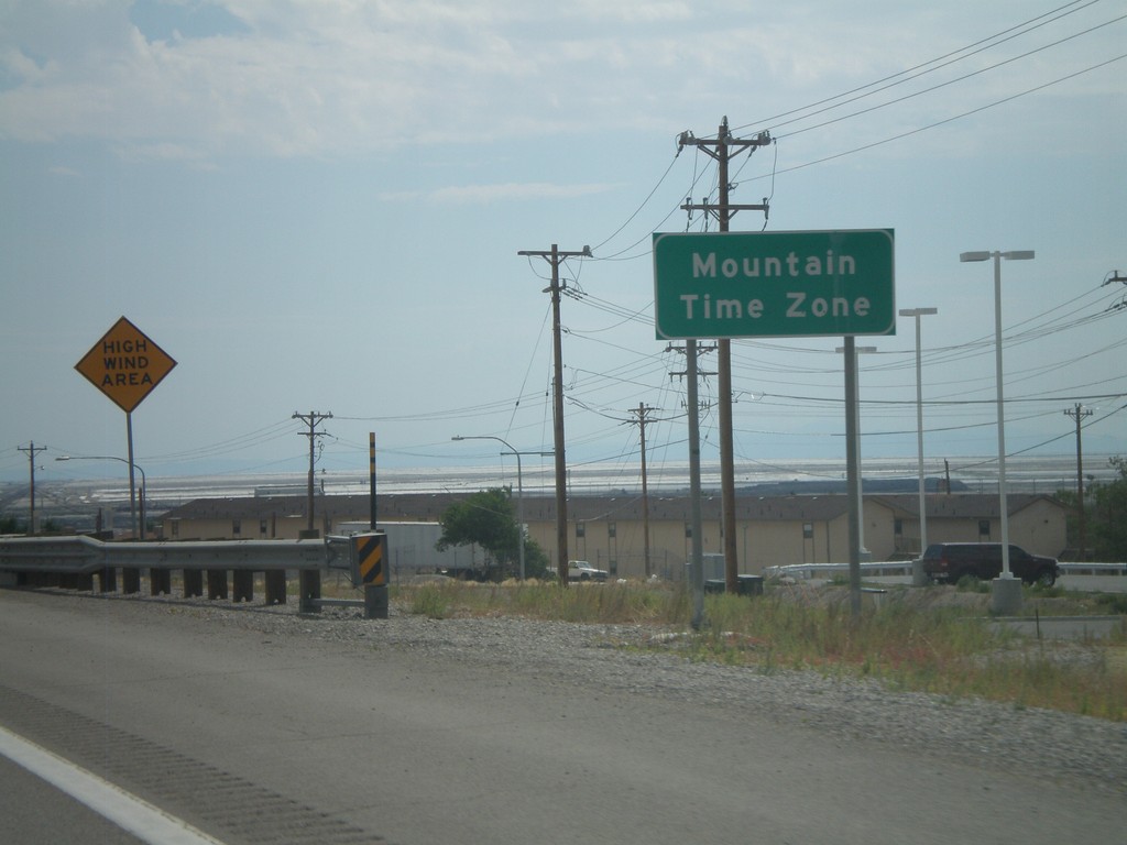
I-80 East - Entering Mountain Time Zone
Entering Mountain Time Zone on I-80 east, just before the Nevada-Utah state line.
Taken 07-31-2010
West Wendover
Elko County
Nevada
United States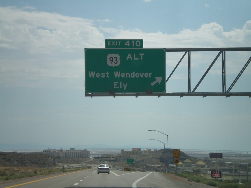
I-80 East - Exit 410
I-80 east at Exit 410 - US-93 Alt./West Wendover/Ely. This is the last exit in Nevada on I-80 east. This exit is the western end of the West Wendover/Wendover business loop. The casinos in West Wendover and the salt flats beyond are visible.
Taken 07-31-2010
West Wendover
Elko County
Nevada
United States