Signs Tagged With Big Green Sign
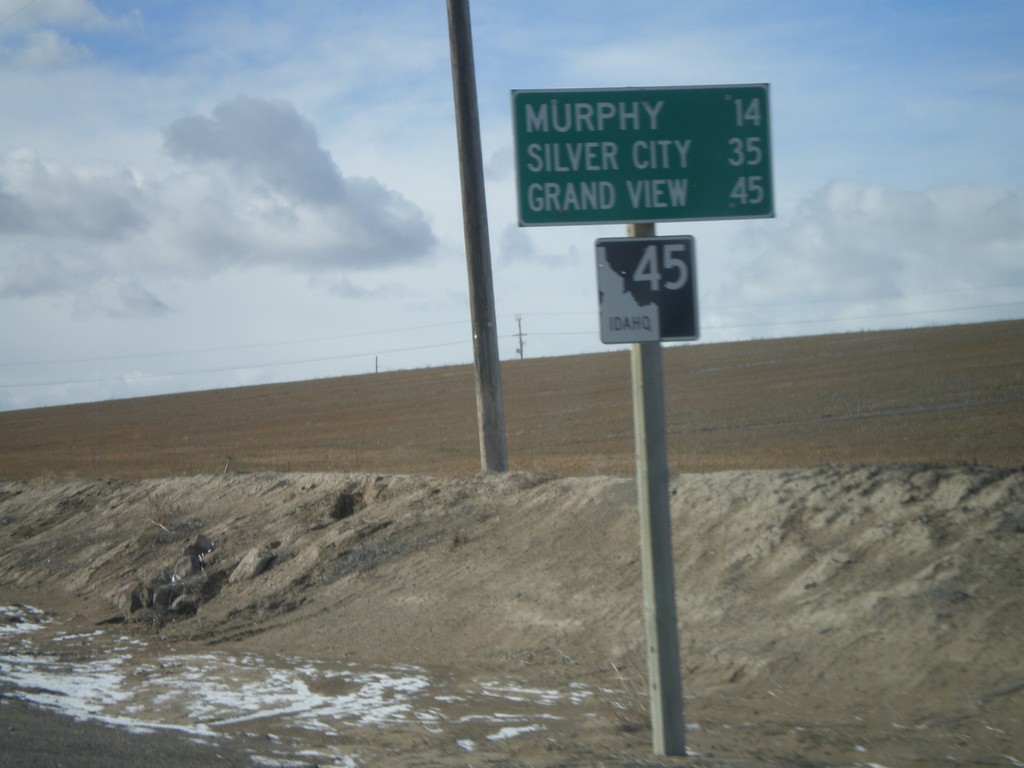
ID-45 South - Distance Marker
Distance marker on ID-45 south to Murphy, Silver City, and Grand View.
Taken 02-07-2011
 Melba
Canyon County
Idaho
United States
Melba
Canyon County
Idaho
United States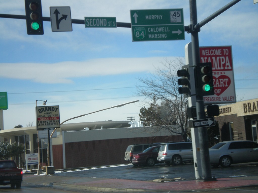
BL-84 West at ID-45
BL-84 West (11th Ave. South) at ID-45. Turn right on 2nd St. South to continue west on BL-84 towards Caldwell and Marsing. Continue ahead on 11th Ave. South for ID-45 south towards Murphy.
Taken 02-07-2011
 Nampa
Canyon County
Idaho
United States
Nampa
Canyon County
Idaho
United States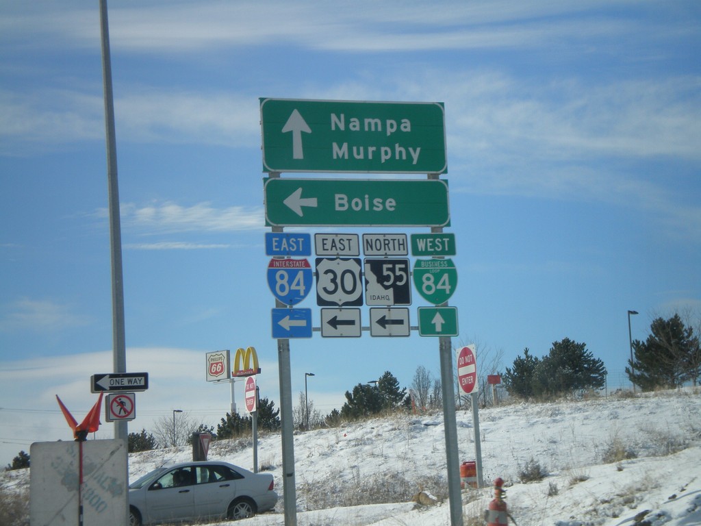
Begin BL-84 West at I-84 Exit 38 Onramp
Begin BL-84 West (Garrity Blvd.) at I-84/US-30/ID-55 onramp at Exit 38. Use I-84/US-30 East/ID-55 north for Boise. Continue on BL-84 west for Nampa and Murphy.
Taken 02-07-2011


 Nampa
Canyon County
Idaho
United States
Nampa
Canyon County
Idaho
United States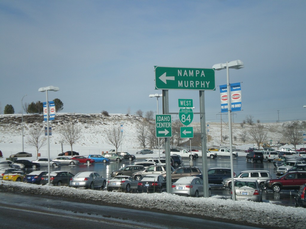
I-84 West - Exit 38 Offramp
I-84 west Exit 38 offramp. Turn left for BL-84 towards Nampa and Murphy. Turn right for the Idaho Center, an event complex.
Taken 02-07-2011
Nampa
Canyon County
Idaho
United States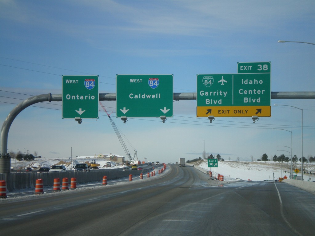
I-84 West - Exit 38
I-84 west at Exit 38 - BL-84/Garrity Blvd./Idaho Center Blvd. I-84 heads west towards Caldwell and Ontario (Oregon). Oddly, there are two different control cities for two different sets of lanes. Through Nampa, all through traffic is urged to use the left lanes, so it does not make since why Ontario bound traffic use the left most lane.
Taken 02-07-2011
Nampa
Canyon County
Idaho
United States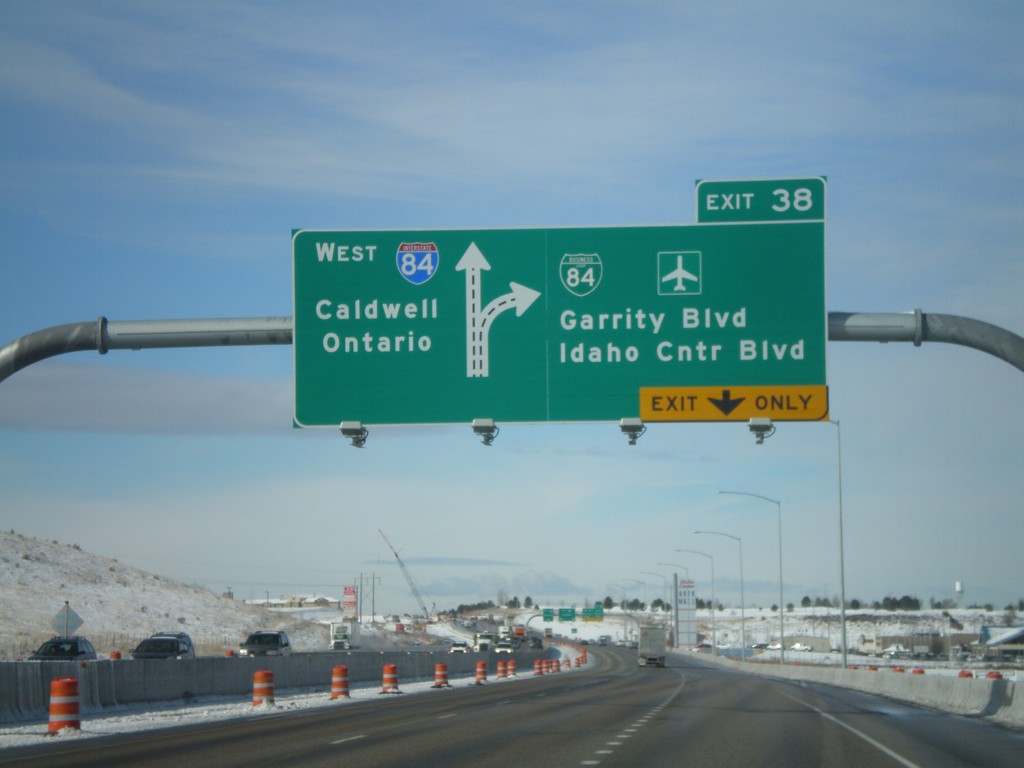
I-84 West - Exit 38
I-84/US-30 west at Exit 38 - BL-84/Garrity Blvd./Idaho Center Blvd. Westbound I-84 traffic continues towards Caldwell and Ontario (OR).
Taken 02-07-2011
Nampa
Canyon County
Idaho
United States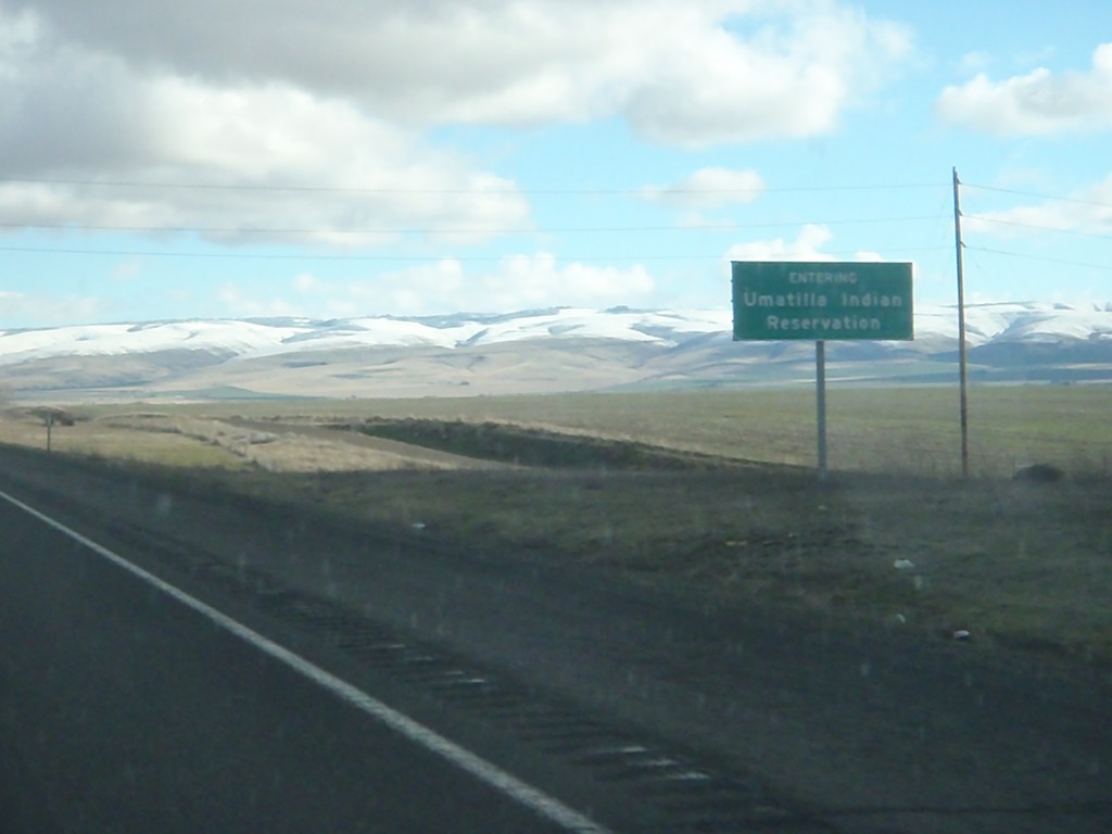
I-84 East - Umatilla Indian Reservation
Entering the Umatilla Indian Reservation on I-84 east.
Taken 01-19-2011
Pendleton
Umatilla County
Oregon
United States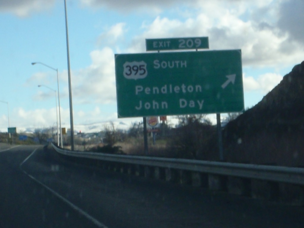
I-84 East - Exit 209
I-84 east at Exit 209 - US-395 South/Pendleton/John Day. US-395 joins I-84 west to Stansfield.
Taken 01-19-2011
 Pendleton
Umatilla County
Oregon
United States
Pendleton
Umatilla County
Oregon
United States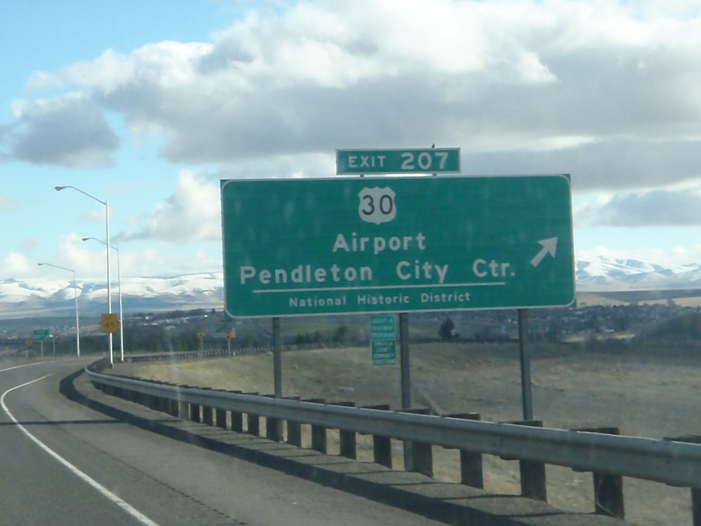
I-84 East - Exit 207
I-84 east at Exit 207 - US-30/Airport/Pendleton City Center/National Historic District. US-30 leaves I-84 here, serving as the Pendleton business loop. US-30 rejoins I-84 on the east side of Pendleton.
Taken 01-19-2011
Pendleton
Umatilla County
Oregon
United States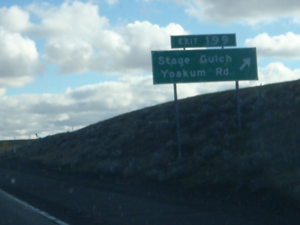
I-84 East - Exit 199
I-84 east at Exit 199 - Stage Gulch/Yoakum Road.
Taken 01-19-2011
Pendleton
Umatilla County
Oregon
United States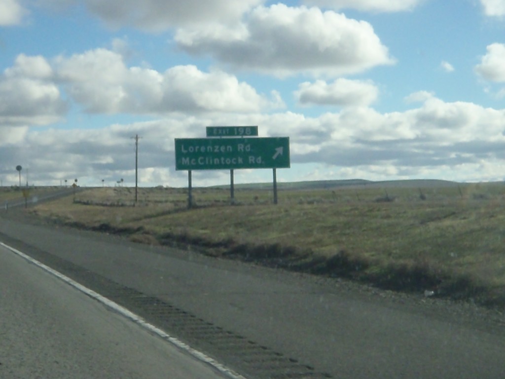
I-84 East - Exit 198
I-84 east at Exit 198 - Lorenzen Road/McClintock Road.
Taken 01-19-2011
Pendleton
Umatilla County
Oregon
United States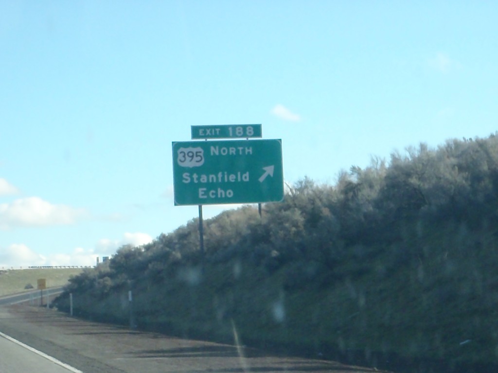
I-84 East - Exit 188
I-84 east at Exit 188 - US-395 North/Stanfield/Echo. US-395 south joins I-84/US-30 east to Pendleton.
Taken 01-19-2011
Stanfield
Umatilla County
Oregon
United States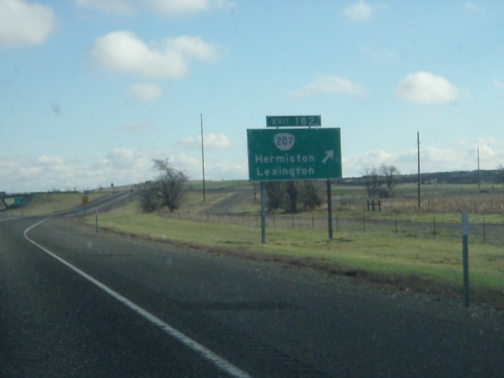
I-84 East - Exit 182
I-84 east at Exit 182 - OR-207/Hermiston/Lexington.
Taken 01-19-2011
 Hermiston
Umatilla County
Oregon
United States
Hermiston
Umatilla County
Oregon
United States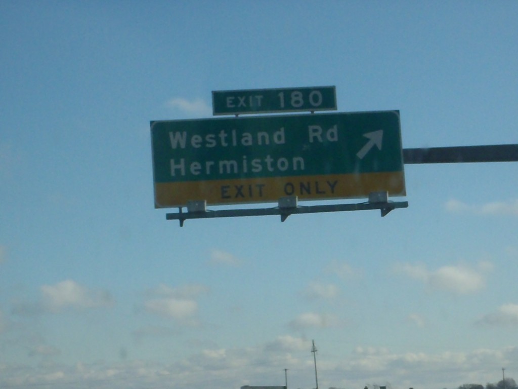
I-84 East - Exit 180
I-84 east at Exit 180 - Westland Road/Hermiston.
Taken 01-19-2011
Hermiston
Umatilla County
Oregon
United States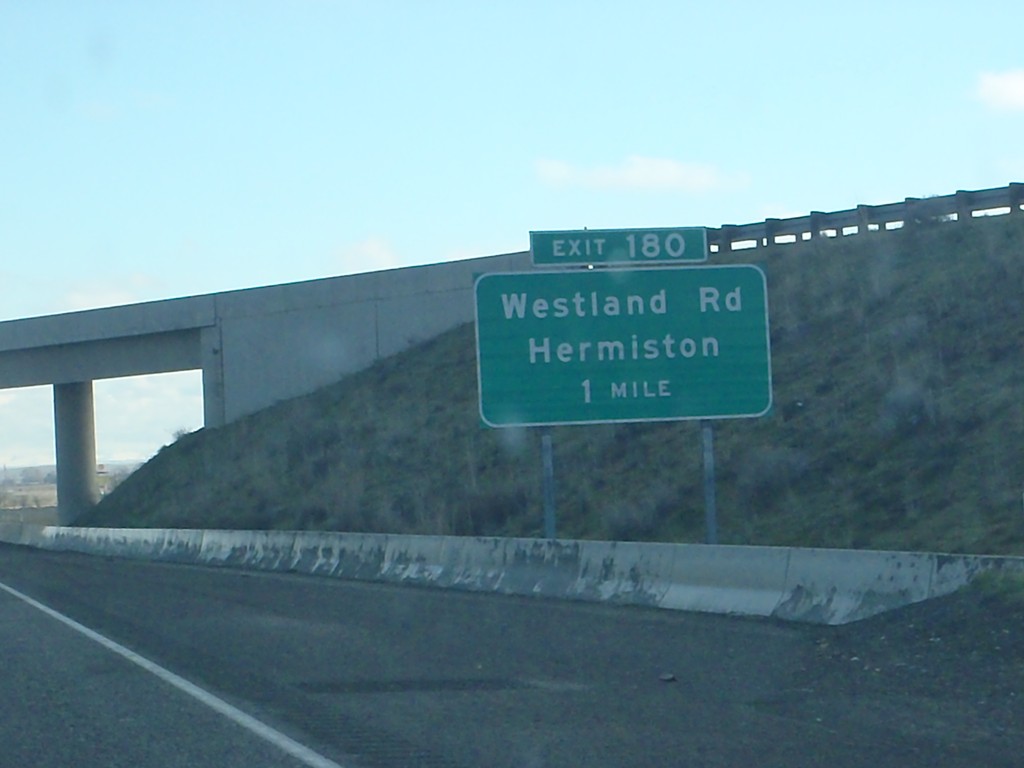
I-84 East Approaching Exit 180
I-84 east approaching Exit 180 - Westland Road/Hermiston.
Taken 01-19-2011
Hermiston
Umatilla County
Oregon
United States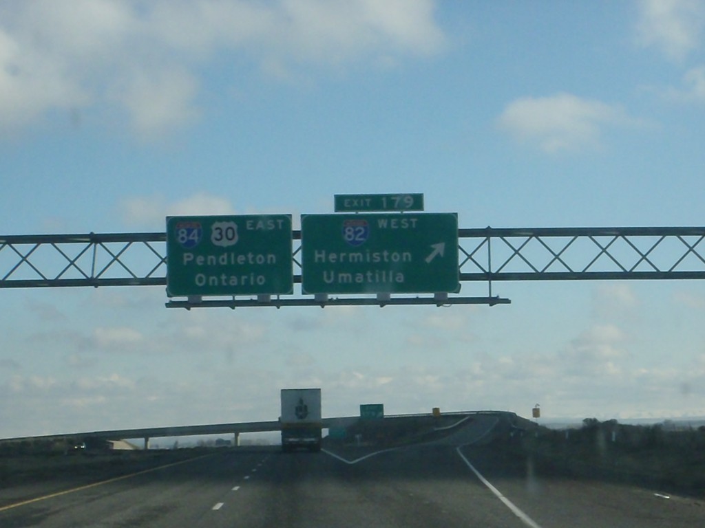
I-84 East - Exit 179
I-84 east at Exit 179 - I-82 West/Hermiston/Umatilla. I-84/US-30 continues east towards Pendleton and Ontario.
Taken 01-19-2011
 Hermiston
Umatilla County
Oregon
United States
Hermiston
Umatilla County
Oregon
United States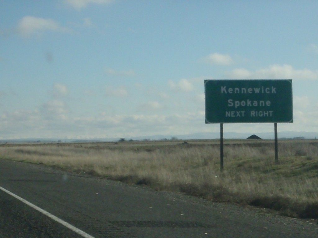
I-84 East Approaching Exit 179
I-84 east approaching Exit 179 (I-82 West). Use I-82 west for Kennewick (WA) and Spokane (WA).
Taken 01-19-2011
Hermiston
Umatilla County
Oregon
United States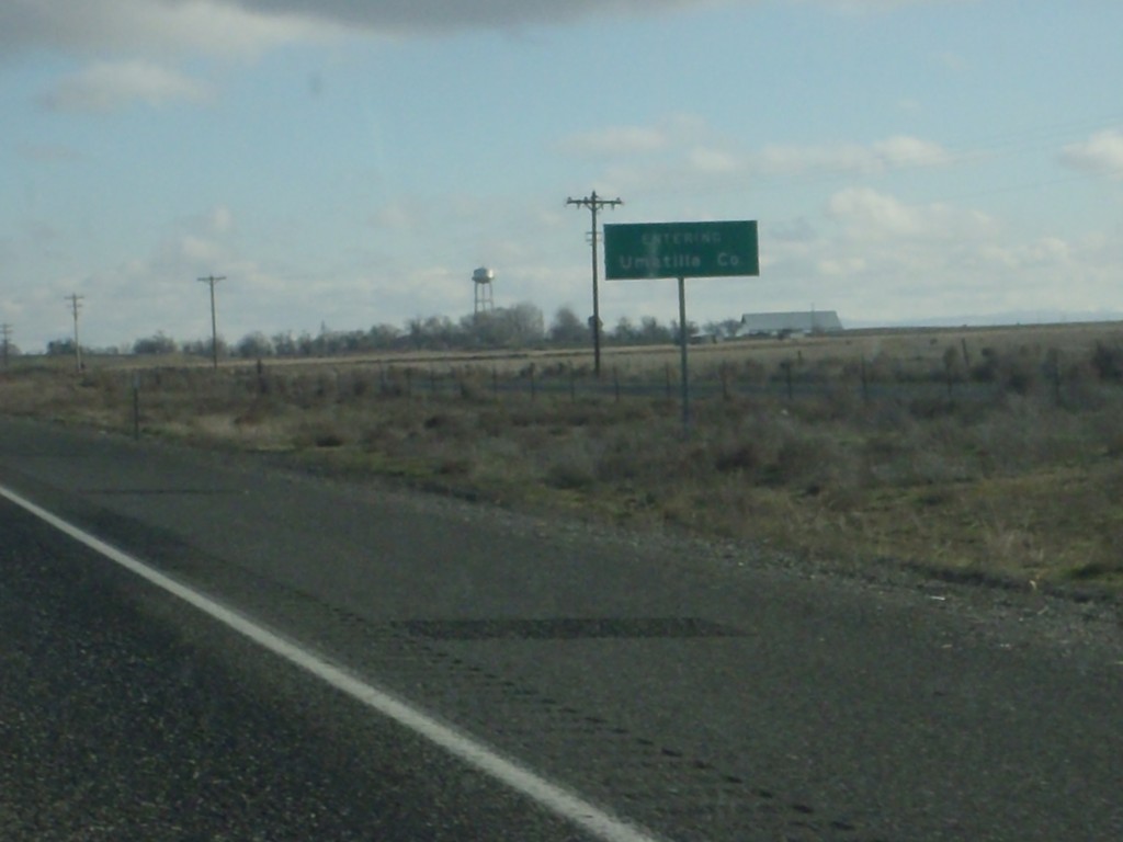
I-84 East - Entering Umatilla County
Entering Umatilla County on I-84 east.
Taken 01-19-2011
Hermiston
Umatilla County
Oregon
United States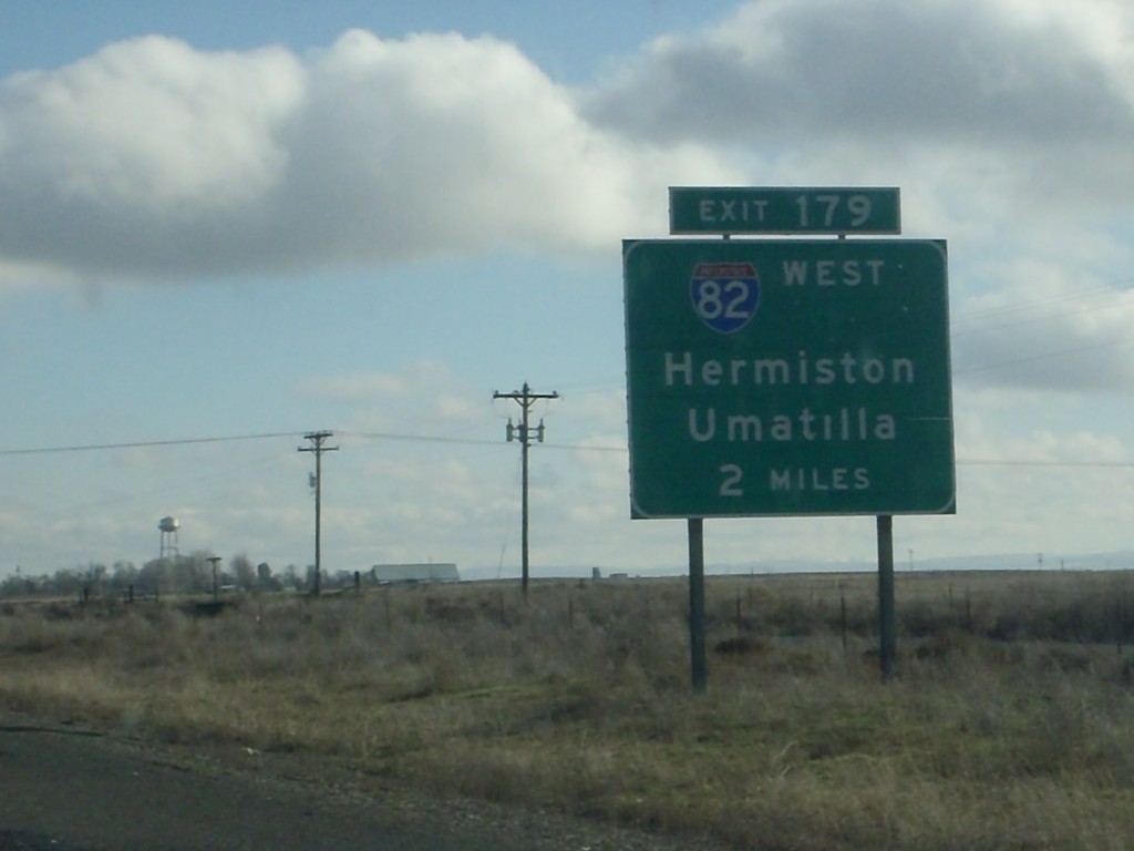
I-84 East Approaching Exit 179
I-84 east approaching Exit 179 - I-82 West/Hermiston/Umatilla.
Taken 01-19-2011
Hermiston
Umatilla County
Oregon
United States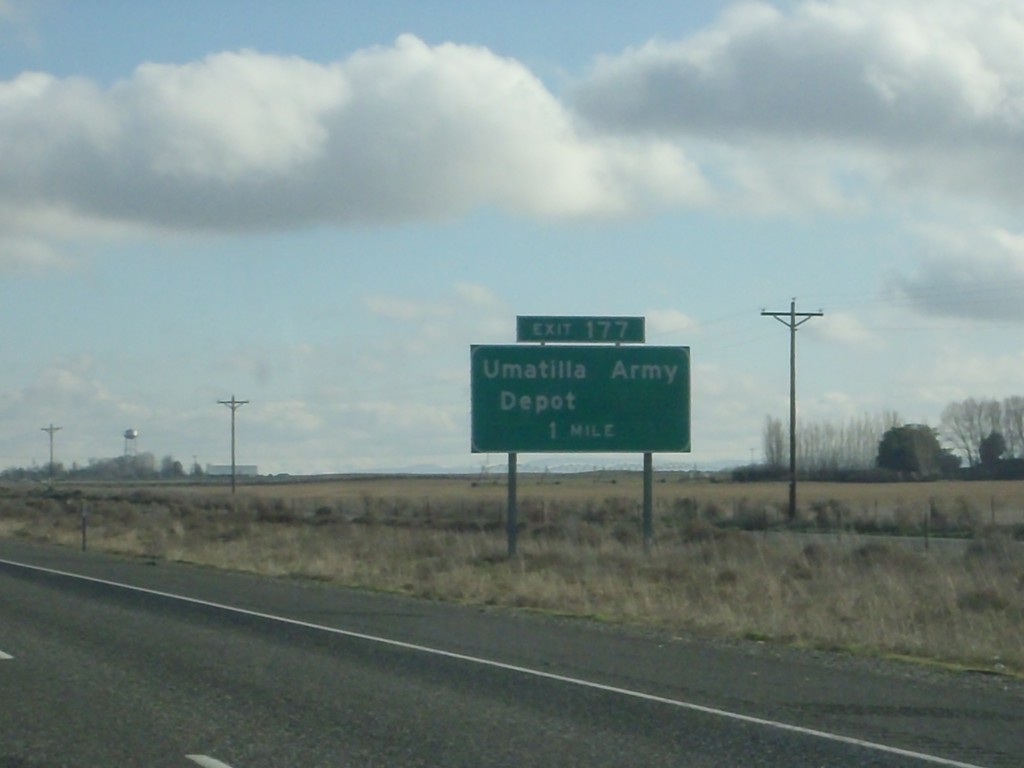
I-84 East - Exit 177
I-84 east approaching Exit 177 - Umatilla Army Depot. The Umatilla Army Depot is one of the few sites in the United States that store chemical weapons.
Taken 01-19-2011
Irrigon
Morrow County
Oregon
United States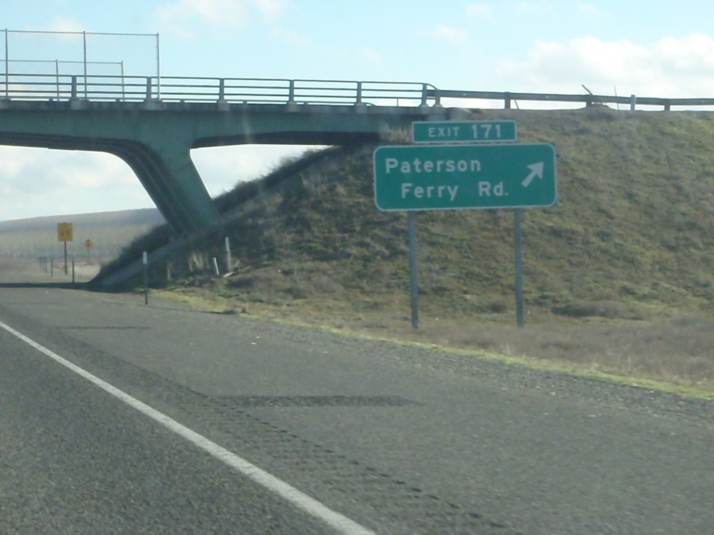
I-84 East - Exit 171
I-84 east at Exit 171 - Patterson Ferry Road.
Taken 01-19-2011
Boardman
Morrow County
Oregon
United States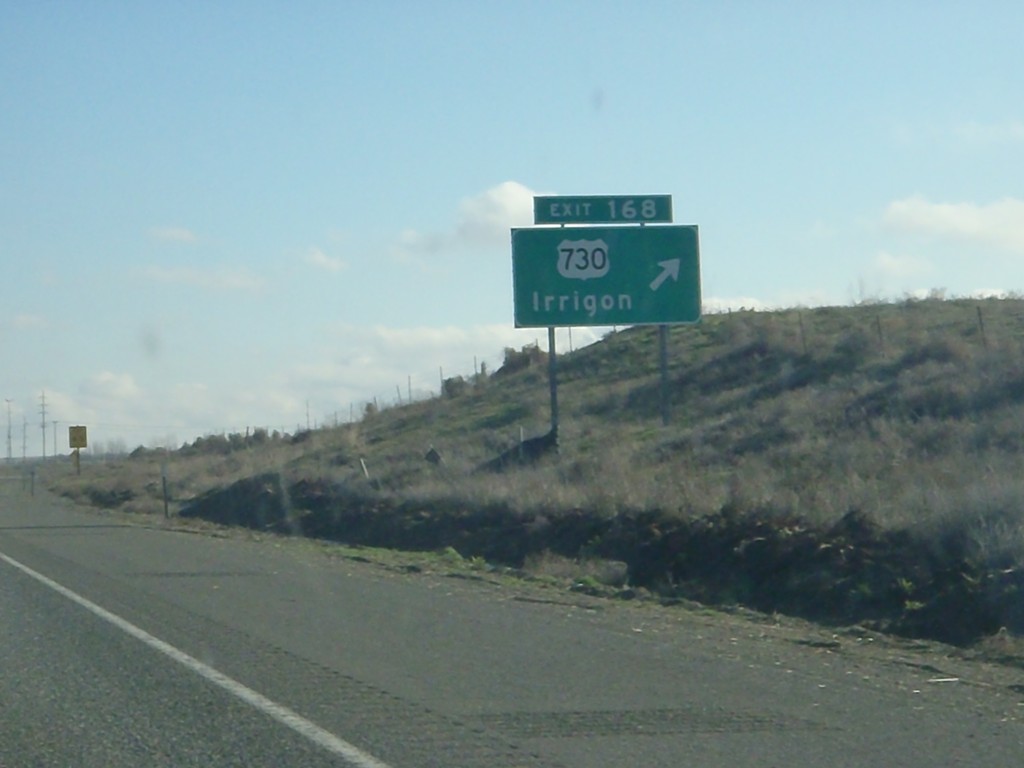
I-84 East - Exit 168
I-84 east at Exit 168 - US-730/Irrigon. The internal Oregon State Highway 2 - The Columbia River Highway leaves I-84 here and joins US-730. I-84 continues east as Oregon State Highway 6 - The Old Oregon Trail Highway.
Taken 01-19-2011
 Boardman
Morrow County
Oregon
United States
Boardman
Morrow County
Oregon
United States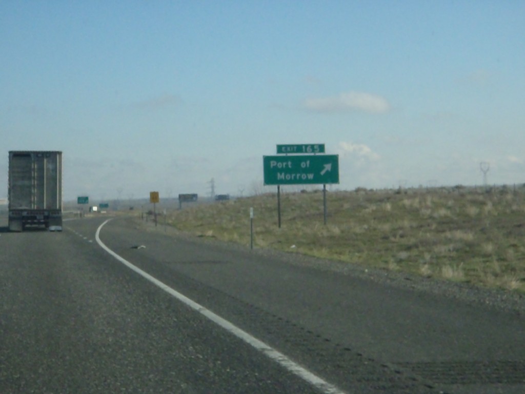
I-84 East - Exit 165
I-84 east at Exit 165 - Port of Morrow
Taken 01-19-2011
Boardman
Morrow County
Oregon
United States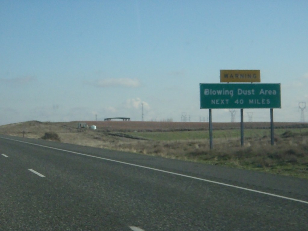
I-84 East - Blowing Dust Area
Blowing Dust Area next 40 miles on I-84 east. This area is roughly between Boardman and Pendleton.
Taken 01-19-2011
Boardman
Morrow County
Oregon
United States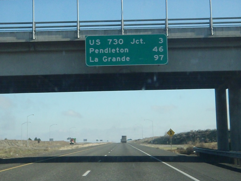
I-84 East - Distance Marker
Distance marker at Boardman Interchange. Distance to US-730 Jct., Pendleton, and La Grande.
Taken 01-19-2011
Boardman
Morrow County
Oregon
United States