Signs Tagged With Big Green Sign
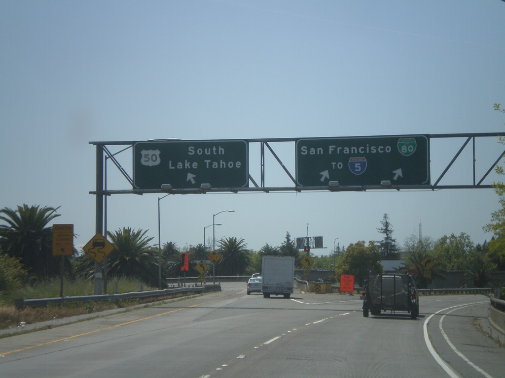
BL-80 West at US-50 on Exit 6A Ramp
BL-80 west at US-50 on Exit 6A ramp. Merge left for US-50 east towards South Lake Tahoe. Merge right for BL-80 towards I-5 and San Francisco.
Taken 04-16-2010


 Sacramento
 County
California
United States
Sacramento
Sacramento County
California
United States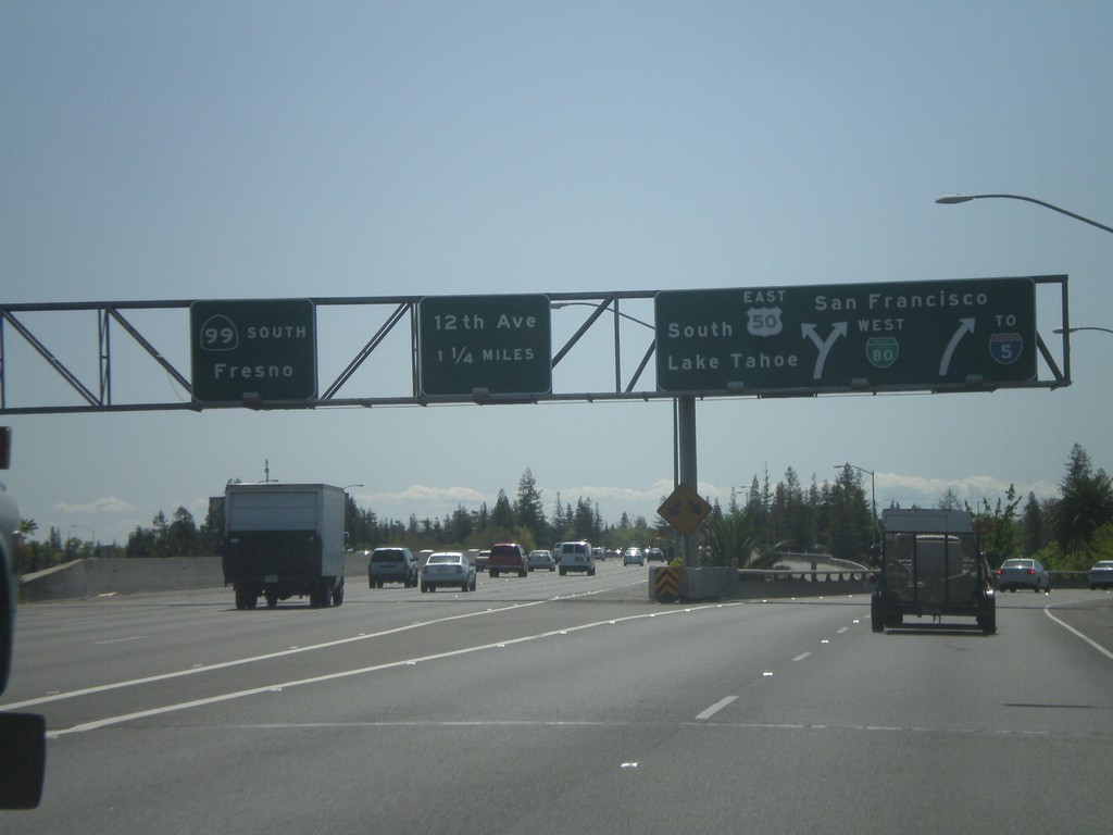
BL-80 West at US-50 and CA-99
BL-80 west at Exits 6A and 6B. Exit 6A is BL-80 West/US-50/To I-5/South Lake Tahoe/San Francisco. Exit 6B is CA-99 South/Fresno.
Taken 04-16-2010
 Sacramento
 County
California
United States
Sacramento
Sacramento County
California
United States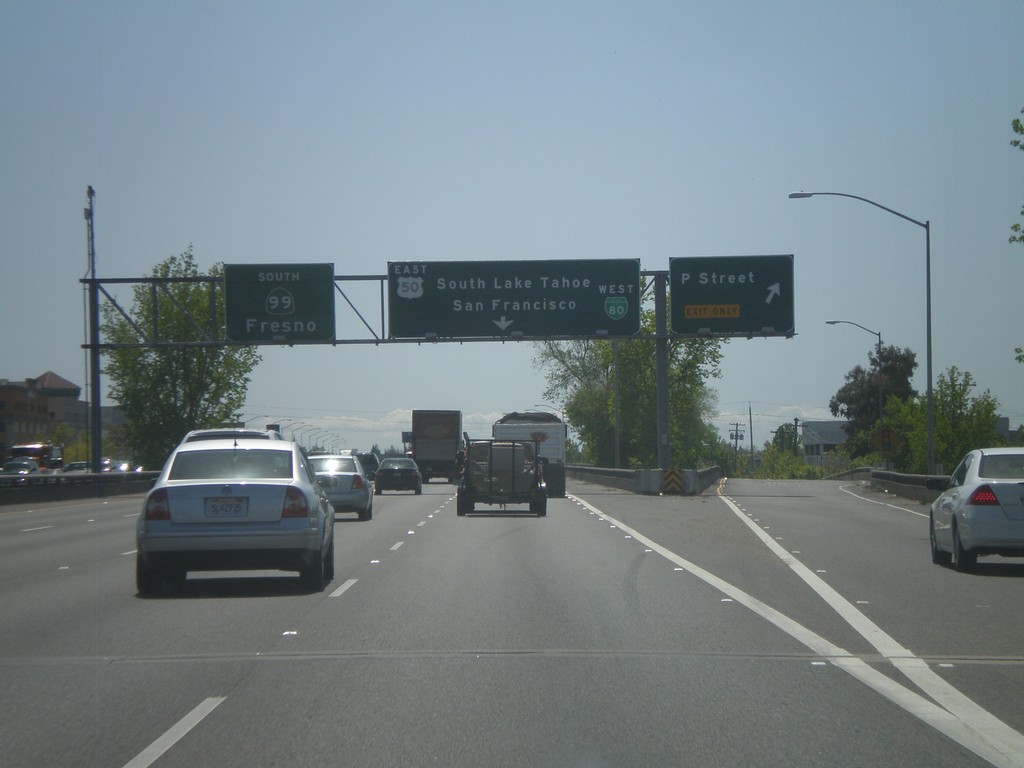
BL-80 West at Exit 6C - Approaching Exit 6A and 6B
BL-80 west at Exit 6C - P St. Approaching Exits 6A - US-50 East/BL-80 West and Exit 6B - CA-99 South.
Taken 04-16-2010
Sacramento
Sacramento County
California
United States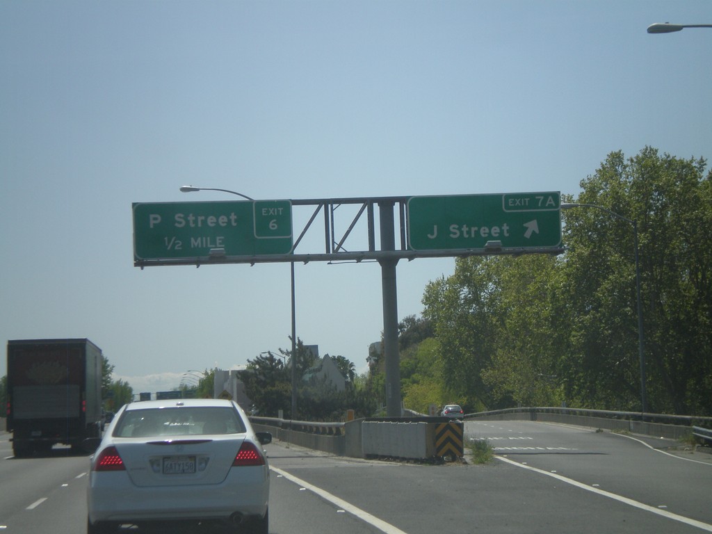
BL-80 West - Exit 7A and Exit 6C
BL-80 west at Exit 7A - J St. Approaching Exit 6C - P St.
Taken 04-16-2010
Sacramento
Sacramento County
California
United States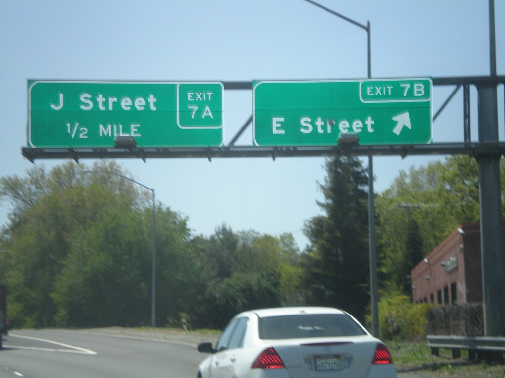
BL-80 West at Exit 7B - Approaching Exit 7A
BL-80 west at Exit 7B - E St. Approaching Exit 7A - J St.
Taken 04-16-2010
Sacramento
Sacramento County
California
United States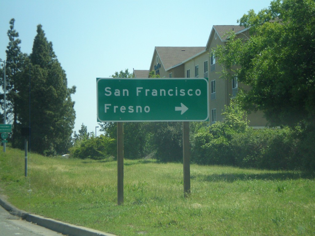
Exposition Blvd. west at BL-80
Exposition Blvd. west approaching BL-80 west onramp to Fresno and San Francisco.
Taken 04-16-2010
Sacramento
Sacramento County
California
United States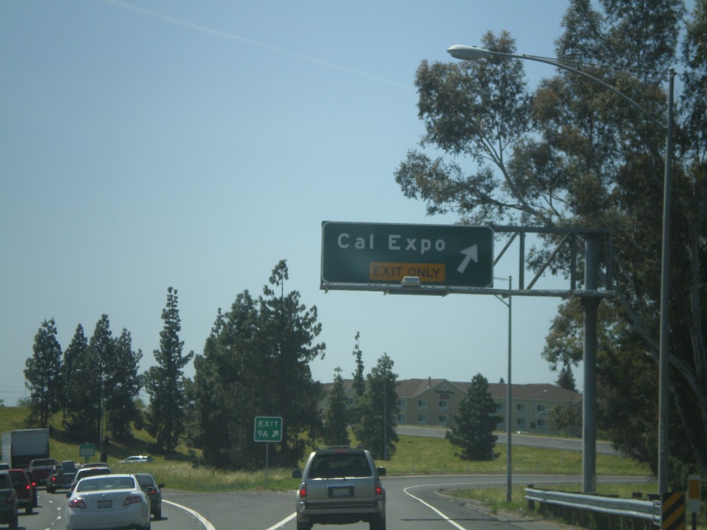
BL-80 West - Exit 9A
BL-80 west at Exit 9A - Cal Expo.
Taken 04-16-2010
Sacramento
Sacramento County
California
United States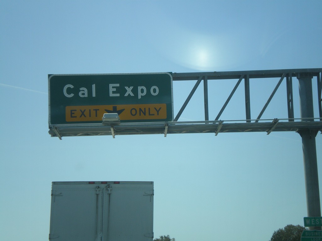
BL-80 West - Exit 9A
BL-80 West at Exit 9A - Cal Expo.
Taken 04-16-2010
Sacramento
Sacramento County
California
United States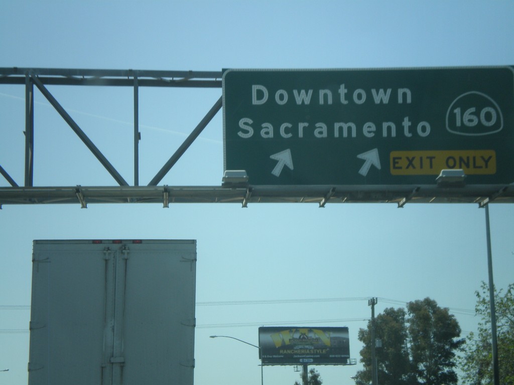
BL-80 West - Exit 5
BL-80 west at Exit 5 - CA-160/Downtown Sacramento.
Taken 04-16-2010
 Sacramento
 County
California
United States
Sacramento
Sacramento County
California
United States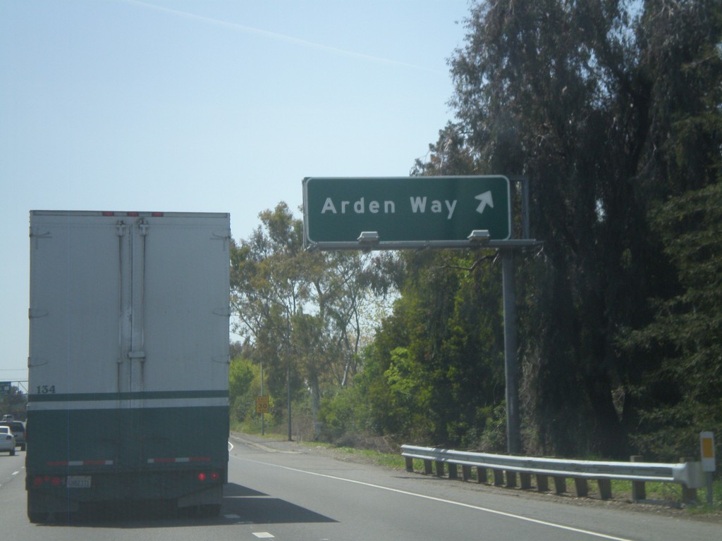
BL-80 West - Exit 10A
BL-80 west at Exit 10A - Arden Way
Taken 04-16-2010
Sacramento
Sacramento County
California
United States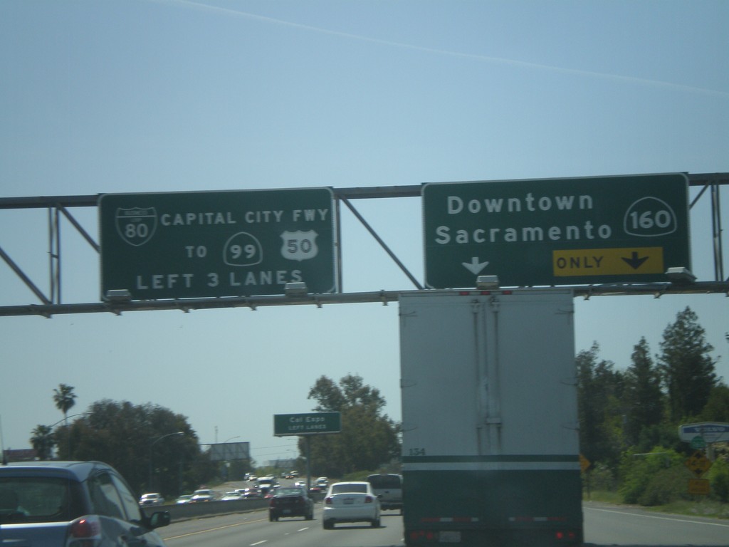
BL-80 West - Exit 9B
BL-80 west at Exit 9B - CA-160/Downtown Sacramento. Use left lanes for BL-80/CA-99/US-50.
Taken 04-16-2010
Sacramento
Sacramento County
California
United States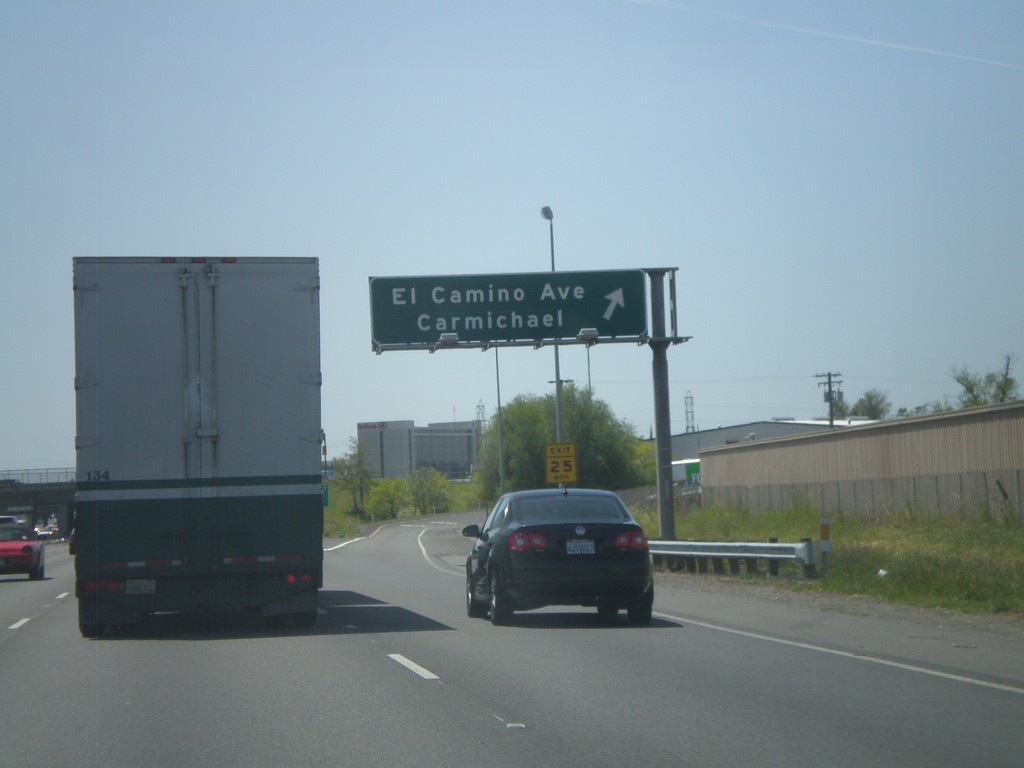
BL-80 West - Exit 10B
BL-80 west at Exit 10B - El Camino Ave/Carmichael.
Taken 04-16-2010
Sacramento
Sacramento County
California
United States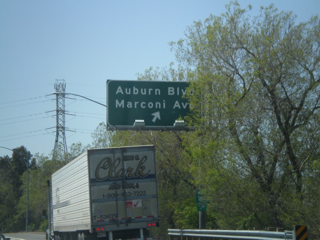
BL-80 West - Exit 11
BL-80 west at Exit 11 - Auburn Blvd./Marconi Ave.
Taken 04-16-2010
Sacramento
Sacramento County
California
United States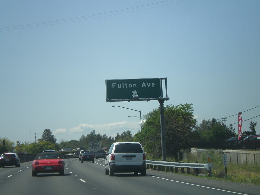
BL-80 West - Exit 12
BL-80 west at Exit 12 - Fulton Ave.
Taken 04-16-2010
Sacramento
Sacramento County
California
United States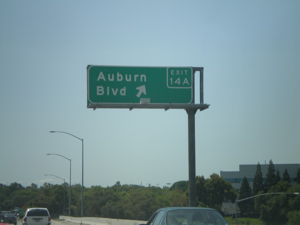
BL-80 West - Exit 14A
BL-80 west at Exit 14A - Auburn Blvd.
Taken 04-16-2010
Sacramento
Sacramento County
California
United States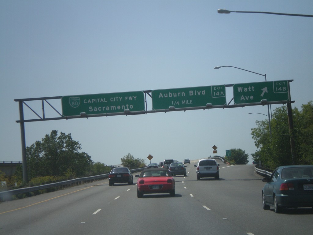
BL-80 West - Exit 14B and Exit 14A
BL-80 west at Exit 14B - Watt Ave. Approaching Exit 14A - Auburn Blvd. This is the first exit on BL-80 westbound after the I-80 split. BL-80 continues west towards Sacramento as the Capitol City Freeway.
Taken 04-16-2010
North Highlands
Sacramento County
California
United States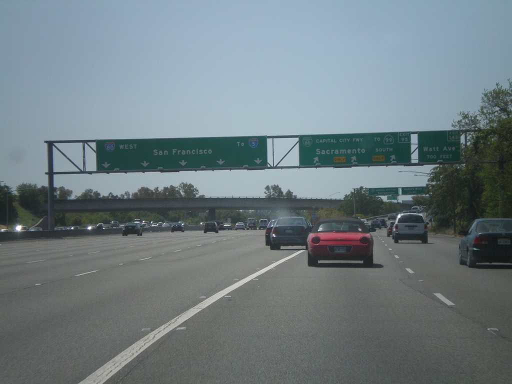
I-80 West at Business Loop I-80
I-80 west at Exit 95 - BL-80/Capitol City Freeway/To CA-99/Sacramento. Also the first exit on BL-80 west, Exit 14B - Watt Ave. is signed. Continue west on I-80 for I-5 and San Francisco.
Taken 04-16-2010
 North Highlands
Sacramento County
California
United States
North Highlands
Sacramento County
California
United States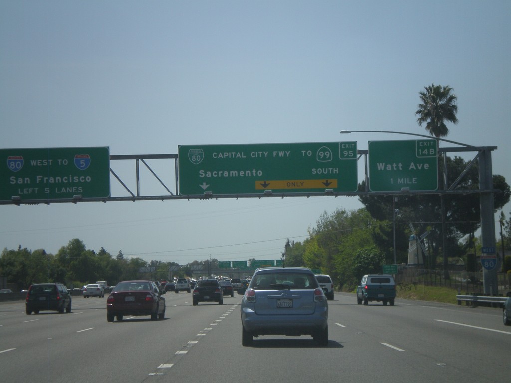
I-80 West Approaching Capitol City Fwy
I-80 west approaching Exit 95 - BL-80/Capitol City Freeway/To CA-99 South/Sacramento. The first exit on BL-80 west is also signed, Exit 14 - Watt Ave. Continue on I-80 west for I-5 and San Francisco.
Taken 04-16-2010
Sacramento
Sacramento County
California
United States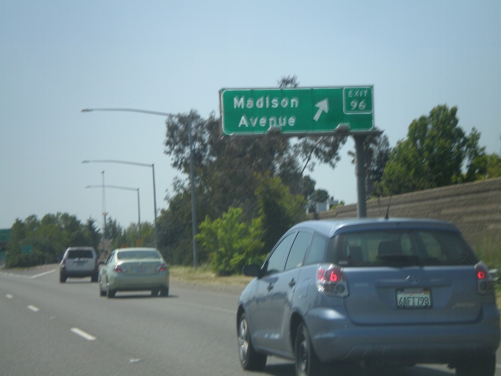
I-80 West - Exit 96
I-80 west at Exit 96 - Madison Ave
Taken 04-16-2010
Sacramento
Sacramento County
California
United States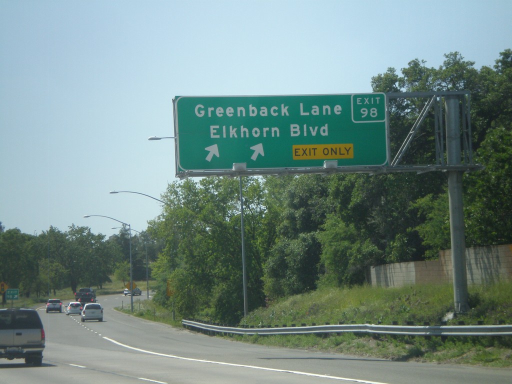
I-80 West - Exit 98
I-80 west at Exit 98 - Greenback Lane/Elkhorn Blvd.
Taken 04-16-2010
Sacramento
Sacramento County
California
United States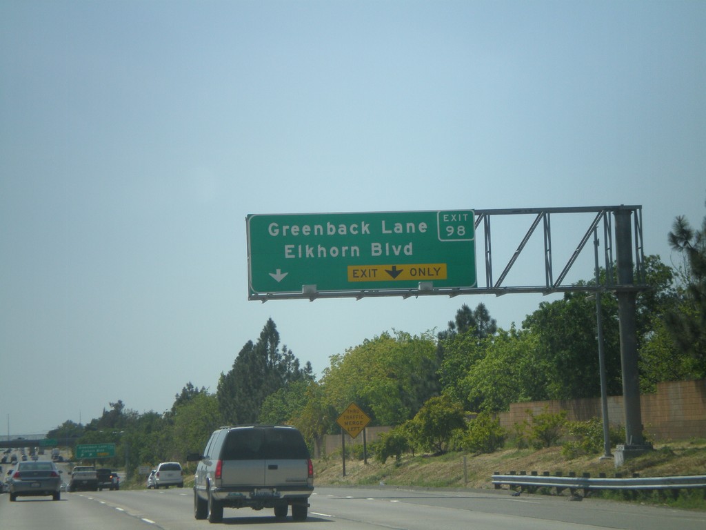
I-80 West Approaching Exit 98
I-80 west approaching Exit 98 - Greenback Lane/Elkhorn Blvd
Taken 04-16-2010
Sacramento
Sacramento County
California
United States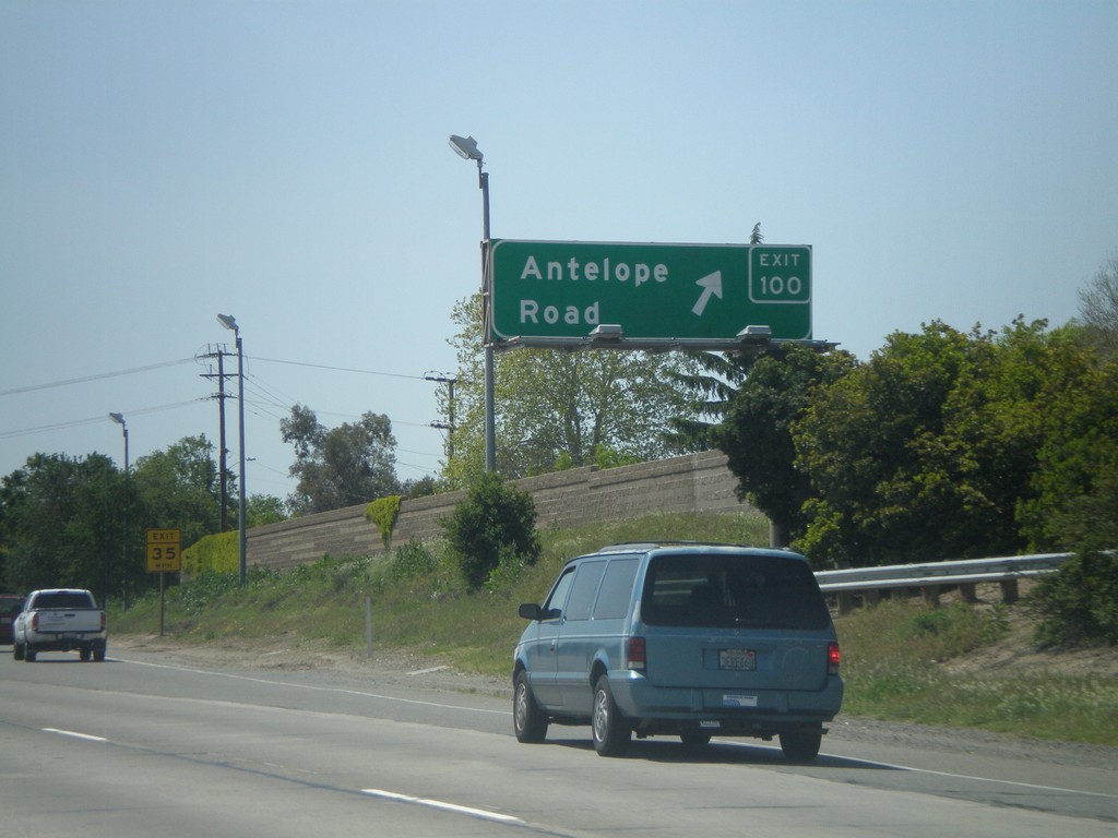
I-80 West - Exit 100
I-80 west at Exit 100 - Antelope Road
Taken 04-16-2010
Citrus Heights
Sacramento County
California
United States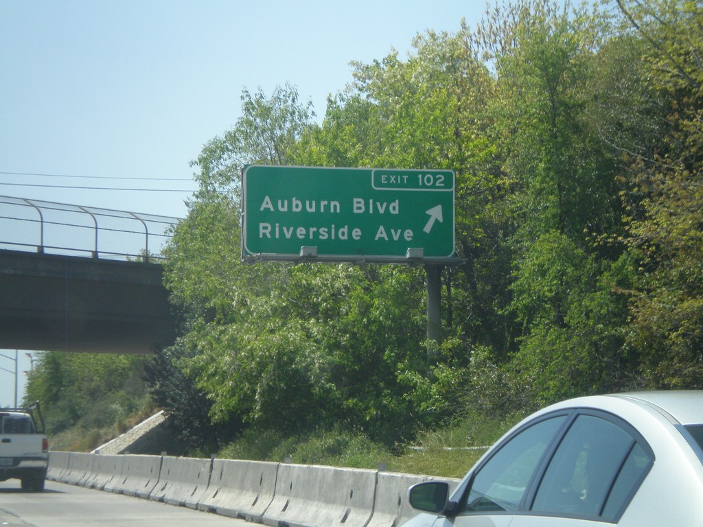
I-80 West - Exit 102
I-80 west at Exit 102 - Auburn Blvd./Riverside Ave.
Taken 04-16-2010
Roseville
Placer County
California
United States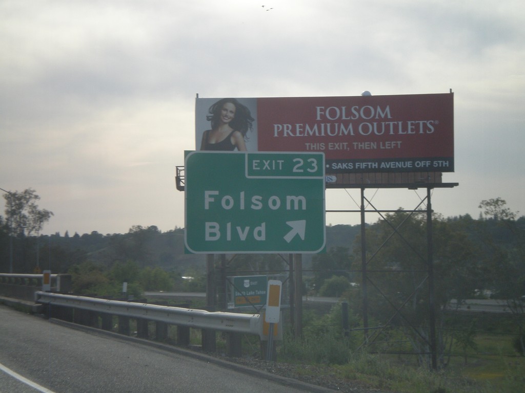
US-50 West - Exit 23
US-50 west at Exit 23 - Folsom Blvd
Taken 04-15-2010
Folsom
Sacramento County
California
United States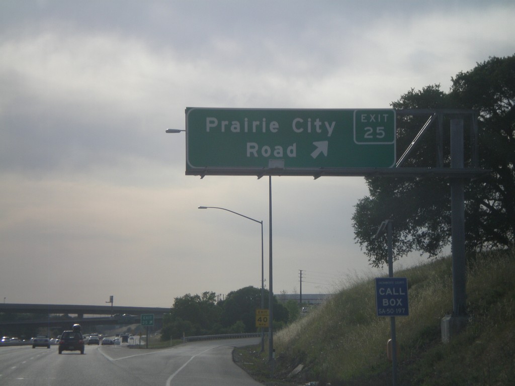
US-50 West - Exit 25
US-50 west at Exit 25 - Prairie City Road.
Taken 04-15-2010
Folsom
Sacramento County
California
United States