Signs Tagged With Big Green Sign
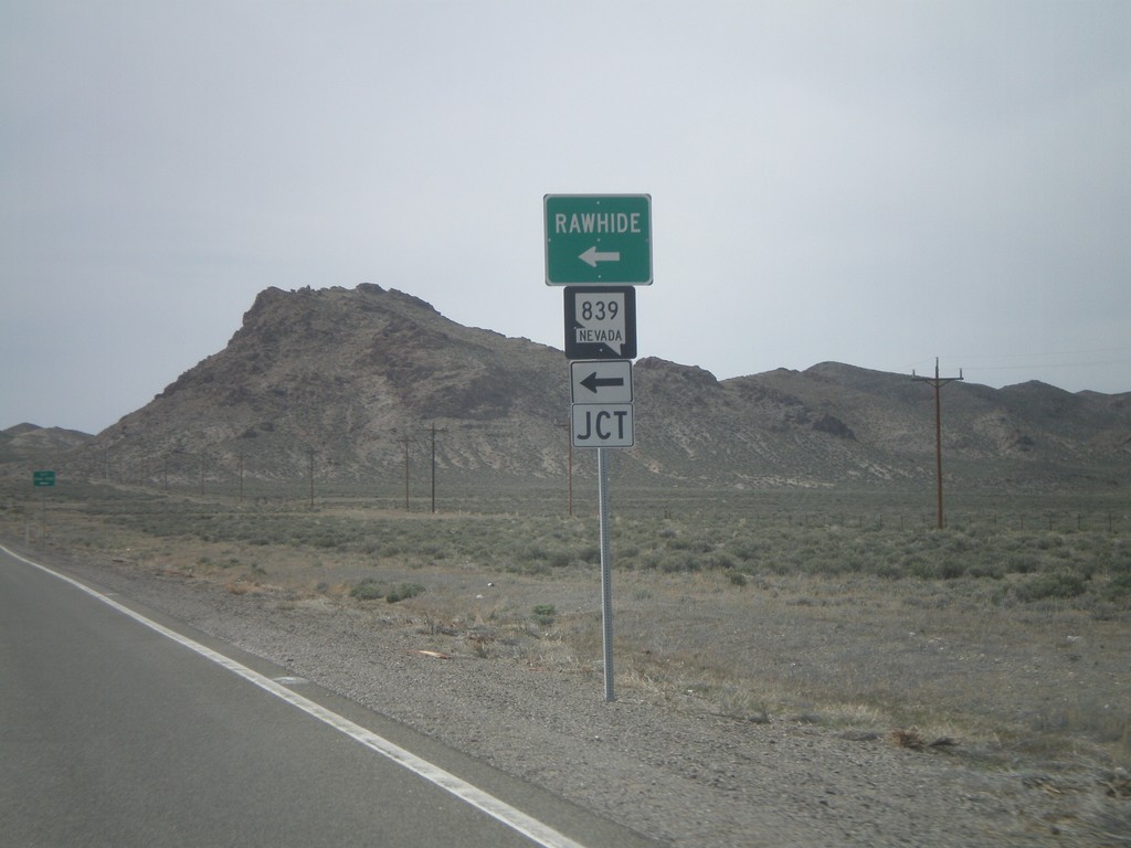
US-50 West at NV-839
US-50 west at NV-839 south to Rawhide.
Taken 04-15-2010

 Fallon
Churchill County
Nevada
United States
Fallon
Churchill County
Nevada
United States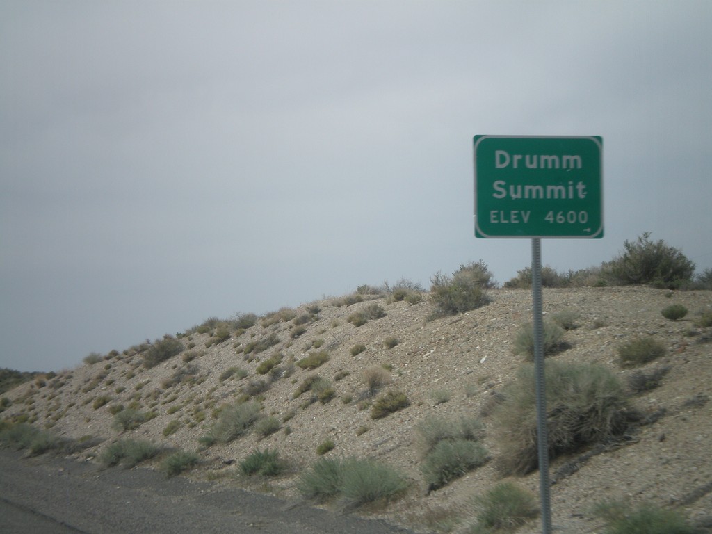
US-50 West - Drumm Summit
US-50 west at Drumm Summit - Elevation 4600 Feet.
Taken 04-15-2010
Fallon
Churchill County
Nevada
United States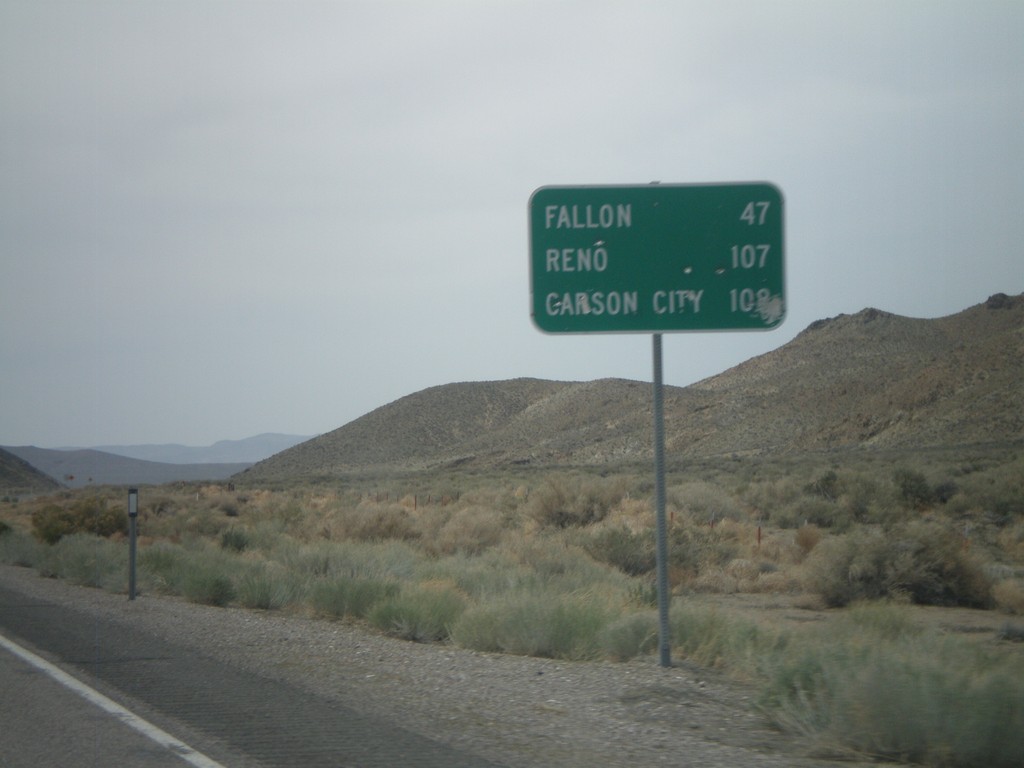
US-50 West - Distance Marker
Distance marker on US-50 west to Fallon, Carson City, and Reno.
Taken 04-15-2010
Fallon
Churchill County
Nevada
United States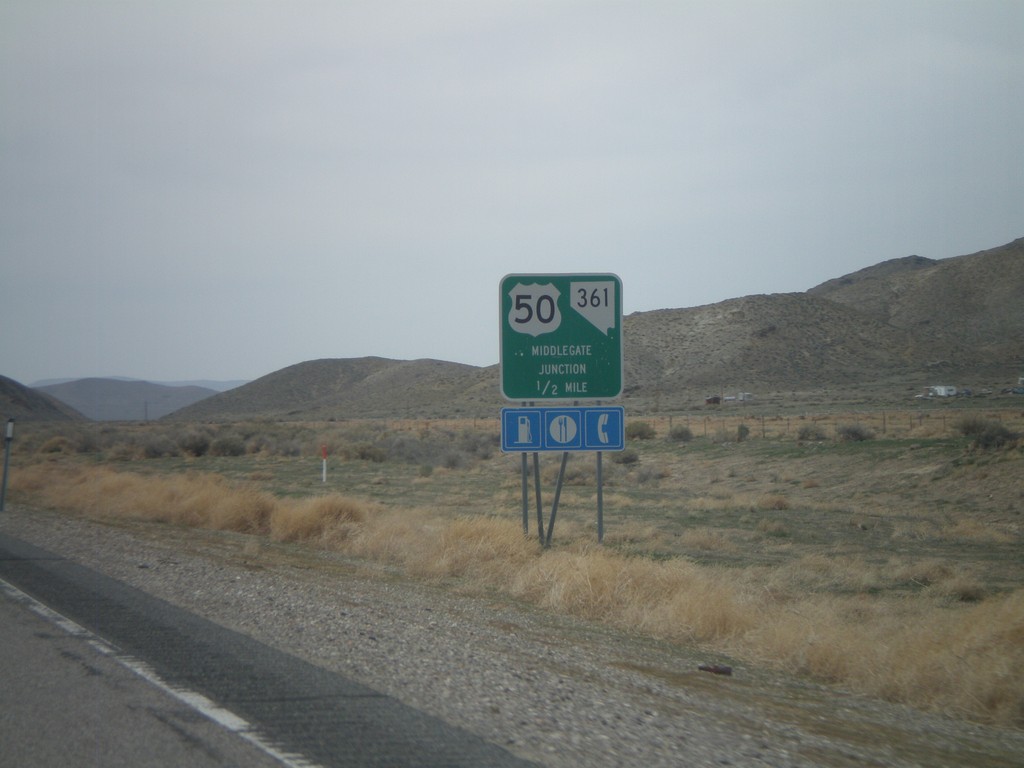
US-50 West Approaching Middlegate Jct.
US-50 west approaching Middlegate Junction (NV-361).
Taken 04-15-2010
 Fallon
Churchill County
Nevada
United States
Fallon
Churchill County
Nevada
United States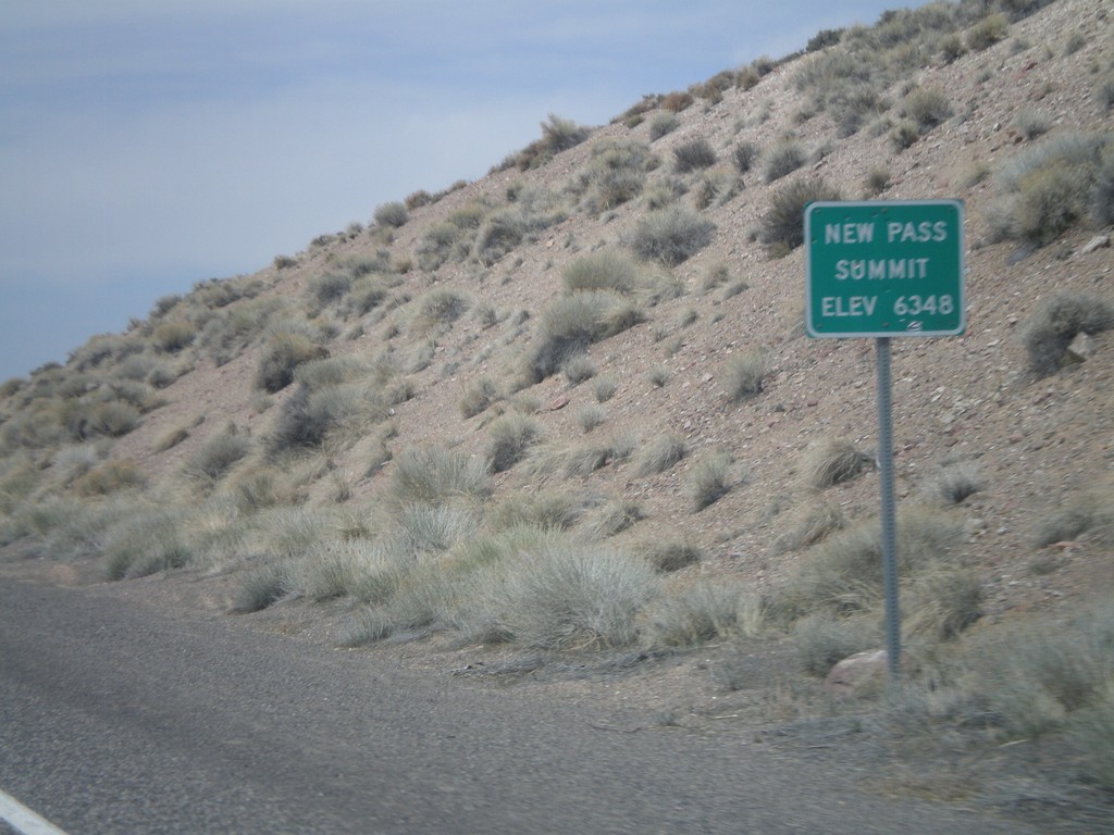
US-50 West - New Pass Summit
US-50 west at New Pass Summit - Elevation 6348 Feet.
Taken 04-15-2010
Fallon
Lander County
Nevada
United States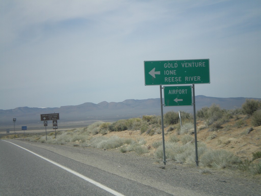
US-50 West Approaching NV-722
US-50 west approaching NV-722 west to Ione, Reese River, Gold Venture, and the Austin Airport.
Taken 04-15-2010
 Austin
Lander County
Nevada
United States
Austin
Lander County
Nevada
United States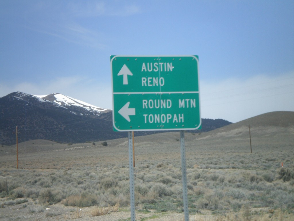
US-50 West at NV-376 South
US-50 west at NV-376 south for Round Mountain and Tonopah. Continue west for Austin and Reno.
Taken 04-15-2010
Austin
Lander County
Nevada
United States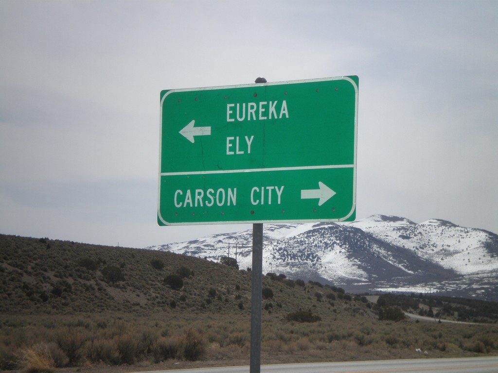
End NV-278 South at US-50
End NV-278 south at US-50. Use US-50 west for Carson City. Use US-50 east for Eureka and Ely.
Taken 04-15-2010
 Eureka
 County
Nevada
United States
Eureka
Eureka County
Nevada
United States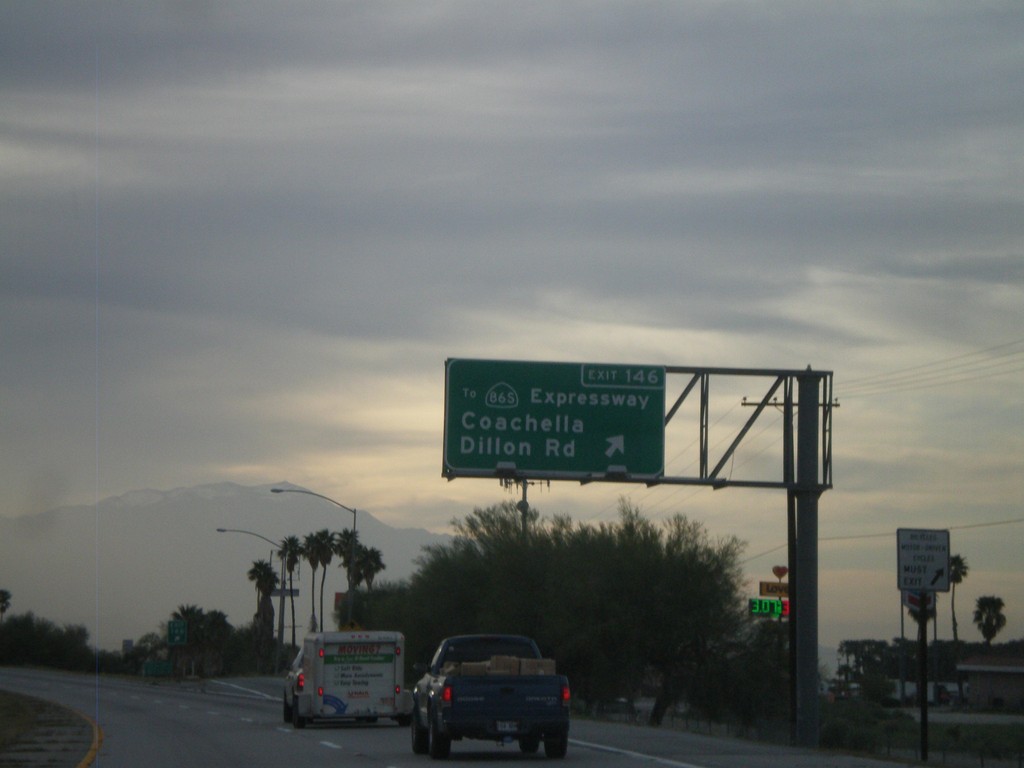
I-10 West - Exit 146
I-10 west at Exit 146 - To CA-86S Expressway/Coachella/Dillon Road. This is the first exit in the Coachella Valley westbound.
Taken 03-22-2010

 Coachella
Riverside County
California
United States
Coachella
Riverside County
California
United States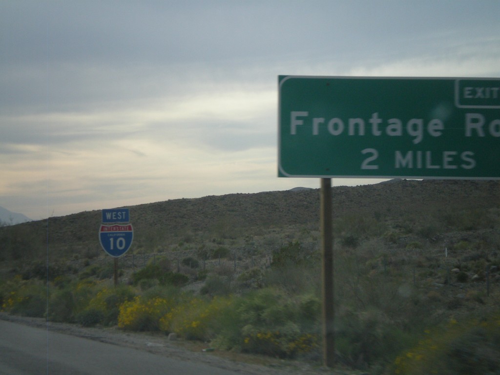
I-10 West Approaching Exit 162
I-10 west approaching Exit 162 - Frontage Road.
Taken 03-22-2010
Cactus City
Riverside County
California
United States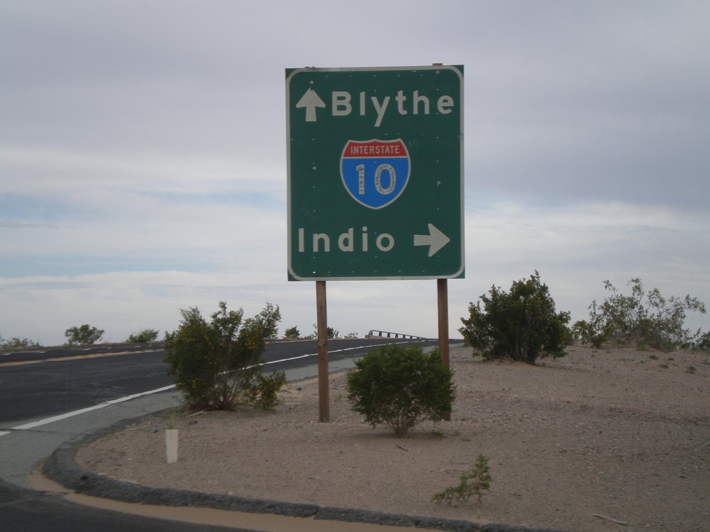
Wileys Well Road at I-10
Wileys Well Road at I-10 (Exit 222). Use I-10 west for Indio. Use I-10 east for Blythe.
Taken 03-22-2010
Blythe
Riverside County
California
United States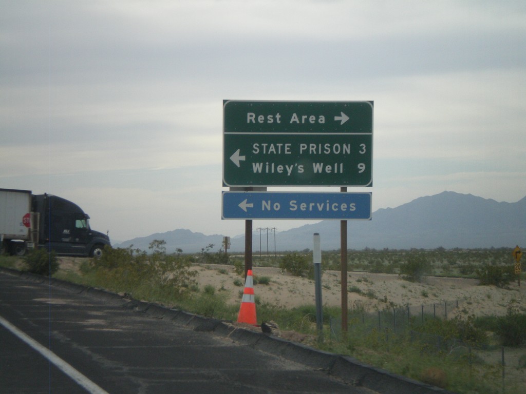
I-10 West - Exit 222 Offramp
I-10 west at Exit 222 offramp - Wiley’s Well. Turn south for Wiley’s Well Road, north for Rest Area.
Taken 03-22-2010
Blythe
Riverside County
California
United States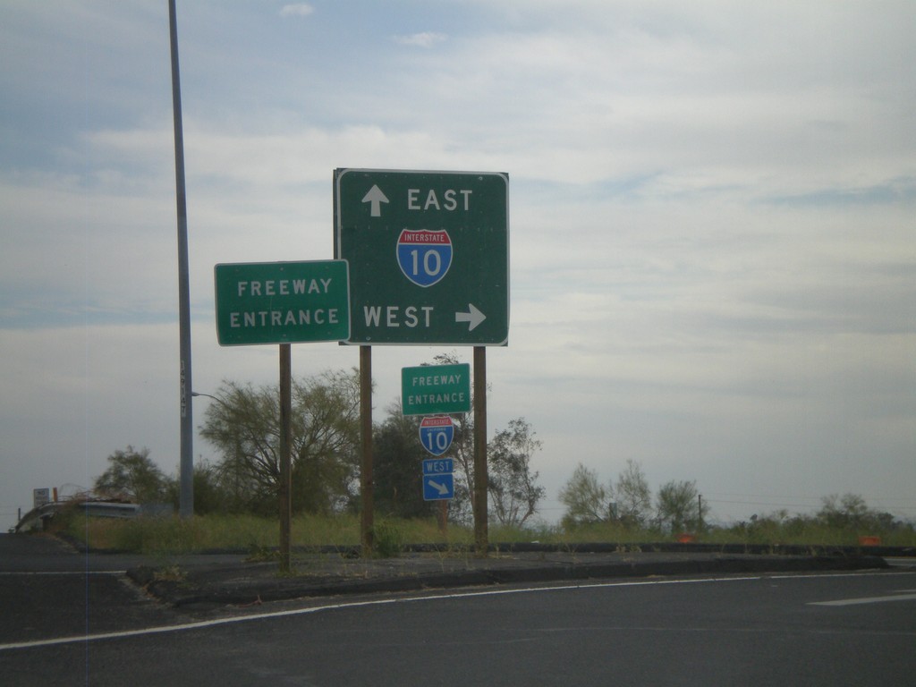
Neighbors Blvd. South at I-10
Neighbors Blvd. south at I-10. BL-10 ends here and CA-78 begins.
Taken 03-22-2010

 Blythe
Riverside County
California
United States
Blythe
Riverside County
California
United States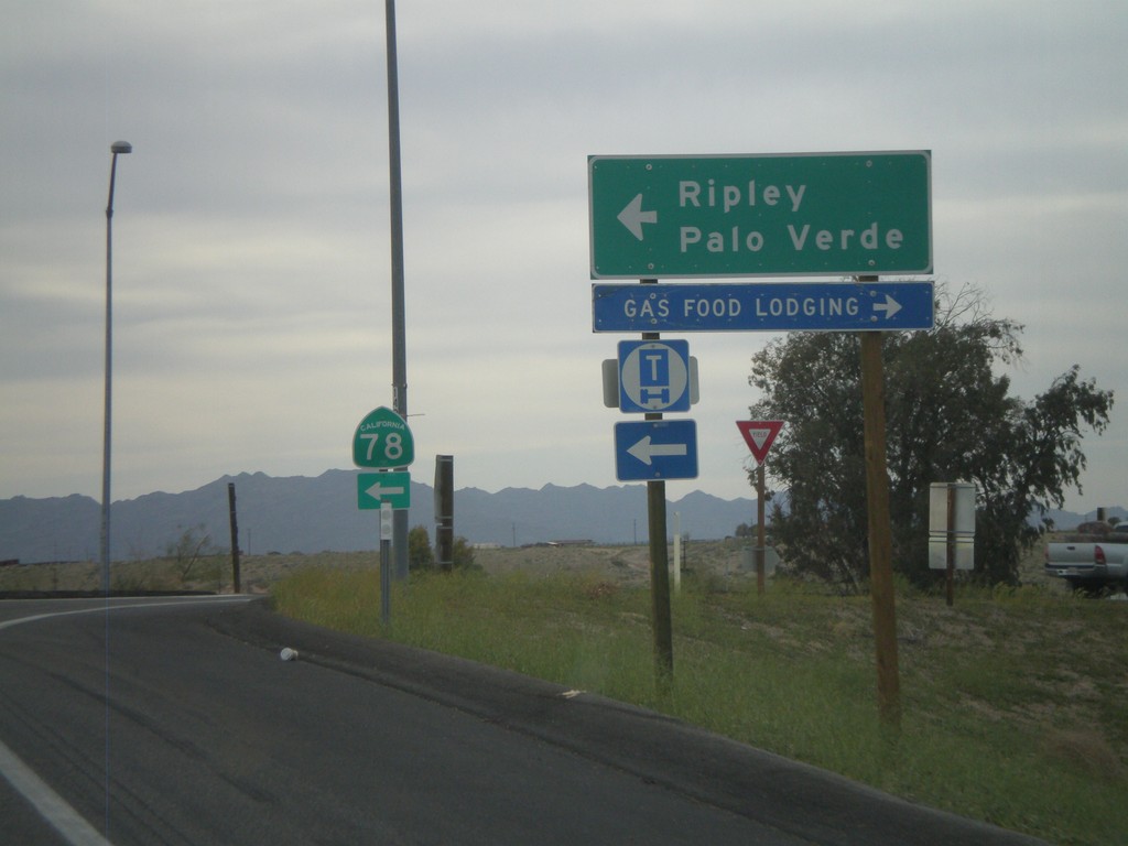
I-10 West Exit 236 Offramp at CA-78
I-10 west at Exit 236 at CA-78 to Palo Verde and Ripley.
Taken 03-22-2010
Blythe
Riverside County
California
United States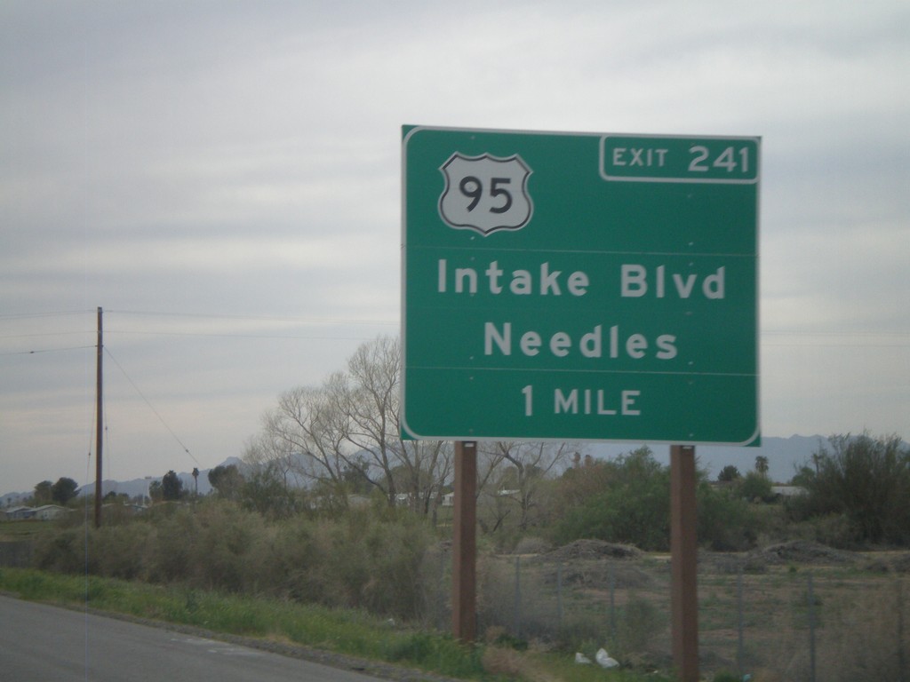
I-10 West Approaching Exit 241
I-10 west approaching Exit 241 - US-95/Intake Blvd/Needles. US-95 north leaves I-10 here. US-95 south joins I-10 east to Quartzsite, AZ.
Taken 03-22-2010
 Blythe
Riverside County
California
United States
Blythe
Riverside County
California
United States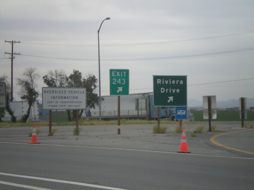
I-10 West - Exit 243
I-10 west at Exit 243 - Riviera Drive. Taken upon leaving the California State Agricultural Inspection Station.
Taken 03-22-2010
Blythe
Riverside County
California
United States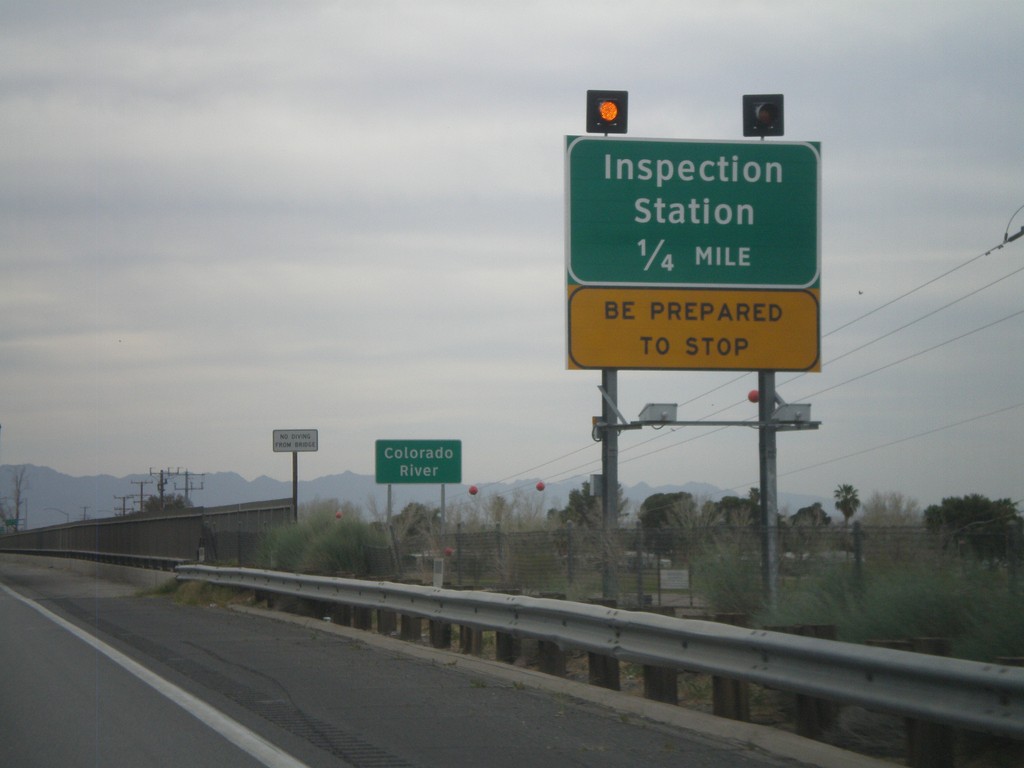
I-10 West - Approaching California Inspection Station
Approaching California Inspection Station and Colorado River on I-10 West/US-95 north.
Taken 03-22-2010
Ehrenberg
La Paz County
Arizona
United States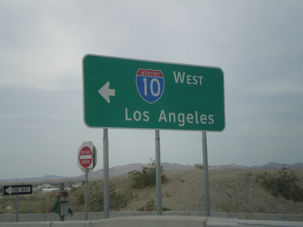
I-10 Exit 1 Onramp
I-10 west onramp to Los Angeles at Exit 1.
Taken 03-22-2010
Ehrenberg
La Paz County
Arizona
United States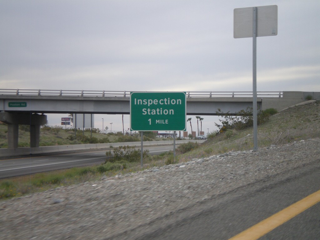
I-10 West Approaching California Agricultural Inspection Station
Approaching the California State Agricultural Inspection Station on I-10 west.
Taken 03-22-2010
Ehrenberg
La Paz County
Arizona
United States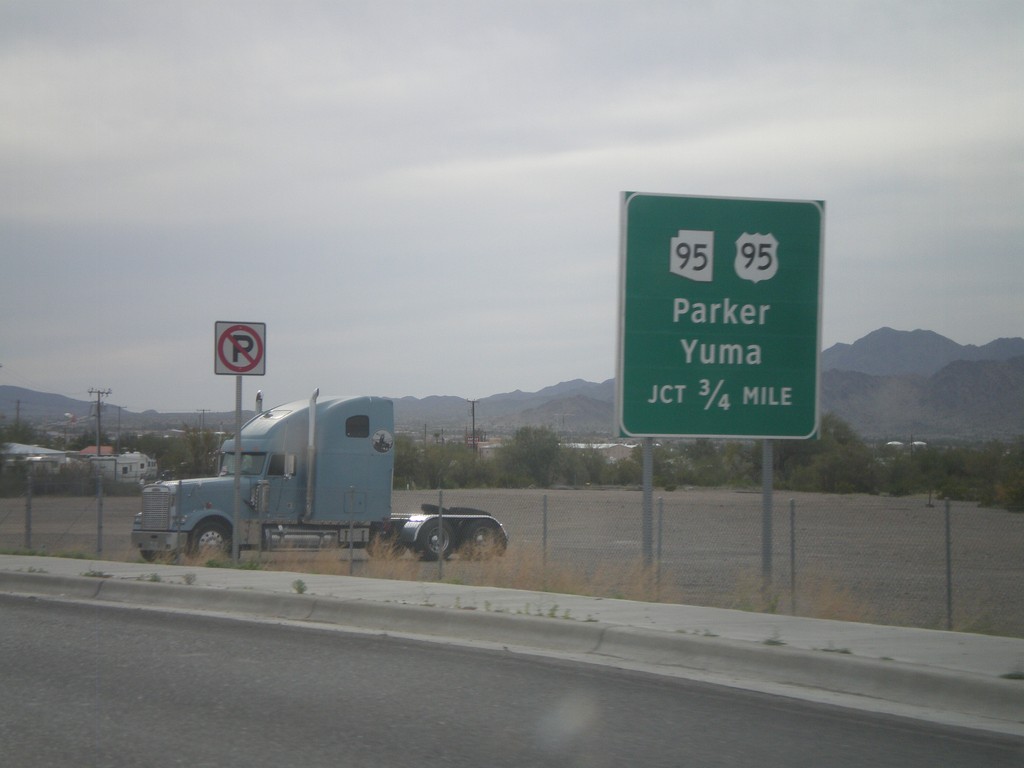
BL-10 West Approaching US-95/AZ-95
BL-10 west approaching US-95 south to Yuma, and AZ-95 north to Parker.
Taken 03-22-2010
 Quartzsite
La Paz County
Arizona
United States
Quartzsite
La Paz County
Arizona
United States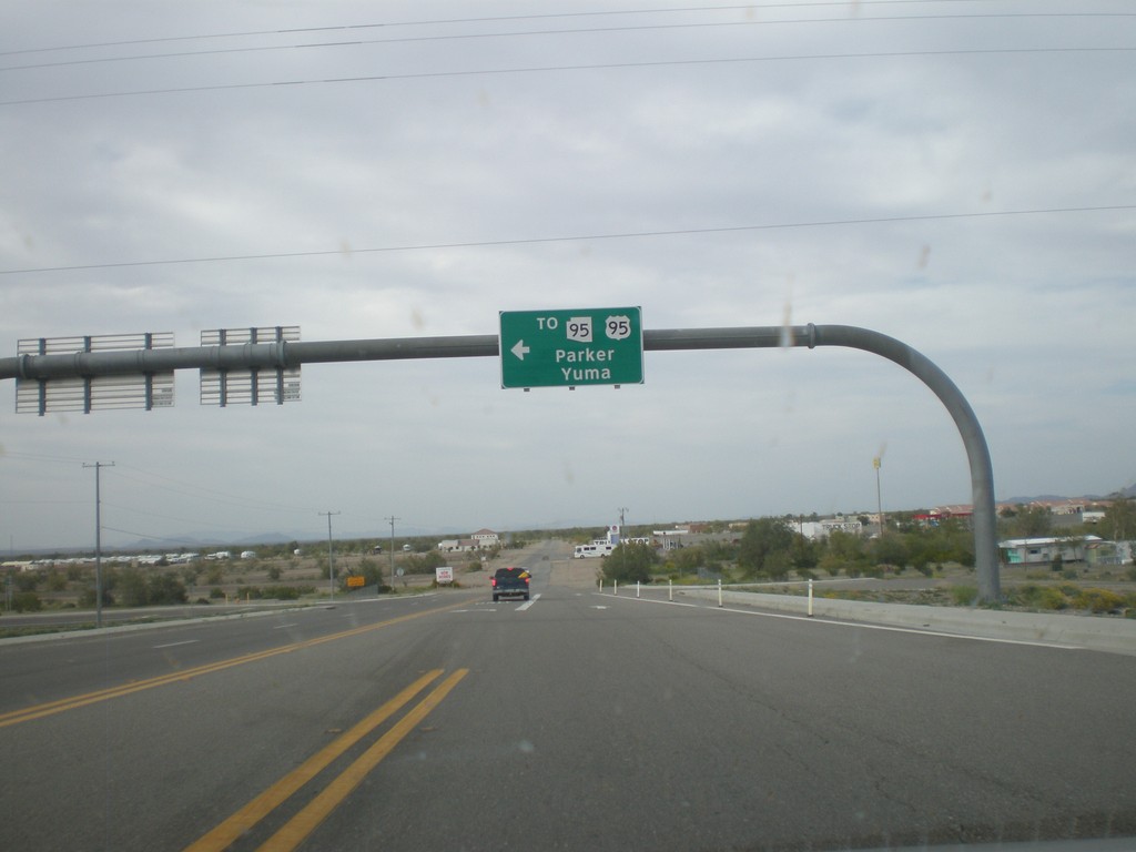
BL-10 West at Main St. - Quartzsite
BL-10 west at Main St. in Quartzsite. Turn left on Main St. for US-95, AZ-95 to Yuma and Parker. Turn left to continue on BL-10.
Taken 03-22-2010
Quartzsite
La Paz County
Arizona
United States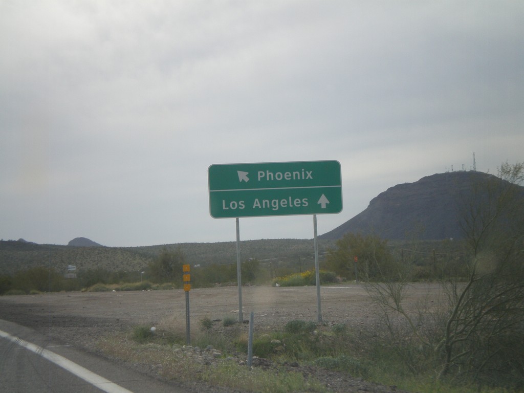
End US-60 Approaching I-10
End US-60 approaching I-10. Use I-10 west for Los Angeles, and I-10 east for Phoenix.
Taken 03-22-2010
 Brenda
La Paz County
Arizona
United States
Brenda
La Paz County
Arizona
United States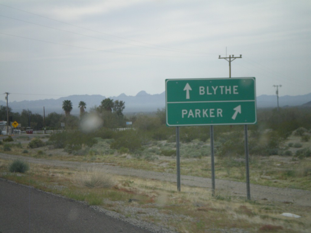
US-60 West at AZ-72
US-60 west at AZ-72. Use AZ-72 east for Parker. Continue west on US-60 for Blythe (CA).
Taken 03-22-2010
 Salome
La Paz County
Arizona
United States
Salome
La Paz County
Arizona
United States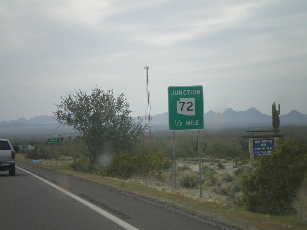
US-60 West Approaching AZ-72
US-60 west approaching AZ-72. Approaching the community of Hope, AZ.
Taken 03-22-2010
Salome
La Paz County
Arizona
United States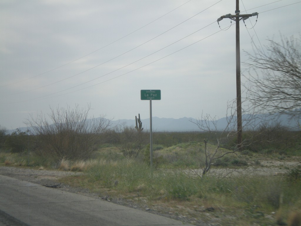
US-60 West - Entering La Paz County
Entering La Paz County on US-60 west at the La Paz - Maricopa County Line.
Taken 03-22-2010
Aguila
Maricopa County
Arizona
United States