Signs Tagged With Big Green Sign
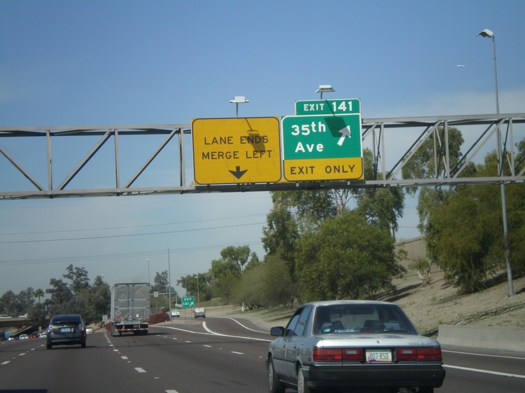
I-10 West - Exit 141
I-10 west at Exit 141 - 34th Ave
Taken 03-22-2010
 Phoenix
Maricopa County
Arizona
United States
Phoenix
Maricopa County
Arizona
United States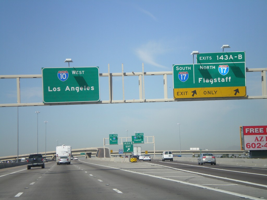
I-10 West - Exit 143
I-10 west at Exit 143A - I-17 North/Flagstaff and Exit 143B - I-17 South.
Taken 03-22-2010

 Phoenix
Maricopa County
Arizona
United States
Phoenix
Maricopa County
Arizona
United States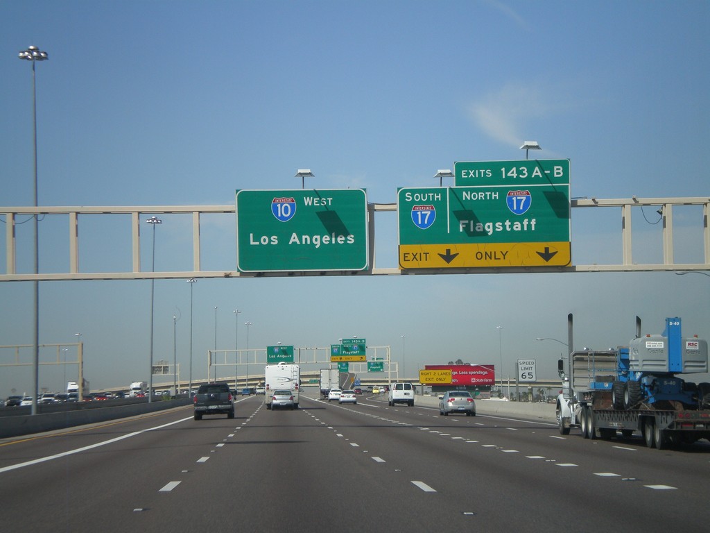
I-10 West - Exits 143 AB
I-10 west approaching Exit 143 A-B - I-17 North/Flagstaff/I-17 South.
Taken 03-22-2010
Phoenix
Maricopa County
Arizona
United States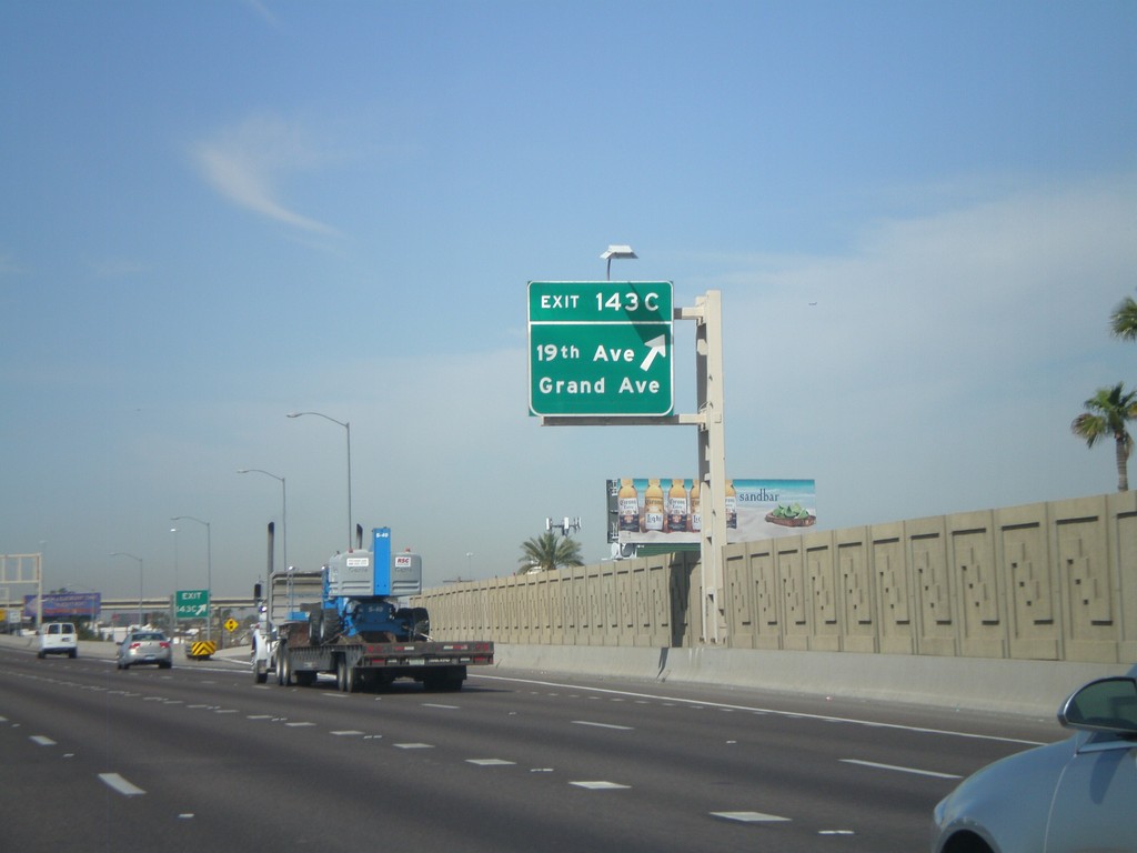
I-10 West - Exit 143C
I-10 west at Exit 143C - 19th Ave./Grand Ave.
Taken 03-22-2010
Phoenix
Maricopa County
Arizona
United States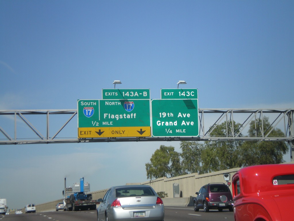
I-10 West Approaching Exits 143 A-C
I-10 west approaching Exit 143C - 19th Ave./Grand Ave. Also approaching Exit 143AB - I-17 North/Flagstaff/I-17 South
Taken 03-22-2010
Phoenix
Maricopa County
Arizona
United States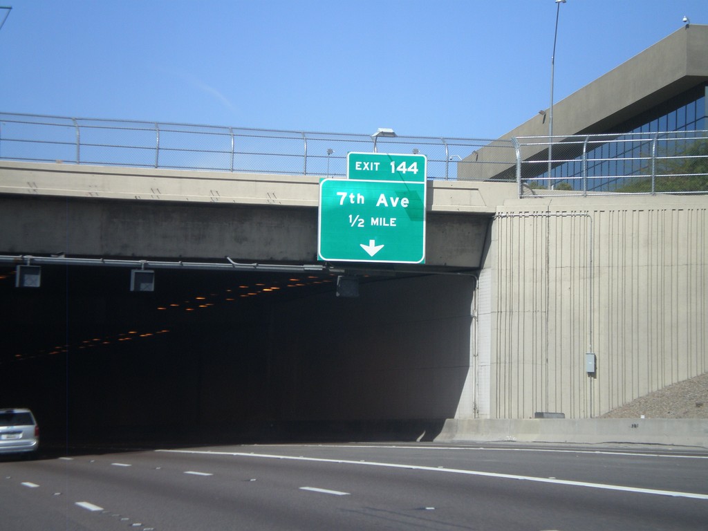
I-10 West Approaching Exit 144
I-10 west approaching Exit 144 - 7th Ave. Entering the Papago Freeway Tunnel.
Taken 03-22-2010
Phoenix
Maricopa County
Arizona
United States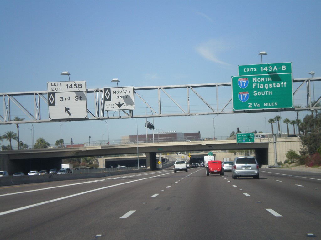
I-10 West - Exit 145B and Exit 143 AB
I-10 west at Exit 145B - 3rd St. (HOV). Approaching Exits 143AB - I-17 North/Flagstaff and I-17 South.
Taken 03-22-2010
Phoenix
Maricopa County
Arizona
United States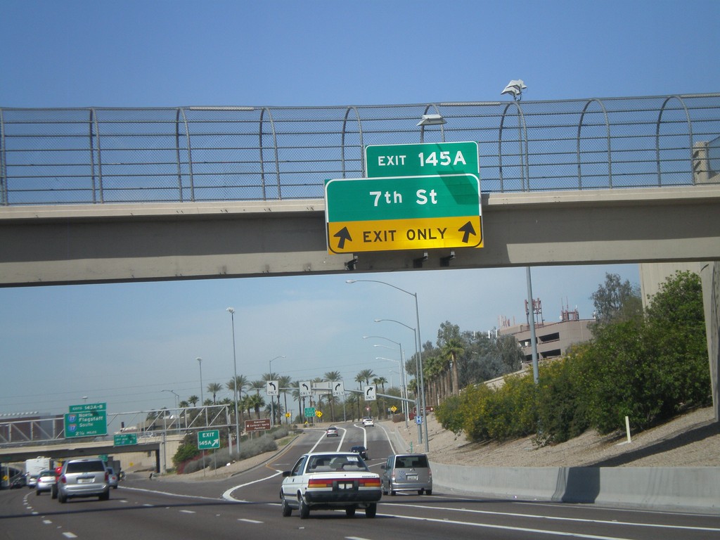
I-10 West - Exit 145A
I-10 west at Exit 145A - 7th St.
Taken 03-22-2010
Phoenix
Maricopa County
Arizona
United States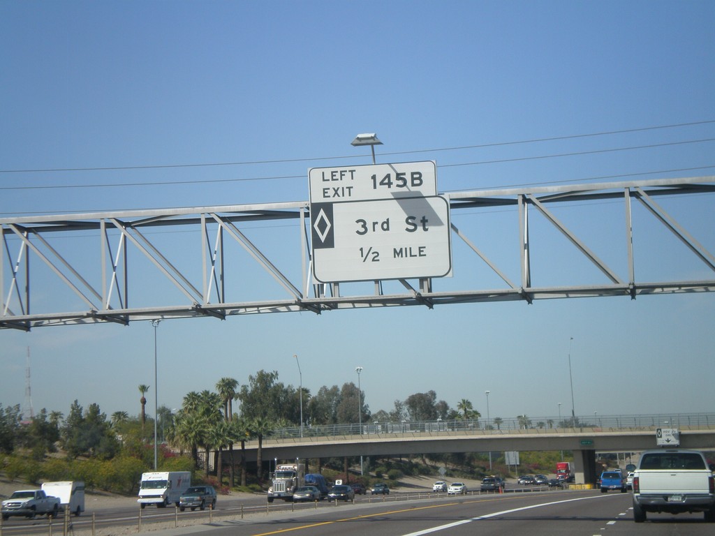
I-10 West - Exit 145B (HOV)
I-10 west approaching Exit 145B - 3rd St. (HOV).
Taken 03-22-2010
Phoenix
Maricopa County
Arizona
United States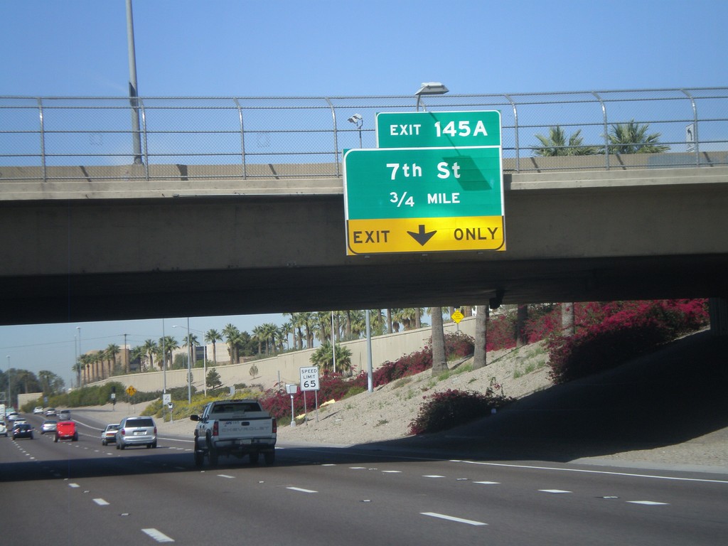
I-10 West - Exit 145A
I-10 west approaching Exit 145A - 7th St.
Taken 03-22-2010
Phoenix
Maricopa County
Arizona
United States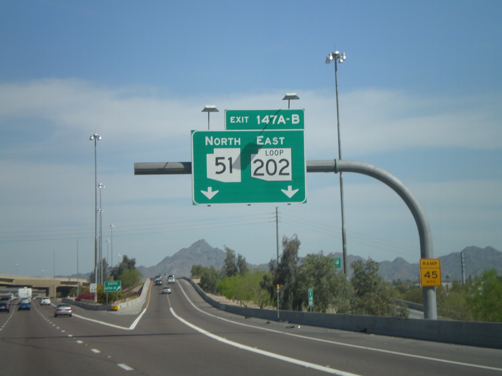
I-10 West - Exits 147A and B
I-10 west at Exit 147B - AZ-51 North. Approaching Exit 147A - AZ-202 Loop East.
Taken 03-22-2010

 Phoenix
Maricopa County
Arizona
United States
Phoenix
Maricopa County
Arizona
United States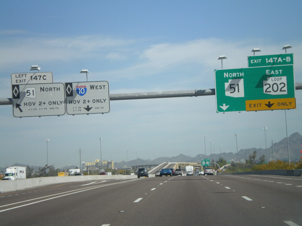
I-10 West - Exits 147 A, B, and C
I-10 west at Exit 147C - AZ-51 North (HOV). Approaching Exit 147B - AZ-51 North and Exit 147A - AZ-202 Loop East.
Taken 03-22-2010
Phoenix
Maricopa County
Arizona
United States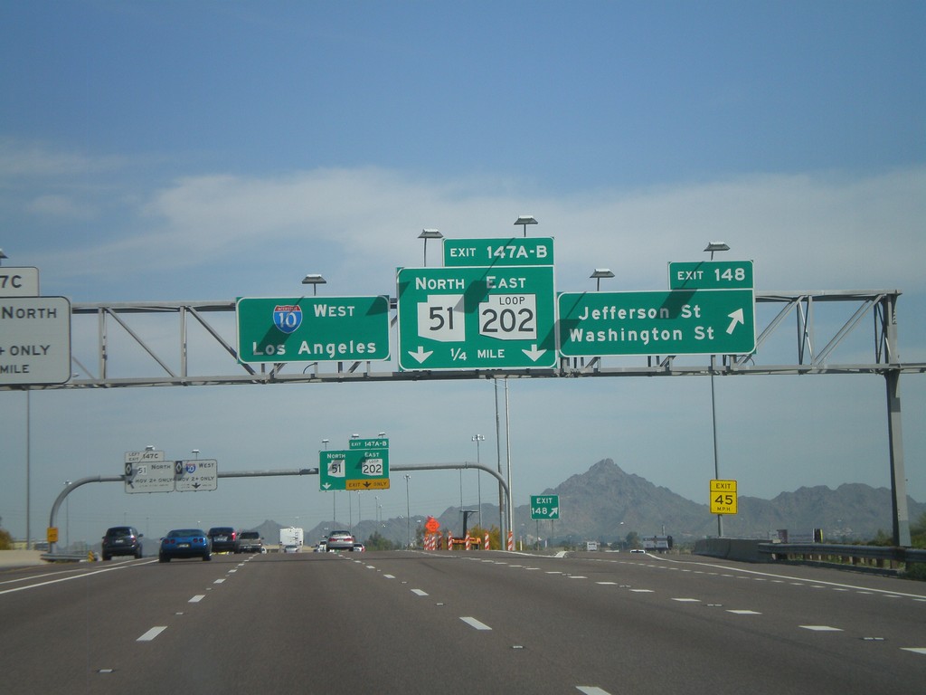
I-10 West - Exits 148 and 147AB
I-10 west at Exit 148 - Jefferson St./Washington St. Approaching Exits 148A-B - AZ-51 North/AZ-202 Loop East.
Taken 03-22-2010
Phoenix
Maricopa County
Arizona
United States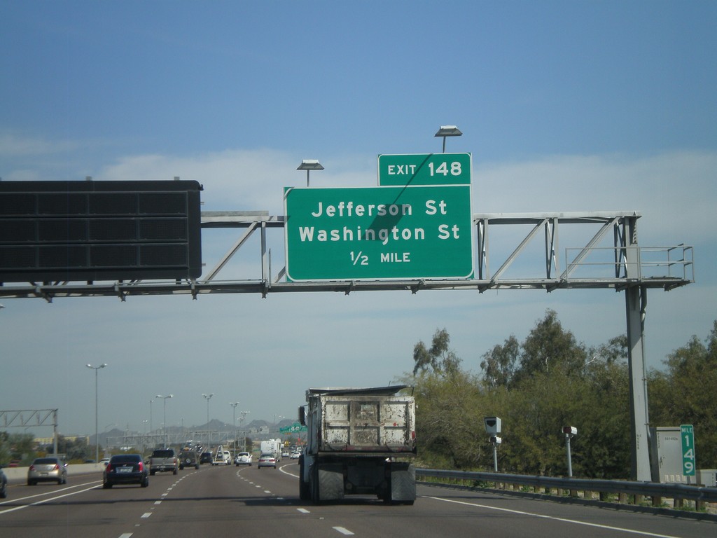
I-10 West Approaching Exit 148
I-10 west approaching Exit 148 - Jefferson St./Washington St.
Taken 03-22-2010
Phoenix
Maricopa County
Arizona
United States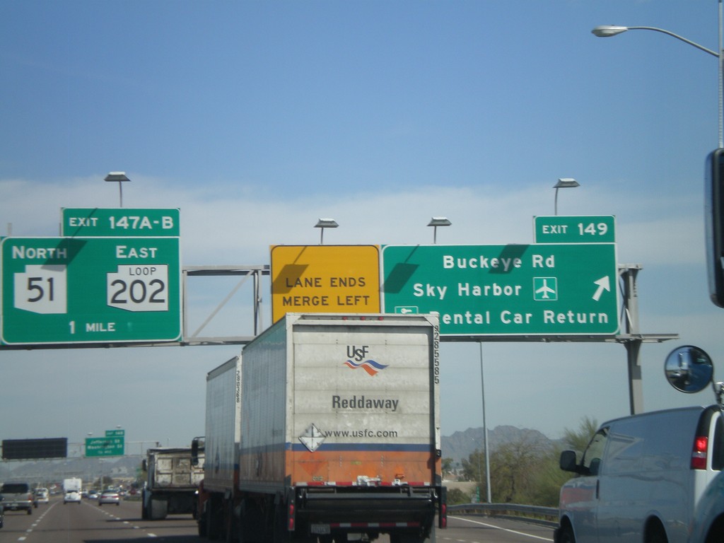
I-10 West - Exits 149 and Exit 147AB
I-10 west at Exit 149 - Buckeye Road/Sky Harbor Airport/Rental Car Return. Approaching Exit 147B - AZ-51 North and Exit 147A - AZ-202 Loop East.
Taken 03-22-2010
Phoenix
Maricopa County
Arizona
United States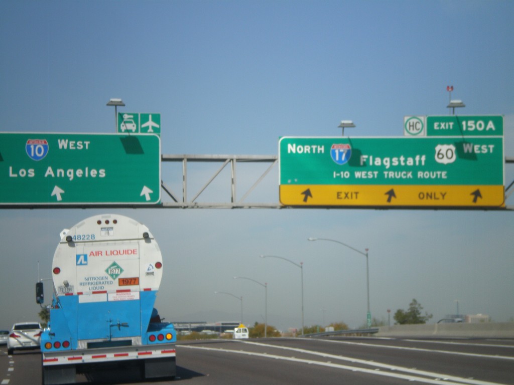
I-10 West - Exit 150
I-10 west at Exit 150A - I-17 North/Flagstaff/US-60 West/I-10 West Truck Route. US-60 west leaves I-10 west here.
Taken 03-22-2010
Phoenix
Maricopa County
Arizona
United States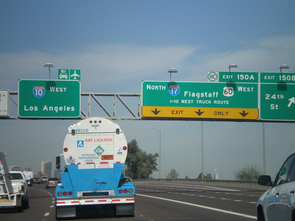
I-10 West - Exits 150B and 150A
I-10 west at Exit 150B - 24th St. Approaching Exit 150A - I-17 North/US-60 West/Flagstaff/I-10 West Truck Route. US-60 leaves I-10 west at I-17. Continue west on I-10 for Los Angeles and the Sky Harbor Airport.
Taken 03-22-2010
Phoenix
Maricopa County
Arizona
United States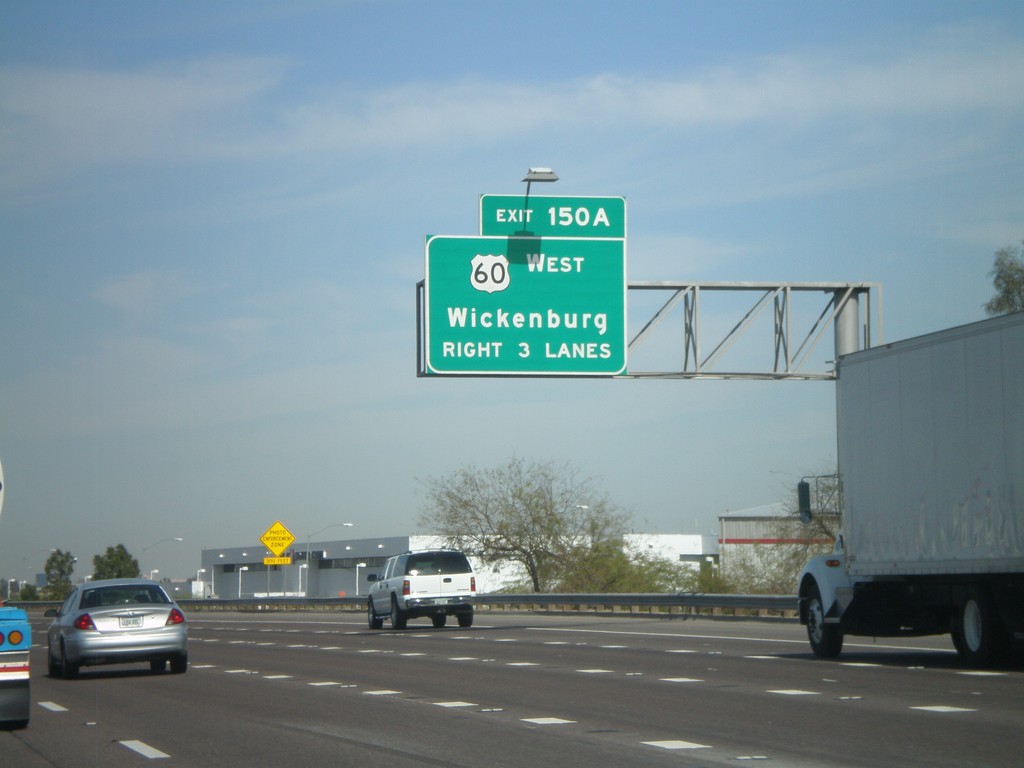
I-10 West Approaching Exit 150A
I-10 west approaching Exit 150A. Wickenburg bound traffic use US-60 west at Exit 150A.
Taken 03-22-2010
Phoenix
Maricopa County
Arizona
United States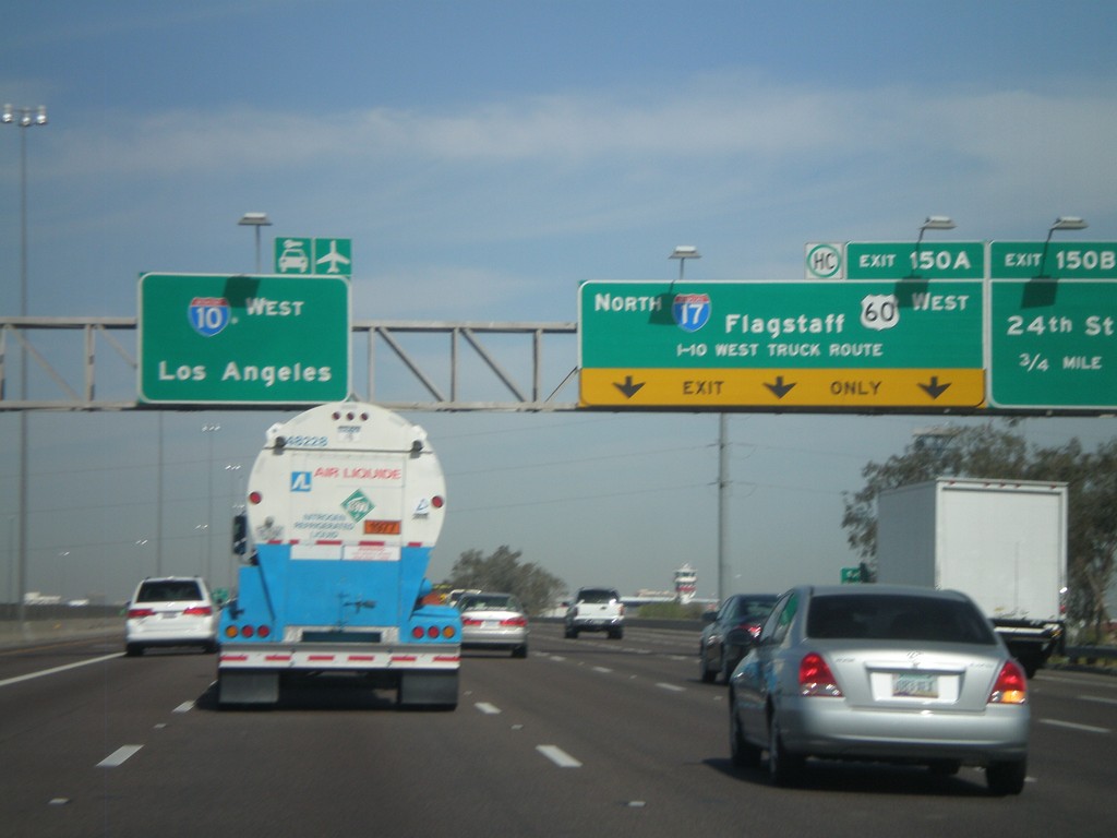
I-10 West - Exits 150B and 150A
I-10 west approaching Exit 150B - 24th St. Approaching Exit 150A - I-17 North/US-60 West/Flagstaff/I-10 West Truck Route. I-10 continues west to Los Angeles. US-60 exits I-10 here and joins I-17 through downtown Phoenix.
Taken 03-22-2010
Phoenix
Maricopa County
Arizona
United States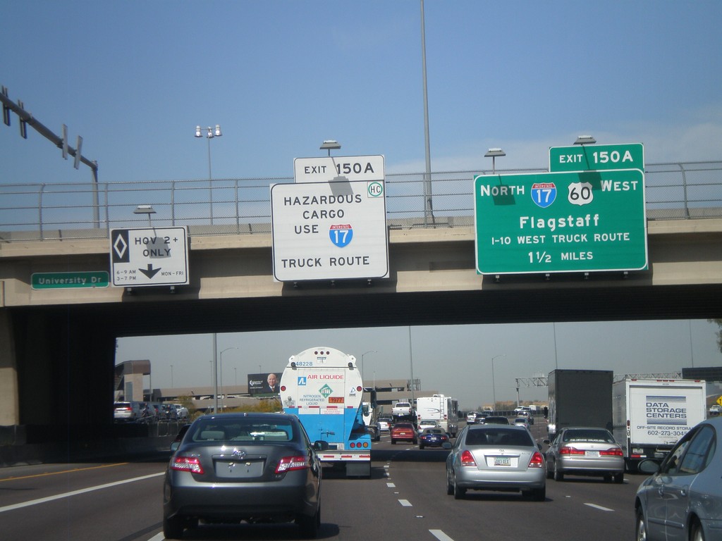
I-10 West Approaching Exit 150A
I-10 west approaching Exit 150A - I-17 North/US-60 West/Flagstaff/To I-10 West Truck Route. Hazardous cargo must use I-17 north through downtown Phoenix.
Taken 03-22-2010
Phoenix
Maricopa County
Arizona
United States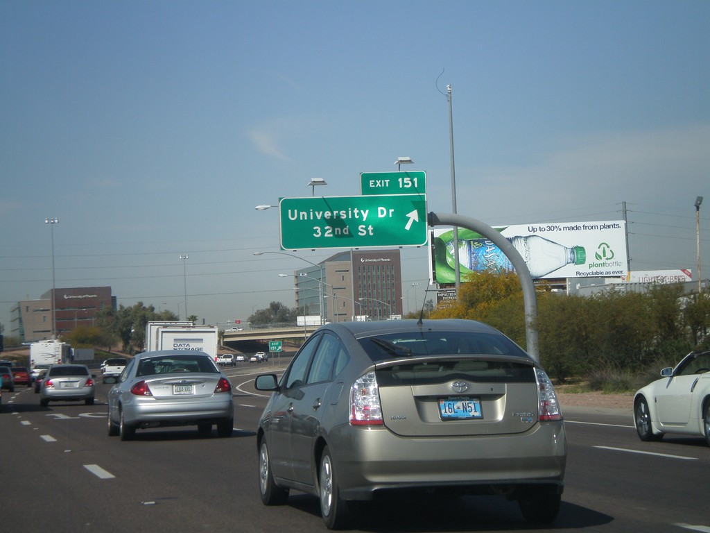
I-10 West - Exit 151
I-10 west at Exit 151 - University Drive/32nd St.
Taken 03-22-2010
Phoenix
Maricopa County
Arizona
United States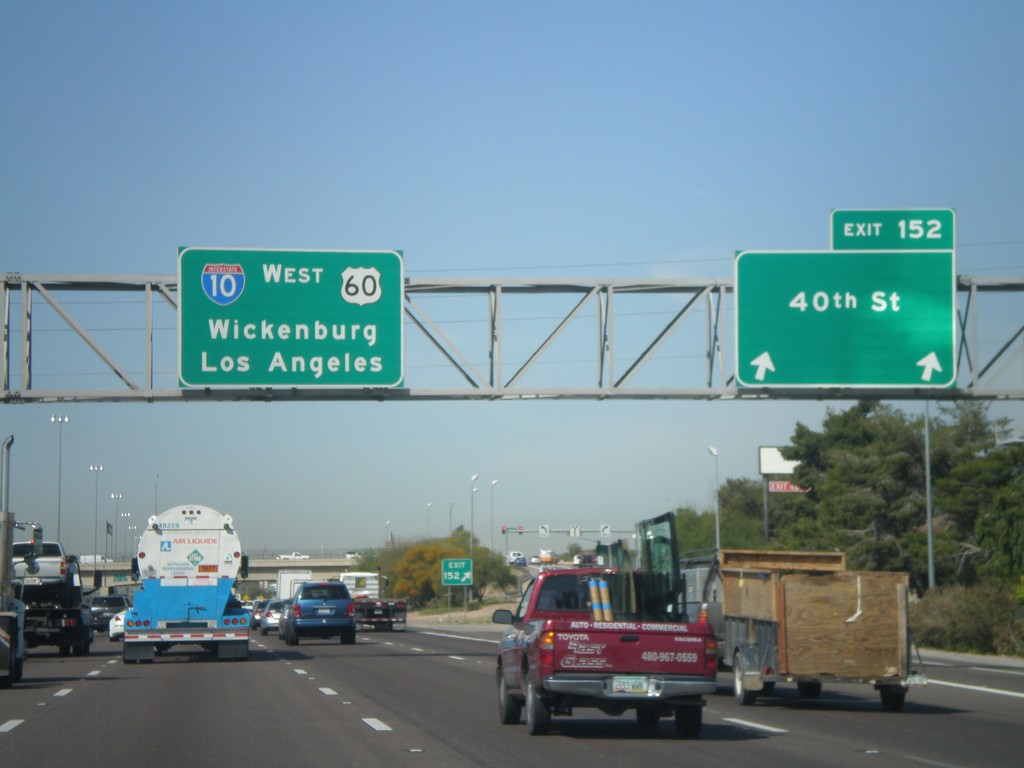
I-10 West - Exit 152
I-10/US-60 west at Exit 152 - 40th St. I-10 and US-60 continue west to Wickenburg (via US-60) and Los Angeles.
Taken 03-22-2010
Phoenix
Maricopa County
Arizona
United States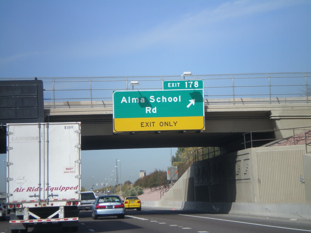
US-60 West - Exit 178
US-60 west at Exit 178 - Alma School Road.
Taken 03-22-2010
Mesa
Maricopa County
Arizona
United States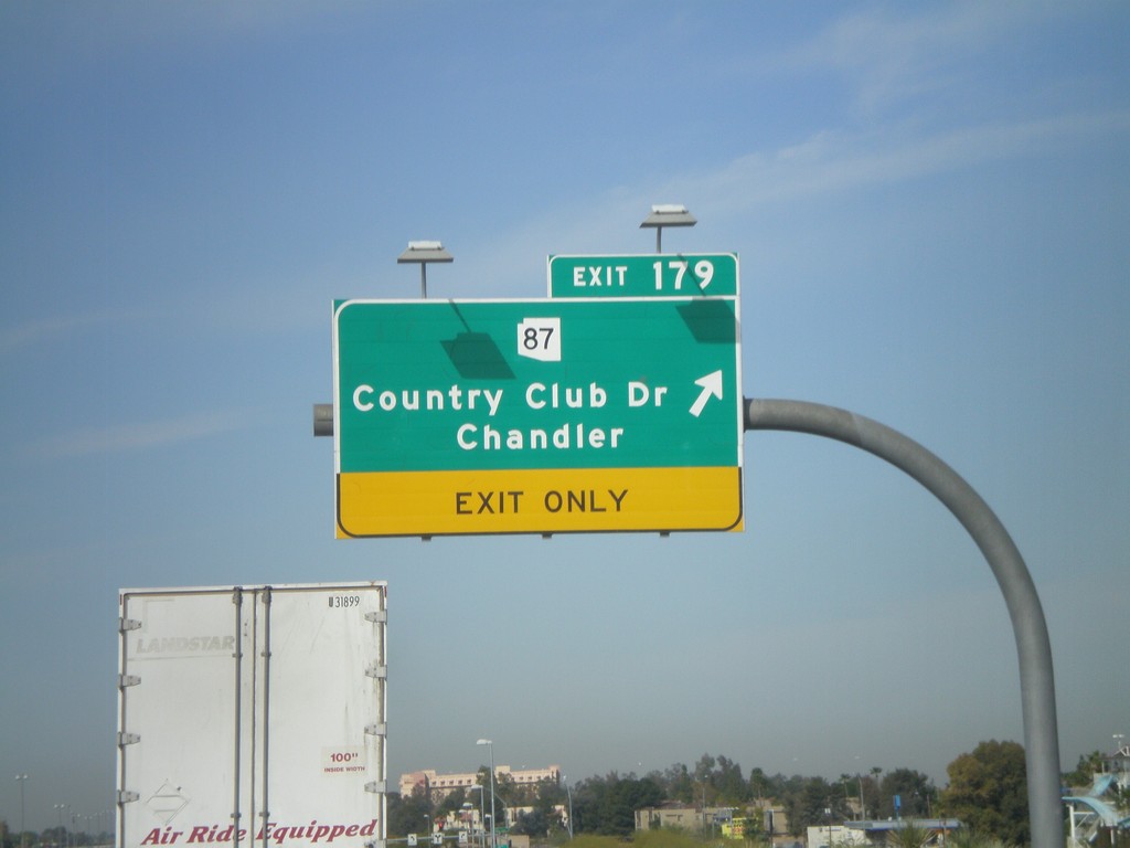
US-60 West - Exit 179
US-60 west at Exit 179 - AZ-87/Country Club Drive/Chandler
Taken 03-22-2010
 Mesa
Maricopa County
Arizona
United States
Mesa
Maricopa County
Arizona
United States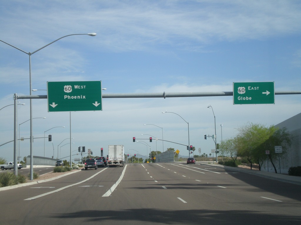
Mesa Drive North at US-60
Mesa Drive north at US-60. Use US-60 west for Phoenix. Use US-60 east for Globe.
Taken 03-22-2010
Mesa
Maricopa County
Arizona
United States