Signs Tagged With Big Green Sign
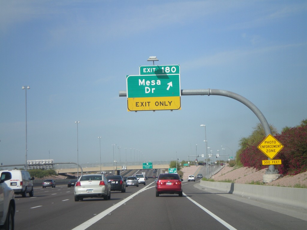
US-60 West - Exit 180
US-60 west at Exit 180 - Mesa Drive
Taken 03-22-2010
 Mesa
Maricopa County
Arizona
United States
Mesa
Maricopa County
Arizona
United States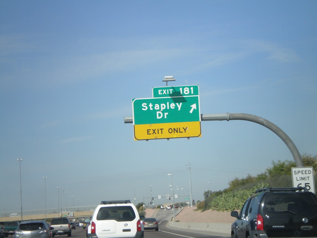
US-60 West - Exit 181
US-60 west at Exit 181 - Stapley Drive
Taken 03-22-2010
Mesa
Maricopa County
Arizona
United States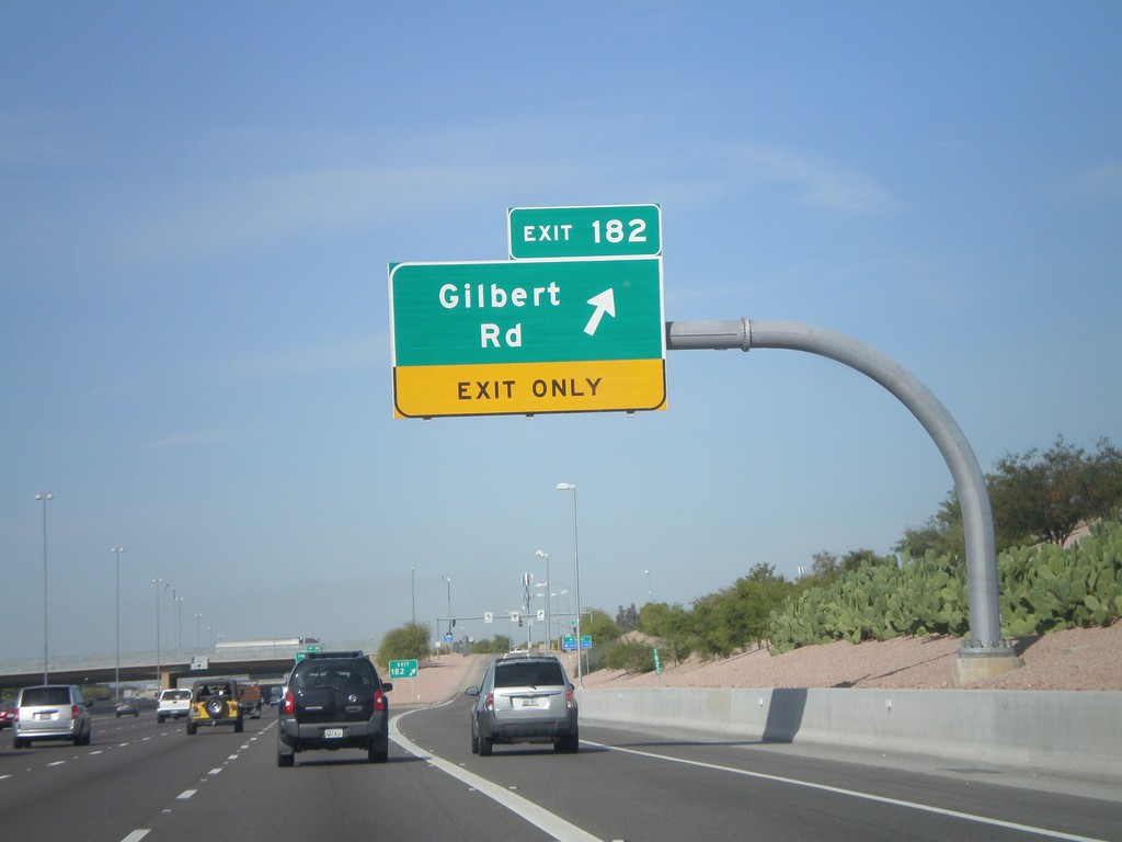
US-60 West - Exit 182
US-60 west at Exit 182 - Gilbert Road
Taken 03-22-2010
Mesa
Maricopa County
Arizona
United States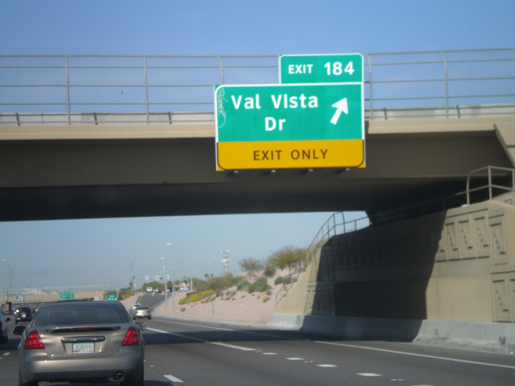
US-60 West - Exit 184
US-60 west at Exit 184 - Val Vista Drive.
Taken 03-22-2010
Mesa
Maricopa County
Arizona
United States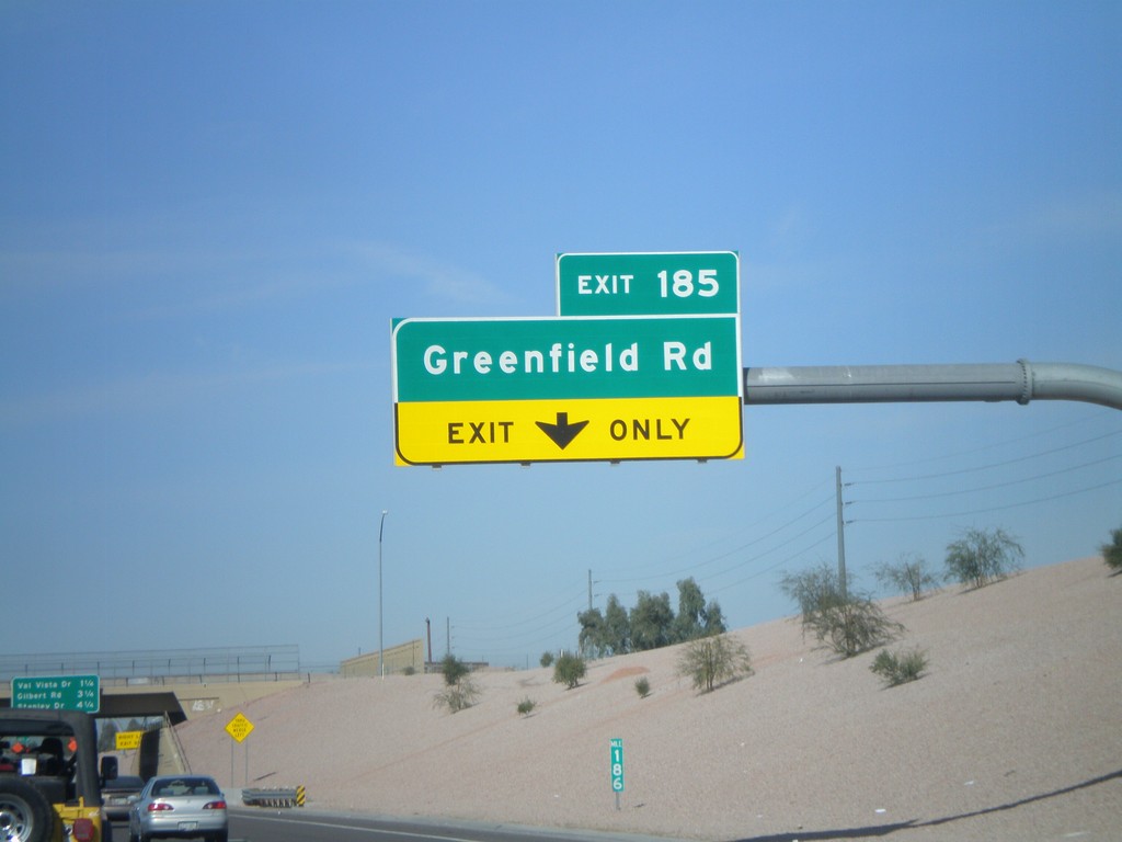
US-60 West - Exit 185
US-60 west at Exit 185 - Greenfield Road
Taken 03-22-2010
Mesa
Maricopa County
Arizona
United States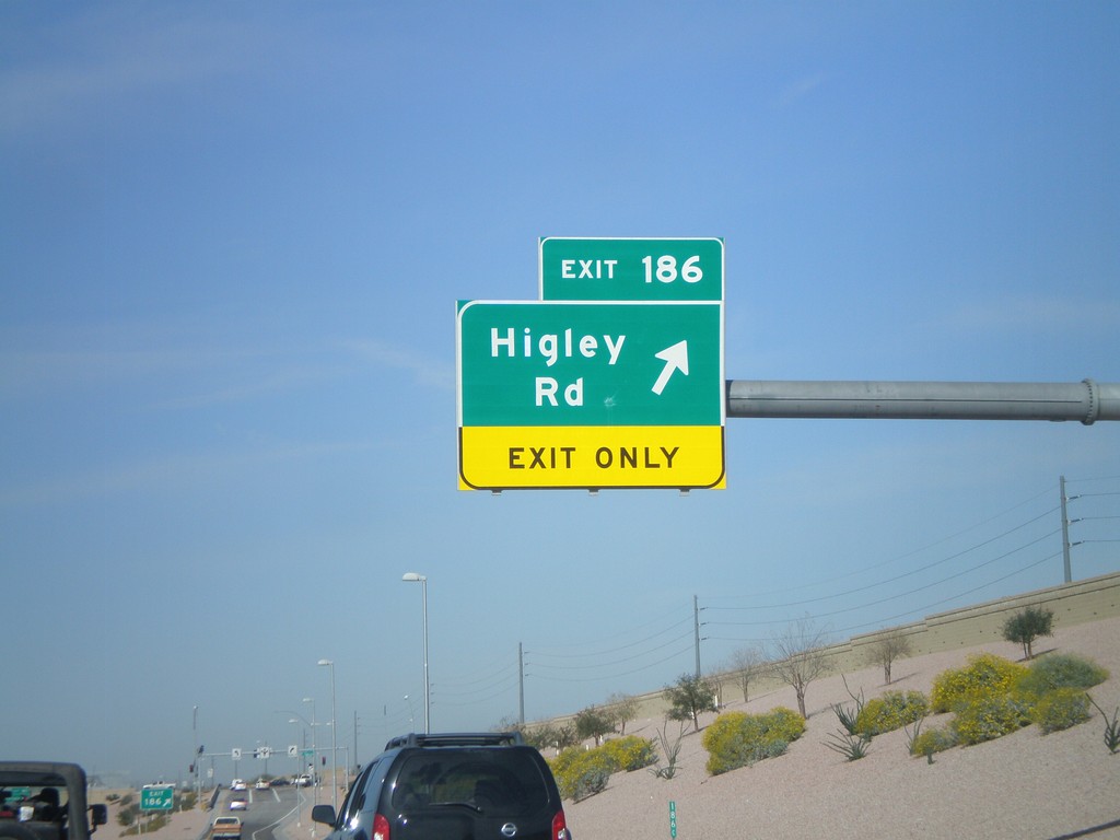
US-60 West - Exit 186
US-60 west at Exit 186 - Higley Road.
Taken 03-22-2010
Mesa
Maricopa County
Arizona
United States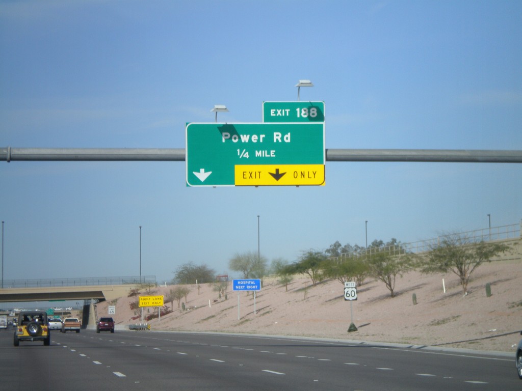
US-60 West Approaching Exit 188
US-60 west approaching Exit 188 - Power Road.
Taken 03-22-2010
Mesa
Maricopa County
Arizona
United States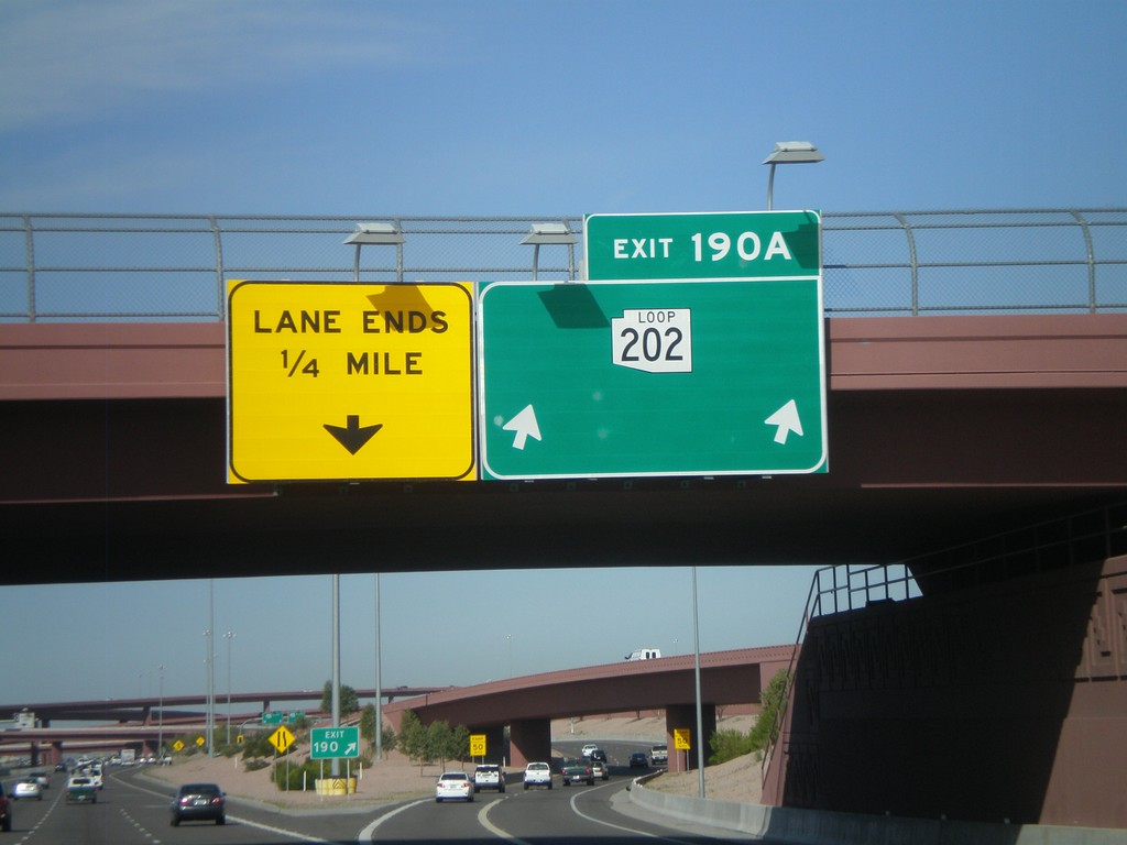
US-60 West - Exit 190A
US-60 west at Exit 190A - AZ-202 Loop. This is the eastern extent of the AZ-202 Loop.
Taken 03-22-2010
 Mesa
Maricopa County
Arizona
United States
Mesa
Maricopa County
Arizona
United States
US-60 West - Exits 191 and 190A
US-60 west at Exit 191 - Ellsworth Road. Approaching Exit 190A - AZ-202 Loop.
Taken 03-22-2010
Mesa
Maricopa County
Arizona
United States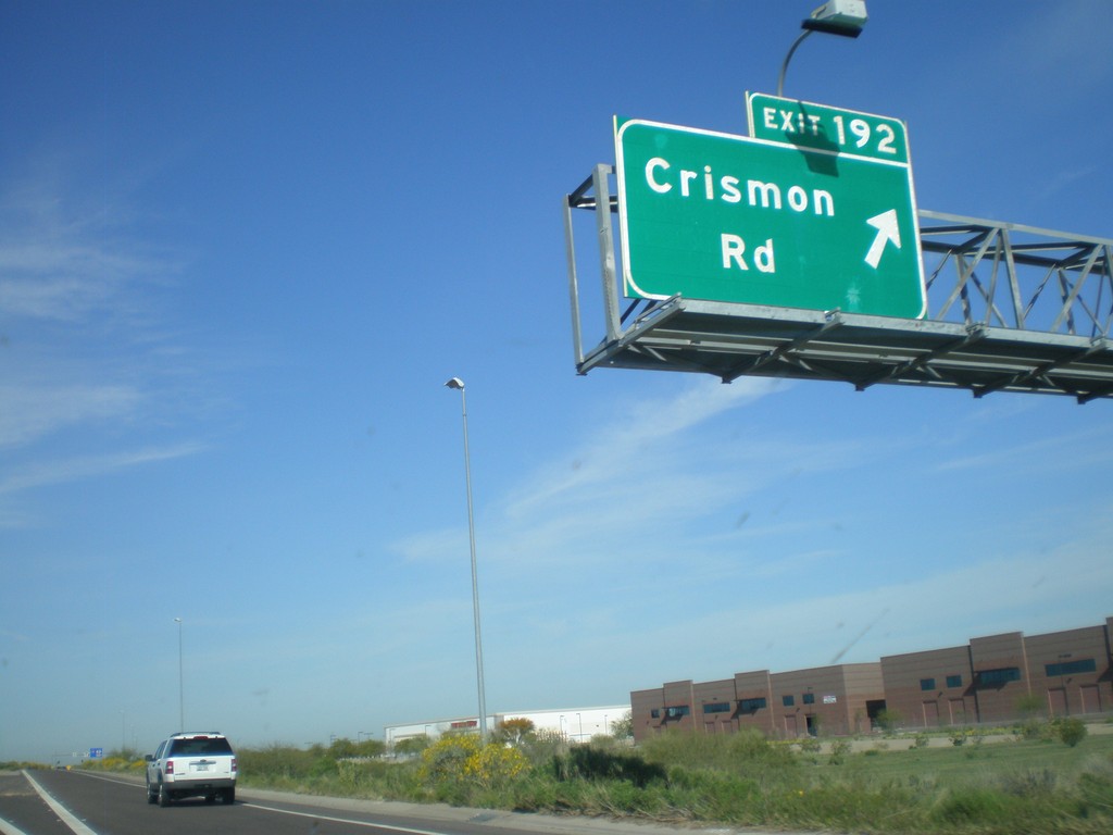
US-60 West - Exit 192
US-60 west at Exit 192 - Crismon Road.
Taken 03-22-2010
Mesa
Maricopa County
Arizona
United States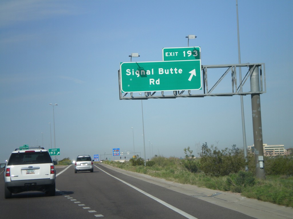
US-60 West - Exit 193
US-60 west at Exit 193 - Signal Butte Road.
Taken 03-22-2010
Mesa
Maricopa County
Arizona
United States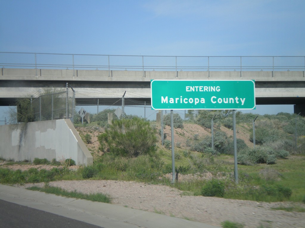
US-60 West - Entering Maricopa County
Entering Maricopa County on US-60 west at the Maricopa-Pinal County Line.
Taken 03-22-2010
Apache Junction
Pinal County
Arizona
United States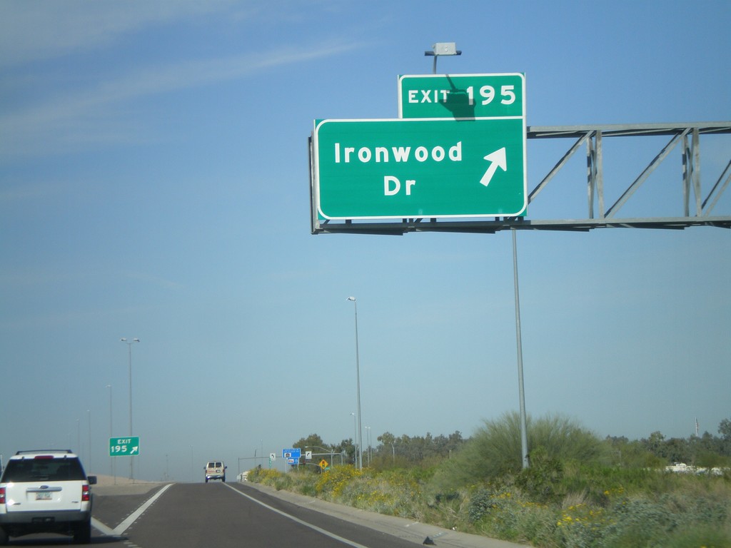
US-60 West - Exit 195
US-60 west at Exit 195 - Ironwood Road.
Taken 03-22-2010
Apache Junction
Pinal County
Arizona
United States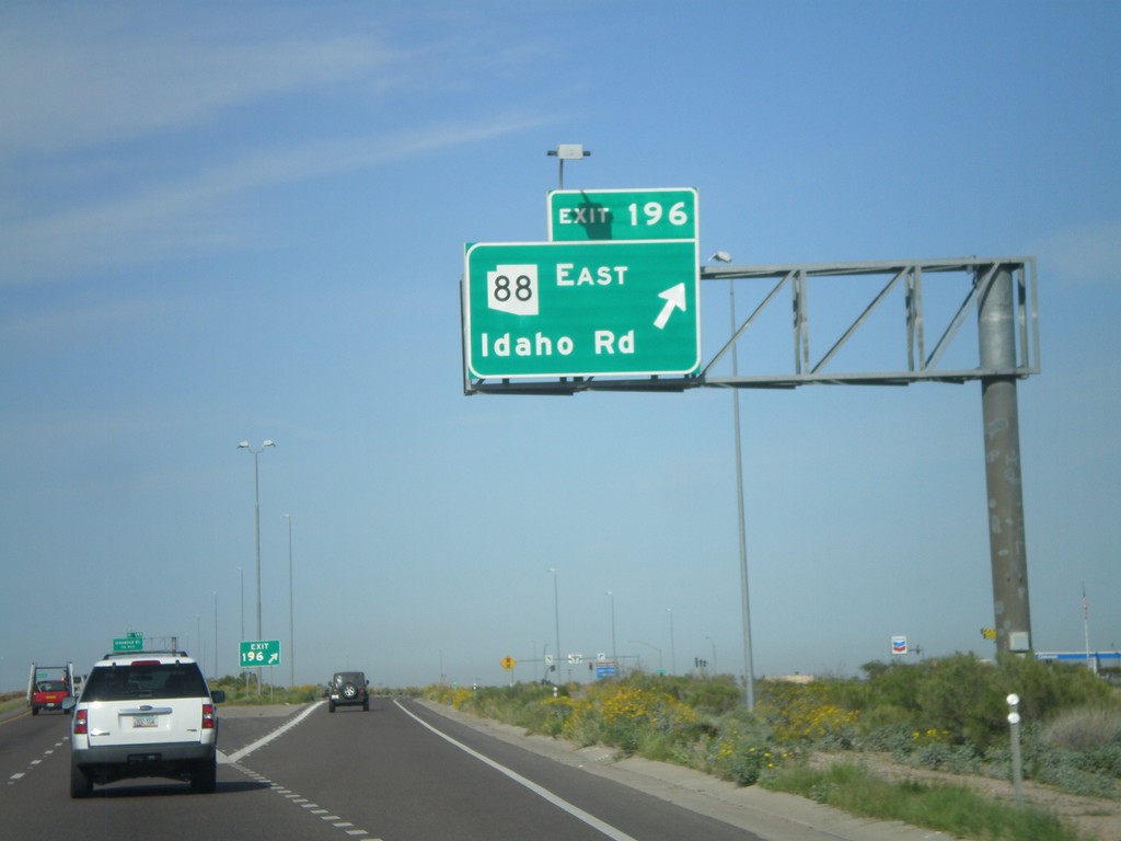
US-60 West - Exit 196
US-60 west at Exit 196 - AZ-88 East/Idaho Road
Taken 03-22-2010
 Apache Junction
Pinal County
Arizona
United States
Apache Junction
Pinal County
Arizona
United States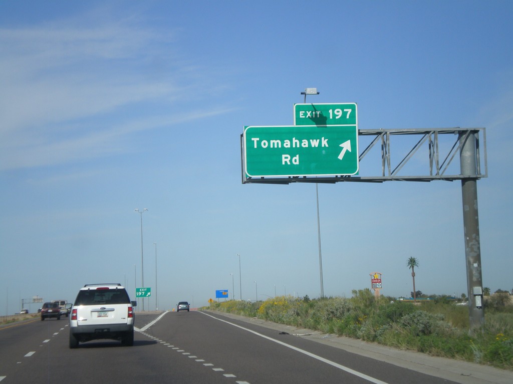
US-60 West - Exit 197
US-60 west at Exit 197 - Tomahawk Road
Taken 03-22-2010
Apache Junction
Pinal County
Arizona
United States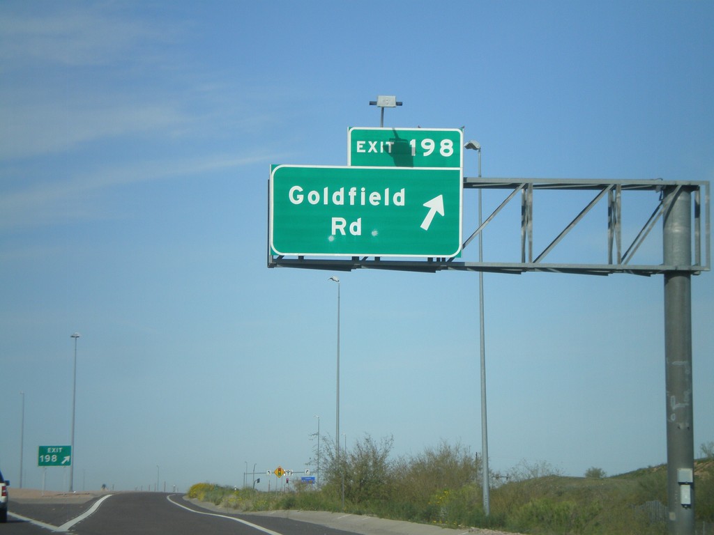
US-60 West - Exit 198
US-60 west at Exit 198 - Goldfield Road.
Taken 03-22-2010
Apache Junction
Pinal County
Arizona
United States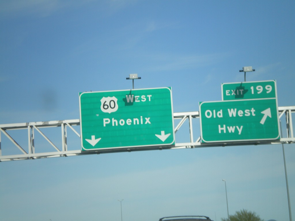
US-60 West - Exit 199
US-60 west at Exit 199 - Old West Highway
Taken 03-22-2010
Apache Junction
Pinal County
Arizona
United States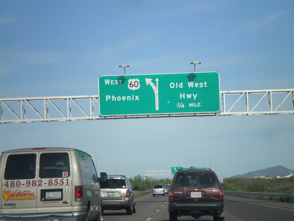
US-60 West Approaching Exit 199
US-60 west approaching Exit 199 - Old West Highway
Taken 03-22-2010
Apache Junction
Pinal County
Arizona
United States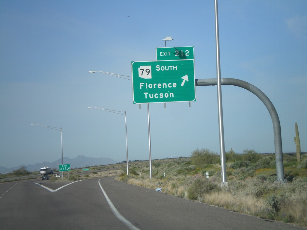
US-60 West - Exit 212
US-60 west at Exit 212 - AZ-79 South/Florence/Tucson.
Taken 03-22-2010
 Queen Valley
Pinal County
Arizona
United States
Queen Valley
Pinal County
Arizona
United States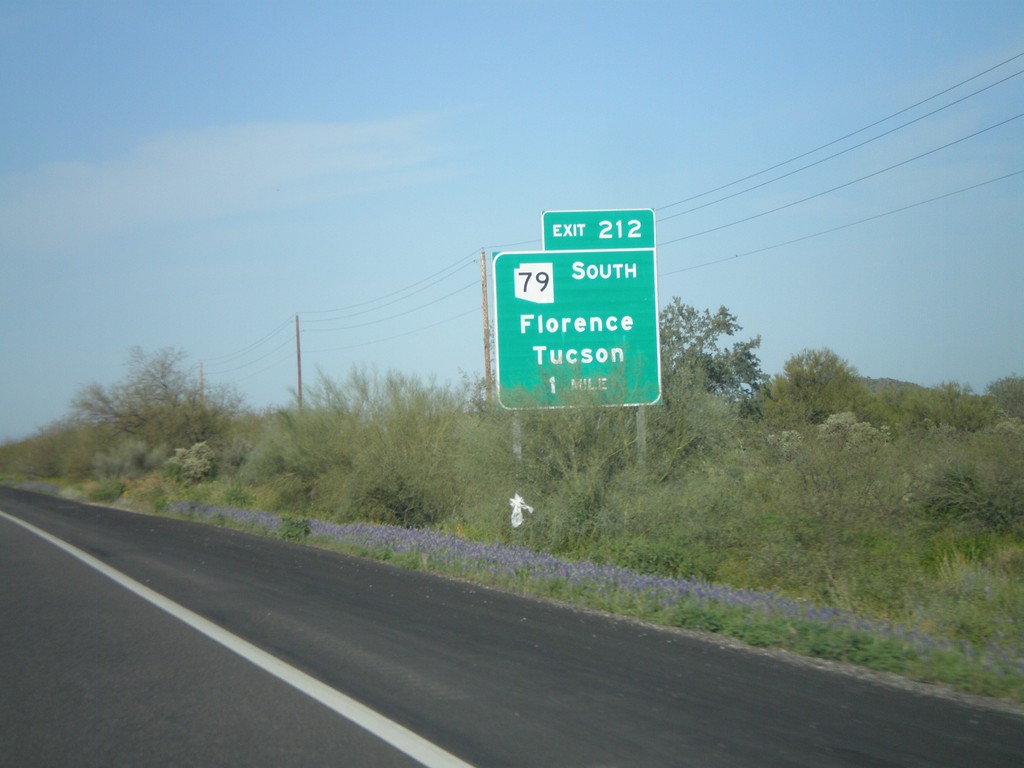
US-60 West Approaching Exit 212
US-60 west approaching Exit 212 - AZ-79 South/Florence/Tucson
Taken 03-22-2010
Queen Valley
Pinal County
Arizona
United States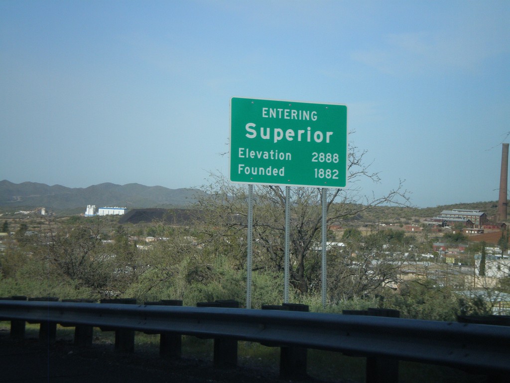
Entering Superior
US-60 west - Entering Superior. Elevation 2,888. Founded in 1882.
Taken 03-22-2010
Superior
Pinal County
Arizona
United States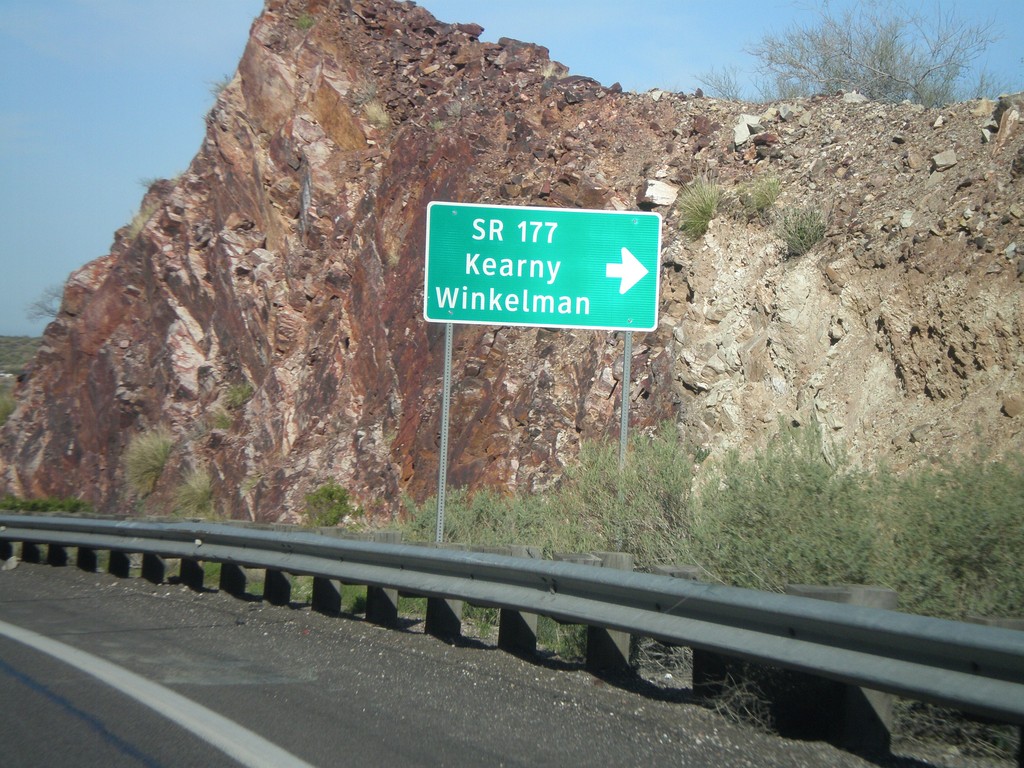
US-60 West at AZ-177 South
US-60 west at AZ-177 south to Winkelman and Kearny. AZ-177 is not displayed as a typical highway shield here, instead it is written out in text.
Taken 03-22-2010
 Superior
Pinal County
Arizona
United States
Superior
Pinal County
Arizona
United States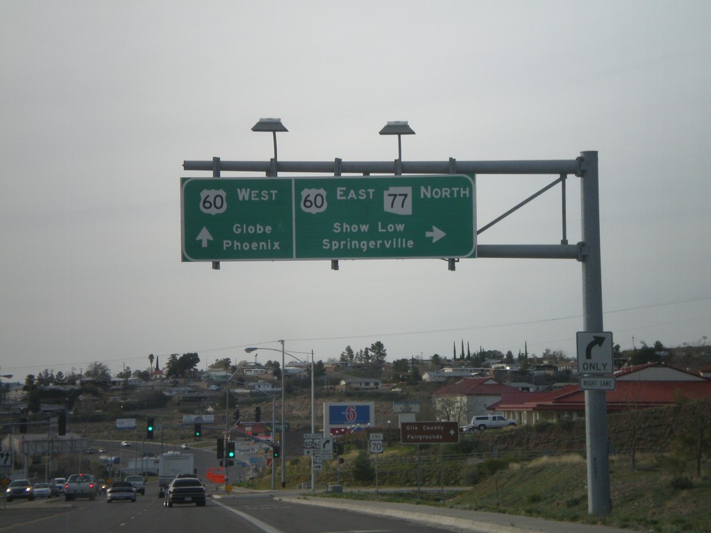
US-70 West/AZ-77 North at US-60/AZ-77
US-70 west at US-60/AZ-77 junction. Use US-60 East/AZ-77 North for Show Low and Springerville. Use US-60 west for Globe and Phoenix. This is the western end of US-70.
Taken 03-21-2010

 Globe
Gila County
Arizona
United States
Globe
Gila County
Arizona
United States
US-70 West Approaching US-60
US-70 west approaching US-60. AZ-77 north has been following US-70 west, and turns onto US-60 east. This is the western terminus of US-70.
Taken 03-21-2010
Globe
Gila County
Arizona
United States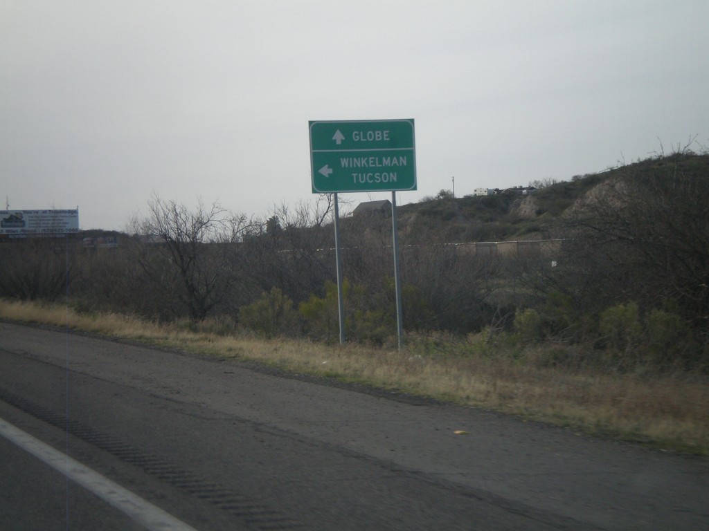
US-70 West at AZ-77
US-70 west at AZ-77. Use AZ-77 south for Winkelman and Tucson. Continue west on US-70/AZ-77 north for Globe.
Taken 03-21-2010
Globe
Gila County
Arizona
United States