Signs Tagged With Big Green Sign
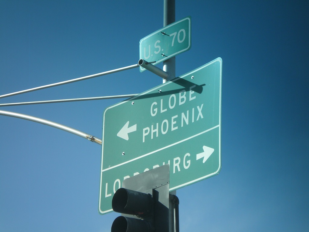
US-70 West at US-191 South
US-70 west at US-191 south. Use US-70 west for Globe and Phoenix. Use US-70 East/US-191 North for Lordsburg (NM).
Taken 03-21-2010

 Safford
Graham County
Arizona
United States
Safford
Graham County
Arizona
United States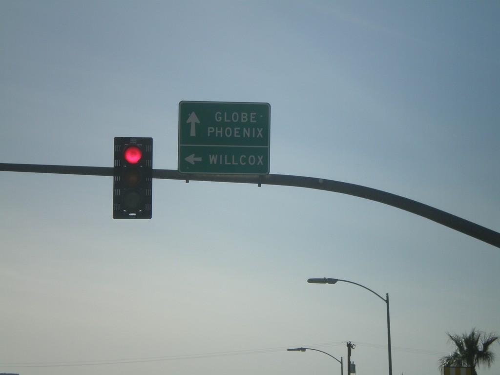
US-70 West at US-191 South
US-70 west at US-191 south. Use US-70 west for Globe and Phoenix. Use US-191 South for Willcox.
Taken 03-21-2010
Safford
Graham County
Arizona
United States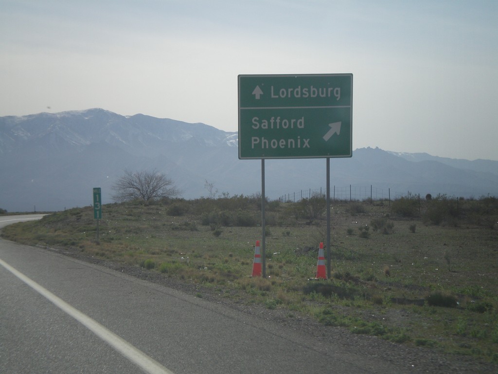
US-191 South Approaching US-70
US-191 south approaching US-70. Use US-70 West/US-191 South for Safford and Phoenix. Use US-70 east for Lordsburg (NM).
Taken 03-21-2010
San Jose
Graham County
Arizona
United States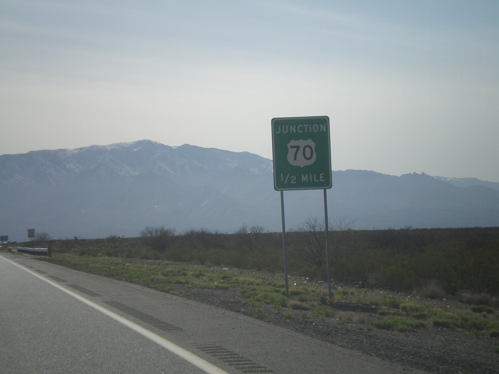
US-191 South Approaching US-70
US-191 south approaching US-70.
Taken 03-21-2010
Safford
Graham County
Arizona
United States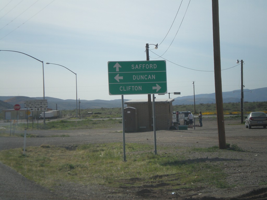
End AZ-78 West at US-191/AZ-75
End AZ-78 west at US-191/AZ-75. Use US-191 north for Clifton. Use US-191 south for Safford. Use AZ-75 south for Duncan.
Taken 03-21-2010

 Clifton
Greenlee County
Arizona
United States
Clifton
Greenlee County
Arizona
United States
AZ-78 West Approaching US-191/AZ-75
AZ-78 west approaching US-191 and AZ-75.
Taken 03-21-2010
Three Way
Greenlee County
Arizona
United States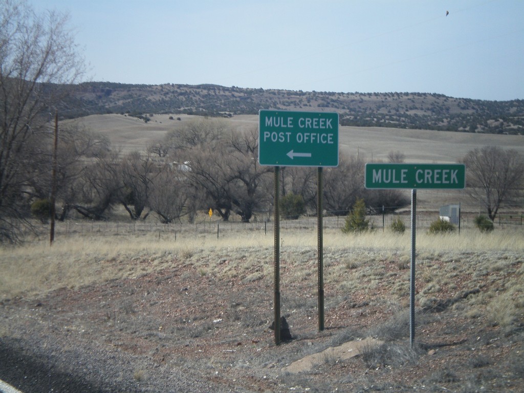
NM-78 West - Mule Creek
Entering the community of Mule Creek on NM-78 west.
Taken 03-21-2010
 Mule Creek
Grant County
New Mexico
United States
Mule Creek
Grant County
New Mexico
United States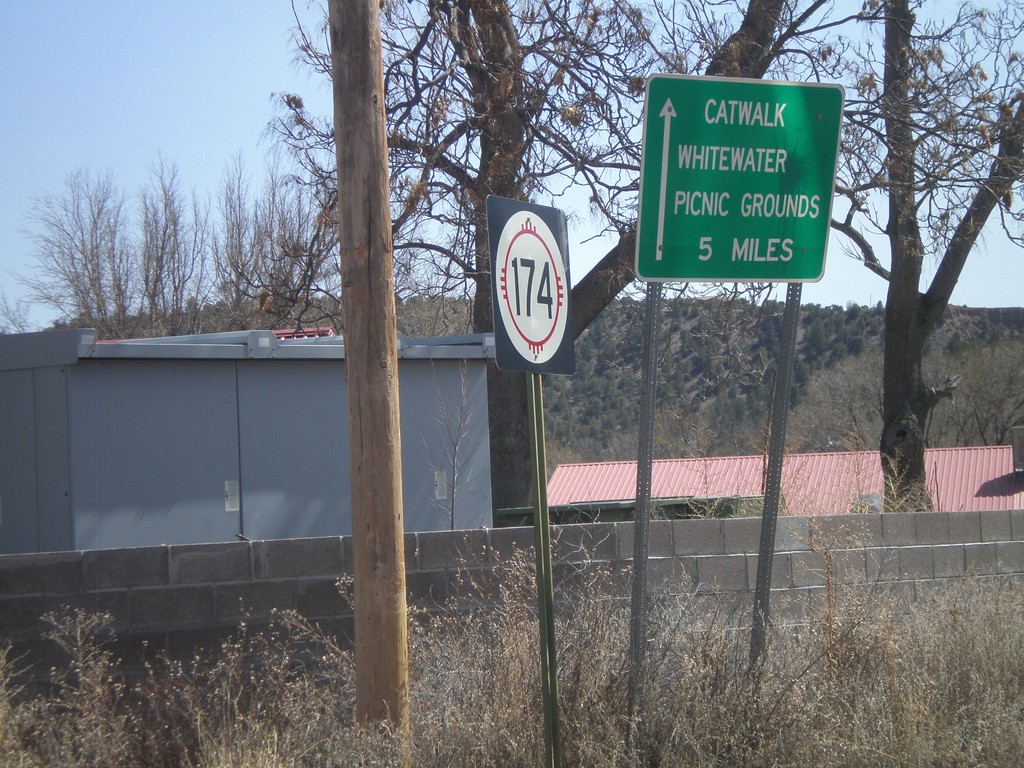
NM-174 East
NM-174 east at US-180. Use NM-174 east for the Catwalk, and Whitewater Picnic Grounds.
Taken 03-21-2010

 Mogollon
Catron County
New Mexico
United States
Mogollon
Catron County
New Mexico
United States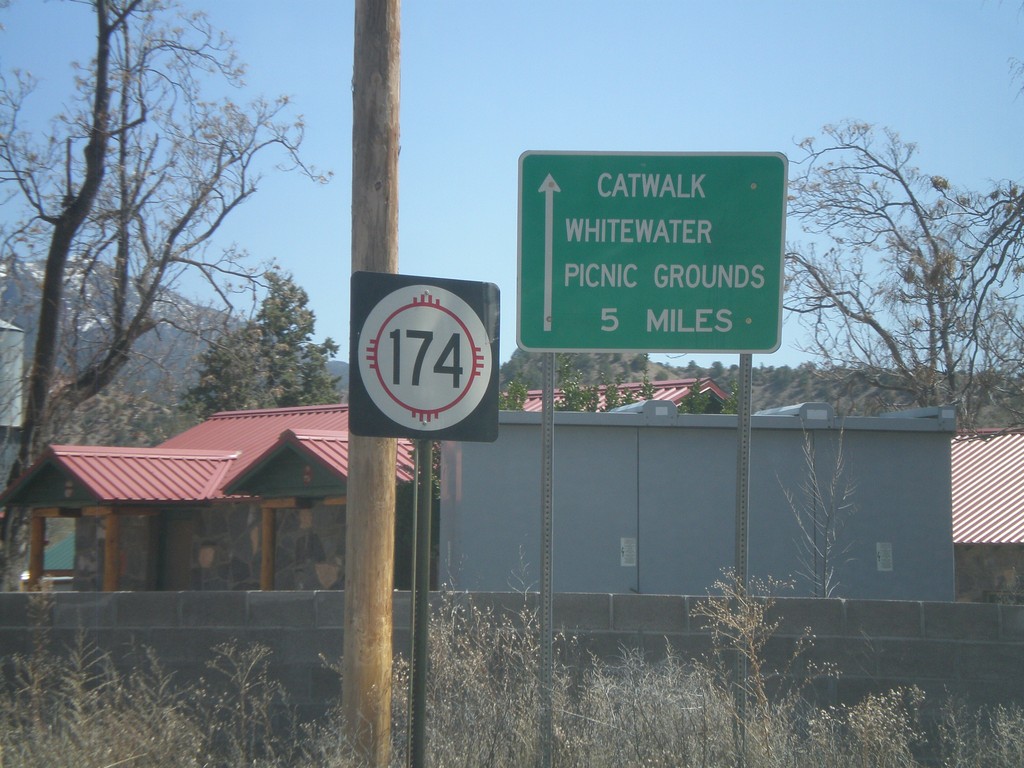
NM-174 East
NM-174 east at US-180. Use NM-174 east for the Catwalk, and Whitewater Picnic Grounds.
Taken 03-21-2010
Mogollon
Catron County
New Mexico
United States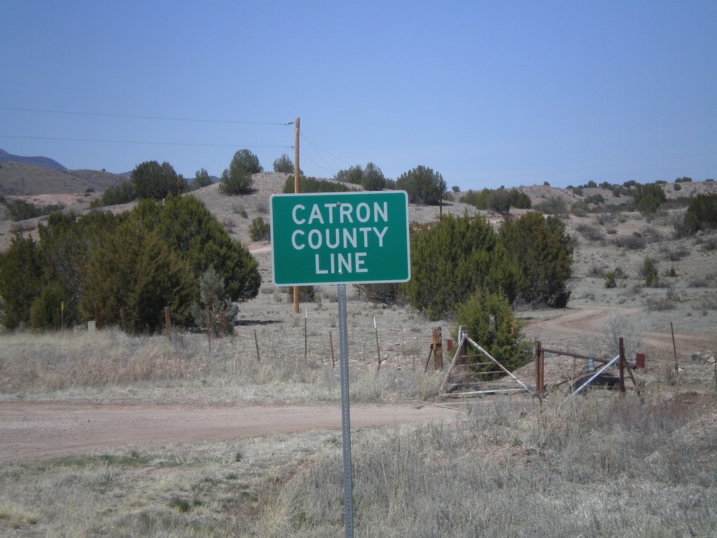
US-180 West - Catron County Line
Catron County Line on US-180 west at the Grant-Catron County Line.
Taken 03-21-2010
Buckhorn
Catron County
New Mexico
United States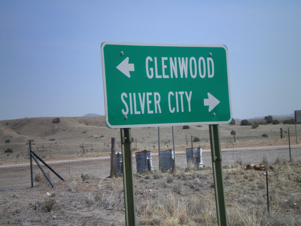
End NM-78 East at US-180
End NM-78 east at US-180. Use US-180 west for Glenwood. Use US-180 east for Silver City.
Taken 03-21-2010
Buckhorn
Grant County
New Mexico
United States
US-180 West Approaching NM-78
US-180 west approaching NM-78. Use NM-78 west for Clifton, AZ, Safford, AZ, and Mule Creek.
Taken 03-21-2010
Buckhorn
Grant County
New Mexico
United States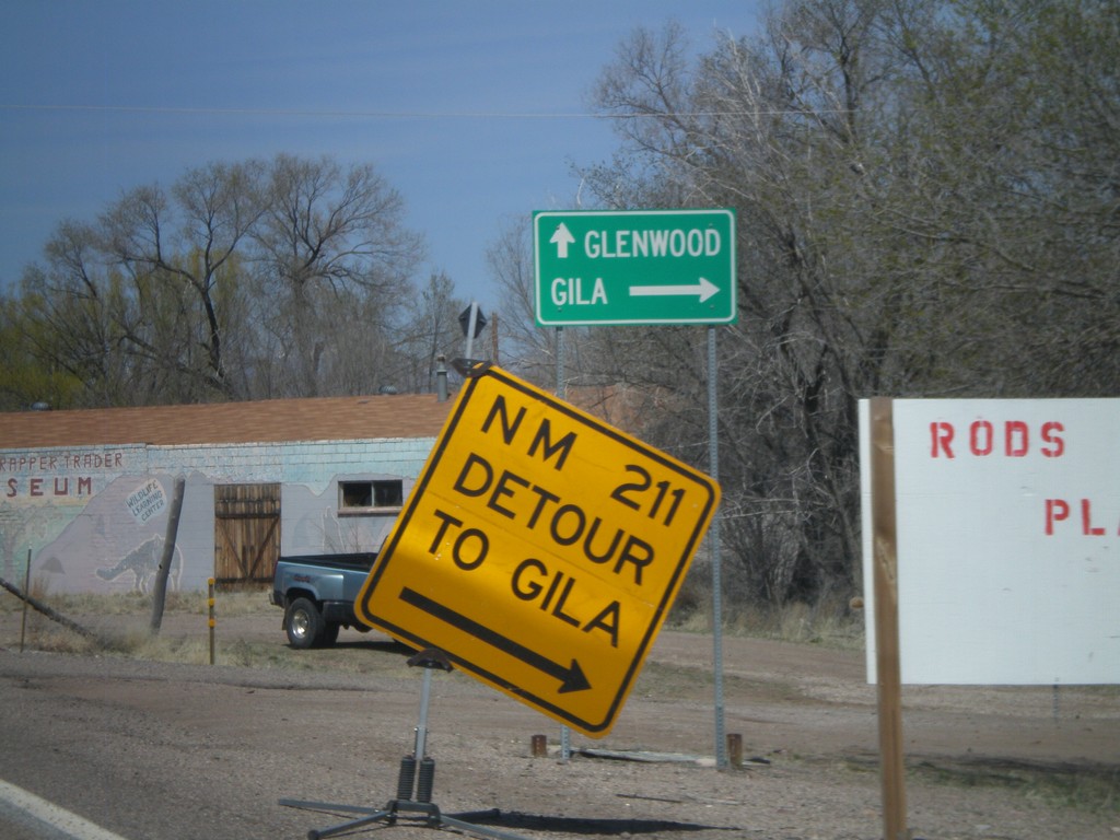
US-180 West at NM-211
US-180 west at NM-211 to Gila.
Taken 03-21-2010
 Gila
Grant County
New Mexico
United States
Gila
Grant County
New Mexico
United States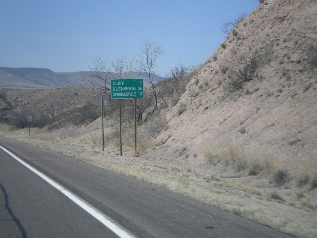
US-180 West - Distance Marker
Distance marker on US-180 west to Cliff, Glenwood, and Springerville (AZ).
Taken 03-21-2010
Gila
Grant County
New Mexico
United States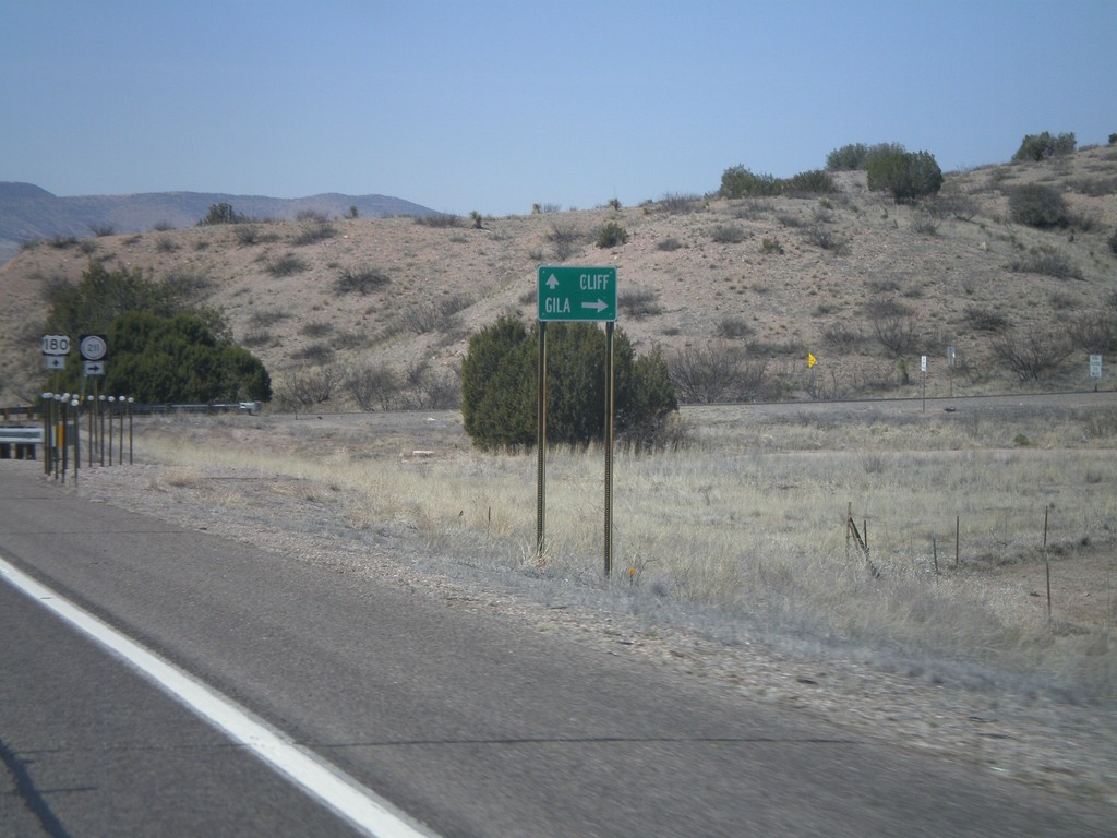
US-180 West Approaching NM-211
US-180 west approaching NM-211 to Gila. US-180 continues west to Cliff.
Taken 03-21-2010
Silver City
Grant County
New Mexico
United States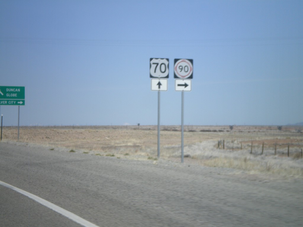
US-70 West/NM-90 East at Split
US-70 West/NM-90 East at US-70/NM-90 split. Use US-70 west for Duncan(AZ) and Globe(AZ). Use NM-90 for Silver City.
Taken 03-21-2010
 Lordsburg
Hidalgo County
New Mexico
United States
Lordsburg
Hidalgo County
New Mexico
United States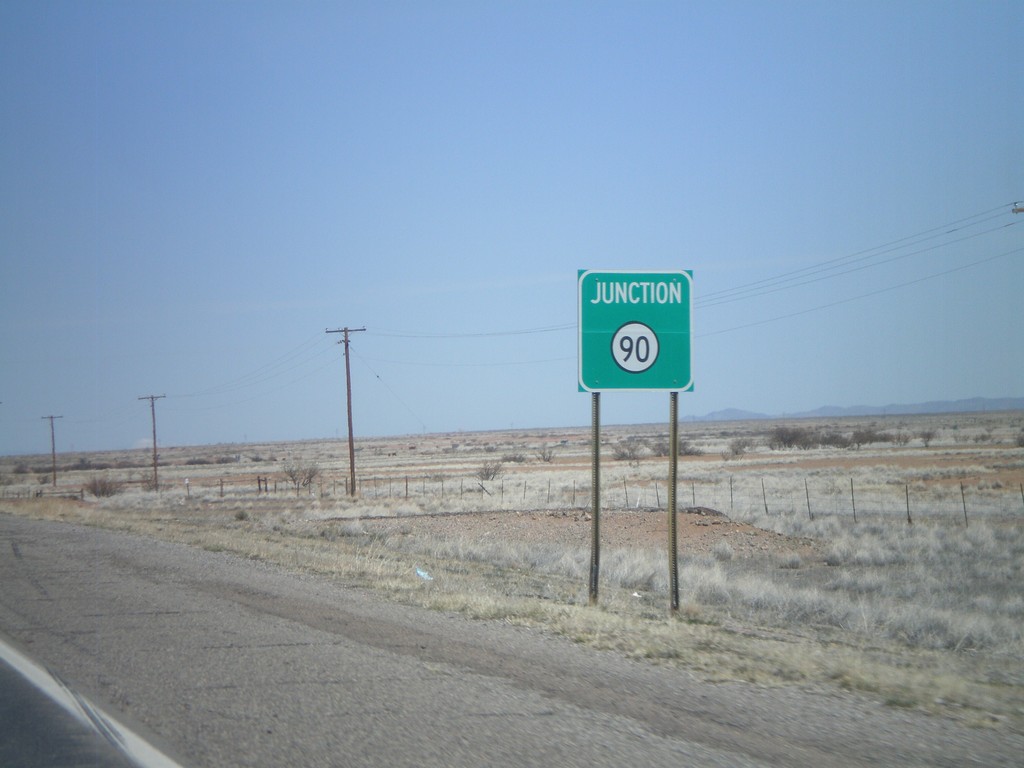
US-70 West/NM-90 East Approaching Split
US-70 West/NM-East approaching US-70/NM-90 Split.
Taken 03-21-2010
Lordsburg
Hidalgo County
New Mexico
United States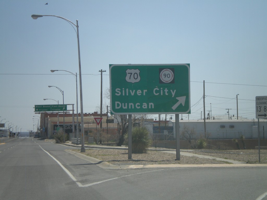
BL-10 East at US-70/NM-90
BL-10 east at US-70/NM-90 to Duncan (AZ) and Silver City.
Taken 03-21-2010
 Lordsburg
Hidalgo County
New Mexico
United States
Lordsburg
Hidalgo County
New Mexico
United States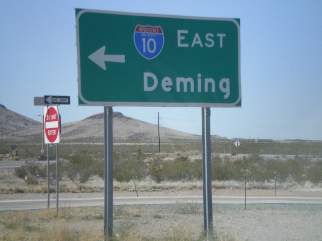
BL-10 West at I-10 East to Deming
BL-10 west at I-10 east to Deming.
Taken 03-21-2010
 Lordsburg
Hidalgo County
New Mexico
United States
Lordsburg
Hidalgo County
New Mexico
United States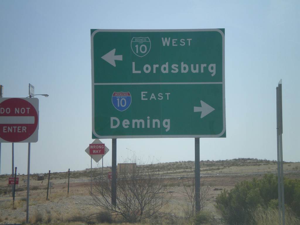
Rest Area Access Road at BL-10
New Mexico Rest Area access road at BL-10. Turn right for I-10 East to Deming. Turn left for BL-10 east into Lordsburg.
Taken 03-21-2010
Lordsburg
Hidalgo County
New Mexico
United States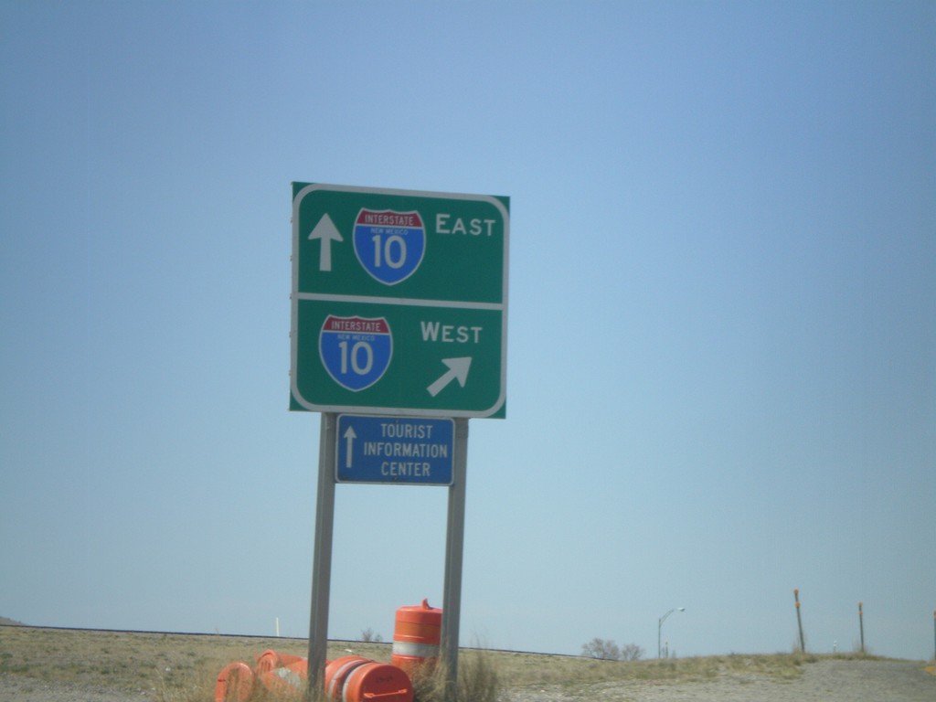
BL-10 West at I-10
BL-10 west at I-10 West. Head over the overpass for I-10 east.
Taken 03-21-2010
Virden
Hidalgo County
New Mexico
United States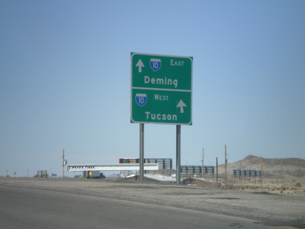
BL-10 West Approaching I-10
BL-10 west approaching I-10. Use I-10 west for Tucson. Use I-10 east for Deming.
Taken 03-21-2010
Lordsburg
Hidalgo County
New Mexico
United States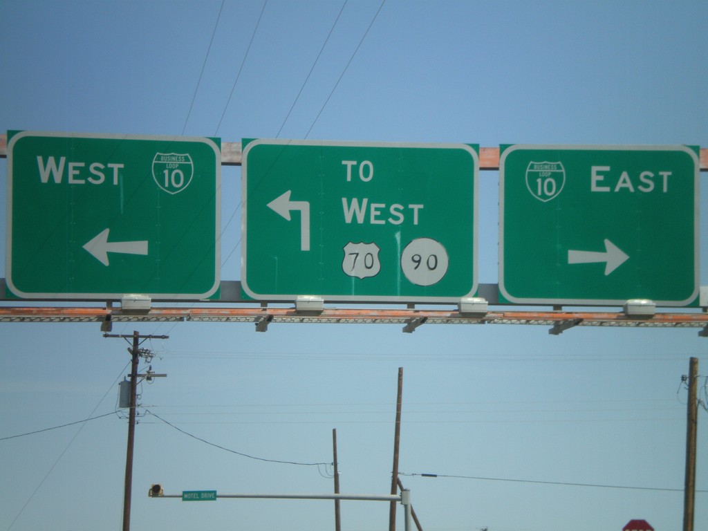
NM-494 North at BL-10/US-70/NM-90
NM-494 north at BL-10/US-70 and NM-90.
Taken 03-21-2010
 Lordsburg
Hidalgo County
New Mexico
United States
Lordsburg
Hidalgo County
New Mexico
United States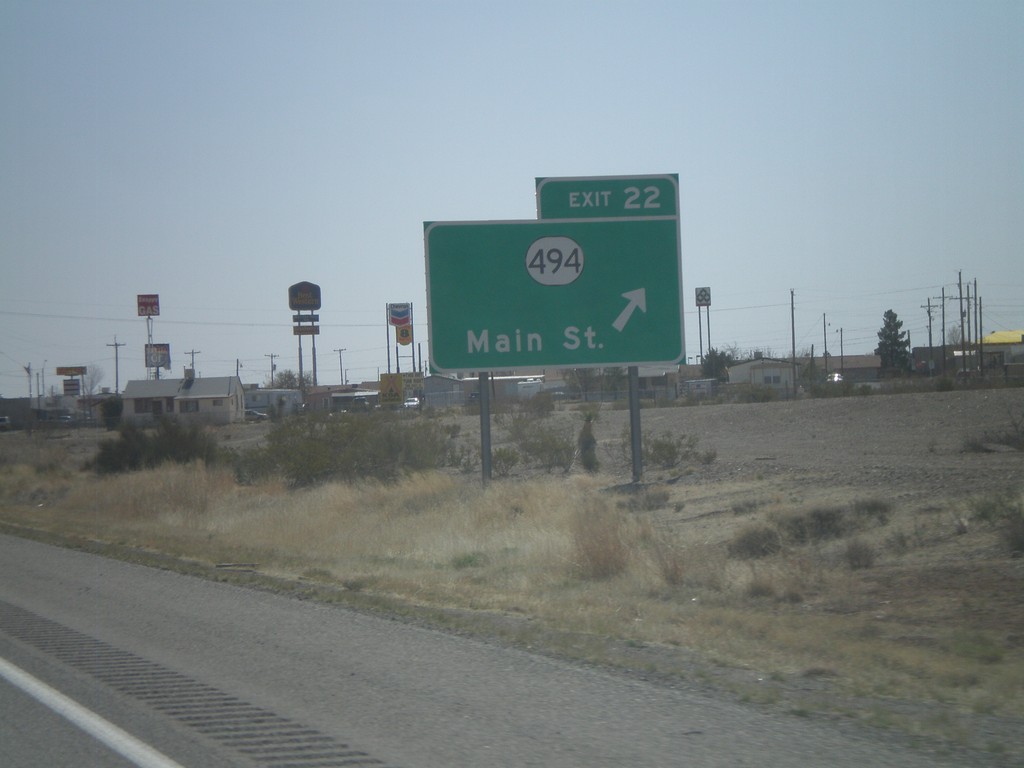
I-10 East - Exit 22
I-10 east at Exit 22 - NM-494/Main St.
Taken 03-21-2010
Lordsburg
Hidalgo County
New Mexico
United States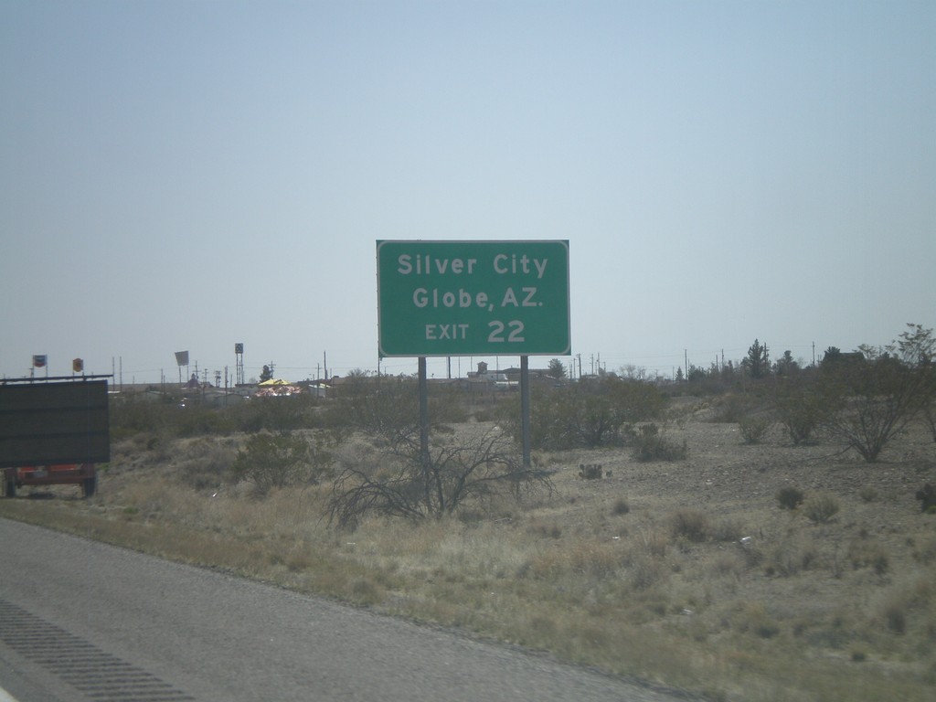
I-10 East Approaching Exit 22
I-10 east approaching Exit 22. Use Exit 22 for Silver City (via NM-90) and Globe, AZ (via US-70).
Taken 03-21-2010
Road Forks
Hidalgo County
New Mexico
United States