Signs Tagged With Big Green Sign
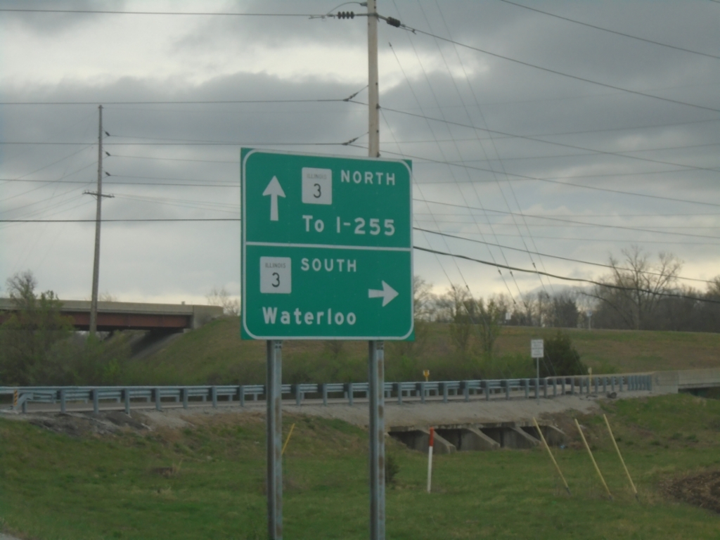
Palmer Road East at IL-3
Palmer Road East at IL-3 interchange. Use IL-3 South to Waterloo; IL-3 North To I-255.
Taken 03-27-2026

 Columbia
Monroe County
Illinois
United States
Columbia
Monroe County
Illinois
United States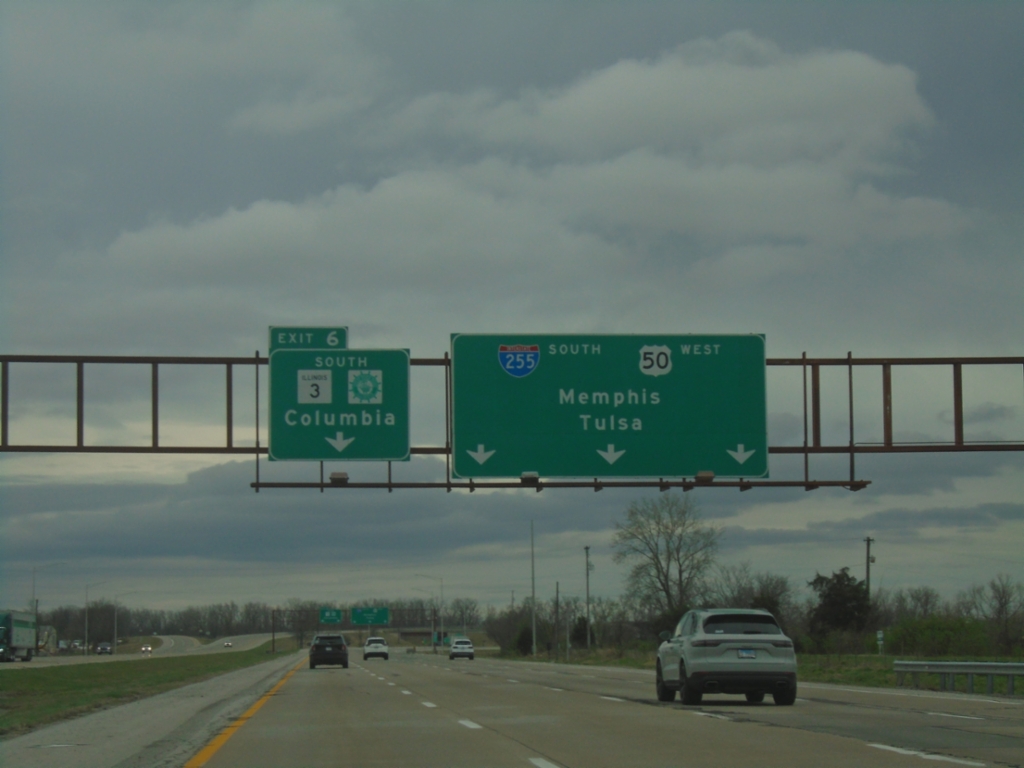
I-255 South - Exit 6
I-255/IL-3 South/US-50 West approaching Exit 6 - IL-3 South/Great River Road/Columbia. Continue on I-255 South/US-50 West to Tulsa (OK) and Memphis (TN). IL-3 South leaves the freeway here. This is the last exit southbound on I-255 in Illinois.
Taken 03-27-2026
 Columbia
Monroe County
Illinois
United States
Columbia
Monroe County
Illinois
United States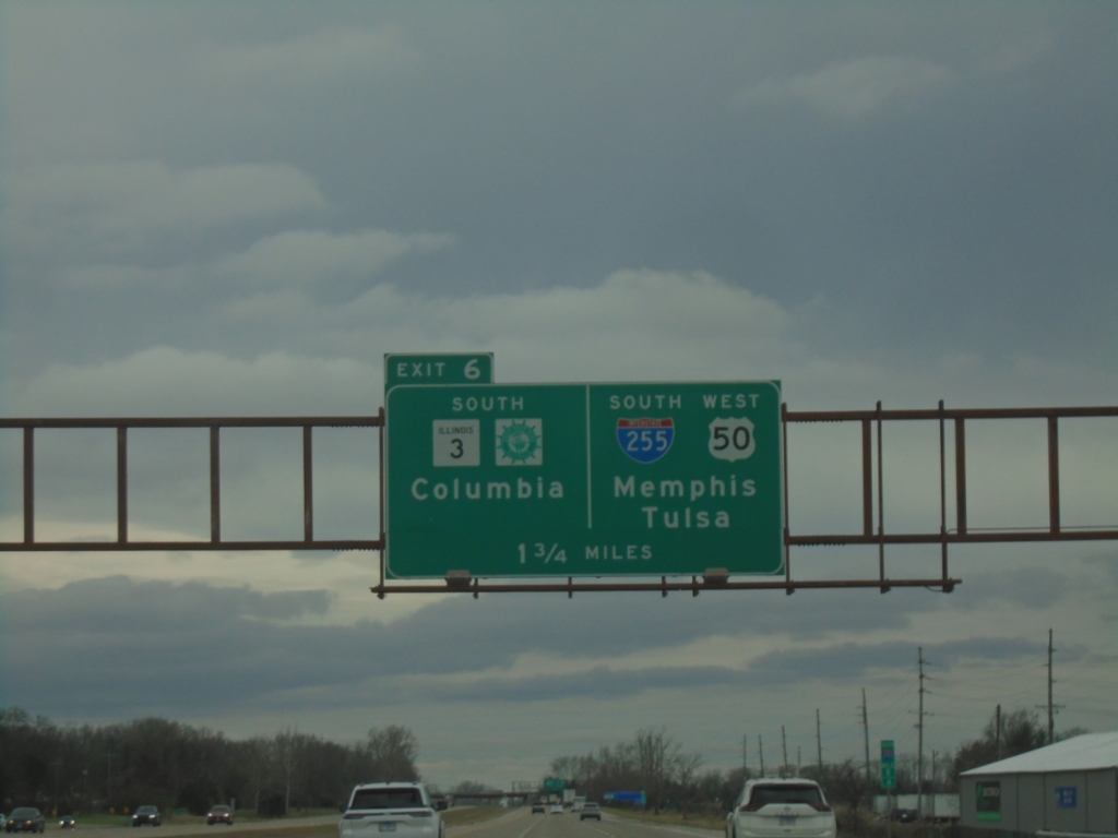
I-255 South - Exit 6
I-255/IL-3 South/US-50 West approaching Exit 6 - IL-3 South/Great River Road/Columbia. Continue on I-255 South/US-50 West to Memphis (TN) and Tulsa (OK). IL-3 South leaves the freeway here. This is the last exit on I-255 South in Illinois.
Taken 03-27-2026
Dupo
St. Clair County
Illinois
United States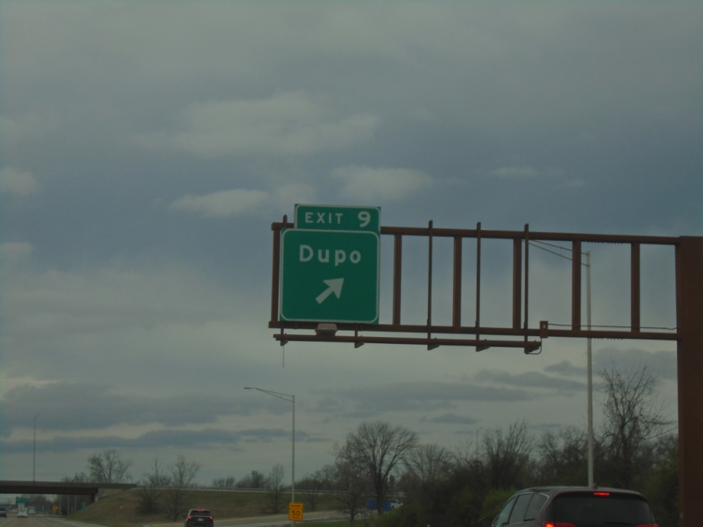
I-255 South - Exit 9
I-255 South at Exit 9 - Dupo
Taken 03-27-2026
Dupo
St. Clair County
Illinois
United States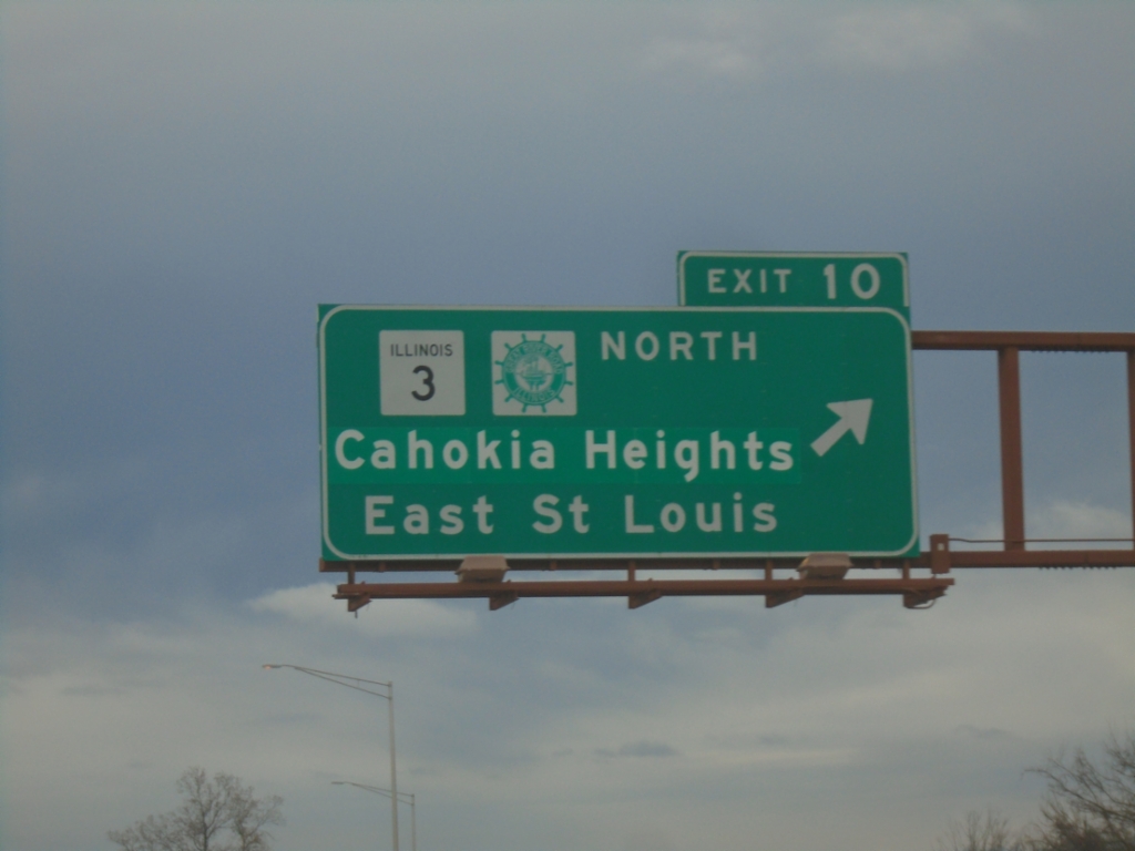
I-255 South - Exit 10
I-255 south at Exit 10 - IL-3 North/Great River Road/Cahokia Heights/East Saint Louis. IL-3 South joins I-255 South/US-50 West to Columbia.
Taken 03-27-2026
Dupo
St. Clair County
Illinois
United States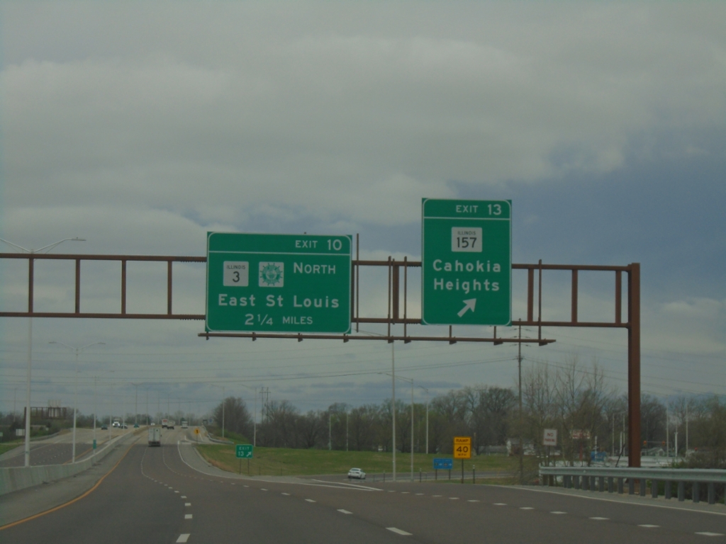
I-255 South - Exits 13 and 10
I-255 south at Exit 13 - IL-157/Cahokia Heights. Approaching Exit 10 - IL-3 North/Great River Road/East Saint Louis.
Taken 03-27-2026
 Cahokia
St. Clair County
Illinois
United States
Cahokia
St. Clair County
Illinois
United States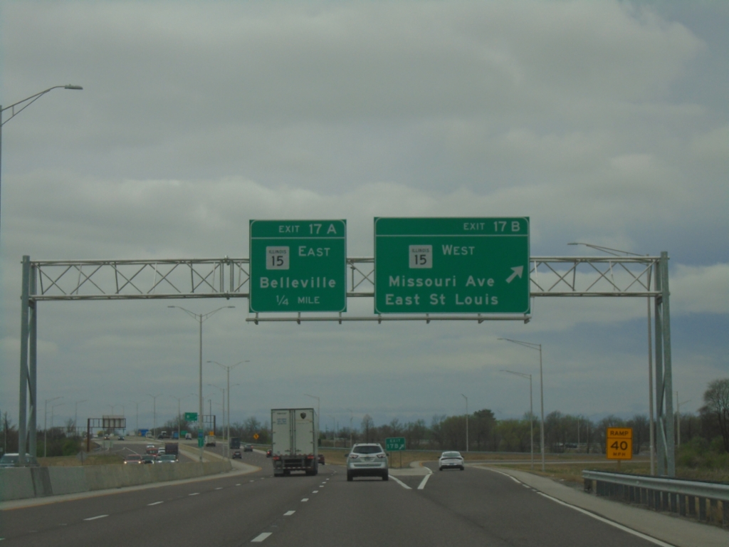
I-255 South - Exits 17B and 17A
I-255 south at Exit 17B - IL-15 West/Missouri Ave./Saint Louis. Approaching Exit 17A - IL-15 East/Belleville.
Taken 03-27-2026
 East St. Louis
St. Clair County
Illinois
United States
East St. Louis
St. Clair County
Illinois
United States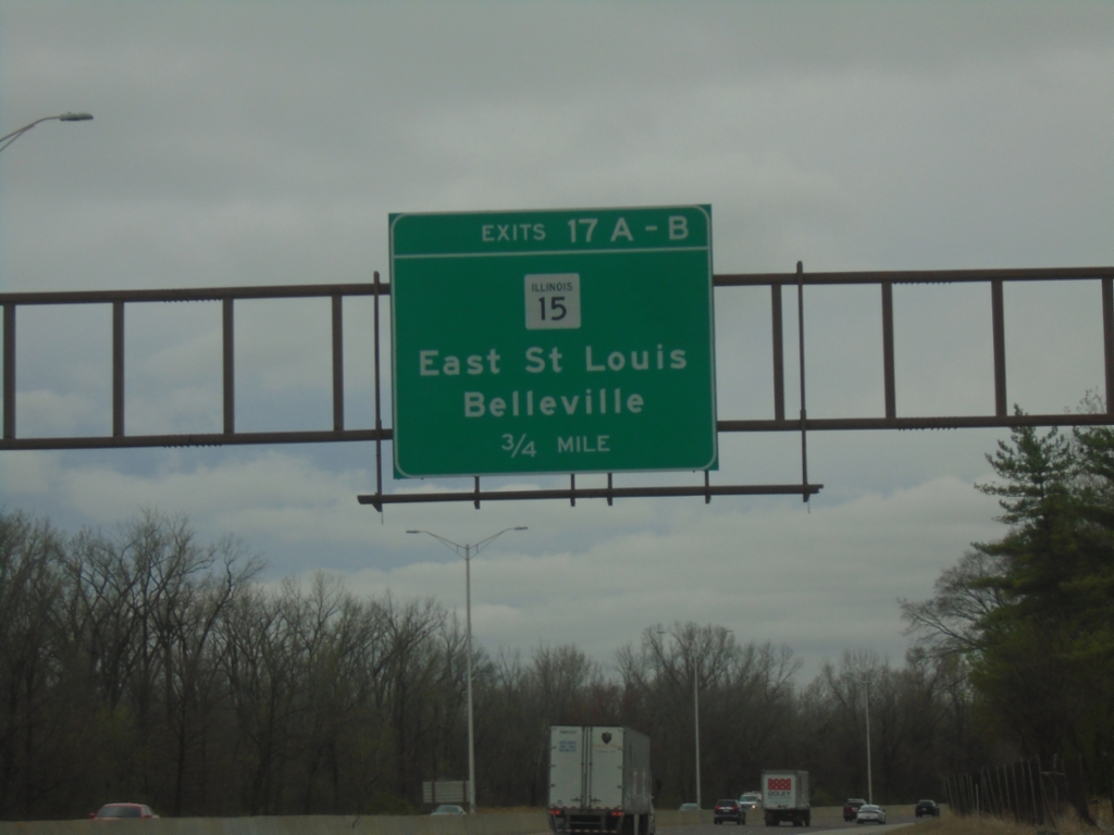
I-255 South - Exits 17A-B
I-255 South approaching Exits 17A-B - IL-15/East Saint Louis/Belleville.
Taken 03-27-2026
East St. Louis
St. Clair County
Illinois
United States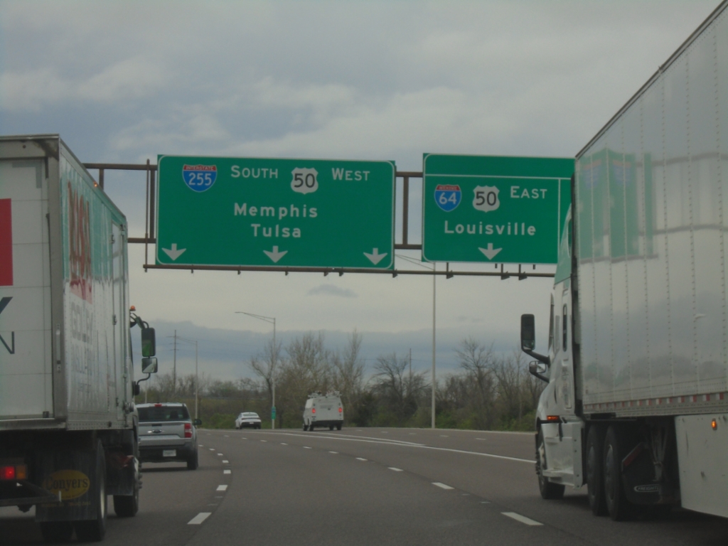
I-255 South - Exit 20
I-255 south at Exit 20. Use Exit 20 for I-64/US-50 East/Louisville (KY) and I-64 West/Saint Louis (MO). Continue on I-255 South/US-50 West to Memphis (TN) and Tulsa (OK). US-50 west joins I-255 southbound to Saint Louis, Missouri.
Taken 03-27-2026
 East St. Louis
St. Clair County
Illinois
United States
East St. Louis
St. Clair County
Illinois
United States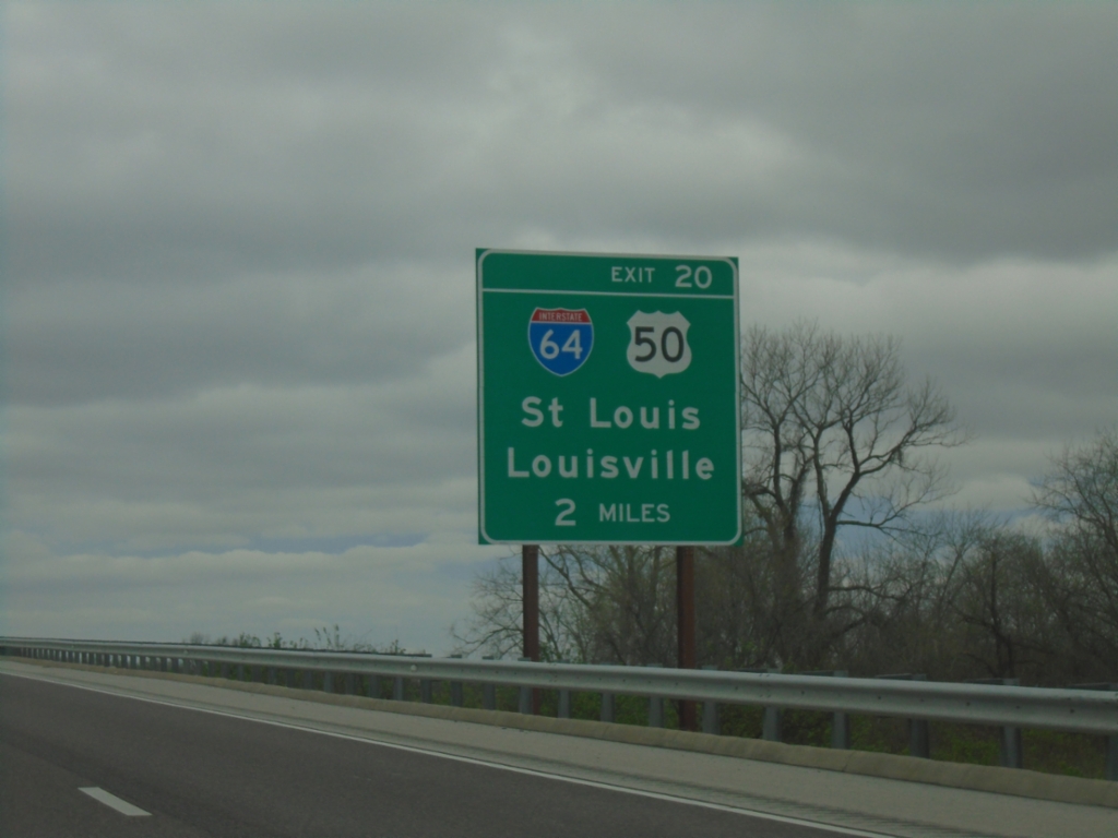
I-255 South - Exit 20
I-255 south approaching Exit 20 - I-64/US-50/Saint Louis (MO)/Louisville (KY).
Taken 03-27-2026
Collinsville
St. Clair County
Illinois
United States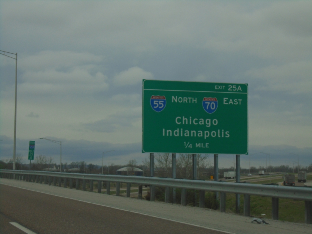
I-255 South - Exit 25A
I-255 south approaching Exit 25A - I-55 North/I-70 East/Chicago/Indianapolis (IN).
Taken 03-27-2026


 Collinsville
Madison County
Illinois
United States
Collinsville
Madison County
Illinois
United States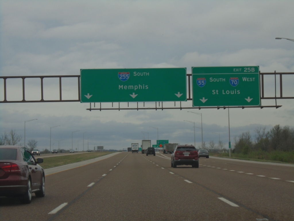
I-255 South - Exit 25B
I-255 south approaching Exit 25B - I-70 West/I-55 South/Saint Louis. Continue south on I-255 for Memphis (TN).
Taken 03-27-2026
Collinsville
Madison County
Illinois
United States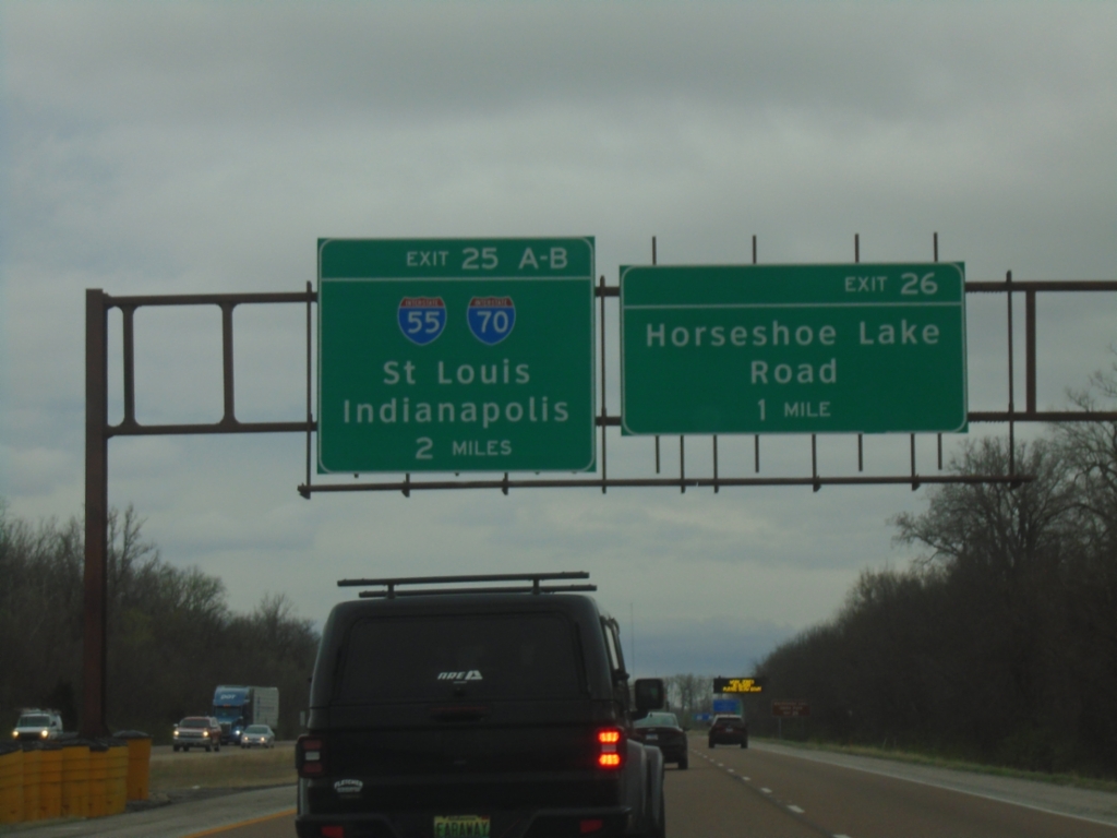
I-255 South - Exits 26 and 25A-B
I-255 South at Exit 26 - Horseshoe Lake Road. Approaching Exit 25A-B - I-70/I-55/St. Louis (MO)/Indianapolis (IN).
Taken 03-27-2026
 Granite City
Madison County
Illinois
United States
Granite City
Madison County
Illinois
United States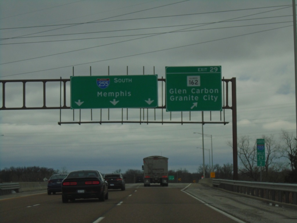
I-255 South - Exit 29
I-255 South at Exit 29 - IL-162/Glen Carbon/Granite City. Continue south on I-255 for Memphis (TN).
Taken 03-27-2026
 Pontoon Beach
Madison County
Illinois
United States
Pontoon Beach
Madison County
Illinois
United States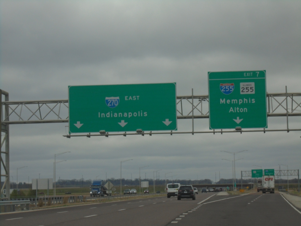
I-270 East - Exit 7
I-270 east at Exit 7 - I-255/IL-255/Memphis (TN)/Alton. I-270 continues east to Indianapolis (IN).
Taken 03-27-2026
 Pontoon Beach
Madison County
Illinois
United States
Pontoon Beach
Madison County
Illinois
United States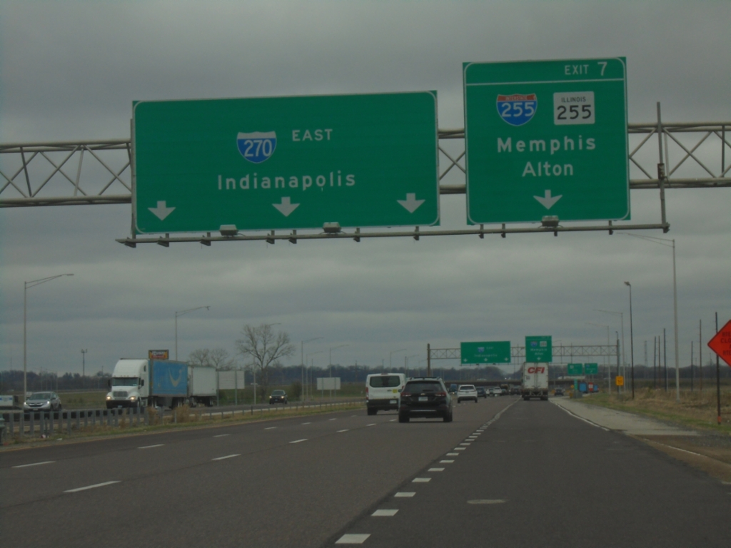
I-270 East - Exit 7
I-270 East approaching Exit 7 - I-255/IL-255/Memphis (TN)/Alton. I-270 East continues to Indianapolis.
Taken 03-27-2026
Pontoon Beach
Madison County
Illinois
United States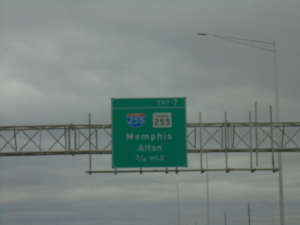
I-270 East - Exit 7
I-270 east approaching Exit 7 - I-255/IL-255/Memphis (TN)/Alton.
Taken 03-27-2026
Pontoon Beach
Madison County
Illinois
United States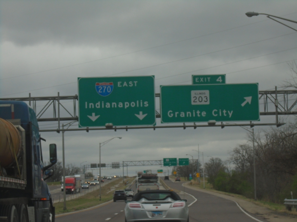
I-270 East - Exit 4
I-270 East at Exit 4 - IL-203/Granite City. Continue east on I-270 for Indianapolis (IN).
Taken 03-27-2026
 Chouteau
Madison County
Illinois
United States
Chouteau
Madison County
Illinois
United States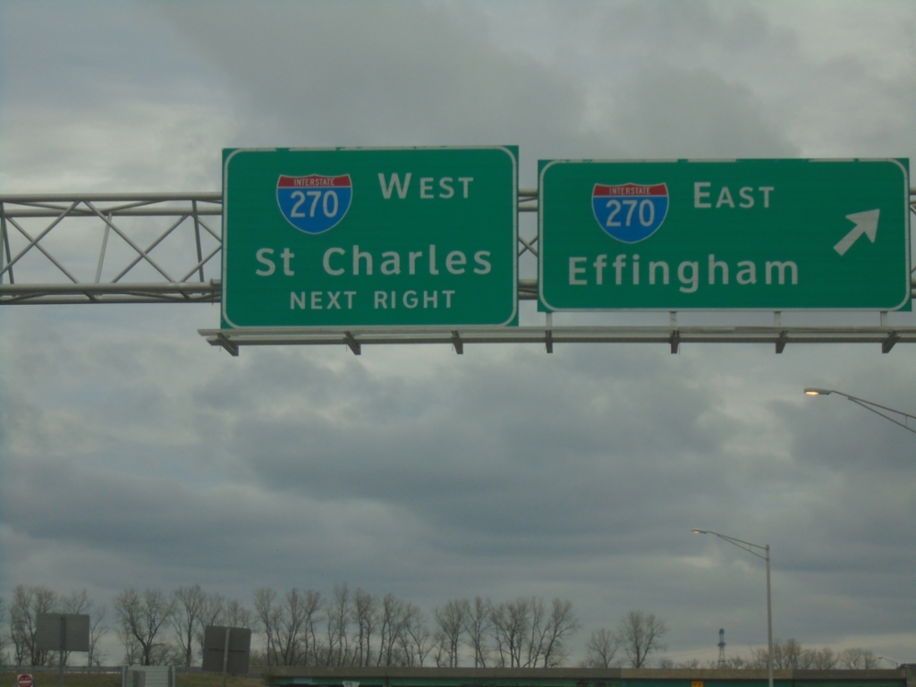
IL-3 North at I-270
IL-3 north at I-270. Use I-270 East for Effingham; I-270 West for Saint Charles (MO).
Taken 03-27-2026
Granite City
Madison County
Illinois
United States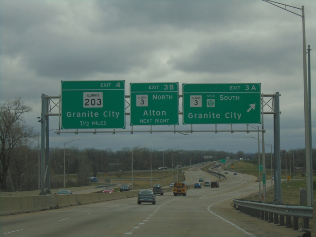
I-270 East - Exits 3A-B and 4
I-270 east at Exit 3A - IL-3 South/Great River Road/Granite City. Approaching Exit 3B - IL-3 North/Alton. Approaching Exit 4 - IL-203/Granite City.
Taken 03-27-2026
Granite City
Madison County
Illinois
United States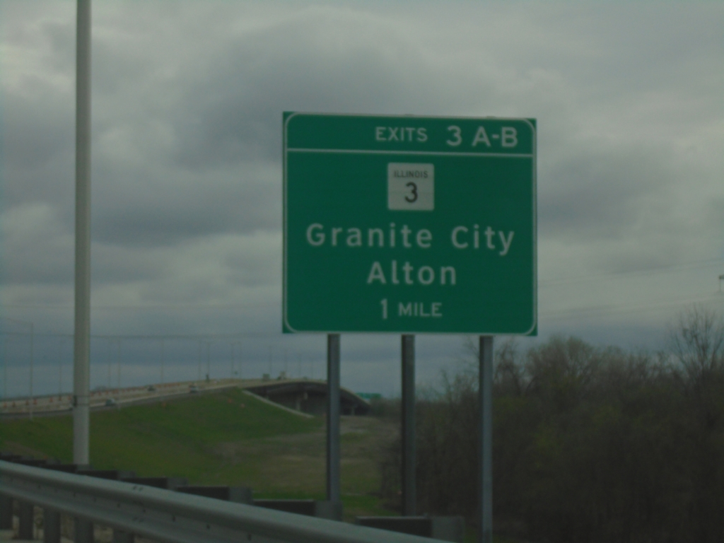
I-270 East - Exits 3A-B
I-270 east approaching Exits 3A-B - IL-3/Granite City/Alton.
Taken 03-27-2026
Madison
Madison County
Illinois
United States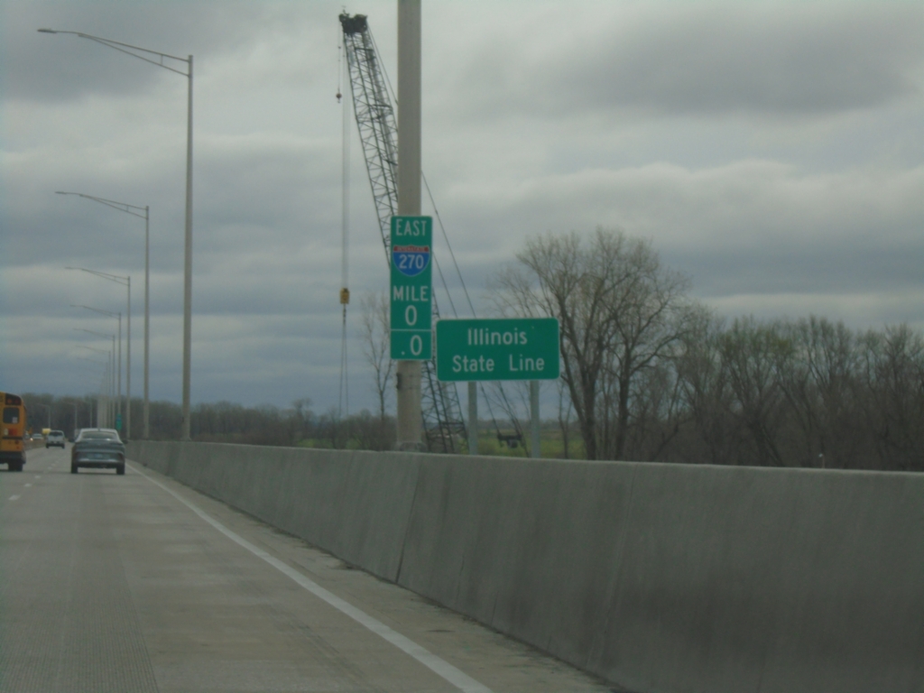
I-270 East - Illinois State Line
Illinois State Line on the Mississippi River bridge. Milemarker 0.0.
Taken 03-27-2026
Madison
Madison County
Illinois
United States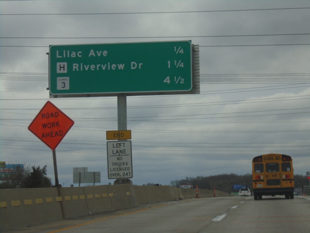
I-270 East - Distance Marker
Distance marker on I-270 east. Distance to Lilac Ave., MO-H/Riverview Drive, and IL-3.
Taken 03-27-2026
 Larimore
St. Louis County
Missouri
United States
Larimore
St. Louis County
Missouri
United States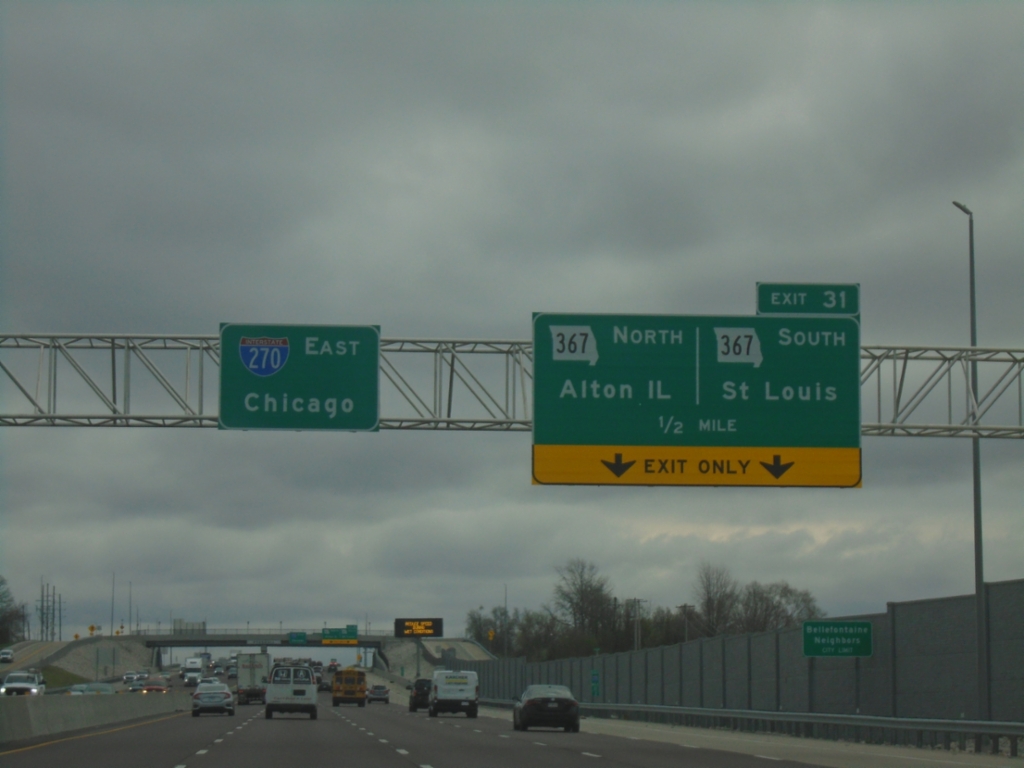
I-270 East - Exit 31
I-270 East approaching Exit 31 - MO-367/Alton IL/Saint Louis. Continue east on I-270 to Chicago, IL.
Taken 03-27-2026
 Bellefontaine Neighbors
St. Louis County
Missouri
United States
Bellefontaine Neighbors
St. Louis County
Missouri
United States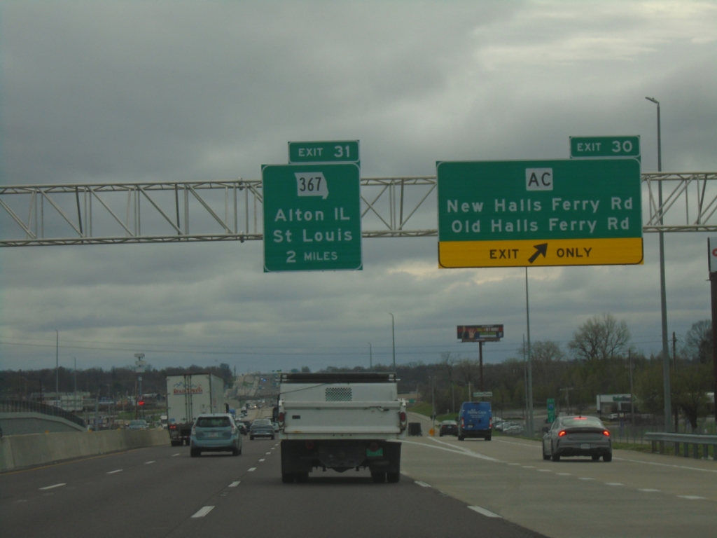
I-270 East - Exit 30 and 31
I-270 east at Exit 30 - MO-AC/New Halls Ferry Road/Old Halls Ferry Road. Approaching Exit 31 - MO-367/Alton IL/Saint Louis.
Taken 03-27-2026
 Florissant
St. Louis County
Missouri
United States
Florissant
St. Louis County
Missouri
United States