Signs Tagged With Big Green Sign
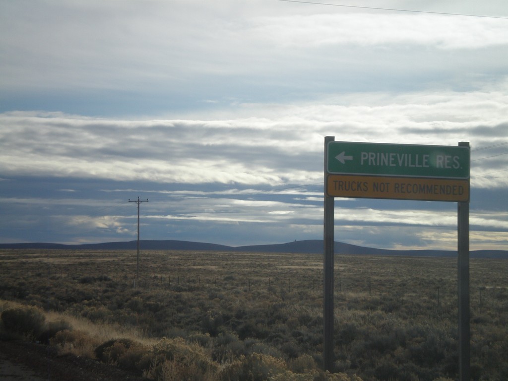
US-20 East at OR-27 North
US-20 east at OR-27 north to Prineville Reservoir.
Taken 01-18-2010

 Prineville
Deschutes County
Oregon
United States
Prineville
Deschutes County
Oregon
United States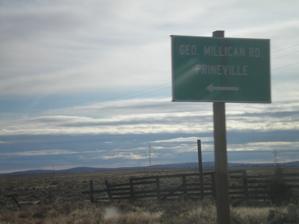
US-20 East at George Millican Road
US-20 East at George Millican Road north to Prineville.
Taken 01-18-2010
Millican
Deschutes County
Oregon
United States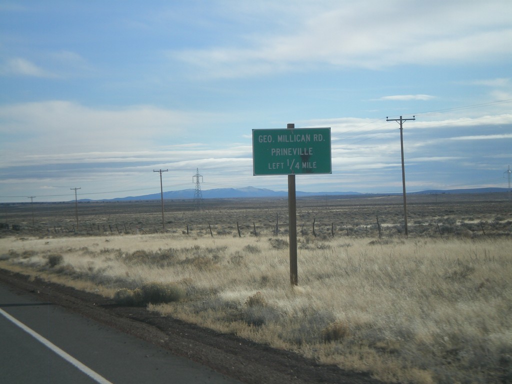
US-20 East Approaching George Millican Road
US-20 east approaching George Millican Road, north to Prineville.
Taken 01-18-2010
Bend
Deschutes County
Oregon
United States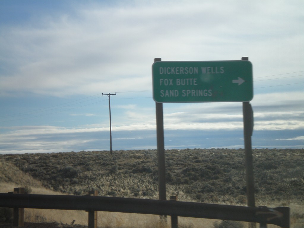
US-20 East at Dickerson Wells Jct.
US-20 east at Newt Morris Road south to Dickerson Wells, Fox Butte, and Sand Springs.
Taken 01-18-2010
Bend
Deschutes County
Oregon
United States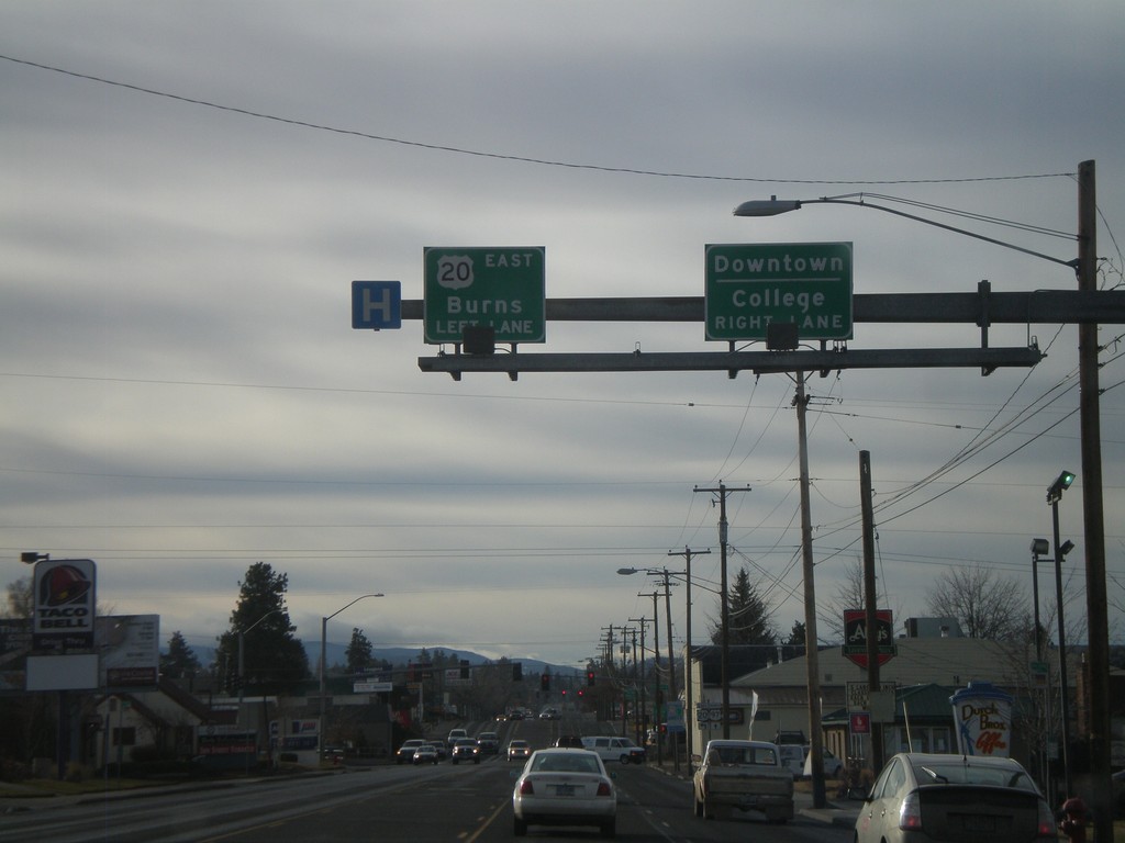
US-20 East/Business US-97 South At US-20
US-20 West/Business US-97 South approaching US-20 East towards Burns (Greenwood Ave.) Use Greenwood Ave. west for Downtown Bend and College.
Taken 01-18-2010
Bend
Deschutes County
Oregon
United States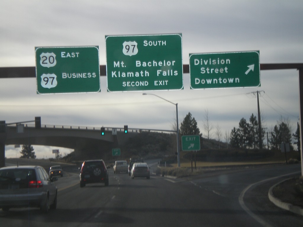
US-20 East/US-97 Business at US-97 South
US-20 West/Business US-97 South at Division St./Downtown exit. Approaching US-97 South/Mt. Bachelor/Klamath Falls exit.
Taken 01-18-2010
 Bend
Deschutes County
Oregon
United States
Bend
Deschutes County
Oregon
United States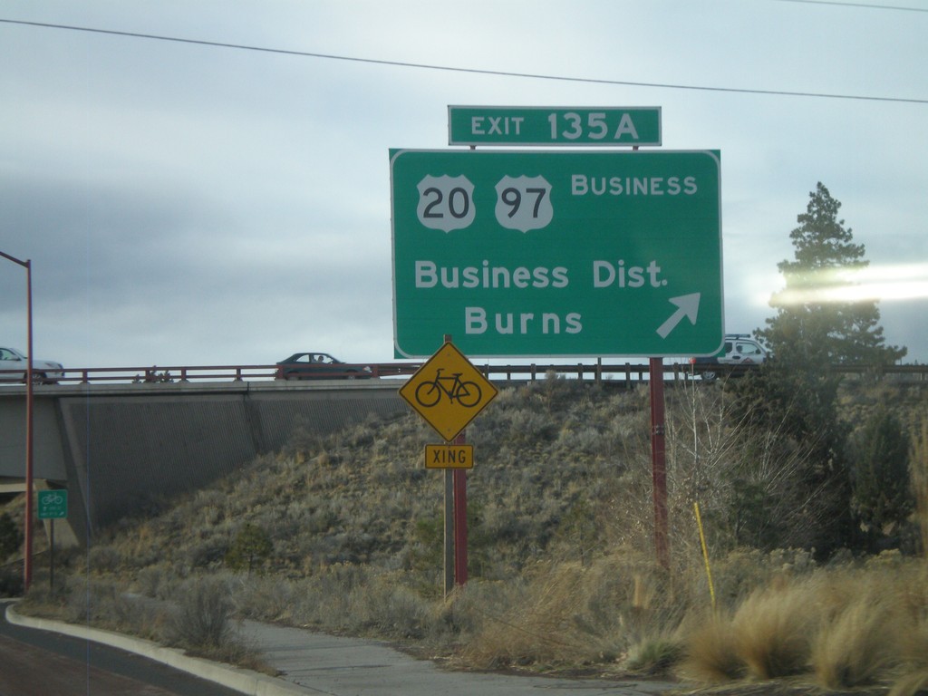
US-97 South - Exit 135A
US-97 south at Exit 135A - US-20/US-97 Business/Business District/Burns.
Taken 01-18-2010
Bend
Deschutes County
Oregon
United States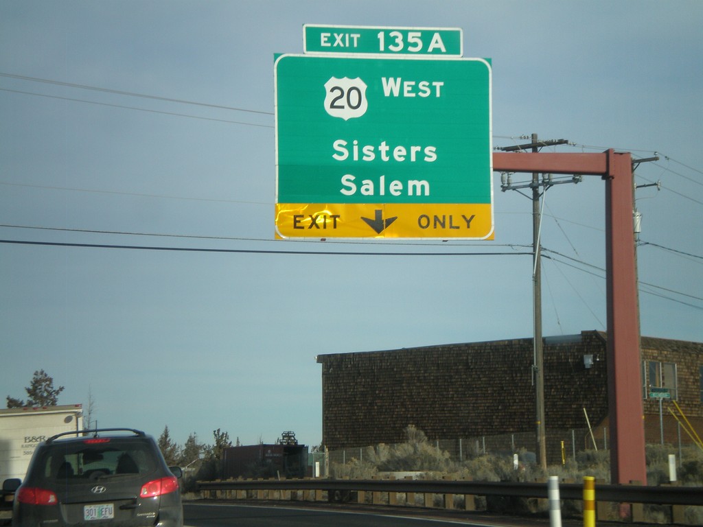
US-97 North - Exit 135A
US-97 north at Exit 135A - US-20 West/Sisters/Salem.
Taken 01-18-2010
Bend
Deschutes County
Oregon
United States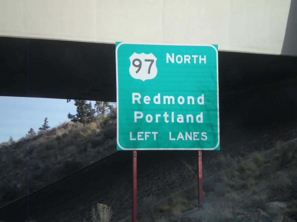
US-97 North Approaching Exit 135A - US-20
US-97 north approaching Exit 135A. Use left lanes for US-97 North/Redmond/Portland.
Taken 01-18-2010
Bend
Deschutes County
Oregon
United States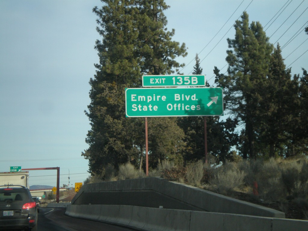
US-97 North - Exit 135B
US-97 north at Exit 135B - Empire Blvd./State Offices
Taken 01-18-2010
Bend
Deschutes County
Oregon
United States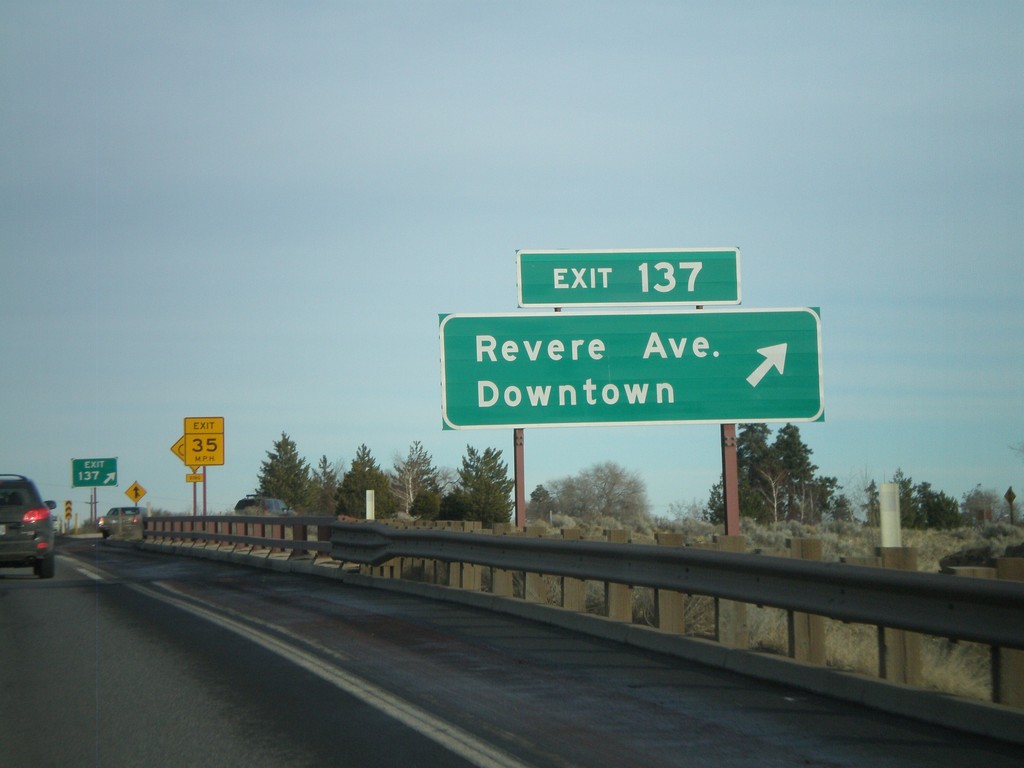
US-97 North - Exit 137
US-97 north at Exit 137 - Revere Ave./Downtown.
Taken 01-18-2010
Bend
Deschutes County
Oregon
United States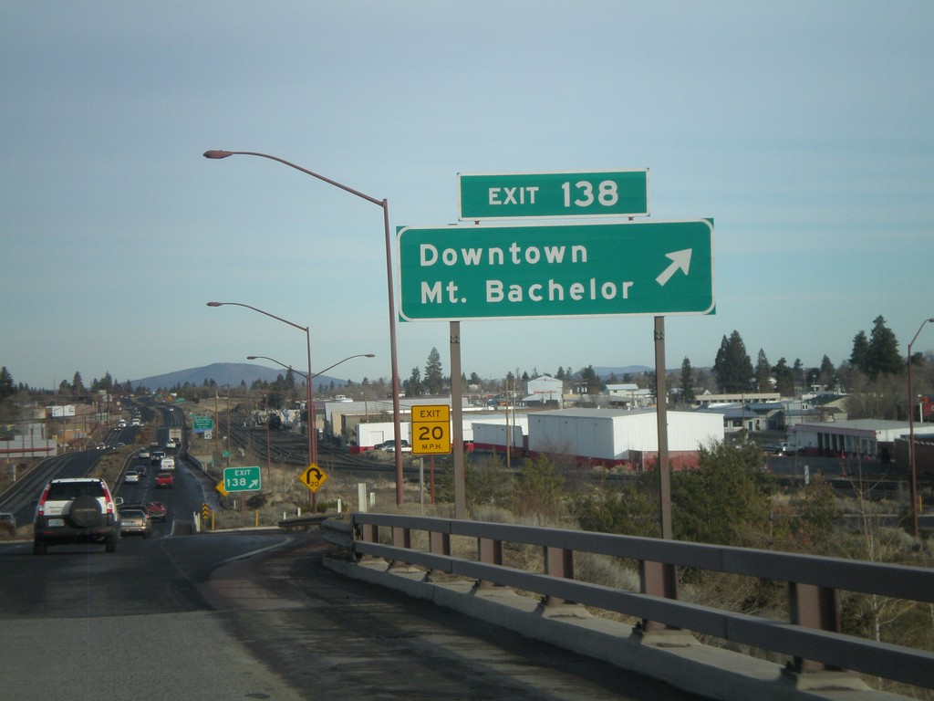
US-97 North - Exit 138
US-97 north at Exit 138 - Downtown/Mt. Bachelor
Taken 01-18-2010
Bend
Deschutes County
Oregon
United States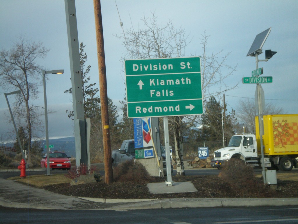
Reed Market Road at US-97 Exit 139
Reed Market Road west at US-97 junction. Use US-97 north for Redmond. Use US-97 south for Klamath Falls.
Taken 01-18-2010
Bend
Deschutes County
Oregon
United States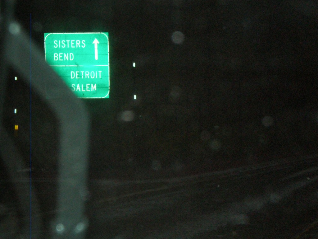
US-20 East/OR-126 East at OR-22 West
US-20 East/OR-126 East at OR-22 west. This is the western base of Santiam Pass.
Taken 01-17-2010

 Sisters
Linn County
Oregon
United States
Sisters
Linn County
Oregon
United States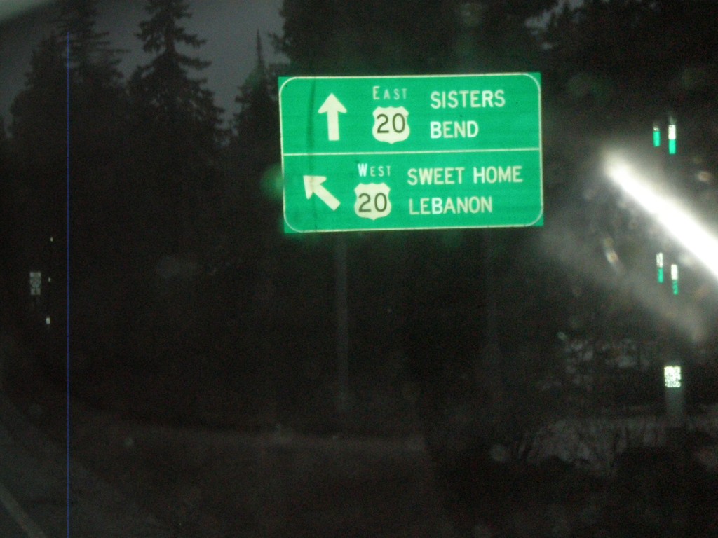
OR-126 East at US-20 Near Santiam Pass
OR-126 at US-20 nearing Santiam Pass. OR-126 joins US-20 east over Santiam Pass to Sisters.
Taken 01-17-2010
Santiam Junction
Linn County
Oregon
United States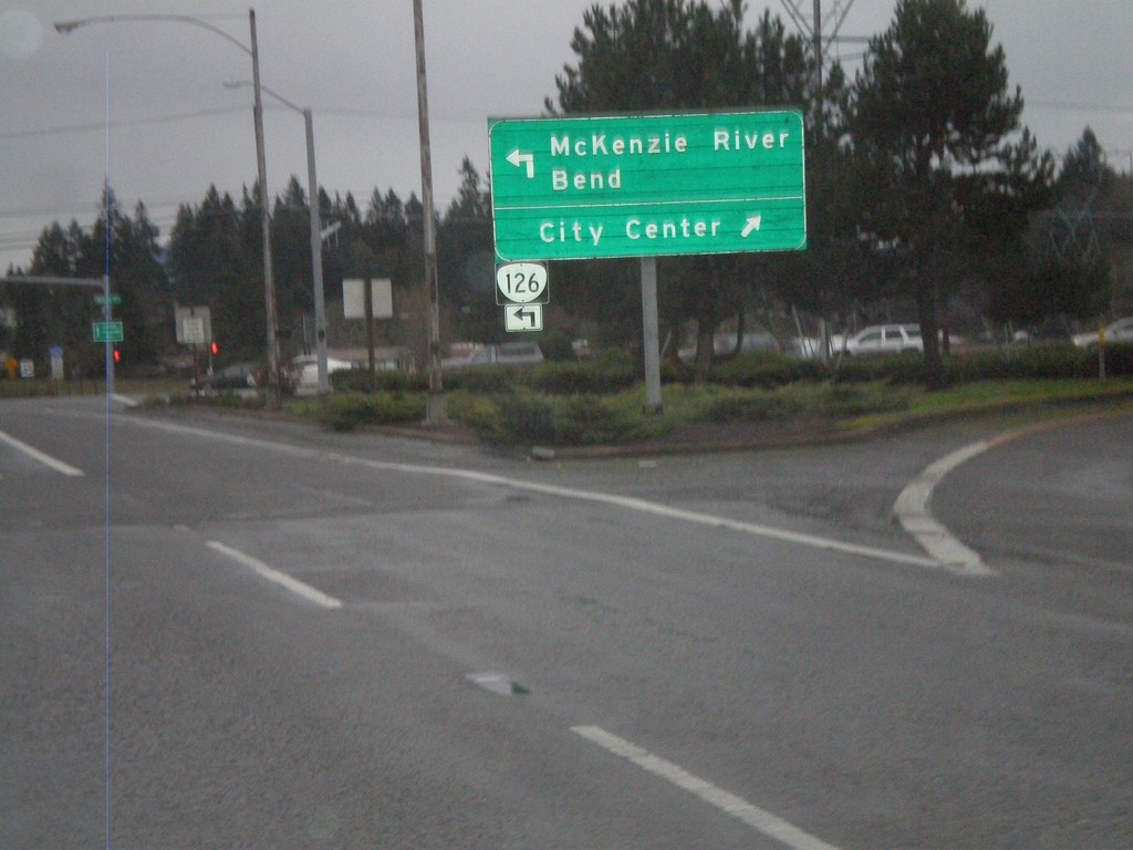
OR-126 East at Business OR-126 West
End of OR-126 freeway in Springfield, at Business OR-126 (Main St.). OR-126 continues east towards McKenzie River and Bend, along Main St. east. Use Main St. west (Business OR-126) for the Springfield City Center.
Taken 01-17-2010
Springfield
Lane County
Oregon
United States
OR-126 East Approaching Business OR-126
Approaching end of OR-126 freeway in Springfield, near Business OR-126 (Main St.) junction. OR-126 continues east towards McKenzie River and Bend, along Main St. east.
Taken 01-17-2010
Springfield
Lane County
Oregon
United States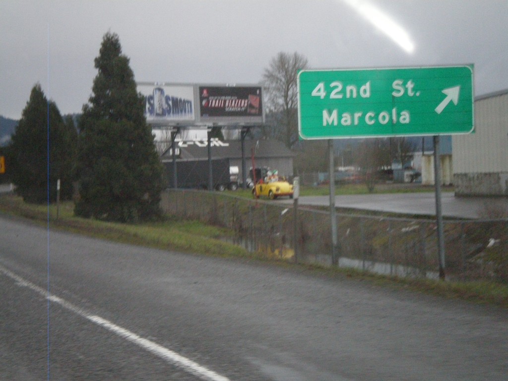
OR-126 East at 42nd St. Exit
OR-126 east at 42nd St./Marcola Exit.
Taken 01-17-2010
Springfield
Lane County
Oregon
United States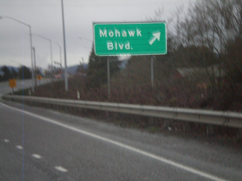
OR-126 East at Mohawk Blvd. Exit
OR-126 east at Mohawk Blvd. Exit
Taken 01-17-2010
Springfield
Lane County
Oregon
United States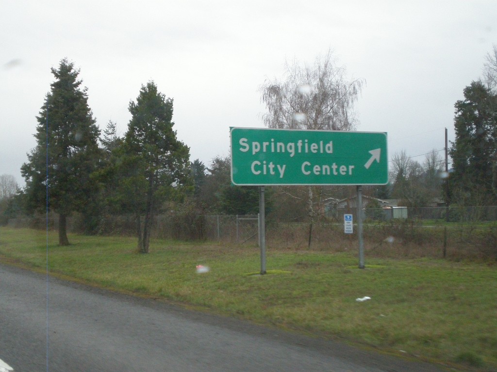
OR-126 East at Springfield City Center Exit
OR-126 east at Springfield City Center exit
Taken 01-17-2010
Springfield
Lane County
Oregon
United States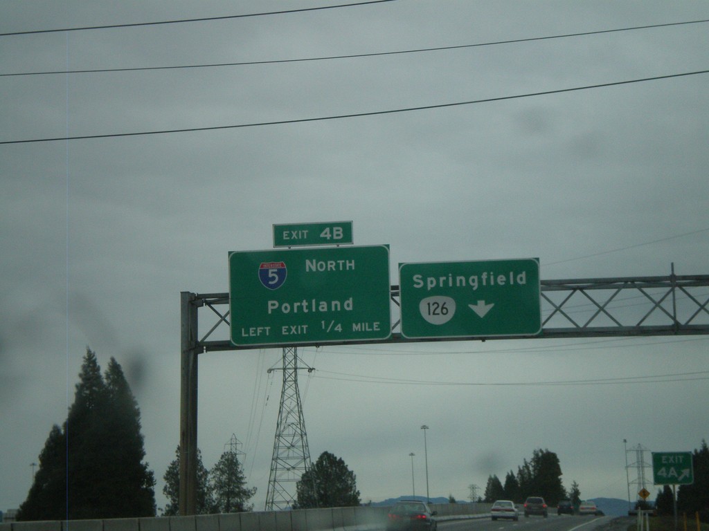
I-105 East at Exit 4B - I-5 North
I-105 East/OR-126 East at Exit 4B - I-5 North/Portland. I-105 ends at Exit 4B, OR-126 continues east to Springfield.
Taken 01-17-2010

 Eugene
Lane County
Oregon
United States
Eugene
Lane County
Oregon
United States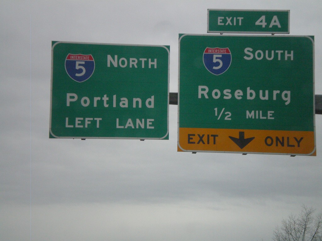
I-105/OR-126 East Approaching I-5
I-105/OR-126 East approaching I-5 at Exit 4A and 4B. Exit 4A - I-5 South/Roseburg. Exit 4B - I-5 North/Portland
Taken 01-17-2010
Eugene
Lane County
Oregon
United States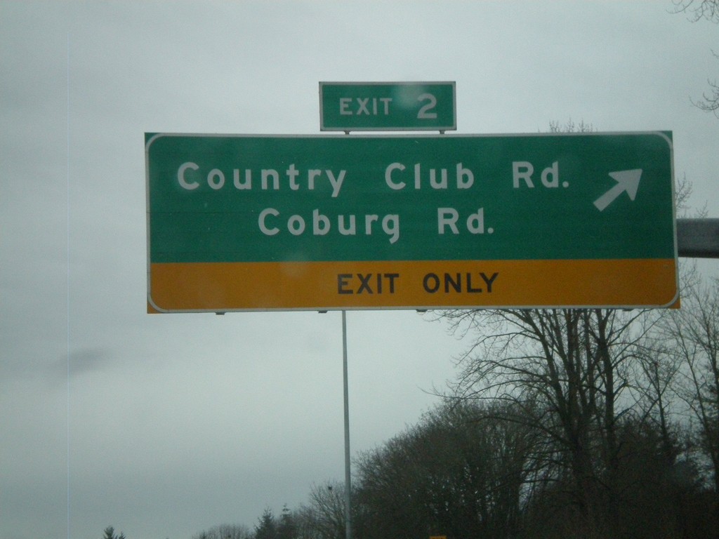
I-105/OR-126 East at Exit 2
I-105/OR-126 East at Exit 2 - Country Club Road/Coburg Road
Taken 01-17-2010
Eugene
Lane County
Oregon
United States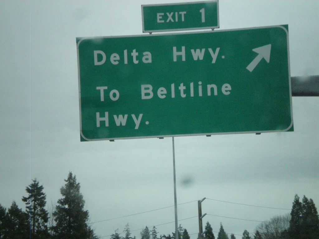
I-105 East - Exit 1
I-105 East/OR-126 East at Exit 1 - Delta Highway/To Beltline Highway
Taken 01-17-2010
Eugene
Lane County
Oregon
United States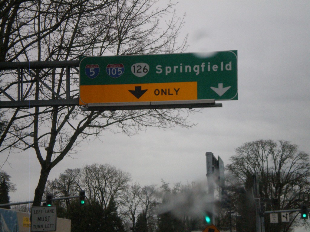
OR-126 East/OR-99 South at I-105
OR-126 East/OR-99 South at I-105. OR-126 East joins I-105 east to I-5 and Springfield. OR-99 continues south through Eugene.
Taken 01-17-2010
 Eugene
Lane County
Oregon
United States
Eugene
Lane County
Oregon
United States