Signs Tagged With Big Green Sign
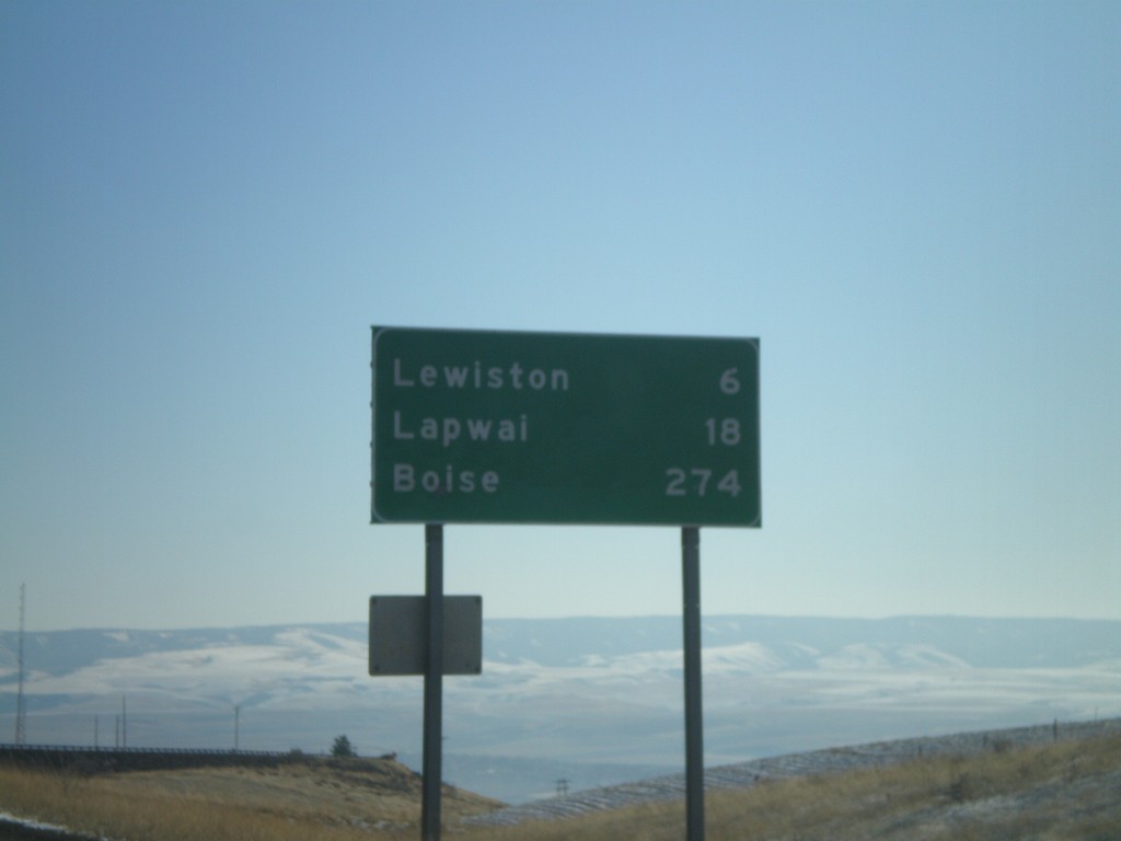
US-95 South - Distance Marker
Distance marker on US-95 south at the top of Lewiston Hill. Distance to Lewiston, Lapwai, and Boise.
Taken 12-27-2009
 Genesee
Nez Perce County
Idaho
United States
Genesee
Nez Perce County
Idaho
United States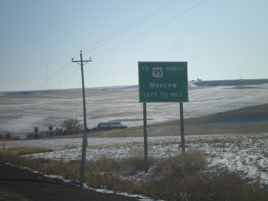
US-195 South Approaching US-95
US-195 south approaching US-95 north to Moscow. There is no direct connection from US-195 south to US-95 north, nor from US-95 south to US-195 north.
Taken 12-27-2009
 Uniontown
Whitman County
Washington
United States
Uniontown
Whitman County
Washington
United States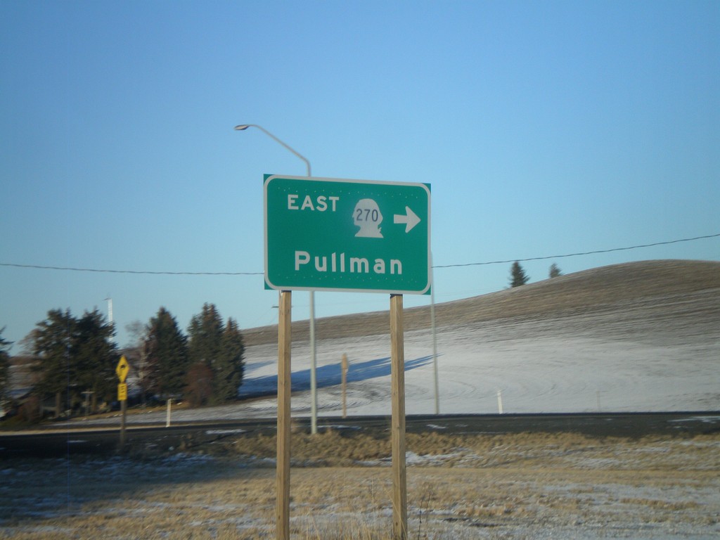
US-195 North at WA-270 East
US-195 north at WA-270 east to Pullman.
Taken 12-26-2009
 Pullman
Whitman County
Washington
United States
Pullman
Whitman County
Washington
United States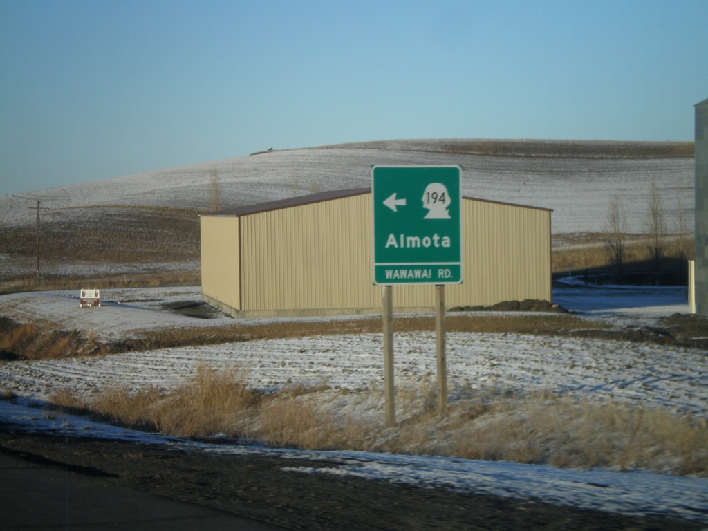
US-195 North at WA-194 West
US-195 north at WA-194 (Wawawai Road) west to Almota.
Taken 12-26-2009
 Pullman
Whitman County
Washington
United States
Pullman
Whitman County
Washington
United States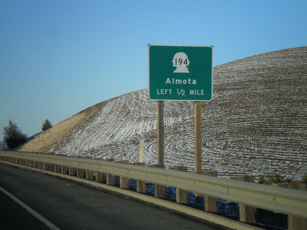
US-195 North Approaching WA-194
US-195 north approaching WA-194 west to Almota.
Taken 12-26-2009
Pullman
Whitman County
Washington
United States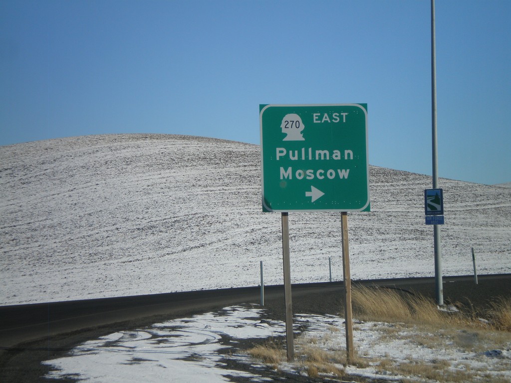
Begin WA-270 East
Begin WA-270 east at US-195 to Pullman and Moscow (Idaho).
Taken 12-26-2009
Pullman
Whitman County
Washington
United States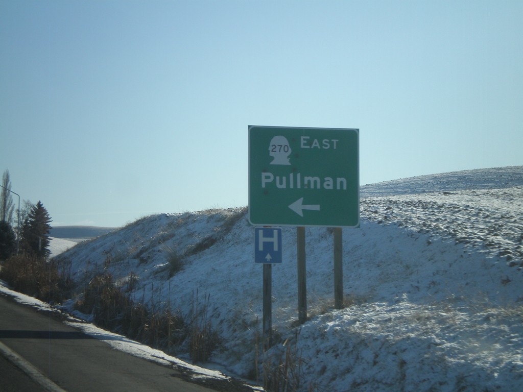
US-195 South at WA-270 East
US-195 south at WA-270 east to Pullman.
Taken 12-26-2009
Pullman
Whitman County
Washington
United States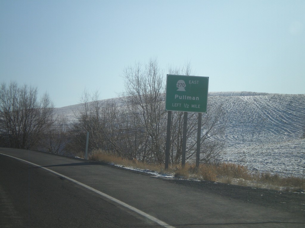
US-195 South Approaching WA-270
US-195 south approaching WA-270 east to Pullman.
Taken 12-26-2009
Pullman
Whitman County
Washington
United States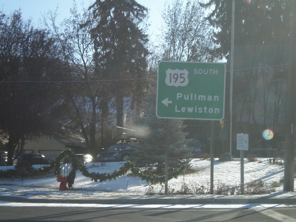
US-195 South - Colfax
US-195 south (Main St.) at James St. Southbound traffic veer left on James St. towards Pullman and Lewiston (Idaho).
Taken 12-26-2009
Colfax
Whitman County
Washington
United States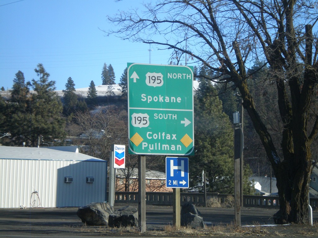
End WA-26 West at US-195
End WA-26 east at US-195. Use US-195 north for Spokane. Use US-195 south for Colfax and Pullman.
Taken 12-26-2009
 Colfax
Whitman County
Washington
United States
Colfax
Whitman County
Washington
United States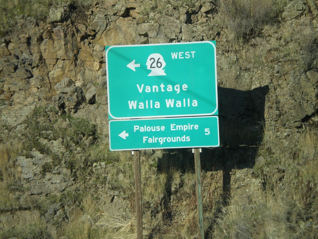
US-195 North at WA-26 West
US-195 north at WA-26 west to Vantage and Walla Walla. WA-26 is the main highway across central Washington from the Palouse region to Seattle. Use WA-26 west for the Palouse Empire Fairgrounds.
Taken 12-26-2009
Colfax
Whitman County
Washington
United States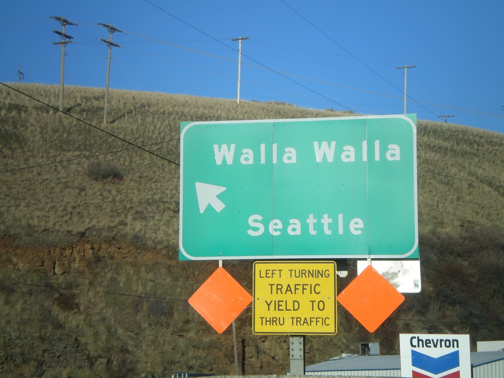
US-195 North at WA-26
US-195 north at WA-26 to Walla Walla and Seattle.
Taken 12-26-2009
Colfax
Whitman County
Washington
United States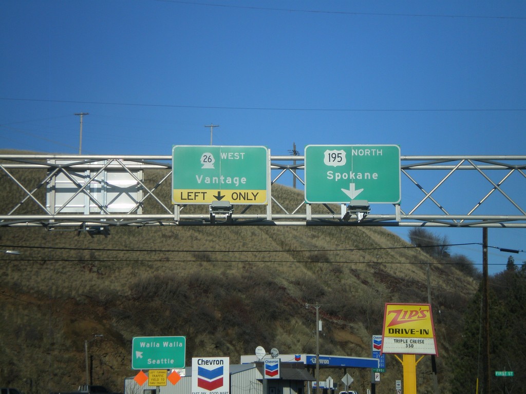
US-195 North at WA-26 West
US-195 north in Colfax at WA-26 west to Vantage. US-195 continues north to Spokane.
Taken 12-26-2009
Colfax
Whitman County
Washington
United States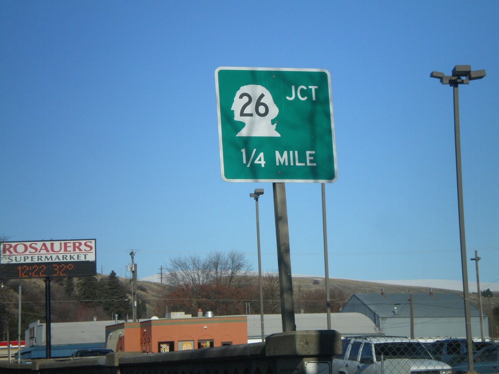
US-195 North Approaching WA-26
US-195 north in Colfax approaching WA-26.
Taken 12-26-2009
Colfax
Whitman County
Washington
United States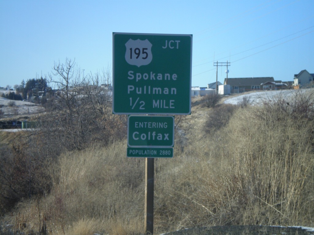
WA-272 West Approaching US-195
WA-272 west approaching US-195 to Spokane and Pullman. Entering Colfax - Population 2880. Colfax is the Whitman County Seat.
Taken 12-26-2009
 Colfax
Whitman County
Washington
United States
Colfax
Whitman County
Washington
United States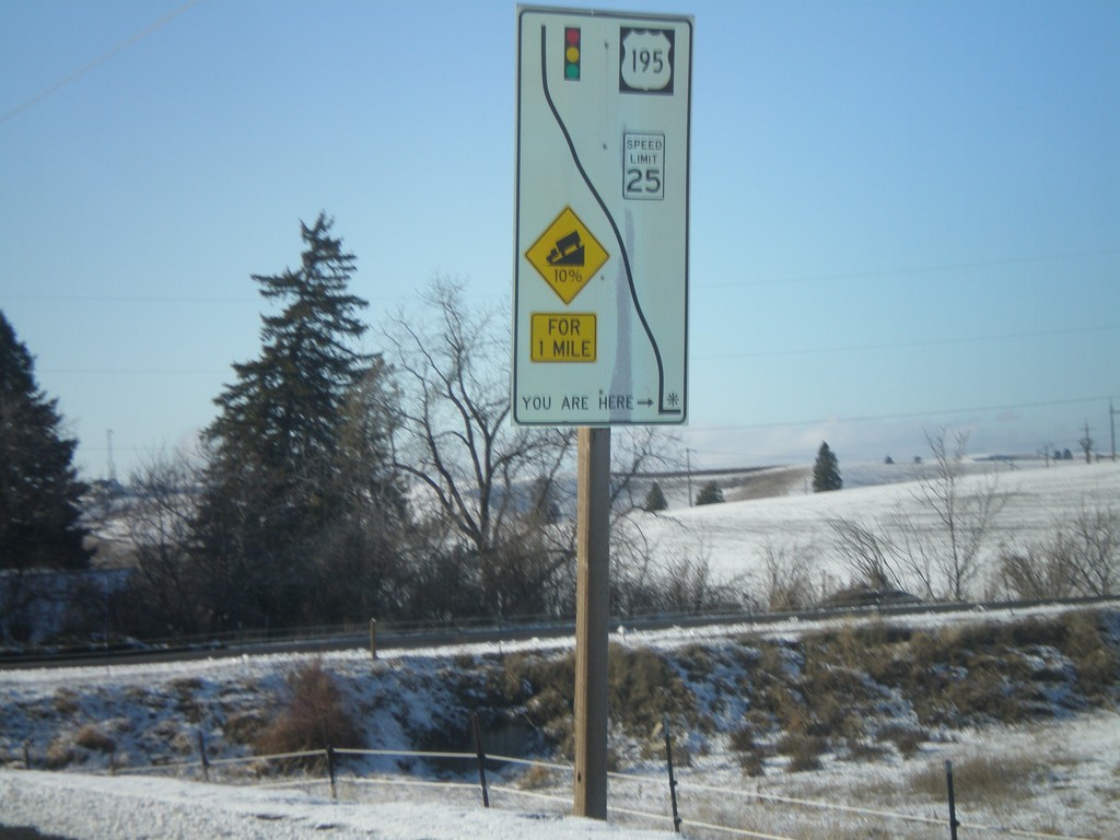
WA-272 East - Grade Information
WA-272 west at the top of a 10% grade above Colfax. Route diagram showing the speed and grade information, and the stoplight at the bottom of the hill at US-195.
Taken 12-26-2009
Colfax
Whitman County
Washington
United States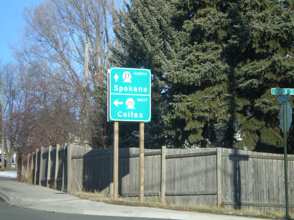
WA-27 North/WA-27 West at WA-272 West
WA-27 North/WA-272 West at WA-272 west to Colfax. WA-27 continues north to Spokane.
Taken 12-26-2009
 Palouse
Whitman County
Washington
United States
Palouse
Whitman County
Washington
United States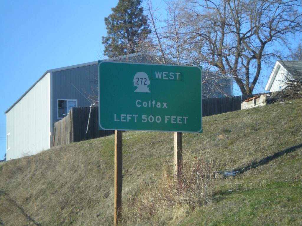
WA-27 North Approaching WA-272 West
WA-27 North/WA-272 West approaching WA-272 west to Colfax.
Taken 12-26-2009
Palouse
Whitman County
Washington
United States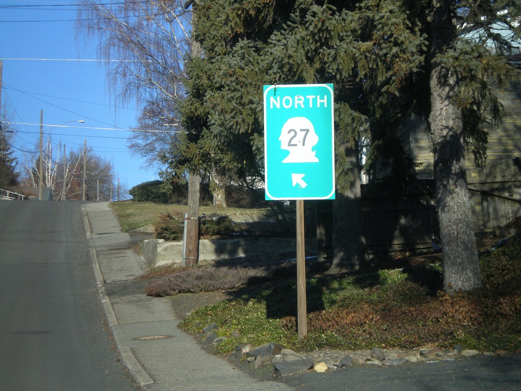
WA-27 North - Palouse
WA-27 North/WA-272 West (unsigned) on Division St. in Palouse.
Taken 12-26-2009
Palouse
Whitman County
Washington
United States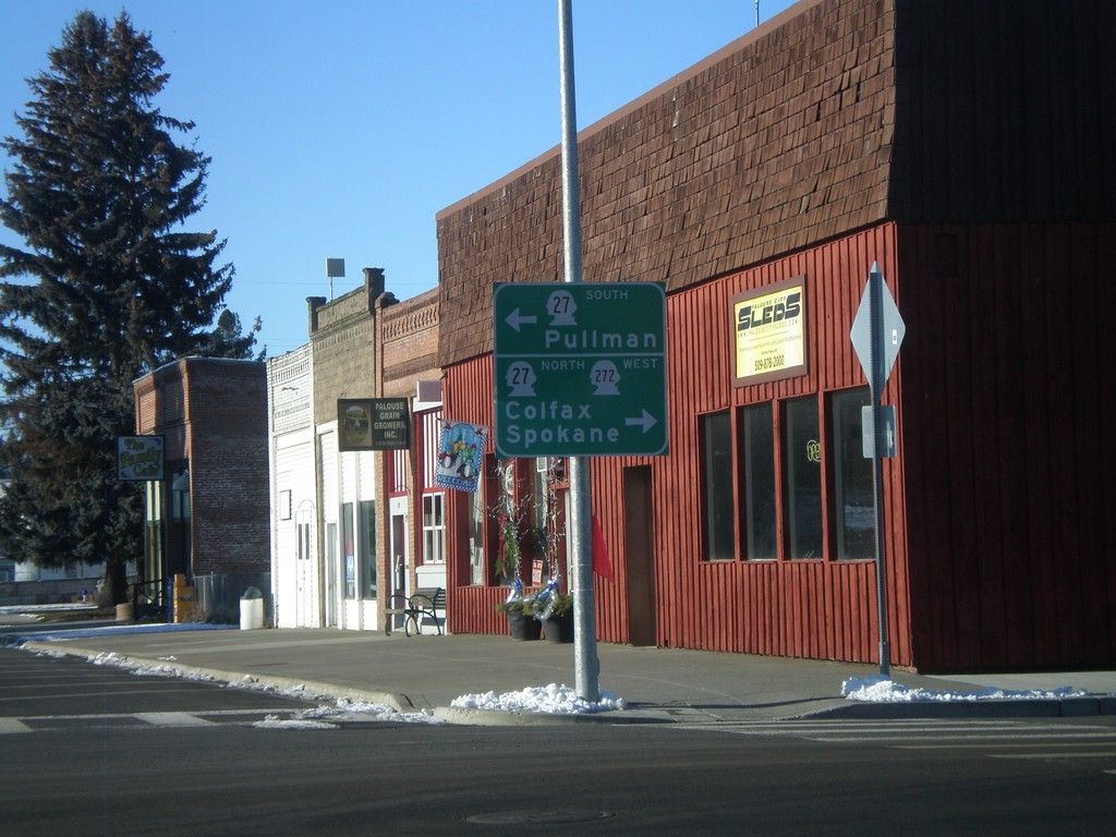
WA-272 West at WA-27
WA-272 west at WA-27 in Palouse. WA-272 joins WA-27 through Palouse. Use WA-27 South for Pullman. Use WA-27 North/WA-272 West for Colfax and Spokane.
Taken 12-26-2009
Palouse
Whitman County
Washington
United States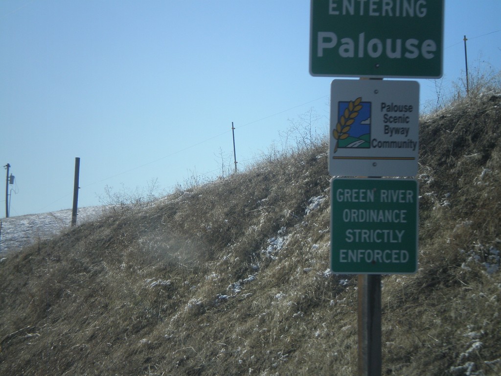
WA-272 West - Entering Palouse
Entering Palouse on WA-272 west. Palouse is a Palouse Scenic Byway Community.
Taken 12-26-2009
Palouse
Whitman County
Washington
United States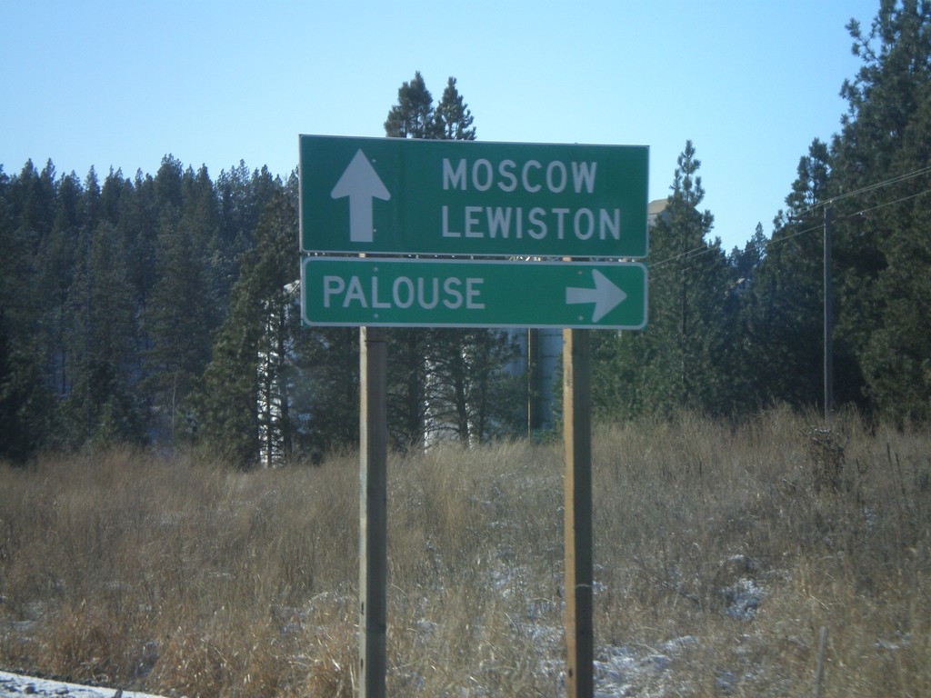
US-95 South/ID-6 West at ID-6 Split
US-95/ID-6 at ID-6 west to Palouse (Washington). Continue south on US-95 for Moscow and Lewiston.
Taken 12-26-2009
 Potlatch
Latah County
Idaho
United States
Potlatch
Latah County
Idaho
United States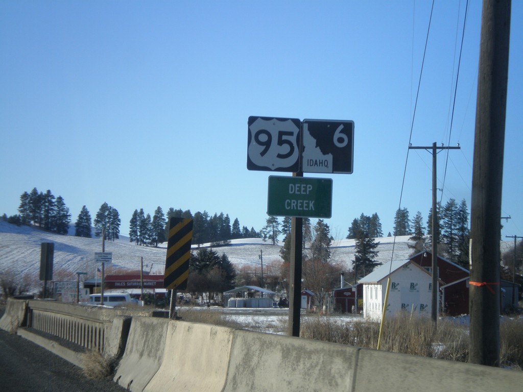
US-95 South/ID-6 West - Deep Creek
US-95/ID-6 at the Deep Creek bridge.
Taken 12-26-2009
Potlatch
Latah County
Idaho
United States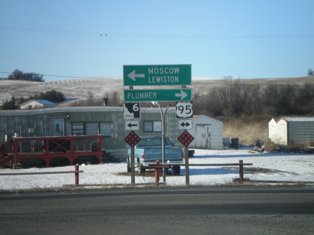
ID-6 West at US-95
ID-6 west at US-95. ID-6 west briefly joins US-95 south. Use US-95 north for Plummer. Use US-95 south/ID-6 west for Moscow and Lewiston.
Taken 12-26-2009
Onaway
Latah County
Idaho
United States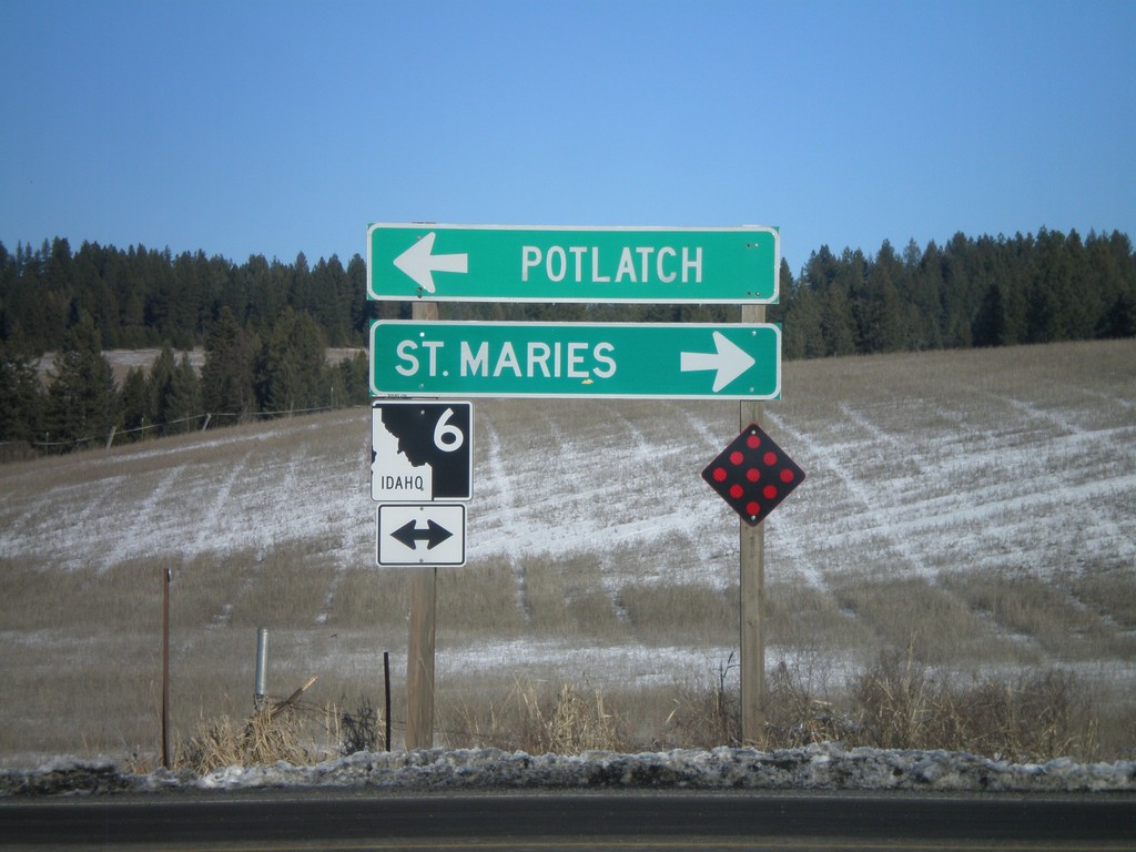
End ID-9 North at ID-6
End ID-9 north at ID-6. Use ID-6 west for Potlatch. Use ID-6 east for St. Maries
Taken 12-26-2009
 Harvard
Latah County
Idaho
United States
Harvard
Latah County
Idaho
United States