Signs Tagged With Big Green Sign
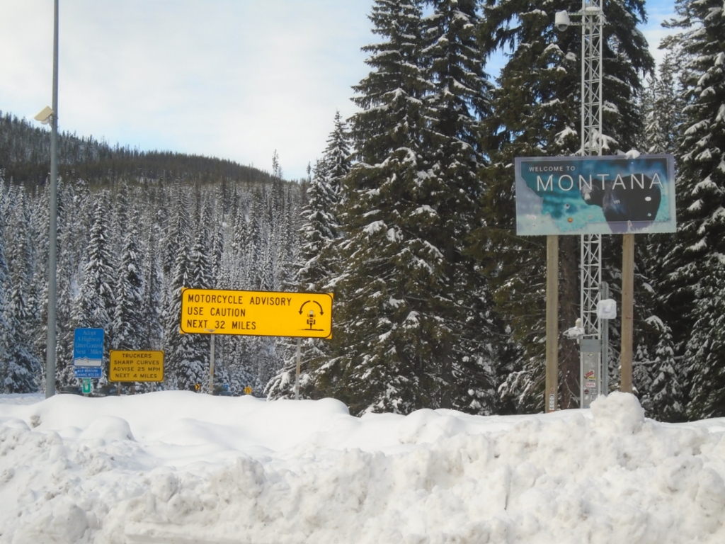
US-12 East - Welcome To Montana
Welcome To Montana on US-12 east at Lolo Pass. Motorcycle Advisory - Use Caution Next 32 Miles.
Taken 11-30-2024
 Lolo Hot Springs
Missoula County
Montana
United States
Lolo Hot Springs
Missoula County
Montana
United States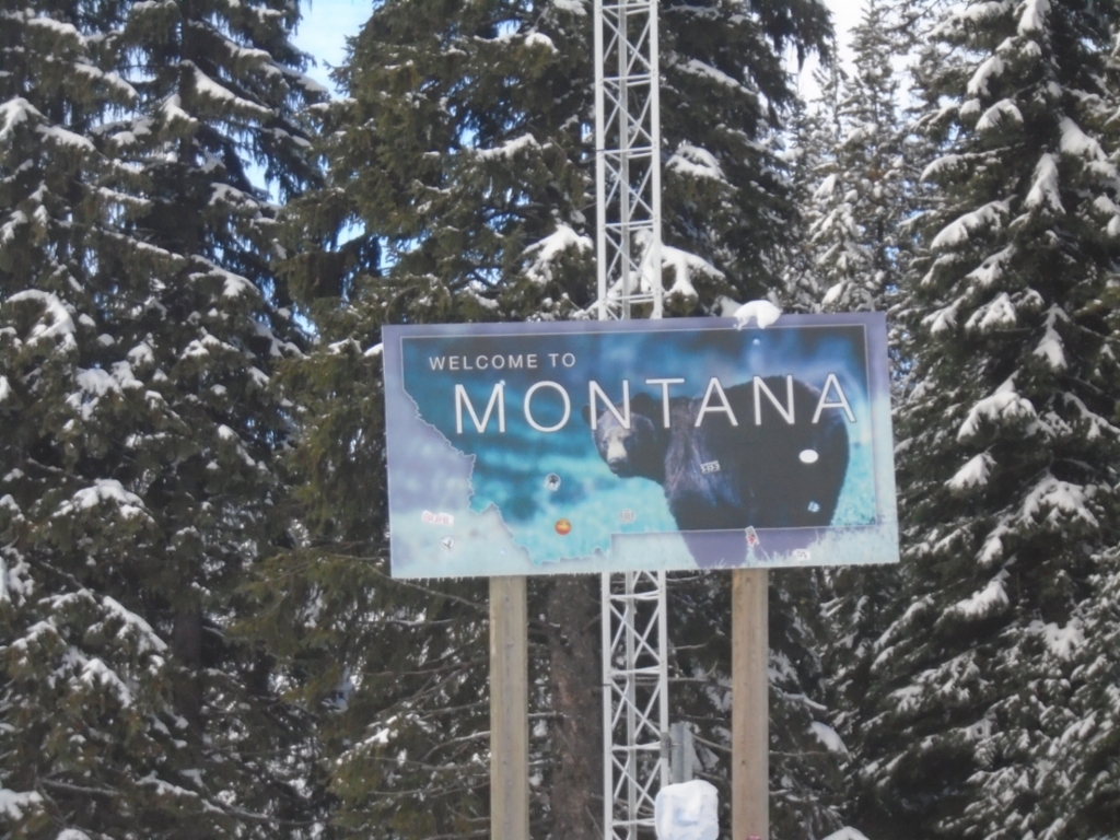
US-12 East - Welcome To Montana
Welcome To Montana on US-12 east at Lolo Pass.
Taken 11-30-2024
Lolo Hot Springs
Missoula County
Montana
United States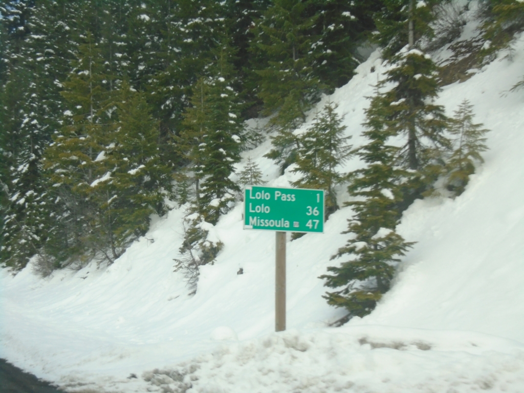
US-12 East - Distance Marker
Last distance marker in Idaho on US-12 east. Distance to Lolo Pass, Lolo (Montana), and Missoula (Montana).
Taken 11-30-2024
Powell Junction
Idaho County
Idaho
United States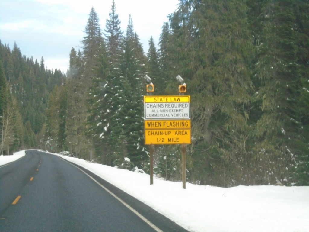
US-12 East - Lolo Pass Chain-Up Area
US-12 east approaching Chain-Up Area on approach to Lolo Pass.
Taken 11-30-2024
Powell Junction
Idaho County
Idaho
United States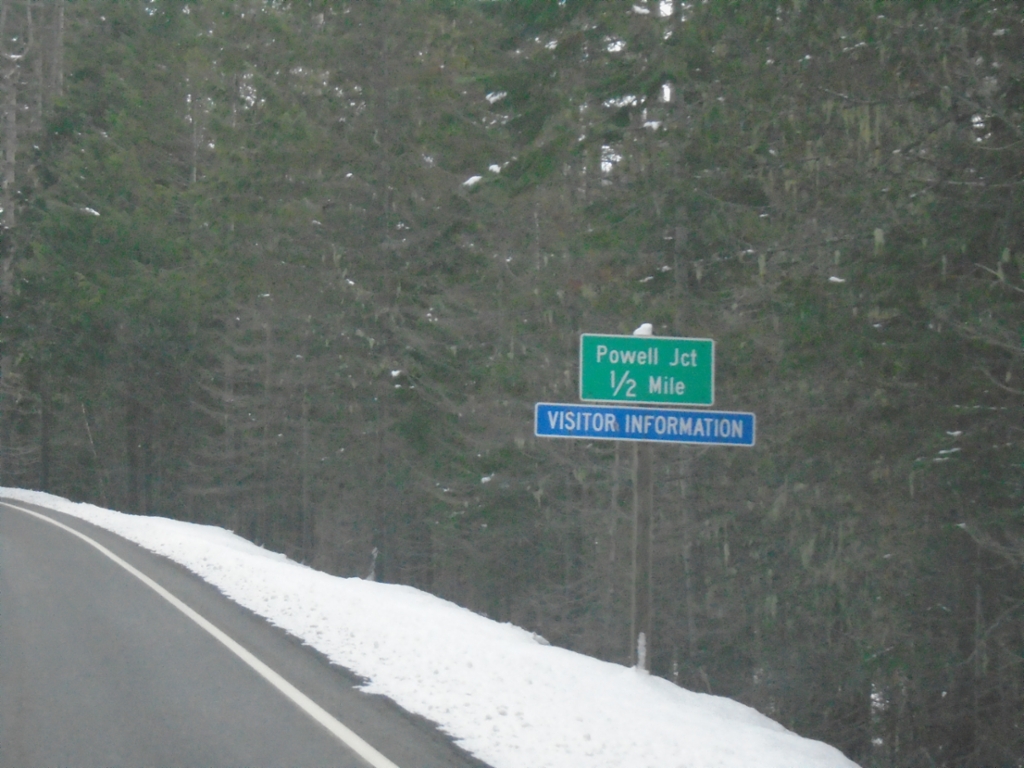
US-12 East Approaching Powell Junction
US-12 East approaching Powell Junction.
Taken 11-30-2024
Powell Junction
Idaho County
Idaho
United States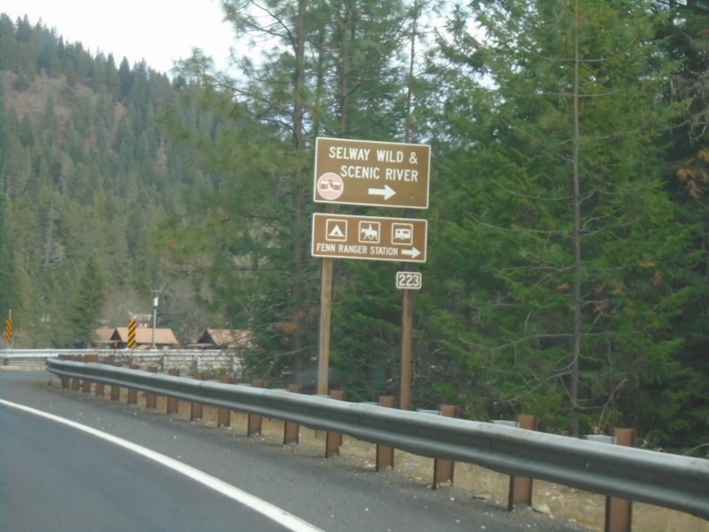
US-12 East - Selway Road Junction
US-12 East at Selway Road (FS 223) Junction to Selway Wild and Scenic River.
Taken 11-30-2024
Kooskia
Idaho County
Idaho
United States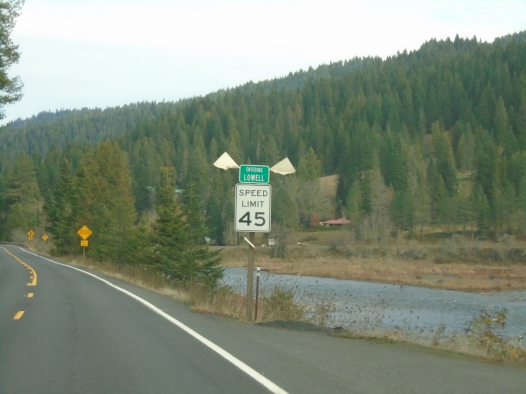
US-12 East - Lowell
Entering Lowell on US-12 east. Lowell is where the Lochsa and Selway Rivers combine to form the Clearwater River.
Taken 11-30-2024
Kooskia
Idaho County
Idaho
United States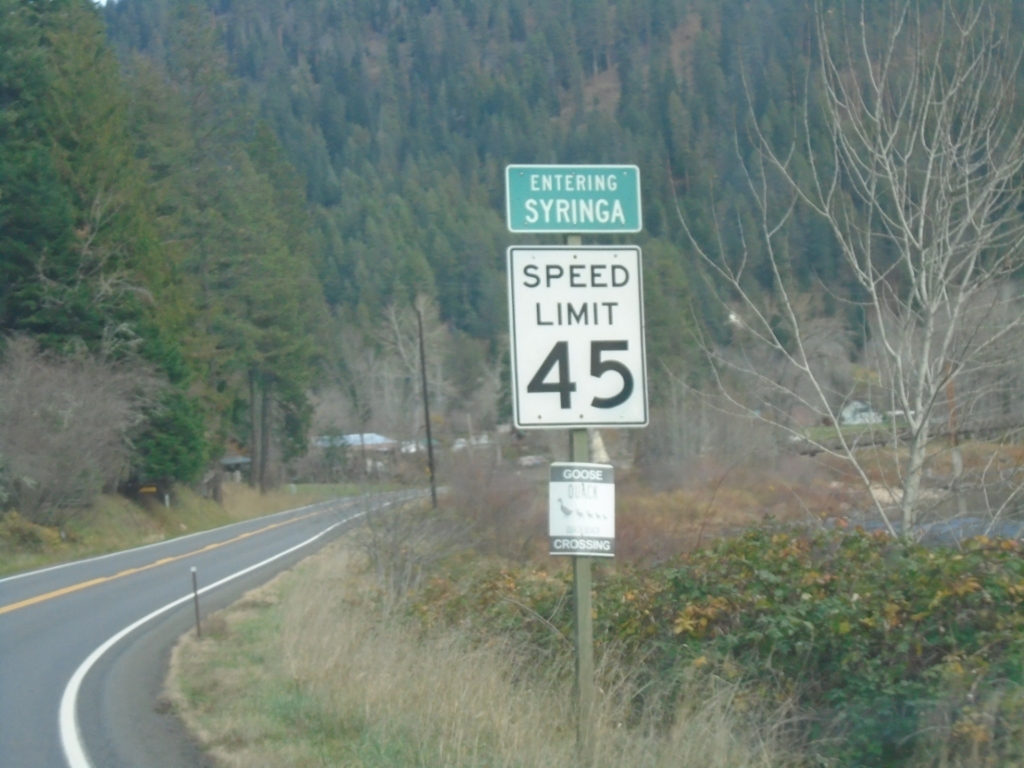
US-12 East - Syringa
Entering Syringa on US-12 east. Syringa is the Idaho state flower.
Taken 11-30-2024
Kooskia
Idaho County
Idaho
United States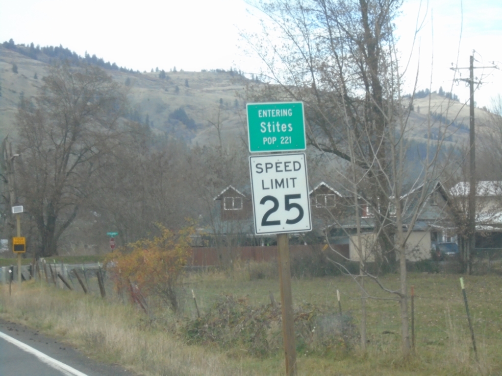
ID-13 North - Stites
Entering Stites on ID-13 North. Population 221.
Taken 11-30-2024
 Stites
Idaho County
Idaho
United States
Stites
Idaho County
Idaho
United States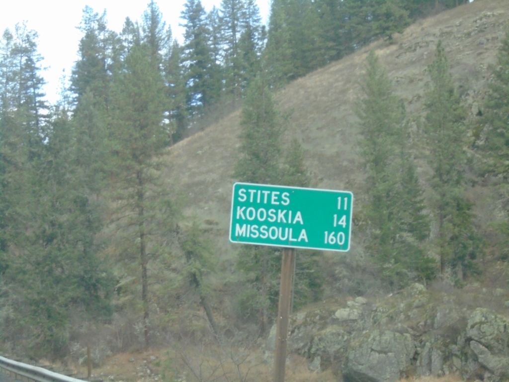
ID-13 North - Distance Marker
Distance marker on ID-13 north. Distance to Stites, Kooskia, and Missoula (Montana).
Taken 11-30-2024
Grangeville
Idaho County
Idaho
United States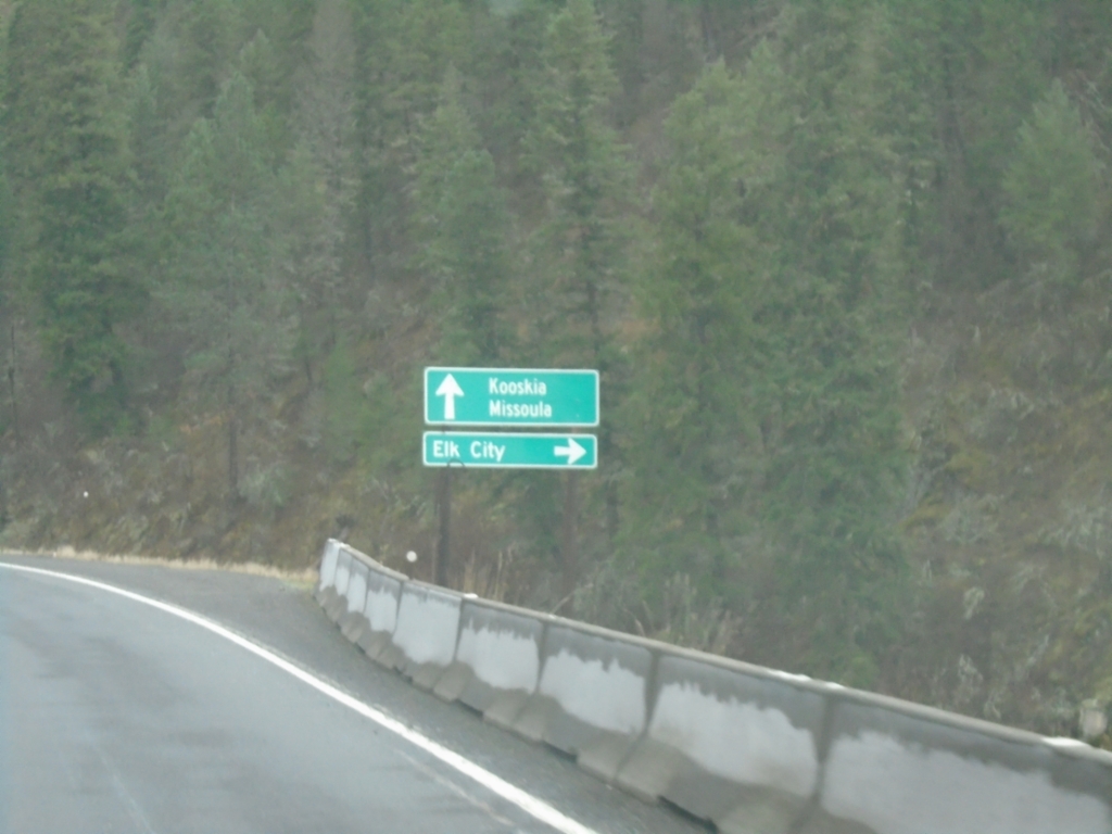
ID-13 North at ID-14
ID-13 North at ID-14 to Elk City. Continue north on ID-13 to Kooskia and Missoula (Montana).
Taken 11-30-2024
 Grangeville
Idaho County
Idaho
United States
Grangeville
Idaho County
Idaho
United States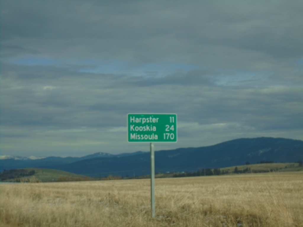
ID-13 North - Distance Marker
Distance marker on ID-13 north. Distance to Harpster, Kooskia, and Missoula (Montana).
Taken 11-30-2024
Grangeville
Idaho County
Idaho
United States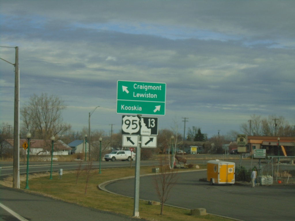
US-95 North at ID-13
US-95 North at ID-13 in Grangeville. Use ID-13 to Kooskia; continue north on US-95 to Craigmont and Lewiston.
Taken 11-30-2024
 Grangeville
Idaho County
Idaho
United States
Grangeville
Idaho County
Idaho
United States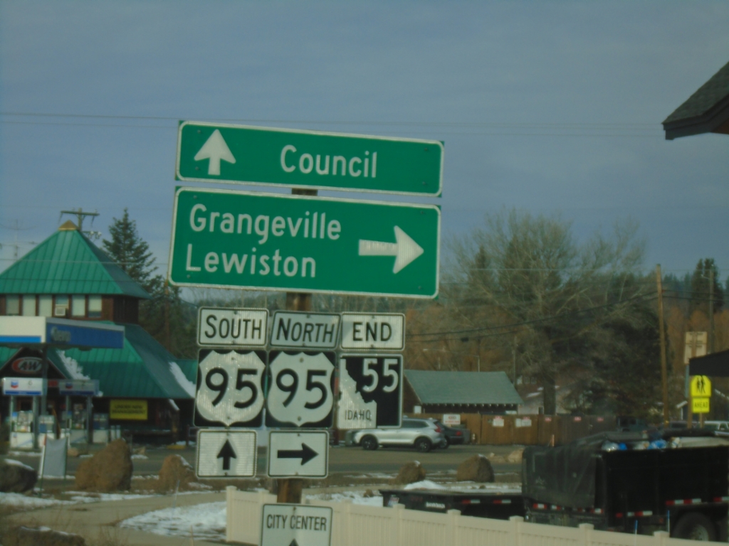
End ID-55 North at US-95
End ID-55 at US-95 south to Council, and north to Grangeville and Lewiston.
Taken 11-30-2024
 New Meadows
Adams County
Idaho
United States
New Meadows
Adams County
Idaho
United States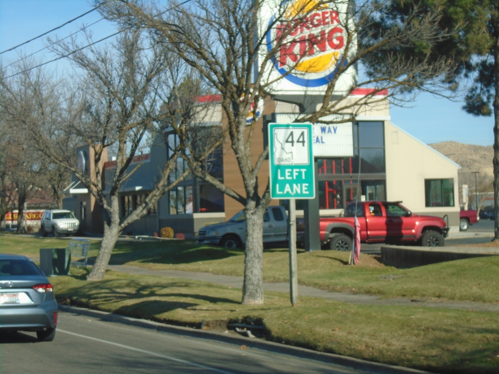
ID-44 West Approaching State St.
ID-44 West (Glenwood St.) approaching State St. Use left lanes to continue west on ID-44.
Taken 11-29-2024
 Garden City
Ada County
Idaho
United States
Garden City
Ada County
Idaho
United States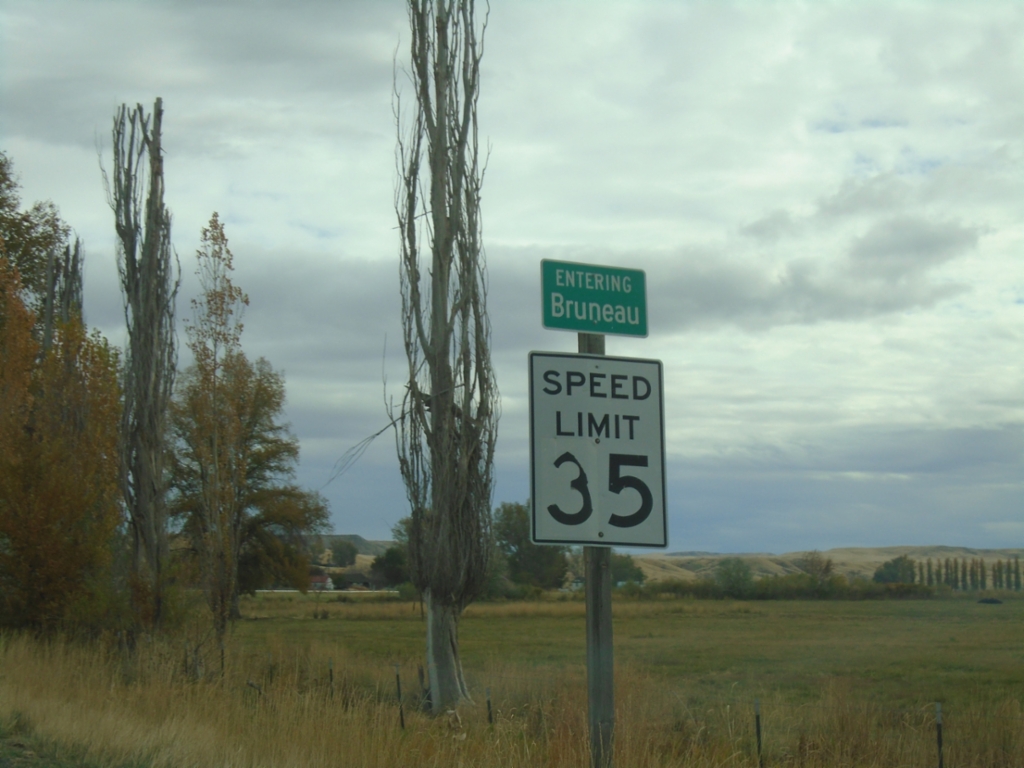
ID-51 North/ID-78 East - Bruneau
Entering Bruneau on ID-51 North/ID-78 East.
Taken 11-02-2024

 Bruneau
Owyhee County
Idaho
United States
Bruneau
Owyhee County
Idaho
United States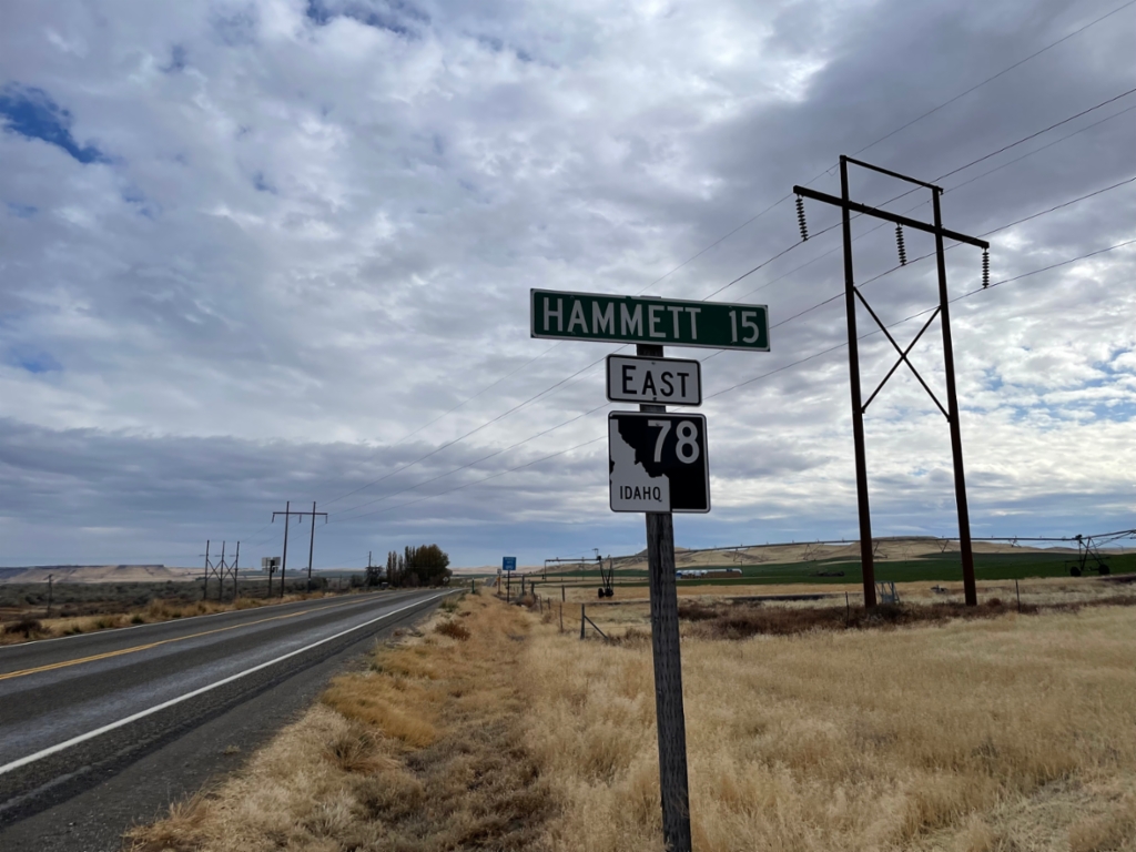
ID-78 East - Distance Marker
Distance marker on ID-78 East. Distance to Hammett.
Taken 11-02-2024
Mountain Home
Owyhee County
Idaho
United States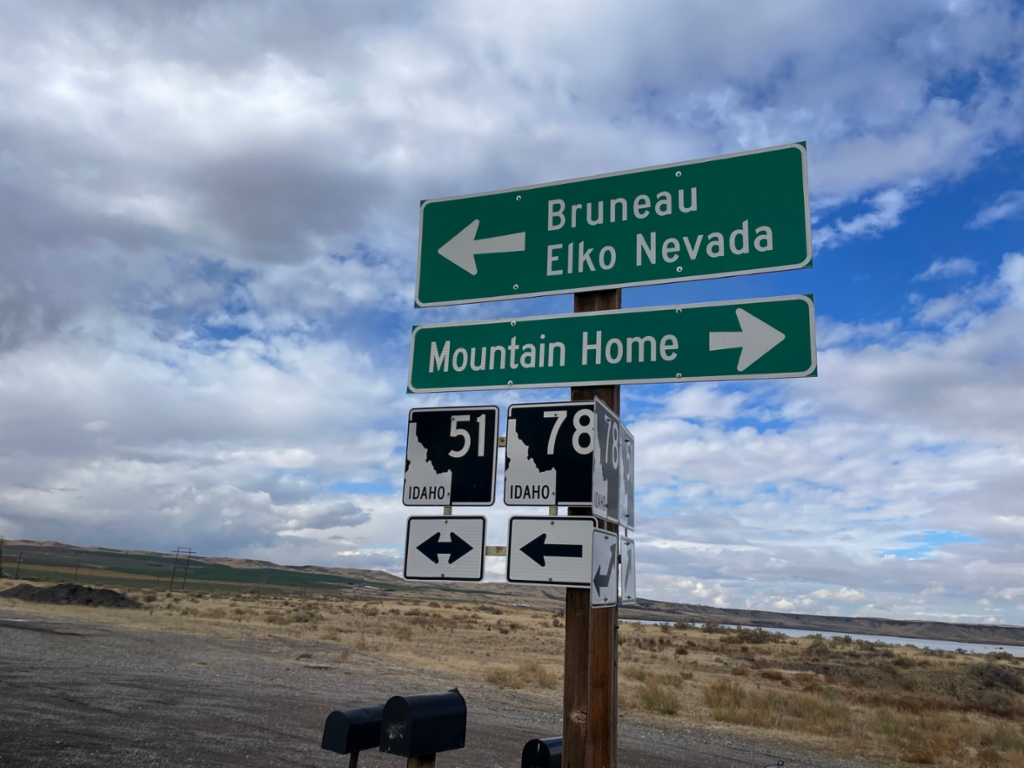
ID-78 West at ID-51
ID-78 west at ID-51. Use ID-51 north for Mountain Home. Use ID-51 South/ID-78 West for Bruneau and Elko, Nevada.
Taken 11-02-2024
Bruneau
Owyhee County
Idaho
United States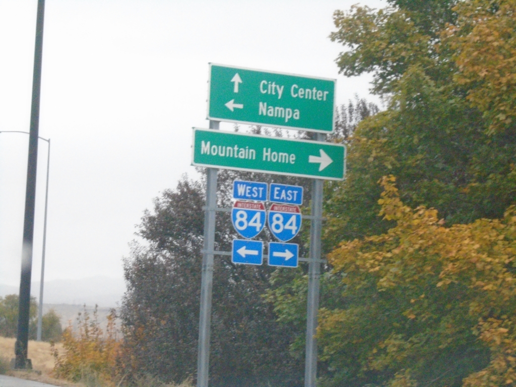
Vista Ave. North at I-84
Vista Ave. North at I-84 (Exit 53). Use I-84 East to Mountain Home; I-84 West to Nampa. Continue north on Vista Ave. to (Boise) City Center.
Taken 11-02-2024

 Boise
Ada County
Idaho
United States
Boise
Ada County
Idaho
United States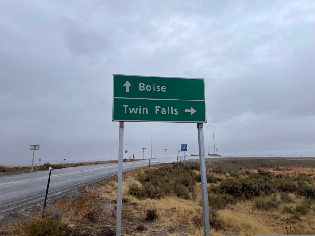
Simco Road North at I-84
Simco Road North at I-84. Turn right for I-84 east to Twin Falls. Proceed over freeway for I-84 west to Boise.
Taken 11-02-2024

 Regina
Ada County
Idaho
United States
Regina
Ada County
Idaho
United States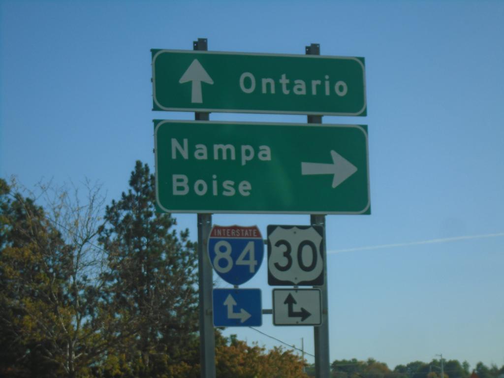
ID-19 West at I-84 Onramp
End BL-84 West at I-84/US-30/(US-20/US-26) in Caldwell. Use I-84/US-30 east for Nampa and Boise; I-84/US-30 west for Ontario (Oregon).
Taken 10-19-2024

 Caldwell
Canyon County
Idaho
United States
Caldwell
Canyon County
Idaho
United States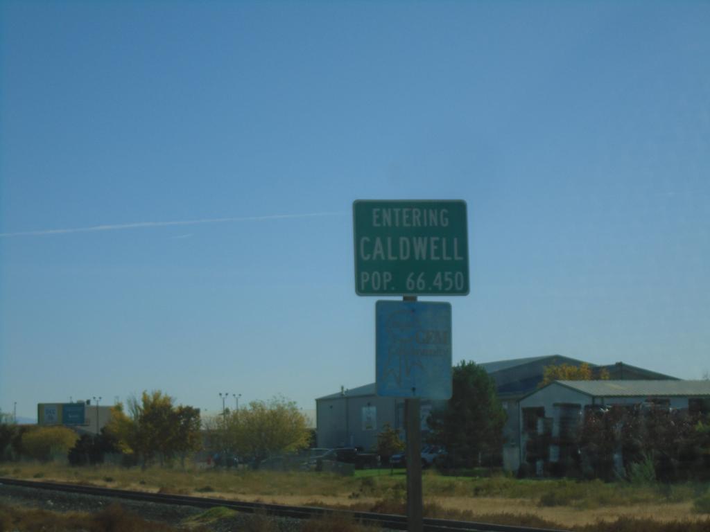
ID-19 East - Caldwell
Entering Caldwell on ID-19 east. Caldwell is the county seat of Canyon County, and is the 5th largest city in Idaho (2020 Census).
Taken 10-19-2024
Caldwell
Canyon County
Idaho
United States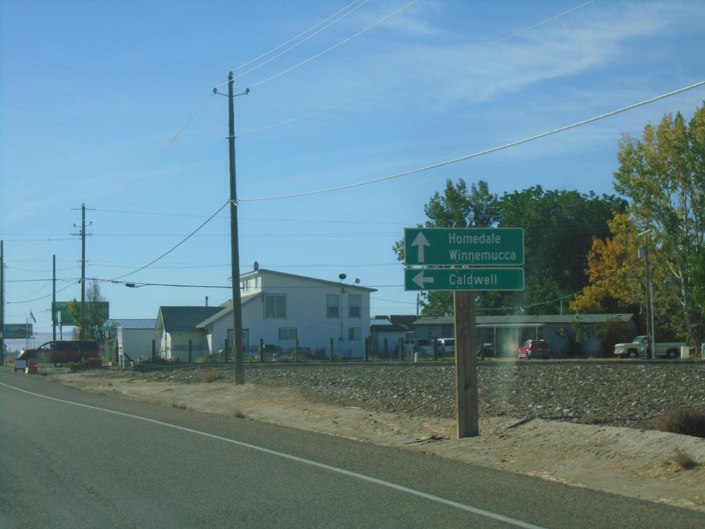
US-95 South Approaching ID-19 East
US-95 South approaching ID-19 East. Use ID-19 east to Caldwell. Continue south on US-95 and ID-19 West for Homedale and Winnemucca (Nevada). ID-19 joins US-95 south to Homedale.
Taken 10-19-2024
Wilder
Canyon County
Idaho
United States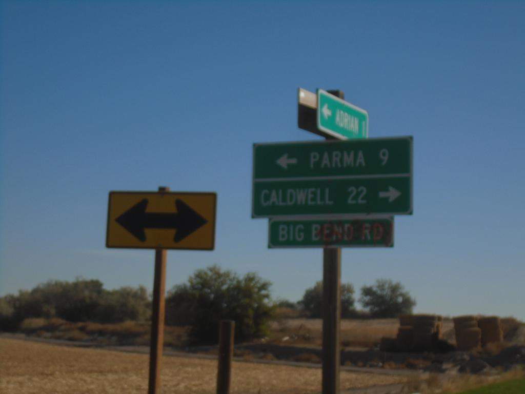
OR-452 East at OR-454
OR-452 East at OR-454 (Big Bend Road) in Malheur County. Turn right for OR-454 East to Caldwell (Idaho); turn left for OR-452 East to Parma (Idaho). OR-452 and OR-454 are both unsigned for their entire length.
Taken 10-19-2024

 Adrian
Malheur County
Oregon
United States
Adrian
Malheur County
Oregon
United States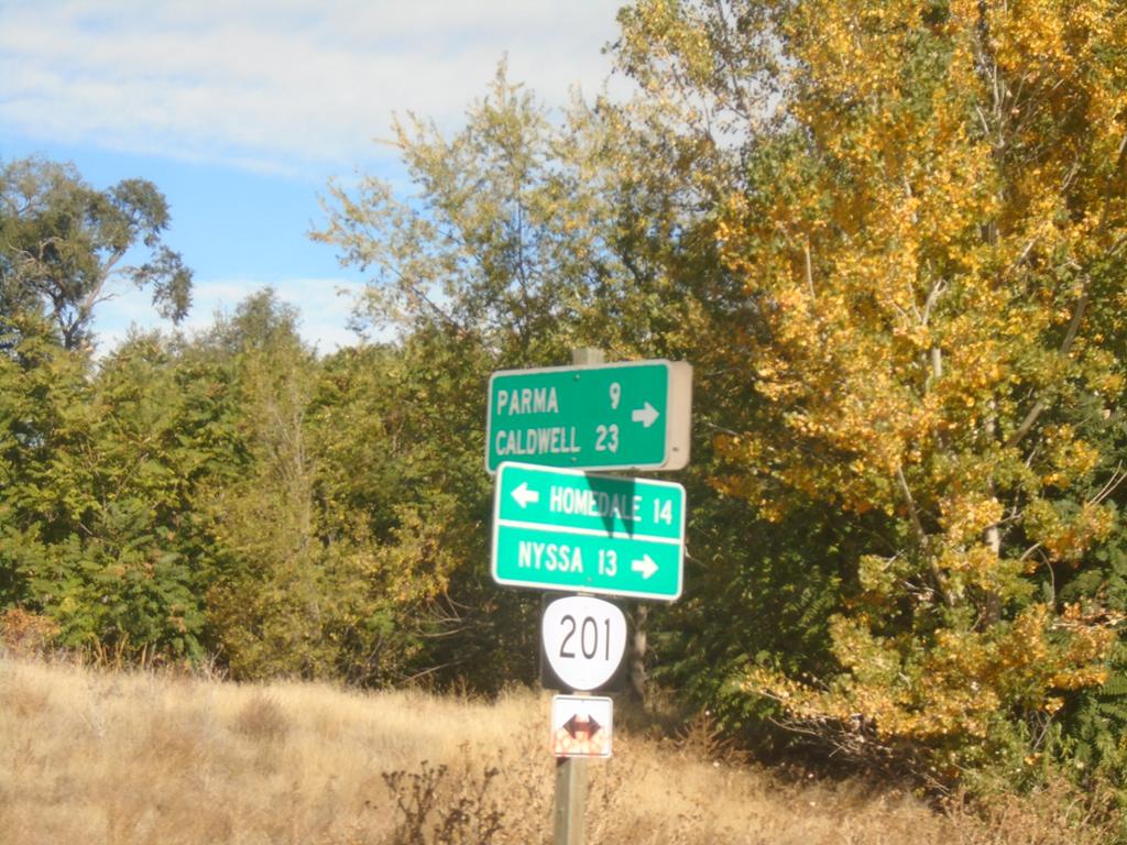
OR-201 North at OR-452
OR-201 North at OR-452 (unsigned) in Adrian. Turn right for OR-452 east to Parma (Idaho) and Caldwell (Idaho). Use OR-201 North to Nyssa; OR-201 South to Homedale (Idaho).
Taken 10-19-2024
 Adrian
Malheur County
Oregon
United States
Adrian
Malheur County
Oregon
United States