Signs Tagged With Big Green Sign
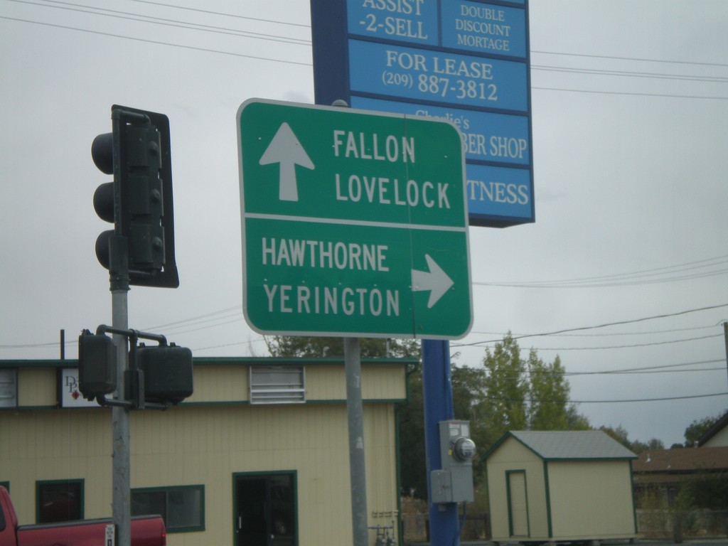
End NV-427 South at Alt. US-95 and Alt. US-50
End of NV-427 south at Alt. US-95/Alt. US-50 south to Hawthorne and Yerrington. BL-80 continues eastwards from NV-427 to Alt. US-95 North/Alt. US-50 East. Continue on BL-80 east for Fallon and Lovelock.
Taken 10-04-2009


 Fernley
Lyon County
Nevada
United States
Fernley
Lyon County
Nevada
United States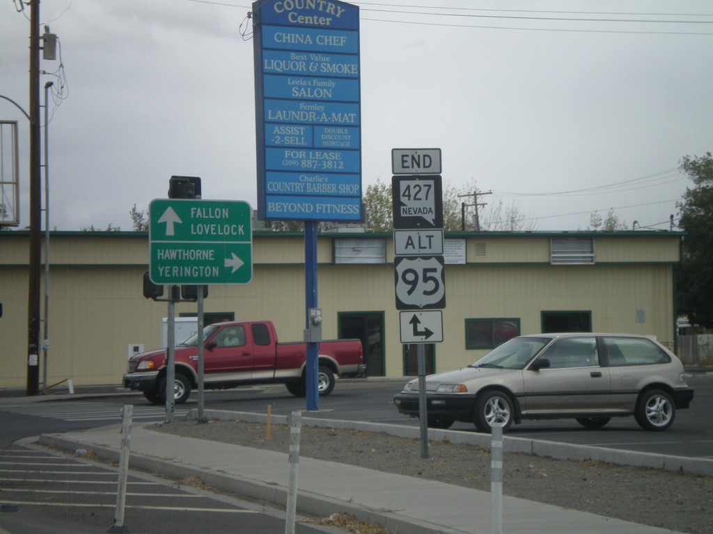
End NV-427 at Alt. US-95/Alt. US-50
End of NV-427 south at Alt. US-95/Alt. US-50 south to Hawthorne and Yerrington. Alt. US-50 is not signed at this intersection, but Alt. US-50 and Alt. US-95 are concurrent south of Fernley to Silver Springs at US-50 junction.
Taken 10-04-2009
Fernley
Lyon County
Nevada
United States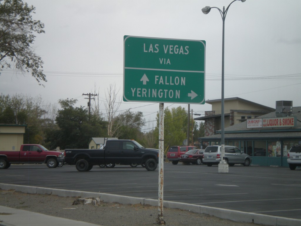
NV-427 South - Two Routes to Las Vegas
BL-80/NV-427 South approaching Alt. US-50/Alt. US-95. For Las Vegas via Yerrington, use Alt. US-95 South. For Las Vegas via Fallon, use Alt. US-50 East.
Taken 10-04-2009
Fernley
Lyon County
Nevada
United States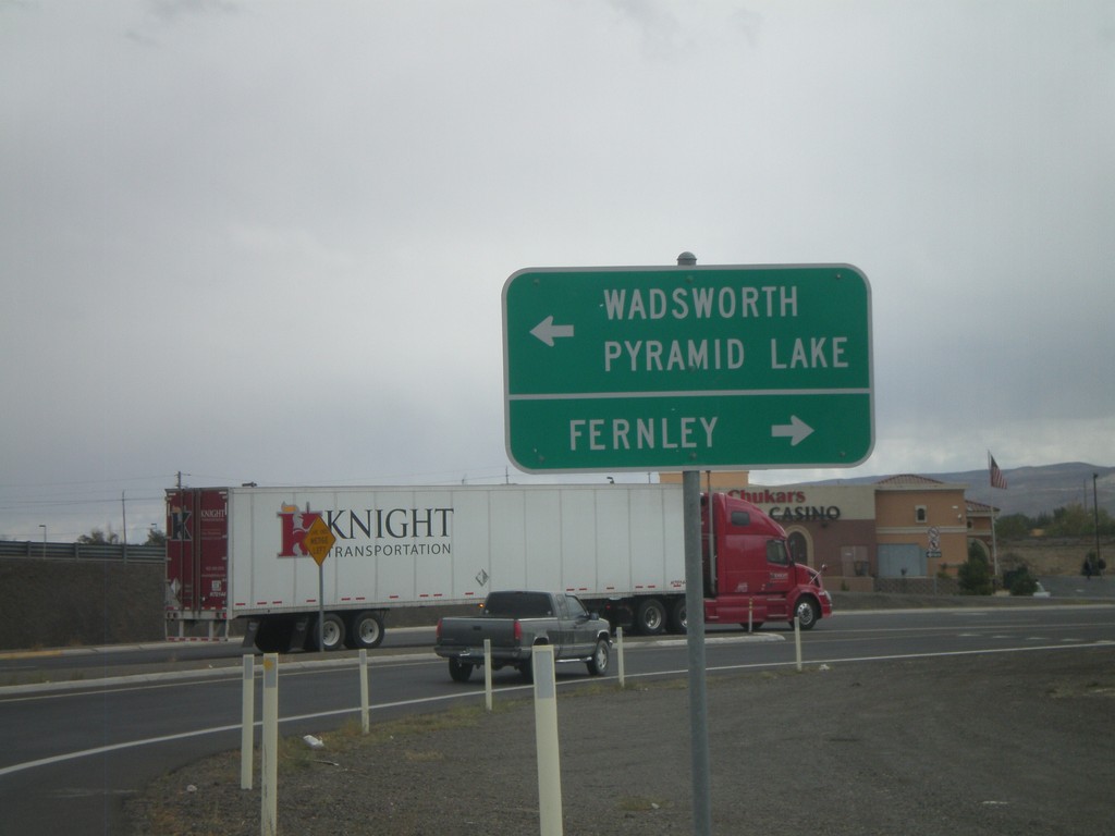
I-80 East Exit 46 Offramp at NV-427
I-80 east Exit 46 offramp at NV-427. Use NV-427 north for Wadsworth and Pyramid Lake. Use NV-427 south, also signed as BL-80 for Fernley.
Taken 10-04-2009
 Fernley
Lyon County
Nevada
United States
Fernley
Lyon County
Nevada
United States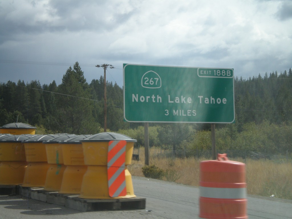
I-80 East Advanced for Exit 188B
Advanced signage for Exit 188B - CA-267/North Lake Tahoe. Approaching Exit 185 - CA-89 south, Lake Tahoe. Both CA-89 and CA-267 connect Truckee with the north shore of Lake Tahoe.
Taken 10-04-2009

 Truckee
Nevada County
California
United States
Truckee
Nevada County
California
United States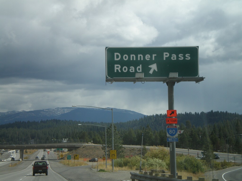
I-80 East - Exit 184
I-80 east at Exit 184 - Donner Pass Road
Taken 10-04-2009
Truckee
Nevada County
California
United States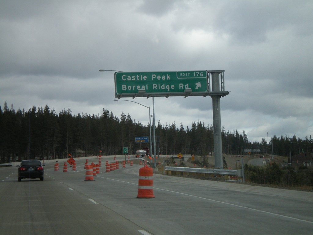
I-80 East - Exit 176
I-80 east at Exit 176 - Castle Peak/Boreal Ridge Road. Exit 176 provides access to Boreal Ski Area. This exit is at the top of Donner Summit, the highest point on I-80 in California.
Taken 10-04-2009
Soda Springs
Nevada County
California
United States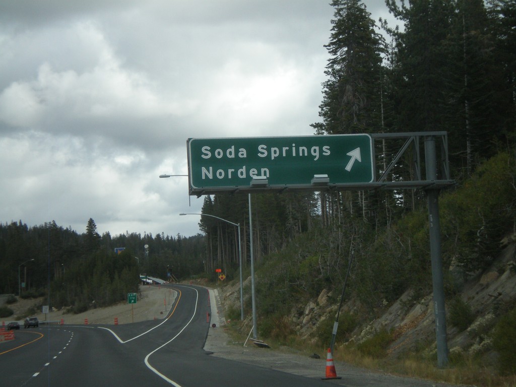
I-80 East - Exit 174
I-80 east at Exit 174 - Soda Springs/Norden
Taken 10-04-2009
Soda Springs
Nevada County
California
United States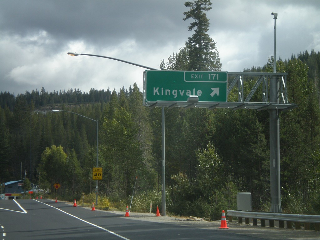
I-80 East - Exit 171
I-80 east at Exit 171 - Kingvale
Taken 10-04-2009
Troy
Placer County
California
United States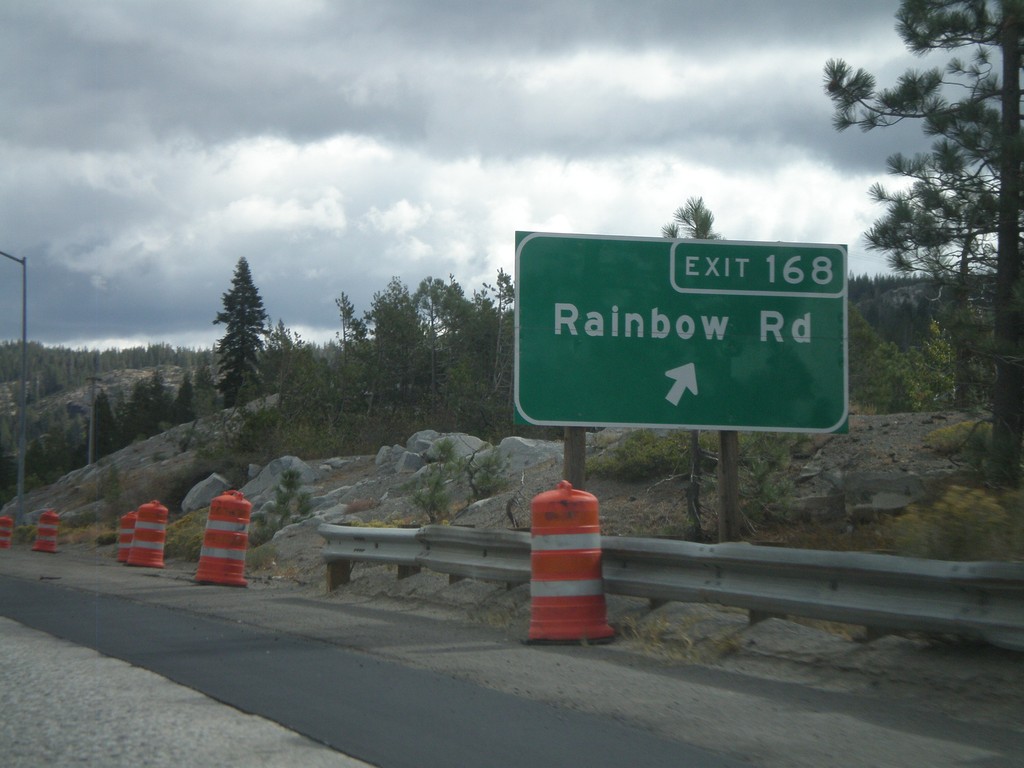
I-80 East - Exit 168
I-80 east at Exit 168 - Rainbow Road
Taken 10-04-2009
Emigrant Gap
Placer County
California
United States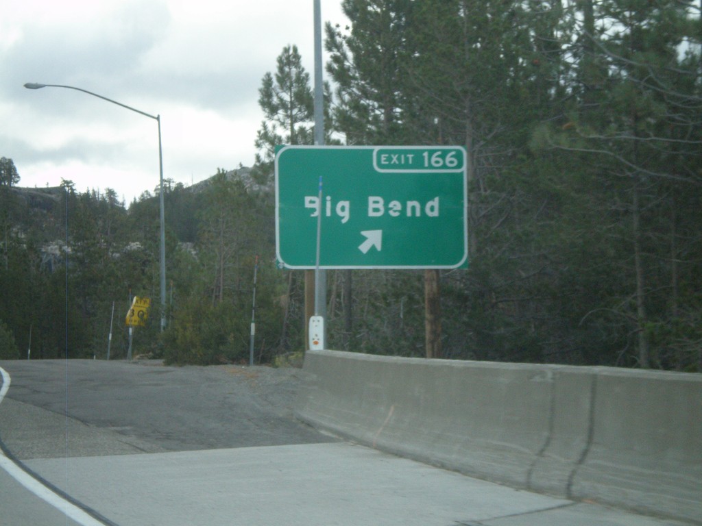
I-80 East - Exit 166
I-80 east at Exit 166 - Big Bend
Taken 10-04-2009
Big Bend
Placer County
California
United States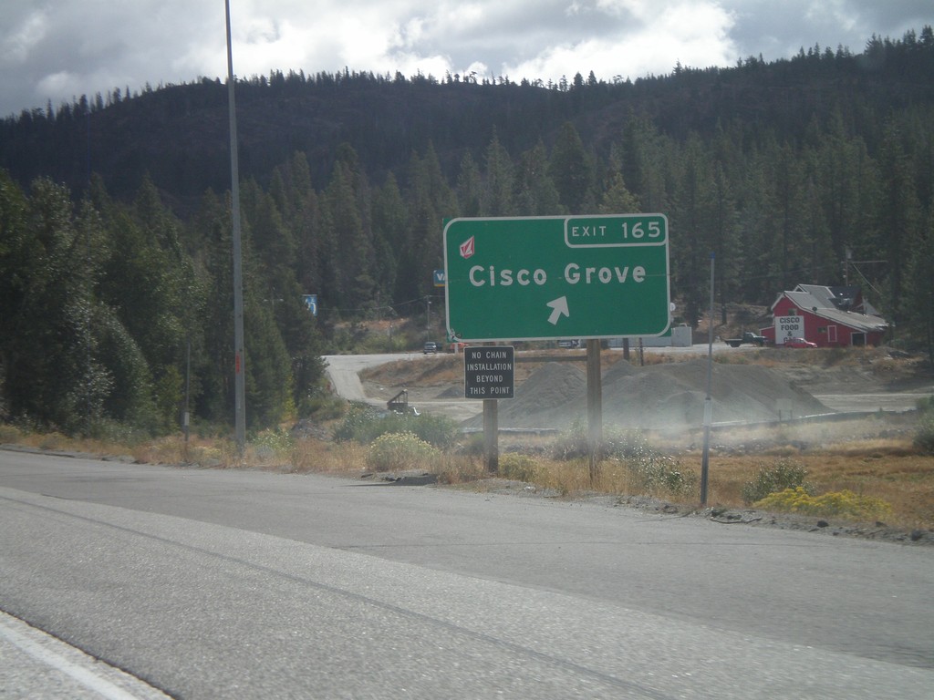
I-80 East at Exit 165
I-80 east at Exit 165 - Cisco Grove
Taken 10-04-2009
Emigrant Gap
Placer County
California
United States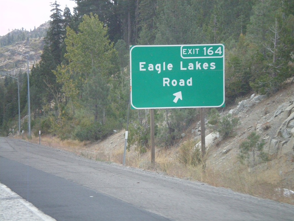
I-80 East - Exit 164
I-80 east at Exit 164 - Eagle Lakes Road
Taken 10-04-2009
Nevada City
Nevada County
California
United States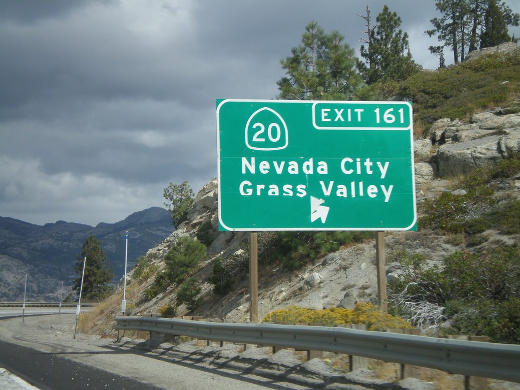
I-80 East - Exit 161
I-80 east at Exit 161 - CA-20/Nevada City/Grass Valley
Taken 10-04-2009
 Yuba Pass
Nevada County
California
United States
Yuba Pass
Nevada County
California
United States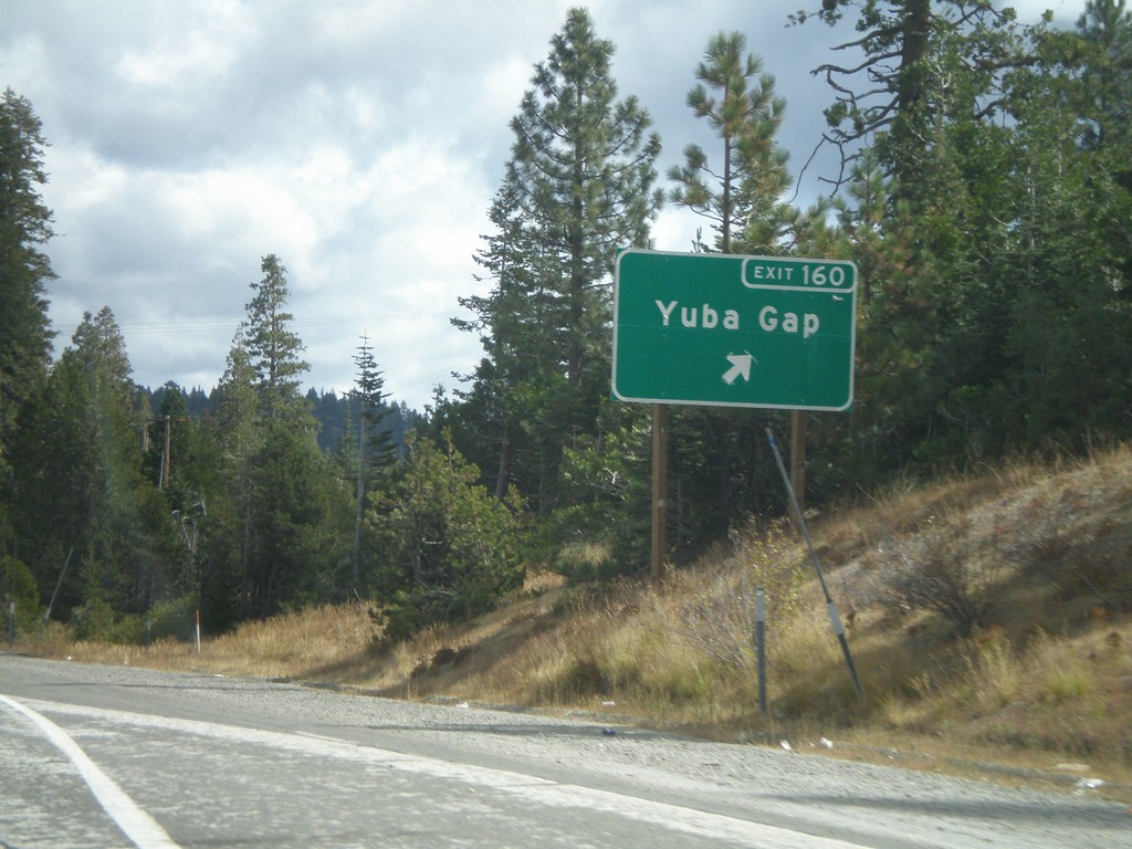
I-80 East - Exit 160
I-80 east at Exit 160 - Yuba Gap
Taken 10-04-2009
Yuba Pass
Nevada County
California
United States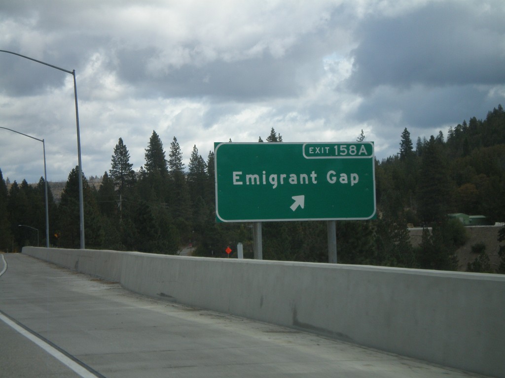
I-80 East - Exit 158A
I-80 east at Exit 158A - Emigrant Gap
Taken 10-04-2009
Nevada City
Placer County
California
United States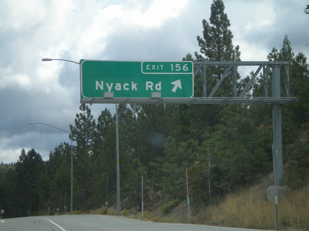
I-80 East - Exit 156
I-80 east at Exit 156 - Nyack Road
Taken 10-04-2009
Emigrant Gap
Placer County
California
United States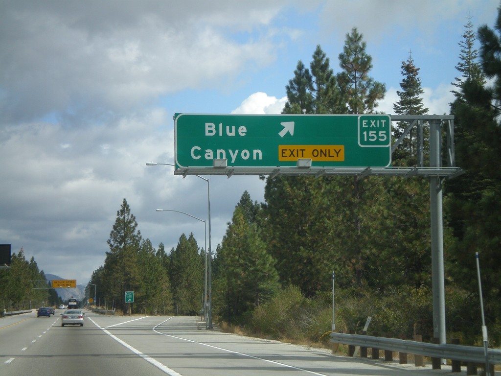
I-80 East - Exit 155
I-80 east at Exit 155 - Blue Canyon
Taken 10-04-2009
Blue Canyon
Placer County
California
United States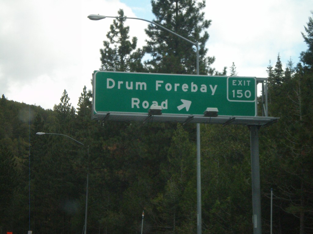
I-80 East - Exit 150
I-80 east at Exit 150 - Drum Forebay Road
Taken 10-04-2009
Alta
Placer County
California
United States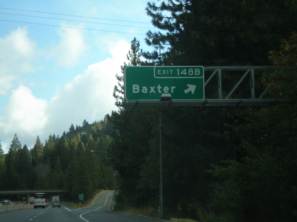
I-80 East - Exit 148B
I-80 east at Exit 148B - Baxter
Taken 10-04-2009
Alta
Placer County
California
United States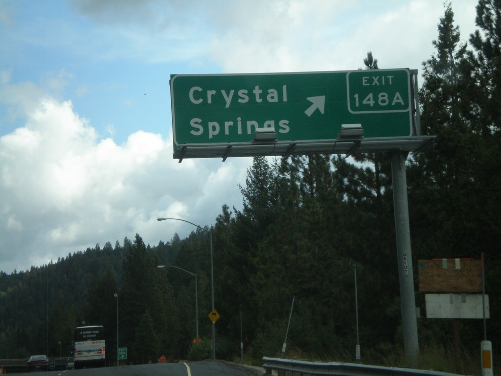
I-80 East Exit 148A
I-80 east at Exit 148A - Crystal Springs
Taken 10-04-2009
Alta
Placer County
California
United States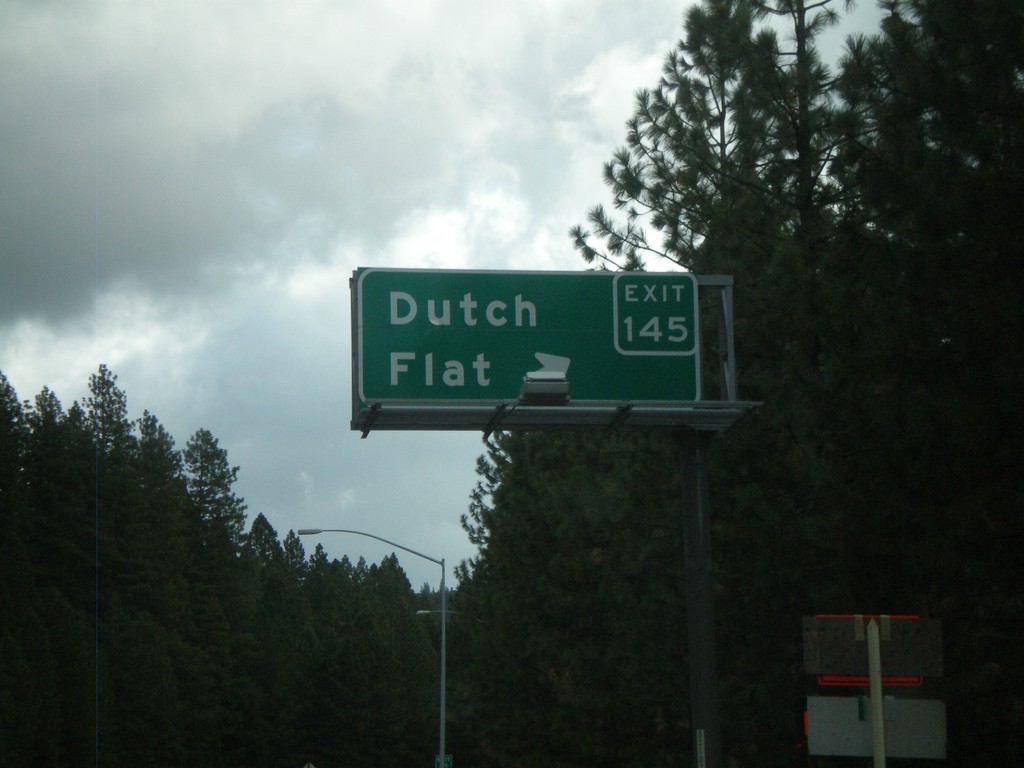
I-80 East - Exit 145
I-80 east at Exit 145 - Dutch Flat
Taken 10-04-2009
Dutch Flat
Placer County
California
United States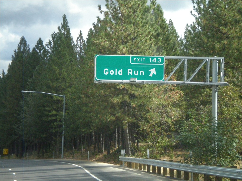
I-80 East - Exit 143
I-80 east at Exit 143 - Gold Run
Taken 10-04-2009
Gold Run
Placer County
California
United States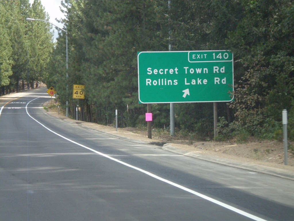
I-80 East - Exit 140
I-80 east at Exit 140 - Secret Town Road/Rollins Lake Road
Taken 10-04-2009
Colfax
Placer County
California
United States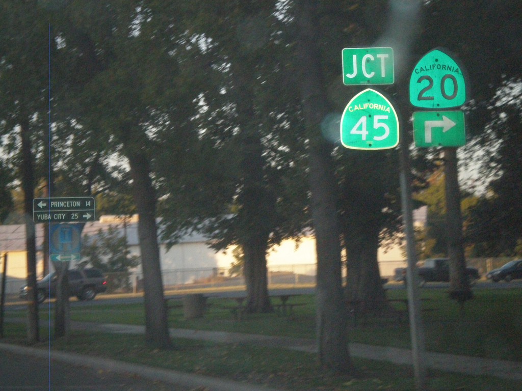
CA-20 East at CA-45
CA-20 east at CA-45 in Colusa. CA-45 south joins CA-20 through Colusa. Use CA-45 north for Princeton. Use CA-20/CA-45 south for Yuba City.
Taken 09-25-2009
 Colusa
 County
California
United States
Colusa
Colusa County
California
United States