Signs Tagged With Big Green Sign
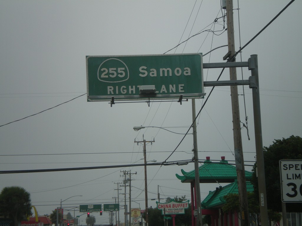
US-101 South Approaching CA-255
US-101 south (4th St.) approaching CA-255/Samoa in downtown Eureka.
Taken 09-25-2009

 Eureka
Humboldt County
California
United States
Eureka
Humboldt County
California
United States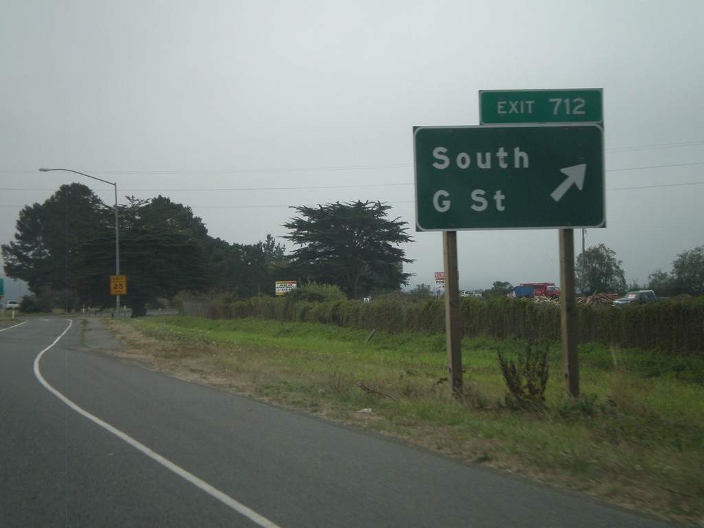
US-101 South - Exit 712
US-101 south Exit 712 - South G St.
Taken 09-25-2009
Arcata
Humboldt County
California
United States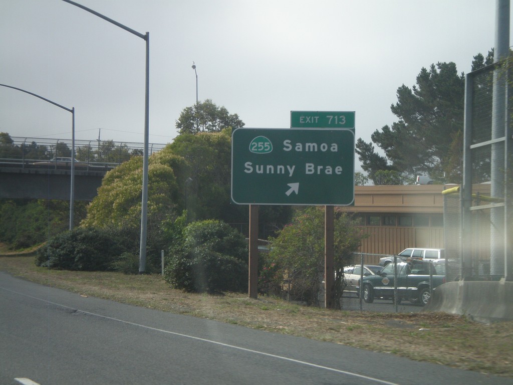
US-101 South - Exit 713
US-101 south Exit 713 - CA-255/Samoa/Sunny Brae
Taken 09-25-2009
Arcata
Humboldt County
California
United States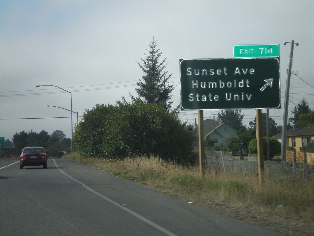
US-101 South - Exit 714
US-101 south Exit 714 - Sunset Ave./Humboldt State University
Taken 09-25-2009
Arcata
Humboldt County
California
United States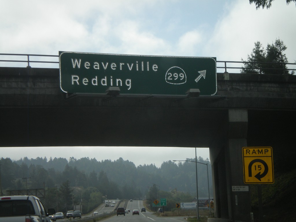
US-101 South - Exit 716A
US-101 south Exit 716A - CA-299/Weaverville/
Taken 09-25-2009
 Arcata
Humboldt County
California
United States
Arcata
Humboldt County
California
United States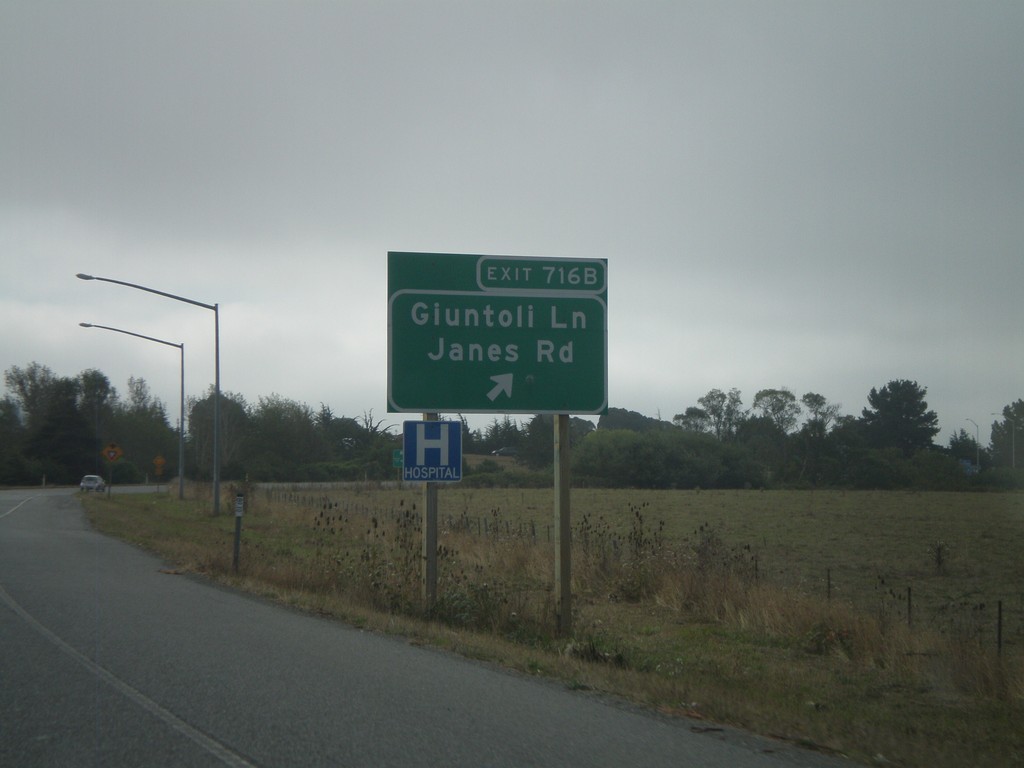
US-101 South - Exit 716B
US-101 south Exit 716B - Giuntoli Lane/Janes Road
Taken 09-25-2009
Arcata
Humboldt County
California
United States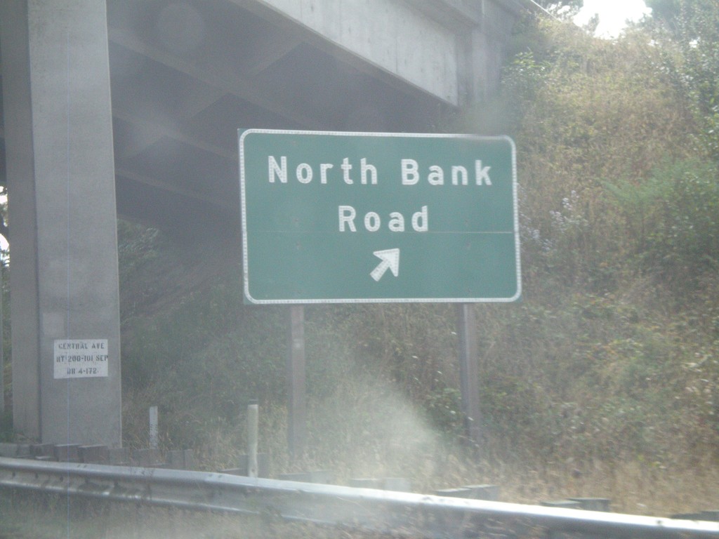
US-101 South - Exit 718
US-101 south Exit 718 - North Bank Road
Taken 09-25-2009
 McKinleyville
Humboldt County
California
United States
McKinleyville
Humboldt County
California
United States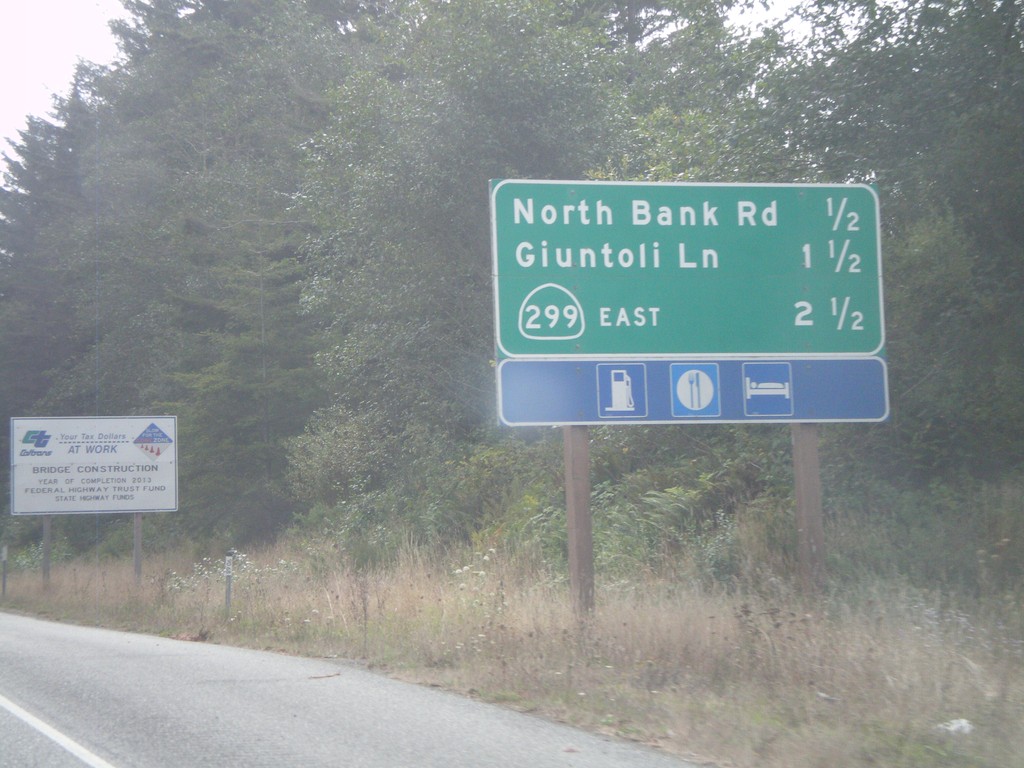
US-101 South - Arcata Exits
US-101 South - Arcata Exits. Next 3 exits: North Bank Road, Giuntoli Lane, CA-299 East.
Taken 09-25-2009
McKinleyville
Humboldt County
California
United States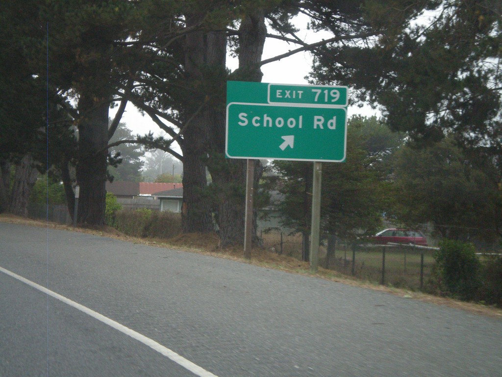
US-101 South - Exit 719
US-101 south Exit 719 - School Road
Taken 09-25-2009
McKinleyville
Humboldt County
California
United States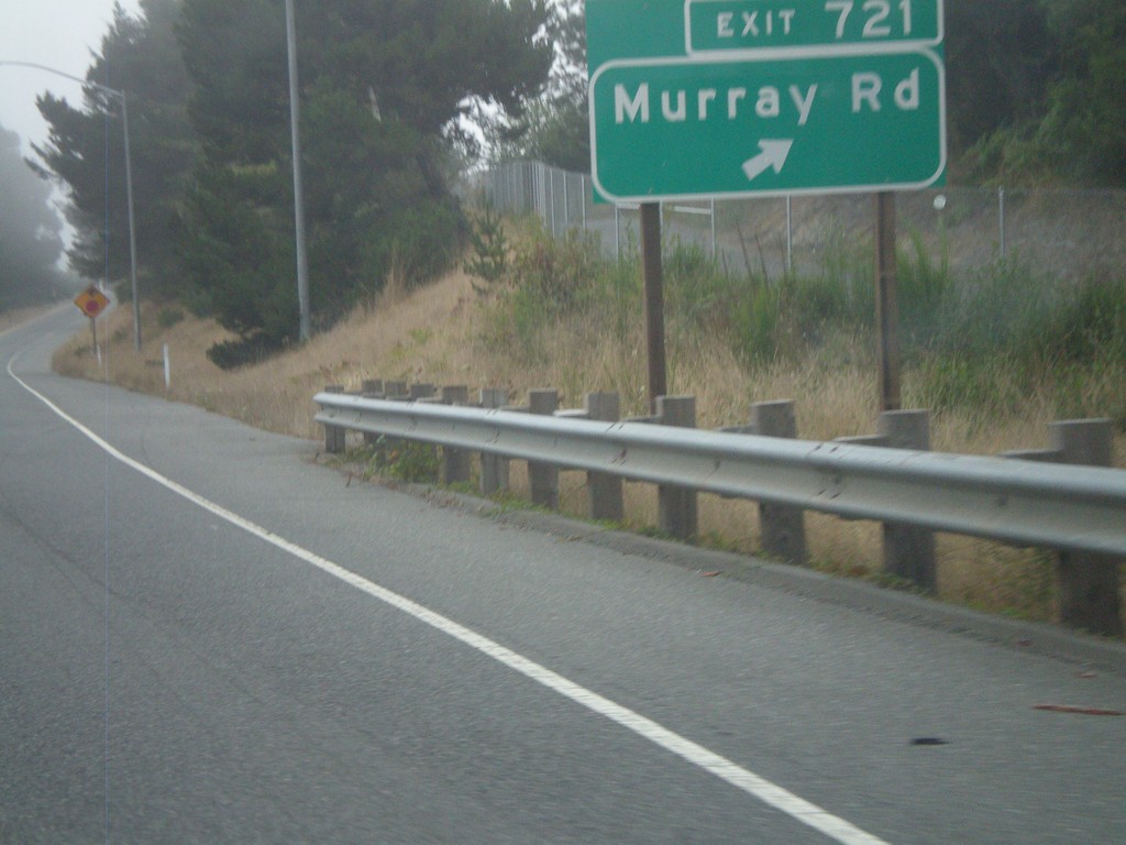
US-101 South - Exit 721
US-101 south Exit 721 - Murray Road
Taken 09-25-2009
McKinleyville
Humboldt County
California
United States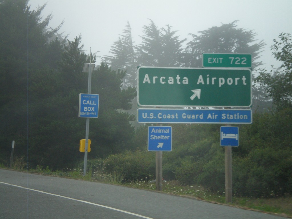
US-101 South - Exit 722
US-101 south Exit 722 - Arcata Airport
Taken 09-25-2009
McKinleyville
Humboldt County
California
United States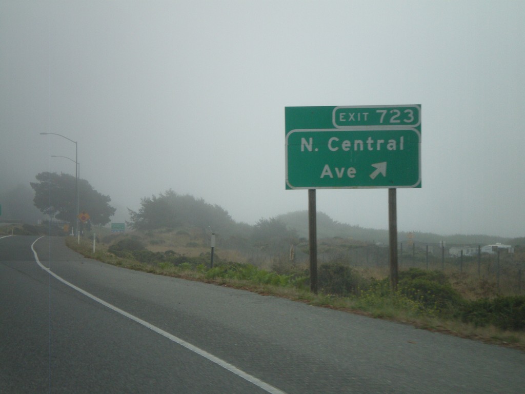
US-101 South - Exit 723
US-101 south Exit 723 - N. Central Ave.
Taken 09-25-2009
McKinleyville
Humboldt County
California
United States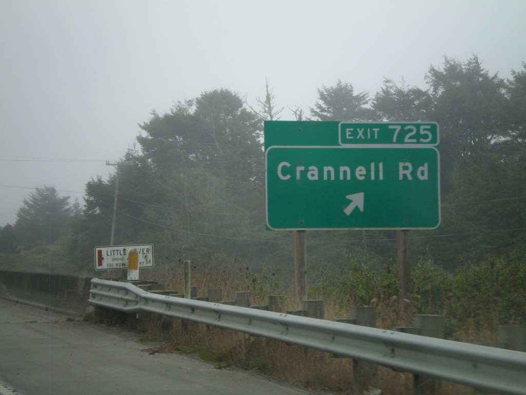
US-101 South - Exit 725
US-101 south Exit 725 - Crannell Road
Taken 09-25-2009
McKinleyville
Humboldt County
California
United States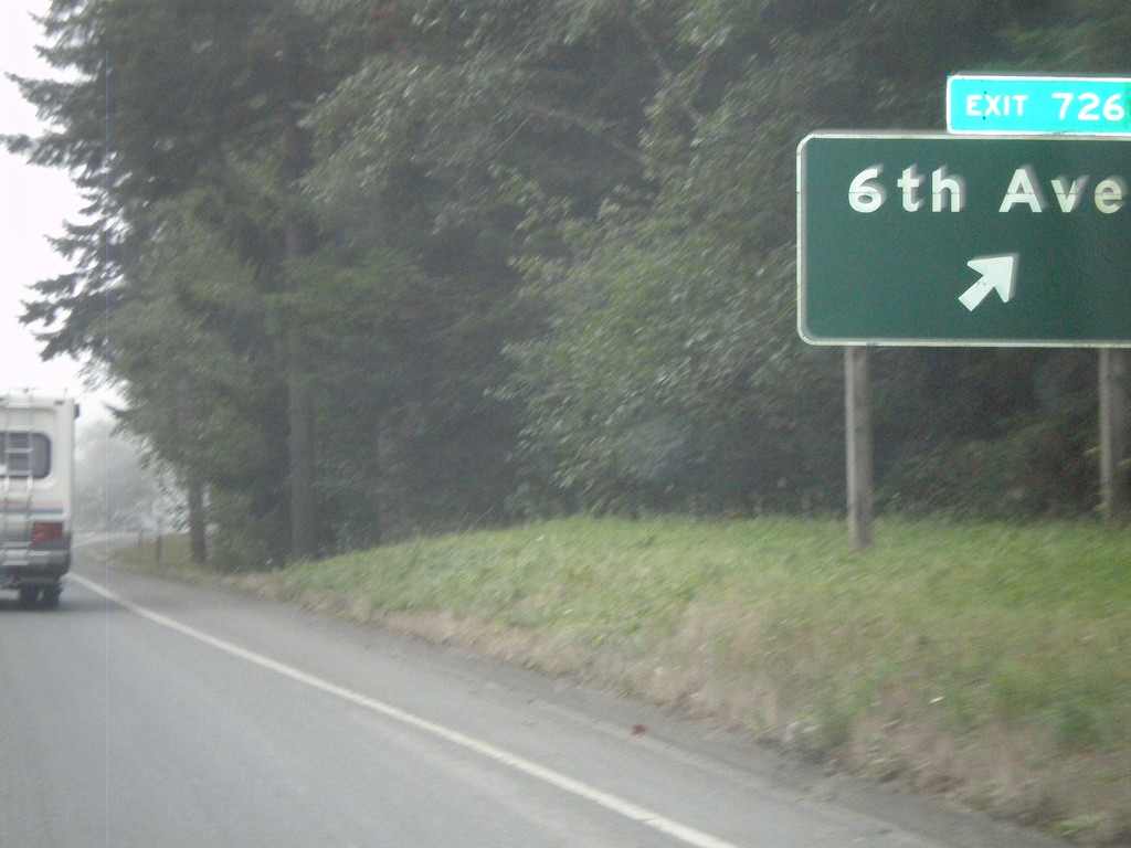
US-101 South - Exit 726
US-101 south Exit 726 - 6th Ave.
Taken 09-25-2009
Trinidad
Humboldt County
California
United States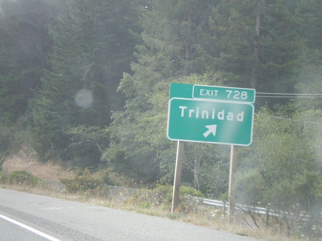
US-101 South - Exit 728
US-101 south Exit 728 - Trinidad
Taken 09-25-2009
Trinidad
Humboldt County
California
United States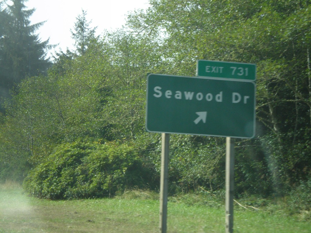
US-101 South - Exit 731
US-101 south Exit 731 -Seawood Drive
Taken 09-25-2009
Patricks Point
Humboldt County
California
United States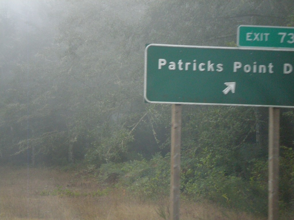
US-101 South - Exit 734
US-101 south Exit 734 -Patricks Point Drive
Taken 09-25-2009
Patricks Point
Humboldt County
California
United States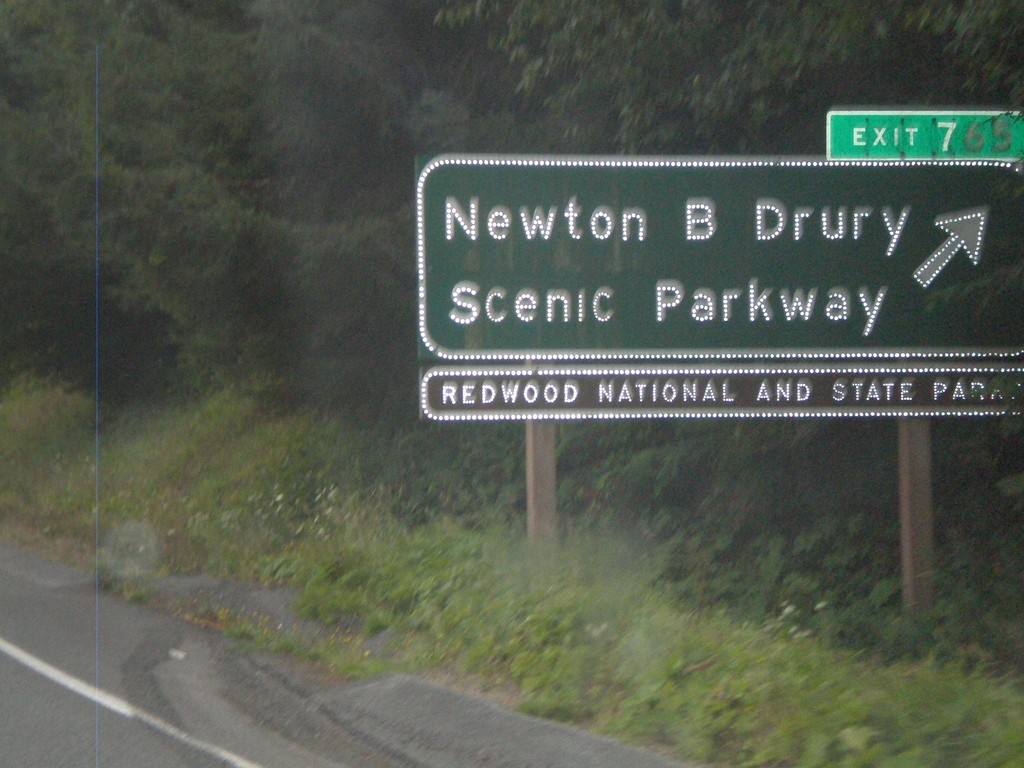
US-101 South - Exit 765
US-101 south Exit 765 - Newton B Drury Scenic Parkway
Taken 09-23-2009
Klamath
Del Norte County
California
United States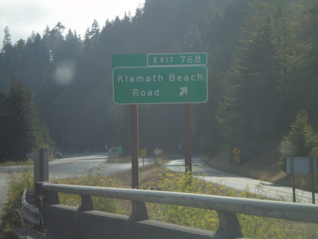
US-101 South - Exit 768
US-101 south Exit 768 - Klamath Beach Road
Taken 09-23-2009
Klamath
Del Norte County
California
United States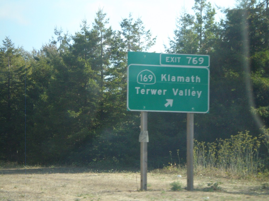
US-101 South - Exit 769
US-101 south Exit 769 - CA-169/Klamath/Terwer Valley
Taken 09-23-2009
 Klamath
Del Norte County
California
United States
Klamath
Del Norte County
California
United States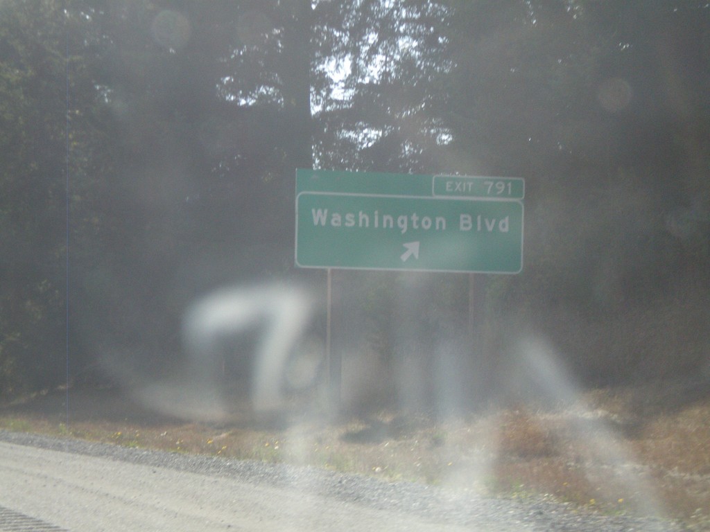
US-101 South - Exit 791
US-101 south Exit 791 - Washington Blvd.
Taken 09-23-2009
Crescent City
Del Norte County
California
United States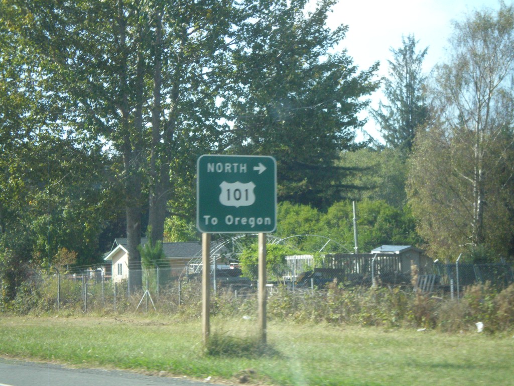
US-199 West at US-101 North
US-199 west at Elk Valley Cross Road, which provides access to US-101 north to Oregon. This is the western terminus of US-199.
Taken 09-23-2009
 Crescent City
Del Norte County
California
United States
Crescent City
Del Norte County
California
United States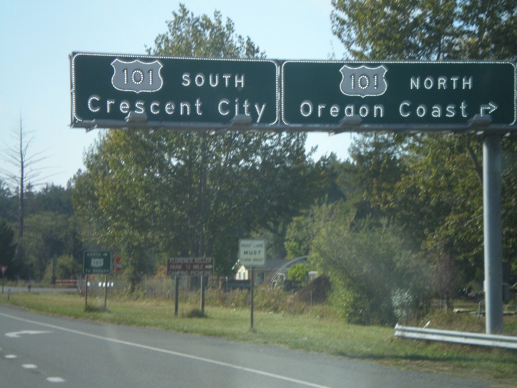
US-199 West Approaching US-101
US-199 west approaching US-101. Use US-101 north for the Oregon Coast. Use US-101 south for Crescent City. There is no direct connection to US-101 north from US-199 west. Traffic follows the Elk Valley Cross Road to reach US-101. This is the western terminus of US-199.
Taken 09-23-2009
Crescent City
Del Norte County
California
United States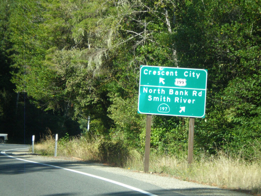
US-199 South At CA-197
US-199 west at CA-197/North Bank Road/Smith River. US-199 continues west towards Crescent City.
Taken 09-23-2009
 Crescent City
Del Norte County
California
United States
Crescent City
Del Norte County
California
United States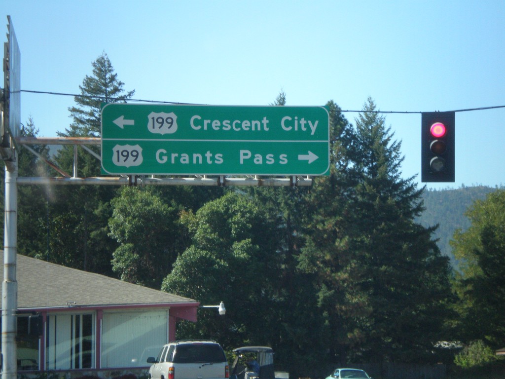
End OR-46 West at US-199
End OR-46 west at US-199. Use US-199 east for Grants Pass. Use US-199 west for Crescent City.
Taken 09-23-2009
 Cave Junction
Josephine County
Oregon
United States
Cave Junction
Josephine County
Oregon
United States