Signs Tagged With Big Green Sign
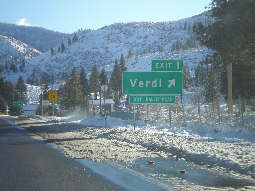
I-80 West - Exit 1
I-80 west at Exit 1 - Verdi. This is the last Nevada exit on I-80. Exit 1 is actually between Mile 2 and 3.
Taken 12-26-2008
 Verdi
Washoe County
Nevada
United States
Verdi
Washoe County
Nevada
United States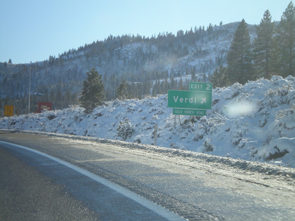
I-80 West - Exit 2
I-80 east at Exit 2 - Verdi. Access to Gold Ranch Road.
Taken 12-26-2008
Verdi
Washoe County
Nevada
United States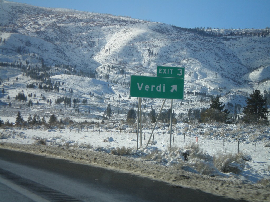
I-80 West - Exit 3
I-80 west at Exit 3 - Verdi
Taken 12-26-2008
Reno
Washoe County
Nevada
United States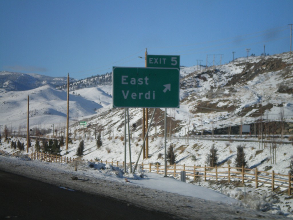
I-80 West - Exit 5
I-80 west at Exit 5 - East Verdi
Taken 12-26-2008
Reno
Washoe County
Nevada
United States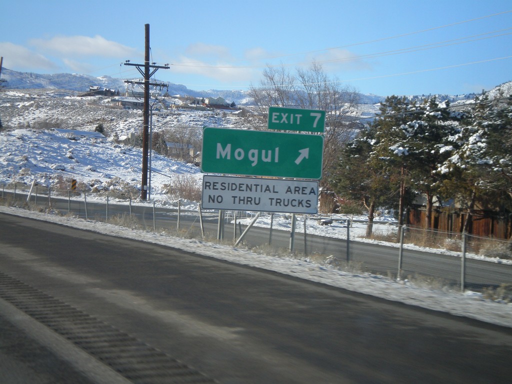
I-80 West - Exit 7
I-80 west at Exit 7 - Mogul
Taken 12-26-2008
Reno
Washoe County
Nevada
United States
ID-27 North at I-84 West Onramp
ID-27 north to Paul at I-84 west to Twin Falls and Boise.
Taken 10-26-2008

 Heyburn
Minidoka County
Idaho
United States
Heyburn
Minidoka County
Idaho
United States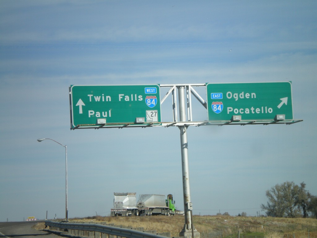
ID-27 North at I-84 Onramp
BL-84 West/ID-27 North at I-84 (Exit 208). Merge right for I-84 East/Ogden (Utah)/Pocatello. Continue over bridge for I-84 West/Twin Falls and ID-27 North to Paul.
Taken 10-26-2008
 Heyburn
Minidoka County
Idaho
United States
Heyburn
Minidoka County
Idaho
United States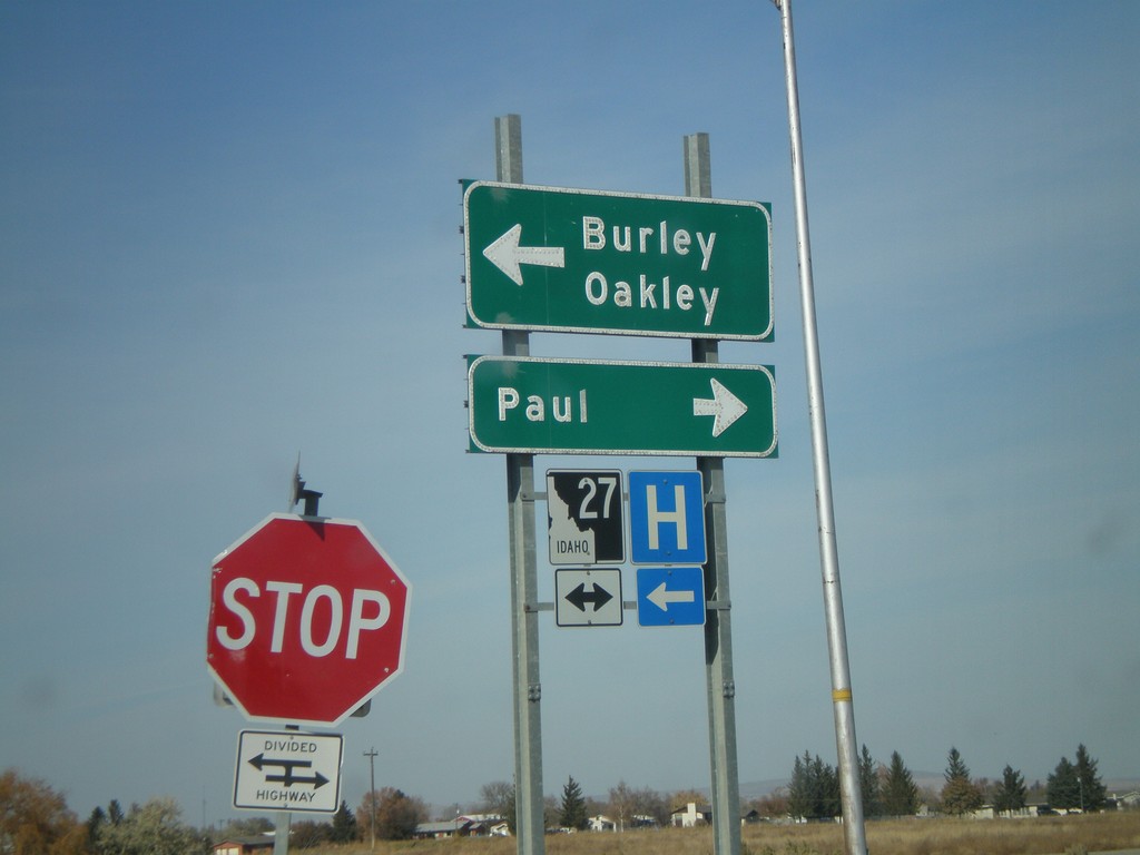
I-84 West Offramp at ID-27
I-84 west Exit 208 offramp at ID-27. Turn right for ID-27 north to Paul; left for BL-84 East/ID-27 south to Burley and Oakley.
Taken 10-26-2008
Heyburn
Minidoka County
Idaho
United States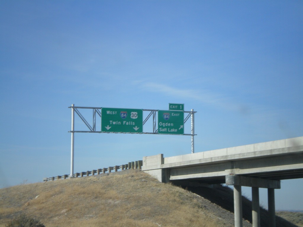
I-86 West - Exit 1
End I-86 west at Exit 1 - I-84 East/Ogden/Salt Lake. Continue ahead for I-84/US-30 West/Twin Falls. Taken from underpass on I-84 east.
Taken 10-26-2008

 Cotterel
Cassia County
Idaho
United States
Cotterel
Cassia County
Idaho
United States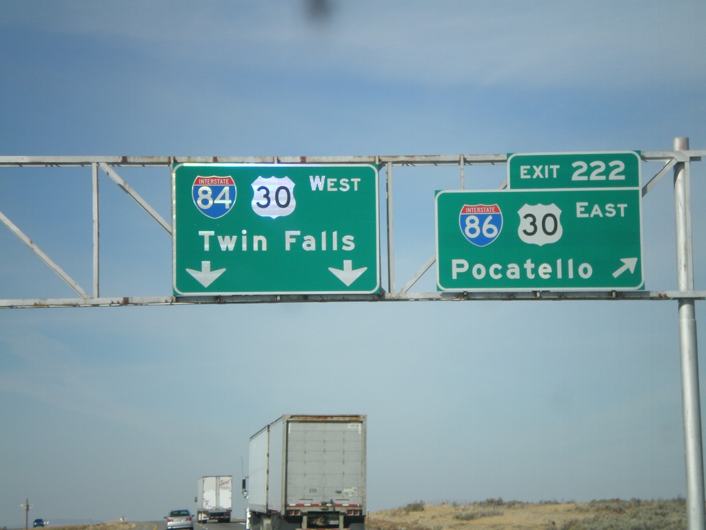
I-84 West - Exit 222
I-84 west at Exit 222 - I-86/US-30 East/Pocatello. Continue west on I-84/US-30 for Twin Falls.
Taken 10-26-2008
Cotterel
Cassia County
Idaho
United States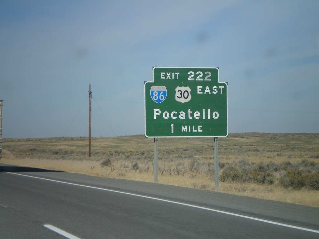
I-84 West Approaching Exit 222
I-84 west approaching Exit 222 - I-86/US-30 East/Pocatello.
Taken 10-26-2008
Declo
Cassia County
Idaho
United States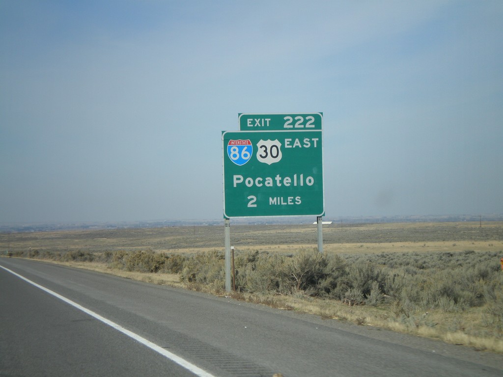
I-84 West Approaching Exit 222
I-84 west approaching Exit 222 - I-86/US-30 East/Pocatello.
Taken 10-26-2008
Declo
Cassia County
Idaho
United States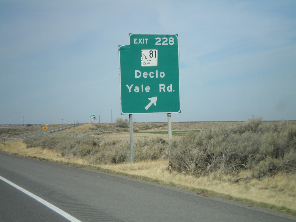
I-84 West - Exit 228
I-84 west at Exit 228 - ID-81/Declo/Yale Road.
Taken 10-26-2008
 Cotterel
Cassia County
Idaho
United States
Cotterel
Cassia County
Idaho
United States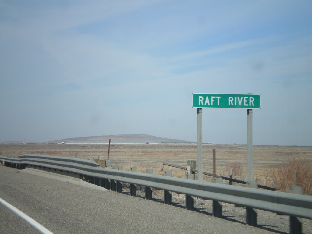
I-84 West - Raft River
I-84 West - Raft River bridge in Cassia County.
Taken 10-26-2008
Declo
Cassia County
Idaho
United States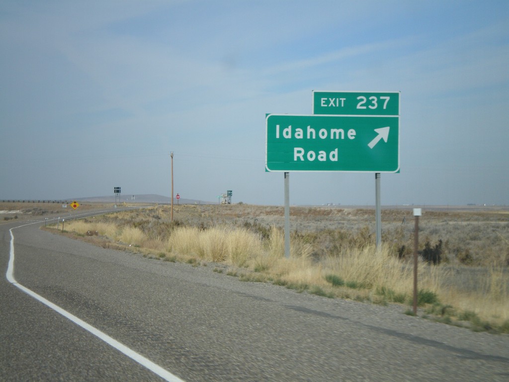
I-84 West - Exit 237
I-84 west at Exit 237 - Idahome Road.
Taken 10-26-2008
Declo
Cassia County
Idaho
United States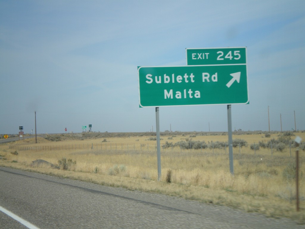
I-84 West - Exit 245
I-84 west at Exit 245 - Sublett Road/Malta.
Taken 10-26-2008
Sublett
Cassia County
Idaho
United States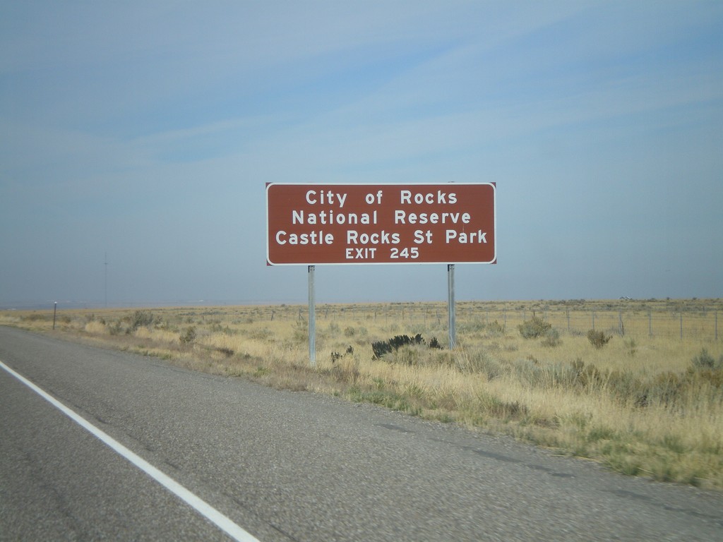
I-84 West - City of Rocks
I-84 west approaching Exit 245. Use Exit 245 for Castle Rock State Park and City of Rocks National Preserve.
Taken 10-26-2008
Malta
Cassia County
Idaho
United States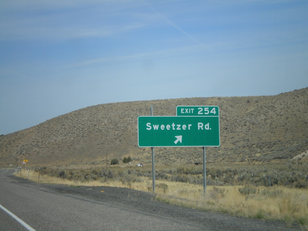
I-84 West - Exit 254
I-84 west at Exit 254 - Sweetzer Road.
Taken 10-26-2008
Sublett
Cassia County
Idaho
United States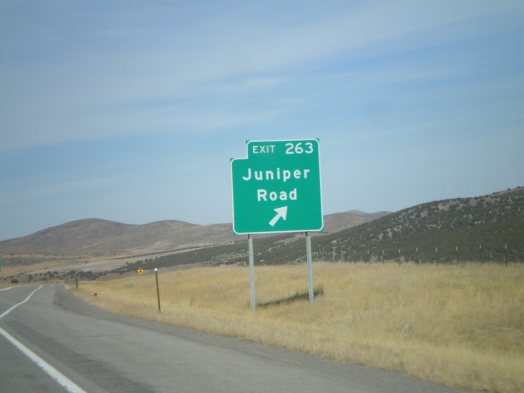
I-84 West - Exit 263
I-84 west at Exit 263 - Juniper Road.
Taken 10-26-2008
Juniper
Oneida County
Idaho
United States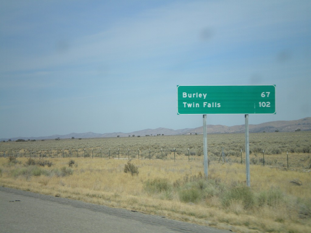
I-84 West - First Distance Marker In Idaho
Distance marker on I-84 west. Distance to Burley and Twin Falls. This is the first distance marker along I-84 west in Idaho.
Taken 10-26-2008
Malad City
Oneida County
Idaho
United States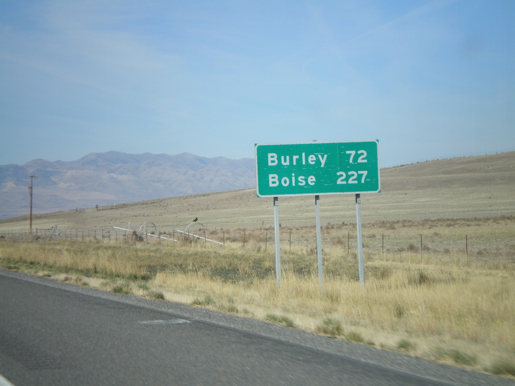
I-84 West - Last Distance Marker In Utah
Distance marker on I-84 west to Burley and Boise. Both cities are in Idaho. This is the last distance marker on I-84 in Utah.
Taken 10-26-2008
Snowville
Box Elder County
Utah
United States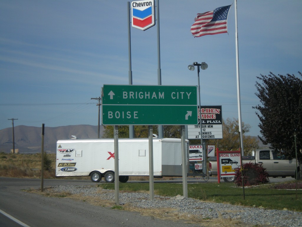
UT-102 West at I-84 Onramps
UT-102 west approaching I-84 (Exit 40). Use I-84 west for Boise. Use I-84 east for Brigham City.
Taken 10-26-2008
 Tremonton
Box Elder County
Utah
United States
Tremonton
Box Elder County
Utah
United States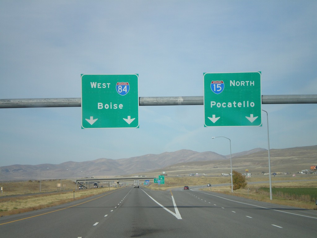
I-15 North - Exit 379
I-15 North/I-84 West Split (Exit 379) in Tremonton. Use I-15 north for Pocatello (Idaho); I-84 west for Boise (Idaho).
Taken 10-26-2008
 Tremonton
Box Elder County
Utah
United States
Tremonton
Box Elder County
Utah
United States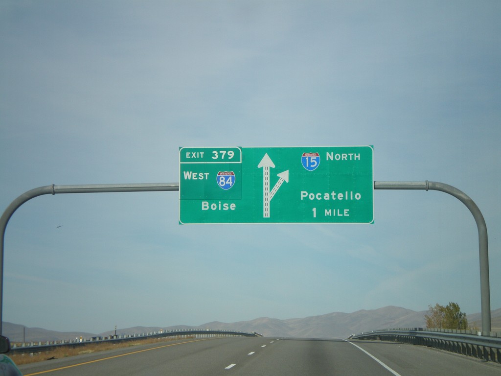
I-15 North - Exit 379
I-15 North/I-84 West approaching Exit 379 - I-84 West/Boise (Idaho). Continue north on I-15 for Pocatello (Idaho).
Taken 10-26-2008
Tremonton
Box Elder County
Utah
United States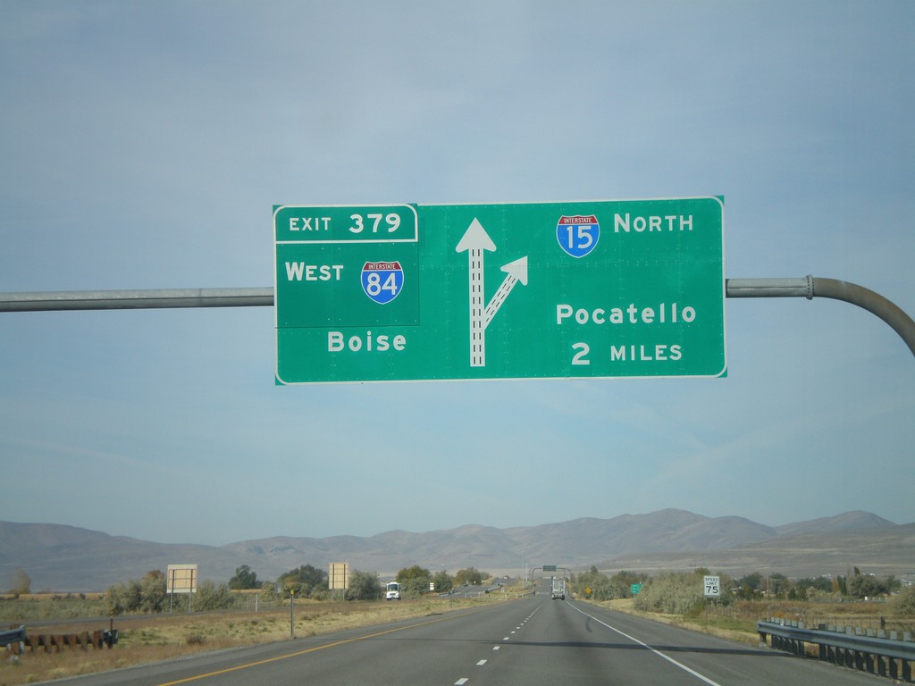
I-15 North - Exit 379
I-15 North/I-84 West approaching Exit 379 - I-84 West/Boise (Idaho). Continue north on I-15 for Pocatello (Idaho).
Taken 10-26-2008
Elwood
Box Elder County
Utah
United States