Signs Tagged With Big Green Sign
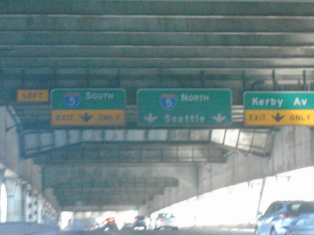
I-405 North Approaching I-5 and Kirby Ave.
I-405 North approaching I-5 and Kirby Ave. Taken on the lower deck of the Fremont Bridge.
Taken 09-28-2024


 Portland
Multnomah County
Oregon
United States
Portland
Multnomah County
Oregon
United States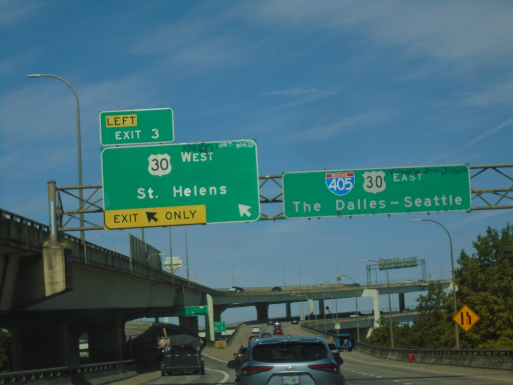
I-405 North Exit 3
I-405 north at Exit 3 - US-30 West/St. Helens. I-405 North/US-30 East continue to The Dalles-Seattle.
Taken 09-28-2024
Portland
Multnomah County
Oregon
United States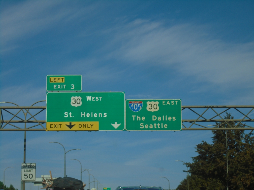
I-405 North - Exit 3
I-405 north approaching Exit 3 - US-30 West/St. Helens. Continue on I-405 North/US-30 West for Seattle (via I-5) and The Dalles (via US-30 and I-84).
Taken 09-28-2024
Portland
Multnomah County
Oregon
United States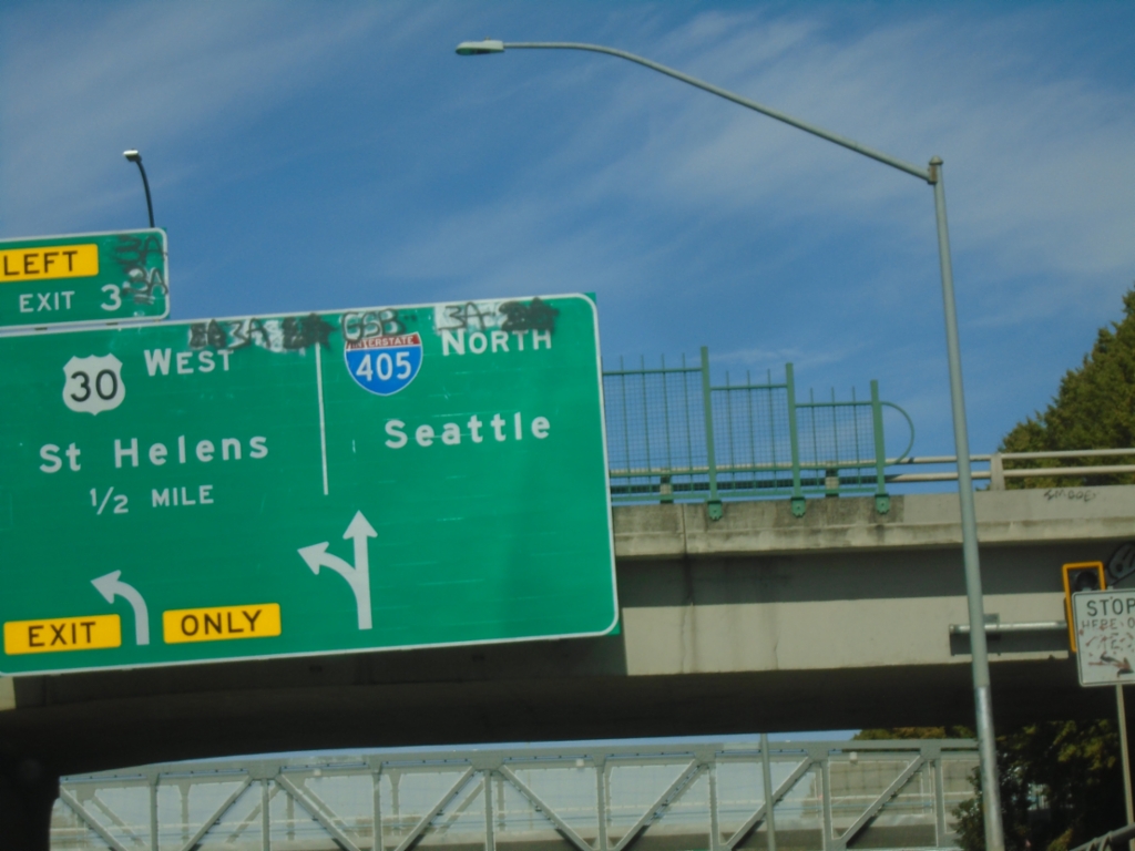
I-405 North - Exit 3
I-405 north approaching Exit 3 - US-30 West/St. Helens. Continue north on I-405 to Seattle.
Taken 09-28-2024
Portland
Multnomah County
Oregon
United States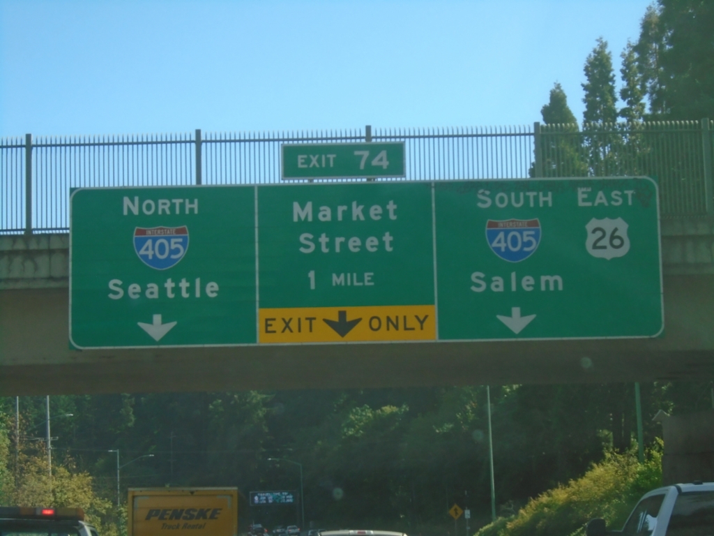
US-26 East- Exit 74
US-26 east approaching Exit 74 - I-405 North/Seattle, Market St., I-405 South/US-26 East/Salem.
Taken 09-28-2024
 Portland
Multnomah County
Oregon
United States
Portland
Multnomah County
Oregon
United States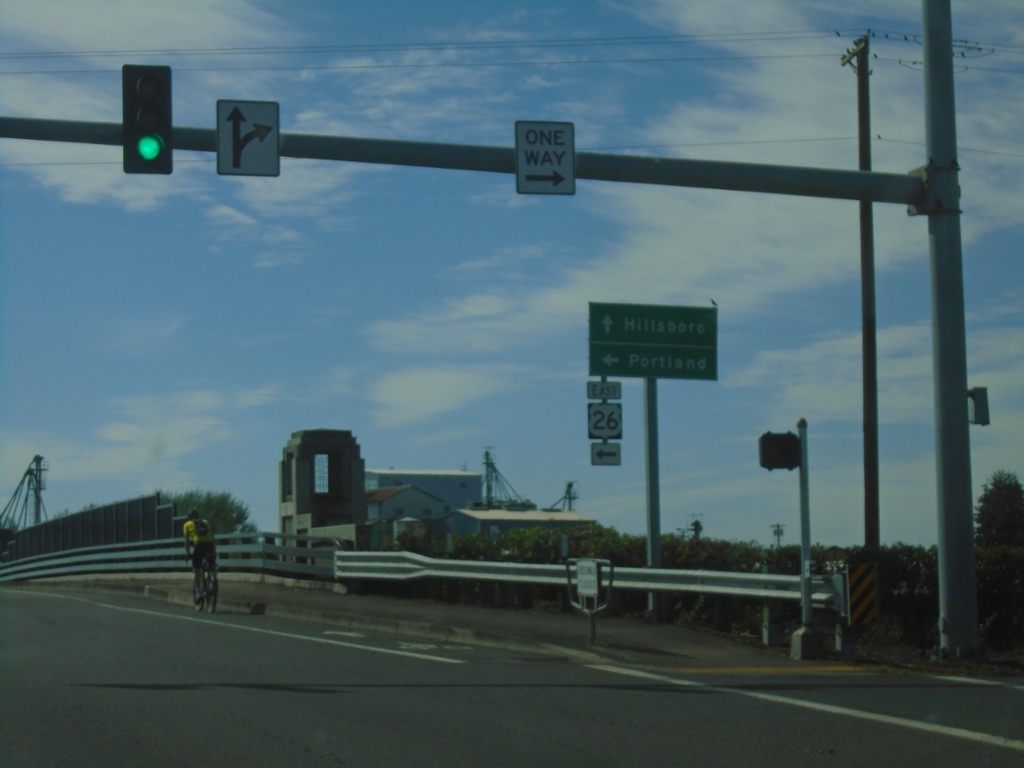
Glencoe Road South at US-26 East
Glencoe Road South at US-26 East to Portland. Continue south on Glencoe Road to Hillsboro.
Taken 09-28-2024
North Plains
Washington County
Oregon
United States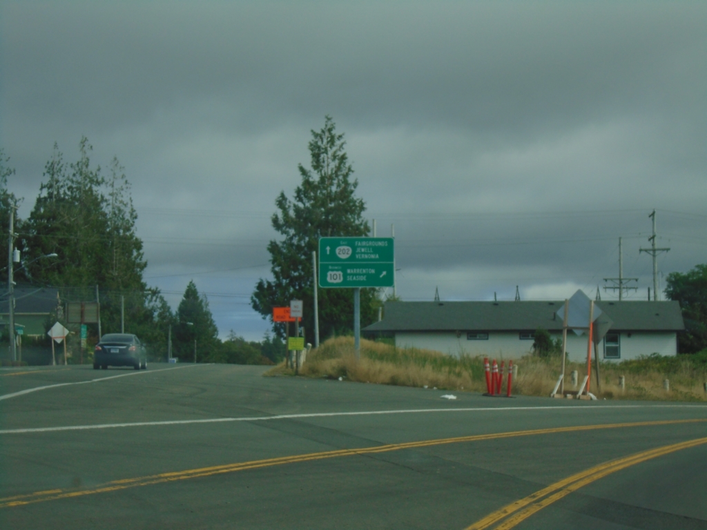
Bus. US-101 South/OR-202 East at Bus. US-101/OR-202 Split
Bus. US-101 South/OR-202 East (Marine Drive) at Bus. US-101/OR-202 split. Use Bus. US-101 South to Warrenton and Seaside; use OR-202 East to Fairgrounds, Jewell, and Vernonia.
Taken 09-23-2024

 Astoria
Clatsop County
Oregon
United States
Astoria
Clatsop County
Oregon
United States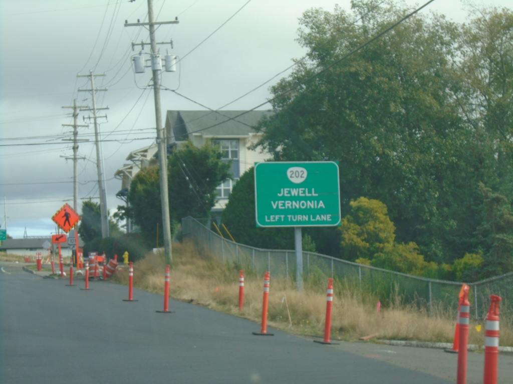
Bus. US-101 South/OR-202 East Approaching Split
Bus. US-101 South/OR-202 East (Marine Drive) approaching OR-202/Bus. US-101 Split. Use left lanes to continue east on OR-202 to Vernonia and Jewell.
Taken 09-23-2024
Astoria
Clatsop County
Oregon
United States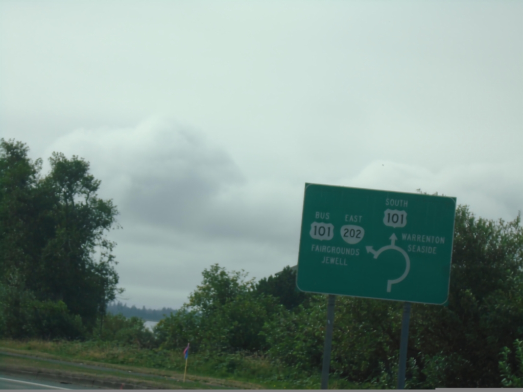
US-101 South at OR-202/Bus. US-101 Roundabout
US-101 South at OR-202/Bus. US-101 roundabout. Use OR-202/Bus. US-101 to Fairground and Jewell. Continue south on US-101 to Warrenton and Seaside.
Taken 09-23-2024
 Astoria
Clatsop County
Oregon
United States
Astoria
Clatsop County
Oregon
United States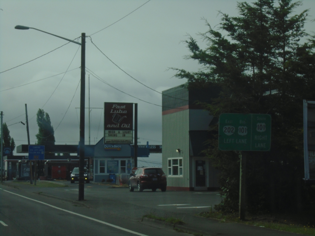
US-101 South at OR-202
US-101 south approaching OR-202/US-101 Business.
Taken 09-23-2024
Astoria
Clatsop County
Oregon
United States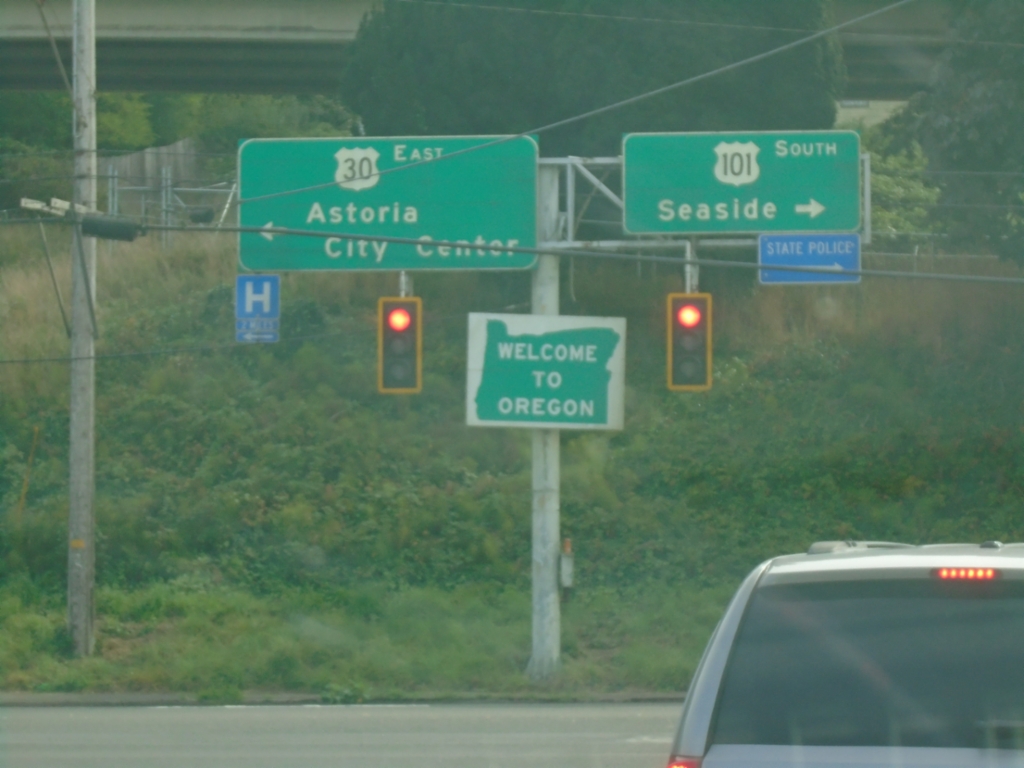
US-101 South at Western Terminus of US-30
US-101 south at US-30. Turn left for US-30 west to Astoria City Center; turn right to continue south on US-101 to Seaside. This is the beginning of US-30 eastbound. Welcome To Oregon.
Taken 09-23-2024
Astoria
Clatsop County
Oregon
United States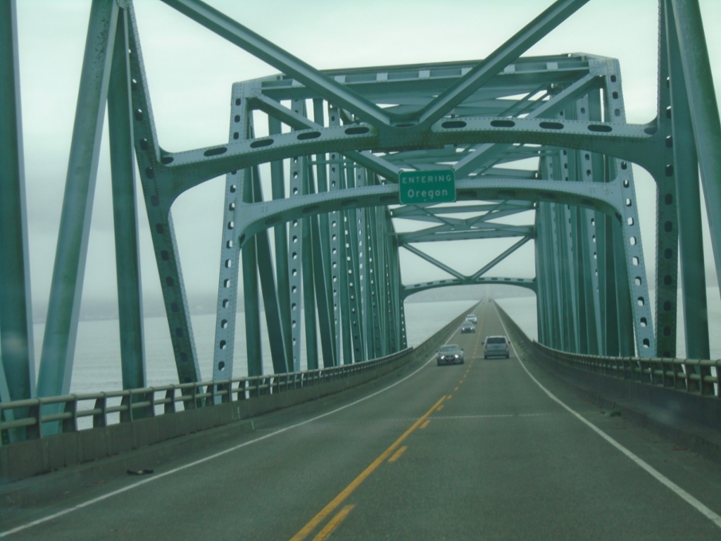
US-101 South - Entering Oregon
Entering Oregon on US-101 south, crossing the Columbia River.
Taken 09-23-2024
Astoria
Clatsop County
Oregon
United States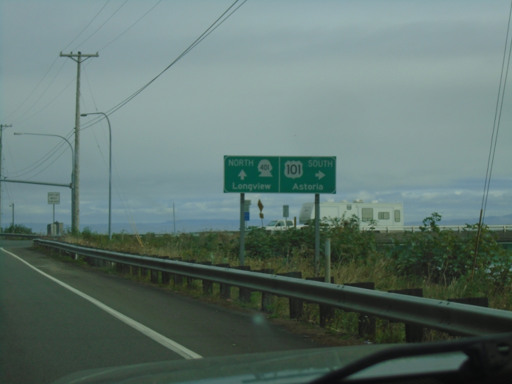
US-101 South at WA-401 to Longview
US-101 south at WA-401 north to Longview. Continue south on US-101 to Astoria (Oregon)
Taken 09-23-2024
 Naselle
Pacific County
Washington
United States
Naselle
Pacific County
Washington
United States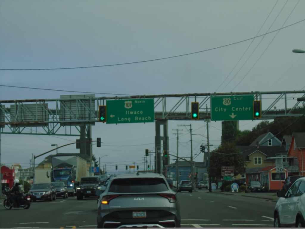
US-101 North at US-30
Begin US-30 to (Astoria) City Center at US-101 north to Ilwaco (WA) and Long Beach (WA). The overpass in background is the US-101 North approach to the Columbia River Bridge.
Taken 09-23-2024
Astoria
Clatsop County
Oregon
United States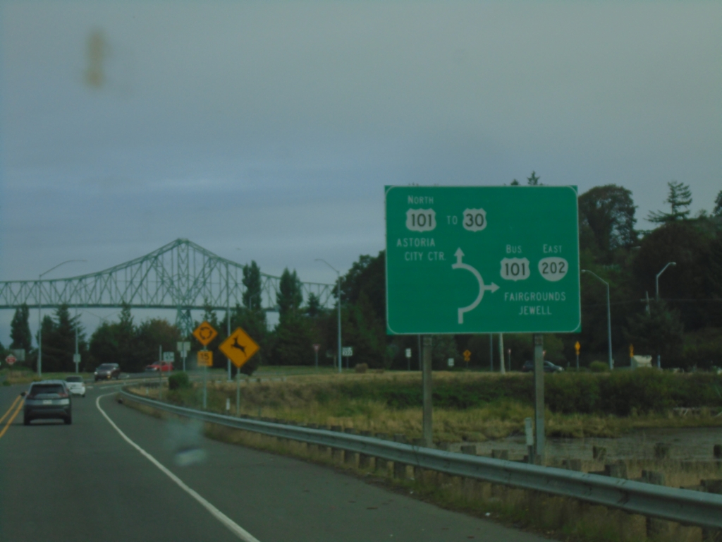
US-101 North at OR-202 South - Roundabout
US-101 north at OR-202 East/Bus. US-101 South to Jewell and Fairgrounds. Continue north on US-101 to US-30 and Astoria City Center. The bridge over the Columbia River is in the background.
Taken 09-23-2024
Astoria
Clatsop County
Oregon
United States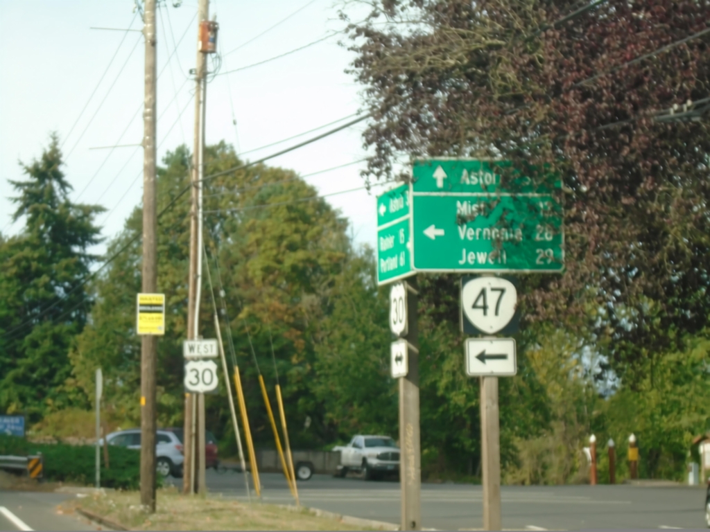
US-30 West at OR-47
US-30 West at OR-47 in Clatskanie. Use OR-47 south to Mist, Vernonia, and Jewell. Continue west on US-30 to Astoria.
Taken 09-22-2024
 Clatskanie
Columbia County
Oregon
United States
Clatskanie
Columbia County
Oregon
United States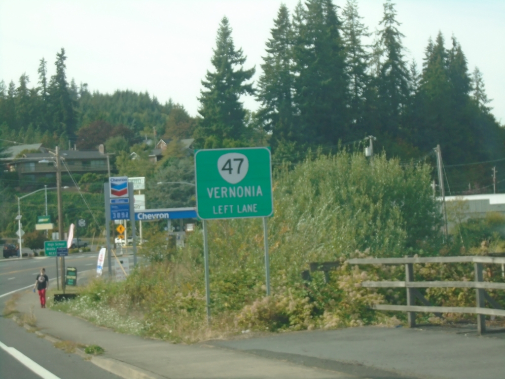
US-30 West Approaching OR-47
US-30 West approaching OR-47 south to Vernonia.
Taken 09-22-2024
Clatskanie
Columbia County
Oregon
United States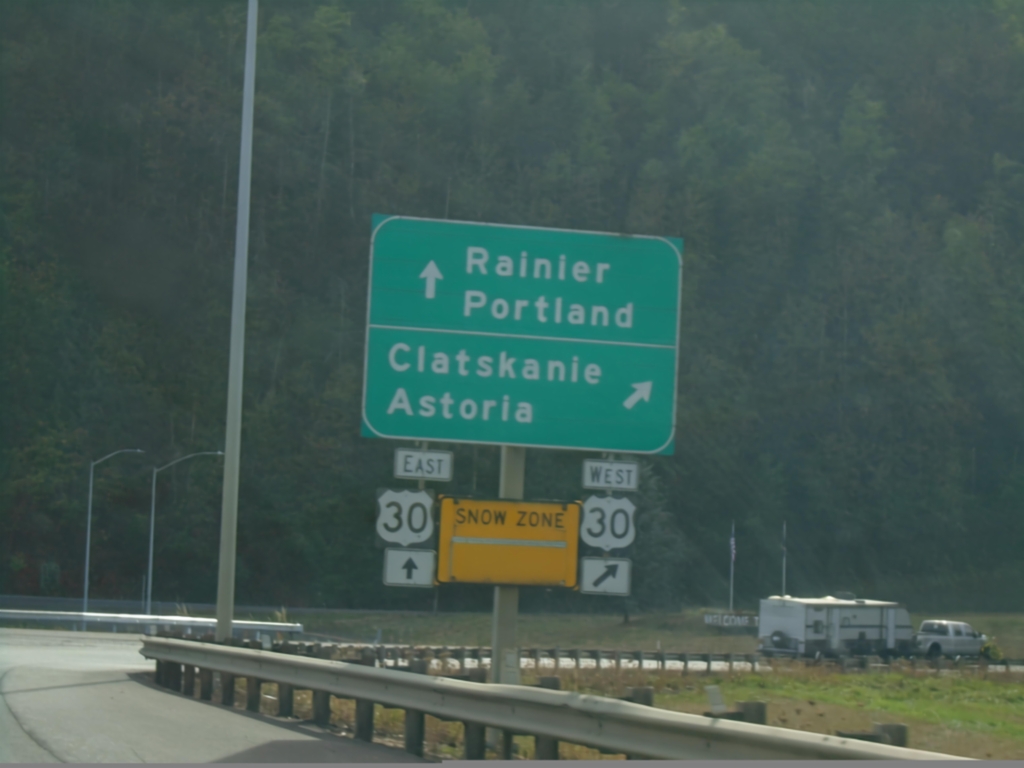
Lewis and Clark Bridge at US-30
Lewis and Clark Bridge at US-30 in Rainier. Use US-30 West to Astoria and Clatskanie. Use US-30 East to Rainier and Portland. Entering a Snow Zone.
Taken 09-22-2024
Rainier
Columbia County
Oregon
United States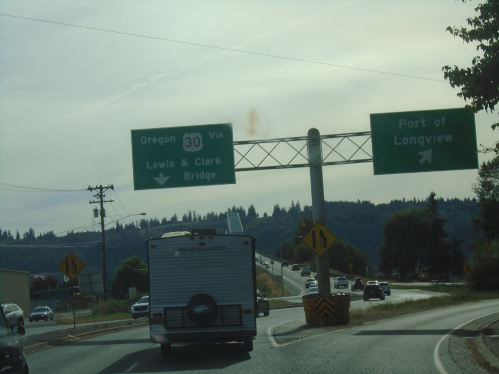
WA-433 South - Port of Longview
WA-433 south at the Port of Longview interchange. Continue on WA-433 south for the Lewis and Clark Bridge to Oregon and US-30 junction. The bridge can be seen in the background of the photo.
Taken 09-22-2024
 Longview
Cowlitz County
Washington
United States
Longview
Cowlitz County
Washington
United States
WA-432 West at WA-433
WA-432 West at WA-433 (Oregon Way). Turn left for WA-433 south; continue straight for WA-432 west to WA-4.
Taken 09-22-2024

 Longview
Cowlitz County
Washington
United States
Longview
Cowlitz County
Washington
United States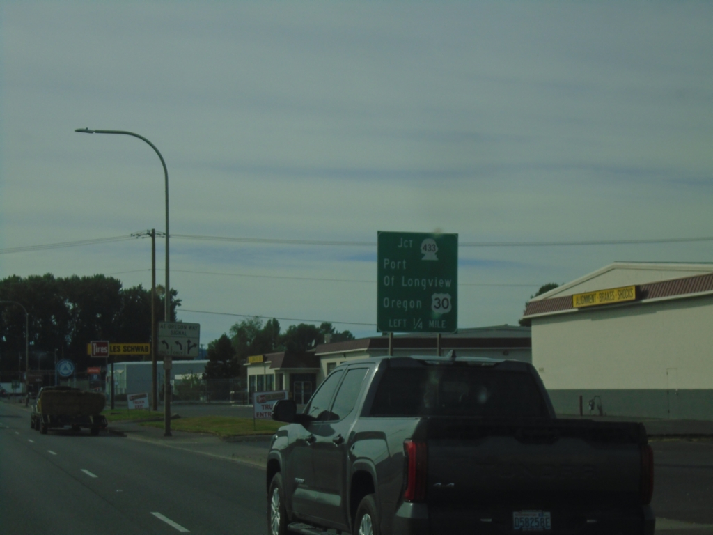
WA-432 West Approaching WA-433
WA-432 West approaching WA-433. Use WA-432 for the Port of Longview; WA-433 for the bridge to Oregon.
Taken 09-22-2024
Longview
Cowlitz County
Washington
United States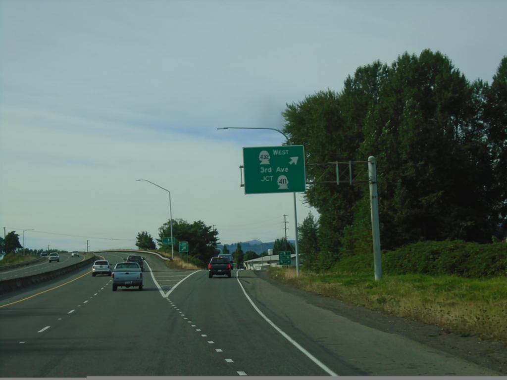
WA-432 West - WA-411/3rd St. Interchange
WA-432 West at WA-411/WA-432/3rd St. interchange. Exit here to continue west on WA-432 (3rd St. south). Continue straight for Tennant Way.
Taken 09-22-2024
 Longview
Cowlitz County
Washington
United States
Longview
Cowlitz County
Washington
United States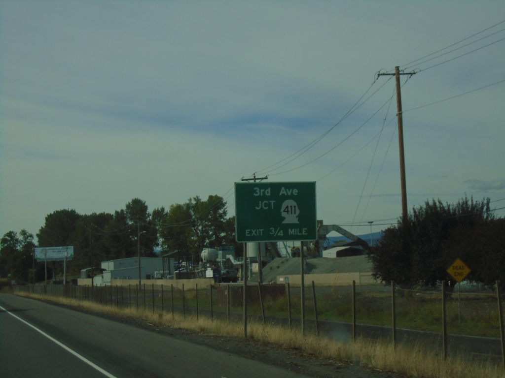
WA-432 West - WA-411/3rd St. Interchange
WA-432 West Approaching WA-411/3rd St. interchange in Longview.
Taken 09-22-2024
Longview
Cowlitz County
Washington
United States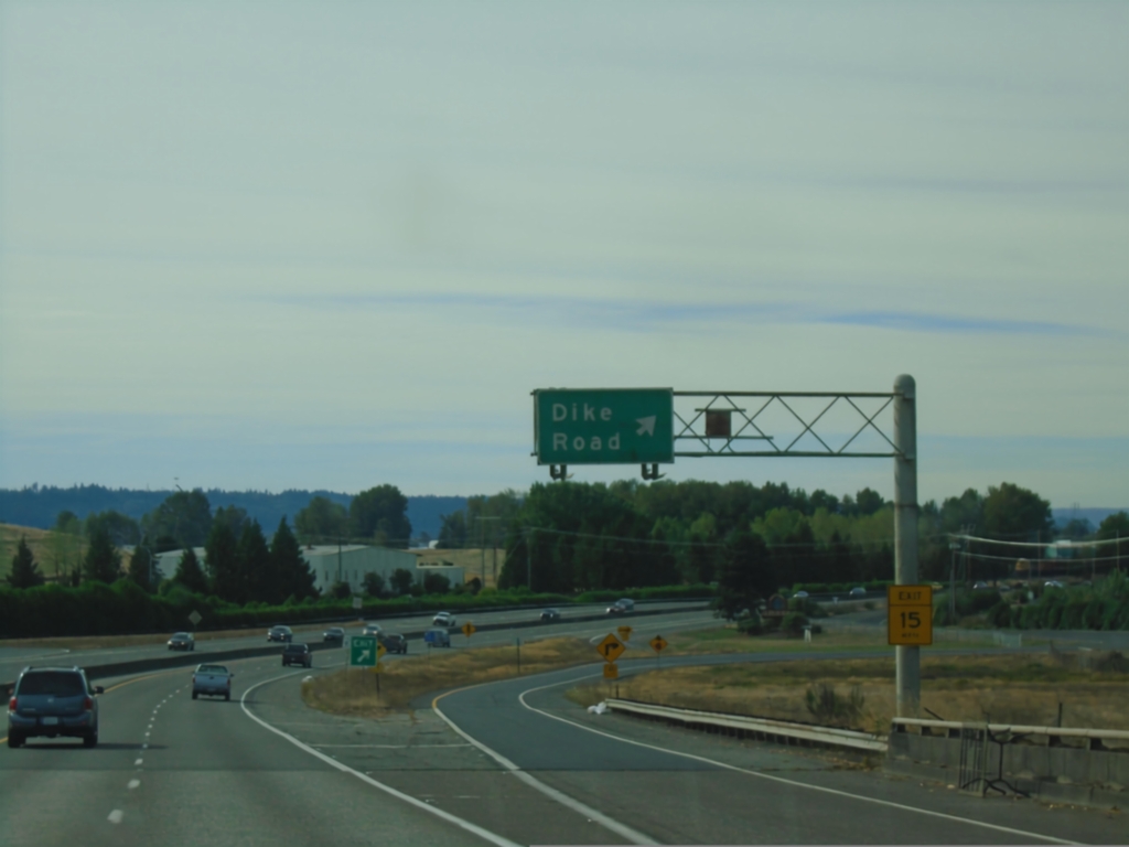
WA-432 West - Dike Road Interchange
WA-432 West at Dike Road interchange
Taken 09-22-2024
Longview
Cowlitz County
Washington
United States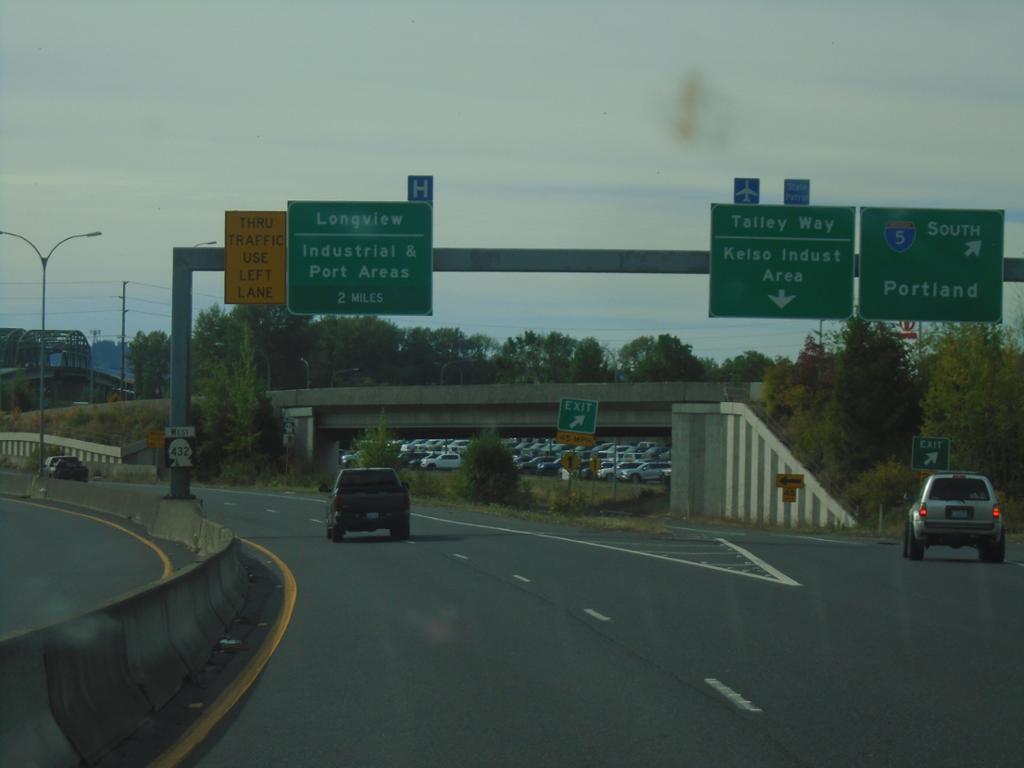
WA-432 West at I-5 South and Talley Way
WA-432 West at I-5 South to Portland and Talley Way/Kelso Industrial Area interchange. Approaching Longview/Port and Industrial Areas interchange.
Taken 09-22-2024
Kelso
Cowlitz County
Washington
United States