Signs Tagged With Big Green Sign
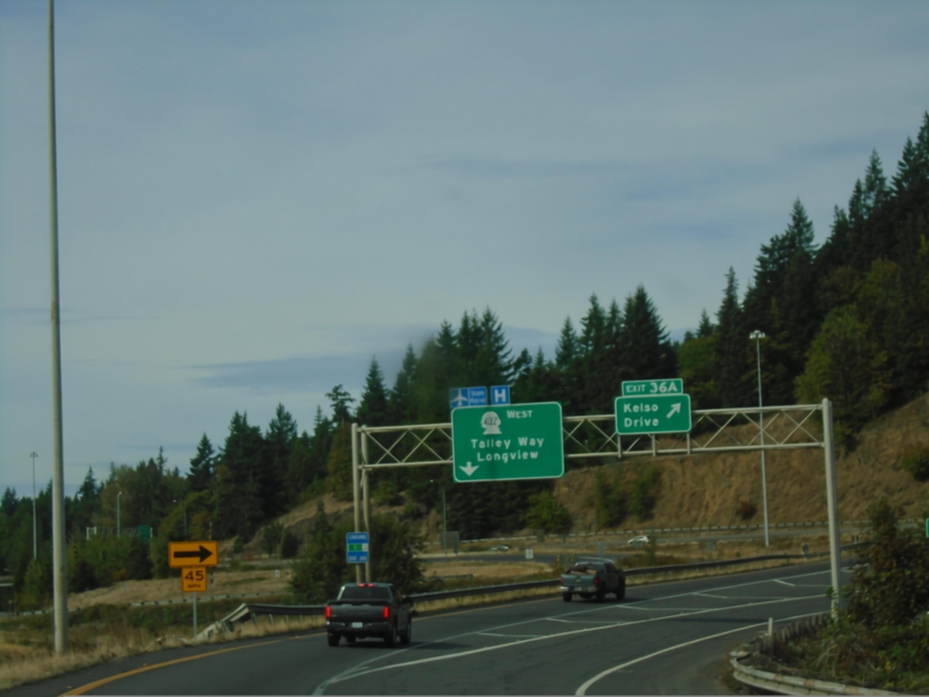
I-5 North - Exit 36
I-5 north at Exit 36. Use Exit 36A for Kelso Drive; Exit 36B to WA-432 West/Talley Way/Longview.
Taken 09-22-2024

 Kelso
Cowlitz County
Washington
United States
Kelso
Cowlitz County
Washington
United States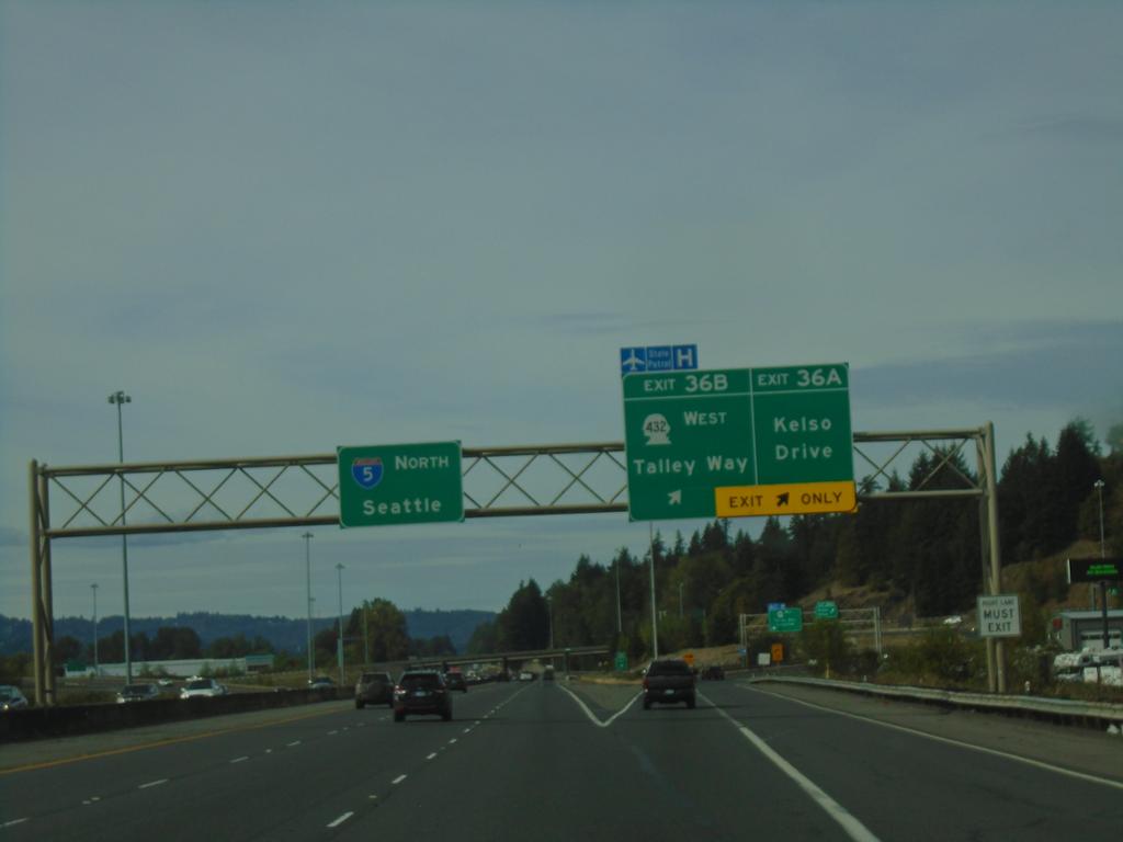
I-5 North - Exit 36A-B
I-5 north at Exit 36A - Kelso Drive. Approaching Exit 36B - WA-432 West/Talley Way. Continue north on I-5 North to Seattle.
Taken 09-22-2024
Kelso
Cowlitz County
Washington
United States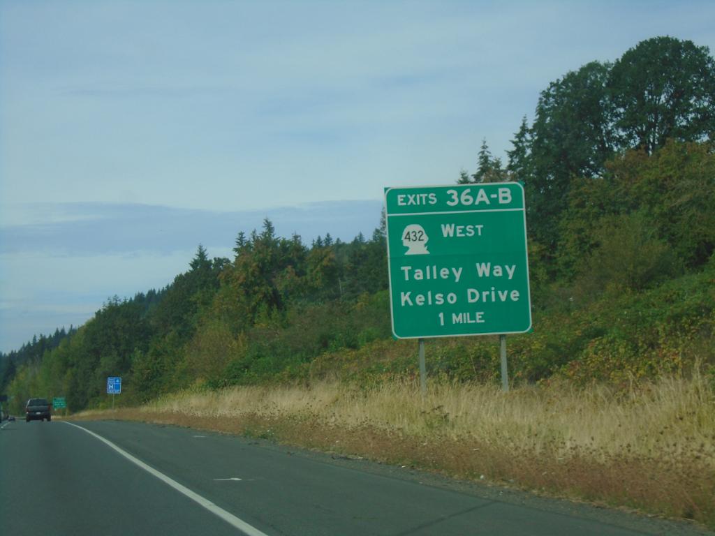
I-5 North - Exit 36
I-5 north approaching Exit 36A-B - WA-432 West/Talley Way/Kelso Drive.
Taken 09-22-2024
Kelso
Cowlitz County
Washington
United States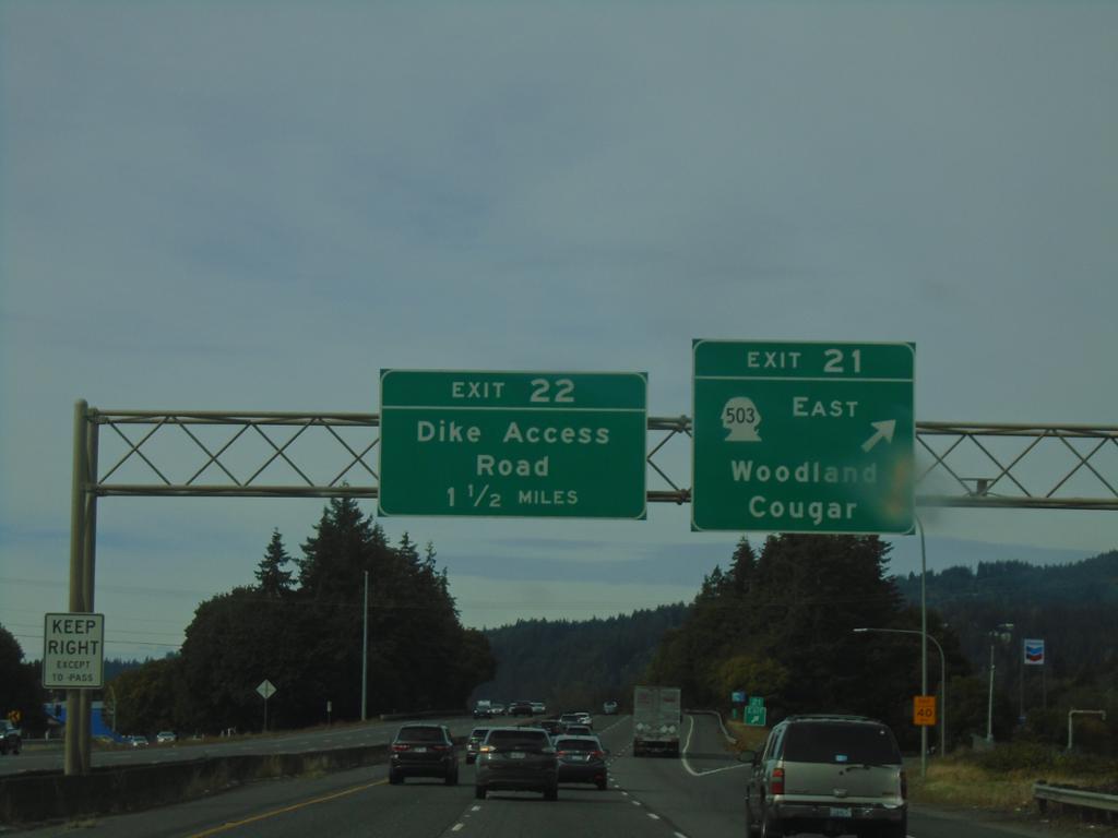
I-5 North - Exits 21 and 22
I-5 north at Exit 21 - WA-503 East/Woodland/Cougar, and approaching Exit 22 - Dike Access Road.
Taken 09-22-2024
 Woodland
Cowlitz County
Washington
United States
Woodland
Cowlitz County
Washington
United States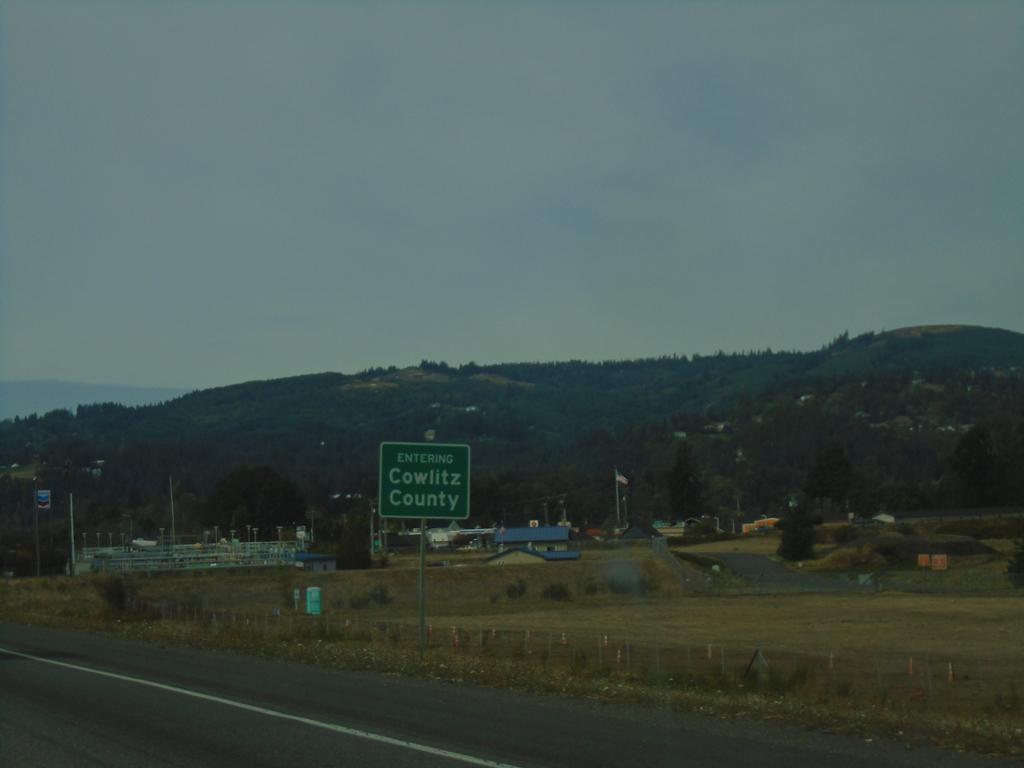
I-5 North - Cowlitz County
Entering Cowlitz County on I-5 North.
Taken 09-22-2024
Woodland
Cowlitz County
Washington
United States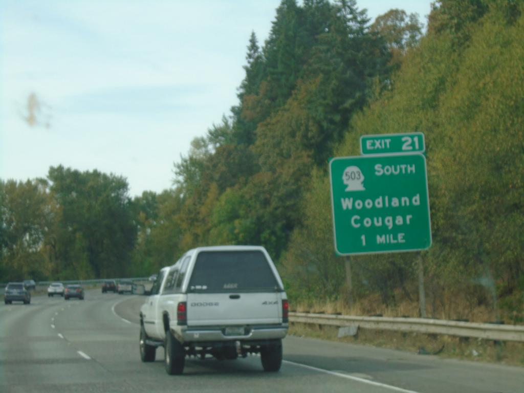
I-5 North - Exit 21
I-5 north approaching Exit 21 - WA-503 East/Woodland/Cougar.
Taken 09-22-2024
Woodland
Cowlitz County
Washington
United States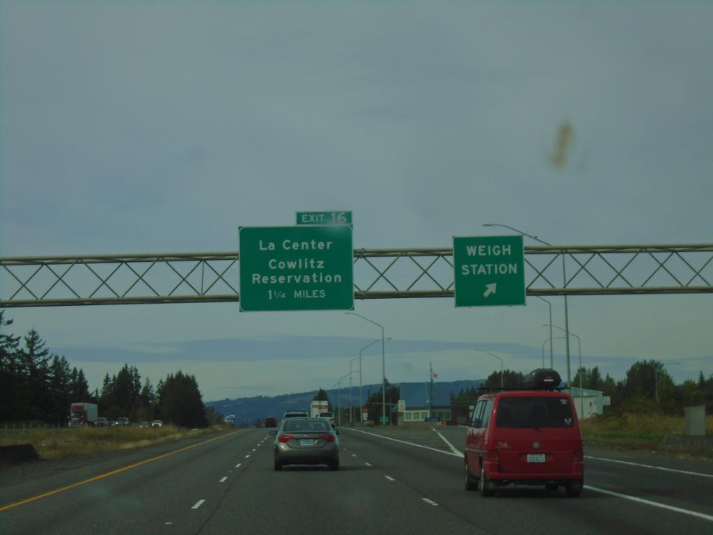
I-5 North - Exit 16 and Weigh Station
I-5 north at Weigh Station. Approaching Exit 16 - La Center/Cowlitz Reservation.
Taken 09-22-2024
Ridgefield
Clark County
Washington
United States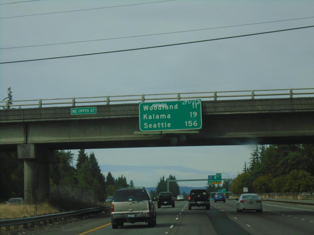
I-5 North - Distance Marker
Distance marker on I-5 north. Distance to Woodland, Kalama, and Seattle.
Taken 09-22-2024
Ridgefield
Clark County
Washington
United States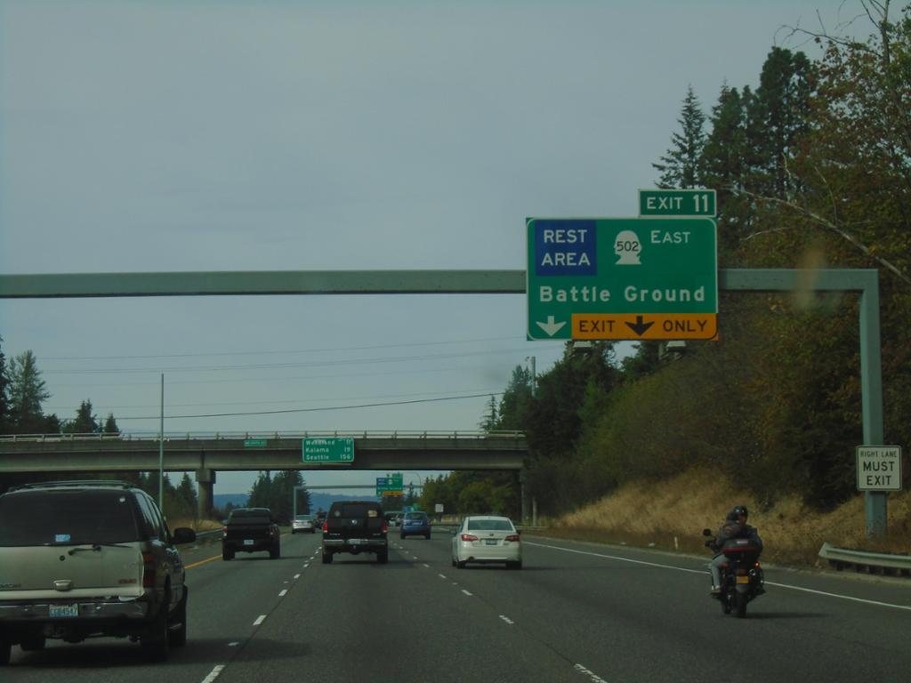
I-5 North - Exit 11
I-5 north approaching Exit 11 - WA-502 East/Battle Ground and Rest Area.
Taken 09-22-2024
 Ridgefield
Clark County
Washington
United States
Ridgefield
Clark County
Washington
United States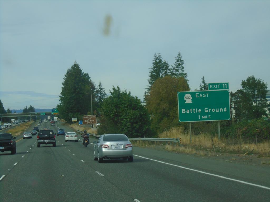
I-5 North - Exit 11
I-5 north approaching Exit 11 - WA-502 East/Battle Ground.
Taken 09-22-2024
Ridgefield
Clark County
Washington
United States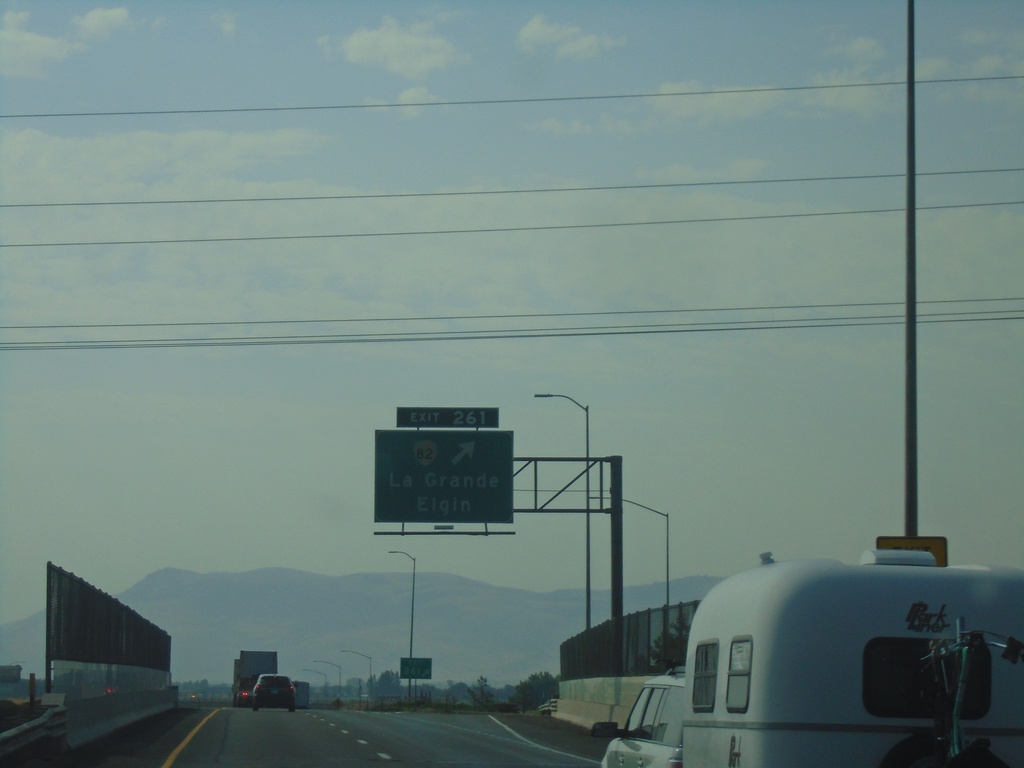
I-84 East - Exit 261
I-84 East at Exit 261 - OR-82/La Grande/Elgin.
Taken 08-10-2024

 La Grande
Union County
Oregon
United States
La Grande
Union County
Oregon
United States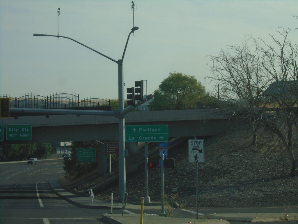
US-395 North at I-84 - Pendleton
US-395 North at I-84 in Pendleton. Use I-84 East to La Grande; I-84 West/US-395 North to Portland.
Taken 08-10-2024
 Pendleton
Umatilla County
Oregon
United States
Pendleton
Umatilla County
Oregon
United States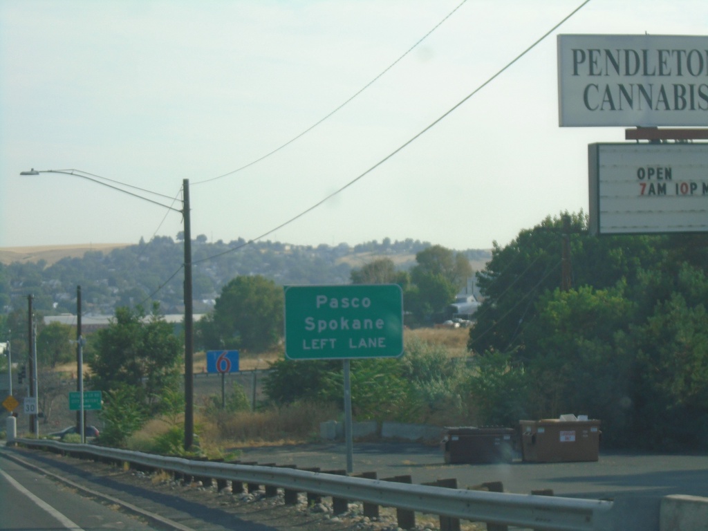
US-395 North Approaching I-84
US-395 north approaching I-84. Use left lane for I-84 West/US-395 North to Pasco and Spokane (both in Washington via US-395).
Taken 08-10-2024
Pendleton
Umatilla County
Oregon
United States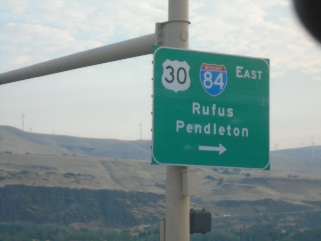
US-97 North at I-84/US-30 East
US-97 north at I-84/US-30 east for Rufus and Pendleton.
Taken 08-10-2024

 Wasco
Sherman County
Oregon
United States
Wasco
Sherman County
Oregon
United States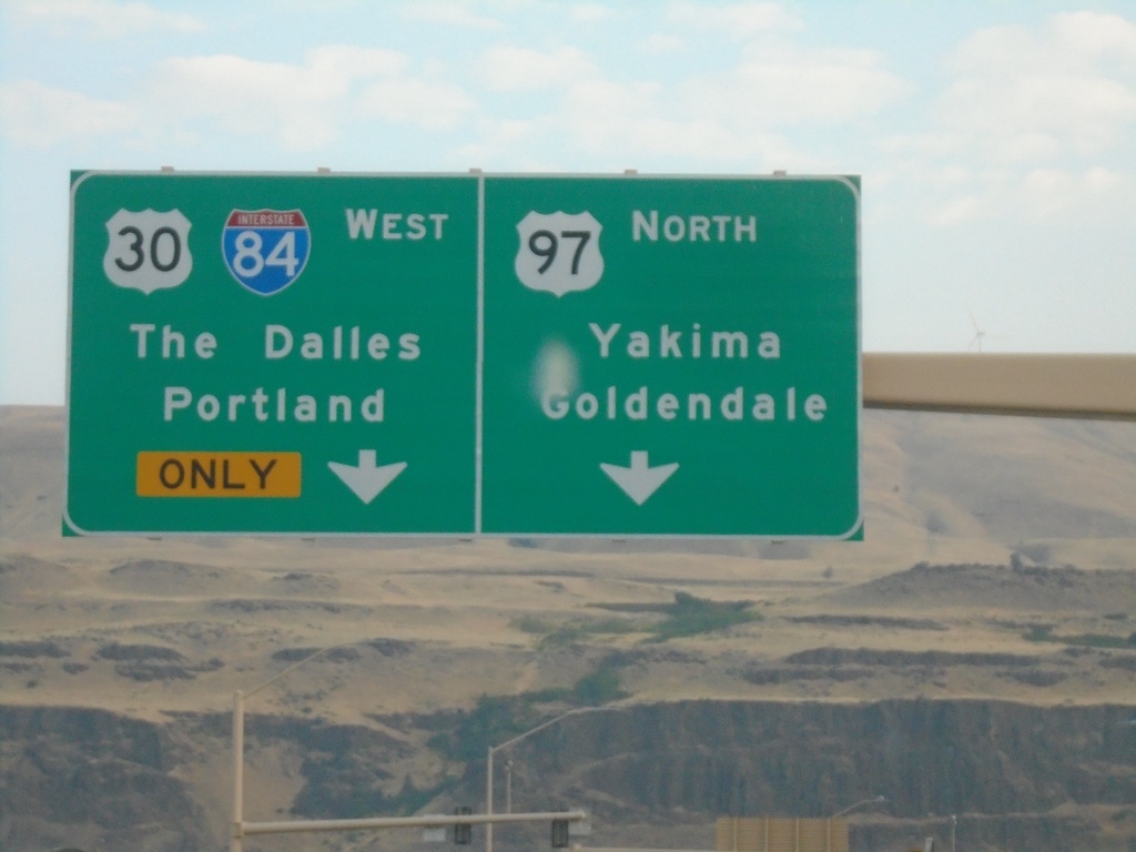
US-97 North at I-84
US-97 North at I-84/US-30 West in Biggs Junction. Use I-84/US-30 West to The Dalles and Portland. Continue north on US-97 for Goldendale (WA) and Yakima (WA).
Taken 08-10-2024
Wasco
Sherman County
Oregon
United States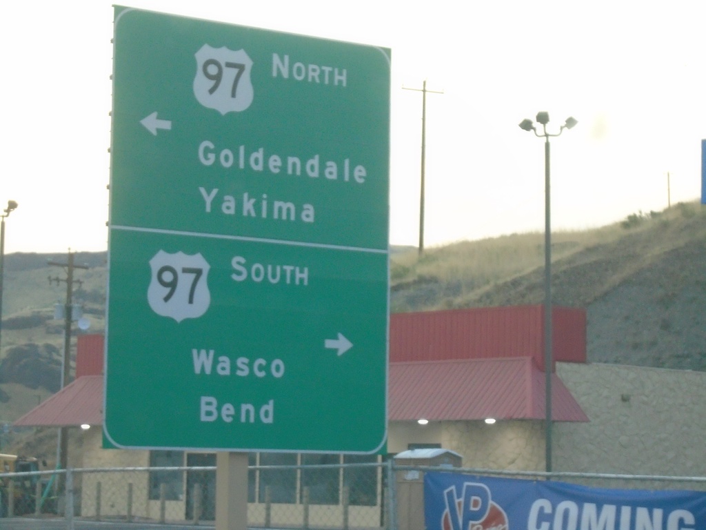
Biggs-Rufus Highway East at US-97
Biggs-Rufus Highway East at US-97 - Biggs Junction. Use US-97 south to Wasco and Bend; US-97 north to Goldendale (WA) and Yakima (WA).
Taken 08-10-2024
Wasco
Sherman County
Oregon
United States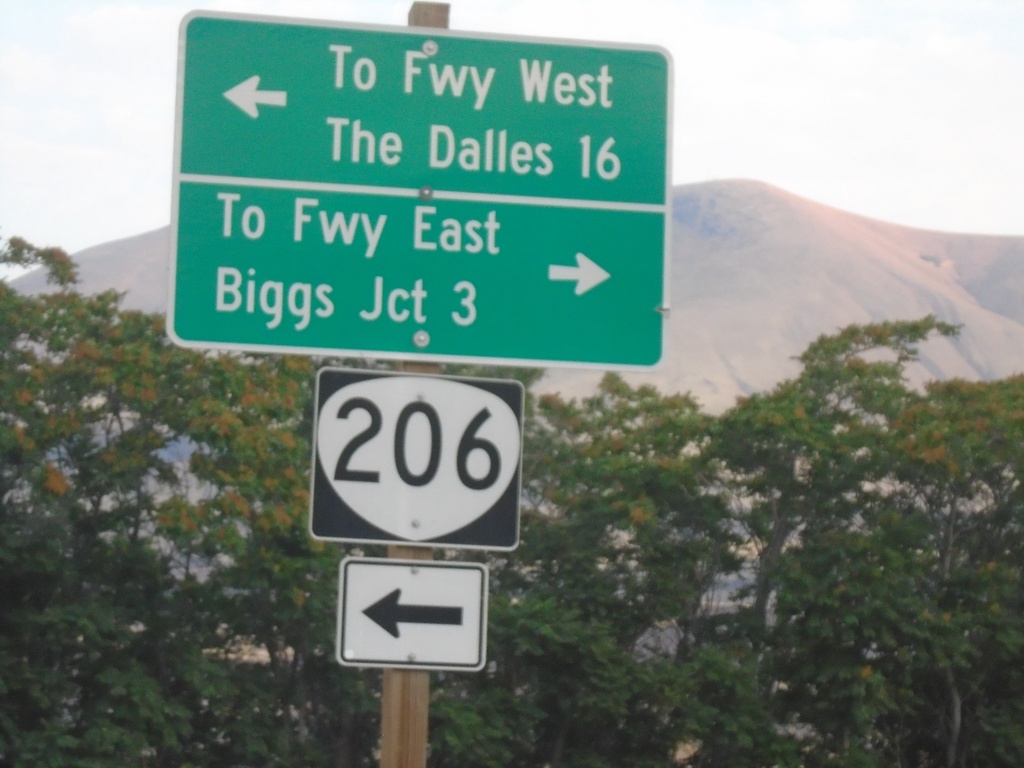
OR-206 West at Biggs-Rufus Highway
OR-206 West at Biggs-Rufus Highway. Turn left to continue on OR-206 west to Freeway West (I-84) and The Dalles. Turn right for Biggs-Rufus Highway to Freeway East (I-84) and Biggs Junction.
Taken 08-10-2024
 Wasco
Sherman County
Oregon
United States
Wasco
Sherman County
Oregon
United States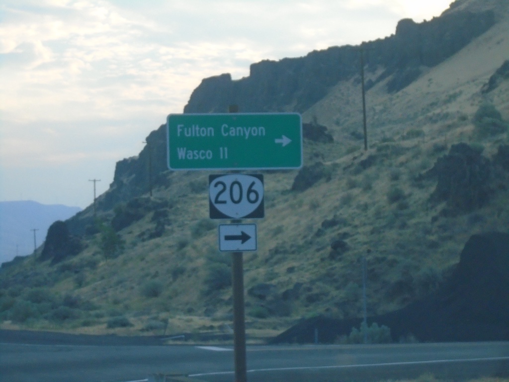
OR-206 East Approaching Biggs-Rufus Highway Junction
OR-206 East Approaching Biggs-Rufus Highway Junction. Turn right to continue east on OR-206 to Fulton Canyon and Wasco.
Taken 08-10-2024
Wasco
Sherman County
Oregon
United States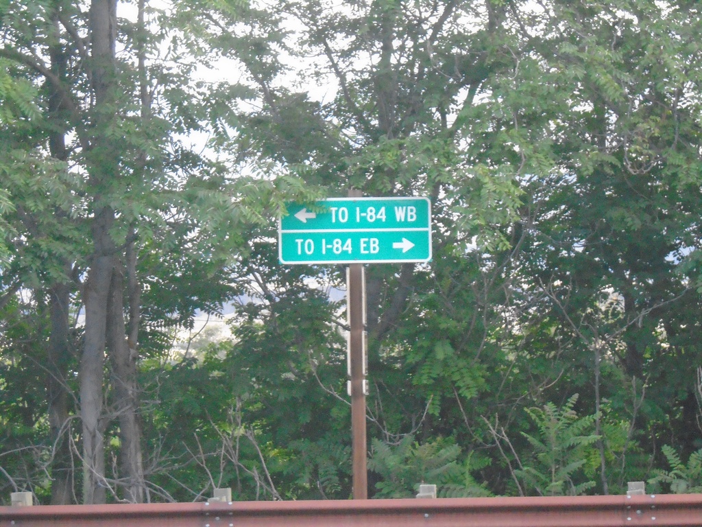
Deschutes State Park Access Road at OR-206
Deschutes State Park Access Road at OR-206. Use OR-206 East for I-84 Eastbound; OR-206 West for I-84 Westbound.
Taken 08-10-2024
Wasco
Sherman County
Oregon
United States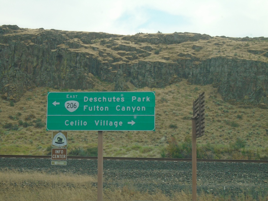
OR-206 - Celilo Village Junction
OR-206 at Celilo Village Junction. Turn right for Celilo Village; left for OR-206 East to Deschutes Park and Fulton Canyon.
Taken 08-09-2024
The Dalles
Wasco County
Oregon
United States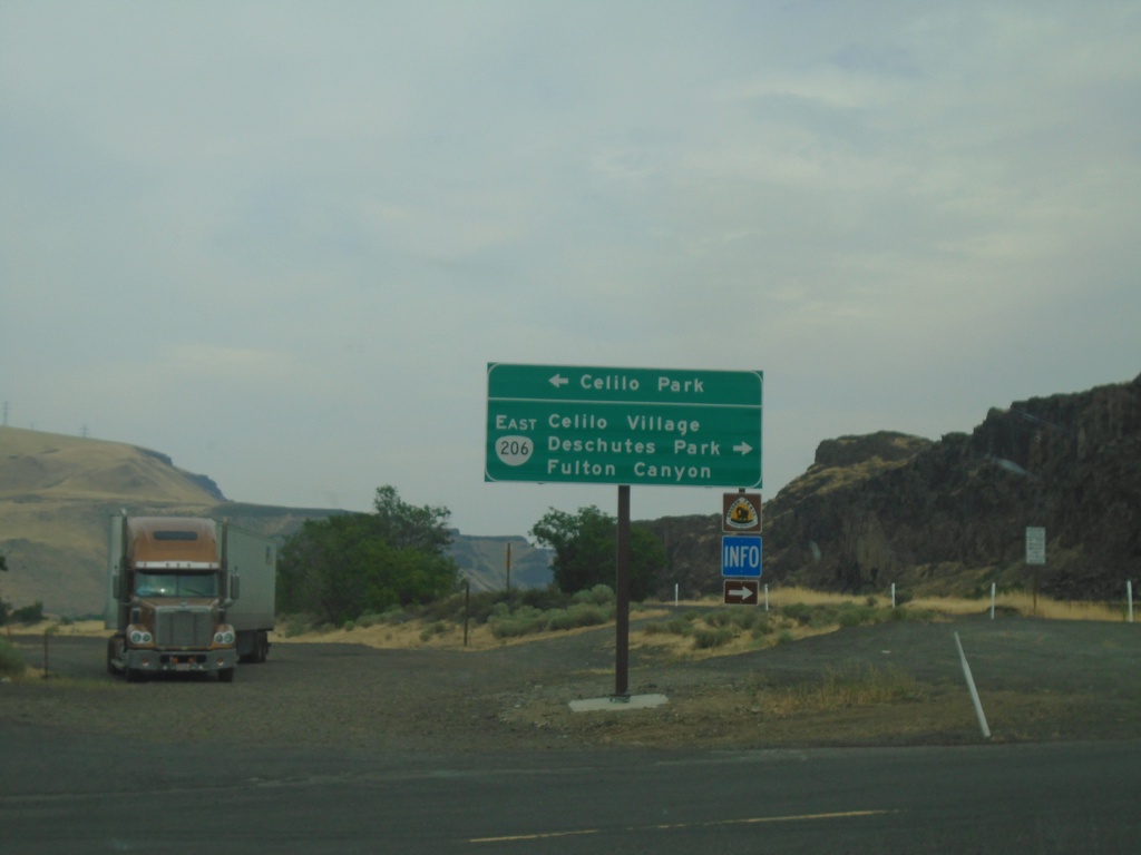
I-84 East Exit 97 Offramp at OR-206
I-84 East Exit 97 offramp at OR-206. Turn left for Celilo Park. Turn right for OR-206 East/Celilo Village/Deschutes Park/Fulton Canyon.
Taken 08-09-2024
The Dalles
Wasco County
Oregon
United States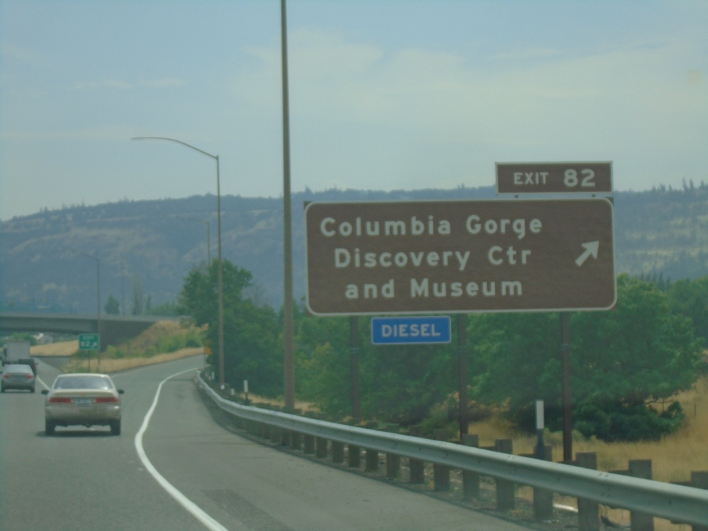
I-84 East - Exit 82
I-84 east at Exit 82 - Columbia Gorge Discovery Center and Museum.
Taken 08-09-2024
The Dalles
Wasco County
Oregon
United States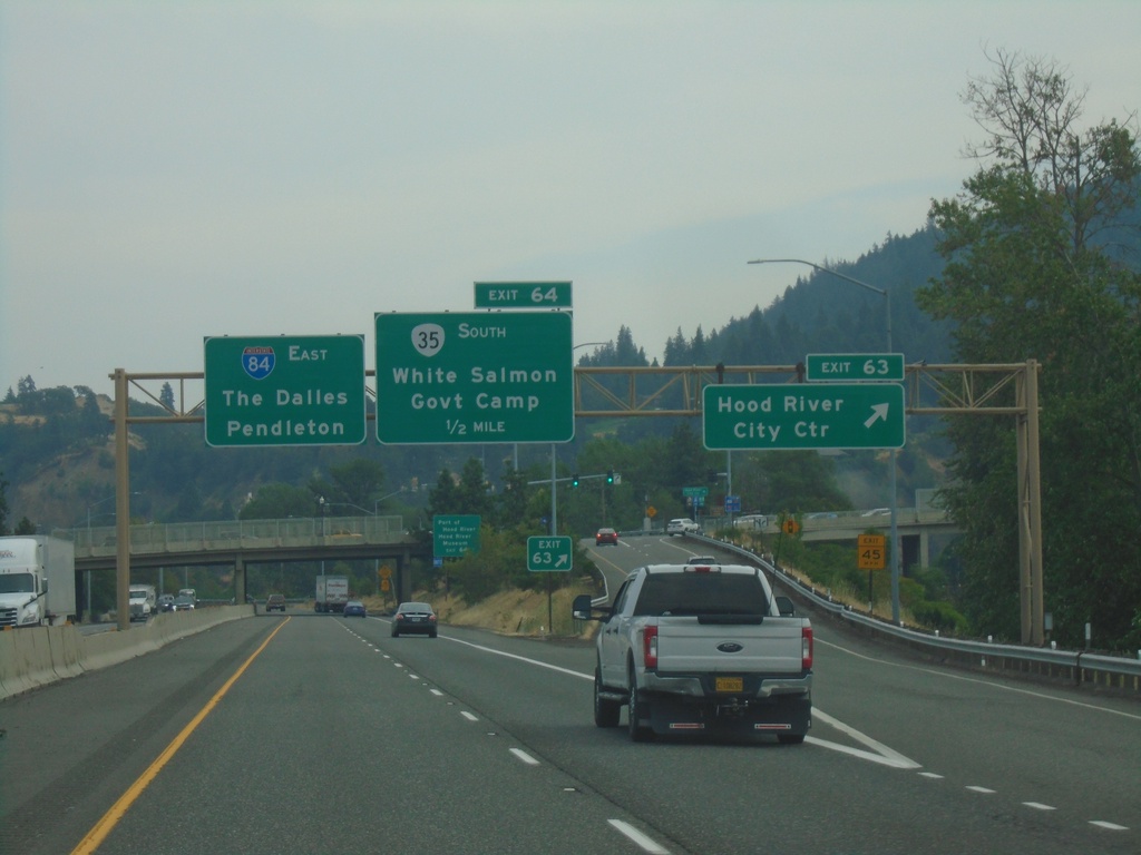
I-84 East - Exits 63 and 64
I-84 east at Exit 63 - Hood River City Center. Approaching Exit 64 - OR-35 South/White Salmon (Washington)/Government Camp. I-84 continues east to The Dalles and Pendleton.
Taken 08-09-2024
 Hood River
 County
Oregon
United States
Hood River
Hood River County
Oregon
United States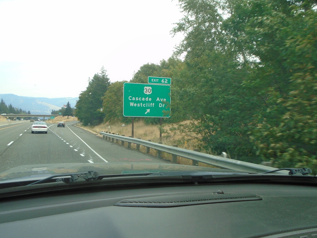
I-84 East - Exit 62
I-84 east at Exit 62 - US-30/Cascade Ave./Westcliff Drive. US-30 leaves I-84 here through the city of Hood River.
Taken 08-09-2024
Hood River
Hood River County
Oregon
United States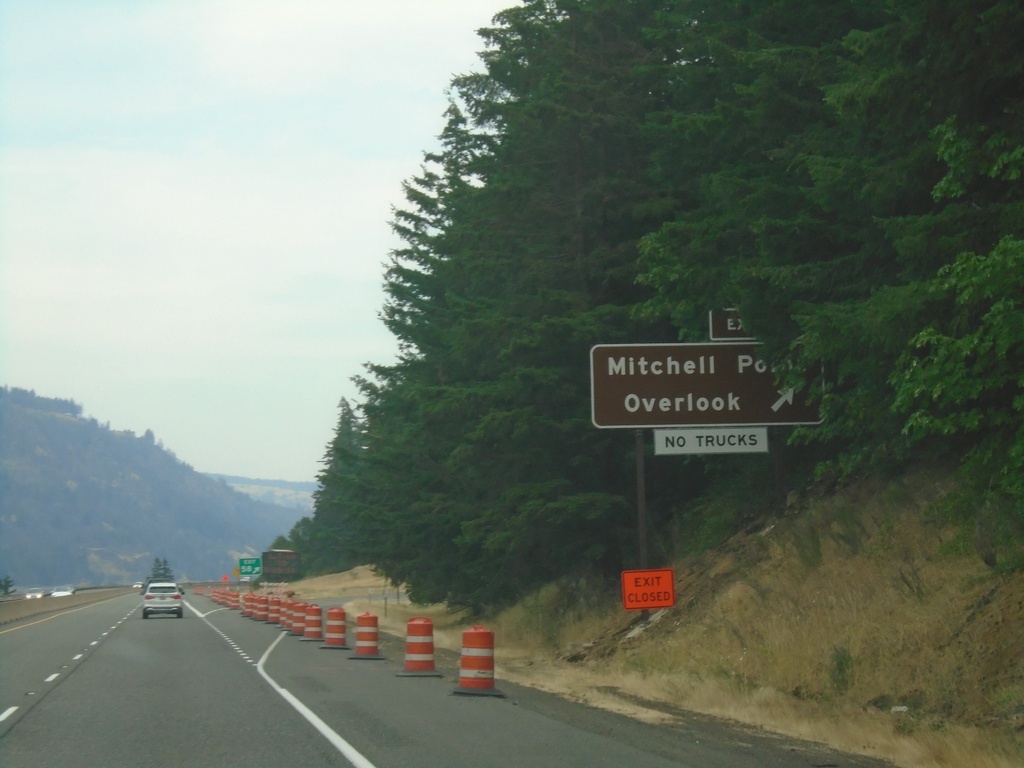
I-84 East - Exit 58
I-84 east at Exit 58 - Mitchell Point Overlook.
Taken 08-09-2024
Hood River
Hood River County
Oregon
United States