Signs Tagged With Big Green Sign
US-93 South Approaching US-93 Alt. (Lages Jct)
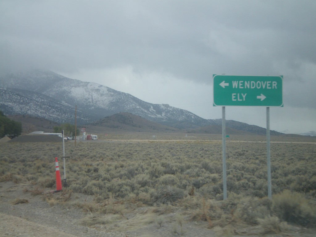
US-93 south at Alt. US-93 north. Use US-93 south for Ely; Alt. US-93 North to Wendover.
Taken 10-11-2008

 Ely
White Pine County
Nevada
United States
Ely
White Pine County
Nevada
United States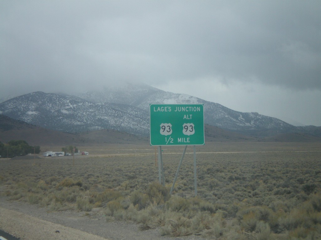
US-93 South Approaching US-93 Alt. (Lages Jct)
US-93 south approaching Alt. US-93 at Lages Junction.
Taken 10-11-2008
Ely
White Pine County
Nevada
United States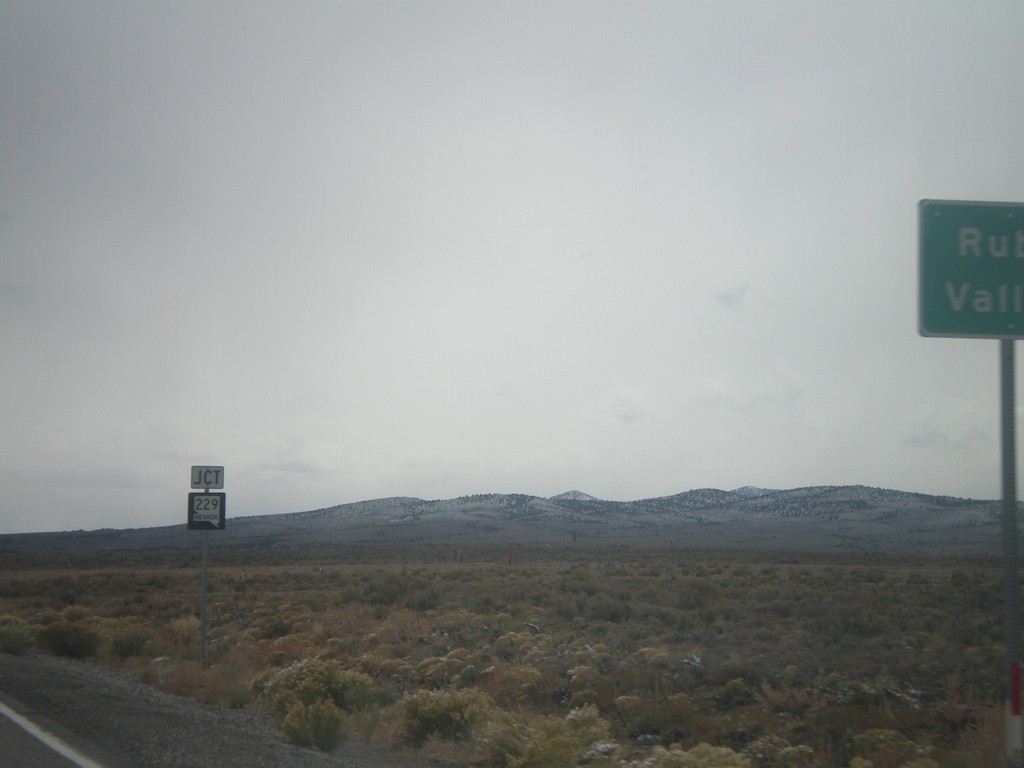
US-93 South Approaching NV-229
US-93 south approaching NV-229 west to Ruby Valley.
Taken 10-11-2008
 Wells
Elko County
Nevada
United States
Wells
Elko County
Nevada
United States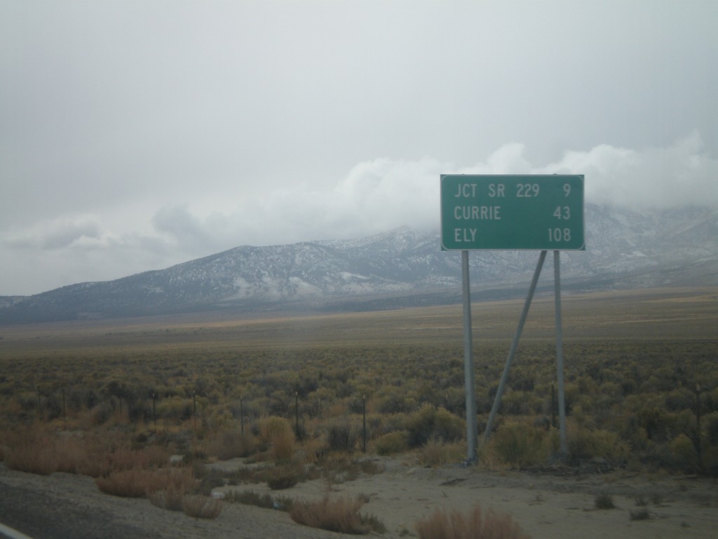
US-93 South - Distance Marker
Distance marker on US-93 south. Distance to Jct. SR-229, Currie, and Ely.
Taken 10-11-2008
Wells
Elko County
Nevada
United States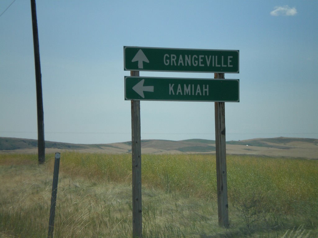
ID-162 East at Old ID-7 Jct.
ID-162 east at Old ID-7 junction. Use ID-162 for Kamiah. Use Old ID-7 for Grangeville.
Taken 07-27-2008
 Dryden
Idaho County
Idaho
United States
Dryden
Idaho County
Idaho
United States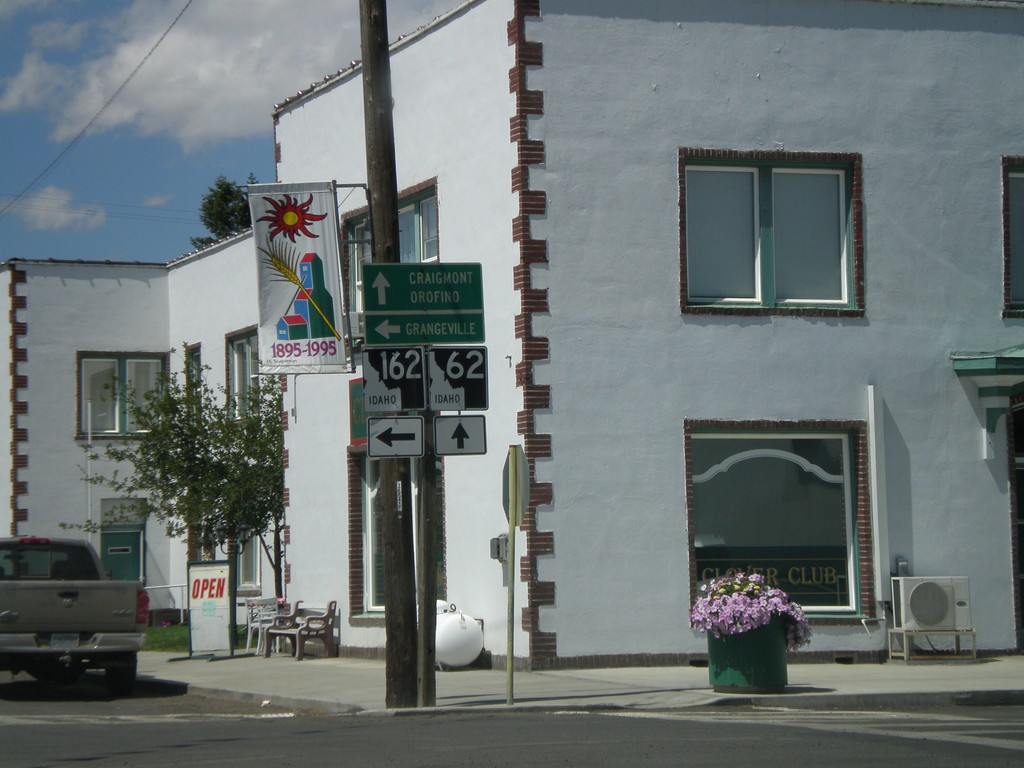
End ID-64 West at ID-62/ID-162
End ID-64 at ID-162 and ID-62. Continue straight for ID-62 towards Craigmont and Orofino. Turn left for ID-162 towards Grangeville.
Taken 07-27-2008

 Nezperce
Lewis County
Idaho
United States
Nezperce
Lewis County
Idaho
United States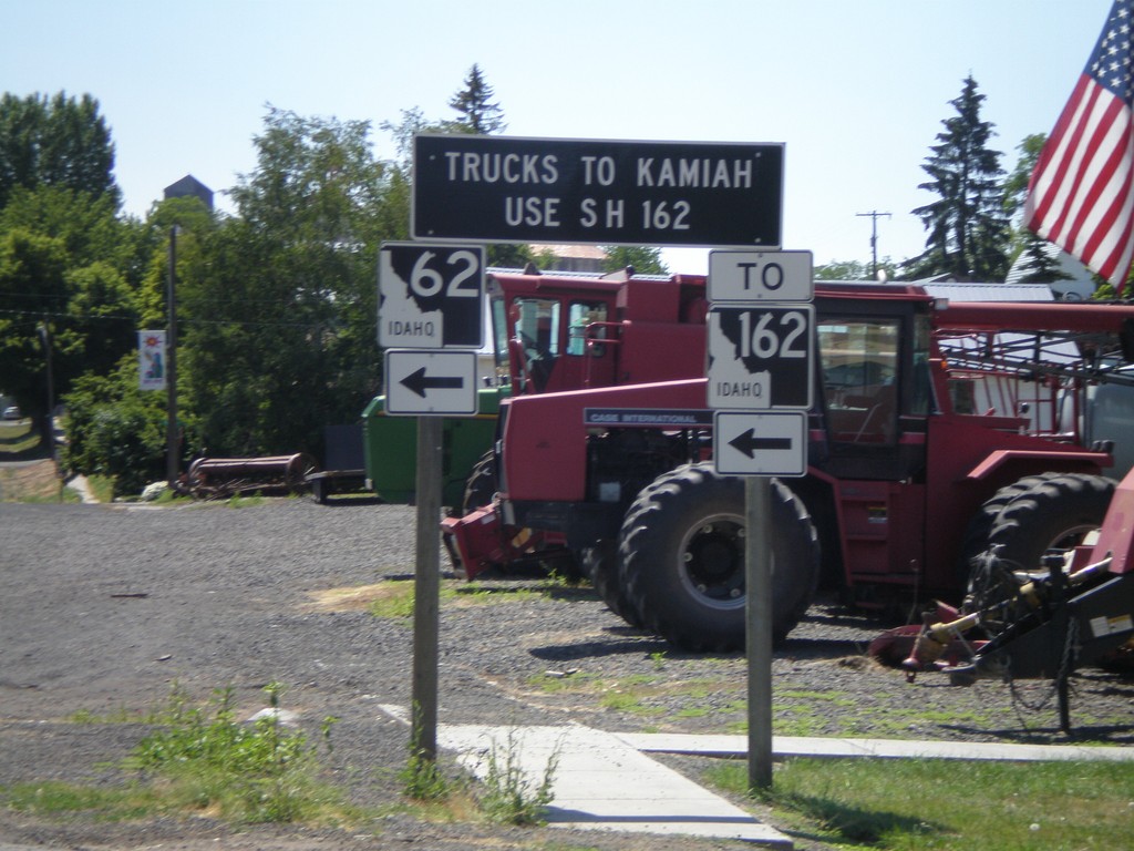
ID-62 East To ID-162 - Truck Information
ID-62 approaching ID-162. All Kamiah truck traffic use ID-162.
Taken 07-27-2008
Nezperce
Lewis County
Idaho
United States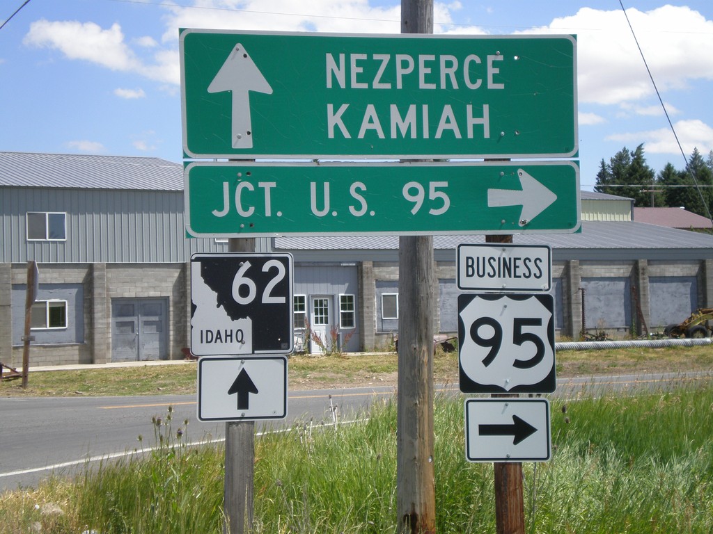
BL-95 South at ID-62
BL-95 south at ID-62 towards Kamiah and Nezperce. Turn left on BL-95 for US-95.
Taken 07-27-2008
 Craigmont
Lewis County
Idaho
United States
Craigmont
Lewis County
Idaho
United States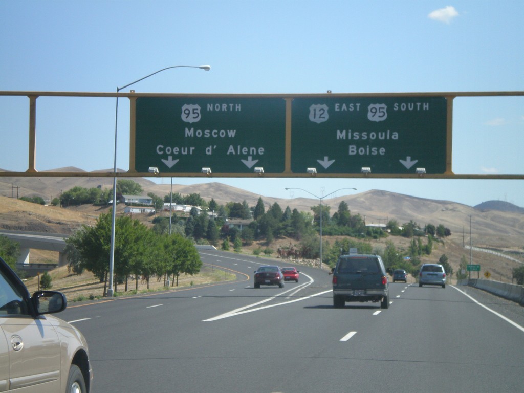
US-12 East At US-95
US-12 East at US-95. Merge left for US-95 north to Moscow and Coeur d’Alene. Use right lanes for US-12 East/US-95 South/Missoula (Montana)/Boise. US-95 south joins US-12 east for about 10 miles eastbound along the Clearwater River.
Taken 07-27-2008

 Lewiston
Nez Perce County
Idaho
United States
Lewiston
Nez Perce County
Idaho
United States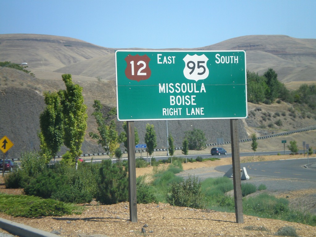
US-12 East Approaching US-95
US-12 east approaching US-95. Use right lanes for US-12 East/US-95 South/Missoula (Montana)/Boise.
Taken 07-27-2008
Lewiston
Nez Perce County
Idaho
United States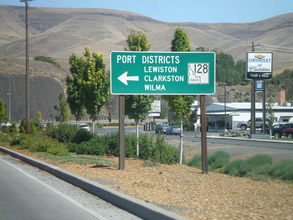
US-12 East at ID-128
US-12 east at ID-128 in Lewiston. Use ID-128 for the Lewiston, Clarkston, and Wilma Port Districts.
Taken 07-27-2008
 Lewiston
Nez Perce County
Idaho
United States
Lewiston
Nez Perce County
Idaho
United States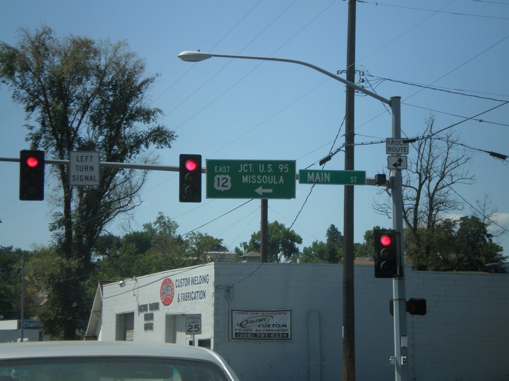
US-12 East - Levee Bypass at Main St.
US-12 East at Main St. Turn left on Main St. to continue east on US-12 to US-95 and Missoula (Montana).
Taken 07-27-2008
Lewiston
Nez Perce County
Idaho
United States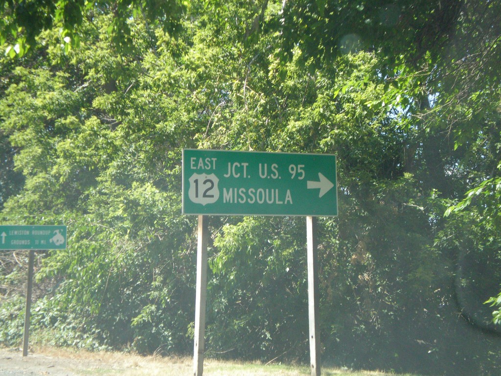
US-12 East - Interstate Bridge
US-12 east at end of Interstate Bridge. Turn right to continue east on US-12 for US-95 and Missoula (Montana).
Taken 07-27-2008
Lewiston
Nez Perce County
Idaho
United States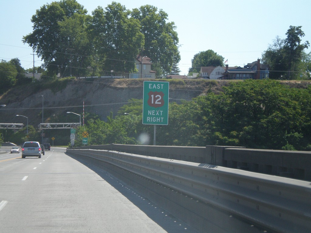
US-12 East - Interstate Bridge
US-12 east on Interstate Bridge over Snake River. Merge right to continue east on US-12.
Taken 07-27-2008
Lewiston
Nez Perce County
Idaho
United States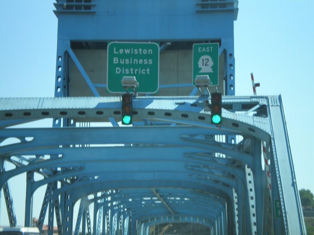
US-12 East - Idaho State Line
Errant US-12 shield displayed as a state route shield on the Interstate bridge over the Snake River on the Idaho border.
Taken 07-27-2008
Clarkston
Asotin County
Washington
United States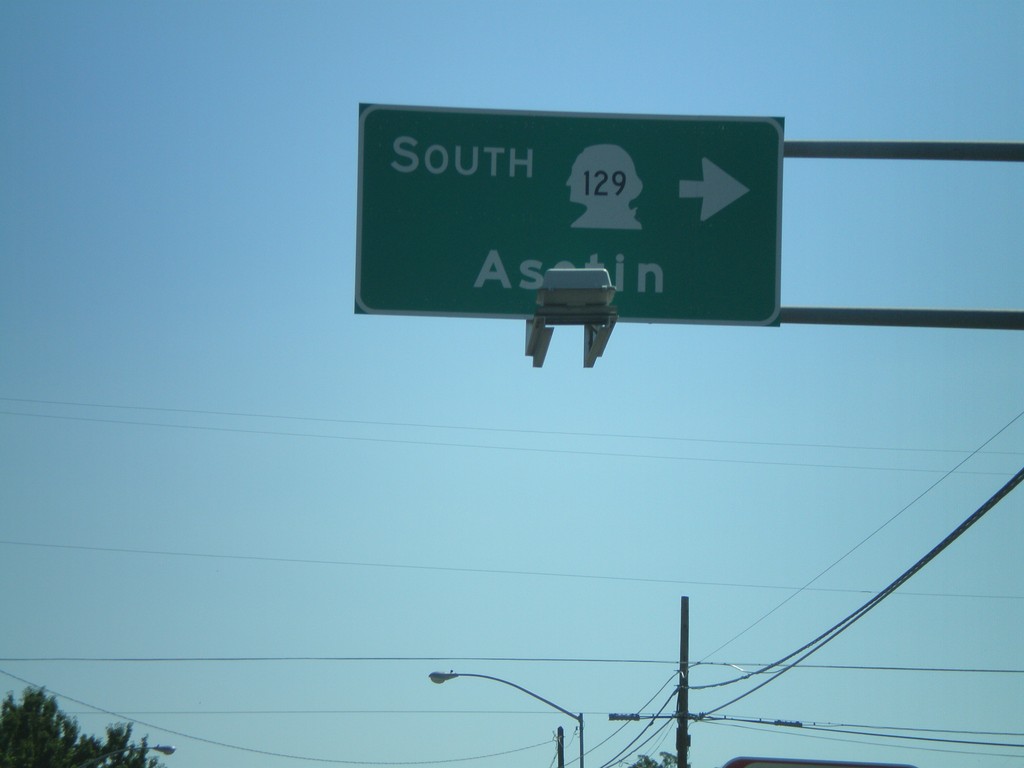
US-12 West at WA-129 South
US-12 east at WA-129 south to Asotin.
Taken 07-27-2008
 Clarkston
Asotin County
Washington
United States
Clarkston
Asotin County
Washington
United States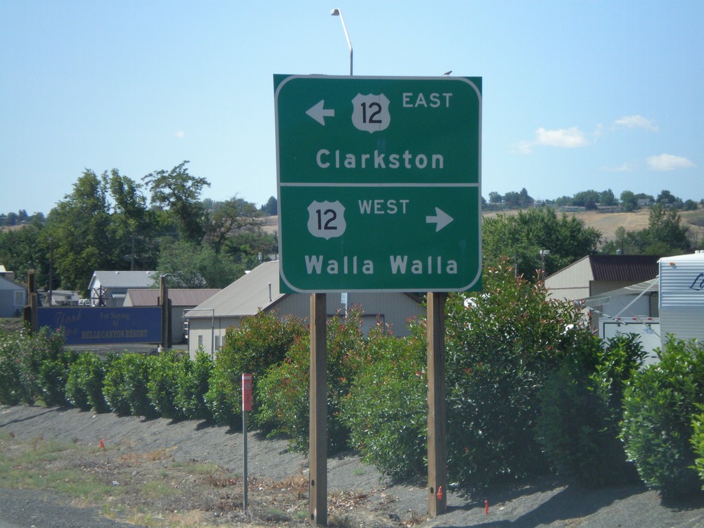
End WA-128 West at US-12
End WA-128 west at US-12 west to Walla Walla; east to Clarkston.
Taken 07-27-2008
 Clarkston
Asotin County
Washington
United States
Clarkston
Asotin County
Washington
United States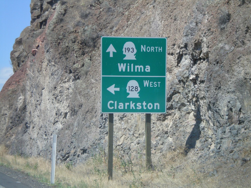
WA-128 West at WA-193 North
WA-128 west at WA-193 north to Wilma. Turn left for WA-128 west to Clarkston.
Taken 07-27-2008
 Clarkston
Asotin County
Washington
United States
Clarkston
Asotin County
Washington
United States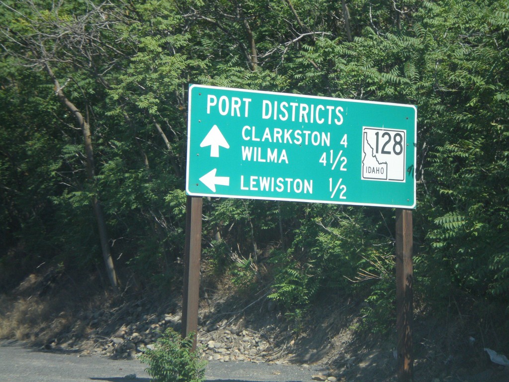
ID-128 West - Port Districts
ID-128 at the Port of Lewiston. Continue ahead for the Ports of Clarkston (WA) and Wilma (WA).
Taken 07-27-2008
Lewiston
Nez Perce County
Idaho
United States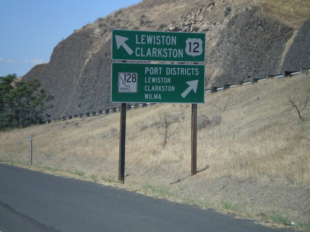
US-12 West at ID-128
US-12 west approaching ID-128 in Lewiston. Merge right for ID-128 west to Lewiston, Clarkston, and Wilma Port Districts. Merge left for US-12 west to Lewiston and Clarkston (WA).
Taken 07-27-2008
Lewiston
Nez Perce County
Idaho
United States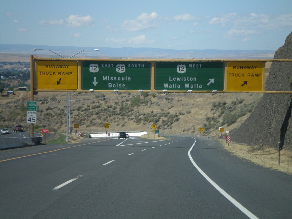
US-95 South at US-12
US-95 south at US-12 junction. Merge right for US-12 West/Lewiston/Walla Walla (Washington). Use left lane for US-95 South/US-12 East/Missoula (Montana)/Boise. Use either lane for access to Runaway Truck Ramps.
Taken 07-27-2008
Lewiston
Nez Perce County
Idaho
United States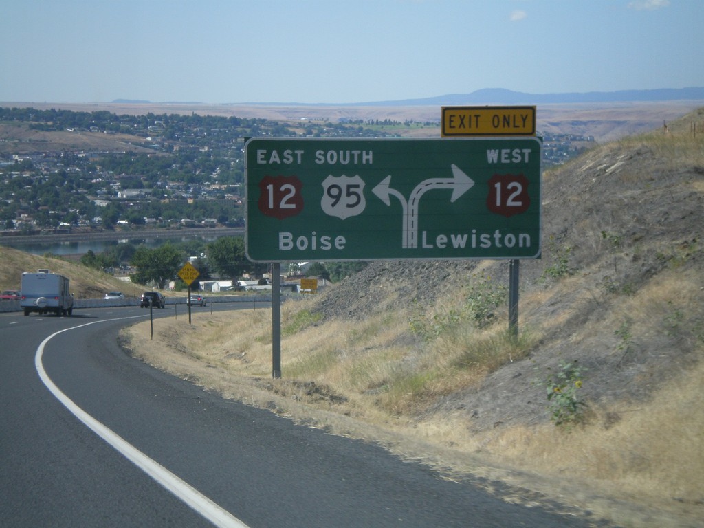
US-95 South Approaching US-12
US-95 south approaching US-12. Use right lane for US-12 west to Lewiston; left lane for US-95 South/US-12 East to Boise.
Taken 07-27-2008
Lewiston
Nez Perce County
Idaho
United States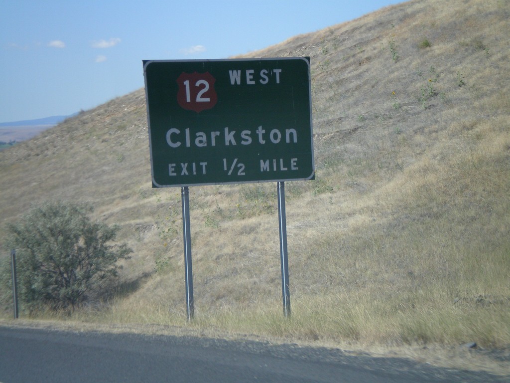
US-95 South Approaching US-12
US-95 south approaching US-12 West - Clarkston at the foot of Lewiston Hill.
Taken 07-27-2008
Lewiston
Nez Perce County
Idaho
United States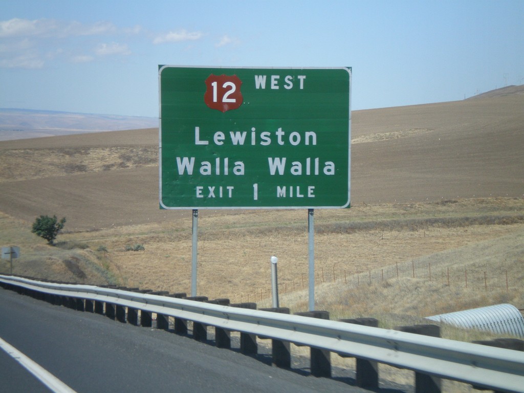
US-95 South Approaching US-12
US-95 South approaching US-12 West to Lewiston and Walla Walla (Washington).
Taken 07-27-2008
Lewiston
Nez Perce County
Idaho
United States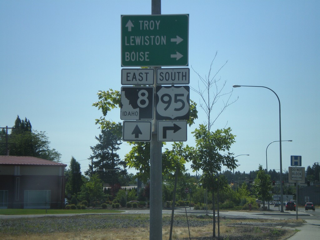
US-95 South/ID-8 Approaching ID-8 East
US-95 South/ID-8 East approaching US-95/ID-8 split. Use ID-8 east for Troy; turn right for US-95 south to Lewiston and Boise.
Taken 07-27-2008
 Moscow
Latah County
Idaho
United States
Moscow
Latah County
Idaho
United States