Signs Tagged With Big Green Sign
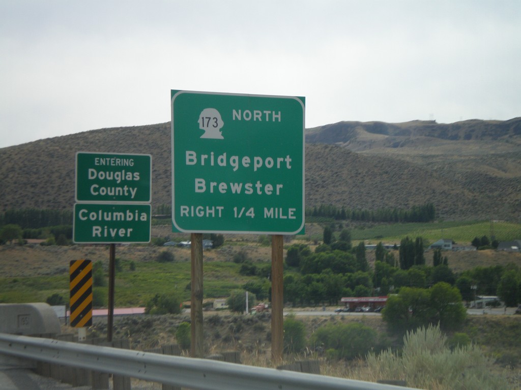
WA-17 South Approaching WA-173 North
WA-17 south approaching WA-173 North/Bridgeport/Brewster. Crossing the Columbia River into Douglas County.
Taken 07-26-2008

 Bridgeport
Okanogan County
Washington
United States
Bridgeport
Okanogan County
Washington
United States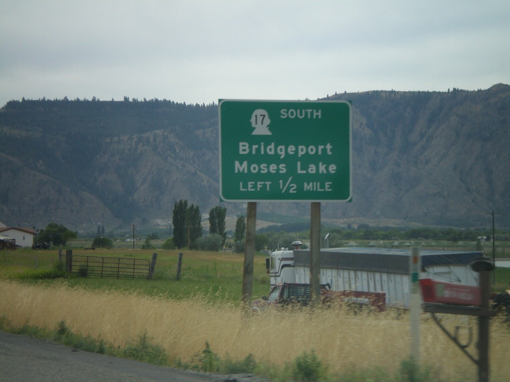
US-97 South Approaching WA-17
US-97 south approaching WA-17 South to Bridgeport and Moses Lake.
Taken 07-26-2008
 Brewster
Okanogan County
Washington
United States
Brewster
Okanogan County
Washington
United States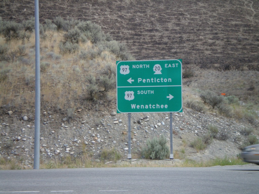
WA-20 East at US-97
WA-20 east at US-97. WA-20 follows US-97 north from here. Use US-97 south for Wenatchee. Use US-97 north for Penticton (Canada).
Taken 07-26-2008
 Okanogan
 County
Washington
United States
Okanogan
Okanogan County
Washington
United States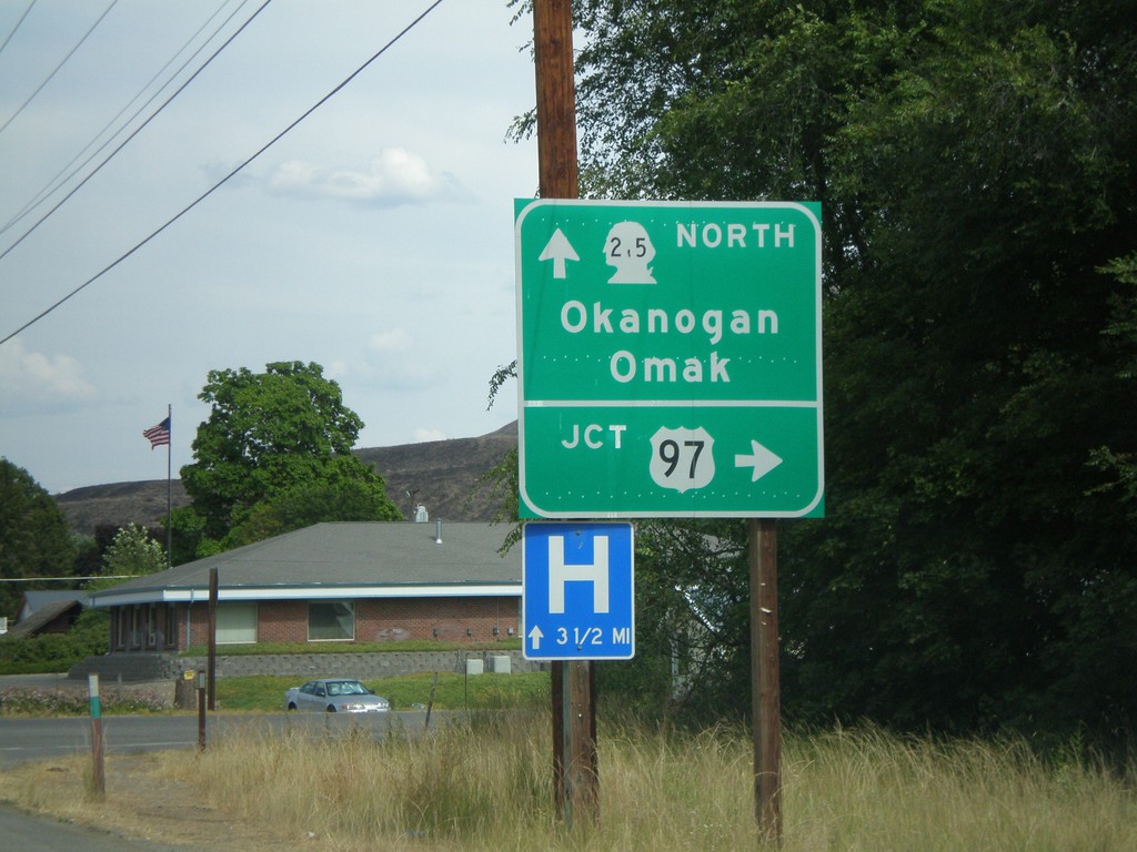
WA-20 East at WA-215
WA-20 east to US-97 at WA-215 North to Okanogan and Omak.
Taken 07-26-2008
 Okanogan
 County
Washington
United States
Okanogan
Okanogan County
Washington
United States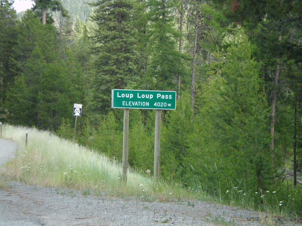
WA-20 East - Loup Loup Pass
WA-20 east at Loup Loup Pass - Elevation 4,020 Feet.
Taken 07-26-2008
Mowich Illahee
Okanogan County
Washington
United States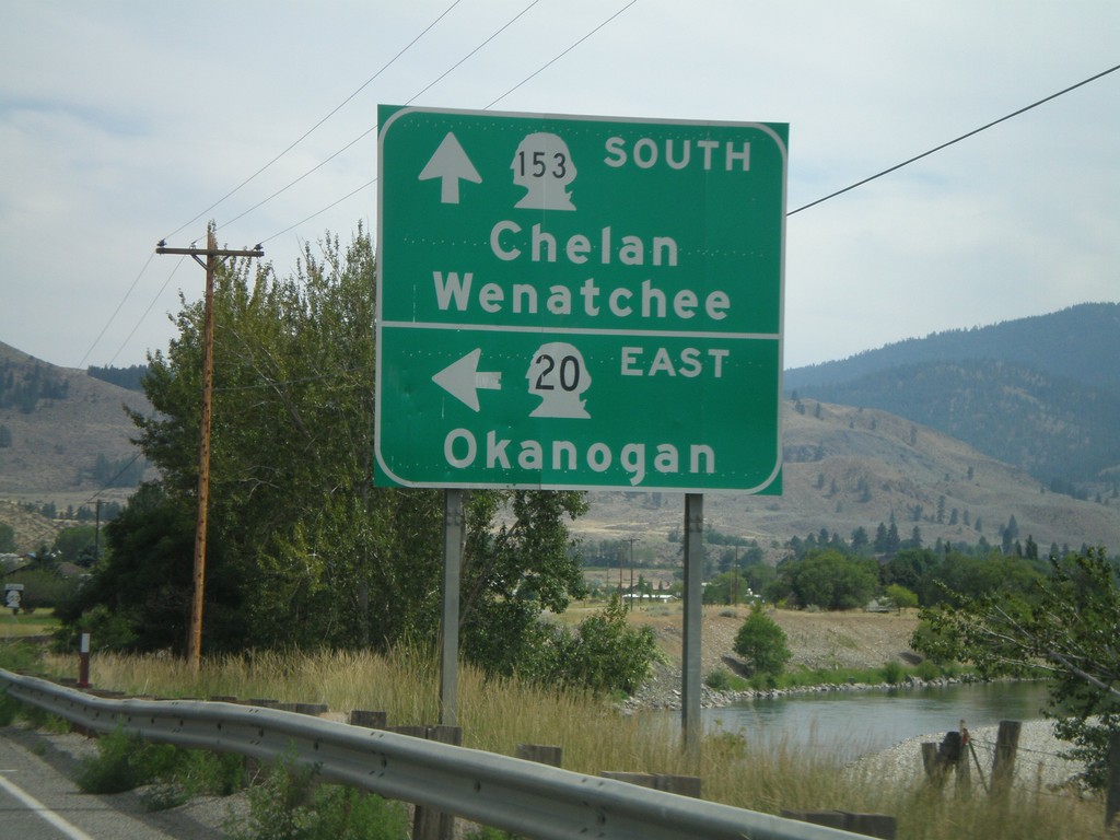
WA-20 East at WA-153 South
WA-20 east to Okanogan at WA-153 south to Chelan and Wenatchee.
Taken 07-26-2008
 Twisp
Okanogan County
Washington
United States
Twisp
Okanogan County
Washington
United States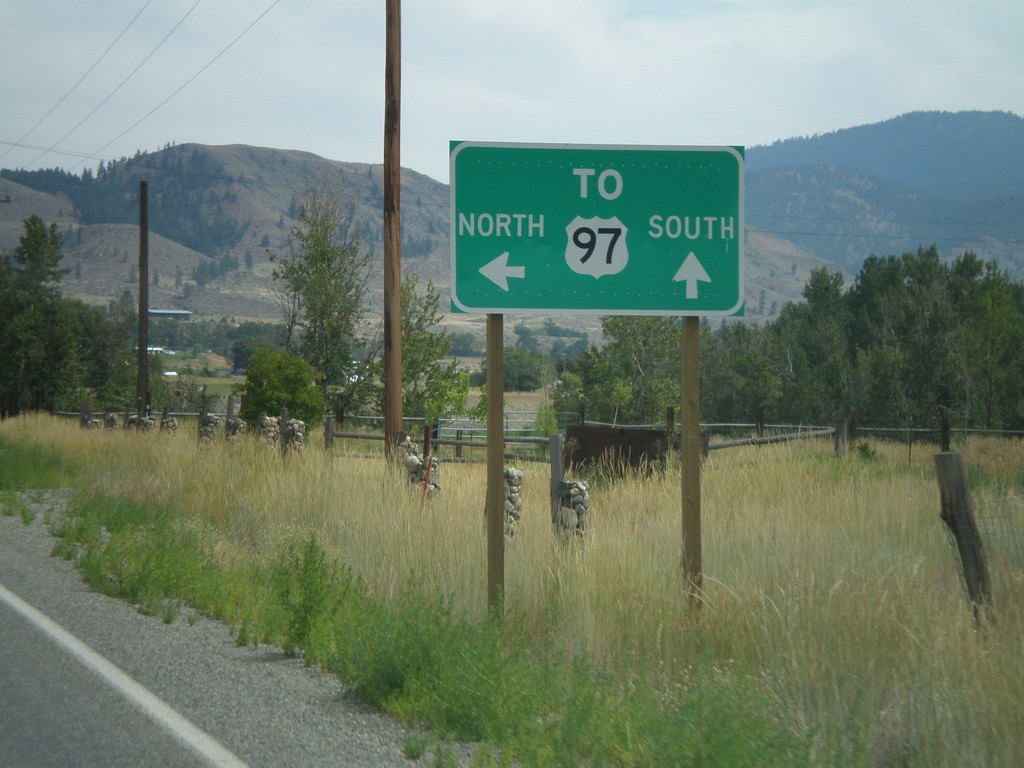
WA-20 East Approaching WA-153
WA-20 east approaching WA-153. For US-97 north use WA-20 east. For US-97 south use WA-153 south.
Taken 07-26-2008
Twisp
Okanogan County
Washington
United States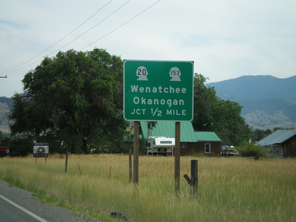
WA-20 East Approaching WA-153
WA-20 east approaching WA-153. WA-20 east heads toward Okanogan. WA-153 heads south towards Wenatchee.
Taken 07-26-2008
Twisp
Okanogan County
Washington
United States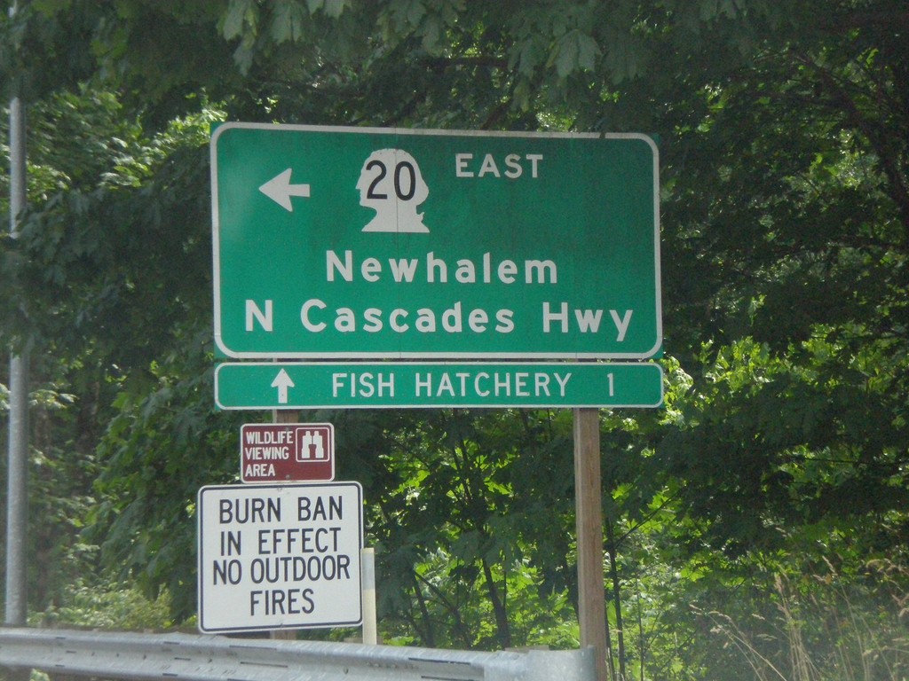
WA-20 East at Cascade River Road
WA-20 East at Cascade River Road. Turn left on WA-20 for Newhalem and North Cascade Highway.
Taken 07-26-2008
Marblemount
Skagit County
Washington
United States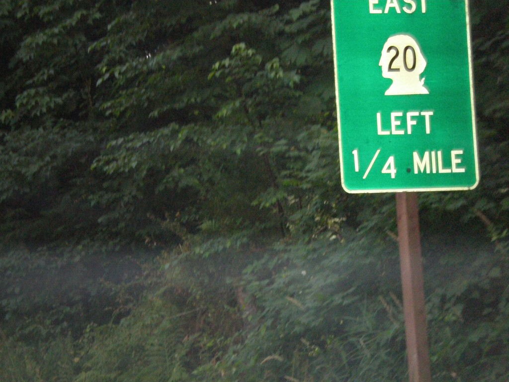
WA-20 East Approaching Cascade River Road
WA-20 east approaching Cascade River Road.
Taken 07-26-2008
Marblemount
Skagit County
Washington
United States
WA-20 East Approaching WA-530
WA-20 east approaching WA-530 to Darrington and Arlington.
Taken 07-26-2008
Rockport
Skagit County
Washington
United States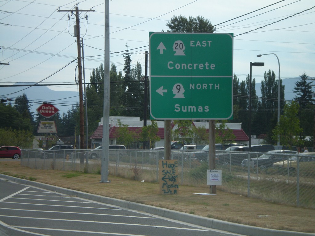
WA-20 East/WA-9 North at WA-9 North
WA-20 East/WA-9 North at WA-9 north to Sumas.
Taken 07-26-2008
 Sedro-Woolley
Skagit County
Washington
United States
Sedro-Woolley
Skagit County
Washington
United States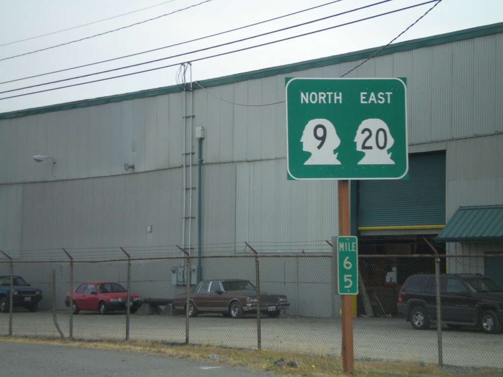
WA-20 East/WA-9 North
WA-20 East/WA-9 North in Sedro-Wooley.
Taken 07-26-2008
Sedro-Woolley
Skagit County
Washington
United States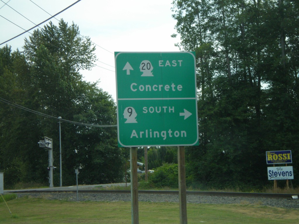
WA-20 East at WA-9 South
WA-20 east at WA-9 south to Arlington. WA-9 joins WA-20 east through Sedro-Wooley.
Taken 07-26-2008
Sedro-Woolley
Skagit County
Washington
United States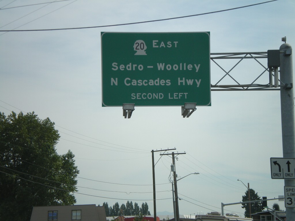
WA-20 East Overhead in Burlington
WA-20 east (Avon. Ave.) approaching N. Cascades Highway. Turn left to continue on WA-20 east to Sedro-Wooley and North Cascades Highway.
Taken 07-26-2008
Burlington
Skagit County
Washington
United States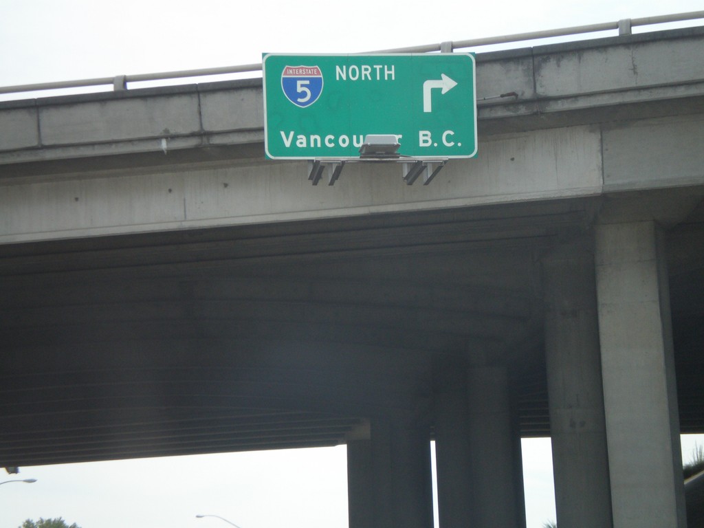
WA-20 East at I-5 North
WA-20 east at I-5 north to Vancouver, BC.
Taken 07-26-2008
 Burlington
Skagit County
Washington
United States
Burlington
Skagit County
Washington
United States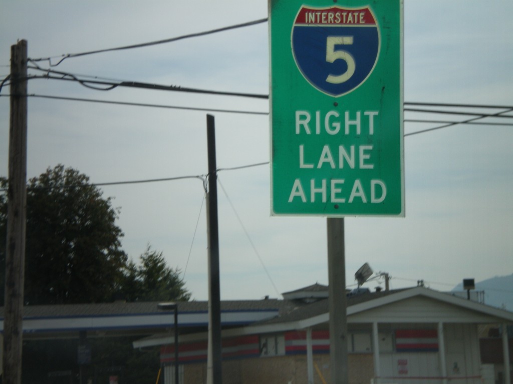
WA-20 East Approaching I-5
WA-20 east approaching I-5. Use right lanes for I-5.
Taken 07-26-2008
Burlington
Skagit County
Washington
United States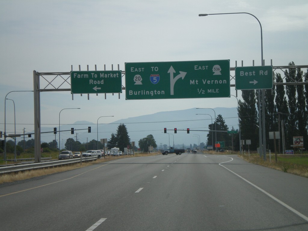
WA-20 East Approaching WA-536 East
WA-20 east at WA-536 East/Mount Vernon. Continue on WA-20 east for Burlington and I-5.
Taken 07-26-2008
 Mount Vernon
Skagit County
Washington
United States
Mount Vernon
Skagit County
Washington
United States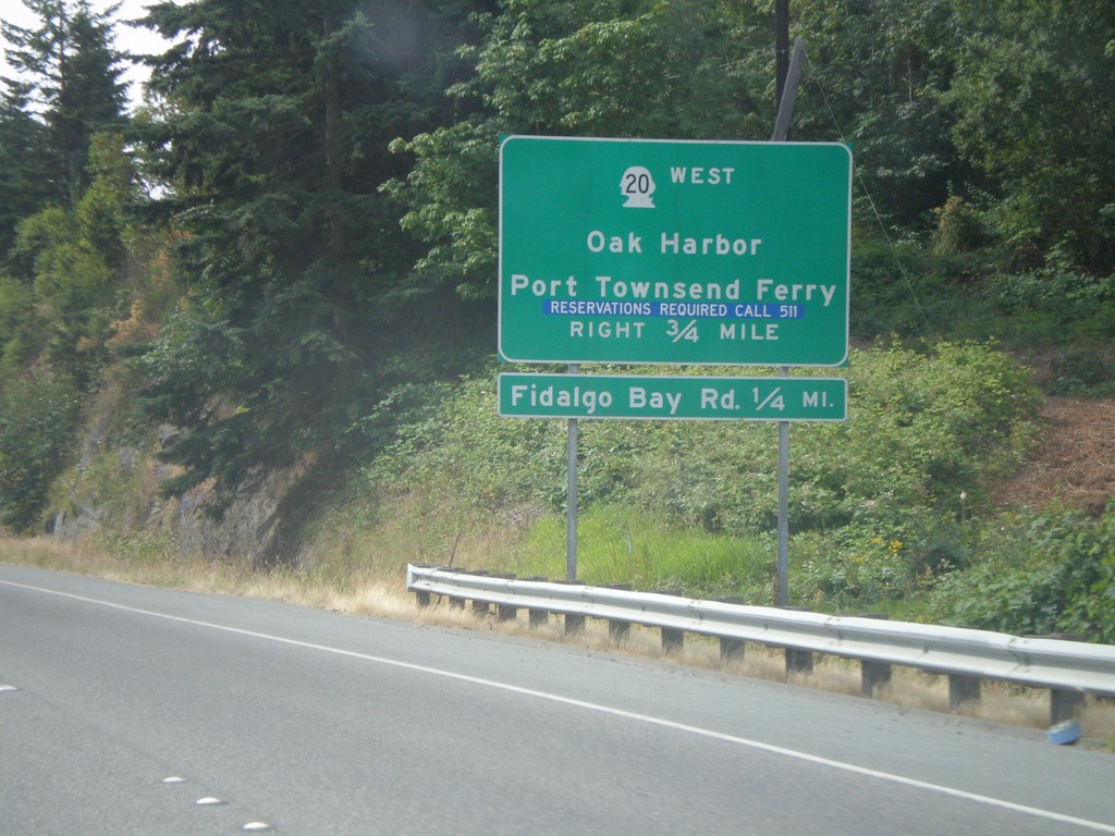
WA-20 Spur East Approaching WA-20
End WA-20 East Spur at WA-20. Turn right for WA-20 West/Oak Harbor/Port Townsend Ferry.
Taken 07-26-2008
 Anacortes
Skagit County
Washington
United States
Anacortes
Skagit County
Washington
United States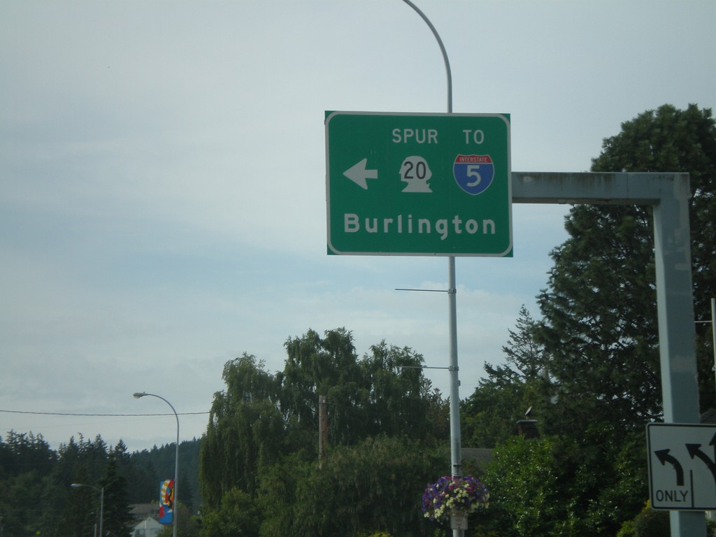
WA-20 Spur East To I-5
WA-20 Spur East/To I-5 in Anacortes to Burlington.
Taken 07-26-2008
Anacortes
Skagit County
Washington
United States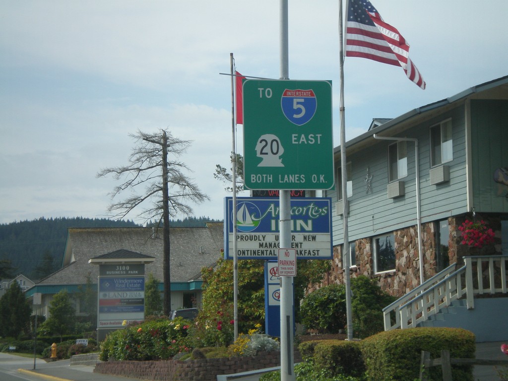
WA-20 Spur East to I-5
WA-20 Spur East (Commercial Ave.) at approaching 36th Ave. to I-5.
Taken 07-26-2008
Anacortes
Skagit County
Washington
United States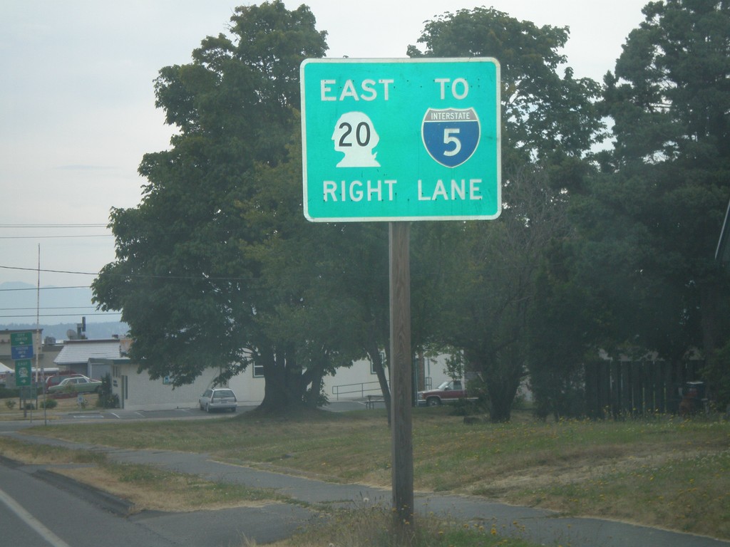
WA-20 Spur East to I-5
WA-20 Spur east (12th Ave.) at Commercial St. to I-5.
Taken 07-26-2008
Anacortes
Skagit County
Washington
United States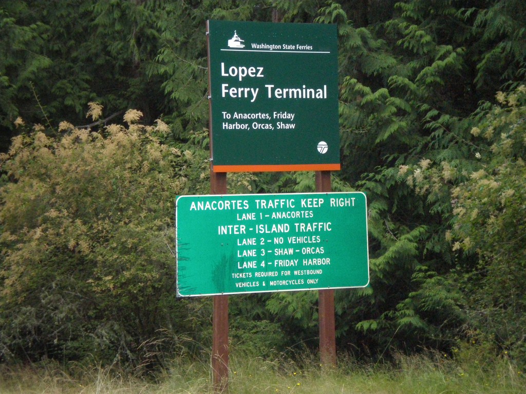
Lopez Ferry Terminal
Ferry Road north on Lopez Island approaching Lopez Ferry Terminal.
Taken 07-25-2008
Lopez Island San Juan County Washington United States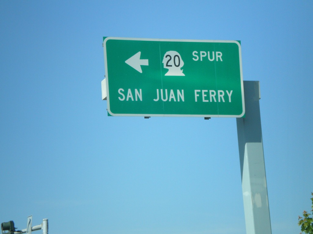
WA-20 Spur West to San Juan Ferry
WA-20 Spur west (Commercial Ave.) at 12th St. Turn left for San Juan Ferry.
Taken 07-24-2008
Anacortes
Skagit County
Washington
United States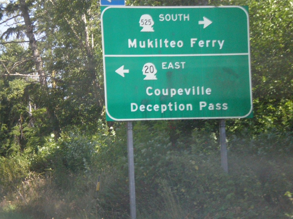
WA-20 East at WA-525 South
WA-20 east at WA-525 South to Mukilteo Ferry. Turn left to continue on WA-20 east to Coupeville and Deception Pass.
Taken 07-24-2008
 Coupeville
Island County
Washington
United States
Coupeville
Island County
Washington
United States