Signs Tagged With Big Green Sign
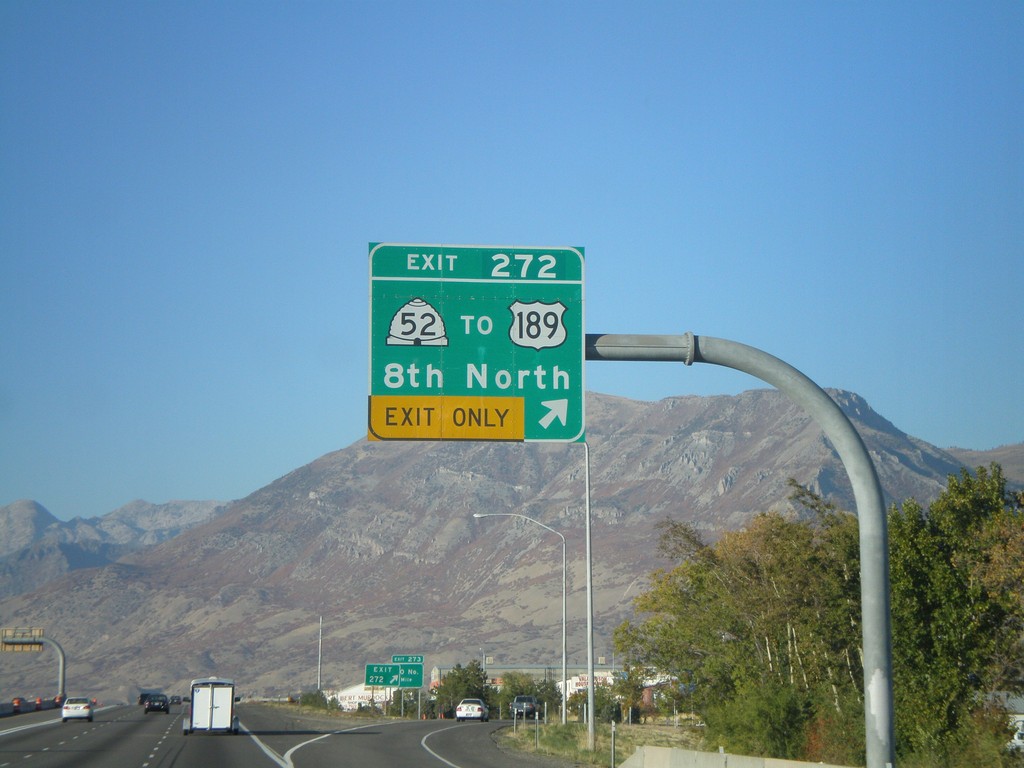
I-15 North - Exit 272
I-15 north at Exit 272 - UT-52/To US-189/8th North.
Taken 10-25-2008


 Orem
Utah County
Utah
United States
Orem
Utah County
Utah
United States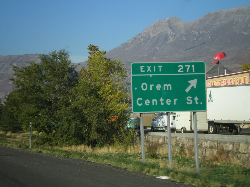
I-15 North - Exit 271
I-15 north at Exit 271 - Orem/Center St.
Taken 10-25-2008
Orem
Utah County
Utah
United States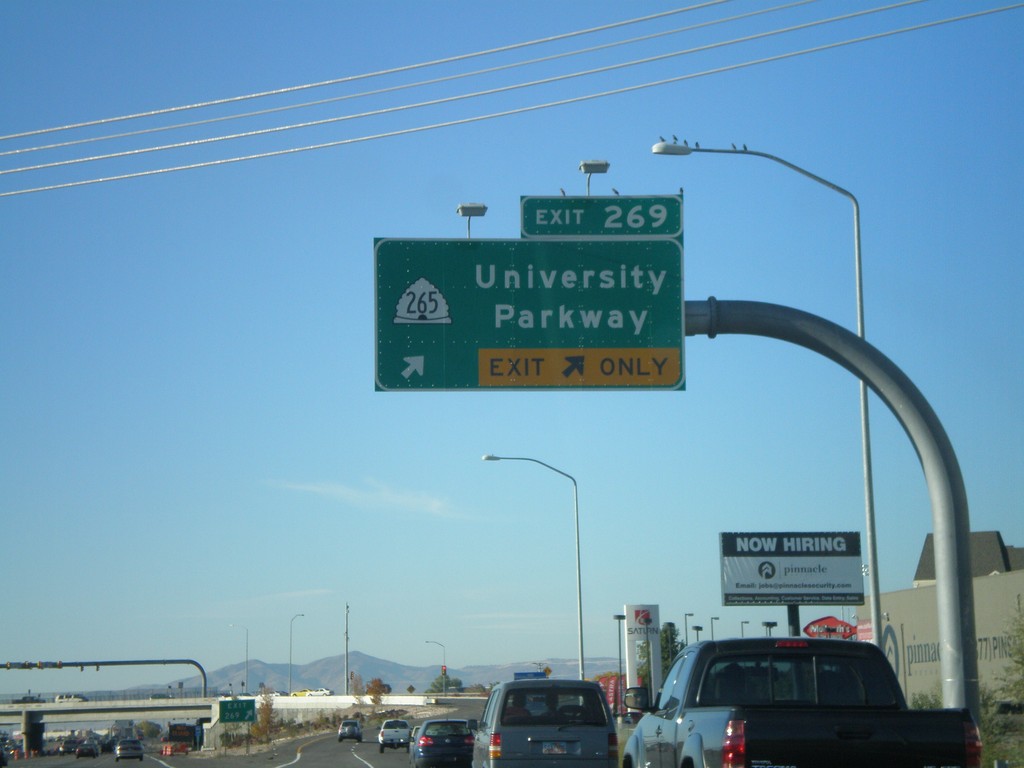
I-15 North - Exit 269
I-15 north at Exit 269 - UT-265/University Parkway.
Taken 10-25-2008
 Orem
Utah County
Utah
United States
Orem
Utah County
Utah
United States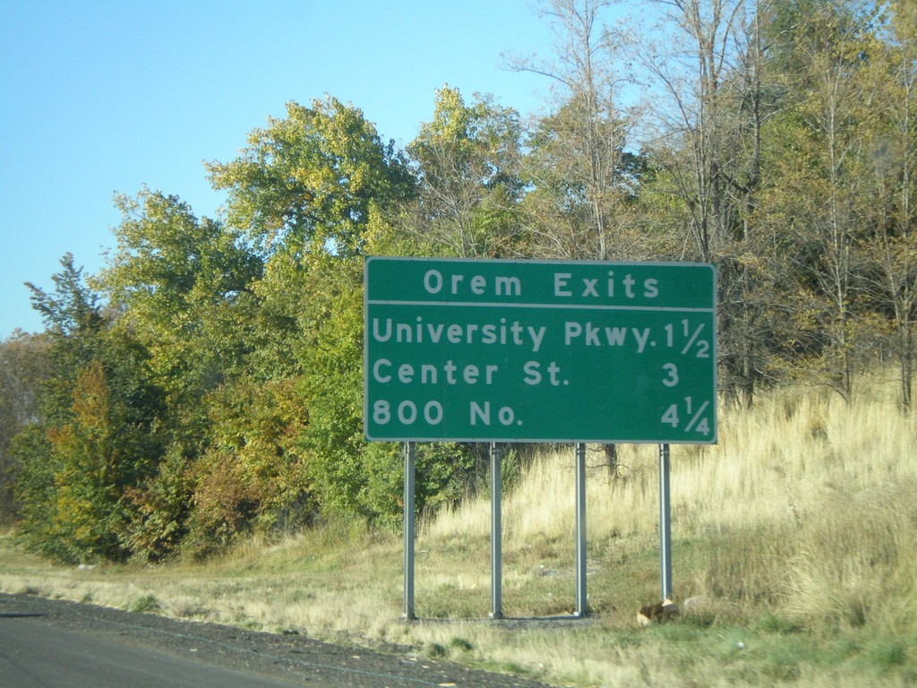
I-15 North - Orem Exits
Orem Exits on I-15 north - University Parkway, Center St., 800 North.
Taken 10-25-2008
Provo
Utah County
Utah
United States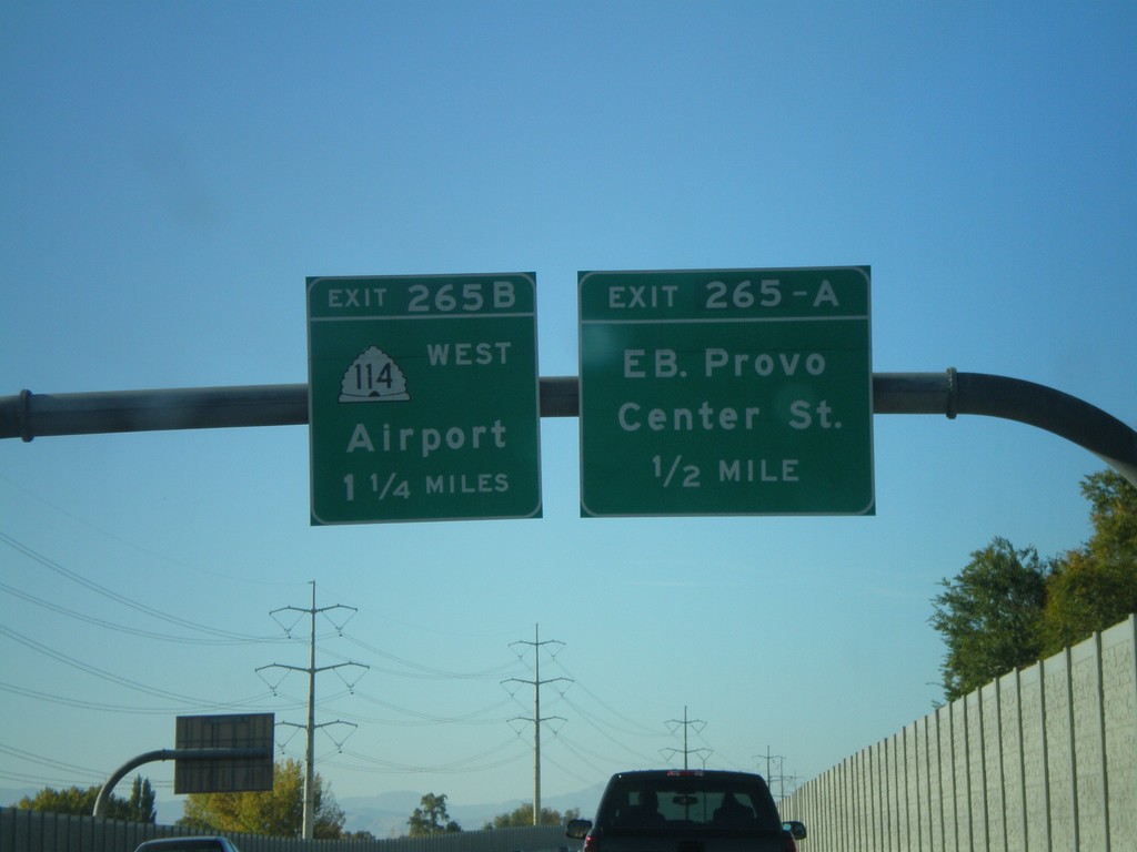
I-15 North - Exit 265A and Exit 265B
I-15 north at Exit 265A - Eastbound Provo Center St. Approaching Exit 265B - UT-114 West/Airport.
Taken 10-25-2008
 Provo
Utah County
Utah
United States
Provo
Utah County
Utah
United States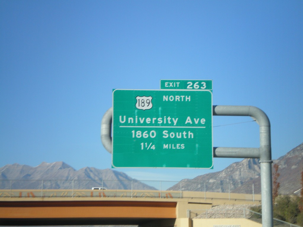
I-15 North - Exit 263
I-15 north approaching Exit 263 - US-189 North/University Ave./1860 South. This is the southern end of US-189.
Taken 10-25-2008
Springville
Utah County
Utah
United States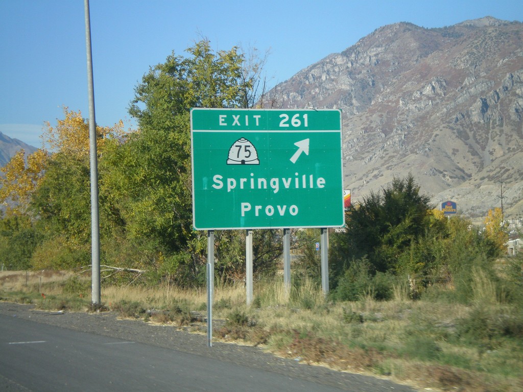
I-15 North - Exit 261
I-15 north at Exit 261 - UT-75/Springville/Provo.
Taken 10-25-2008
 Springville
Utah County
Utah
United States
Springville
Utah County
Utah
United States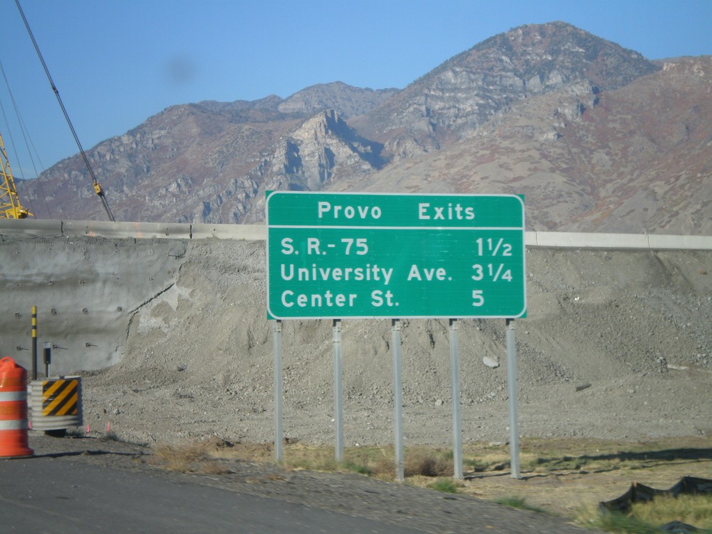
I-15 North - Provo Exits
Next 3 Provo Exits on I-15 north - UT-75, University Ave., and Center St.
Taken 10-25-2008
Springville
Utah County
Utah
United States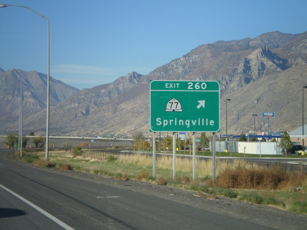
I-15 North - Exit 260
I-15 north at Exit 260 - UT-77/Springville.
Taken 10-25-2008
 Springville
Utah County
Utah
United States
Springville
Utah County
Utah
United States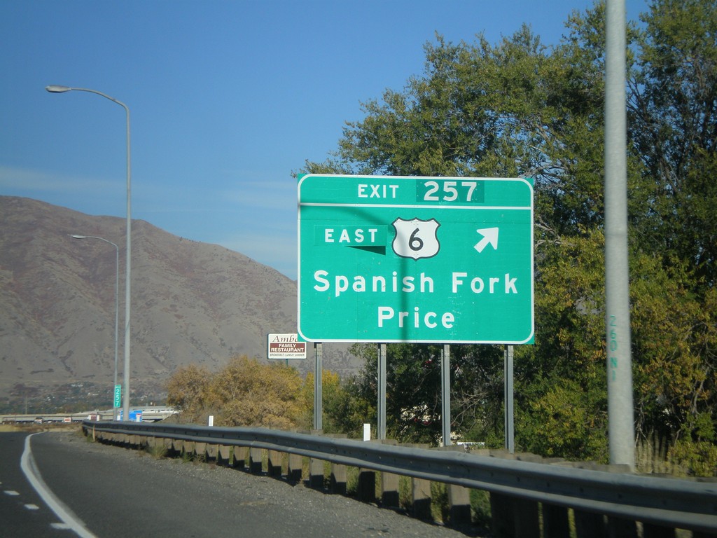
I-15 North - Exit 257
I-15 north at Exit 257 - US-6 East/Spanish Fork/Price. US-6 leaves I-15 north here.
Taken 10-25-2008
 Spanish Fork
Utah County
Utah
United States
Spanish Fork
Utah County
Utah
United States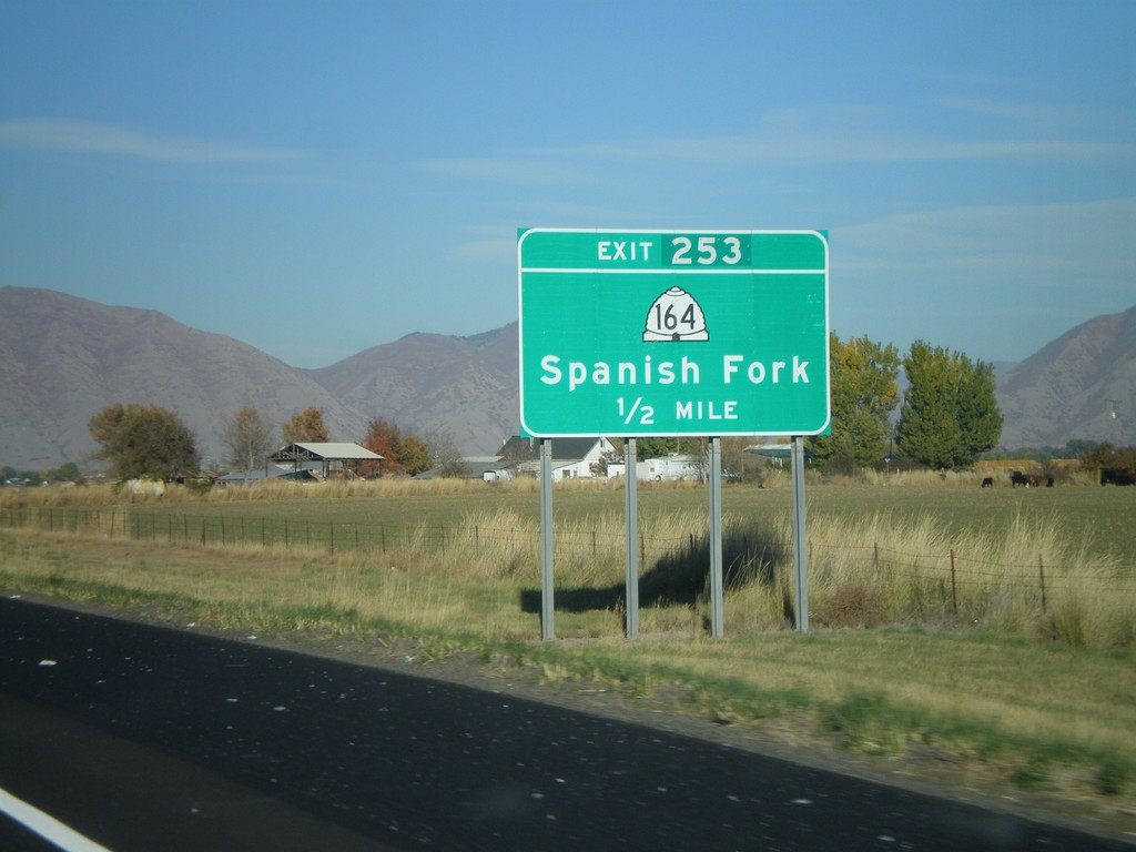
I-15 North - Exit 253
I-15 north approaching Exit 253 - UT-164/Spanish Fork.
Taken 10-25-2008
 Spanish Fork
Utah County
Utah
United States
Spanish Fork
Utah County
Utah
United States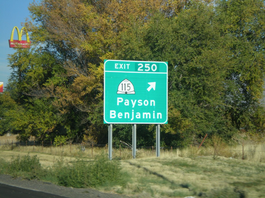
I-15 North - Exit 250
I-15 north at Exit 250 - UT-115/Payson/Benjamin.
Taken 10-25-2008
 Payson
Utah County
Utah
United States
Payson
Utah County
Utah
United States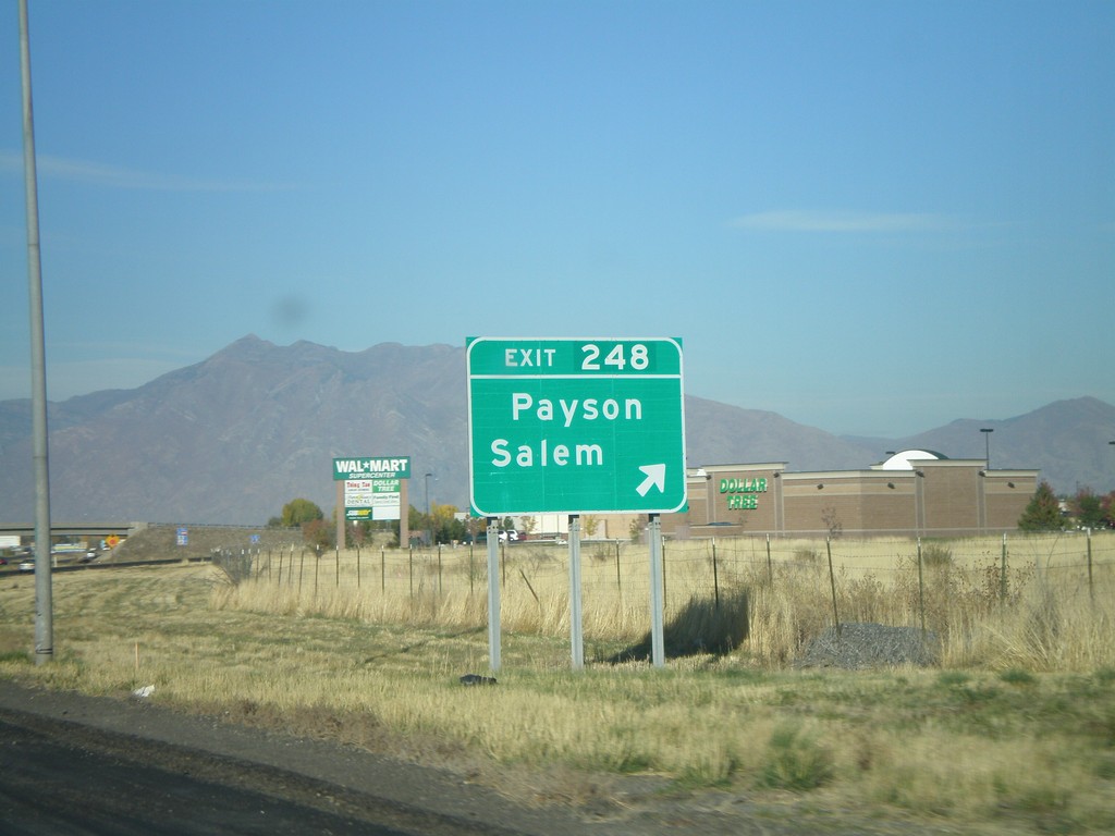
I-15 North - Exit 248
I-15 north at Exit 248 - Payson/Salem.
Taken 10-25-2008
Payson
Utah County
Utah
United States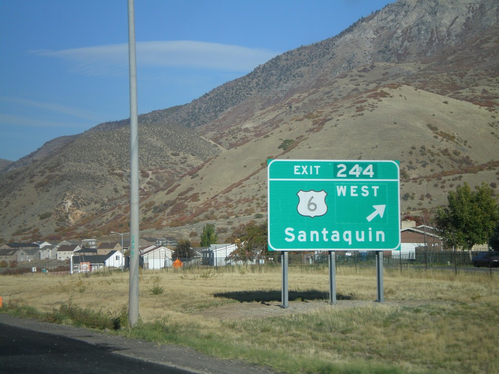
I-15 North - Exit 244
I-15 north at Exit 244 - US-6 West/Santaquin. US-6 joins I-15 north to Spanish Fork.
Taken 10-25-2008
Santaquin
Utah County
Utah
United States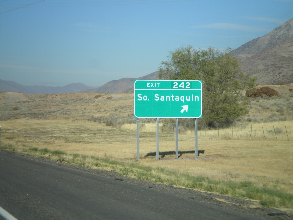
I-15 North - Exit 242
I-15 north at Exit 242 - South Santaquin.
Taken 10-25-2008
Santaquin
Utah County
Utah
United States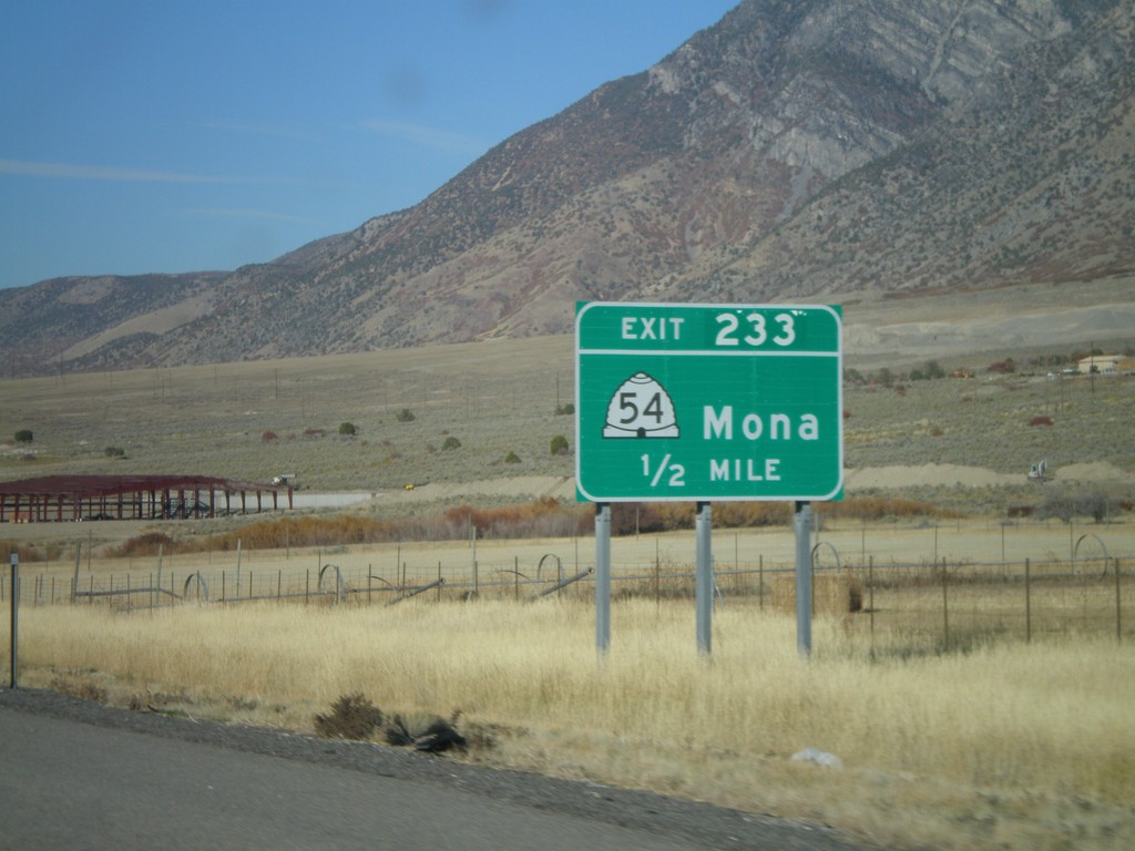
I-15 North - Exit 233
I-15 north approaching Exit 233 - UT-54/Mona.
Taken 10-25-2008
 Mona
Juab County
Utah
United States
Mona
Juab County
Utah
United States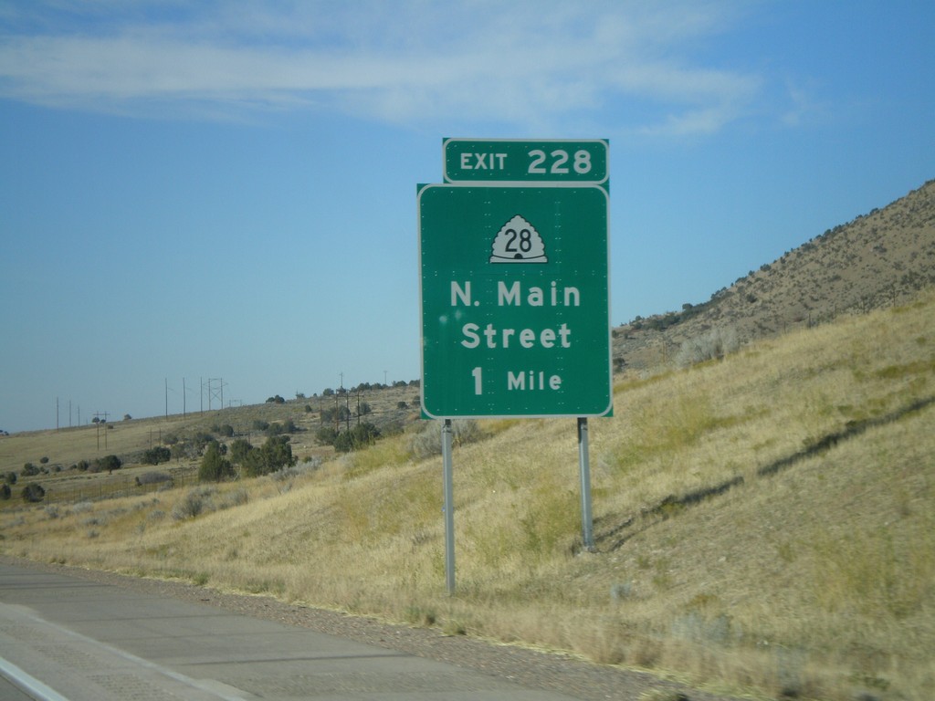
I-15 North - Exit 228
I-15 north approaching Exit 288 - UT-28/North Main St.
Taken 10-25-2008
 Nephi
Juab County
Utah
United States
Nephi
Juab County
Utah
United States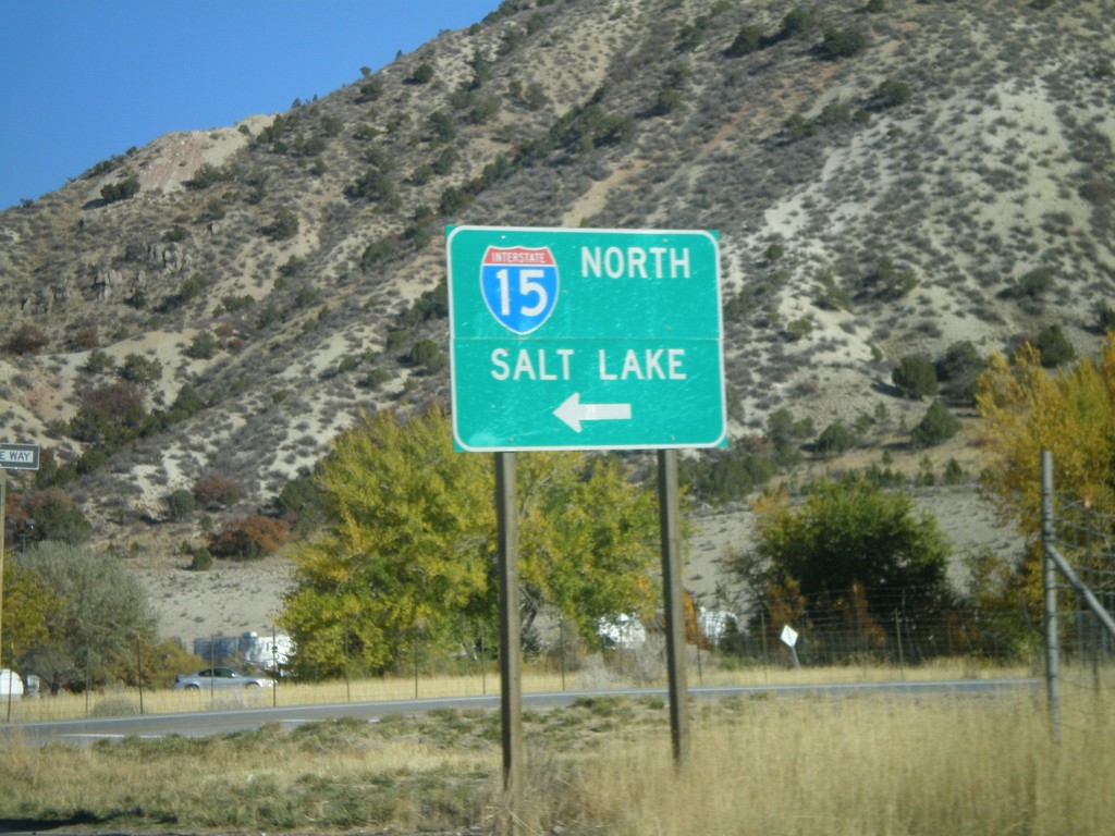
UT-132 East At I-15 North
UT-132 east at I-15 north to Salt Lake City.
Taken 10-25-2008
 Nephi
Juab County
Utah
United States
Nephi
Juab County
Utah
United States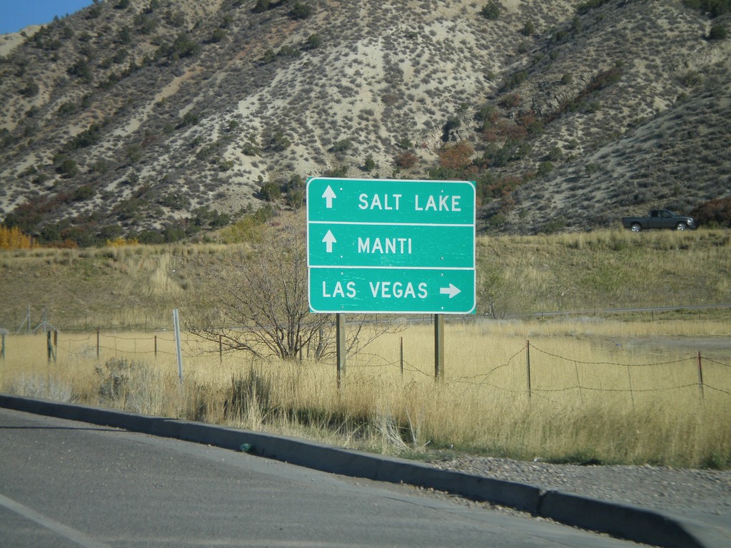
UT-132 East Approaching I-15
UT-132 east approaching I-15. Turn right for I-15 south to Las Vegas (Nevada); straight for I-15 north to Salt Lake, and UT-132 east to Manti.
Taken 10-25-2008
Nephi
Juab County
Utah
United States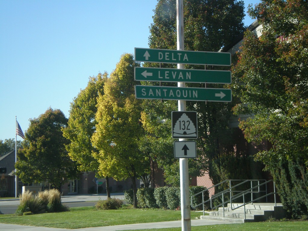
UT-132 West at UT-28
UT-132 west at UT-28. Use UT-28 north for Santaquin. Use UT-28 south for Levan. Continue on UT-132 for Delta.
Taken 10-25-2008
Nephi
Juab County
Utah
United States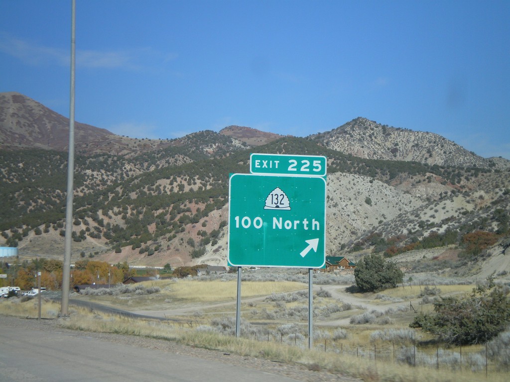
I-15 North - Exit 225
I-15 north at Exit 225 - UT-132/100 North.
Taken 10-25-2008
Nephi
Juab County
Utah
United States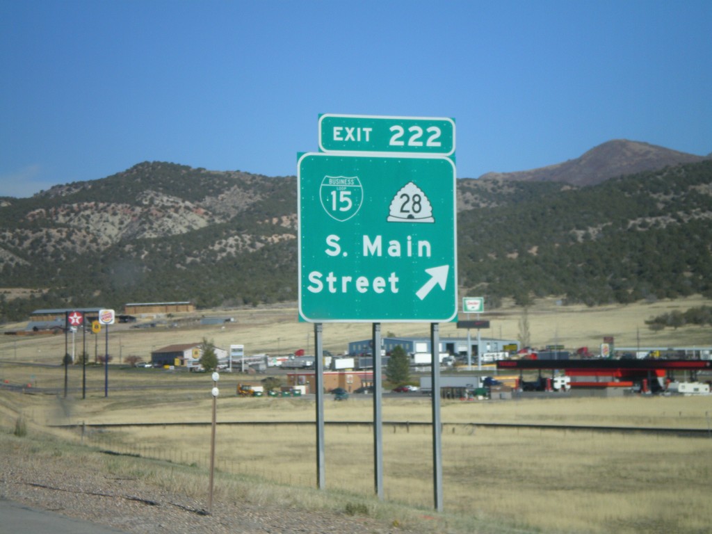
I-15 North - Exit 222
I-15 north at Exit 222 - BL-15/UT-28/S. Main St.
Taken 10-25-2008
 Nephi
Juab County
Utah
United States
Nephi
Juab County
Utah
United States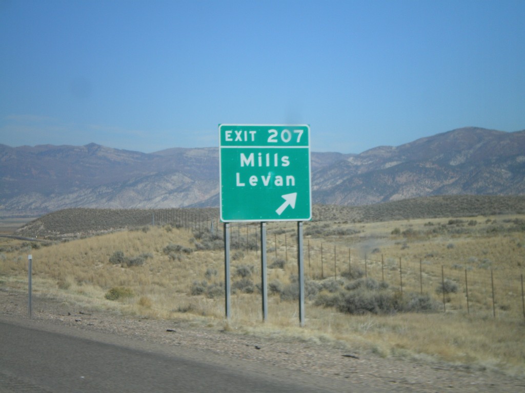
I-15 North - Exit 207
I-15 north at Exit 207 - Mills/Levan.
Taken 10-25-2008
Levan
Juab County
Utah
United States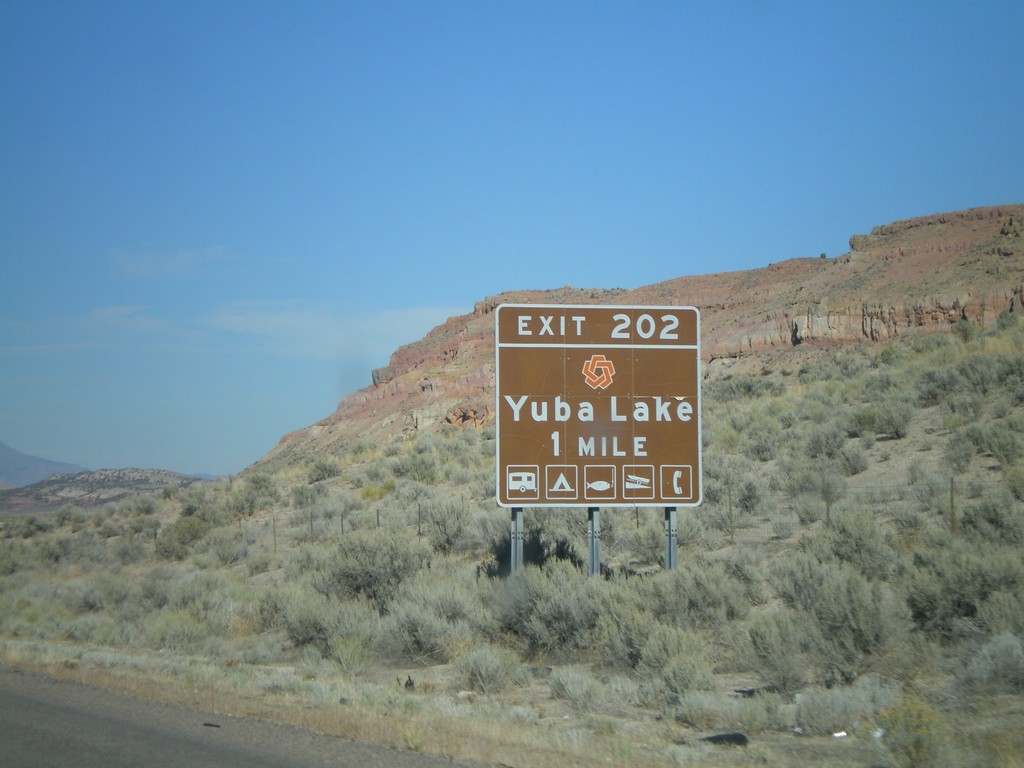
I-15 North - Exit 202
I-15 north approaching Exit 202 - Yuba Lake. The red logo on the top of the sign is for Utah State Parks.
Taken 10-25-2008
Levan
Juab County
Utah
United States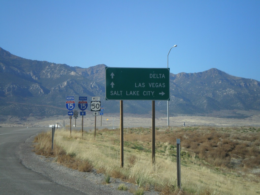
US-50 West at I-15
US-50 west approaching I-15. Use I-15 north for Salt Lake City. Use I-15 south for Las Vegas (Nevada) and Delta (via US-50). US-50 joins I-15 south to Holden.
Taken 10-25-2008
 Scipio
Millard County
Utah
United States
Scipio
Millard County
Utah
United States