Signs Tagged With Big Green Sign
US-64 West - Farmingon Bypass
US-64 West at Bus. US-64 West. Use Bus. US-64 west for Downtown Farmington.
Taken 10-19-2008
 Farmington
San Juan County
New Mexico
United States
Farmington
San Juan County
New Mexico
United States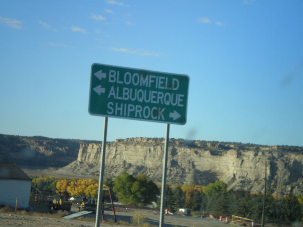
NM-516 South Approaching US-64
NM-516 south approaching US-64. Use US-64 east for Bloomfield and Albuquerque. Use US-64 west for Shiprock.
Taken 10-19-2008
 Farmington
San Juan County
New Mexico
United States
Farmington
San Juan County
New Mexico
United States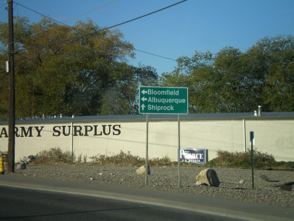
NM-516 South at Browning Parkway
NM-516 south (Main St.) at Browning Parkway. Turn left to continue on NM-516 for Bloomfield and Albuquerque. Continue on Main St.for Shiprock.
Taken 10-19-2008
Farmington
San Juan County
New Mexico
United States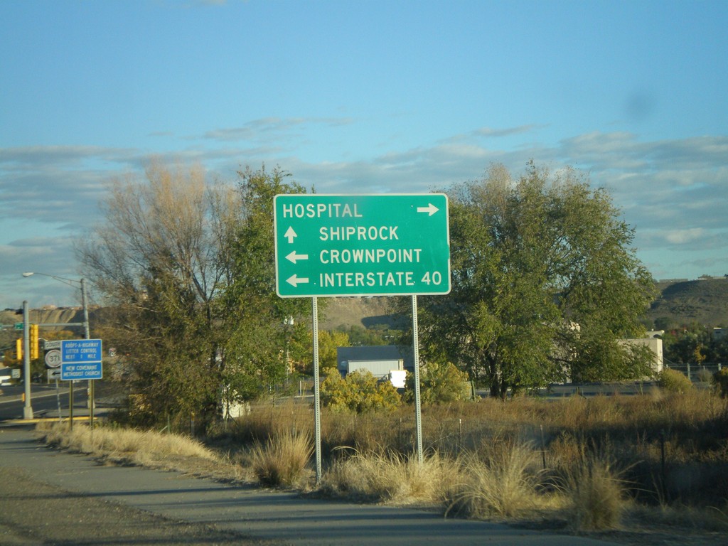
US-64 West Approaching NM-371
US-64 West approaching NM-371 South to Crownpoint and I-40.
Taken 10-19-2008

 Farmington
San Juan County
New Mexico
United States
Farmington
San Juan County
New Mexico
United States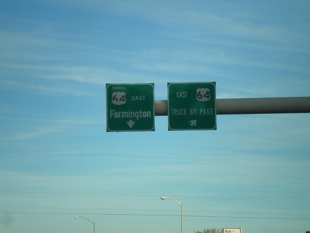
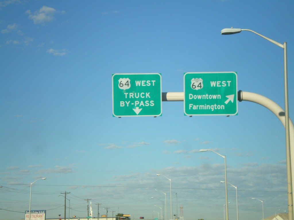
US-64 East - Farmington Bypass
US-64 East at Bus US-64. Use Bus. US-64 for Farmington. Use US-64 for the Truck Bypass.
Taken 10-18-2008
Farmington
San Juan County
New Mexico
United States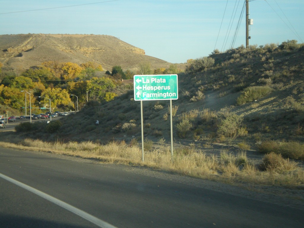
US-64 East at NM-170
US-64 east at NM-170 north to La Plata and Hesperus (CO).
Taken 10-18-2008
 Farmington
San Juan County
New Mexico
United States
Farmington
San Juan County
New Mexico
United States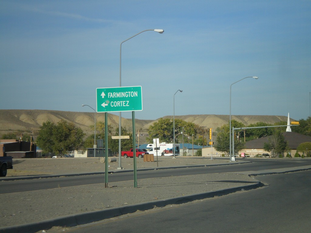
US-64 East/US-491 North Approaching US-491 Jct.
US-64 East/US-491 north at split. Use US-491 north for Cortez (CO). Use US-64 east for Farmington.
Taken 10-18-2008
 Shiprock
San Juan County
New Mexico
United States
Shiprock
San Juan County
New Mexico
United States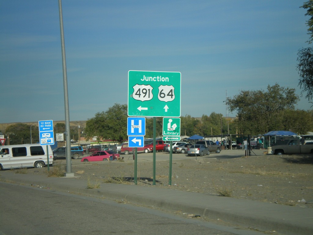
US-64 East/US-491 at Split
US-64 East/US-491 north at split. Turn left for US-491 north.
Taken 10-18-2008
Shiprock
San Juan County
New Mexico
United States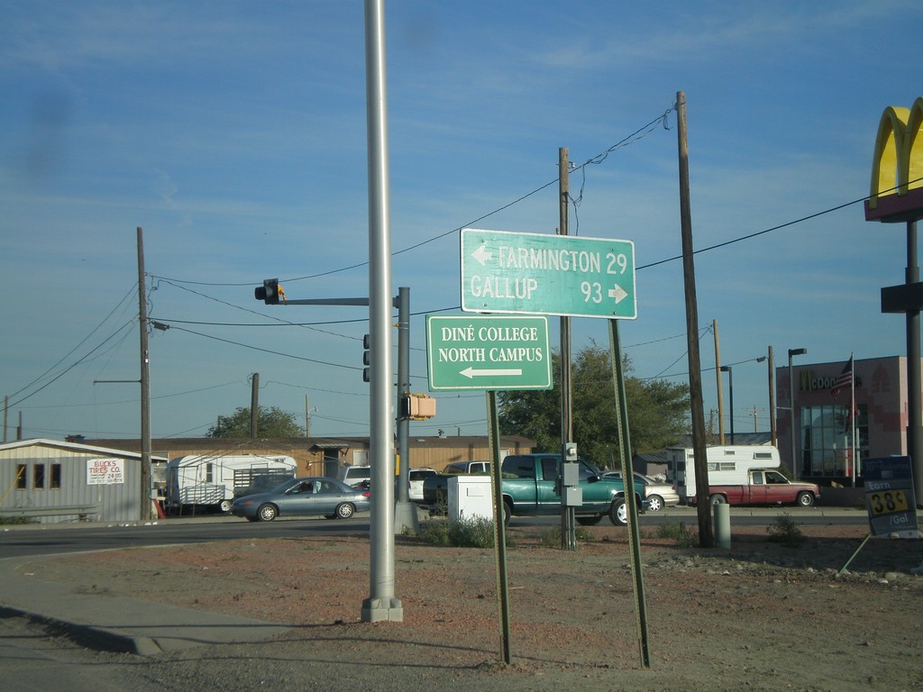
US-64 East at US-491
US-64 east at US-491. Use US-491 south for Gallup. US-491 north joins US-64 through Shiprock.
Taken 10-18-2008
Shiprock
San Juan County
New Mexico
United States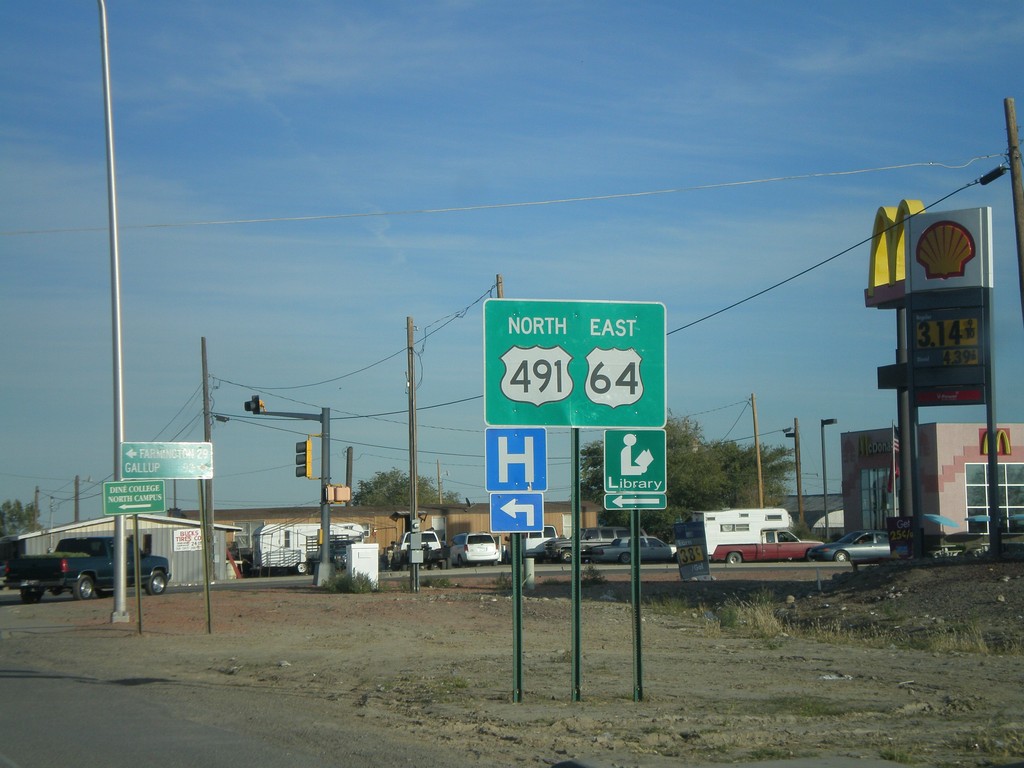
US-64 East Approaching US-491
US-64 east approaching US-491.
Taken 10-18-2008
Shiprock
San Juan County
New Mexico
United States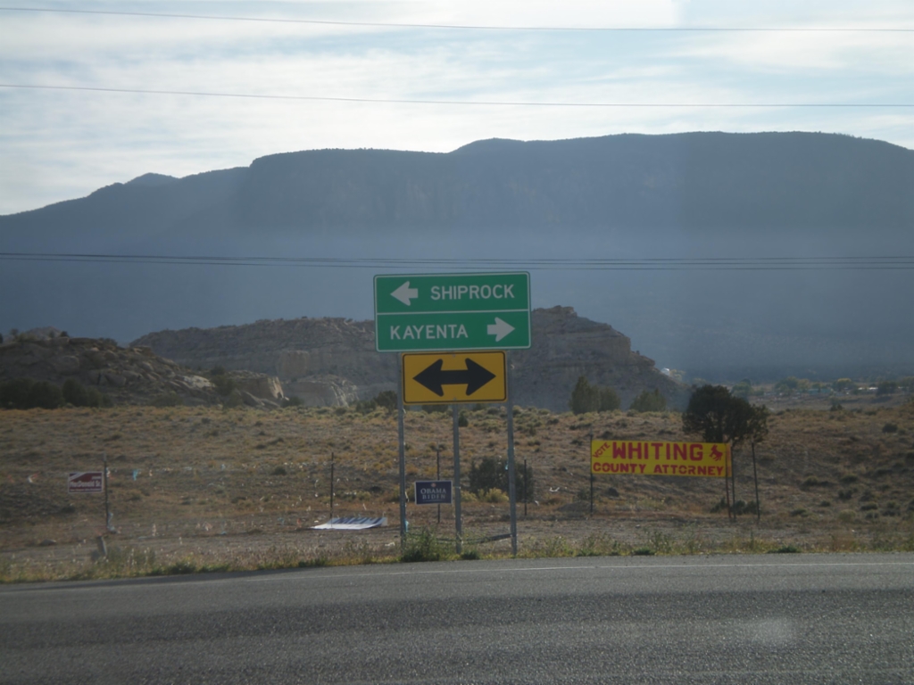
US-160 West at US-64
US-160 west at US-64 east to Shiprock. Use US-160 west for Kayenta.
Taken 10-18-2008
 Teec Nos Pos
Apache County
Arizona
United States
Teec Nos Pos
Apache County
Arizona
United States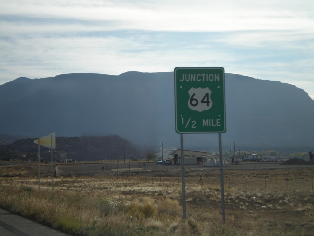
US-160 West Approaching US-64
US-160 west approaching US-64.
Taken 10-18-2008
Teec Nos Pos
Apache County
Arizona
United States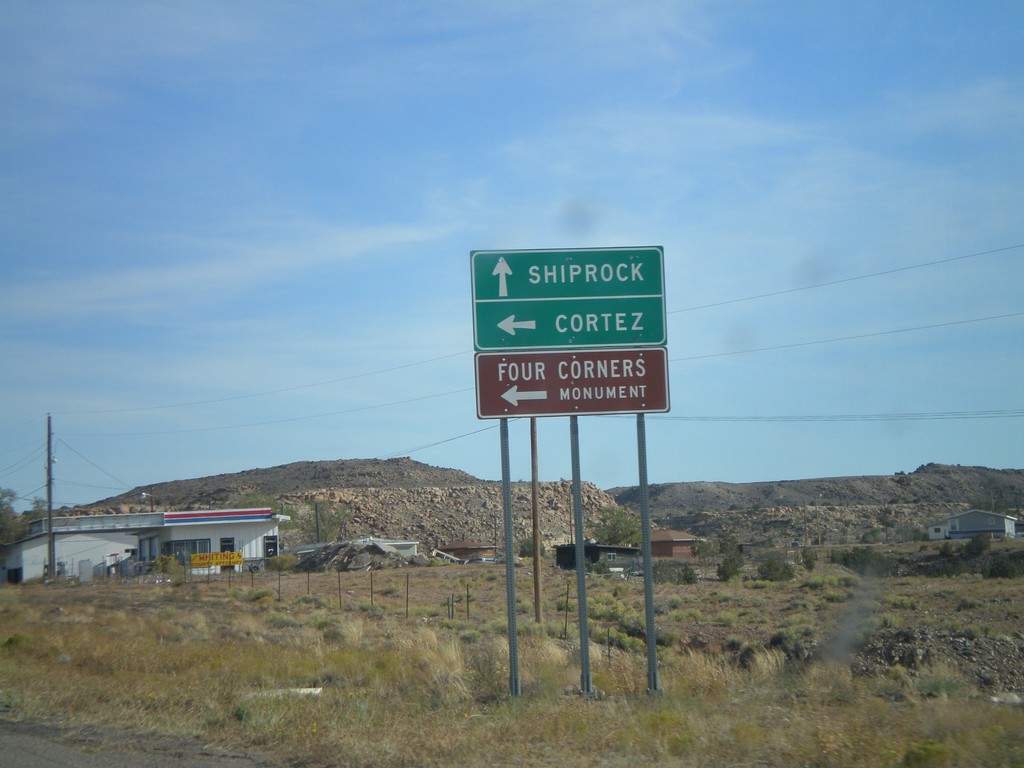
US-160 East at US-64
US-160 east approaching US-64 east to Shiprock (NM). Use US-160 east for Cortez (CO) and Four Corners.
Taken 10-18-2008
Teec Nos Pos
Apache County
Arizona
United States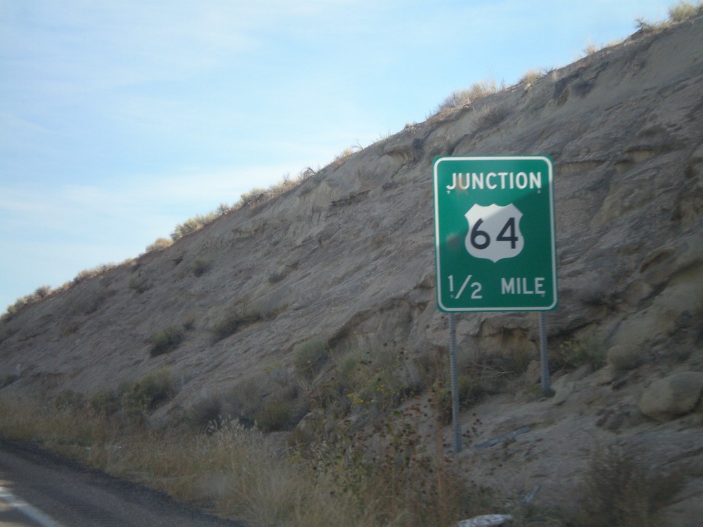
US-160 East Approaching US-64
US-160 east approaching US-64.
Taken 10-18-2008
Teec Nos Pos
Apache County
Arizona
United States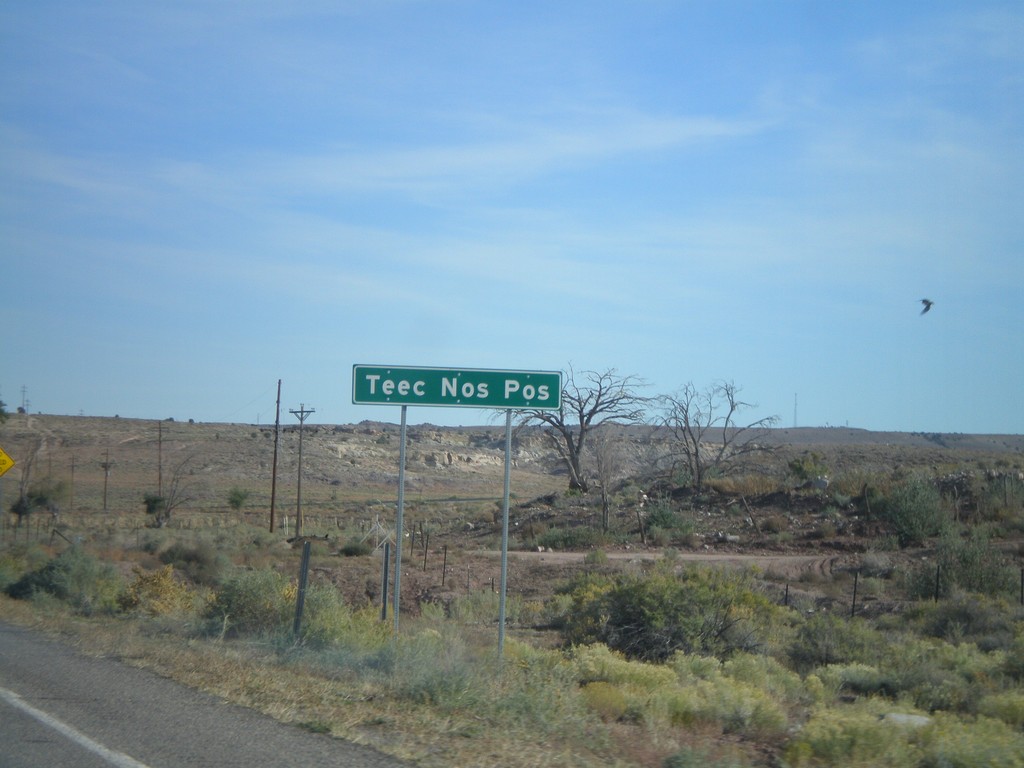
US-160 East - Teec Nos Pos
East US-160 entering Teec Nos Pos
Taken 10-18-2008
Teec Nos Pos
Apache County
Arizona
United States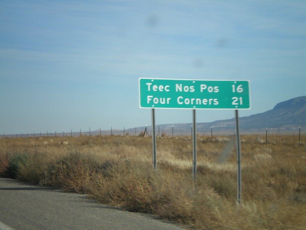
US-160 East - Distance Marker
Distance marker on US-160 east to Teec Nos Pos and Four Corners.
Taken 10-18-2008
Red Mesa
Apache County
Arizona
United States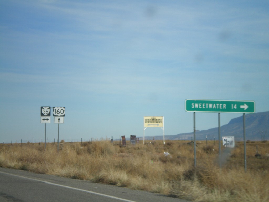
US-160 East at BIA-35
US-160 east at BIA-35. Sweetwater is 14 miles to the south on BIA-35.
Taken 10-18-2008
 Red Mesa
Apache County
Arizona
United States
Red Mesa
Apache County
Arizona
United States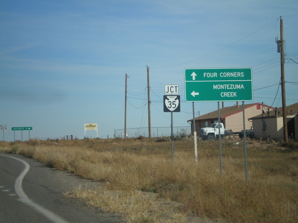
US-160 East at BIA-35
US-160 east approaching BIA-35 north to Montezuma Creek. Continue on US-160 east to Four Corners.
Taken 10-18-2008
Red Mesa
Apache County
Arizona
United States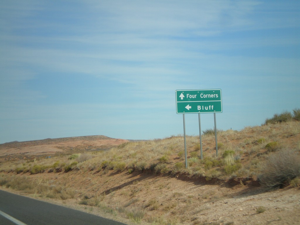
US-160 East at BIA-12 North (US-191)
US-160 east approaching BIA-12 North to US-191 and Bluff (Utah).
Taken 10-18-2008

 Red Mesa
Apache County
Arizona
United States
Red Mesa
Apache County
Arizona
United States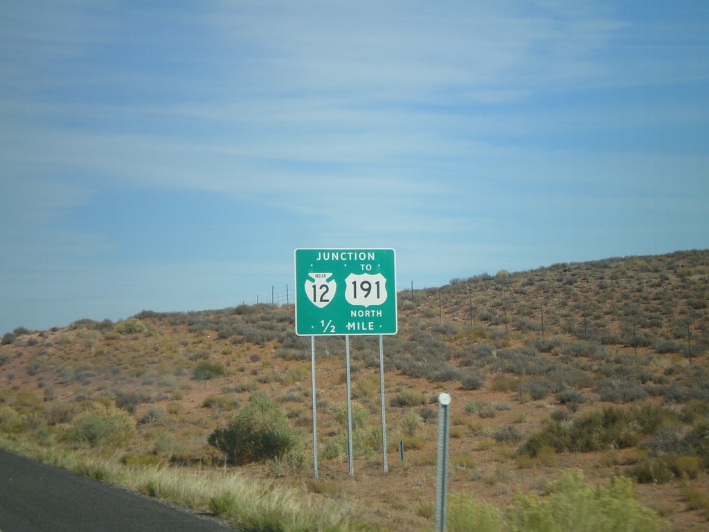
US-160 East Approaching BIA-12/To US-191 North
US-160 east approaching BIA-12 North to US-191.
Taken 10-18-2008
Mexican Water
Apache County
Arizona
United States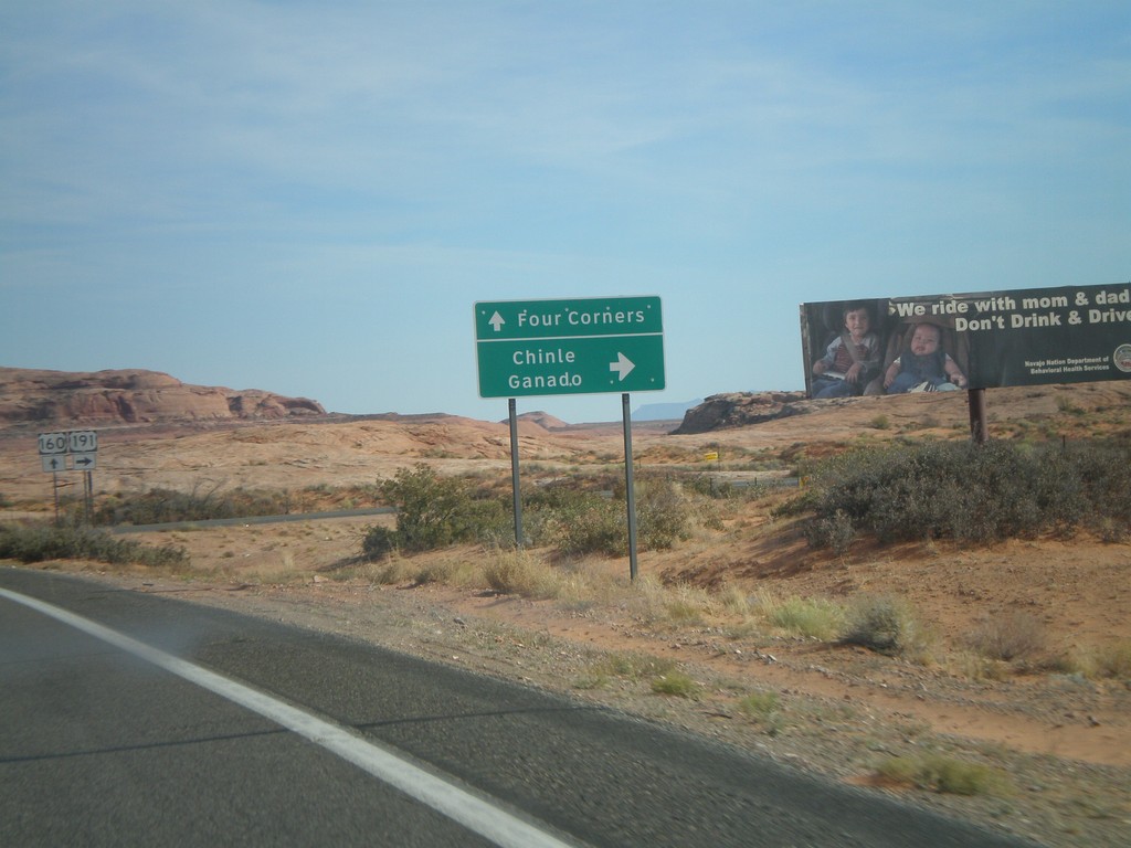
US-160 East at US-191 South
US-160 east at US-191 south to Ganado and Chinle. US-191 joins US-160 east next 3 miles.
Taken 10-18-2008
Mexican Water
Apache County
Arizona
United States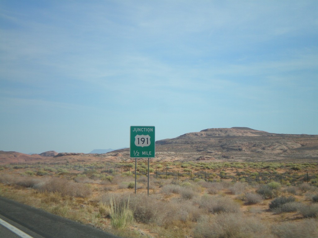
US-160 East Approaching US-191
US-160 east approaching US-191.
Taken 10-18-2008
Mexican Water
Apache County
Arizona
United States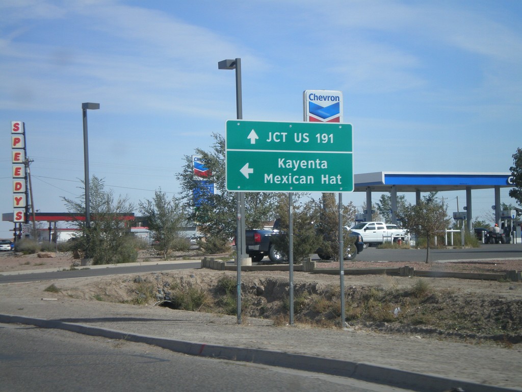
US-160 East at US-163
US-160 east approaching US-163 to Mexican Hat and Kayenta. Continue east on US-160 for US-191.
Taken 10-18-2008
 Kayenta
Navajo County
Arizona
United States
Kayenta
Navajo County
Arizona
United States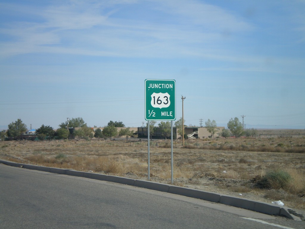
US-160 East Approaching US-163
US-160 east approaching US-163.
Taken 10-18-2008
Kayenta
Navajo County
Arizona
United States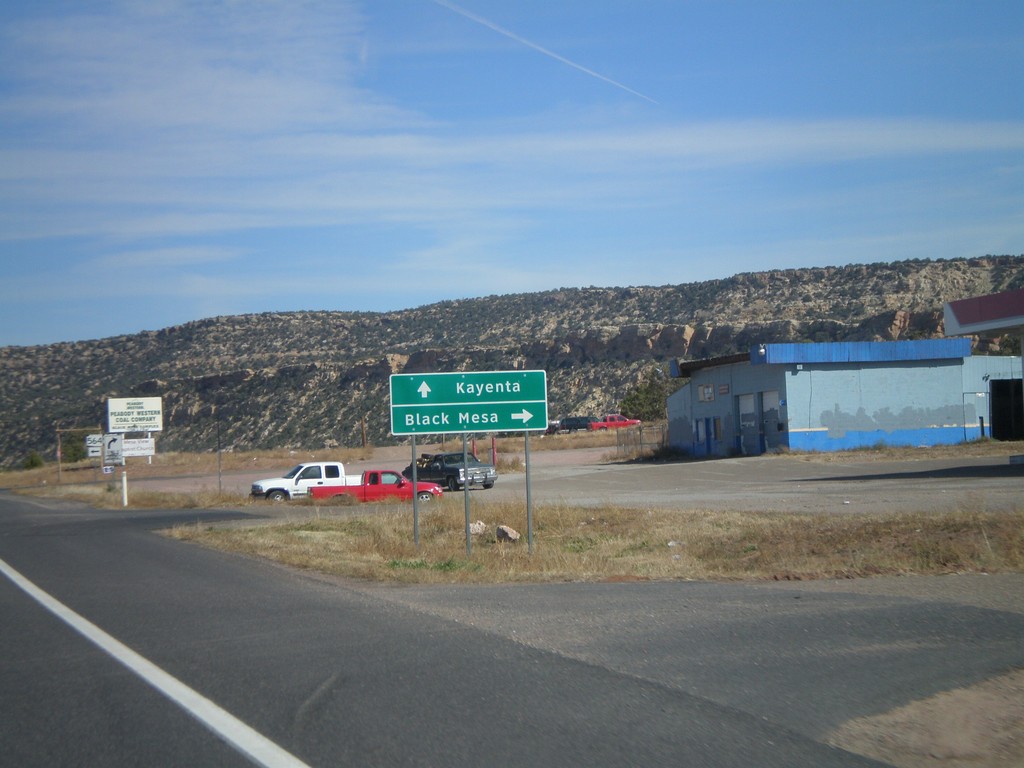
US-160 East at AZ-564
US-160 east at AZ-564.
Taken 10-18-2008
 Shonto
Navajo County
Arizona
United States
Shonto
Navajo County
Arizona
United States