Signs Tagged With Big Green Sign
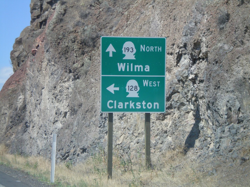
WA-128 West at WA-193 North
WA-128 west at WA-193 north to Wilma. Turn left for WA-128 west to Clarkston.
Taken 07-27-2008

 Clarkston
Asotin County
Washington
United States
Clarkston
Asotin County
Washington
United States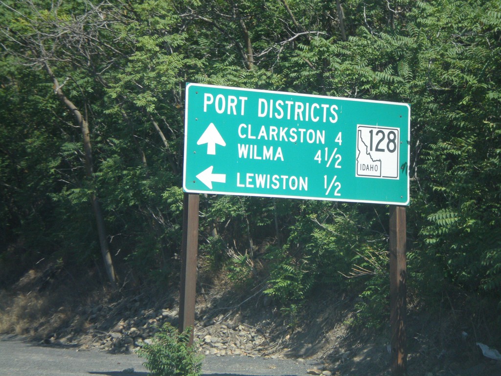
ID-128 West - Port Districts
ID-128 at the Port of Lewiston. Continue ahead for the Ports of Clarkston (WA) and Wilma (WA).
Taken 07-27-2008
 Lewiston
Nez Perce County
Idaho
United States
Lewiston
Nez Perce County
Idaho
United States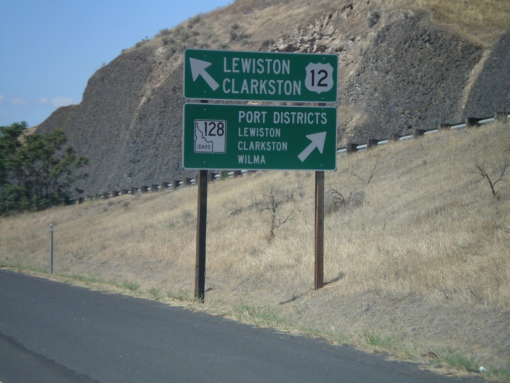
US-12 West at ID-128
US-12 west approaching ID-128 in Lewiston. Merge right for ID-128 west to Lewiston, Clarkston, and Wilma Port Districts. Merge left for US-12 west to Lewiston and Clarkston (WA).
Taken 07-27-2008
 Lewiston
Nez Perce County
Idaho
United States
Lewiston
Nez Perce County
Idaho
United States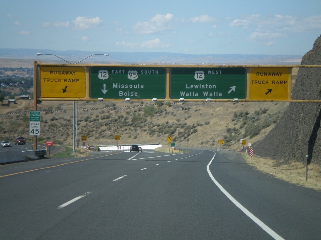
US-95 South at US-12
US-95 south at US-12 junction. Merge right for US-12 West/Lewiston/Walla Walla (Washington). Use left lane for US-95 South/US-12 East/Missoula (Montana)/Boise. Use either lane for access to Runaway Truck Ramps.
Taken 07-27-2008
 Lewiston
Nez Perce County
Idaho
United States
Lewiston
Nez Perce County
Idaho
United States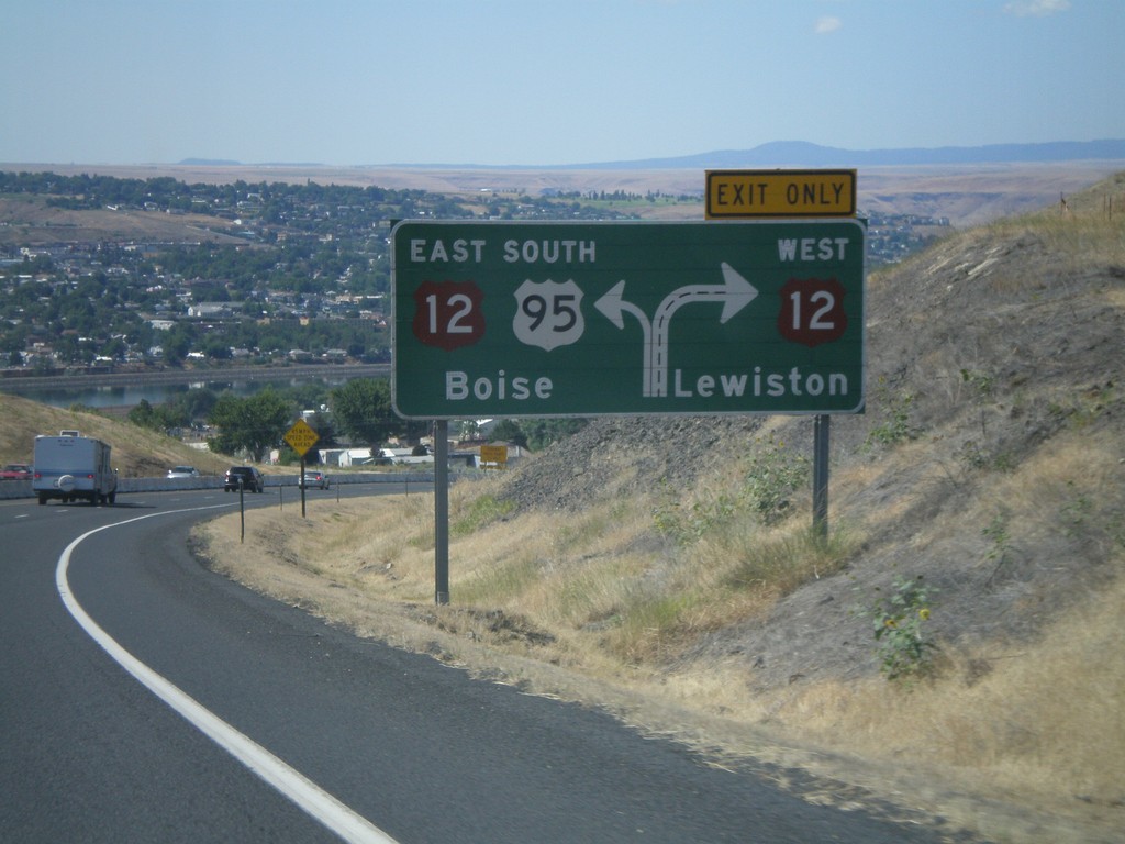
US-95 South Approaching US-12
US-95 south approaching US-12. Use right lane for US-12 west to Lewiston; left lane for US-95 South/US-12 East to Boise.
Taken 07-27-2008
Lewiston
Nez Perce County
Idaho
United States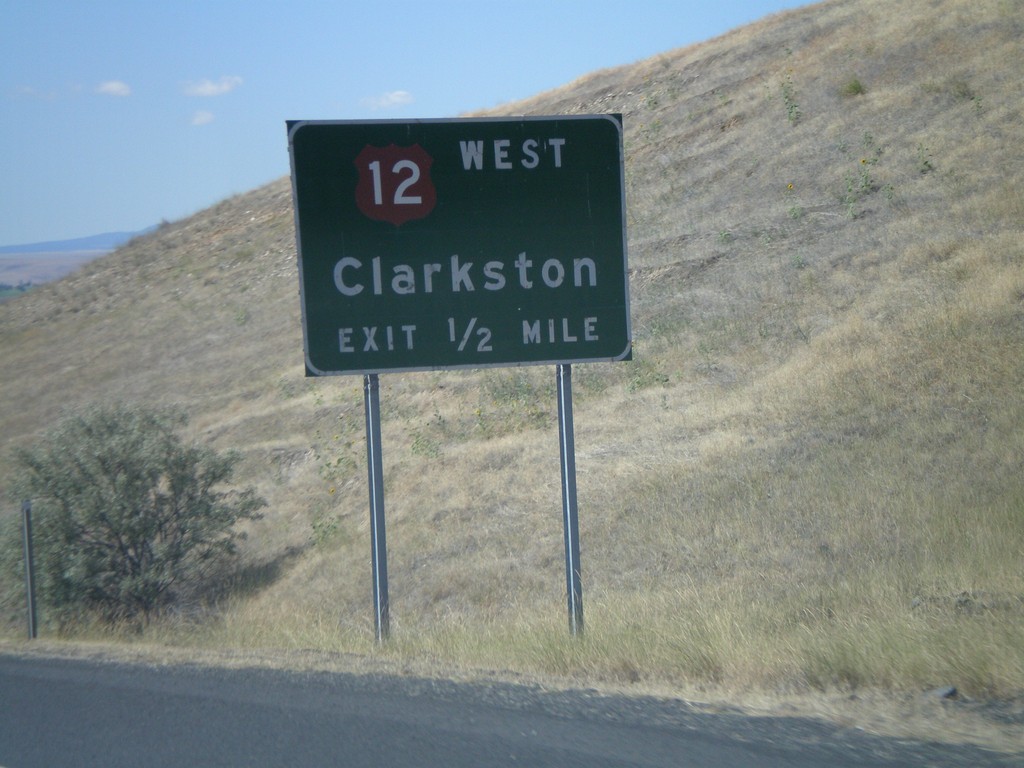
US-95 South Approaching US-12
US-95 south approaching US-12 West - Clarkston at the foot of Lewiston Hill.
Taken 07-27-2008
Lewiston
Nez Perce County
Idaho
United States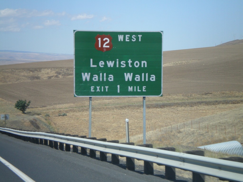
US-95 South Approaching US-12
US-95 South approaching US-12 West to Lewiston and Walla Walla (Washington).
Taken 07-27-2008
Lewiston
Nez Perce County
Idaho
United States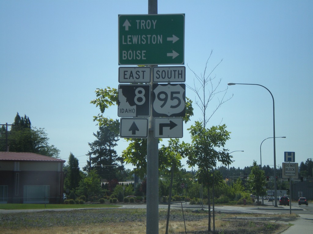
US-95 South/ID-8 Approaching ID-8 East
US-95 South/ID-8 East approaching US-95/ID-8 split. Use ID-8 east for Troy; turn right for US-95 south to Lewiston and Boise.
Taken 07-27-2008
 Moscow
Latah County
Idaho
United States
Moscow
Latah County
Idaho
United States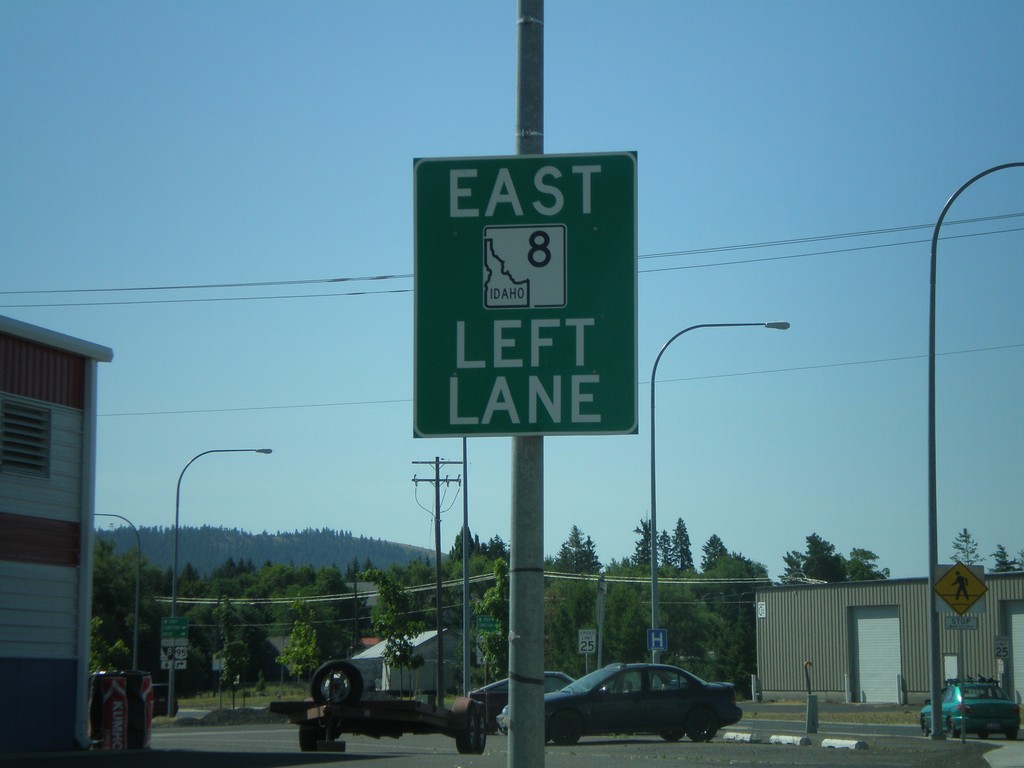
US-95 South/ID-8 Approaching ID-8 East
US-95 South/ID-8 East approaching US-95/ID-8 split in Moscow. Use left lane for ID-8 east.
Taken 07-27-2008
Moscow
Latah County
Idaho
United States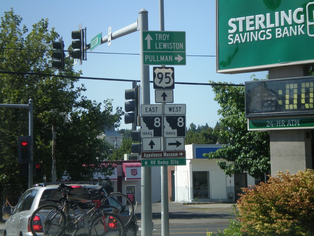
US-95 South at ID-8
US-95 south at ID-8. Turn right for ID-8 west to Pullman (WA). Go straight for US-95 South/ID-8 for Lewiston and Troy (via ID-8). ID-8 joins US-95 through downtown Moscow.
Taken 07-27-2008
Moscow
Latah County
Idaho
United States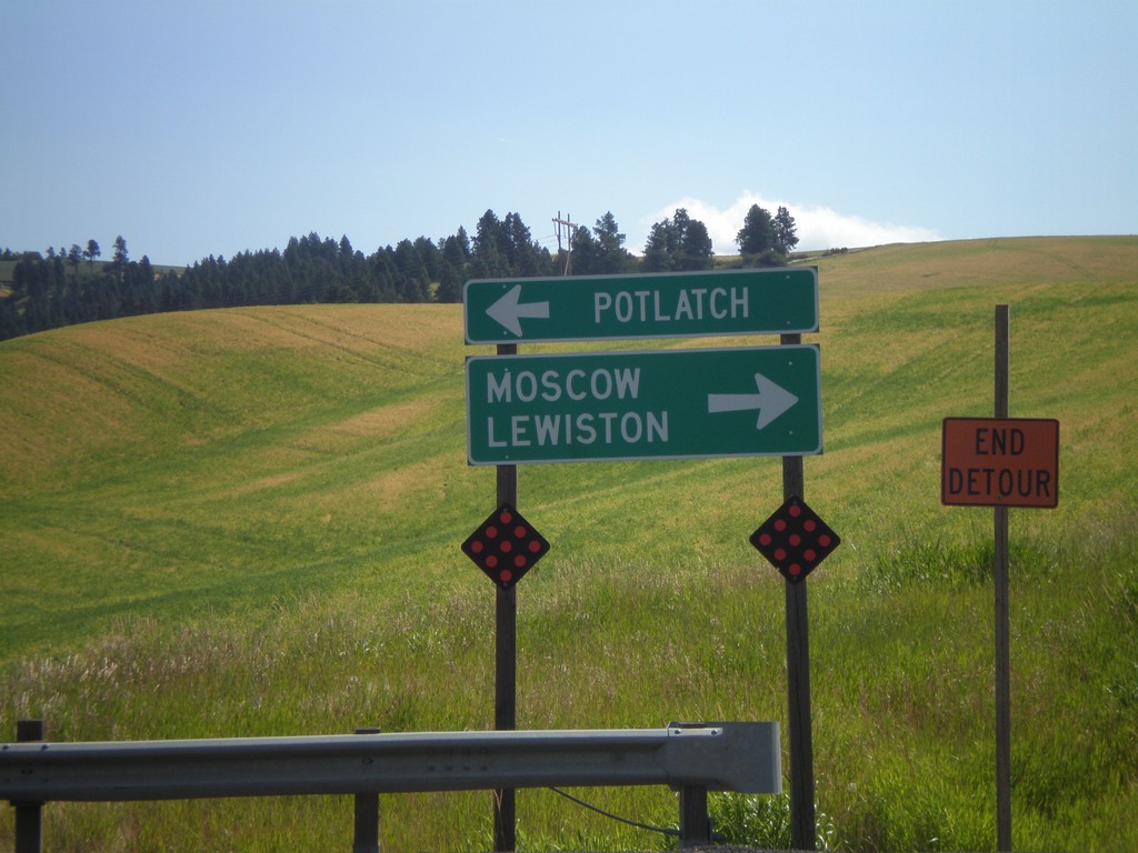
End ID-66 West at US-95
End ID-66 west at US-95. Use US-95 north for Potlatch; use US-95 south for Moscow and Lewiston.
Taken 07-27-2008
 Viola
Latah County
Idaho
United States
Viola
Latah County
Idaho
United States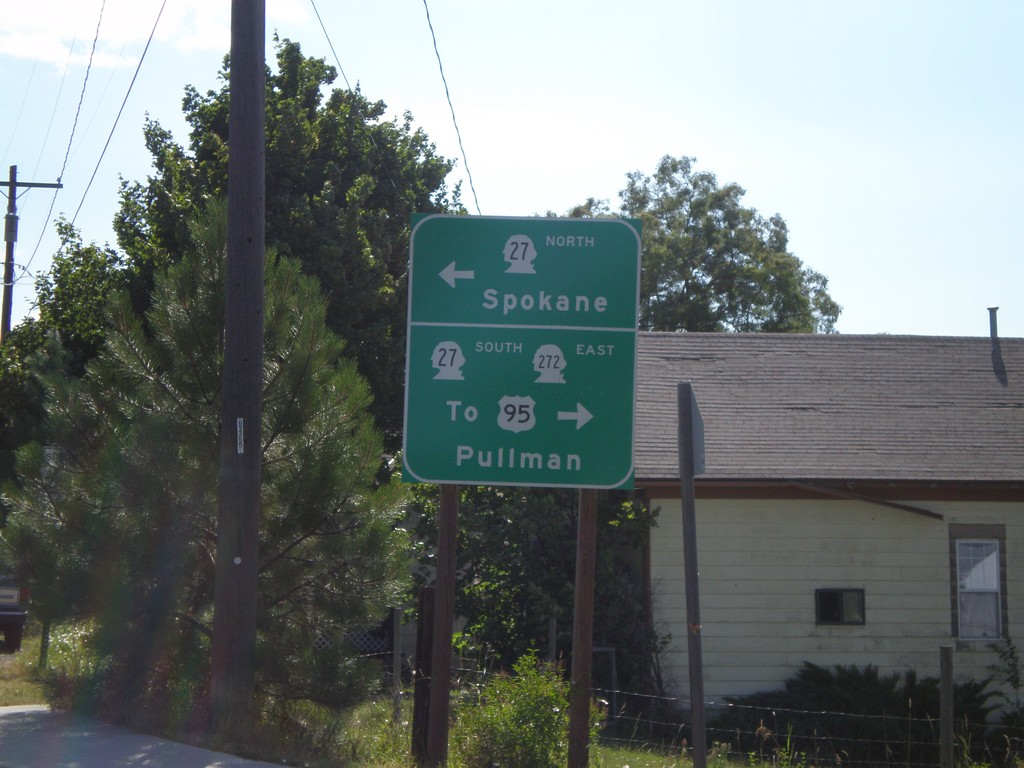
WA-272 East at WA-27
WA-272 east at WA-27. Use WA-27 north for Spokane. Use WA-27 South for WA-272 East/To US-95/Pullman.
Taken 07-27-2008

 Palouse
Whitman County
Washington
United States
Palouse
Whitman County
Washington
United States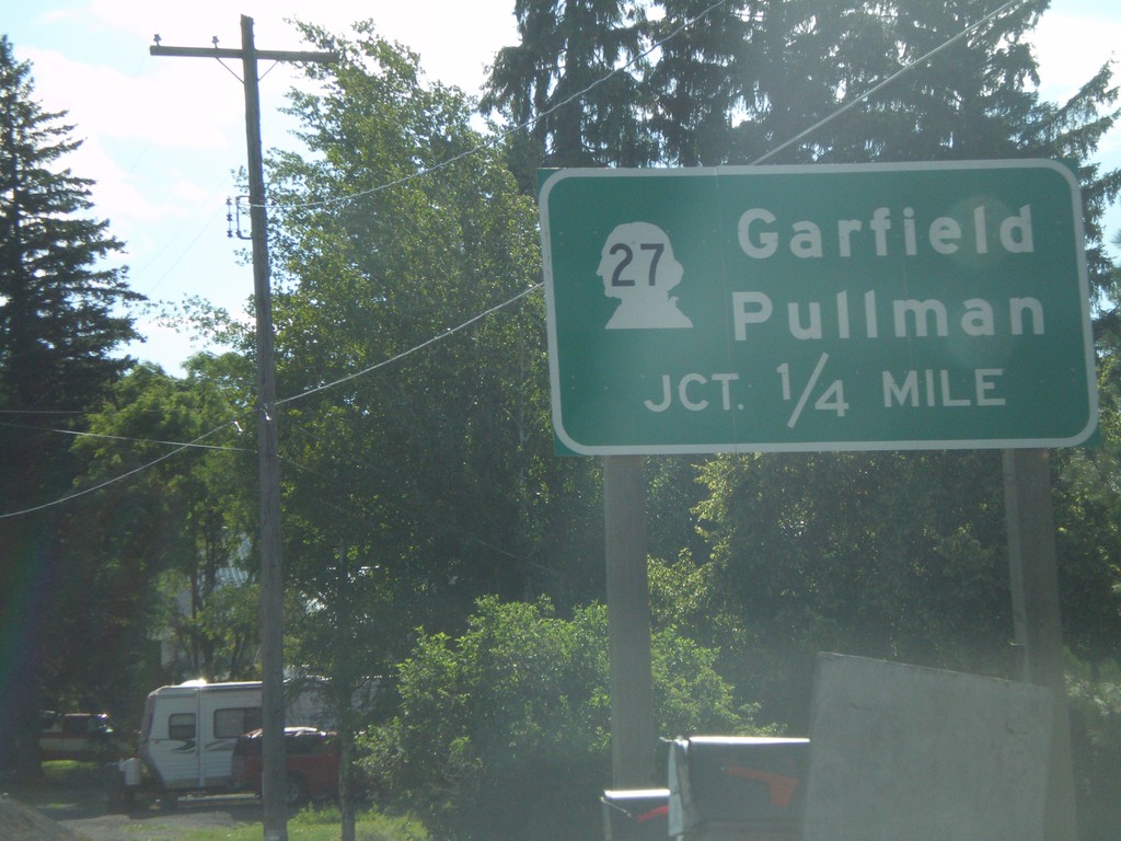
WA-272 East Approaching WA-27
WA-272 east approaching WA-27 to Garfield and Pullman.
Taken 07-27-2008
Palouse
Whitman County
Washington
United States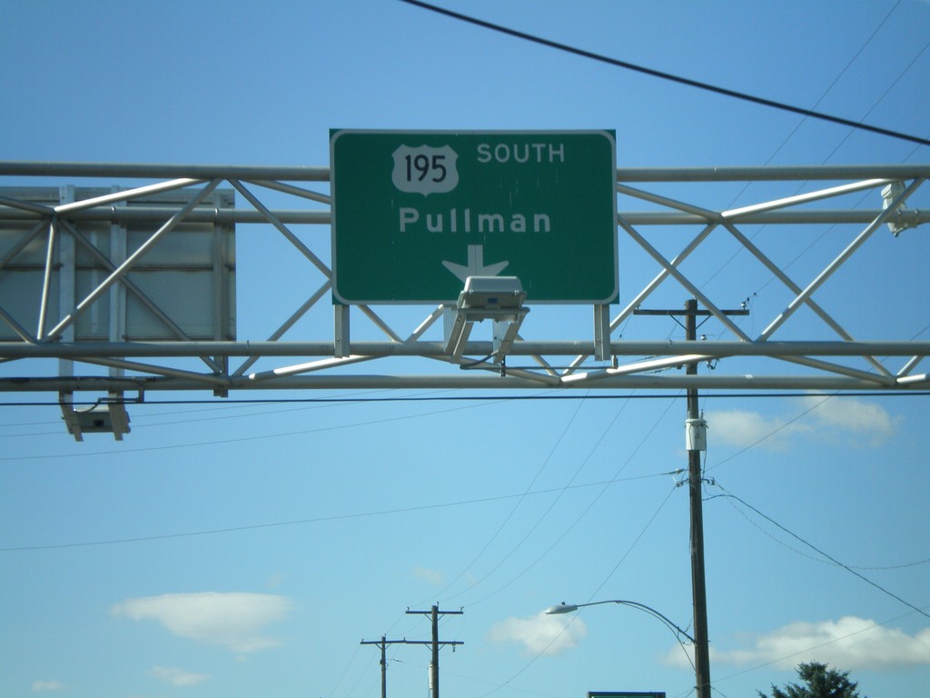
US-195 South - Pullman Overhead
US-195 South/Pullman overhead just south of WA-26.
Taken 07-27-2008

 Colfax
Whitman County
Washington
United States
Colfax
Whitman County
Washington
United States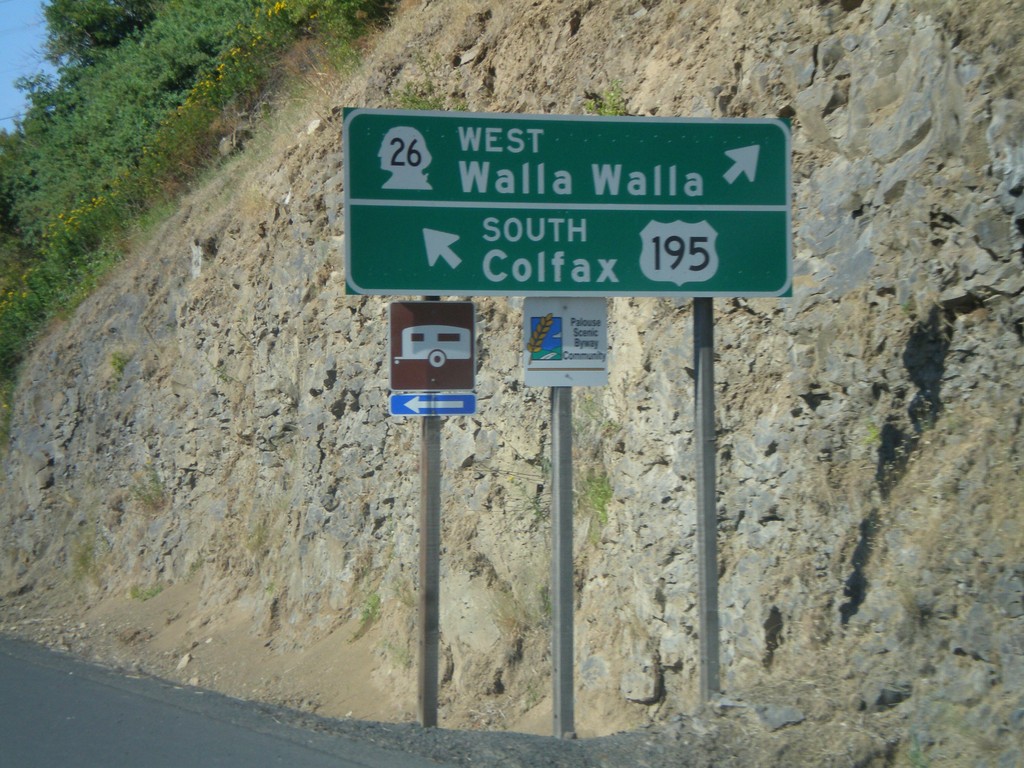
US-195 South at WA-26 West
US-195 south to Colfax at WA-26 West to Walla Walla.
Taken 07-27-2008
Colfax
Whitman County
Washington
United States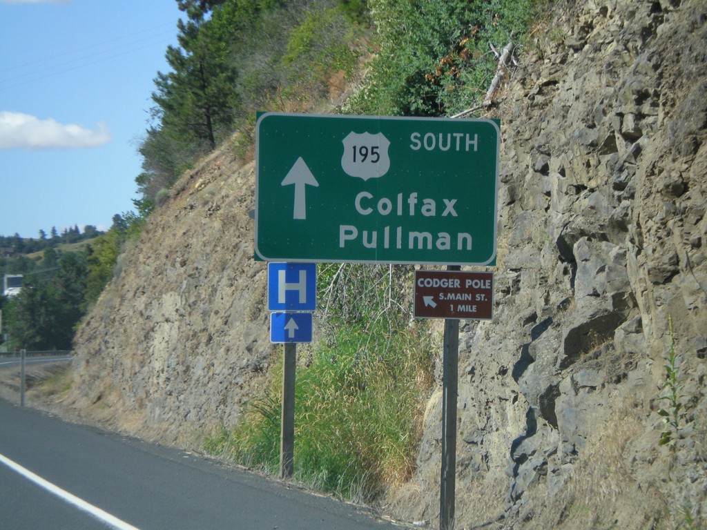
US-195 South Approaching WA-26
US-195 south approaching WA-26 west. Use US-195 south for Colfax and Pullman.
Taken 07-27-2008
Colfax
Whitman County
Washington
United States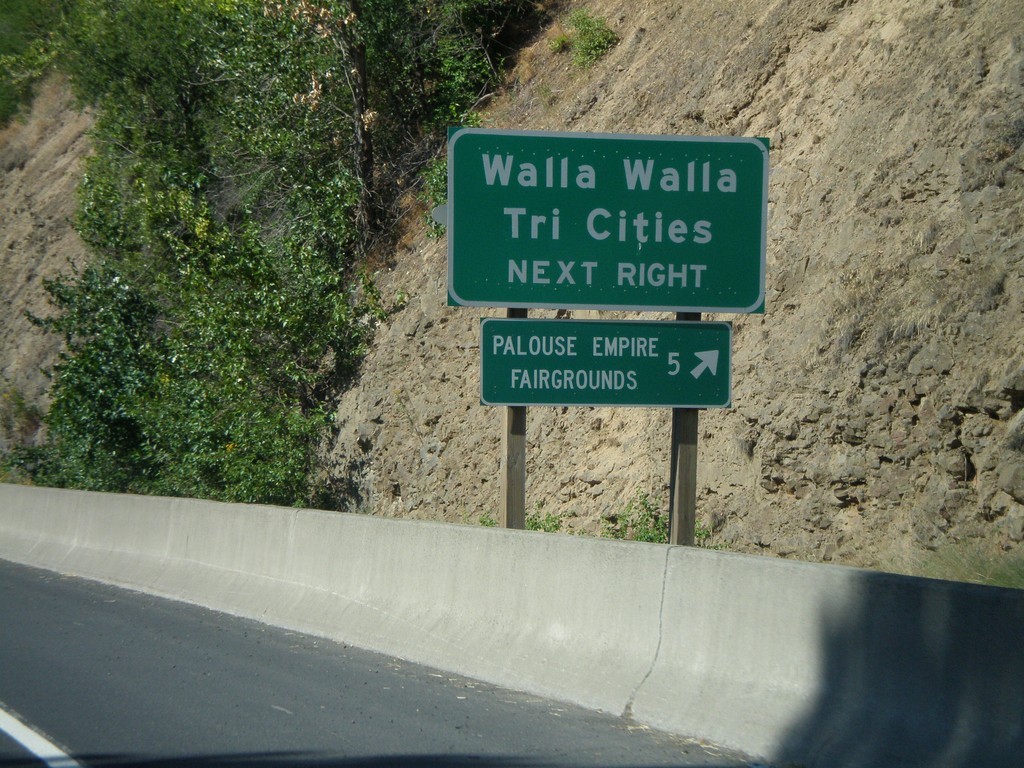
US-195 South Approaching WA-26
US-195 south approaching WA-26 west. Use WA-26 for Walla Walla and the Tri Cities.
Taken 07-27-2008
Colfax
Whitman County
Washington
United States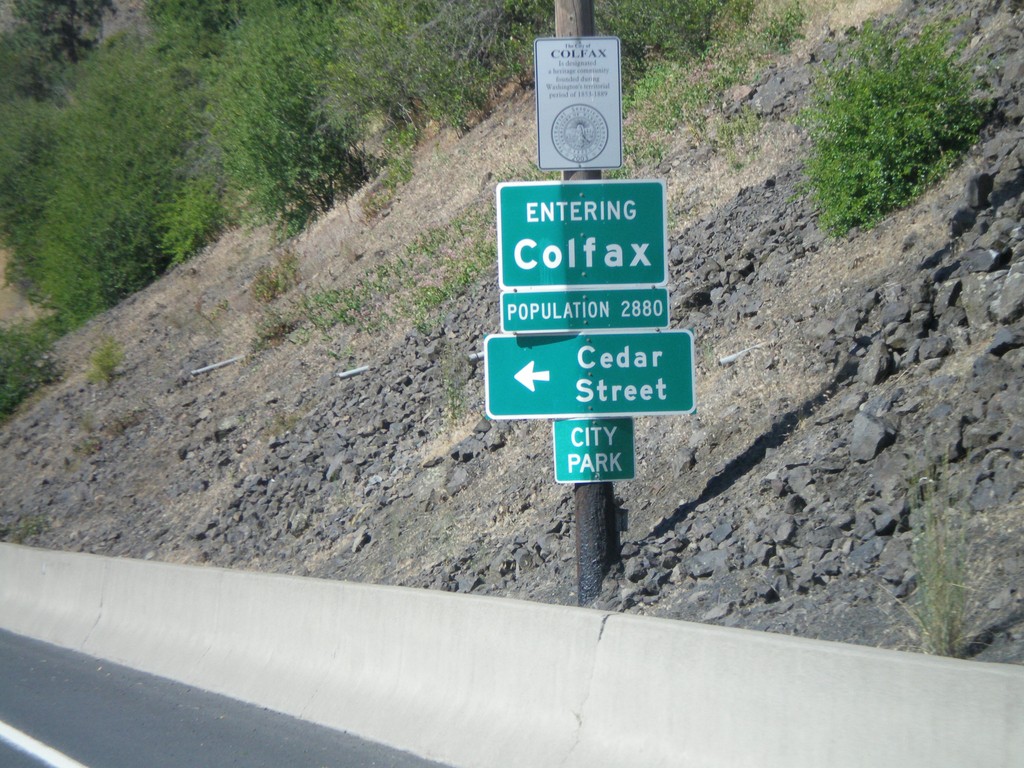
US-195 South - Entering Colfax
Entering Colfax on US-195 south.
Taken 07-27-2008
Colfax
Whitman County
Washington
United States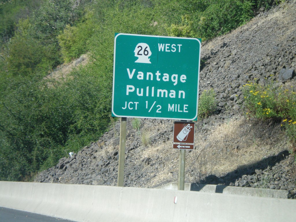
US-195 South Approaching WA-26
US-195 south to Pullman approaching WA-26 West to Vantage.
Taken 07-27-2008
Colfax
Whitman County
Washington
United States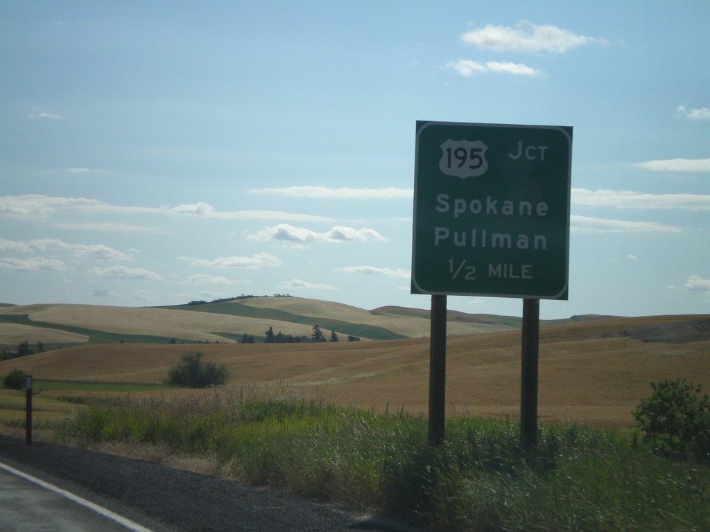
WA-23 East Approaching US-195
WA-23 east approaching US-195 to Pullman and Spokane.
Taken 07-27-2008
 Colfax
Whitman County
Washington
United States
Colfax
Whitman County
Washington
United States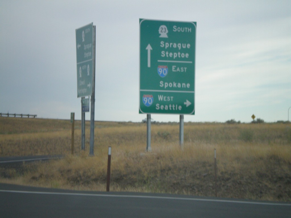
WA-23 South at I-90
WA-23 south at I-90 west to Seattle. Approaching I-90 east to Spokane. Continue on WA-23 to Sprague and Steptoe.
Taken 07-26-2008

 Sprague
Lincoln County
Washington
United States
Sprague
Lincoln County
Washington
United States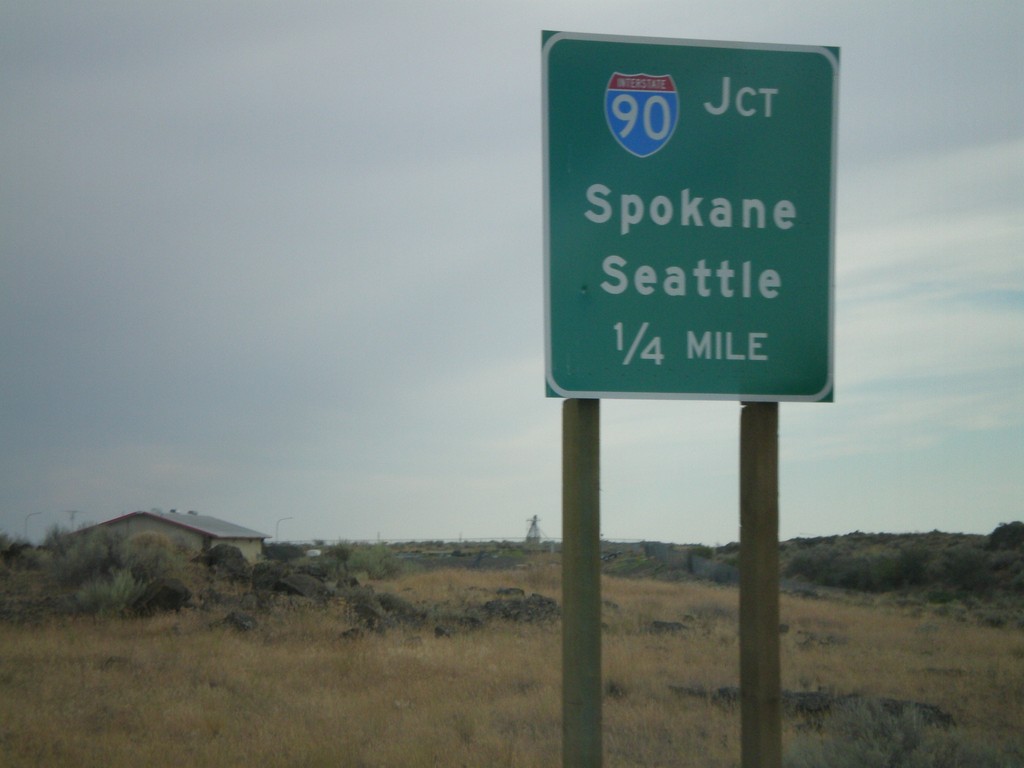
WA-23 South Approaching I-90
WA-23 south approaching I-90 to Seattle and Spokane.
Taken 07-26-2008
Sprague
Lincoln County
Washington
United States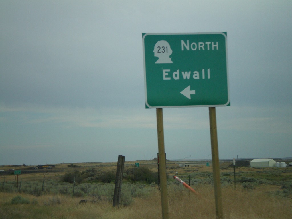
WA-23 South at WA-231 North
WA-23 south at WA-231 north to Edwall.
Taken 07-26-2008
 Sprague
Lincoln County
Washington
United States
Sprague
Lincoln County
Washington
United States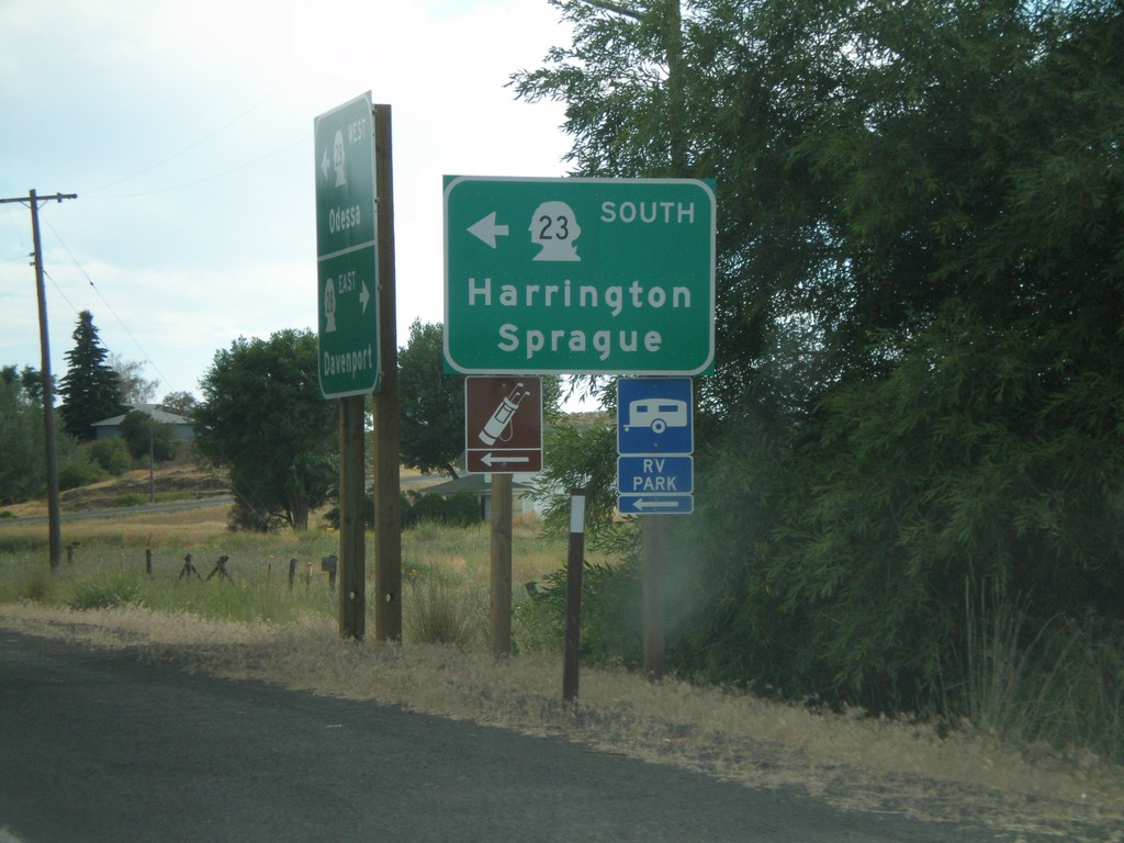
WA-28 West at WA-23 South
WA-28 west at WA-23 South/Harrington/Sprague
Taken 07-26-2008
 Harrington
Lincoln County
Washington
United States
Harrington
Lincoln County
Washington
United States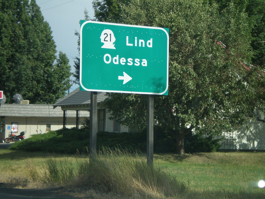
US-2 East/WA-21 South at WA-21 South
US-2 East/WA-21 South at WA-21 south to Lind and Odessa.
Taken 07-26-2008

 Wilbur
Lincoln County
Washington
United States
Wilbur
Lincoln County
Washington
United States