Signs Tagged With Big Green Sign
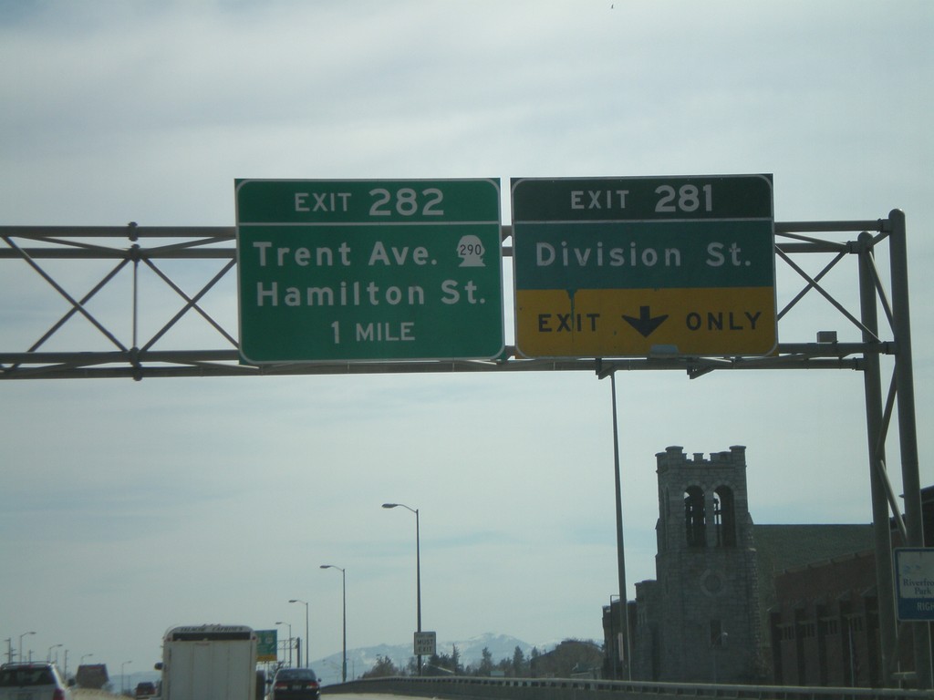
I-90 East - Exits 281 and Exit 282
I-90 east approaching Exit 281 - Division St., and Exit 282 - WA-290 East/Trent Ave./Hamilton St.
Taken 04-13-2008


 Spokane
 County
Washington
United States
Spokane
Spokane County
Washington
United States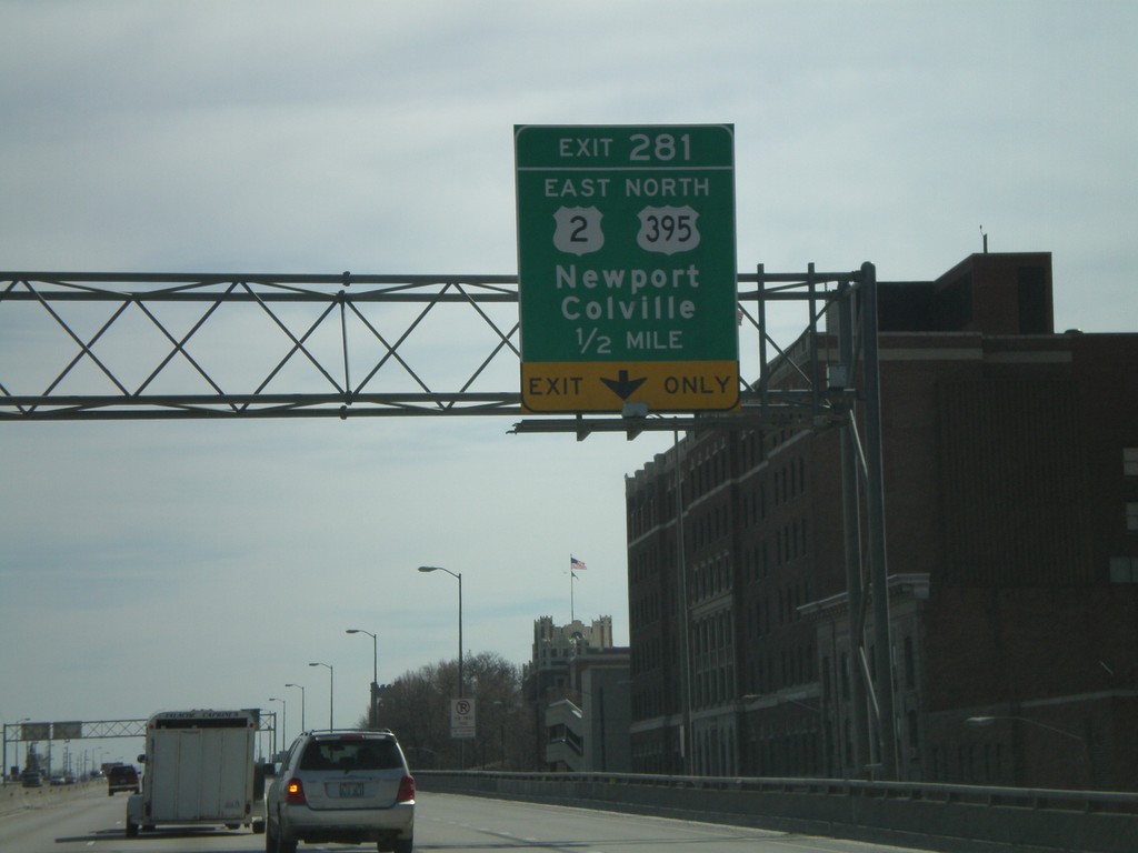
I-90 East - Exit 281
I-90 east approaching Exit 281 - US-2 East/Newport/US-395 North/Colville.
Taken 04-13-2008
Spokane
Spokane County
Washington
United States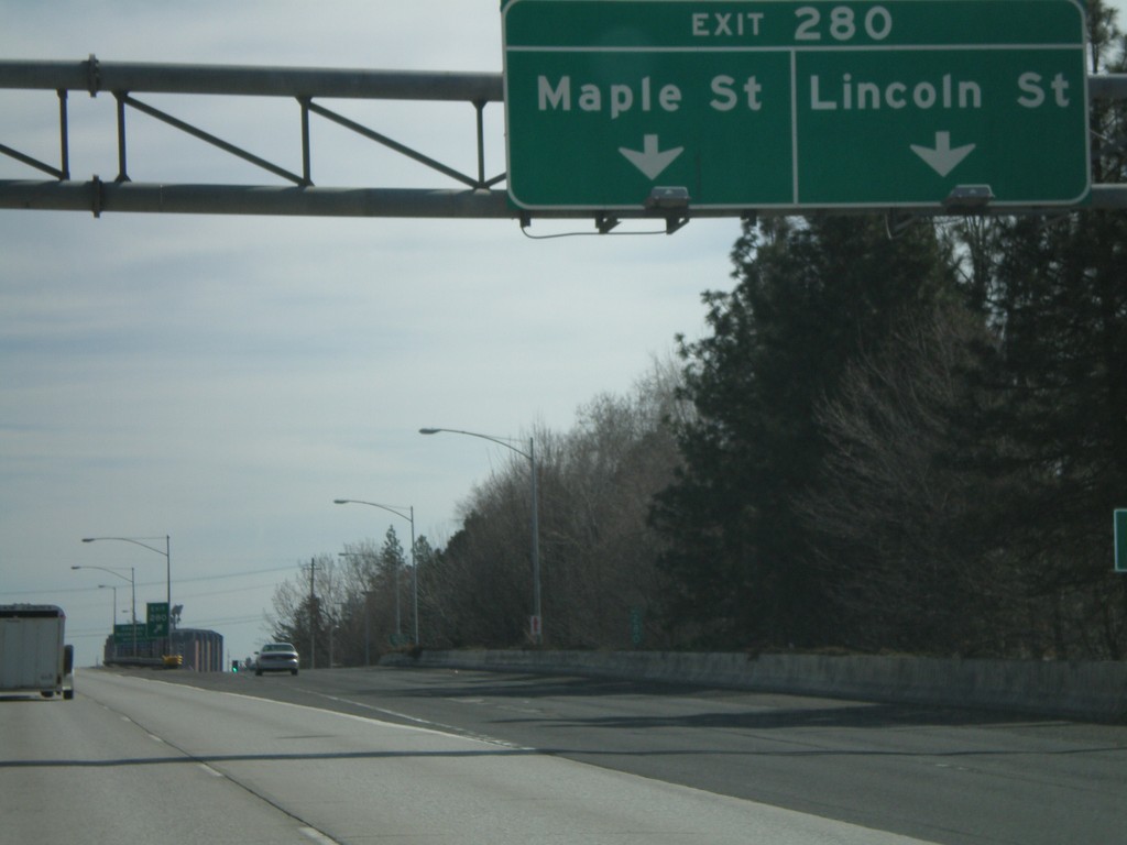
I-90 East - Exit 280
I-90 east at Exit 280 - Maple St./Lincoln St.
Taken 04-13-2008
Spokane
Spokane County
Washington
United States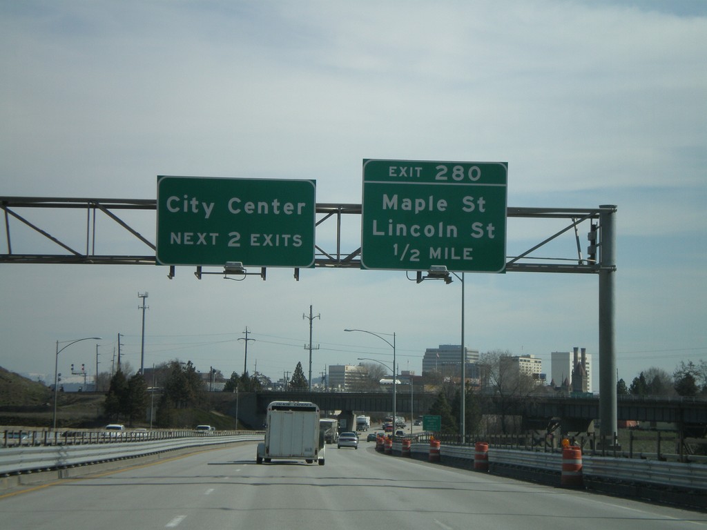
I-90 East - Exit 280
I-90 east approaching Exit 280 - Maple St./Lincoln St. Use next two exits for Spokane City Center.
Taken 04-13-2008
Spokane
Spokane County
Washington
United States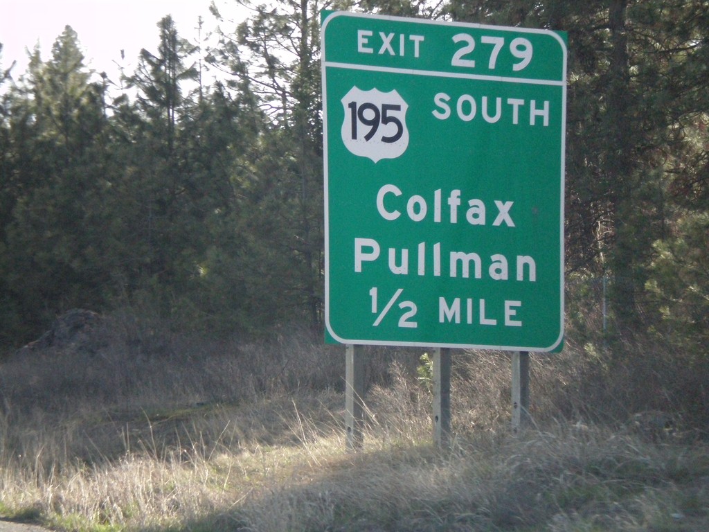
I-90 East - Exit 279
I-90 east approaching Exit 279 - US-195 South/Colfax/Pullman. US-195 begins here and ends near Lewiston, ID at US-95.
Taken 04-13-2008
 Spokane
 County
Washington
United States
Spokane
Spokane County
Washington
United States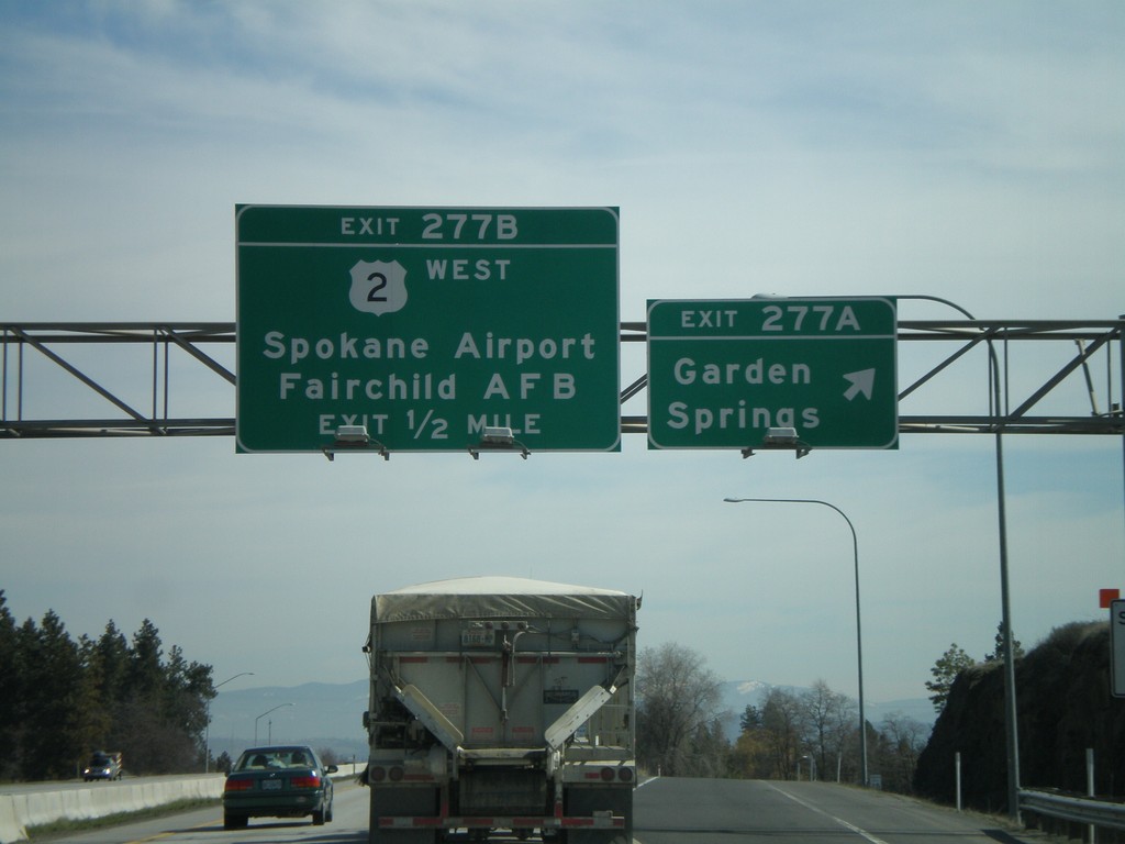
I-90 East - Exits 277A and 277B
I-90 east at Exit 277A - Garden Springs. Approaching US-2 West/Spokane Airport/Fairchild AFB. US-2 east follows I-90 from here into downtown.
Taken 04-13-2008
Spokane
Spokane County
Washington
United States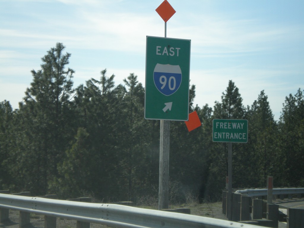
I-90 East - Exit 276 Onramp
Marshall Road south at I-90 East onramp at Exit 276.
Taken 04-13-2008
Spokane
Spokane County
Washington
United States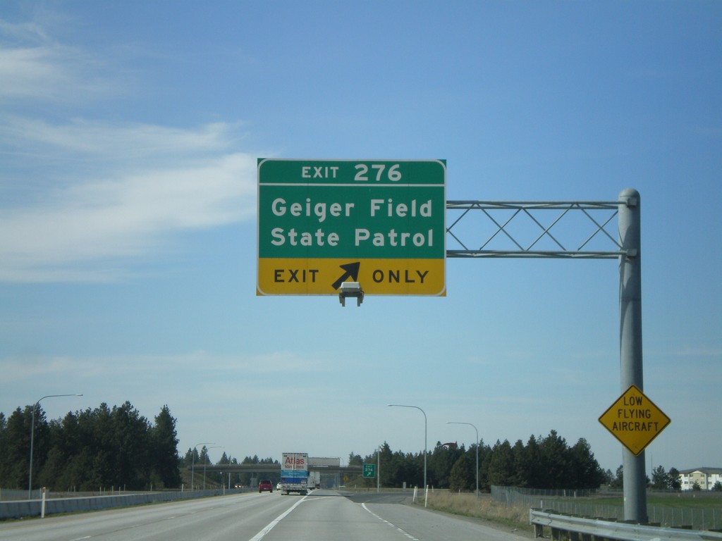
I-90 West - Exit 276
I-90 west at Exit 276 - Geiger Field/State Patrol.
Taken 04-13-2008
Spokane
Spokane County
Washington
United States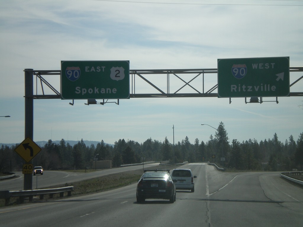
US-2 East at I-90/US-395
US-2 east at I-90. Use right lane for I-90 West to Ritzville. Left lanes for I-90/US-2 East to Spokane.
Taken 04-13-2008
Spokane
Spokane County
Washington
United States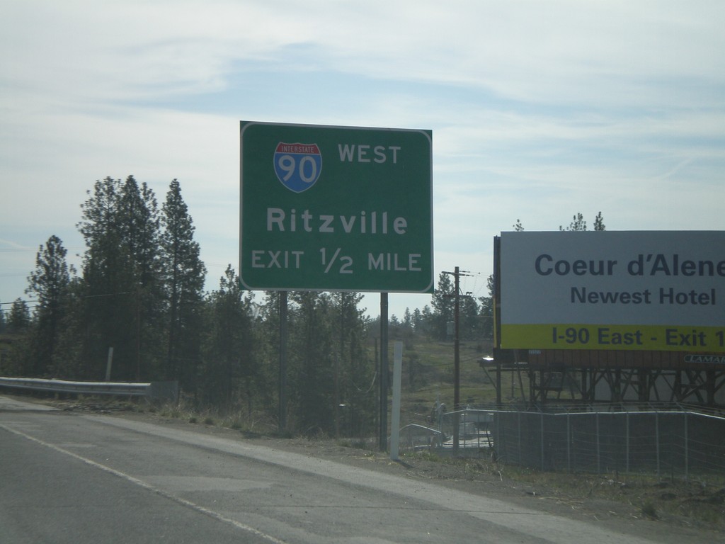
US-2 East Approaching I-90
US-2 east approaching I-90. Use right lane for I-90 west to Ritzville.
Taken 04-13-2008
Spokane
Spokane County
Washington
United States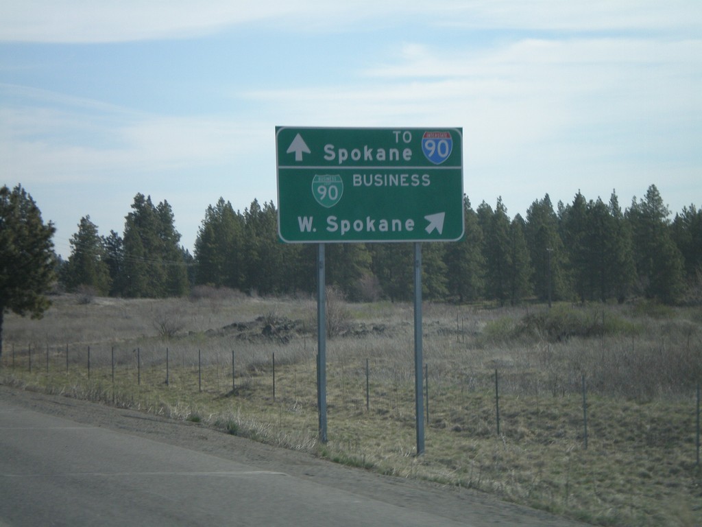
Spokane Airport Road at US-2/BL-90
Airport Drive at BL-90 to Spokane, and US-2 West to I-90 and West Spokane.
Taken 04-13-2008
 Spokane
 County
Washington
United States
Spokane
Spokane County
Washington
United States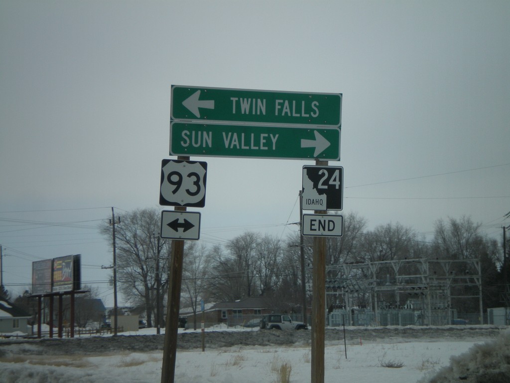
End ID-24 at US-93
End ID-24 West at US-93 Junction north to Sun Valley and south to Twin Falls.
Taken 02-17-2008

 Shoshone
Lincoln County
Idaho
United States
Shoshone
Lincoln County
Idaho
United States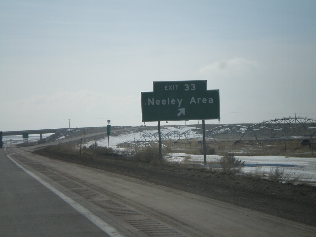
I-86 West - Exit 33
I-86 west at Exit 33 - Neeley Area.
Taken 02-17-2008

 Neeley
Power County
Idaho
United States
Neeley
Power County
Idaho
United States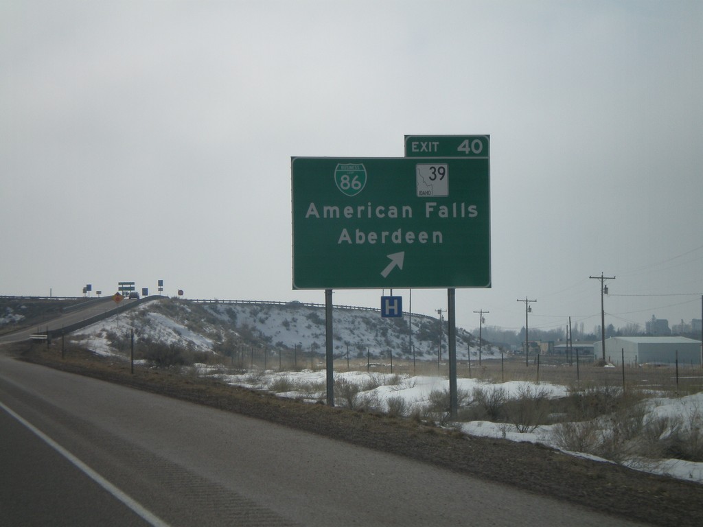
I-86 West - Exit 40
I-86 West at Exit 40 - BL-86/ID-39/American Falls/Aberdeen.
Taken 02-17-2008

 American Falls
Power County
Idaho
United States
American Falls
Power County
Idaho
United States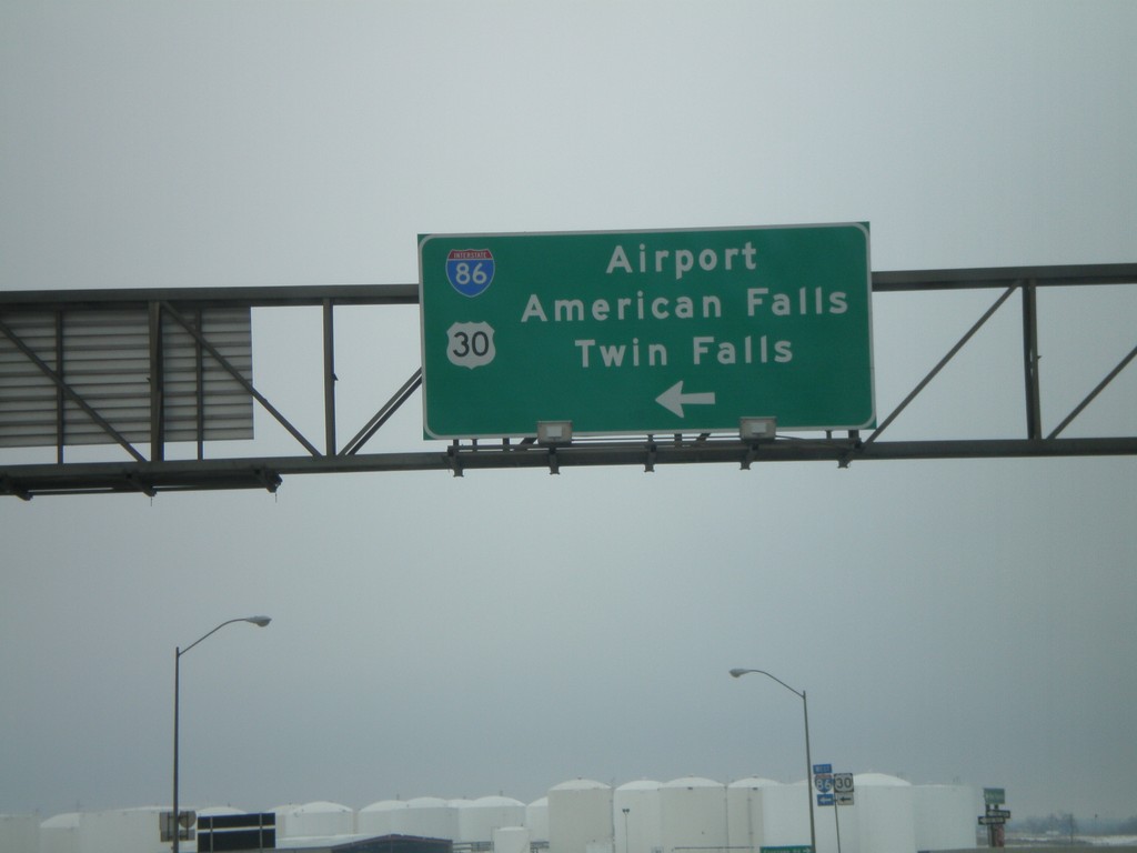
US-30 West at I-86 West
US-30 west at I-86 to Airport, American Falls, and Twin Falls. US-30 west joins I-86 to its western terminus - then joins I-84 west to Heyburn.
Taken 02-17-2008
Pocatello
Power County
Idaho
United States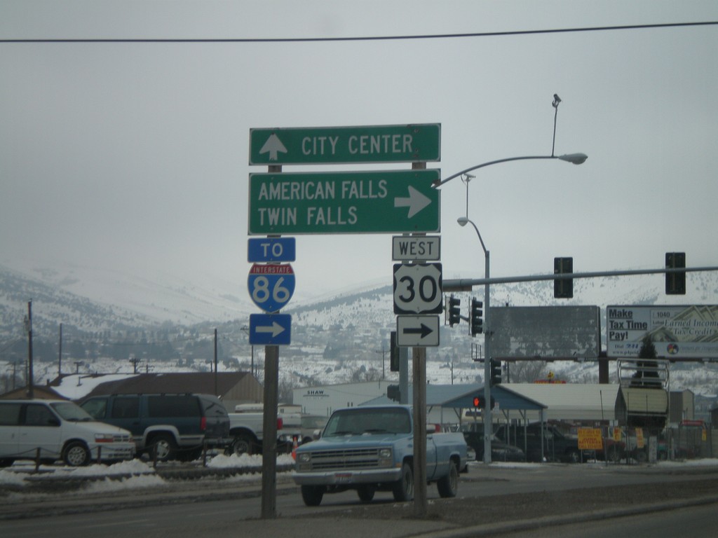
US-30 West - Oak St./Garrett Way Jct.
US-30 west (Oak St.) at Garrett Way to American Falls and Twin Falls.
Taken 02-17-2008
Pocatello
Bannock County
Idaho
United States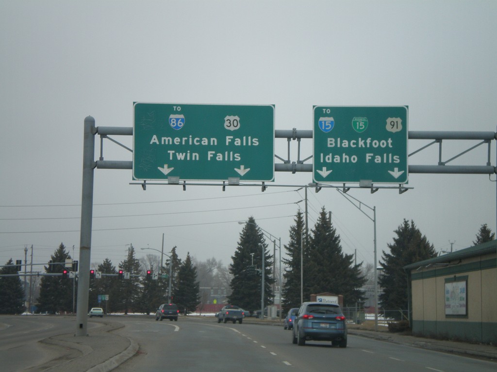
US-91/US-30/BL-15 North at US-30 West
US-91 N./US-30 W./BL-15 N. at US-91/US-30 split. Continue on 5th Ave. for BL-15/US-91/To I-15/Blackfoot/Idaho Falls. Turn left on Oak St. for US-30/To I-86/American Falls/Twin Falls.
Taken 02-17-2008


 Pocatello
Bannock County
Idaho
United States
Pocatello
Bannock County
Idaho
United States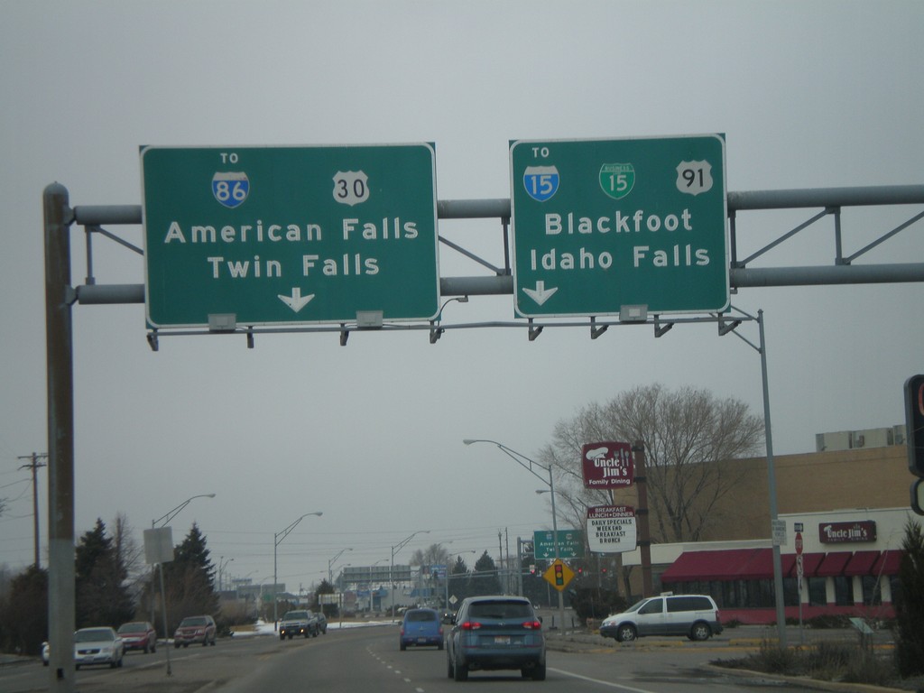
US-91/US-30/BL-15 North at US-30 West
US-91 North/US-30 West/BL-15 North approaching US-91/US-30 split. Continue on 5th Ave. for BL-15/US-91/To I-15/Blackfoot/Idaho Falls. Turn left on Oak St. for US-30/To I-86/American Falls/Twin Falls.
Taken 02-17-2008
Pocatello
Bannock County
Idaho
United States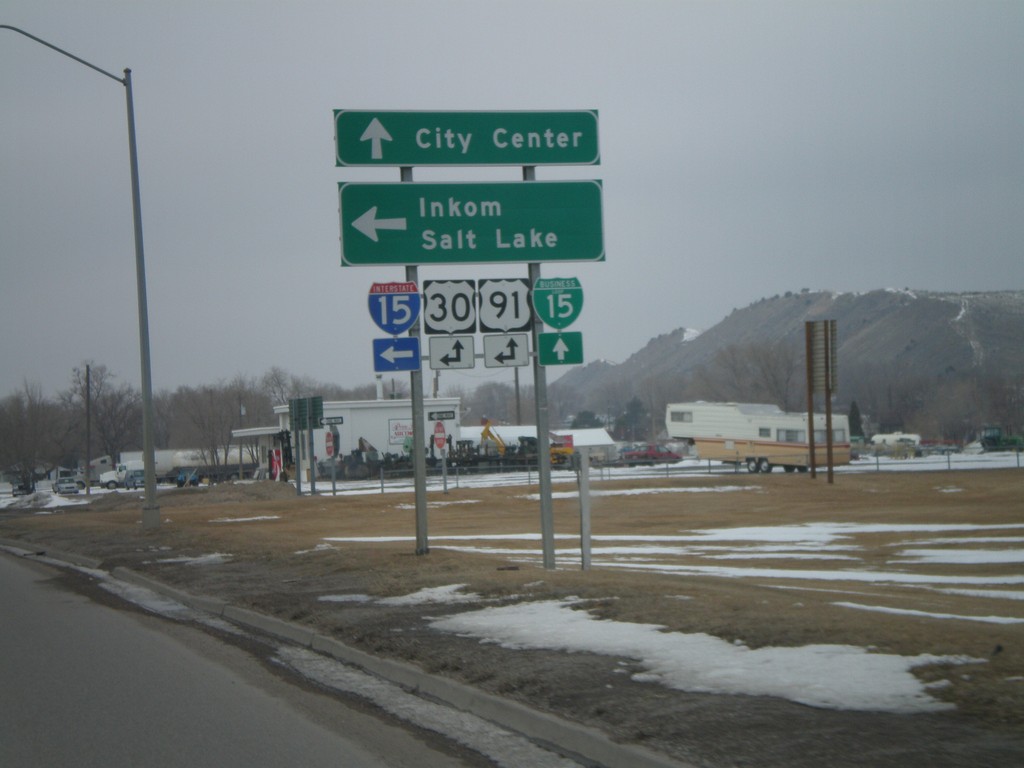
US-91/US-30/BL-15 North at I-15 South
US-91/US-30/BL-15 north at I-15/US-30/US-91 south to Inkom and Salt Lake. US-91 joins I-15 south to Virginia. US-30 joins I-15 south to McCammon.
Taken 02-17-2008
Pocatello
Bannock County
Idaho
United States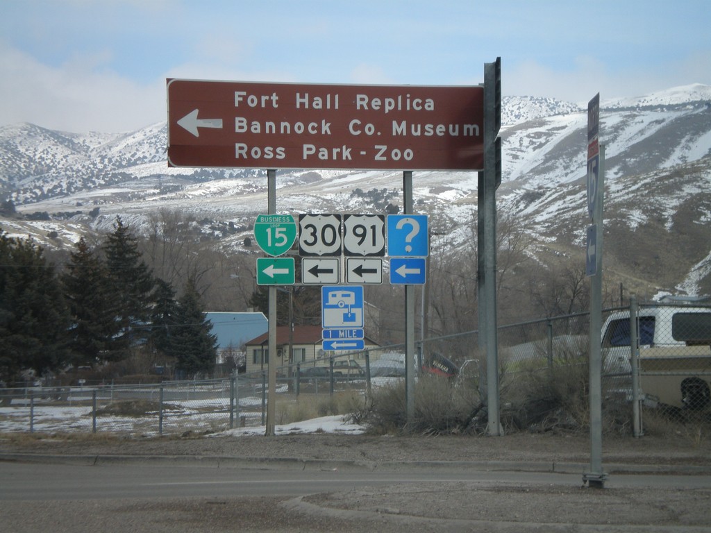
I-15 North at US-91/US-30/BL-15
I-15 offramp at US-91/US-30/BL-15. US-91 and US-30 leave I-15 here. Turn left for Fort Hall Replica, Bannock County Museum, and Ross Park - Zoo.
Taken 02-17-2008
Pocatello
Bannock County
Idaho
United States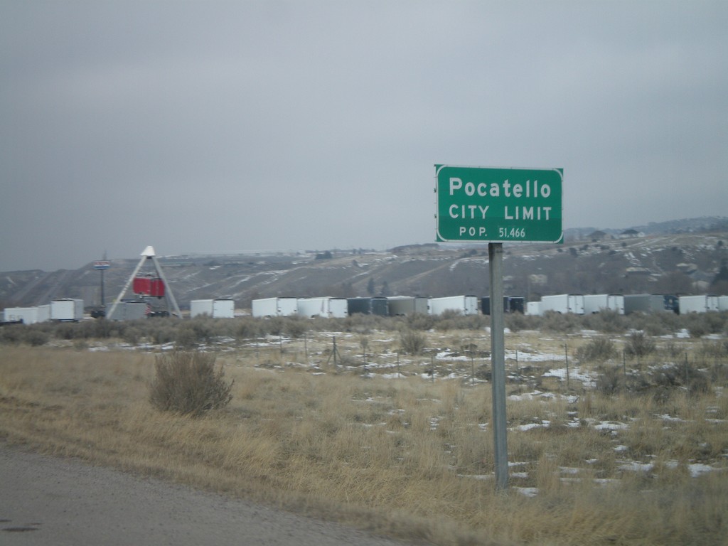
I-15 North - Pocatello City Limit
Entering Pocatello on I-15 north. Pocatello is the 3rd largest city in Idaho followed by Boise and Nampa.
Taken 02-17-2008
Pocatello
Bannock County
Idaho
United States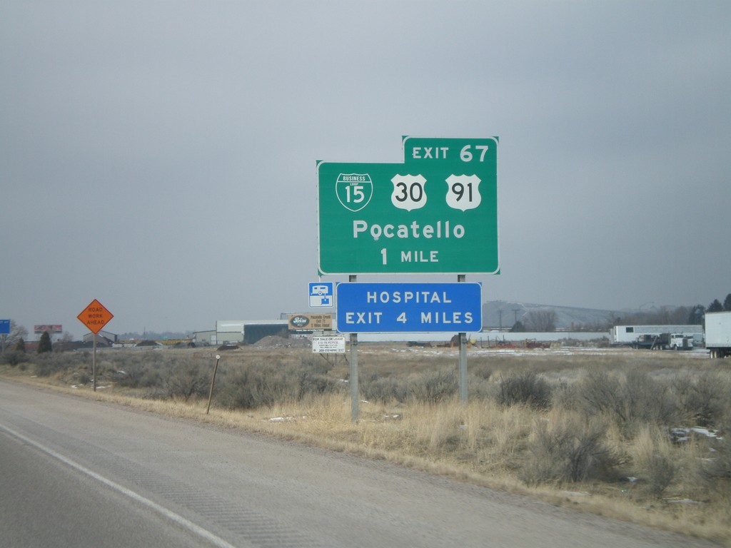
I-15 North - Exit 67
I-15 north approaching Exit 67 - BL-15/US-30/US-91/Pocatello.
Taken 02-17-2008
Pocatello
Bannock County
Idaho
United States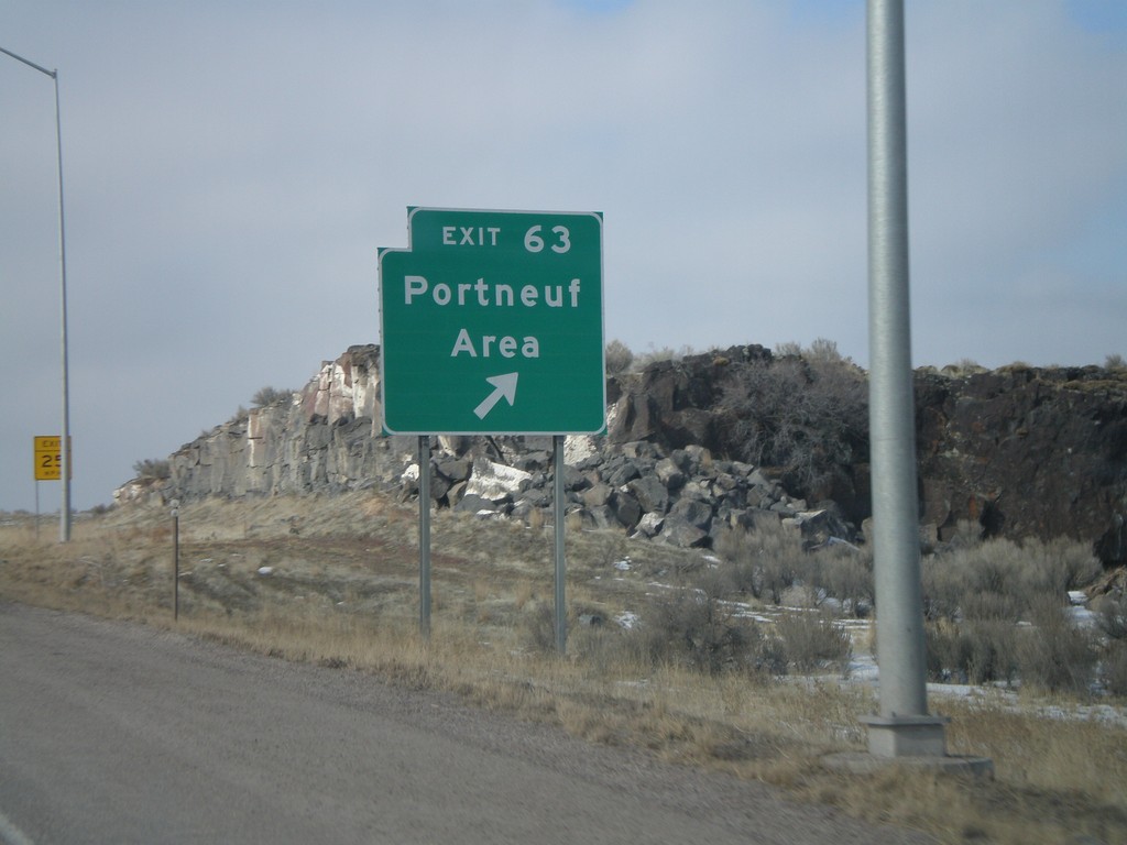
I-15 North - Exit 63
I-15 north at Exit 63 - Portneuf Area.
Taken 02-17-2008
Pocatello
Bannock County
Idaho
United States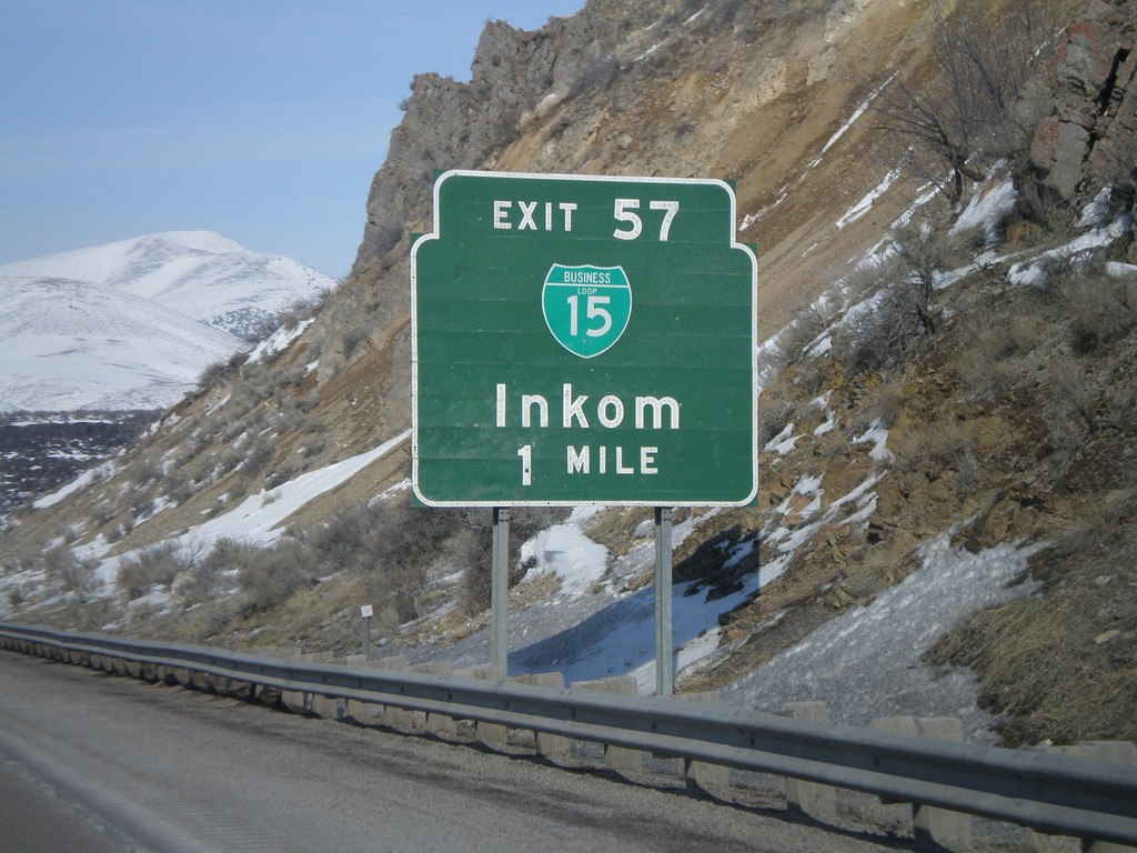
I-15 North - Exit 57
I-15 north approaching Exit 57 - BL-15/Inkom.
Taken 02-17-2008
McCammon
Bannock County
Idaho
United States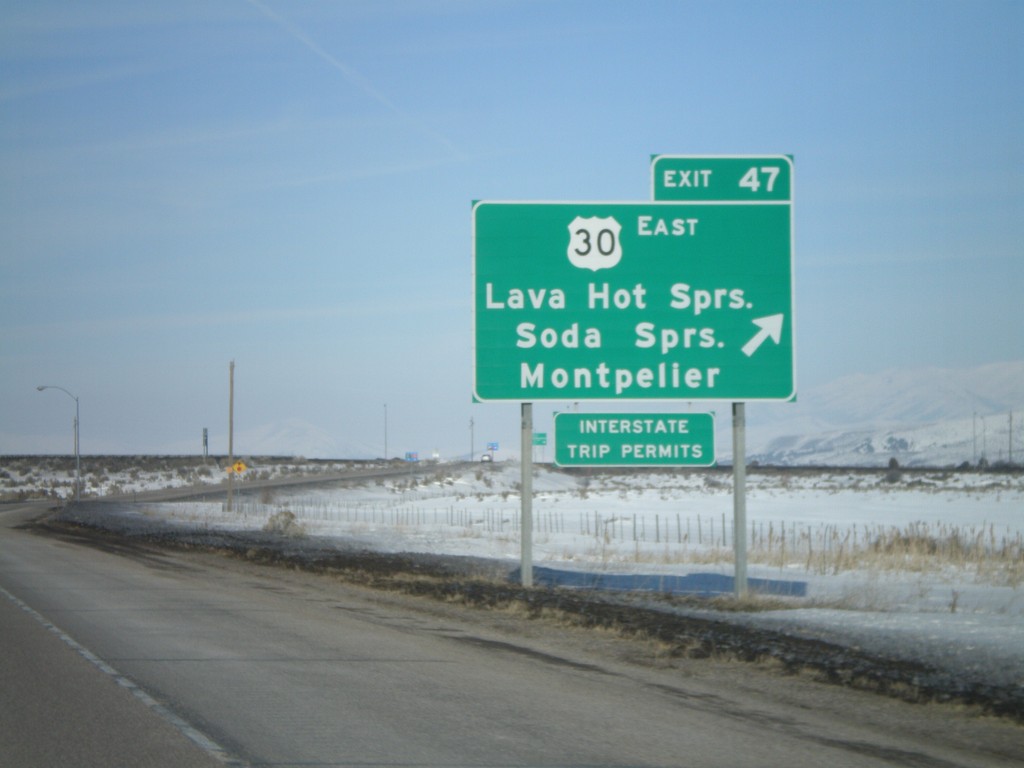
I-15 North - Exit 47
I-15 north at Exit 47 - US-30 East/Lava Hot Springs/Soda Springs/Montpelier. US-30 west joins I-15 north to Pocatello.
Taken 02-17-2008
McCammon
Bannock County
Idaho
United States