Signs Tagged With Big Green Sign
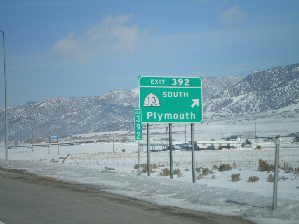
I-15 North - Exit 392
I-15 north at Exit 392 - UT-13 South/Plymouth.
Taken 02-17-2008

 Garland
Box Elder County
Utah
United States
Garland
Box Elder County
Utah
United States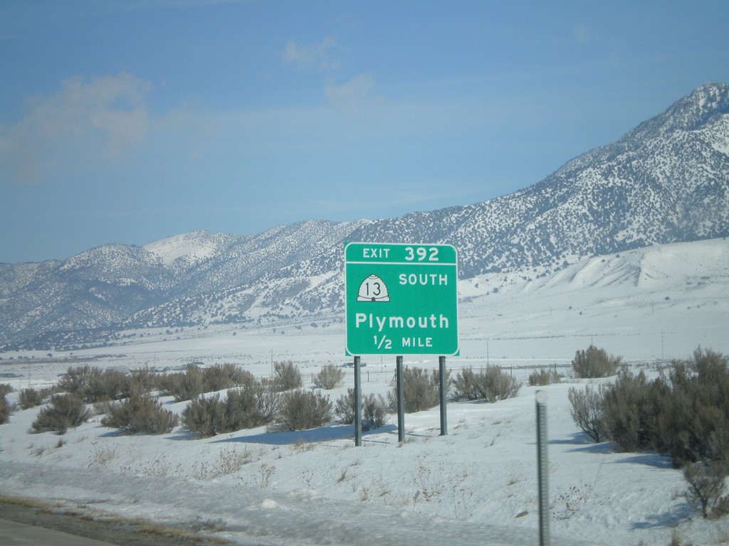
I-15 North - Exit 392
I-15 north approaching Exit 392 - UT-13 South/Plymouth.
Taken 02-17-2008
Garland
Box Elder County
Utah
United States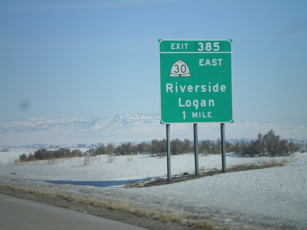
I-15 North - Exit 385
I-15 north approaching Exit 385 - UT-30 East/Riverside/Logan.
Taken 02-17-2008
 Garland
Box Elder County
Utah
United States
Garland
Box Elder County
Utah
United States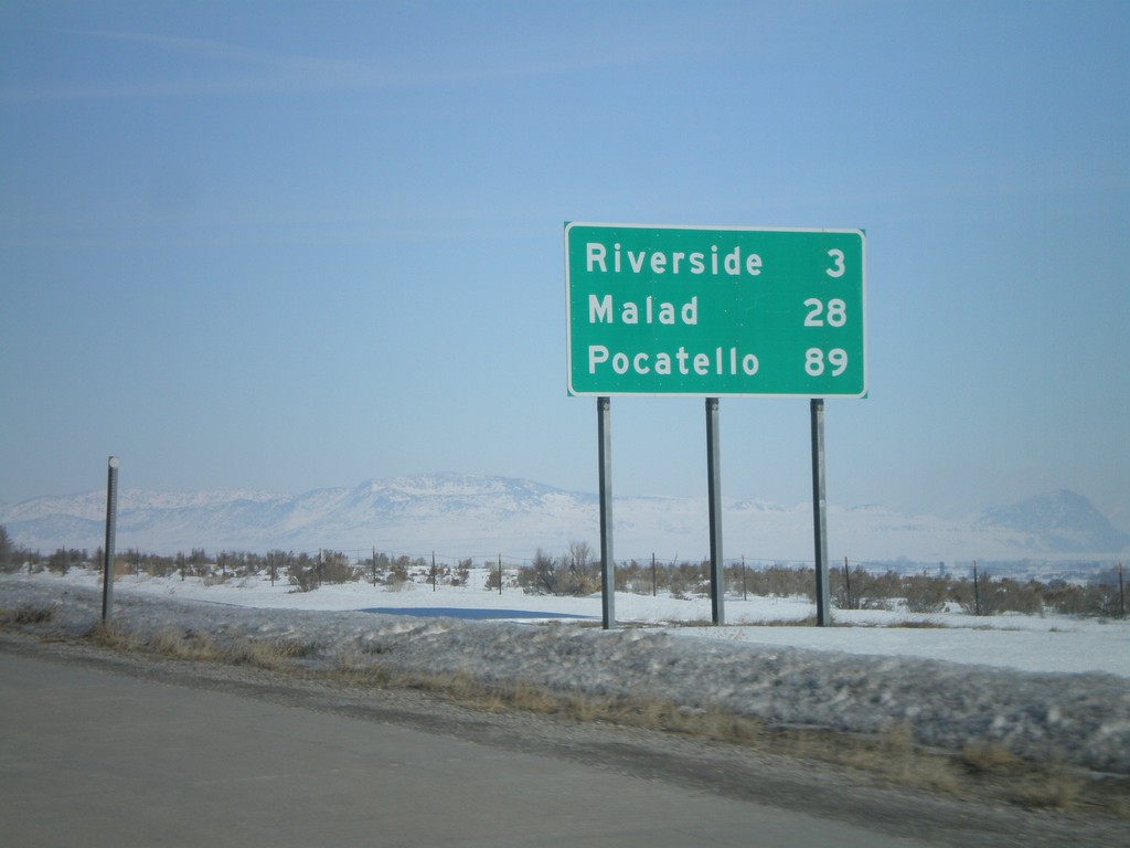
I-15 North - Distance Marker
Distance marker on I-15 north to Riverside, Malad, and Pocatello. This is the first distance marker north of the I-15/I-84 split.
Taken 02-17-2008
Garland
Box Elder County
Utah
United States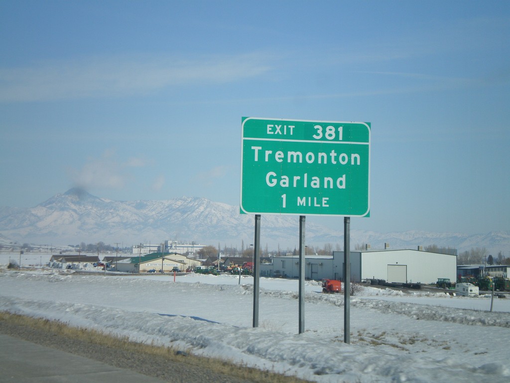
I-15 North - Exit 381
I-15 north approaching Exit 381 - Tremonton/Garland.
Taken 02-17-2008
Tremonton
Box Elder County
Utah
United States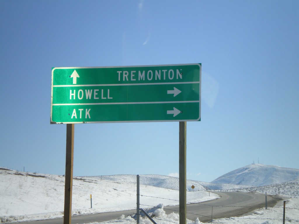
I-84 East at UT-83
I-84 Exit 26 offramp at UT-83 - south to ATK and Howell.
Taken 02-17-2008

 Howell
Box Elder County
Utah
United States
Howell
Box Elder County
Utah
United States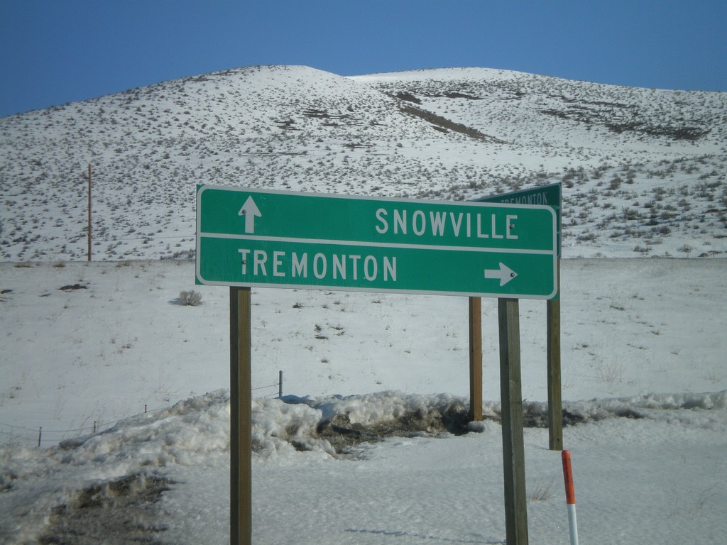
UT-83 North At I-84
End UT-83 north at I-84 - east to Tremonton, west to Snowville.
Taken 02-17-2008
Howell
Box Elder County
Utah
United States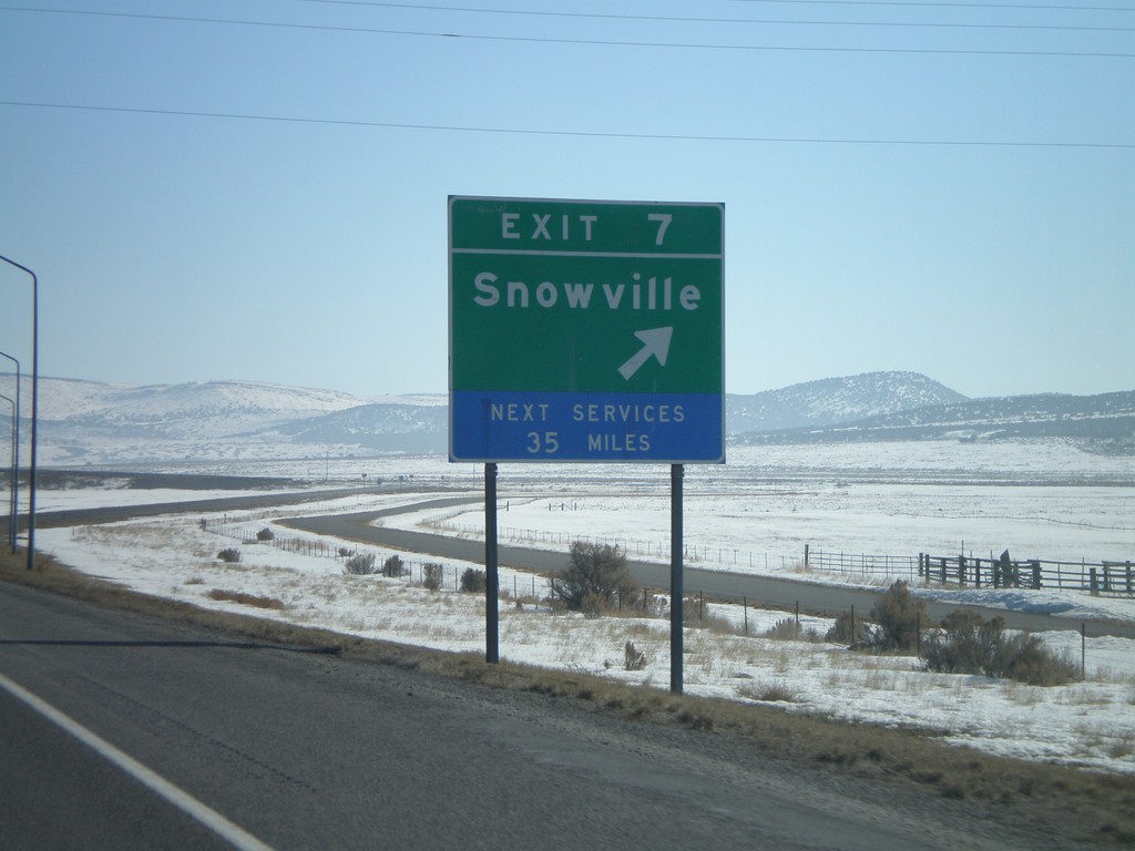
I-84 East - Exit 7
I-84 east at Exit 7 - Snowville.
Taken 02-17-2008
Snowville
Box Elder County
Utah
United States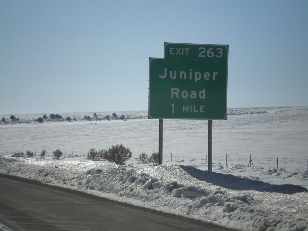
I-84 East - Exit 263
I-84 east approaching Exit 263 - Juniper Road. This is the last exit in Idaho on I-84.
Taken 02-17-2008
Malta
Oneida County
Idaho
United States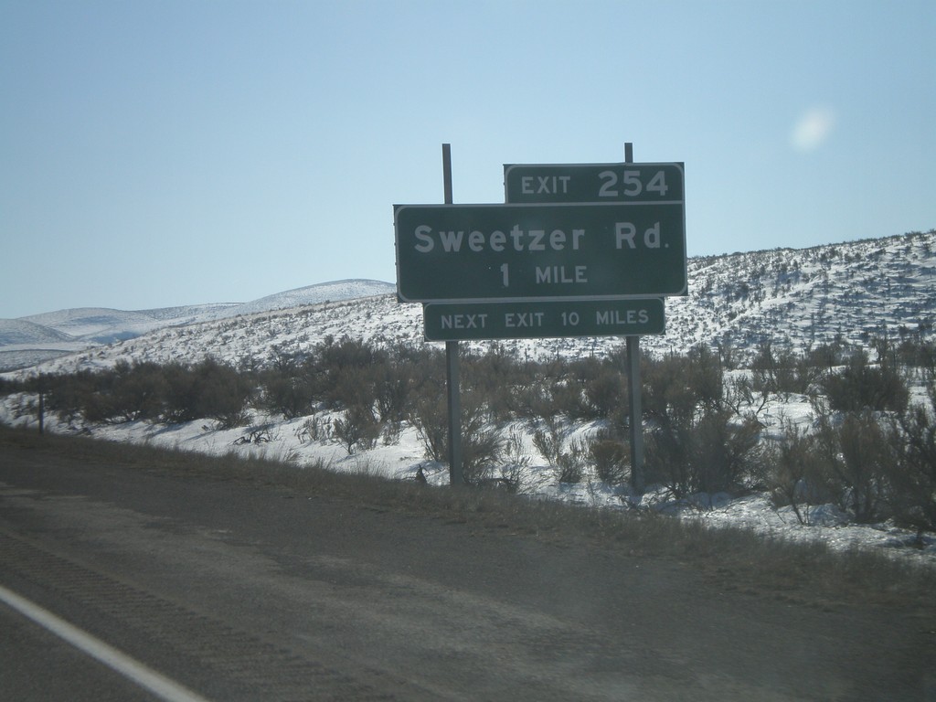
I-84 East - Exit 254
I-84 east approaching Exit 254 - Sweetzer Road.
Taken 02-17-2008
Malta
Cassia County
Idaho
United States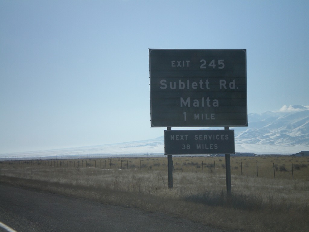
I-84 East - Exit 245
I-84 east approaching Exit 245 - Sublett Road/Malta.
Taken 02-17-2008
Sublett
Cassia County
Idaho
United States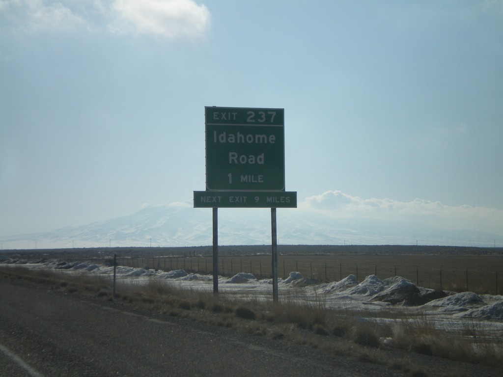
I-84 East - Exit 237
I-84 east approaching Exit 237 - Idahome Road.
Taken 02-17-2008
Idahome
Cassia County
Idaho
United States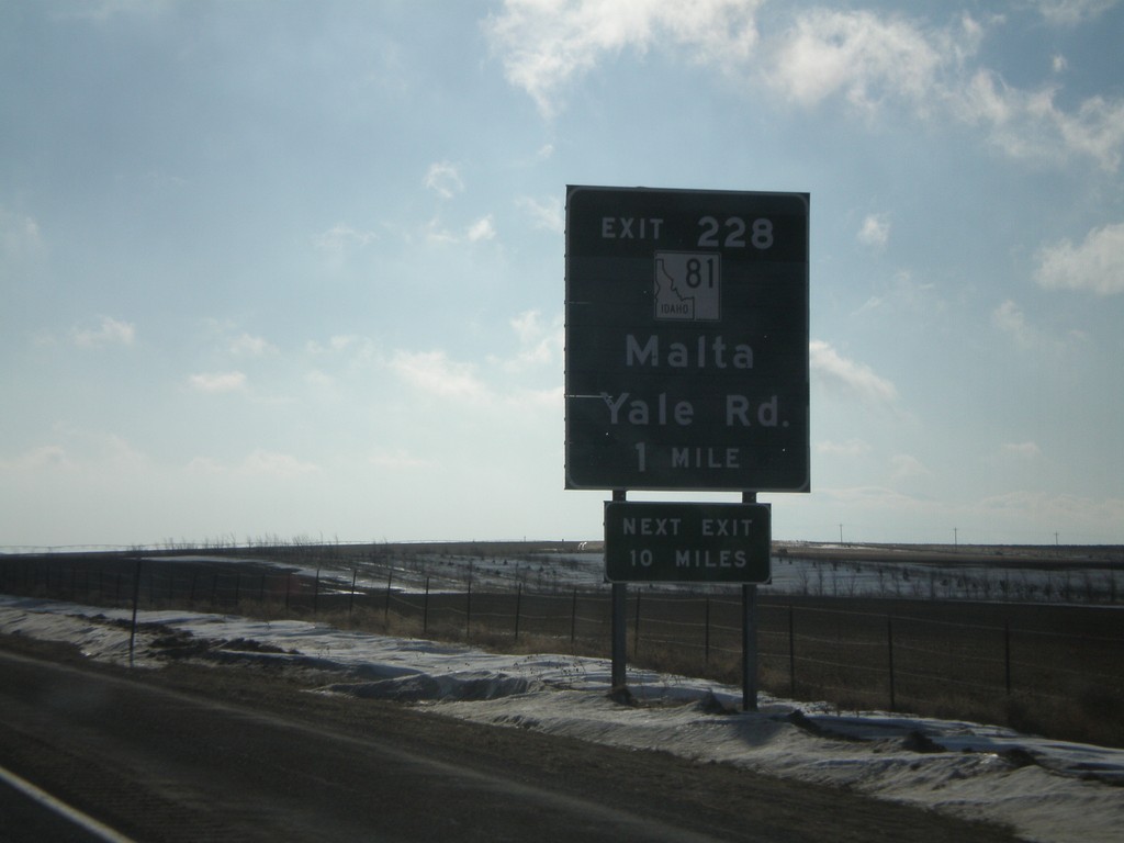
I-84 East - Exit 228
I-84 east approaching Exit 228 - ID-81/Yale Road/Malta.
Taken 02-17-2008
 Declo
Cassia County
Idaho
United States
Declo
Cassia County
Idaho
United States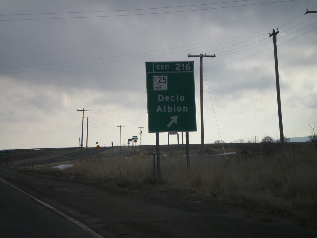
I-84 East - Exit 216
I-84 east at Exit 216 - ID-25/ID-77/Declo/Albion. The ID-77 shield is missing from this sign, but is present in the advance signage, as well as on signs on the other direction.
Taken 02-17-2008


 Rupert
Minidoka County
Idaho
United States
Rupert
Minidoka County
Idaho
United States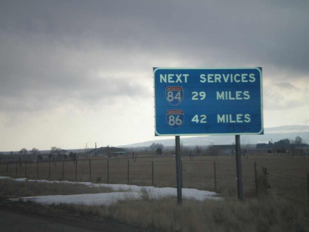
I-84 East - Next Services via I-84 and I-86
I-84 east approaching Exit 216. This sign shows the next services on I-84 and I-86. The next gas along I-86 is 42 miles (American Falls).
Taken 02-17-2008
 Rupert
Minidoka County
Idaho
United States
Rupert
Minidoka County
Idaho
United States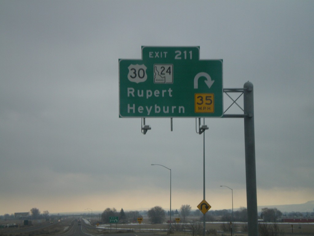
I-84 East - Exit 211
I-84 east at Exit 211 - US-30/ID-24/Rupert/Heyburn. This is one of the few overheads on Idaho highways outside of the metro. areas.
Taken 02-17-2008
 Rupert
Minidoka County
Idaho
United States
Rupert
Minidoka County
Idaho
United States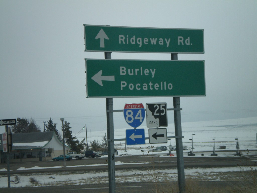
ID-25 East at I-84/ID-25 East
ID-25 east at I-84 east (Exit 194) to Burley and Pocatello. ID-25 follows I-84 east 7 miles.
Taken 02-17-2008
Hazelton
Jerome County
Idaho
United States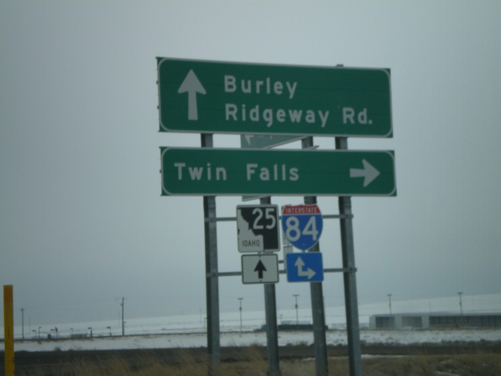
ID-25 East at I-84 West
ID-25 east at I-84 west (Exit 194) to Twin Falls. ID-25 continues east on I-84.
Taken 02-17-2008
Hazelton
Jerome County
Idaho
United States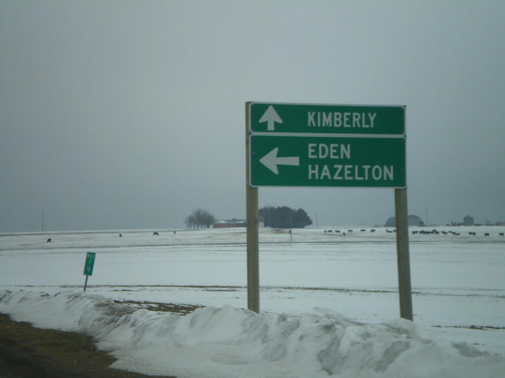
ID-25 East at ID-50 to Kimberly
ID-25 east to Eden and Hazelton, at ID-50 south to Kimberly.
Taken 02-17-2008
 Eden
Jerome County
Idaho
United States
Eden
Jerome County
Idaho
United States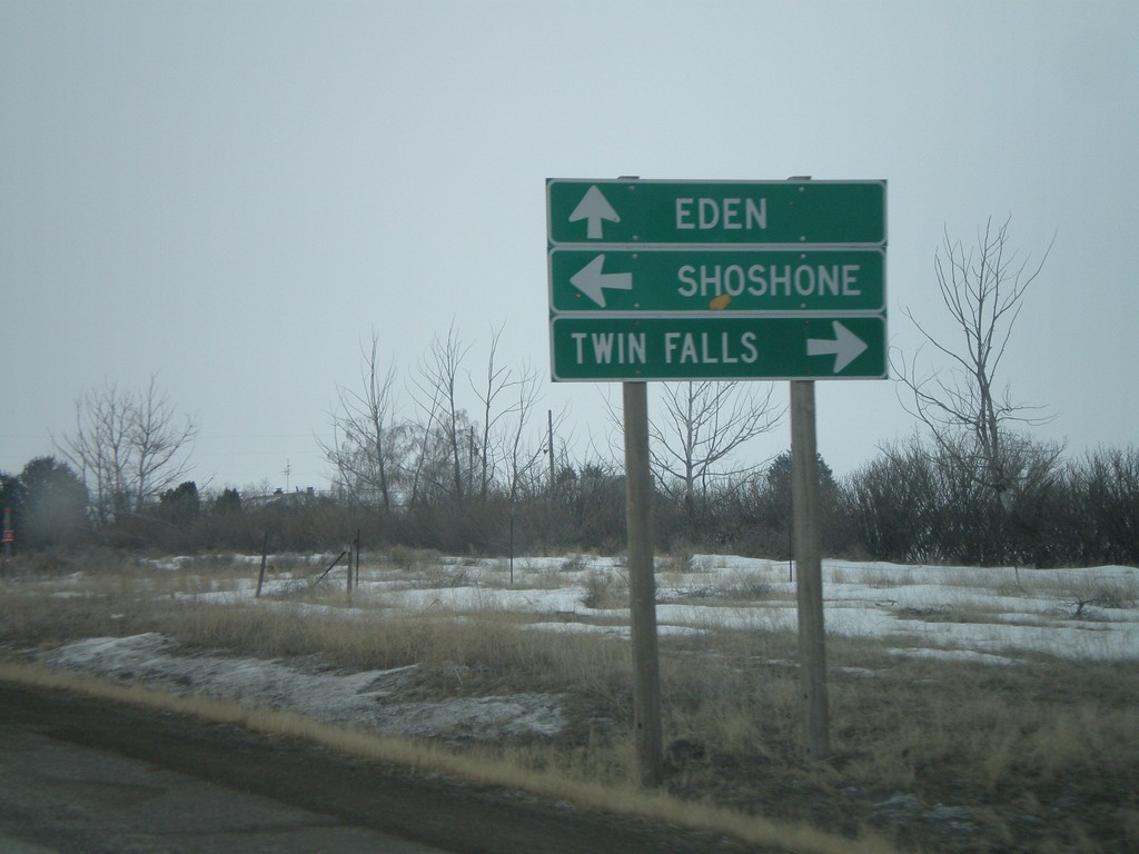
ID-25 East at US-93
ID-25 east approaching US-93 - south to Twin Falls, north to Shoshone.
Taken 02-17-2008
 Jerome
 County
Idaho
United States
Jerome
Jerome County
Idaho
United States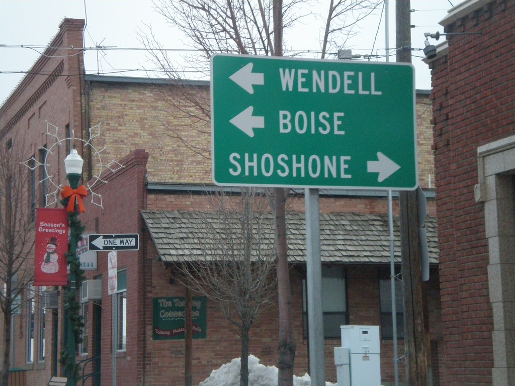
Lincoln Ave. North at ID-25
Lincoln Ave. north (former ID-79) at ID-25 west to Wendell and Boise - east to Shoshone.
Taken 02-17-2008
Jerome
Jerome County
Idaho
United States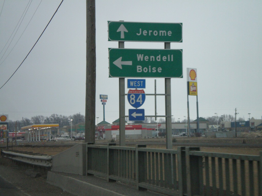
Lincoln Ave. North at I-84 West
Lincoln Ave. north at I-84 west to Wendell and Boise. This is the southern terminus of former ID-79. ID-79 shield used to be to the right of the I-84 shield.
Taken 02-17-2008
Jerome
Jerome County
Idaho
United States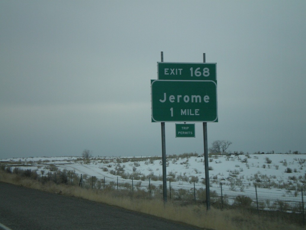
I-84 East - Exit 168
I-84 east at Exit 168 - Jerome. This was formerly ID-79, but it was decommissioned in 2007.
Taken 02-17-2008
Jerome
Jerome County
Idaho
United States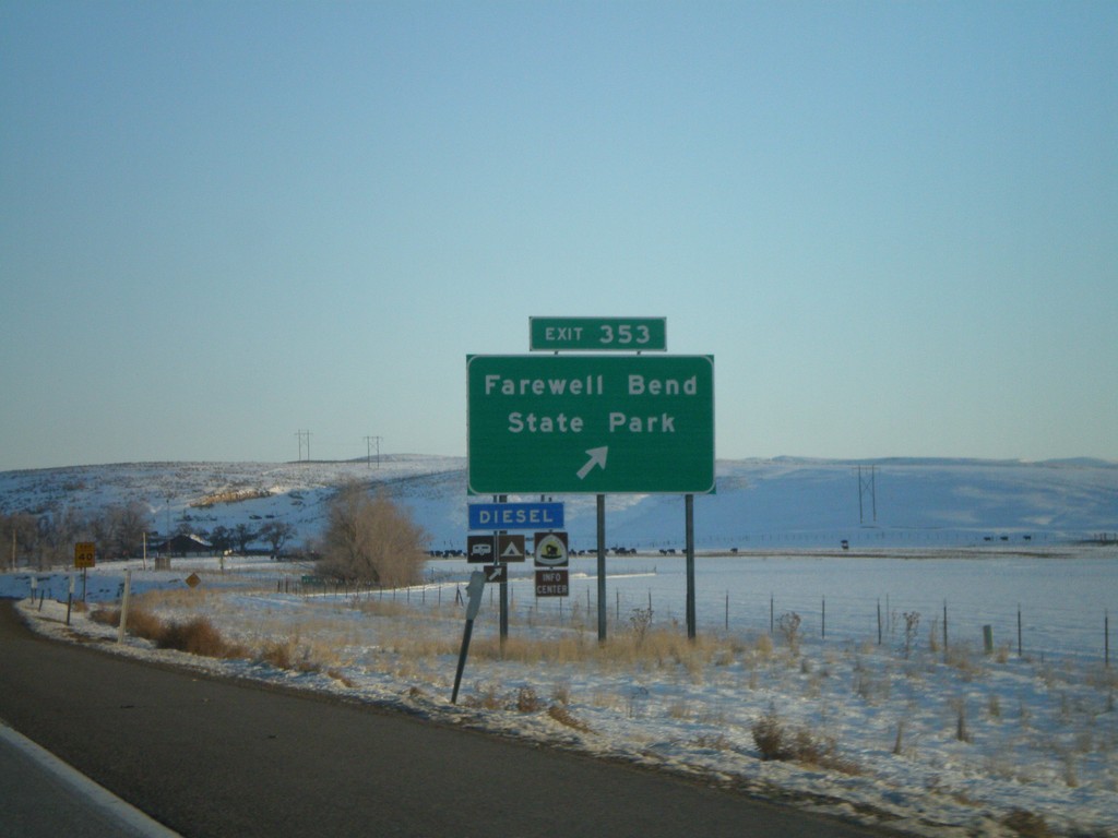
I-84 East - Exit 353
I-84 east at Exit 353 - Farewell Bend State Park.
Taken 01-22-2008
Huntington
Malheur County
Oregon
United States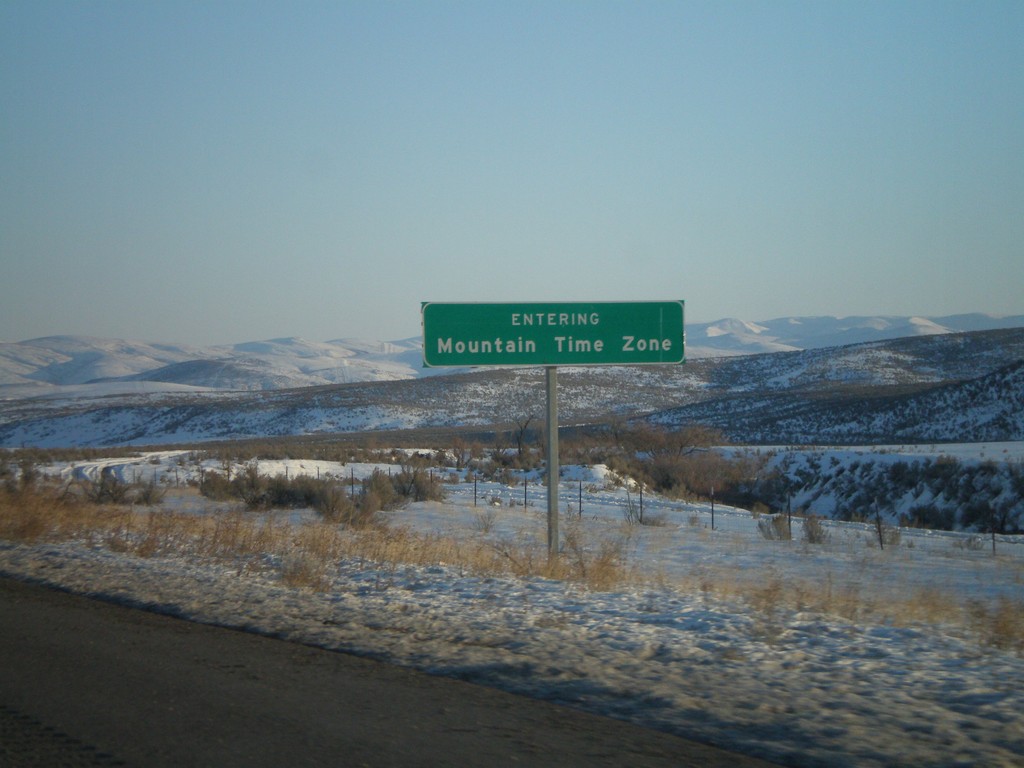
I-84 East - Entering Mountain Time Zone
I-84 East - Entering Mountain Time.
Taken 01-22-2008
Huntington
Baker County
Oregon
United States