Signs Tagged With Big Green Sign
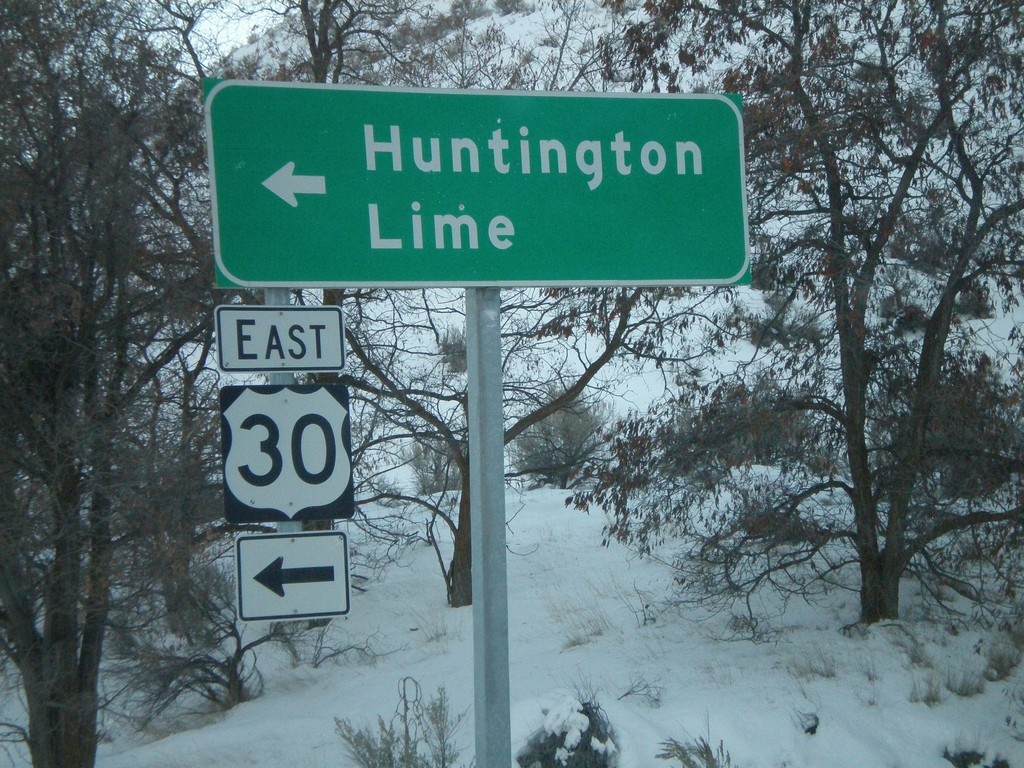
I-84 East at Exit 345 Offramp - US-30 Jct.
I-84 East at Exit 345 Offramp at US-30 Jct. Turn left for US-30 east to Huntington and Lime.
Taken 01-22-2008

 Huntington
Baker County
Oregon
United States
Huntington
Baker County
Oregon
United States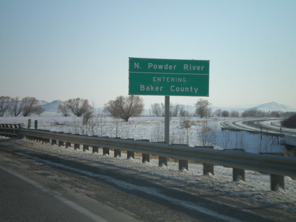
I-84 East - Entering Baker County
I-84 east at the North Powder River. Entering Baker County.
Taken 01-22-2008
North Powder
Union County
Oregon
United States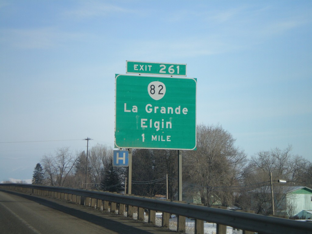
I-84 East - Exit 261
I-84 east approaching Exit 261 - OR-82/La Grande/Elgin.
Taken 01-22-2008
La Grande
Union County
Oregon
United States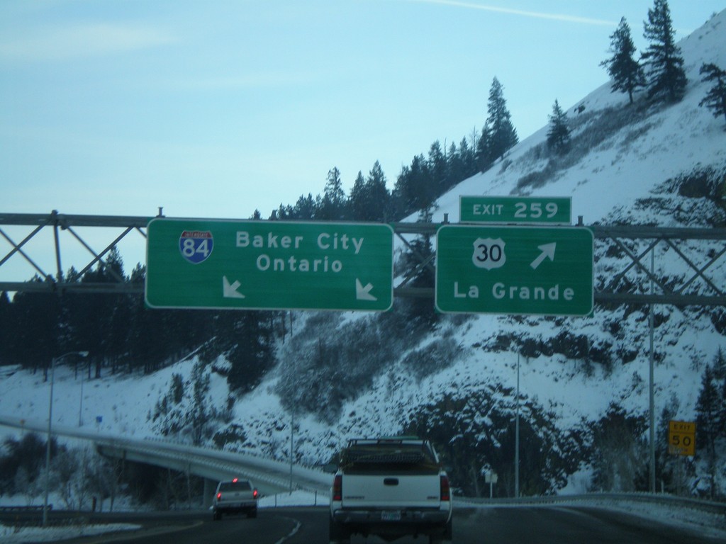
I-84 East - Exit 259
I-84 east at Exit 259 - US-30/La Grande. Overhead for I-84 to Baker City and Ontario.
Taken 01-22-2008
La Grande
Union County
Oregon
United States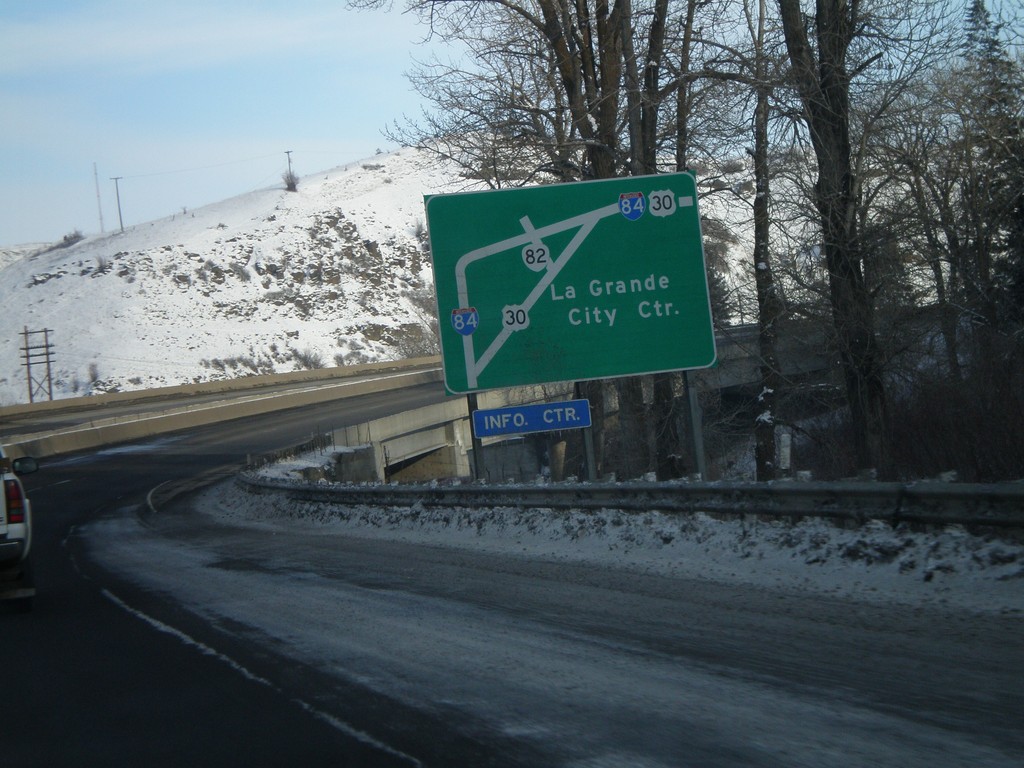
I-84 East - La Grande Route Diagram
Route diagram of La Grande routes on I-84 east approaching Exit 261.
Taken 01-22-2008
La Grande
Union County
Oregon
United States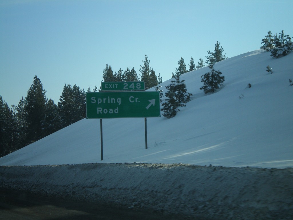
I-84 East - Exit 248
I-84 east at Exit 248 - Spring Creek Road.
Taken 01-22-2008
Hilgard
Union County
Oregon
United States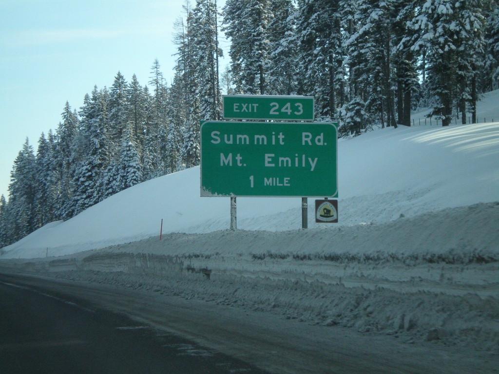
I-84 East Approaching Exit 243
I-84 east approaching Exit 243 - Summit Road/Mount Emily.
Taken 01-22-2008
Meacham
Umatilla County
Oregon
United States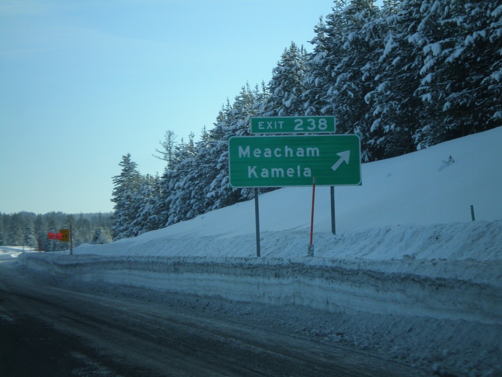
I-84 East - Exit 238
I-84 east at Exit 238 - Meacham/Kamela.
Taken 01-22-2008
Meacham
Umatilla County
Oregon
United States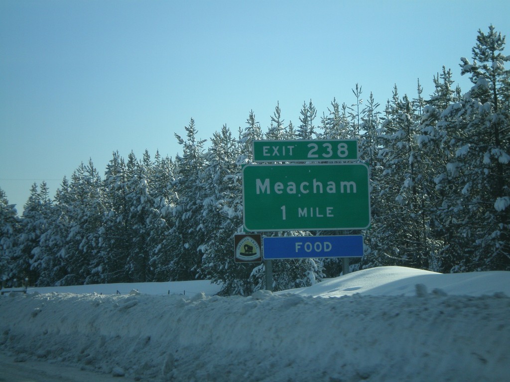
I-84 East Approaching Exit 238
I-84 east approaching Exit 238 - Meacham.
Taken 01-22-2008
Meacham
Umatilla County
Oregon
United States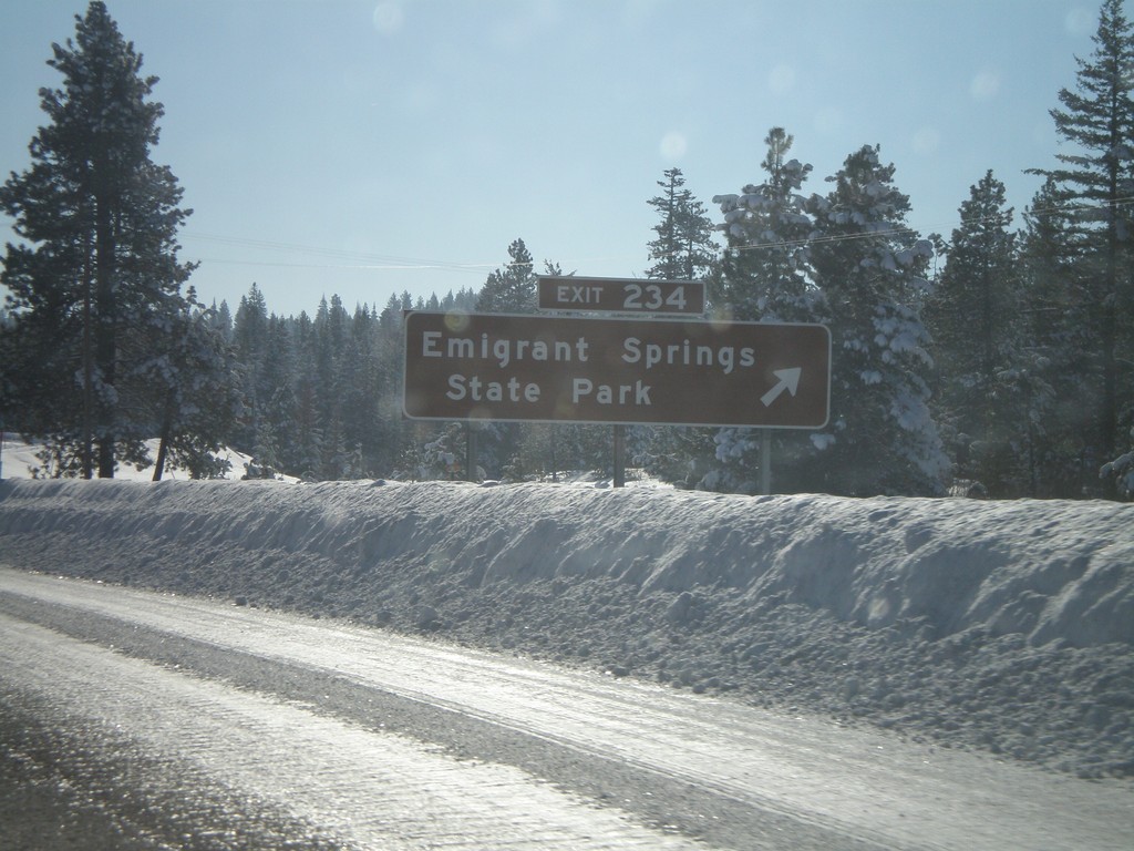
I-84 East - Exit 234
I-84 east at Exit 234 - Emigrant Springs State Park.
Taken 01-22-2008
Meacham
Umatilla County
Oregon
United States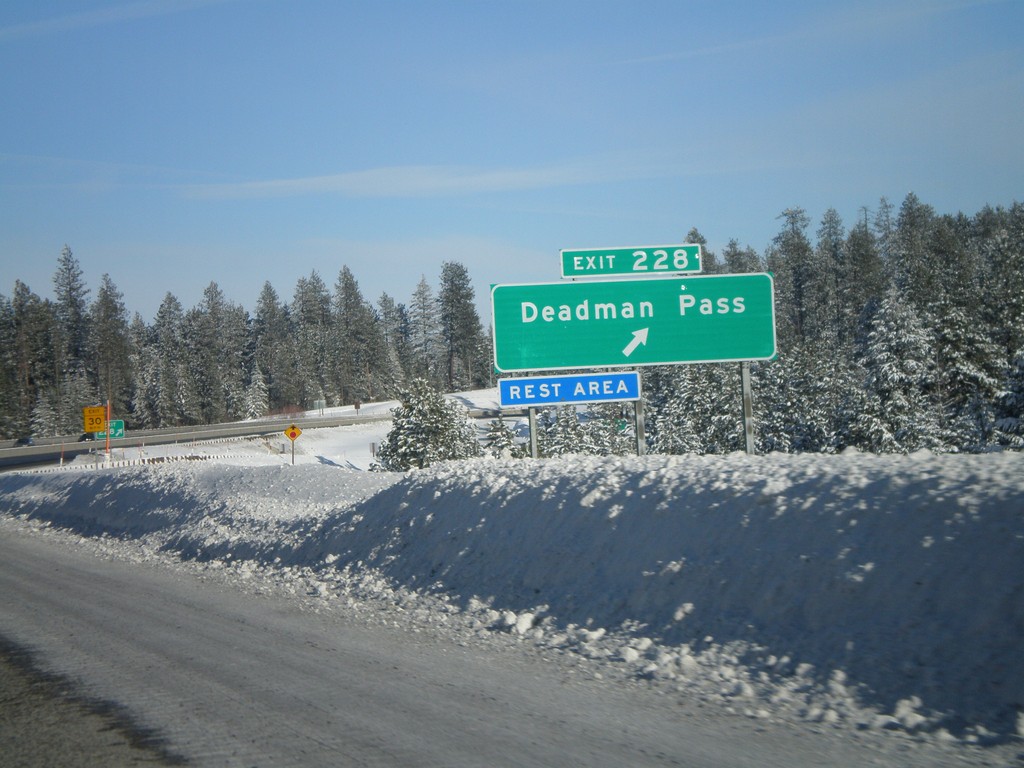
I-84 East - Exit 228
I-84 east at Exit 228 - Deadman Pass.
Taken 01-22-2008
Pendleton
Umatilla County
Oregon
United States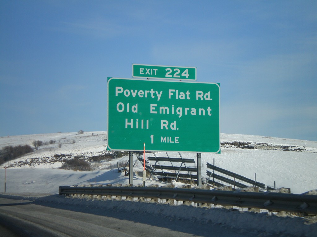
I-84 East - Exit 224
I-84 east at Exit 224 - Poverty Flat Road/Old Emigrant Hill Road.
Taken 01-22-2008
Pendleton
Umatilla County
Oregon
United States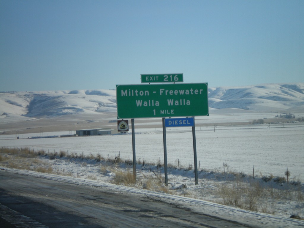
I-84 East - Exit 216
I-84 east at Exit 216 - Milton-Freewater/Walla Walla
Taken 01-22-2008
Pendleton
Umatilla County
Oregon
United States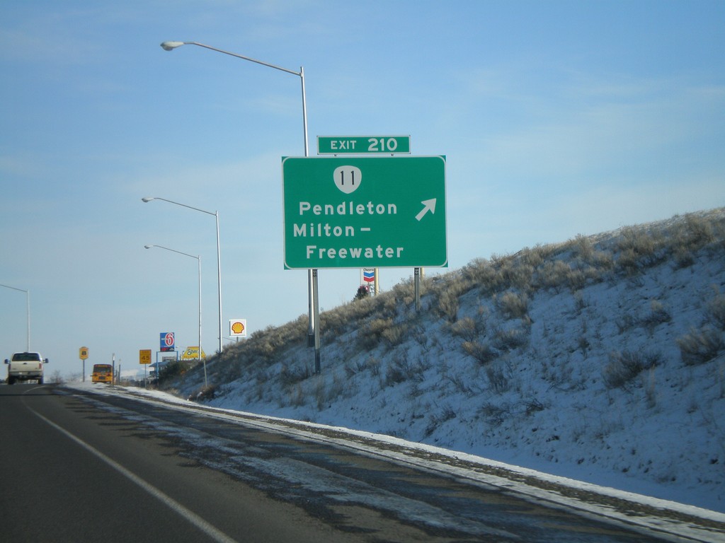
I-84 East - Exit 210
I-84 east at Exit 210 - OR-11/Pendleton/Milton-Freewater.
Taken 01-22-2008
 Pendleton
Umatilla County
Oregon
United States
Pendleton
Umatilla County
Oregon
United States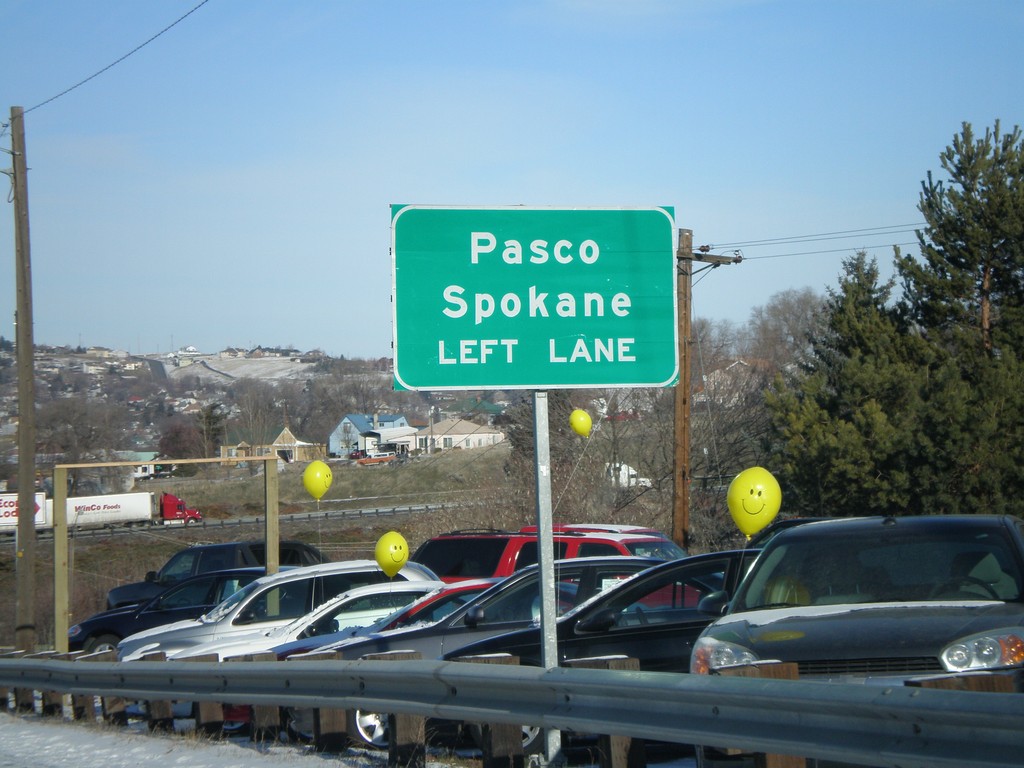
US-395 North Approaching I-84
US-395 north approaching I-84. Use left lane for I-84 West/US-395 North to Pasco and Spokane (both in Washington via US-395).
Taken 01-22-2008
 Pendleton
Umatilla County
Oregon
United States
Pendleton
Umatilla County
Oregon
United States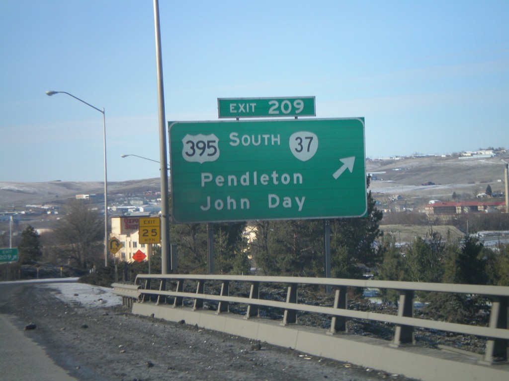
I-84 West - Exit 209
I-84 west at Exit 208 - US-395 South/OR-37/Pendleton/John Day. US-395 joins I-84 west to Stanfield, Oregon.
Taken 01-22-2008
 Pendleton
Umatilla County
Oregon
United States
Pendleton
Umatilla County
Oregon
United States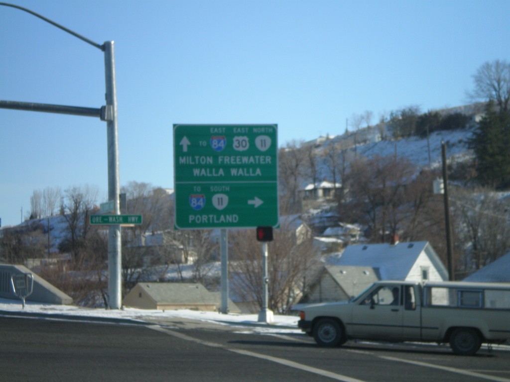
US-30 East at OR-11 (To I-84)
US-30 east at OR-11. Turn right for OR-11 south to I-84, and Portland. Continue straight for US-30 East/OR-11 North/To I-84 East/Milton Freewater/Walla Walla.
Taken 01-22-2008
Pendleton
Umatilla County
Oregon
United States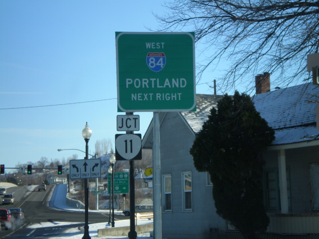
US-30 East Approaching OR-11
US-30 east approaching OR-11. Use OR-11 south to I-84 West/Portland.
Taken 01-22-2008
Pendleton
Umatilla County
Oregon
United States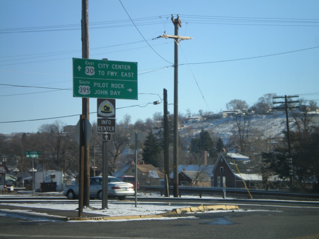
US-30 East to US-395 South - Pendleton
US-30 east at Court St. - To US-395 South/John Day/Pilot Rock. Continue east on US-30 for (Pendleton) City Center and (I-84) Freeway East.
Taken 01-22-2008
Pendleton
Umatilla County
Oregon
United States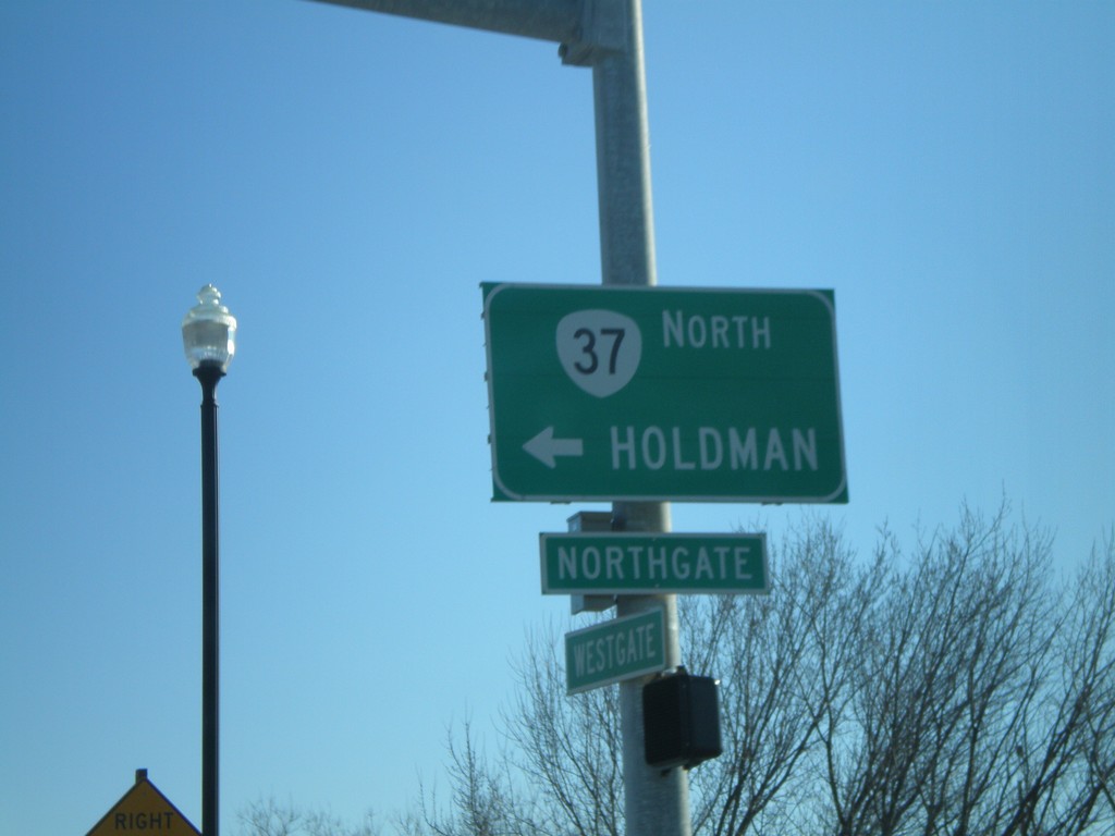
US-30 East at OR-37 North
US-30 east at at OR-37 north to Holdman.
Taken 01-22-2008
Pendleton
Umatilla County
Oregon
United States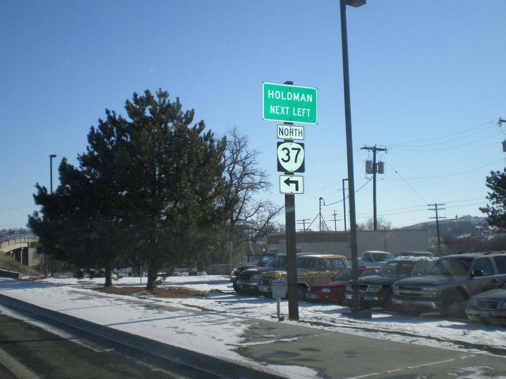
US-30 East Approaching OR-37
US-30 east approaching OR-37 North to Holdman.
Taken 01-22-2008
Pendleton
Umatilla County
Oregon
United States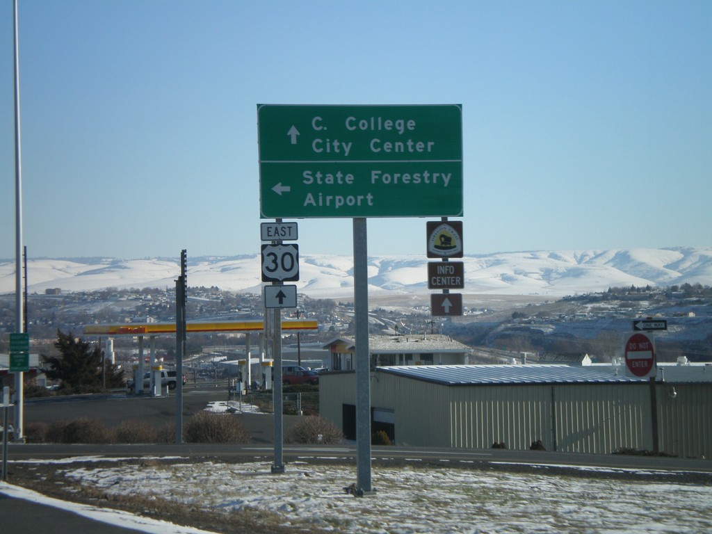
US-30 East at Pendleton Airport Jct.
US-30 east at Airport Road to (Pendleton) Airport and Oregon Department of Forestry unit office. Continue east on US-30 for (Blue Mountain) Community College and (Pendleton) City Center.
Taken 01-22-2008
Pendleton
Umatilla County
Oregon
United States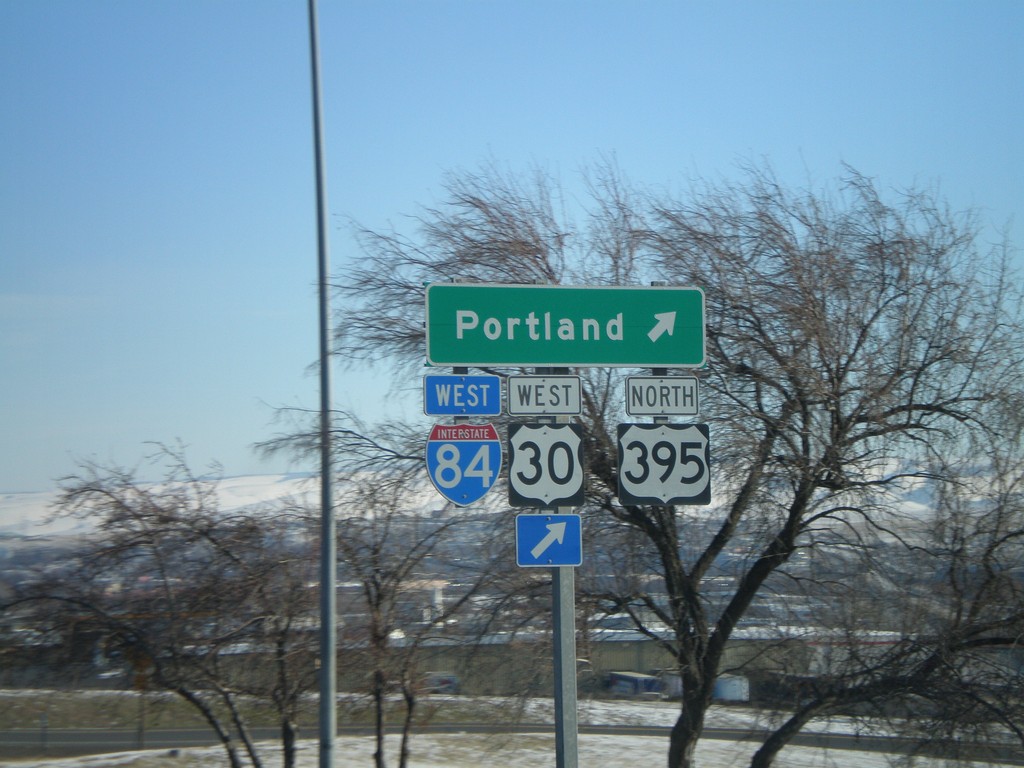
US-30 at I-84/US-395 Exit 207 Westbound Onramp
US-30 East at onramp to I-84/US-30 West/US-395 North to Portland (Exit 207).
Taken 01-22-2008
Pendleton
Umatilla County
Oregon
United States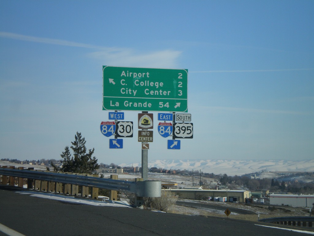
US-30 at I-84/US-395 Exit 207 Onramp
US-30 east at I-84 (Exit 207) onramp. Merge right for I-84 East/US-395 South to La Grande; continue over freeway for I-84/US-30 West/US-395 North, and for (Pendleton) Airport, (Blue Mountain) Community College, and (Pendleton) City Center.
Taken 01-22-2008
Pendleton
Umatilla County
Oregon
United States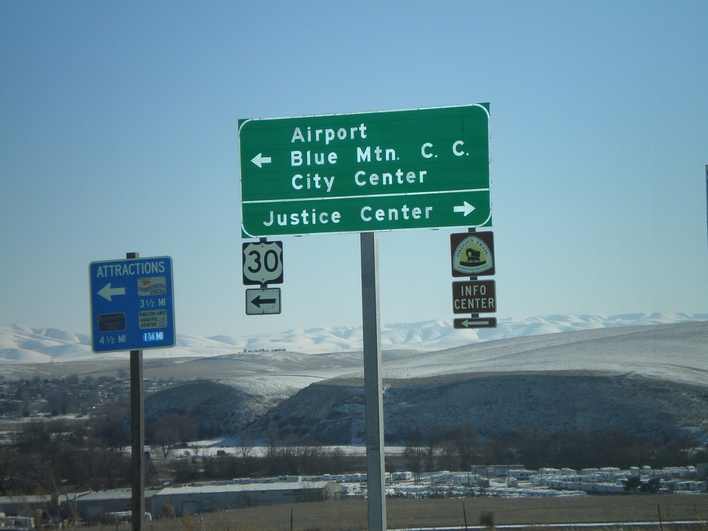
I-84 East - Exit 207 Offramp at US-30 Jct
I-84 East - Exit 207 offramp. Turn left for US-30 west to (Pendleton) Airport, Blue Mountain Community College, and (Pendleton) City Center. Turn right for Justice Center.
Taken 01-22-2008
Pendleton
Umatilla County
Oregon
United States