Signs Tagged With Big Green Sign
US-36 West at CO-66
US-36 west approaching CO-66 east to Longmont.
Taken 05-17-2008


 Longmont
Boulder County
Colorado
United States
Longmont
Boulder County
Colorado
United States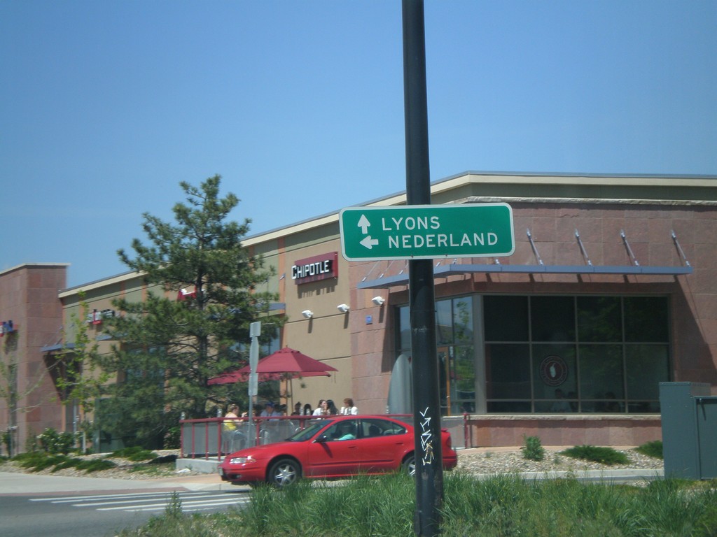
US-36 West Approaching CO-119 West
US-36 west approaching CO-119 west to Nederland.
Taken 05-17-2008
 Boulder
 County
Colorado
United States
Boulder
Boulder County
Colorado
United States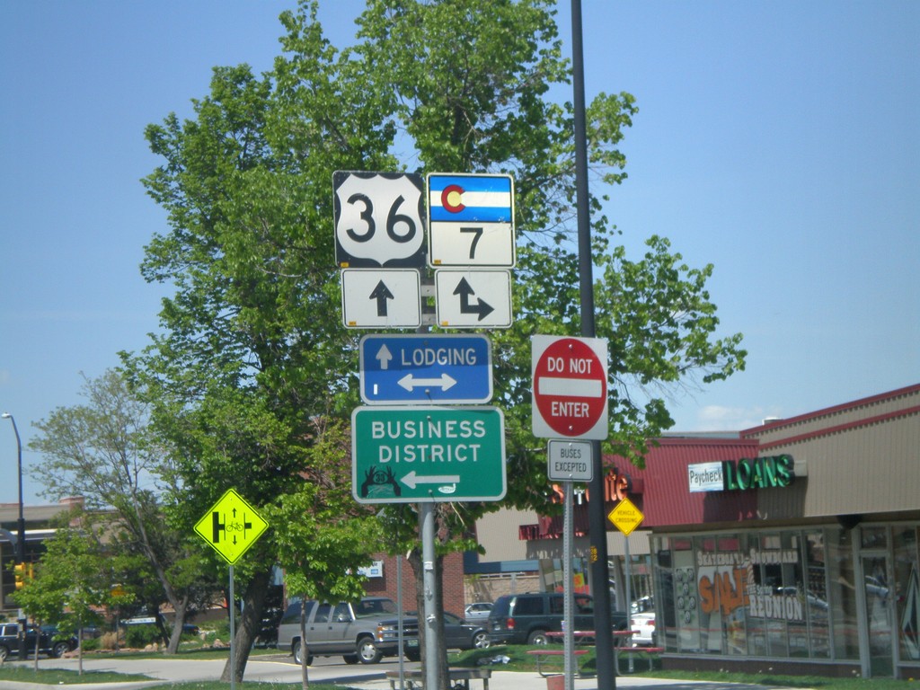
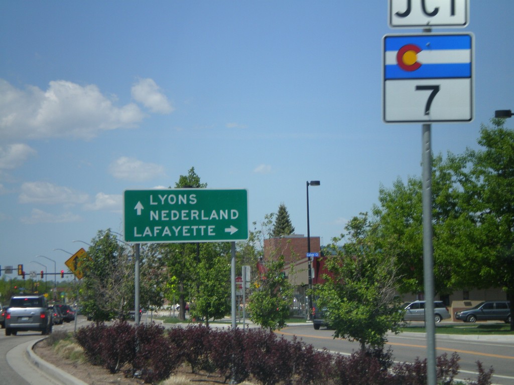
US-36 West Approaching CO-7
US-36 west approaching CO-7 to Lafayette.
Taken 05-17-2008
Boulder
Boulder County
Colorado
United States
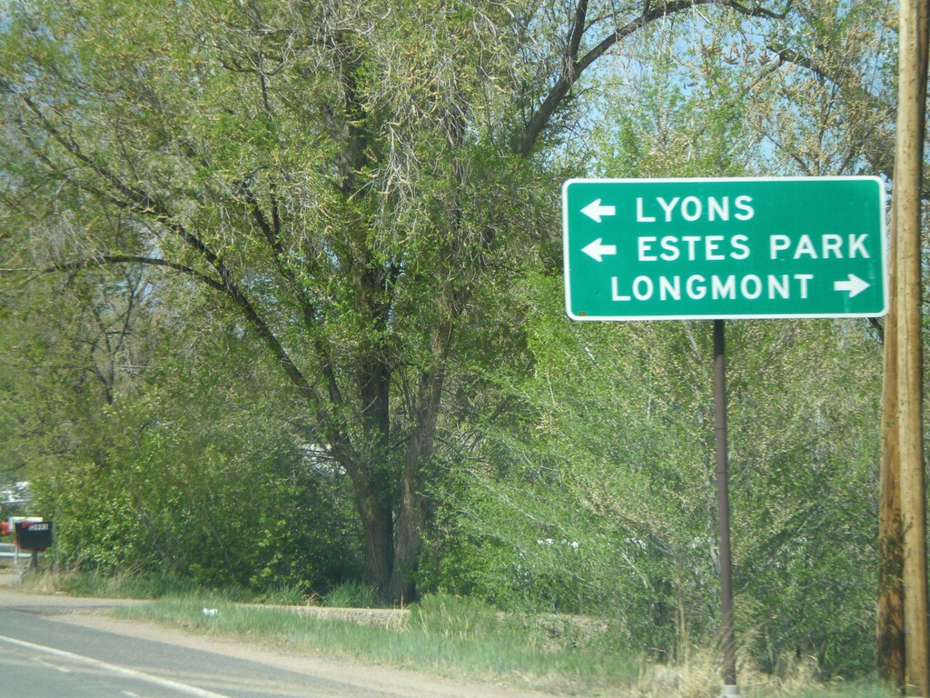
Baseline Road East at US-36
Baseline Road east at US-36 west towards Estes Park.
Taken 05-17-2008
Boulder
Boulder County
Colorado
United States
Baseline Road East at US-36
Baseline Road east at US-36 east to Denver.
Taken 05-17-2008
Boulder
Boulder County
Colorado
United States
Baseline Road East Approaching US-36
Baseline Road east approaching US-36 towards Denver and Estes Park.
Taken 05-17-2008
Boulder
Boulder County
Colorado
United States
Baseline Road East Approaching US-36
Baseline Road east approaching US-36.
Taken 05-17-2008
Boulder
Boulder County
Colorado
United States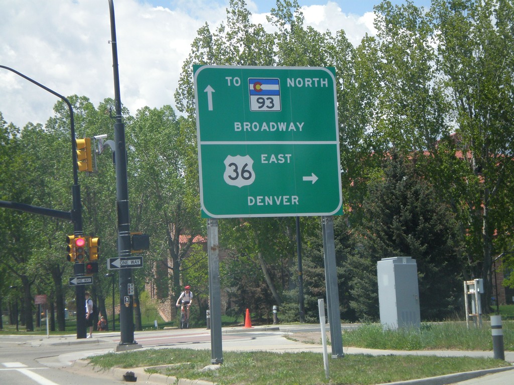
Baseline Road West at US-36 East
Baseline Road west at US-36 east to Denver and approaching CO-93 North/Broadway.
Taken 05-17-2008
 Boulder
 County
Colorado
United States
Boulder
Boulder County
Colorado
United States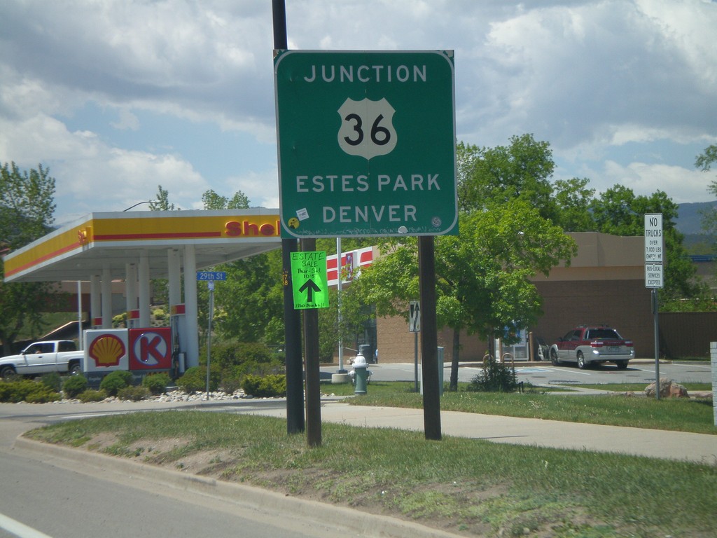
Baseline Road West Approaching US-36
Baseline Road west approaching US-36 to Denver and Estes Park.
Taken 05-17-2008
Boulder
Boulder County
Colorado
United States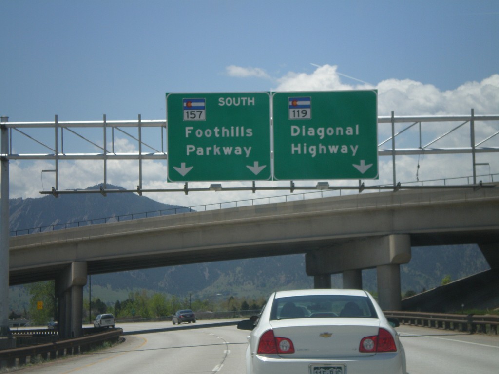
CO-119 West at CO-157
CO-119 west (Diagonal Highway) at CO-157 (Foothills Parkway).
Taken 05-17-2008
 Boulder
 County
Colorado
United States
Boulder
Boulder County
Colorado
United States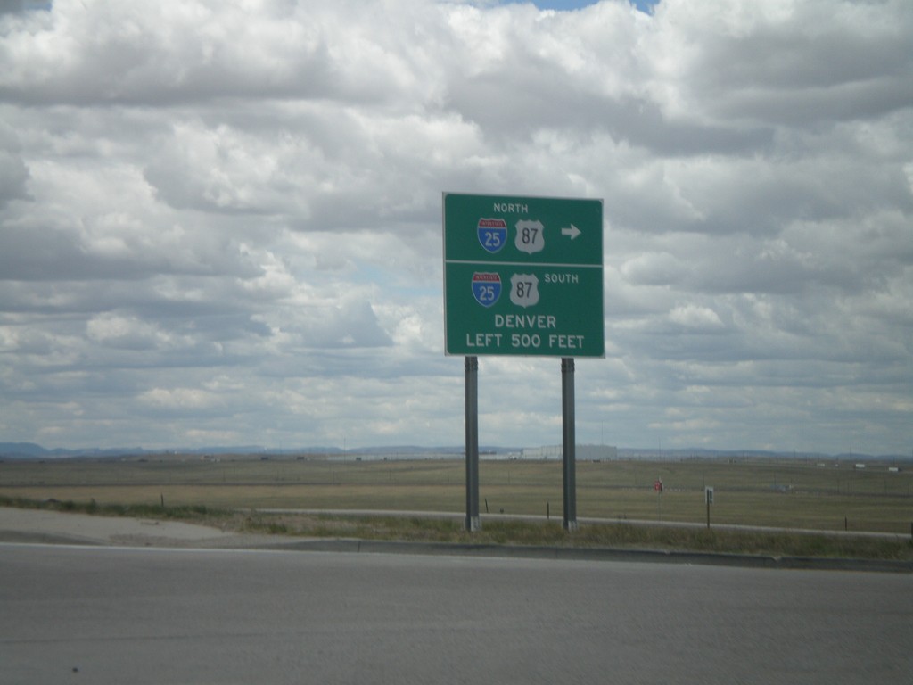
End WY-212/BL-25 at I-25/US-87
End WY-212 west at I-25/US-87. This is the southern end of the Cheyenne business loop.
Taken 05-16-2008
 Cheyenne
Laramie County
Wyoming
United States
Cheyenne
Laramie County
Wyoming
United States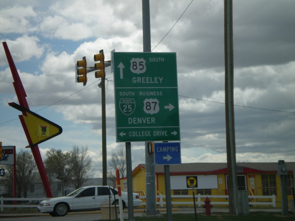
US-85 South at BL-25/BL-87 (WY-212)
US-85/BL-25/BL-87 south at WY-212/BL-25/BL-87 west to Denver (via I-25). Continue on US-85 south for Greeley (CO).
Taken 05-16-2008
 South Greeley
Laramie County
Wyoming
United States
South Greeley
Laramie County
Wyoming
United States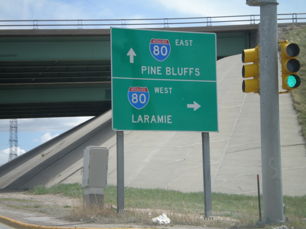
I-180/US-85/BL-25 South at I-80
End I-180 South at I-80 To Pine Bluffs and Laramie. US-85/BL-25 continue south along Central Ave.
Taken 05-16-2008
 Cheyenne
Laramie County
Wyoming
United States
Cheyenne
Laramie County
Wyoming
United States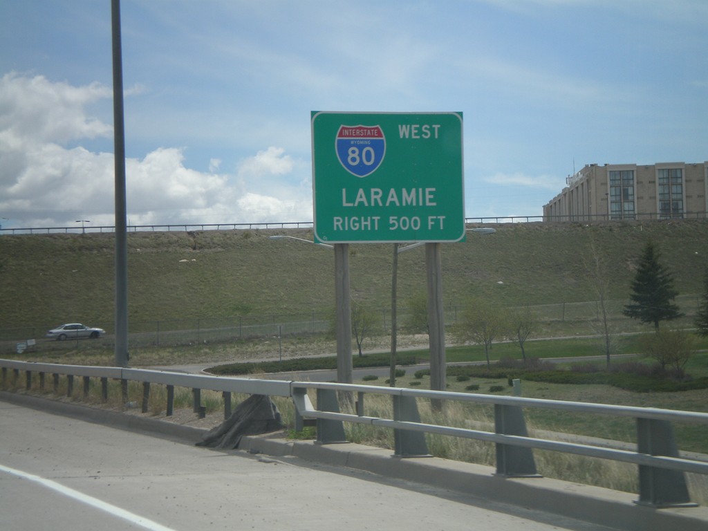
I-180/US-85/BL-25 South Approaching I-80
I-180 south approaching I-80 west to Laramie.
Taken 05-16-2008
Cheyenne
Laramie County
Wyoming
United States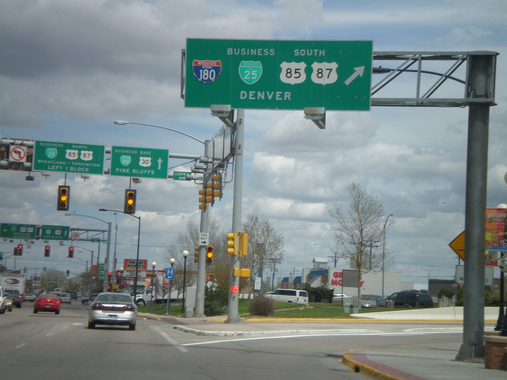
BL-80/US-30 East at I-180 South
BL-80/US-30 East at I-180/BL-25/US-85/US-87 South to Denver.
Taken 05-16-2008


 Cheyenne
Laramie County
Wyoming
United States
Cheyenne
Laramie County
Wyoming
United States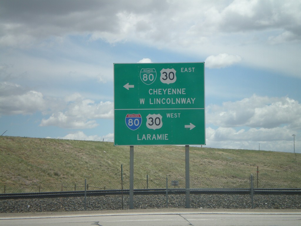
I-25 South - Exit 9 (US-30 Jct)
I-25 Exit 9 offramp at BL-80/US-30. Turn right for BL-80/US-30 for I-80 West/Laramie. Turn left on BL-80/US-30 East to Cheyenne/West Lincolnway.
Taken 05-16-2008
 Cheyenne
Laramie County
Wyoming
United States
Cheyenne
Laramie County
Wyoming
United States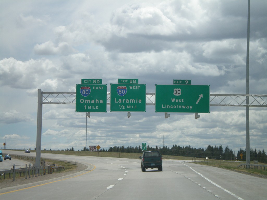
I-25 South - Exits 9, 8B, and 8D
I-25 south at Exit 9 - US-30/West Lincolnway. Approaching Exit 8B - I-80 West/Laramie, and Exit 8D - I-80 East/Omaha.
Taken 05-16-2008
 Cheyenne
Laramie County
Wyoming
United States
Cheyenne
Laramie County
Wyoming
United States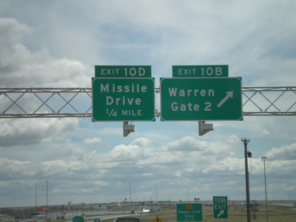
I-25 South - Exits 10B and 10D
I-25 south at Exit 10B - Warren Gate 2. Approaching Exit 10D - Missile Drive. Warren refers to F.E. Warren Air Force Base.
Taken 05-16-2008
Cheyenne
Laramie County
Wyoming
United States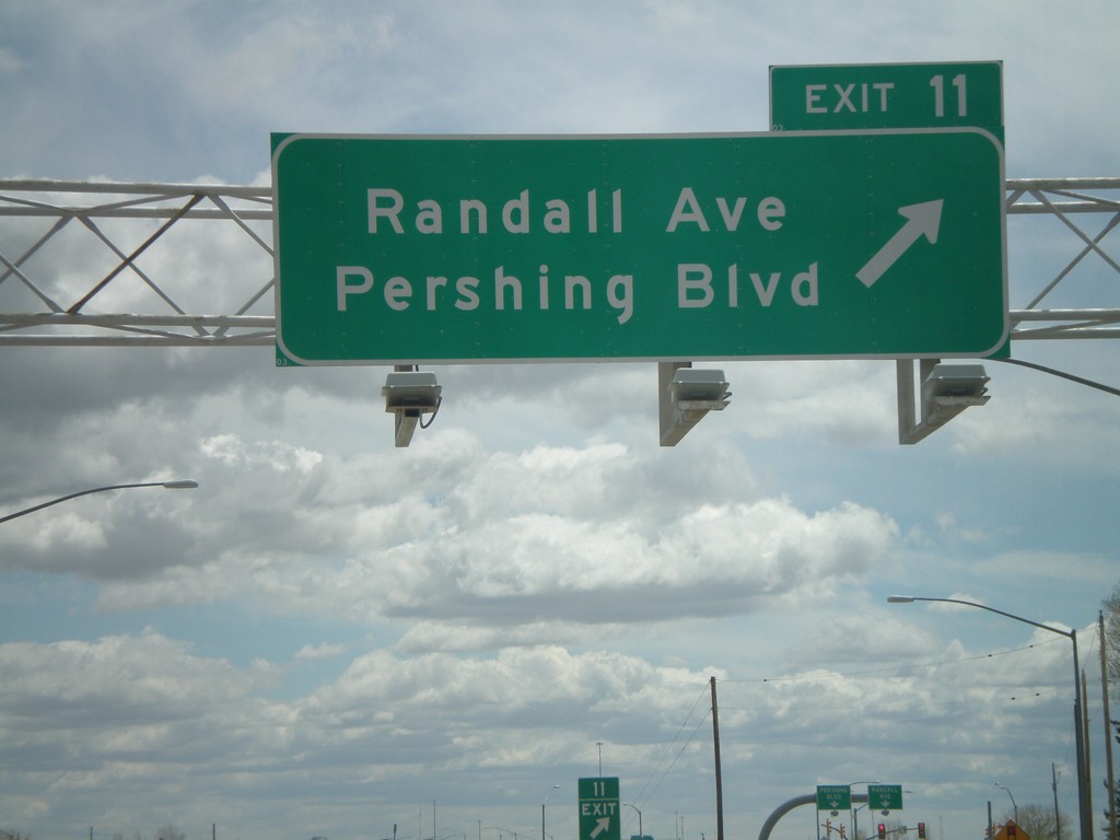
I-25 South - Exit 11
I-25 south at Exit 11 - Randall Ave./Pershing Blvd.
Taken 05-16-2008
Cheyenne
Laramie County
Wyoming
United States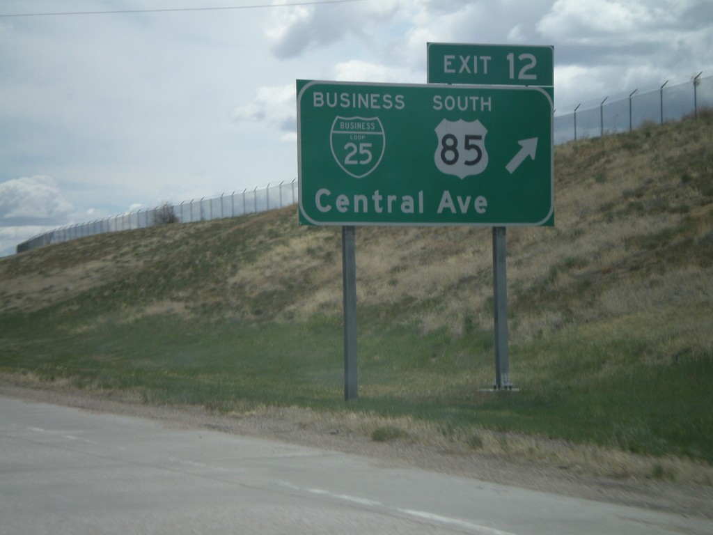
I-25 South - Exit 12
I-25 south at Exit 12 - BL-25/US-85 South/Central Ave.
Taken 05-16-2008
Cheyenne
Laramie County
Wyoming
United States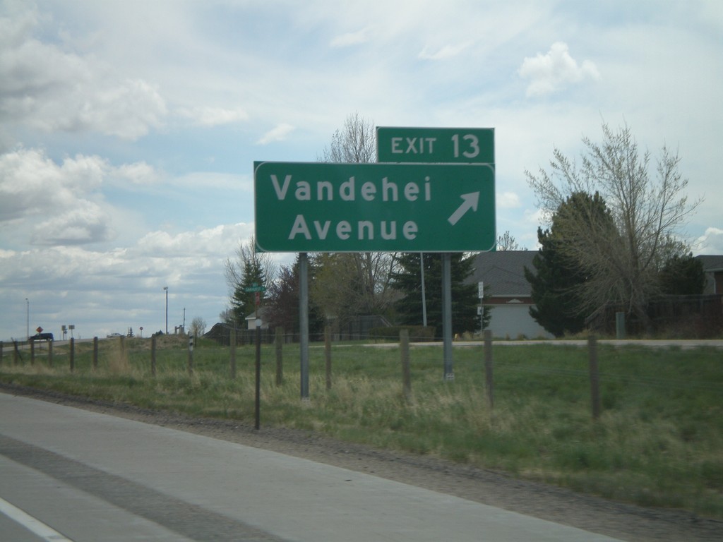
I-25 South - Exit 13
I-25 south at Exit 13 - Vandehei Ave.
Taken 05-16-2008
Cheyenne
Laramie County
Wyoming
United States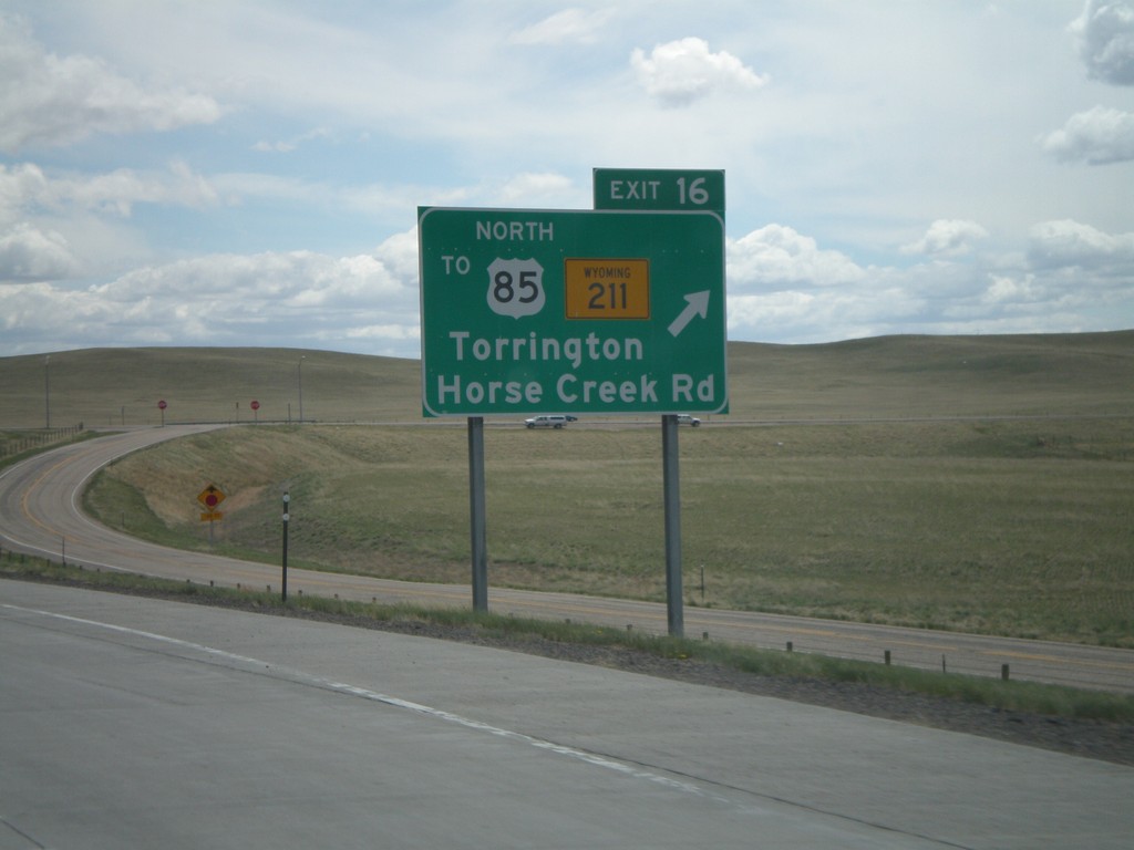
I-25 South - Exit 16
I-25 south at Exit 16 - To US-85 North/WY-211/Torrington/Horse Creek Road. US-85 north traffic exit here, and get on I-25 north.
Taken 05-16-2008
 Cheyenne
Laramie County
Wyoming
United States
Cheyenne
Laramie County
Wyoming
United States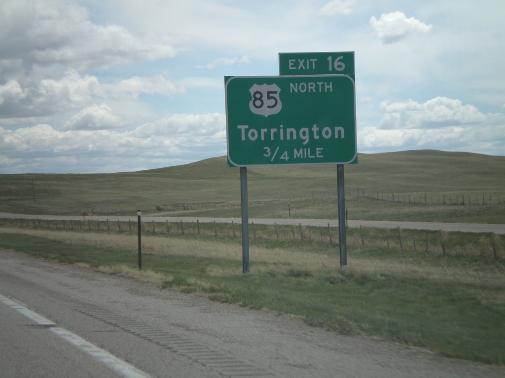
I-25 South - Exit 16
I-25 south approaching Exit 16 - US-85 North/Torrington. There is no direct connection from I-25 south to US-85 north (Exit 17). All US-85 north traffic must use Exit 16, then go north on I-25 to Exit 17.
Taken 05-16-2008
Cheyenne
Laramie County
Wyoming
United States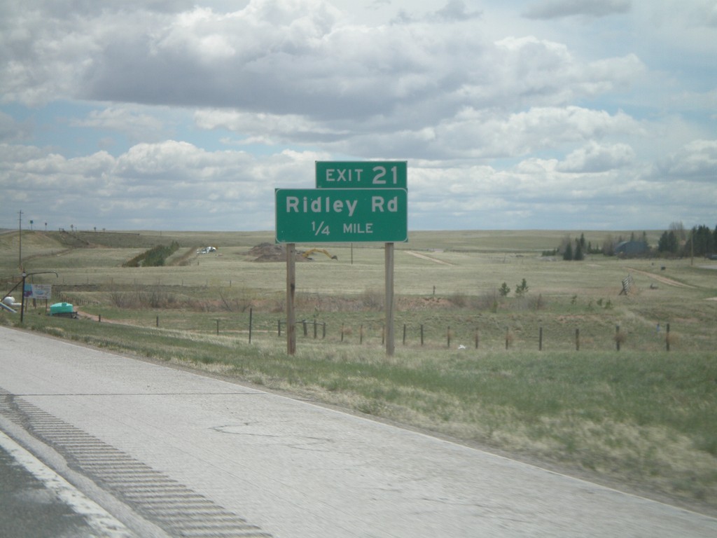
I-25 South - Exit 21
I-25 south approaching Exit 21 - Ridley Road.
Taken 05-16-2008
Cheyenne
Laramie County
Wyoming
United States