Signs Tagged With Big Green Sign
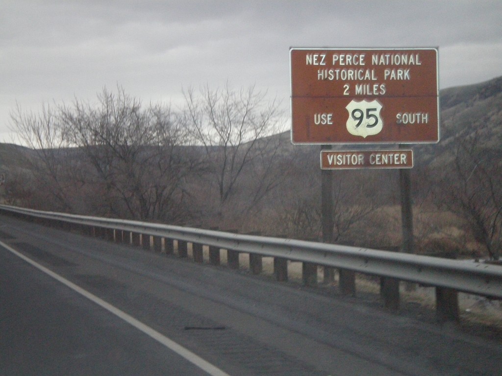
US-12 East/US-95 South - Nez Perce National Historical Park
US-95 South/US-12 East approaching the US-12/US-95 Split. Use US-95 south for the Nez Perce National Historic Park.
Taken 12-26-2007

 Lewiston
Nez Perce County
Idaho
United States
Lewiston
Nez Perce County
Idaho
United States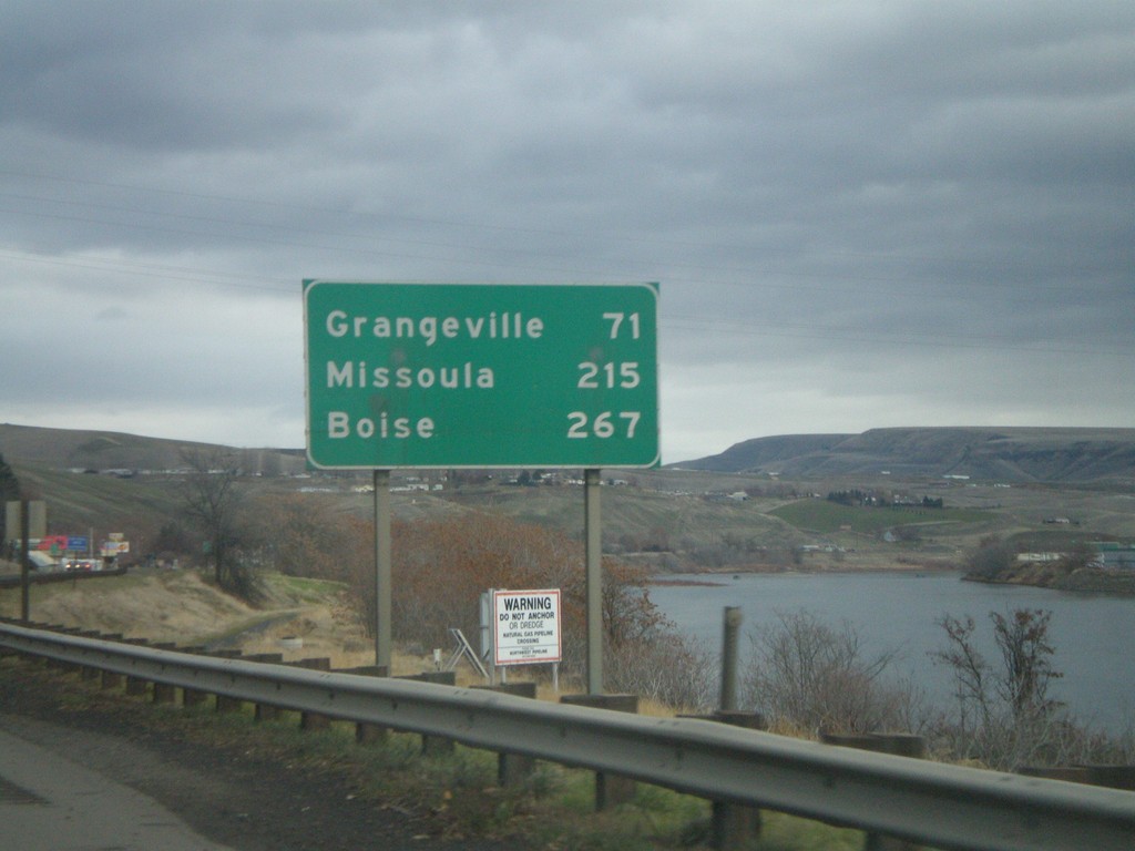
US-12 East/US-95 South - Distance Marker
Distance marker on US-95 South/US-12 East to Grangeville, Missoula (MT - via US-12), and Boise. The Clearwater River is on the right side of the picture.
Taken 12-26-2007
Lewiston
Nez Perce County
Idaho
United States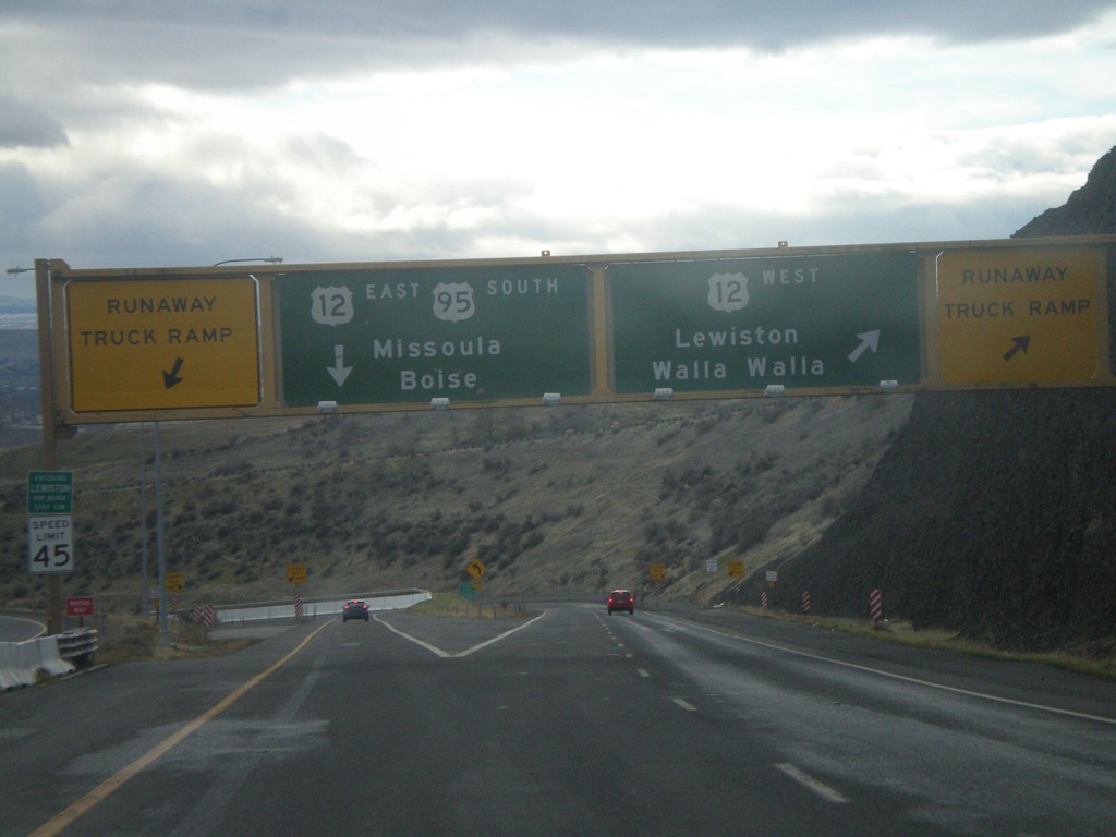
US-95 South at US-12
US-95 south at US-12 at the bottom of the Lewiston Hill. The welcome to Lewiston sign is right above the speed limit sign on the left side of the photo. Lewiston is the lowest city in Idaho - 738 feet. There are Runaway Truck Ramps on either side of the photo.
Taken 12-26-2007
Lewiston
Nez Perce County
Idaho
United States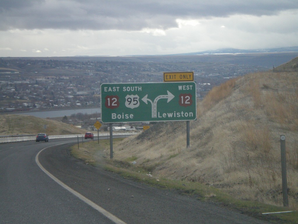
US-95 South Approaching US-12
Route diagram for US-95/US-12 junction on US-95 south. View of the Clearwater Valley and the city of Lewiston. The river in the background is the Clearwater River.
Taken 12-26-2007
Lewiston
Nez Perce County
Idaho
United States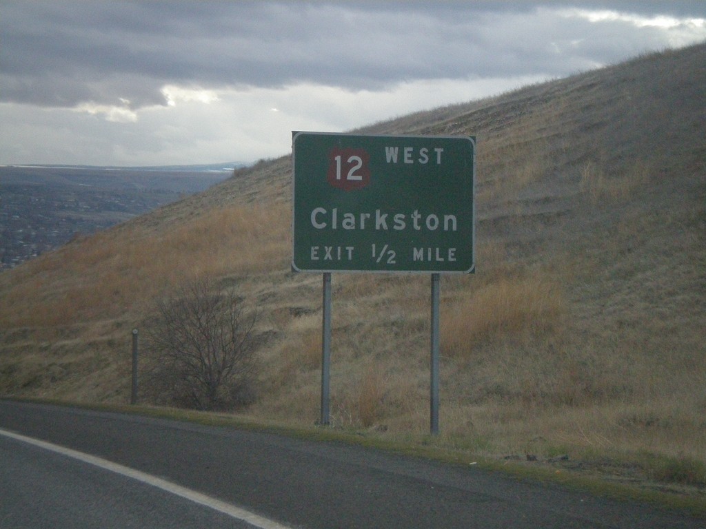
US-95 South Approaching US-12
US-95 south approaching US-12 west to Clarkston (Washington).
Taken 12-26-2007
Lewiston
Nez Perce County
Idaho
United States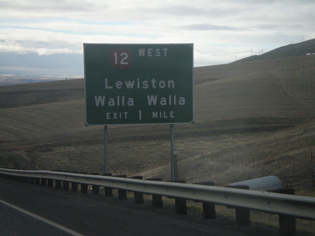
US-95 South Approaching US-12
US-95 south on the Lewiston Hill approaching US-12 west to Lewiston/Walla Walla.
Taken 12-26-2007
Lewiston
Nez Perce County
Idaho
United States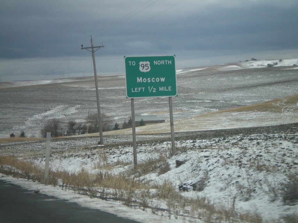
US-195 South Approaching US-95 Spur
US-195 south approaching spur to US-95 north to Moscow. US-195 ends a mile past this sign at US-95 south just into Idaho.
Taken 12-26-2007
 Clarkston
Asotin County
Washington
United States
Clarkston
Asotin County
Washington
United States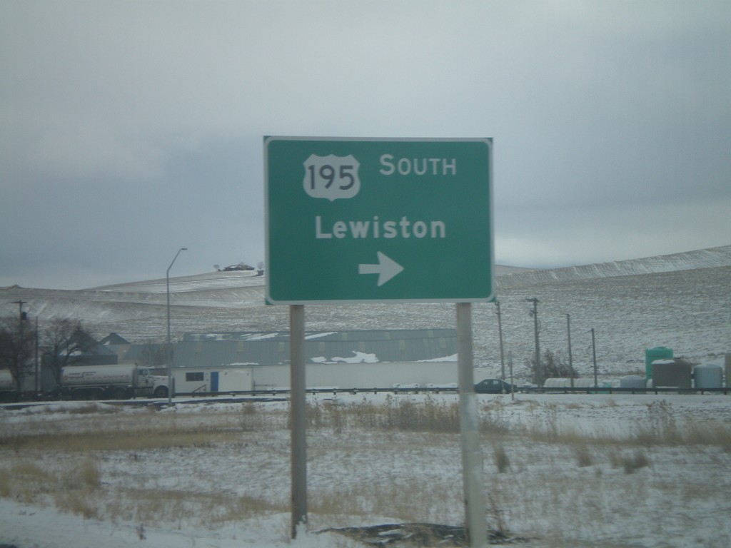
US-195 South At WA-27 North
US-195 south at WA-27 north. Turn right to continue on US-195 south towards Lewiston (Idaho).
Taken 12-26-2007
 Pullman
Whitman County
Washington
United States
Pullman
Whitman County
Washington
United States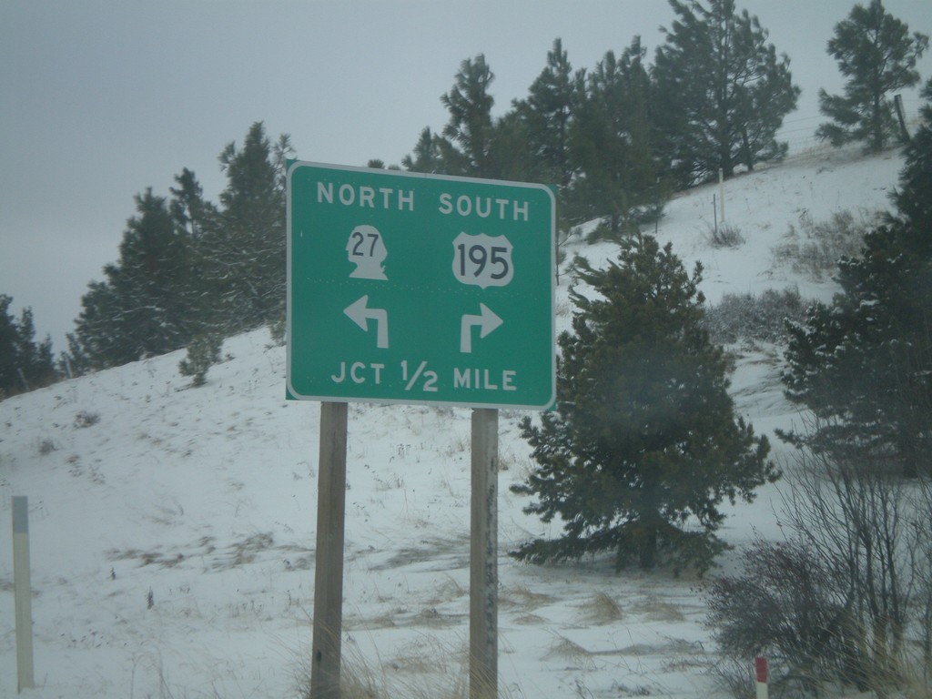
US-195 South Approaching WA-27 North
US-195 south approaching WA-27.
Taken 12-26-2007
Pullman
Whitman County
Washington
United States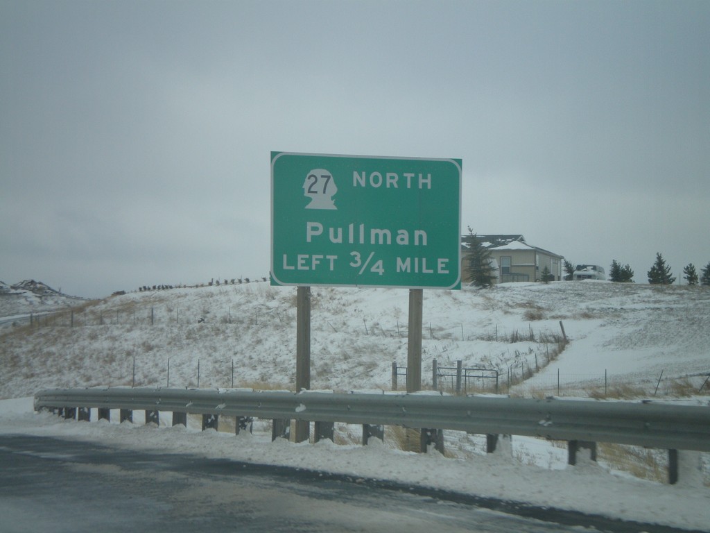
US-195 South Approaching WA-27 North
US-195 south approaching WA-27 north to Pullman. WA-27 parallels US-195 north from here to Spokane.
Taken 12-26-2007
Pullman
Whitman County
Washington
United States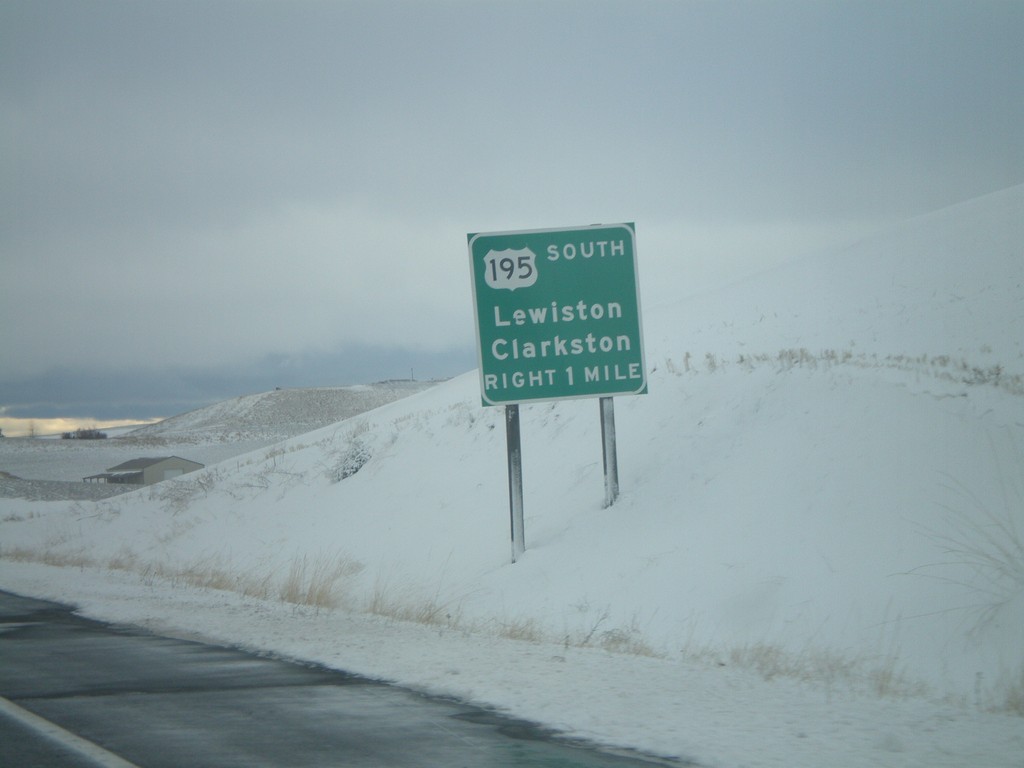
US-195 South Approaching WA-27
US-195 south approaching WA-27. Use US-195 for Lewiston (Idaho) and Clarkston.
Taken 12-26-2007
Pullman
Whitman County
Washington
United States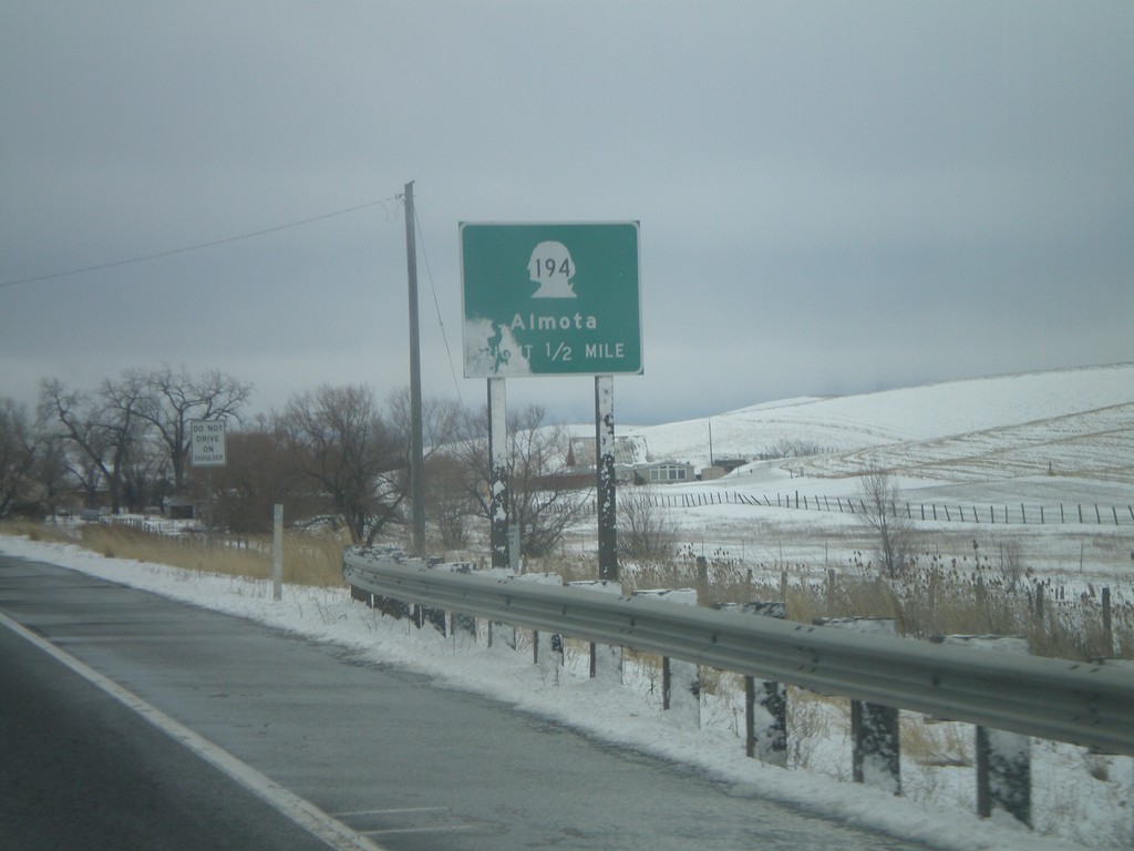
US-195 South Approaching WA-194
US-195 south approaching WA-194 to Almota. Almota is on the Snake River near Lower Granite Dam.
Taken 12-26-2007
 Pullman
Whitman County
Washington
United States
Pullman
Whitman County
Washington
United States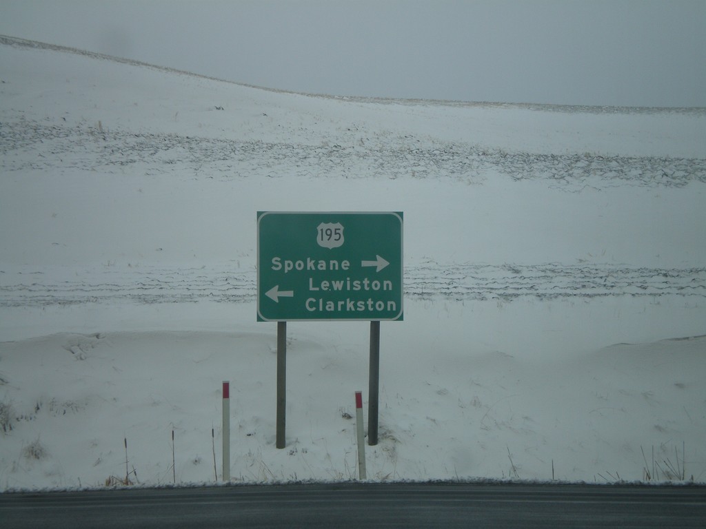
End WA-270 West at US-195
End WA-270 west at US-195 north to Spokane and south to Lewiston and Clarkston.
Taken 12-26-2007
 Pullman
Whitman County
Washington
United States
Pullman
Whitman County
Washington
United States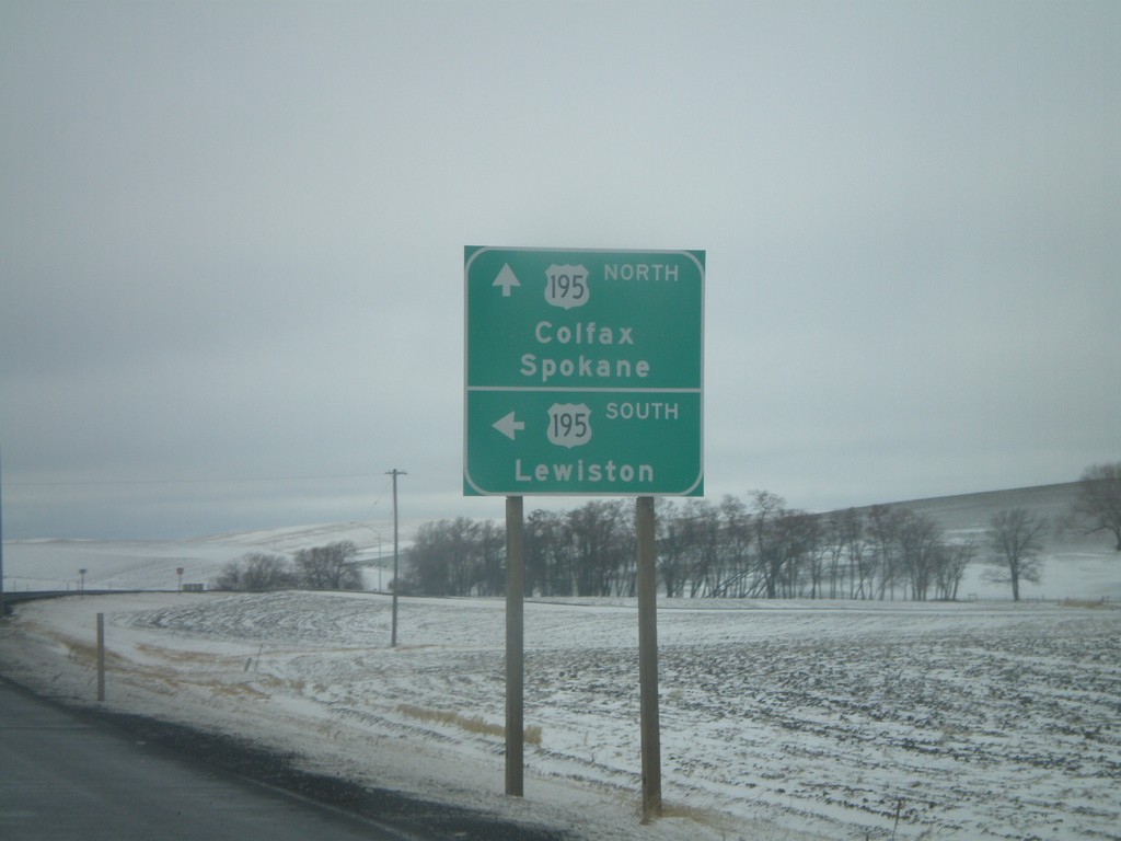
WA-270 West Approaching US-195
End WA-270 west at US-195. Use US-195 north for Colfax and Spokane. Use US-195 south for Lewiston (Idaho).
Taken 12-26-2007
Pullman
Whitman County
Washington
United States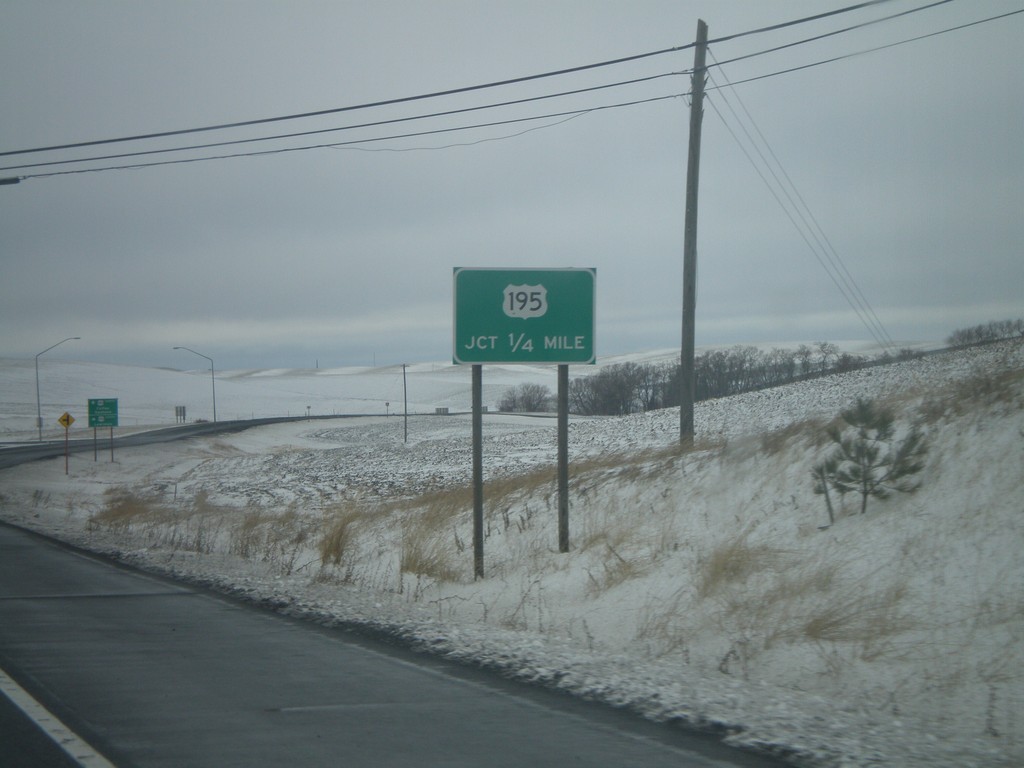
WA-270 West Approaching US-195
WA-270 west approaching US-195 junction.
Taken 12-26-2007
Pullman
Whitman County
Washington
United States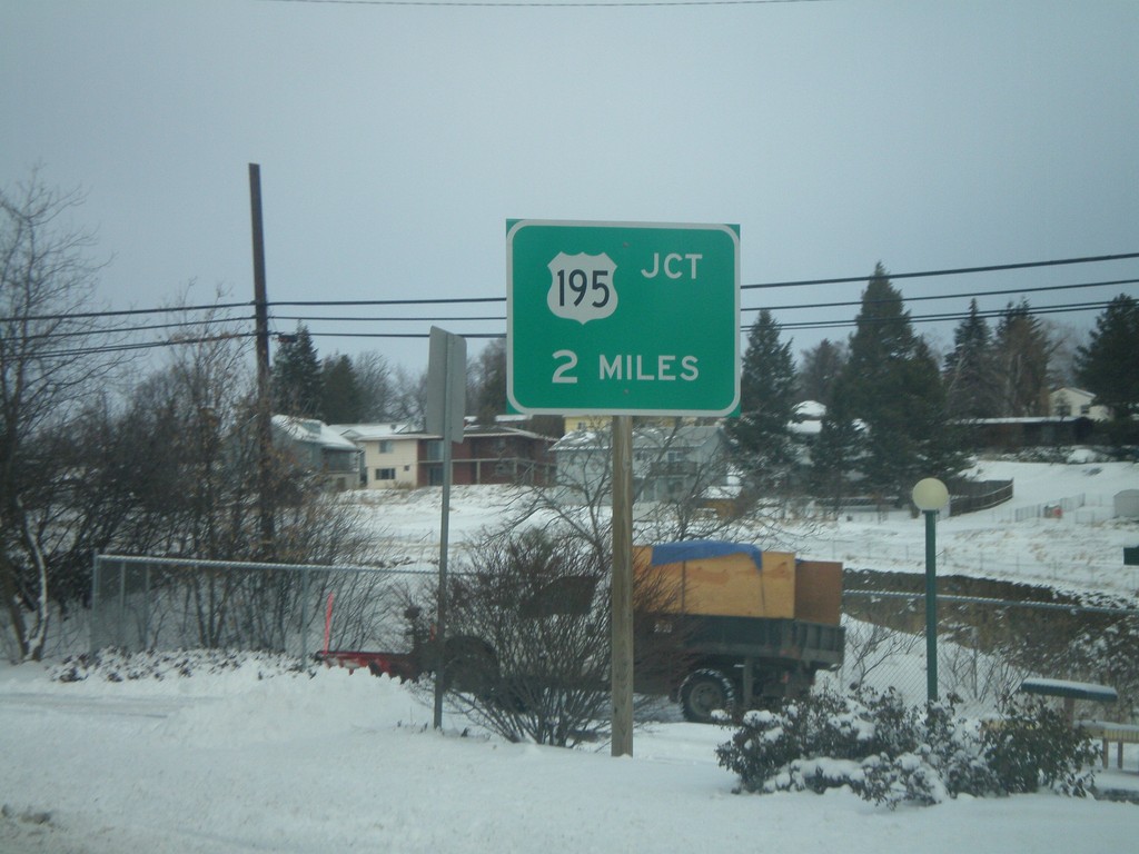
WA-270 - Distance Marker
US-195 junction 2 miles on WA-270 west.
Taken 12-26-2007
Pullman
Whitman County
Washington
United States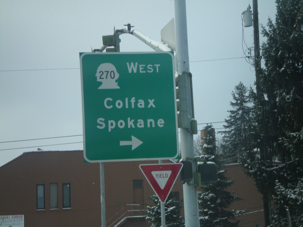
WA-27 South At WA-270 West
WA-27 south at WA-270 west to Colfax and Spokane.
Taken 12-26-2007
Pullman
Whitman County
Washington
United States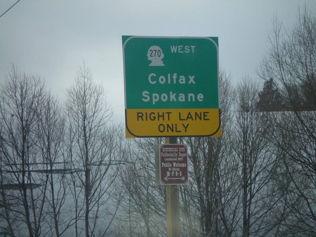
WA-27 South at WA-270 West
WA-27 south approaching WA-270 west to Colfax and Spokane.
Taken 12-26-2007
Pullman
Whitman County
Washington
United States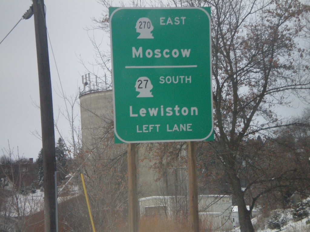
WA-27 South At WA-270 Junction
WA-27 south approaching WA-270. Use WA-27 south for Lewiston (Idaho). Use WA-270 east for Moscow (Idaho).
Taken 12-26-2007
Pullman
Whitman County
Washington
United States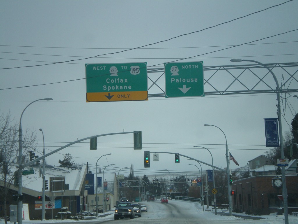
WA-27 North/WA-270 East at WA-270 East
WA-27 north to Palouse at WA-270 west to US-195/Colfax/Spokane.
Taken 12-26-2007
Pullman
Whitman County
Washington
United States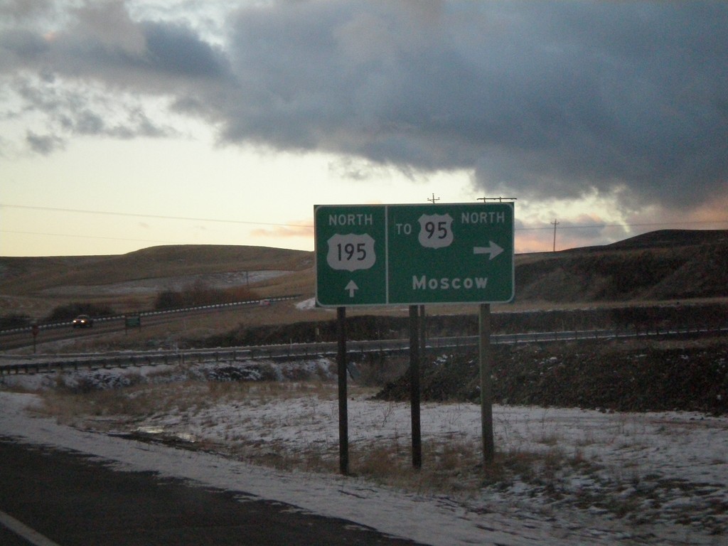
US-195 North At US-95 Spur
US-195 north at short spur to US-95 north to Moscow, Idaho.
Taken 12-24-2007
Clarkston
Asotin County
Washington
United States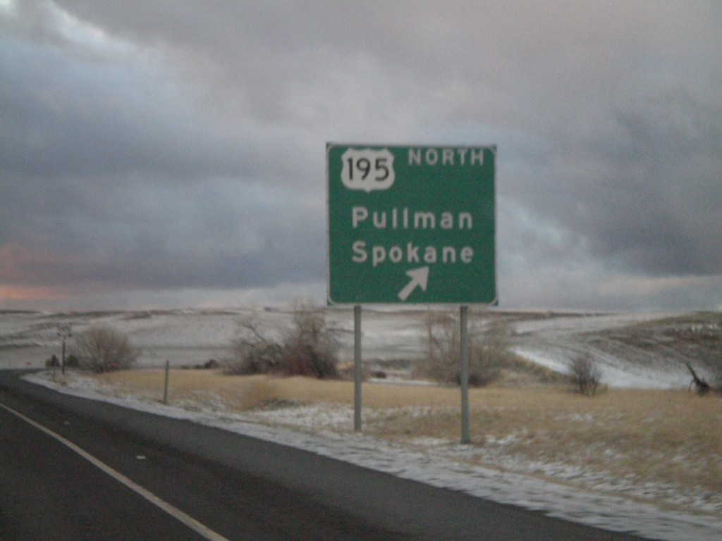
US-95 North At US-195
US-95 north approaching US-195 to Pullman and Spokane. US-195 leaves Idaho less than a mile of this junction.
Taken 12-24-2007
Genesee
Nez Perce County
Idaho
United States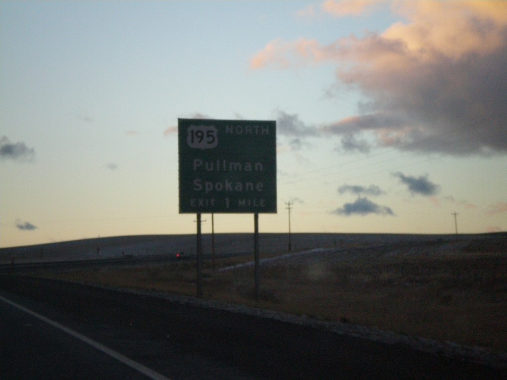
US-95 North Approaching US-195
US-95 north approaching US-195 north to Pullman and Spokane.
Taken 12-24-2007
Genesee
Nez Perce County
Idaho
United States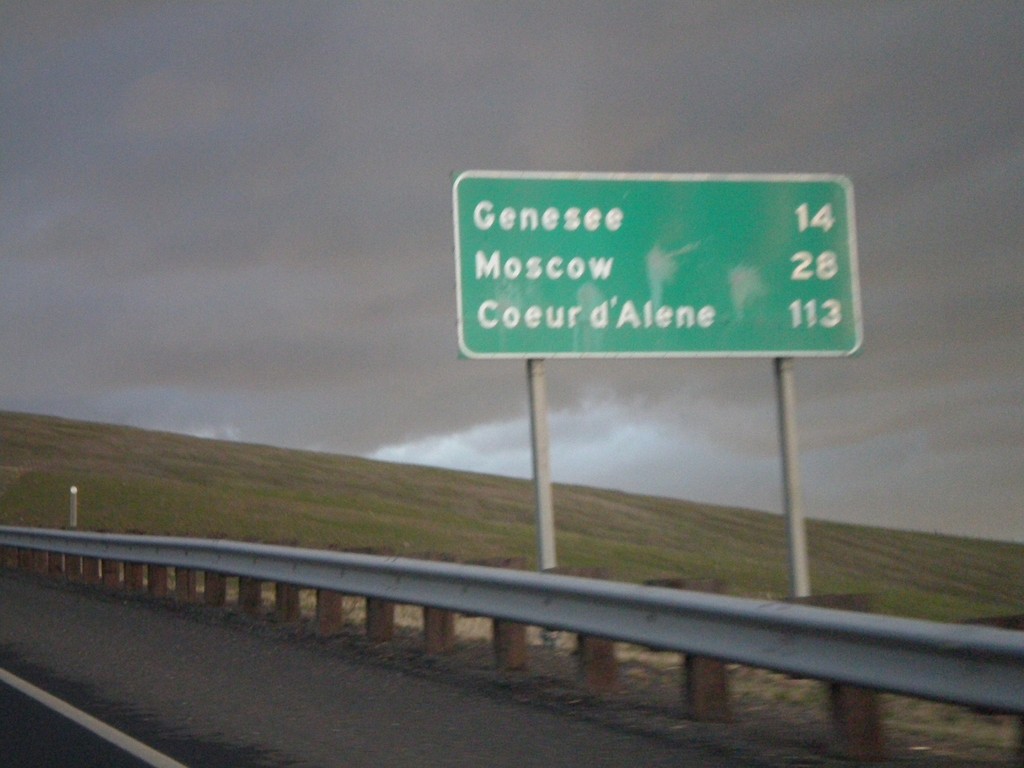
US-95 North - Distance Marker
Distance Marker on US-95 north to Genesee, Moscow, and Coeur d’Alene on Lewiston Hill.
Taken 12-24-2007
Lewiston
Nez Perce County
Idaho
United States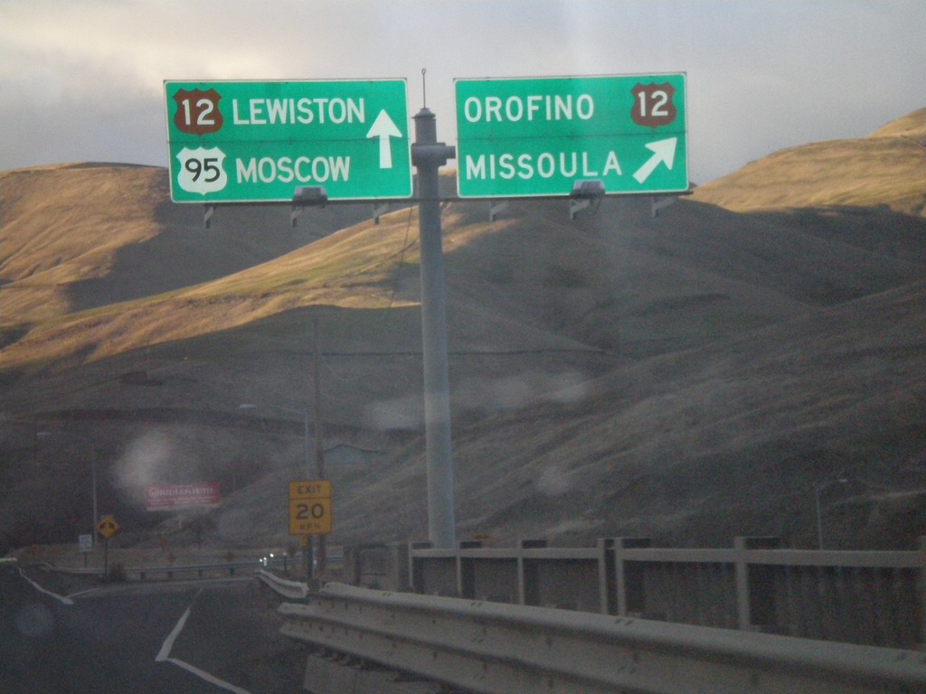
US-95 North at US-12 Junction
US-95 north at US-12 to Orofino and Missoula. US-12 follows US-95 north to Lewiston.
Taken 12-24-2007
Lewiston
Nez Perce County
Idaho
United States