Signs Tagged With Big Green Sign

I-90 East - Exit 34
I-90 east at Exit 34 - ID-3/Rose Lake/Harrison/St. Maries.
Taken 04-13-2008

 Cataldo
Kootenai County
Idaho
United States
Cataldo
Kootenai County
Idaho
United States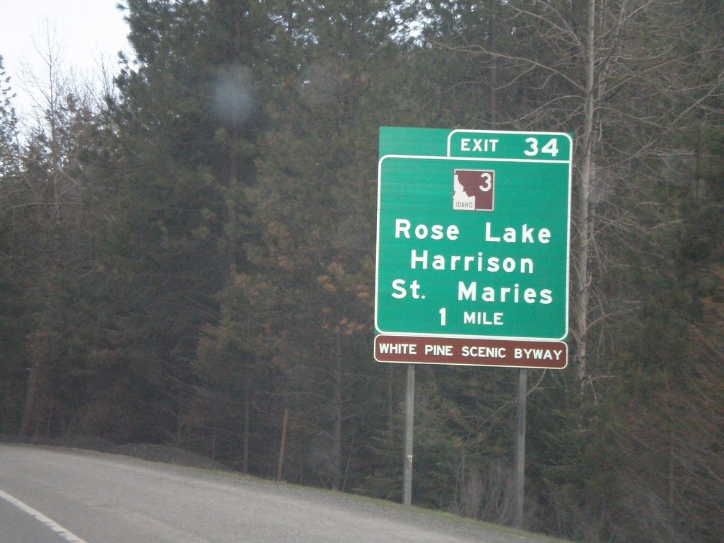
I-90 East - Exit 34
I-90 east approaching Exit 34 - ID-3/Harrison/St. Maries/Rose Lake.
Taken 04-13-2008
Cataldo
Kootenai County
Idaho
United States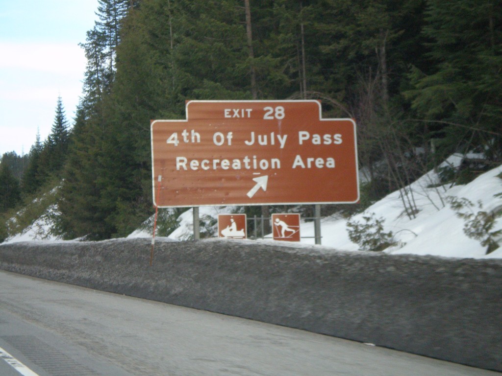
I-90 East - Exit 28
I-90 east at Exit 28 - 4th of July Pass Recreation Area.
Taken 04-13-2008
Wolf Lodge
Kootenai County
Idaho
United States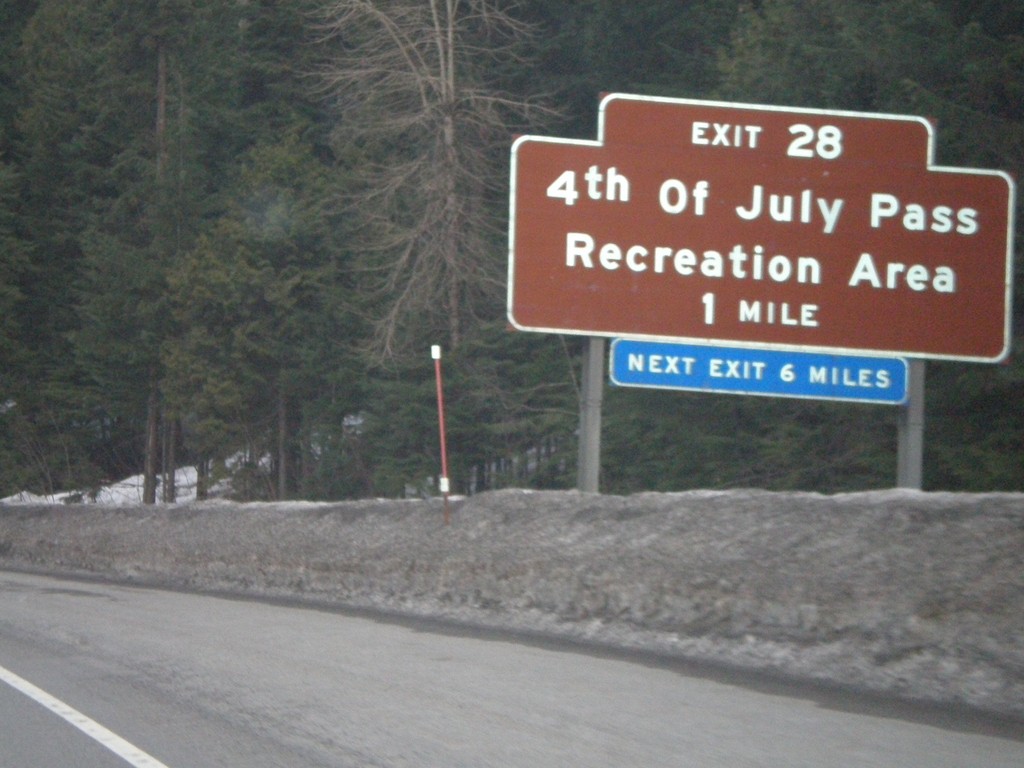
I-90 East - Exit 28
I-90 east approaching Exit 28 - 4th of July Pass Recreation Area.
Taken 04-13-2008
Coeur d'Alene
Kootenai County
Idaho
United States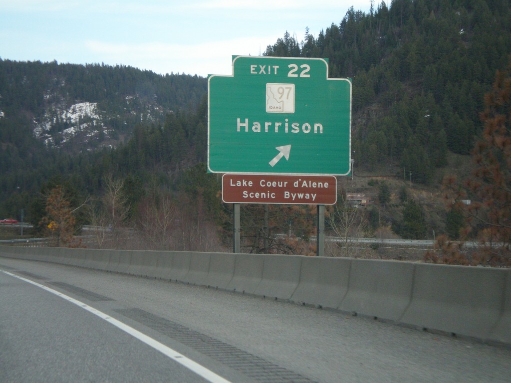
I-90 East - Exit 22
I-90 east at Exit 22 - ID-97/Harrison.
Taken 04-13-2008
 Wolf Lodge
Kootenai County
Idaho
United States
Wolf Lodge
Kootenai County
Idaho
United States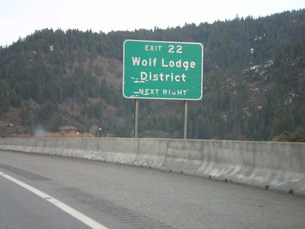
I-90 East - Exit 22 - Wolf Lodge District
I-90 east approaching Exit 22. Use Exit 22 for Wolf Lodge District.
Taken 04-13-2008
Coeur d'Alene
Kootenai County
Idaho
United States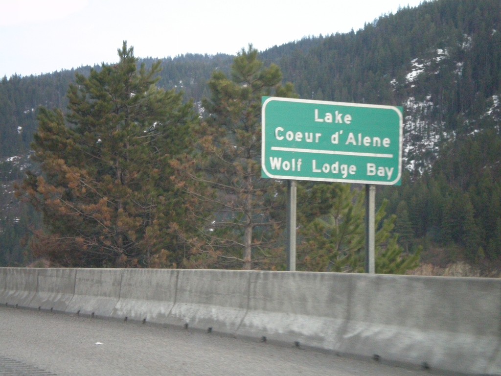
I-90 East - Lake Coeur d'Alene
I-90 east crossing Wolf Lodge Bay of Lake Coeur d’Alene.
Taken 04-13-2008
Coeur d'Alene
Kootenai County
Idaho
United States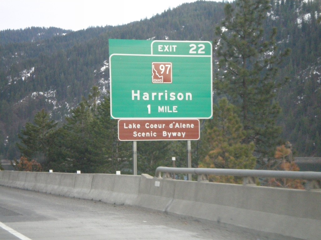
I-90 East - Exit 22
I-90 east approaching Exit 22 - ID-97/Harrison.
Taken 04-13-2008
Coeur d'Alene
Kootenai County
Idaho
United States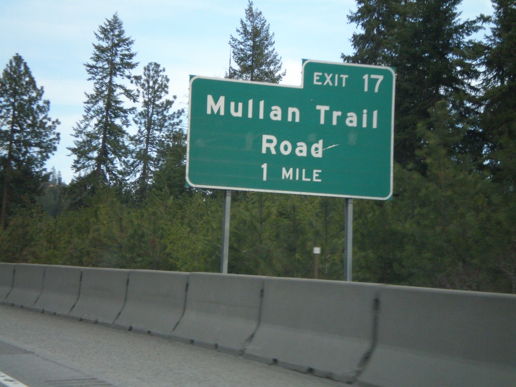
I-90 East - Exit 17
I-90 east approaching Exit 17 - Mullan Trail Road.
Taken 04-13-2008
Coeur d'Alene
Kootenai County
Idaho
United States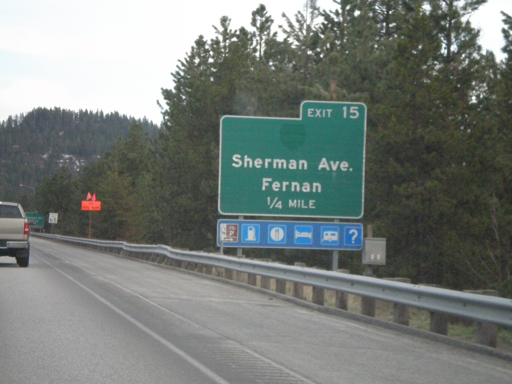
I-90 East - Exit 15
I-90 east approaching Exit 15 - Sherman Ave./Fernan.
Taken 04-13-2008
Coeur d'Alene
Kootenai County
Idaho
United States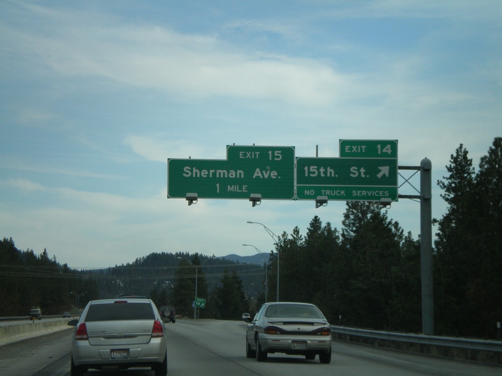
I-90 East - Exit 14 and 15
I-90 east at Exit 14 - 15th St. Approaching Exit 15 - Sherman Ave.
Taken 04-13-2008
Coeur d'Alene
Kootenai County
Idaho
United States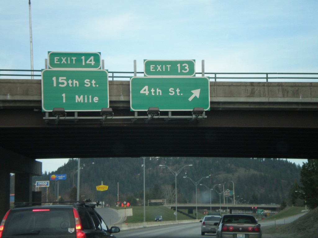
I-90 East - Exits 13 and 14
I-90 east at Exit 13 - 4th St. Approaching Exit 14 - 15th St.
Taken 04-13-2008
Coeur d'Alene
Kootenai County
Idaho
United States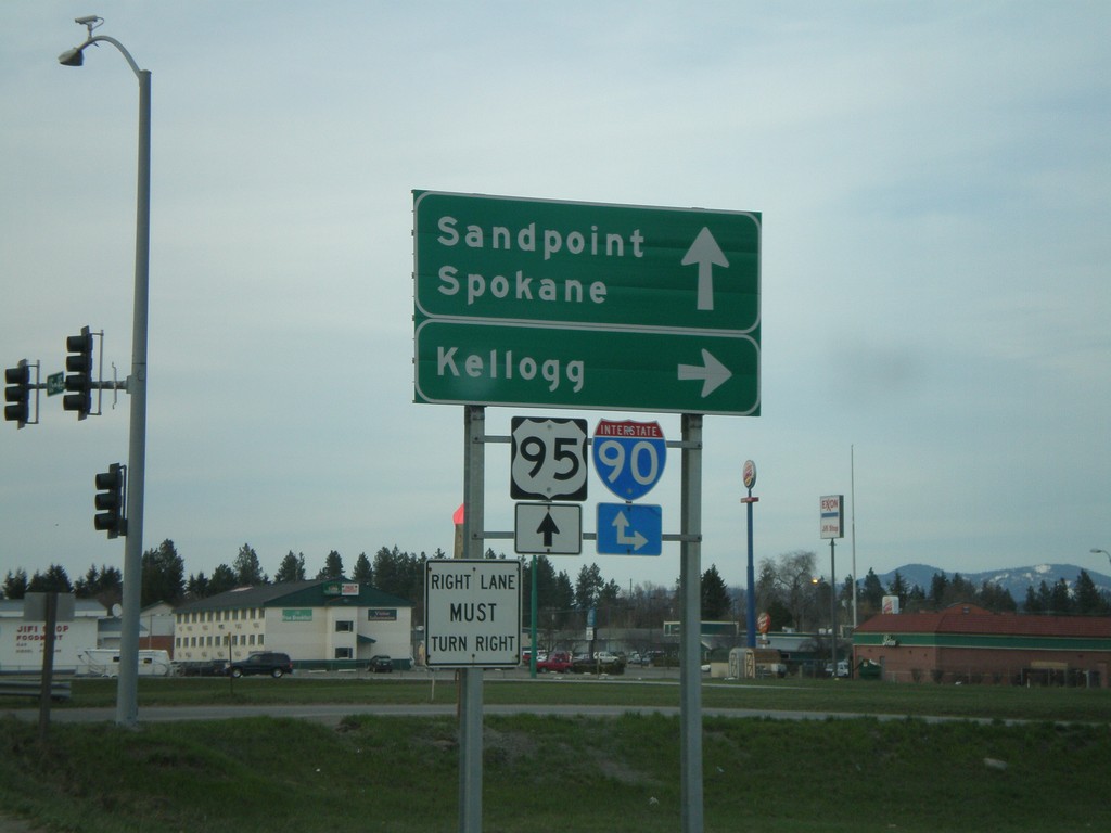
US-95 North at I-90 East
US-95 north at I-90 east to Kellogg. US-95 north continues to Sandpoint, and I-90 west to Spokane.
Taken 04-13-2008
 Coeur d'Alene
Kootenai County
Idaho
United States
Coeur d'Alene
Kootenai County
Idaho
United States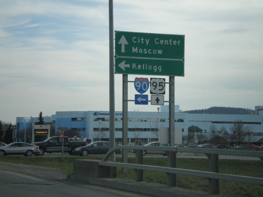
US-95 South at I-90 East
US-95 south at I-90 east to Kellogg. US-95 south continues to City Center and Moscow.
Taken 04-13-2008
Coeur d'Alene
Kootenai County
Idaho
United States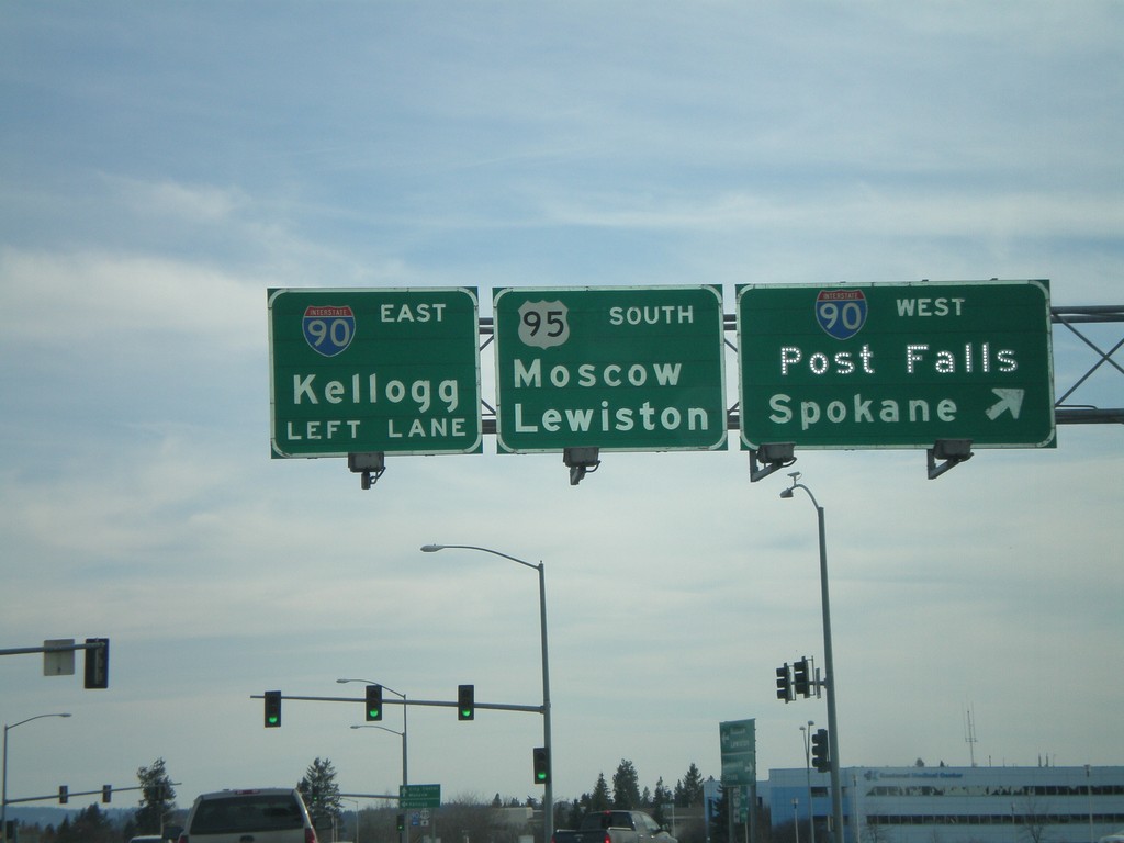
US-95 South at I-90
US-95 south at I-90 west onramp (Exit 12). Use I-90 west for Post Falls and Spokane. Use I-90 east for Kellogg and US-95 south for Moscow and Lewiston.
Taken 04-13-2008
Coeur d'Alene
Kootenai County
Idaho
United States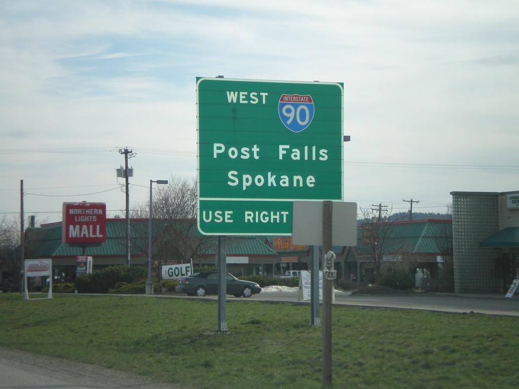
US-95 South Approaching I-90
US-95 south approaching I-90. For I-90 west to Post Falls and Spokane use right lane.
Taken 04-13-2008
Coeur d'Alene
Kootenai County
Idaho
United States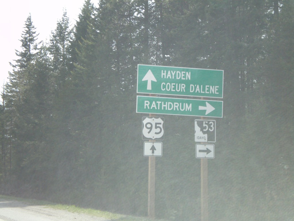
US-95 South at ID-53
US-95 south at ID-53 west to Rathdrum.
Taken 04-13-2008
 Hayden
Kootenai County
Idaho
United States
Hayden
Kootenai County
Idaho
United States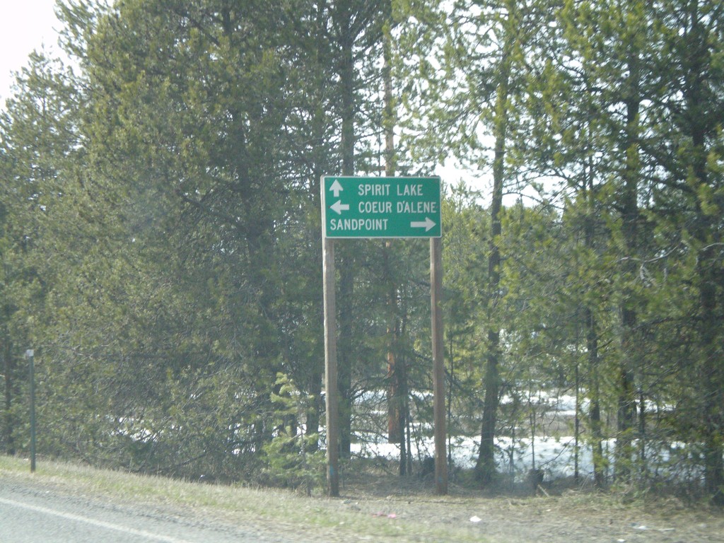
ID-54 West at US-95
ID-54 west at US-95 north to Sandpoint and south to Coeur d’Alene.
Taken 04-13-2008
 Athol
Kootenai County
Idaho
United States
Athol
Kootenai County
Idaho
United States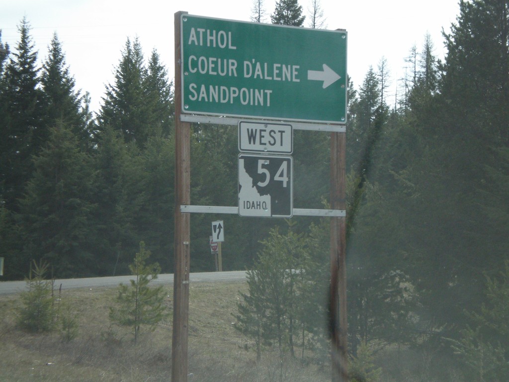
ID-54 West in Farragut State Park
ID-54 west at right turn. Turn right to continue on ID-54 towards Athol, Sandpoint, and Coeur d’Alene.
Taken 04-13-2008
Athol
Kootenai County
Idaho
United States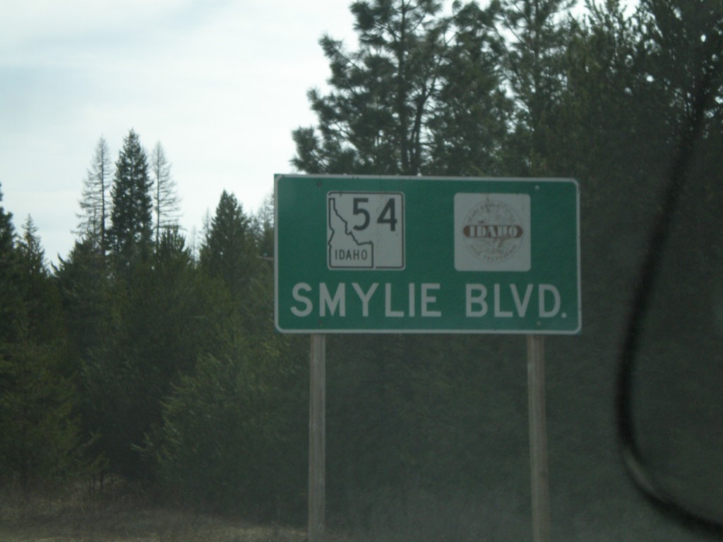
ID-54 West - Smylie Blvd
ID-54 West - Smylie Blvd. Logo next to ID-54 is for Idaho Parks and Recreation.
Taken 04-13-2008
Bayview
Kootenai County
Idaho
United States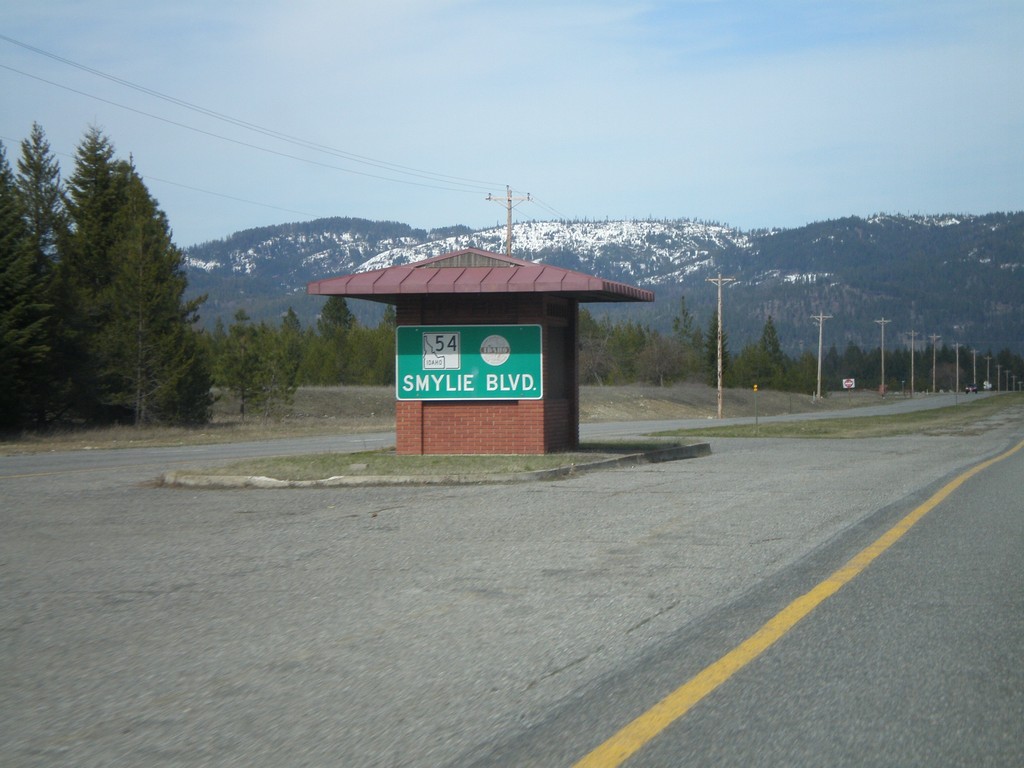
ID-54 East - Smylie Blvd.
Smylie Blvd. on ID-54 east.
Taken 04-13-2008
Athol
Kootenai County
Idaho
United States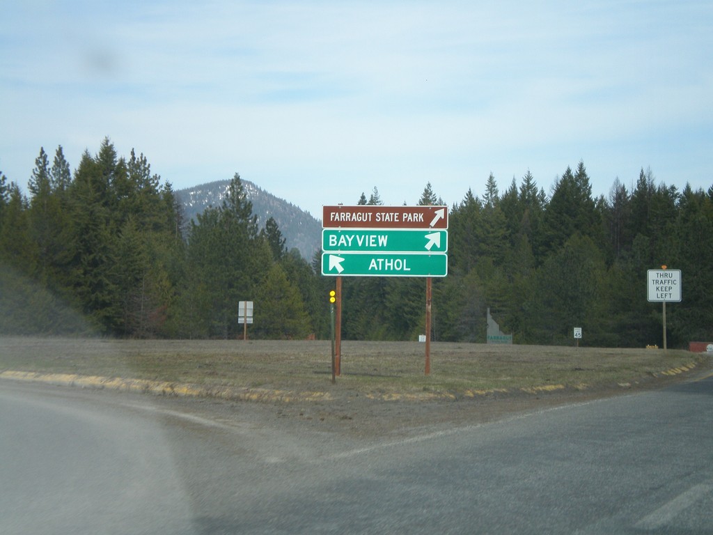
ID-54 East at Farragut SP Traffic Circle
ID-54 east at a roundabout in Farragut State Park. Through traffic stay to the right towards Bayview. West bound ID-54 traffic towards Athol stay left.
Taken 04-13-2008
Athol
Kootenai County
Idaho
United States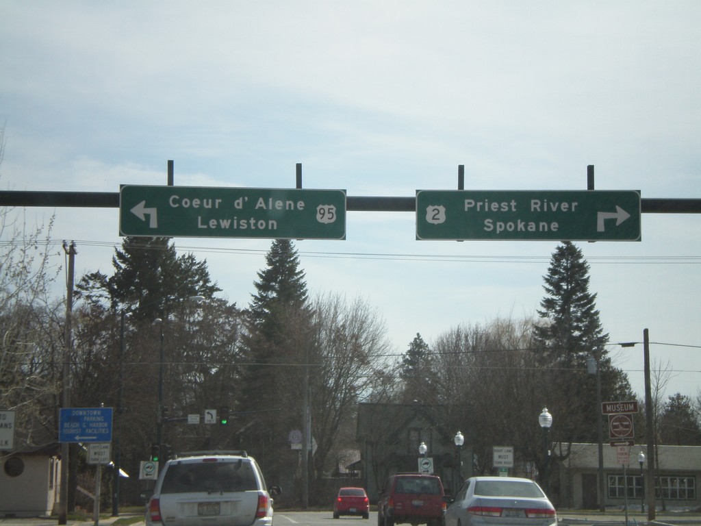
US-2 West/US-95 South at US-2/US-95 Split
US-2 West/US-95 South (5th Ave.) at US-2/US-95 split (Pine St.). Use US-2 West for Priest River and Sandpoint. Use US-95 South for Coeur d’Alene and Lewiston.
Taken 04-13-2008
 Sandpoint
Bonner County
Idaho
United States
Sandpoint
Bonner County
Idaho
United States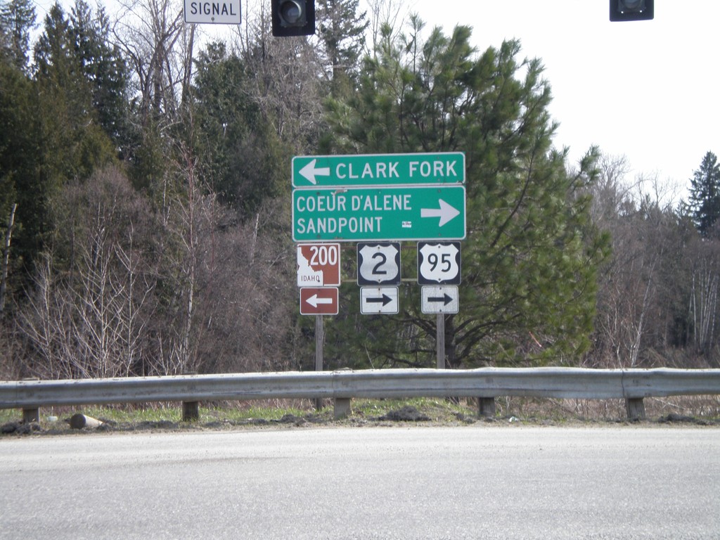
US-95 South/US-2 West at ID-200
US-95 South/US-2 West at ID-200 East to Clark Fork.
Taken 04-13-2008
 Ponderay
Bonner County
Idaho
United States
Ponderay
Bonner County
Idaho
United States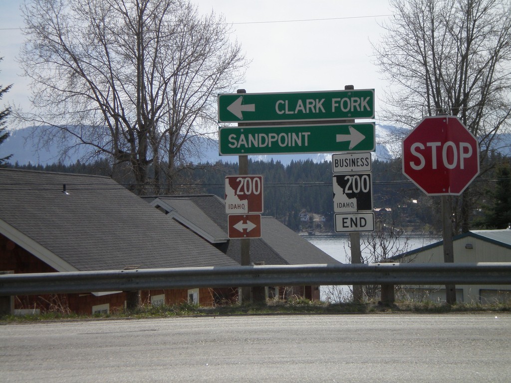
End BL-200 East at ID-200
End BL-200 east at ID-200 to Sandpoint and Clark Fork.
Taken 04-13-2008
 Hope
Bonner County
Idaho
United States
Hope
Bonner County
Idaho
United States