Signs Tagged With Big Green Sign
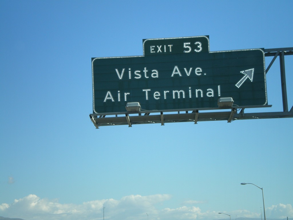
I-84 East Exit 53
I-84 east at Exit 53 - Vista Ave./Air Terminal. Vista Ave. south goes to the Boise Airport. Vista Ave. north goes into downtown Boise.
Taken 10-13-2007

 Boise
Ada County
Idaho
United States
Boise
Ada County
Idaho
United States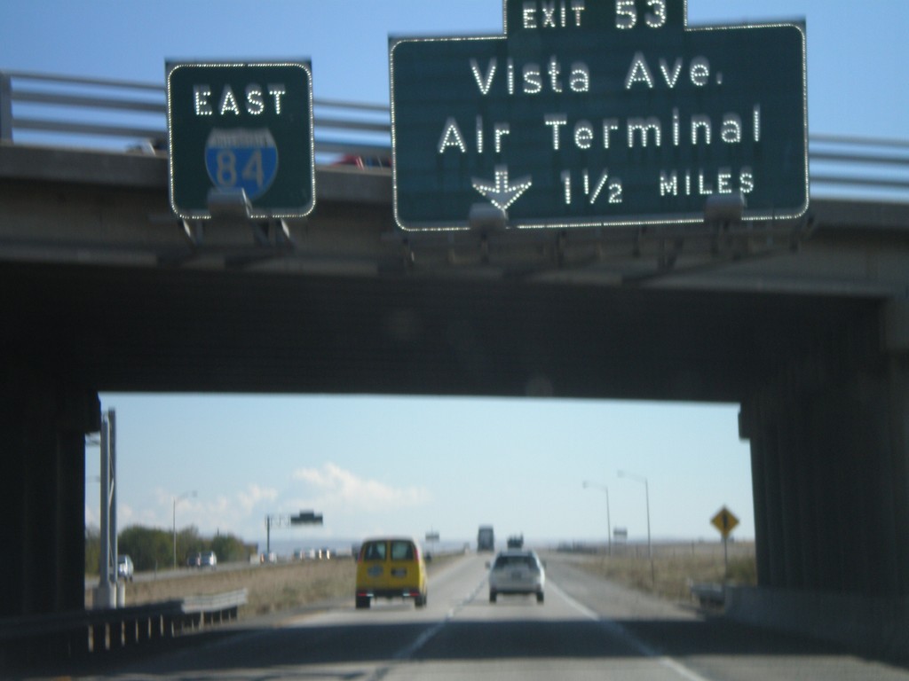
I-84 East Approaching Exit 53
I-84 east overhead, and approaching Exit 53 - Vista Ave./Air Terminal, 1 1/2 miles.
Taken 10-13-2007
Boise
Ada County
Idaho
United States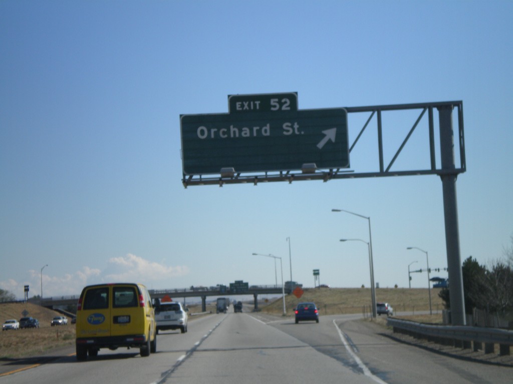
I-84 East Exit 52
I-84 east at Exit 52 - Orchard St. Orchard St. provides access to Gowen Field - the National Guard Base.
Taken 10-13-2007
Boise
Ada County
Idaho
United States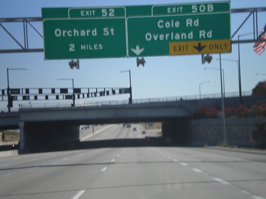
I-84 East Exits 50B and 52
I-84 east at Exit 50B - Cole Rd./Overland Rd., and approaching Exit 52 - Orchard St.
Taken 10-13-2007
Boise
Ada County
Idaho
United States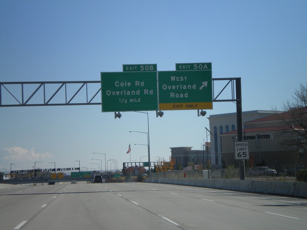
I-84 East Exits 50AB
I-84 east at Exit 50A - West Overland Road. Approaching Exit 50B - Overland Road/Cole Road.
Taken 10-13-2007
Boise
Ada County
Idaho
United States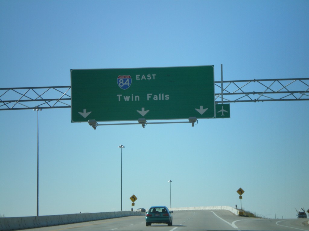
End I-184 at I-84 East
End I-184 on the ramp to I-84 East to Twin Falls. An unmarked ramp here goes to I-84 west. This interchange is known locally as the Flying Wye.
Taken 10-13-2007
 Boise
Ada County
Idaho
United States
Boise
Ada County
Idaho
United States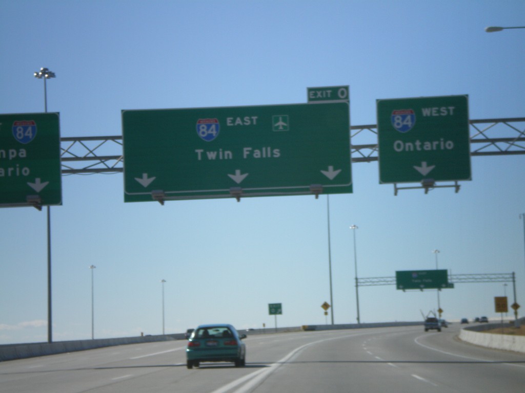
End I-184 at I-84
I-184 west approaching Exit 0, I-84 west to Nampa/Ontario and I-84 east to Twin Falls. The very right lanes and very left lanes go west. This interchange is known locally as the Flying Wye.
Taken 10-13-2007
Boise
Ada County
Idaho
United States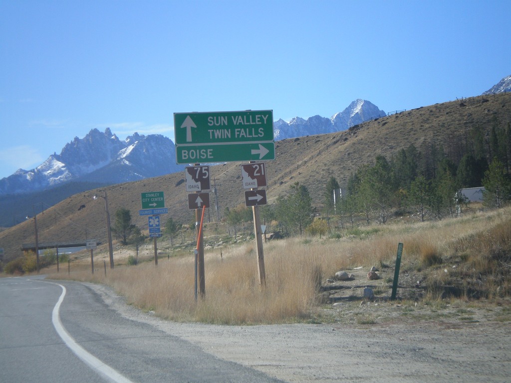
ID-75 South at ID-21 North
ID-75 south at ID-21 west to Boise.
Taken 10-08-2007

 Stanley
Custer County
Idaho
United States
Stanley
Custer County
Idaho
United States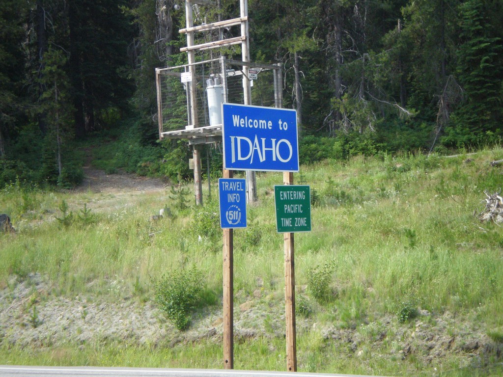
US-12 West - Welcome To Idaho
Welcome to Idaho on US-12 west at Lolo Pass. Entering Pacific Time Zone.
Taken 07-21-2007
 Kooskia
Idaho
United States
Kooskia
Idaho
United States
US-287 South at MTS-435
US-287 south to Wolf Creek and Helena at MTS-435 to Bain Lake.
Taken 07-19-2007
 Augusta
Lewis and Clark County
Montana
United States
Augusta
Lewis and Clark County
Montana
United States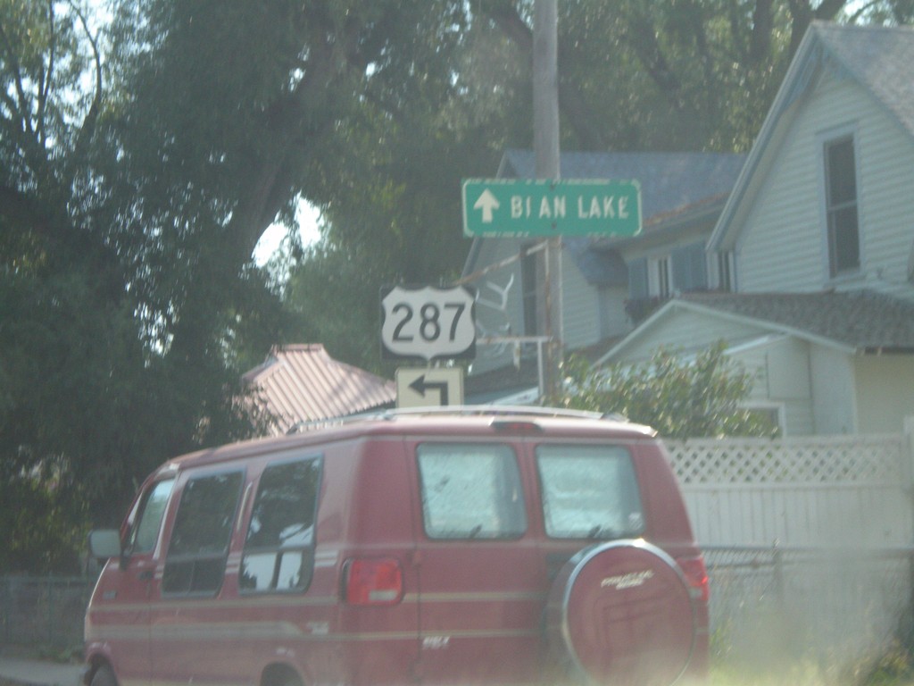
US-287 South at MTS-435
US-287 south approaching MTS-435 to Bain Lake.
Taken 07-19-2007
Augusta
Lewis and Clark County
Montana
United States
US-89 South at US-287
US-287 south at US-89 to Helena.
Taken 07-19-2007
 Choteau
Teton County
Montana
United States
Choteau
Teton County
Montana
United States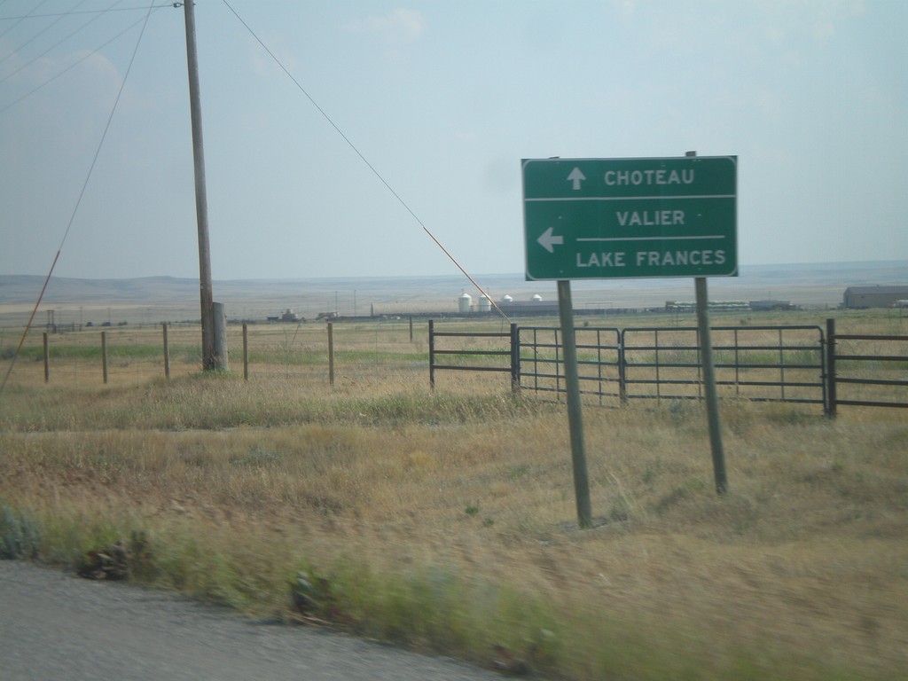
US-89 South at MT-44 East
US-89 south at MT-44 east to Valier and Lake Frances.
Taken 07-19-2007
 Kingsbury Colony
Pondera County
Montana
United States
Kingsbury Colony
Pondera County
Montana
United States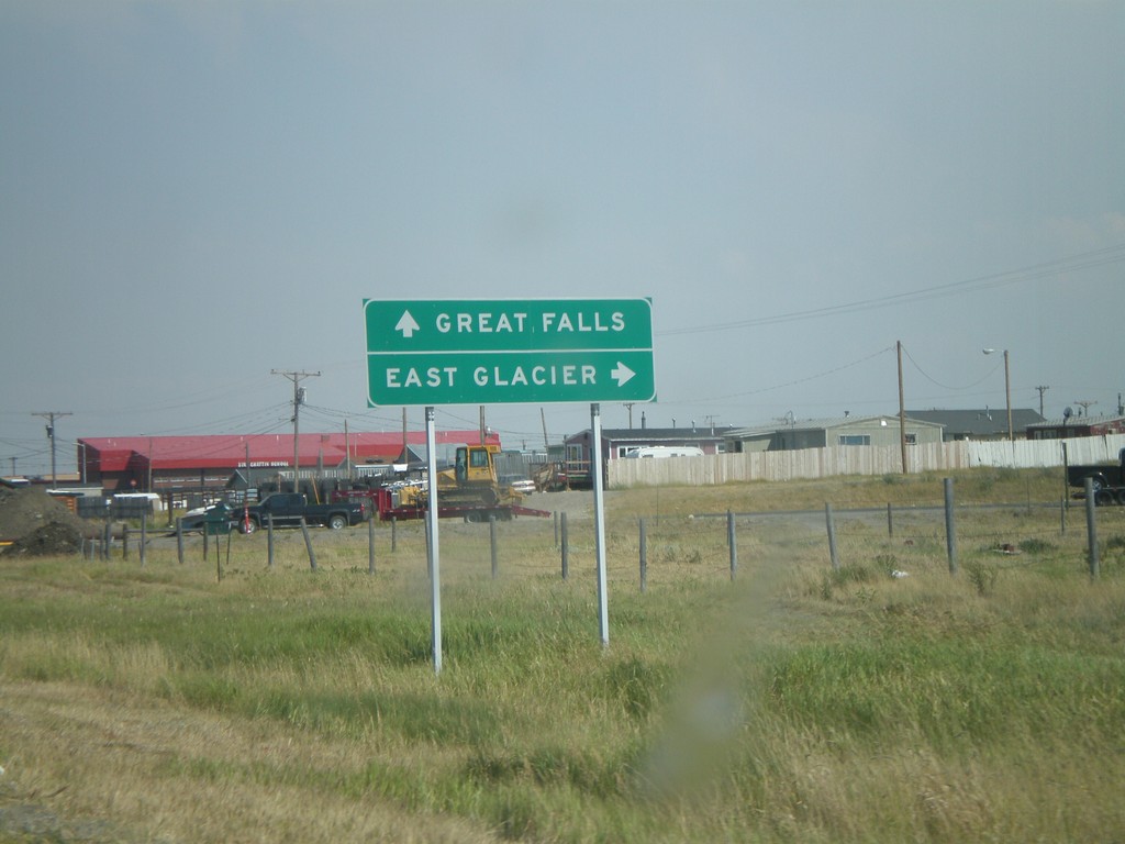
US-89 South at US-2 West
US-89 south at US-2 west to East Glacier.
Taken 07-19-2007
 Browning
Glacier County
Montana
United States
Browning
Glacier County
Montana
United States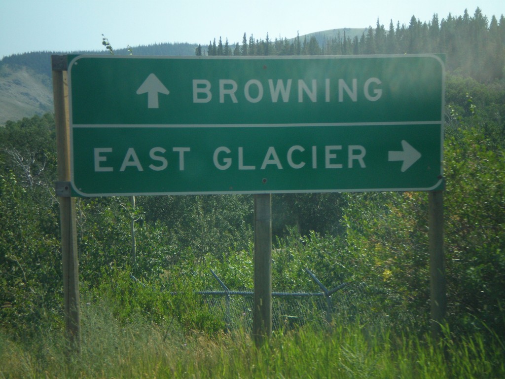
US-89 South at MT-49 South
US-89 south at MT-49 south to East Glacier.
Taken 07-19-2007
 Browning
Glacier County
Montana
United States
Browning
Glacier County
Montana
United States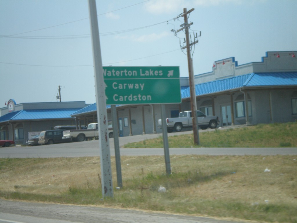
AB-2 South at AB-5 West
AB-2 south at AB-5 west to Waterton Park.
Taken 07-19-2007

 Cardston
 County
Alberta
Canada
Cardston
Cardston County
Alberta
Canada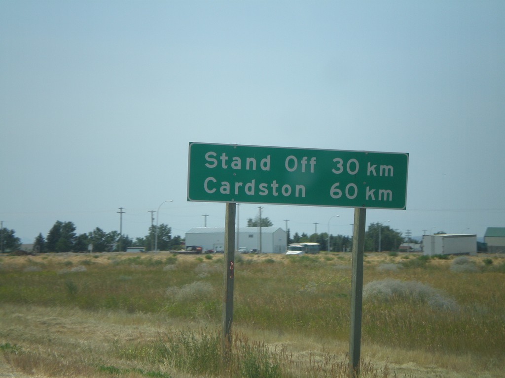
Distance Marker on AB-2 South
Distance marker on AB-2 south of AB-3, to Stand Off and Cardston.
Taken 07-19-2007
Fort Macleod
Willow Creek No. 26
Alberta
Canada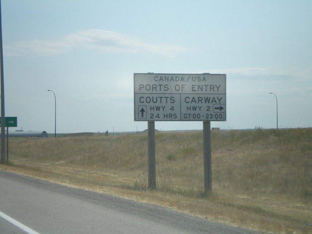
AB-3 East Port of Entry Information
AB-3 east approaching AB-2 south. Hours and locations of US Ports of Entry in this area.
Taken 07-19-2007
 Fort Macleod
Willow Creek No. 26
Alberta
Canada
Fort Macleod
Willow Creek No. 26
Alberta
Canada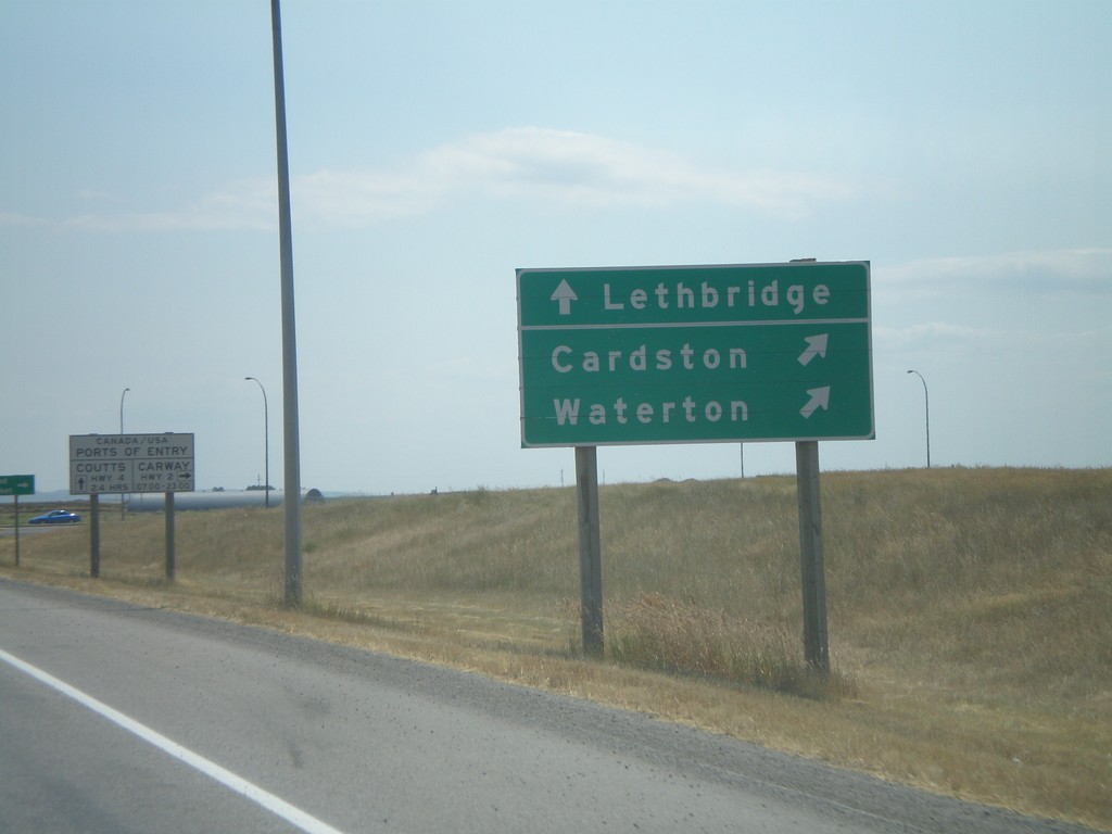
AB-3 East AB-2 Jct.
AB-3 east approaching AB-2 south to Waterton Park and Cardston.
Taken 07-19-2007
Fort Macleod
Willow Creek No. 26
Alberta
Canada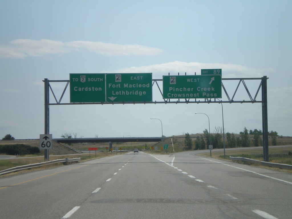
AB-2 South Exit 89
AB-2 south at AB-3 - east to Lethbridge and Fort Macleod. AB-3 west to Pincher Creek and Crowsnest Pass.
Taken 07-19-2007
Fort Macleod
Willow Creek No. 26
Alberta
Canada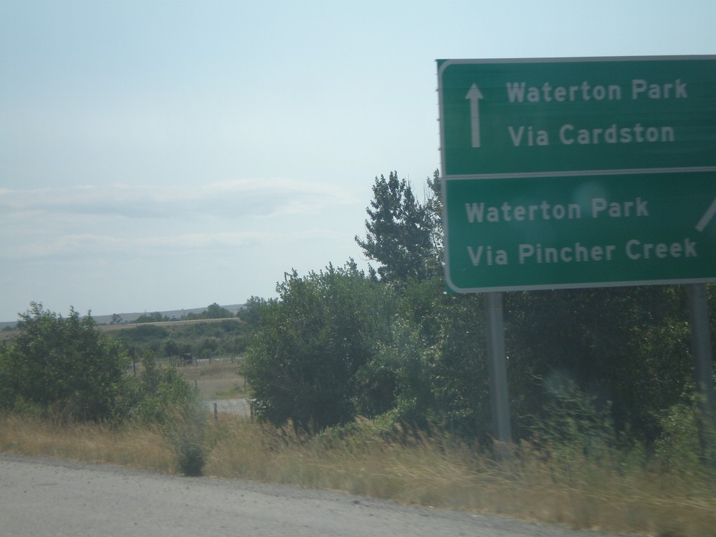
AB-2 South Exit 89, Waterton Park Info
AB-2 south approaching Exit 89, AB-3. Waterton Park via Cardston (AB-3 east), via Pincher Creek (AB-3 west).
Taken 07-19-2007
Fort Macleod
Willow Creek No. 26
Alberta
Canada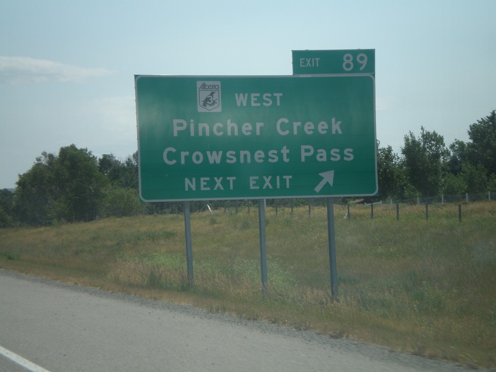
AB-2 South Exit 89
AB-2 south approaching Exit 89, AB-3 West (Crowsnest Hwy.)/Pincher Creek/Crowsnest Pass.
Taken 07-19-2007
Brocket
Willow Creek No. 26
Alberta
Canada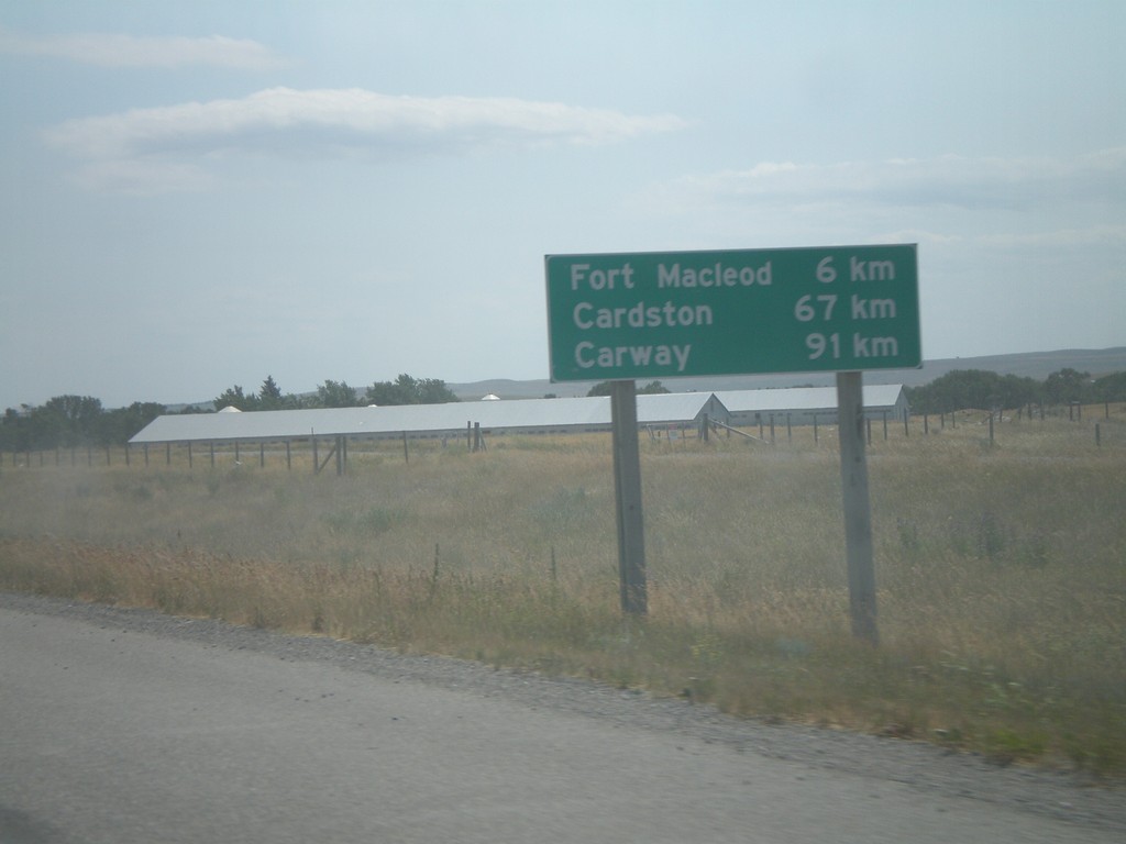
Distance Marker on AB-2 South
Distance marker on AB-2 south to Fort Macleod, Cardston, and Carway, south of ABS-785.
Taken 07-19-2007
Fort Macleod
Willow Creek No. 26
Alberta
Canada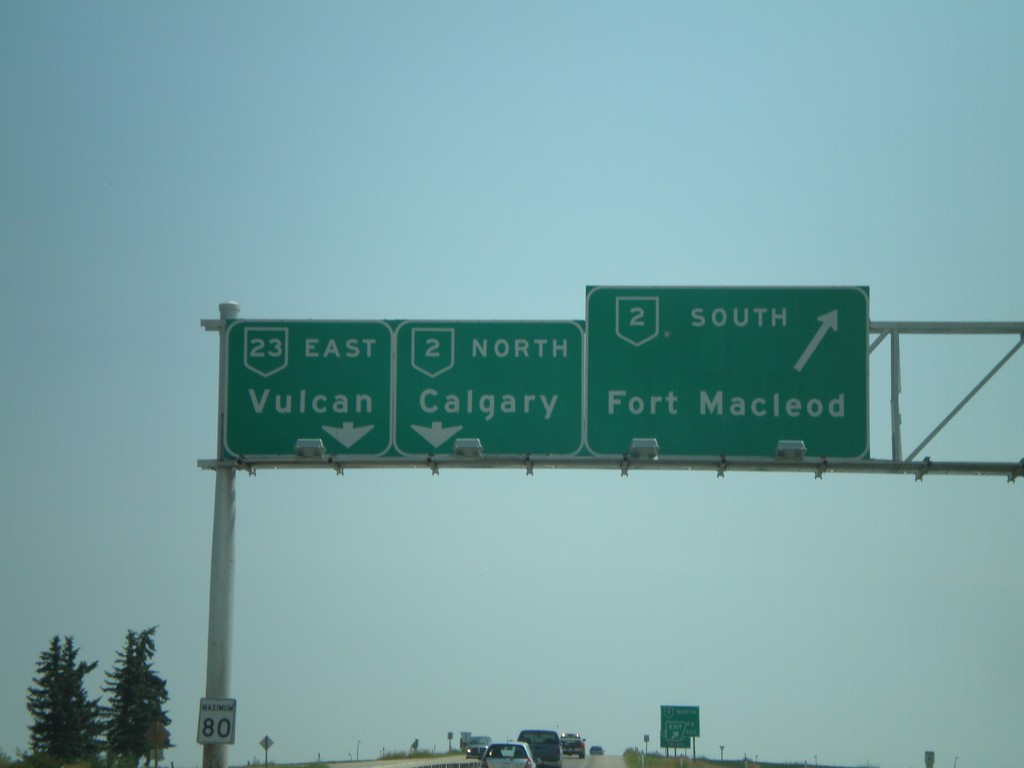
AB-23 South AB-2 Jct.
AB-23 east at AB-2 to Calgary and Fort Macleod.
Taken 07-19-2007

 High River
Foothills County
Alberta
Canada
High River
Foothills County
Alberta
Canada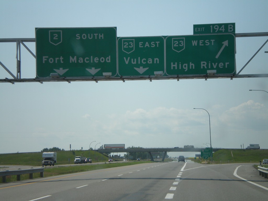
AB-2 South Exit 194AB
AB-2 south at Exit 194B, AB-23 West/High River, approaching Exit 194A, AB-23 East/Vulcan.
Taken 07-19-2007
High River
Foothills County
Alberta
Canada