Signs Tagged With Big Green Sign
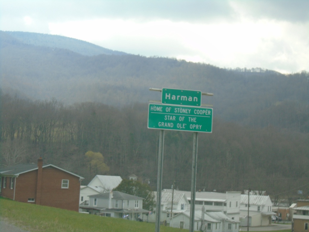
WV-32 South - Harman
Entering Harman on WV-32 South. Home of Stoney Cooper, Star of the Grand Ole Opry.
Taken 03-29-2024
 Harman
Randolph County
West Virginia
United States
Harman
Randolph County
West Virginia
United States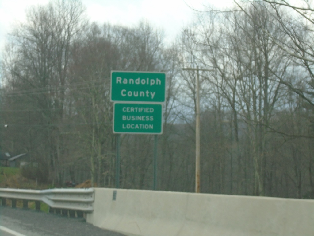
WV-32 South - Randolph County
Randolph County on WV-32 south.
Taken 03-29-2024
Dryfork
Randolph County
West Virginia
United States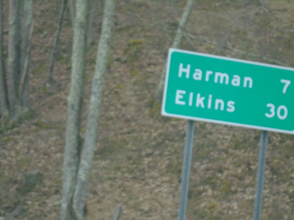
WV-32 South - Distance Marker
Distance marker on WV-32 south. Distance to Harman and Elkins.
Taken 03-29-2024
Davis
Tucker County
West Virginia
United States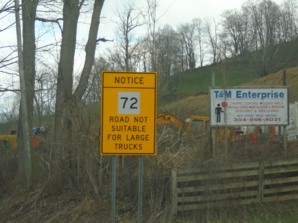
WV-72 Warning on WV-32 South
WV-32 South Approaching WV-72. Warning sign for WV-72 traffic: Road Not Suitable for Large Trucks.
Taken 03-29-2024
 Dryfork
Tucker County
West Virginia
United States
Dryfork
Tucker County
West Virginia
United States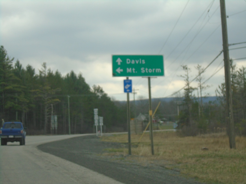
US-48 East/WV-32 South at US-48/WV-93
US-48 East/WV-32 South at US-48/WV-93 to Mount Storm. Continue south on WV-32 to Davis.
Taken 03-29-2024

 Davis
Tucker County
West Virginia
United States
Davis
Tucker County
West Virginia
United States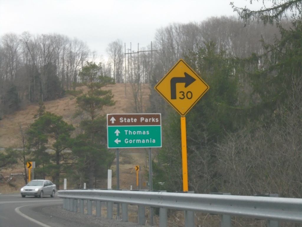
US-219 South at WV-90
US-219 South at WV-90 east to Gormania. Continue south on US-219 for Thomas and State Parks.
Taken 03-29-2024

 William
Tucker County
West Virginia
United States
William
Tucker County
West Virginia
United States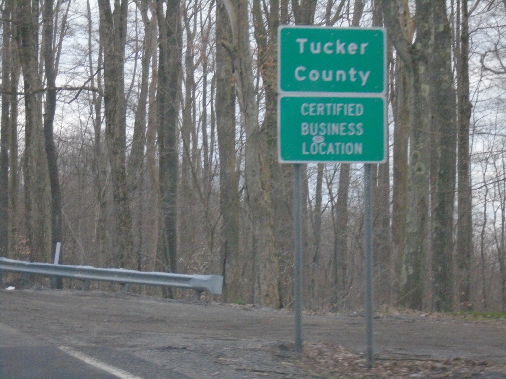
US-219 South - Tucker County
Tucker County on US-219 South.
Taken 03-29-2024
Eglon
Tucker County
West Virginia
United States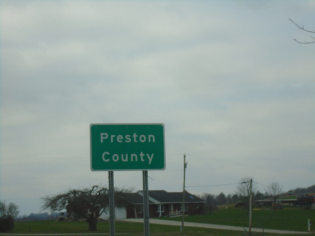
US-219 South - Preston County
Preston County on US-219 south. Taken at the West Virginia/Maryland State Line.
Taken 03-29-2024
Eglon
Preston County
West Virginia
United States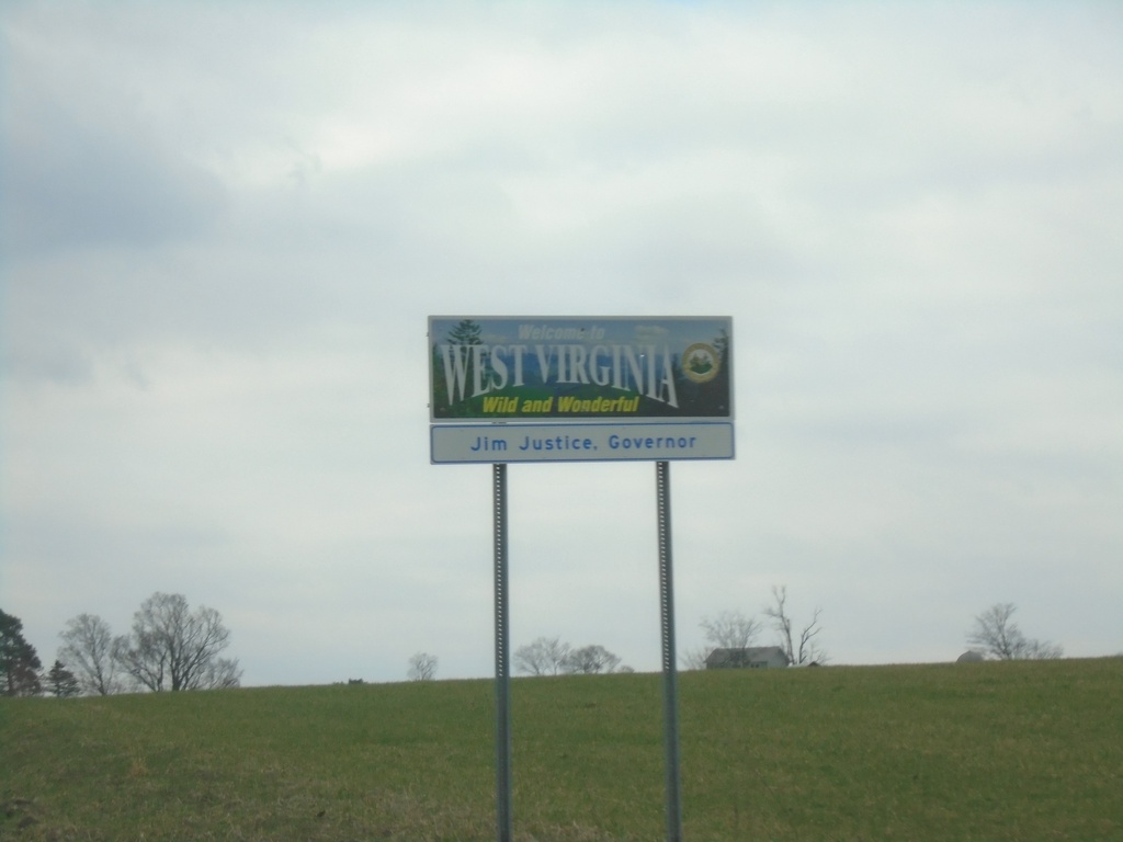
US-219 South - Welcome To West Virginia
Welcome To West Virginia - Wild and Wonderful. Jim Justice, Governor. On US-219 south at the Maryland/West Virginia state line.
Taken 03-29-2024
Eglon
Preston County
West Virginia
United States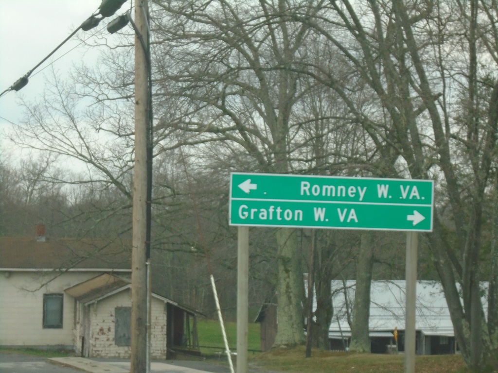
US-219 South at US-50
US-219 South at US-50 at Red House. Turn right on US-50 West to Grafton, WV; turn left on US-50 east to Romney, WV.
Taken 03-29-2024
 Oakland
Garrett County
Maryland
United States
Oakland
Garrett County
Maryland
United States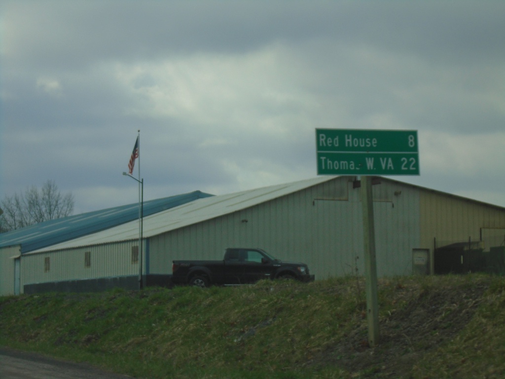
US-219 South - Distance Marker
Distance marker on US-219 south. Distance to Red House and Thomas, WV.
Taken 03-29-2024
Oakland
Garrett County
Maryland
United States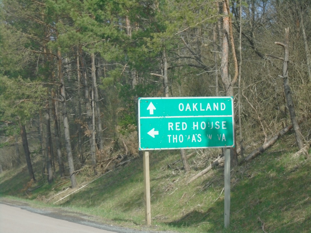
End MD-135 West at US-219
End MD-135 West at US-219 in Oakland. Use US-219 north to Oakland; US-219 south to Red House and Thomas, WV.
Taken 03-29-2024
 Oakland
Garrett County
Maryland
United States
Oakland
Garrett County
Maryland
United States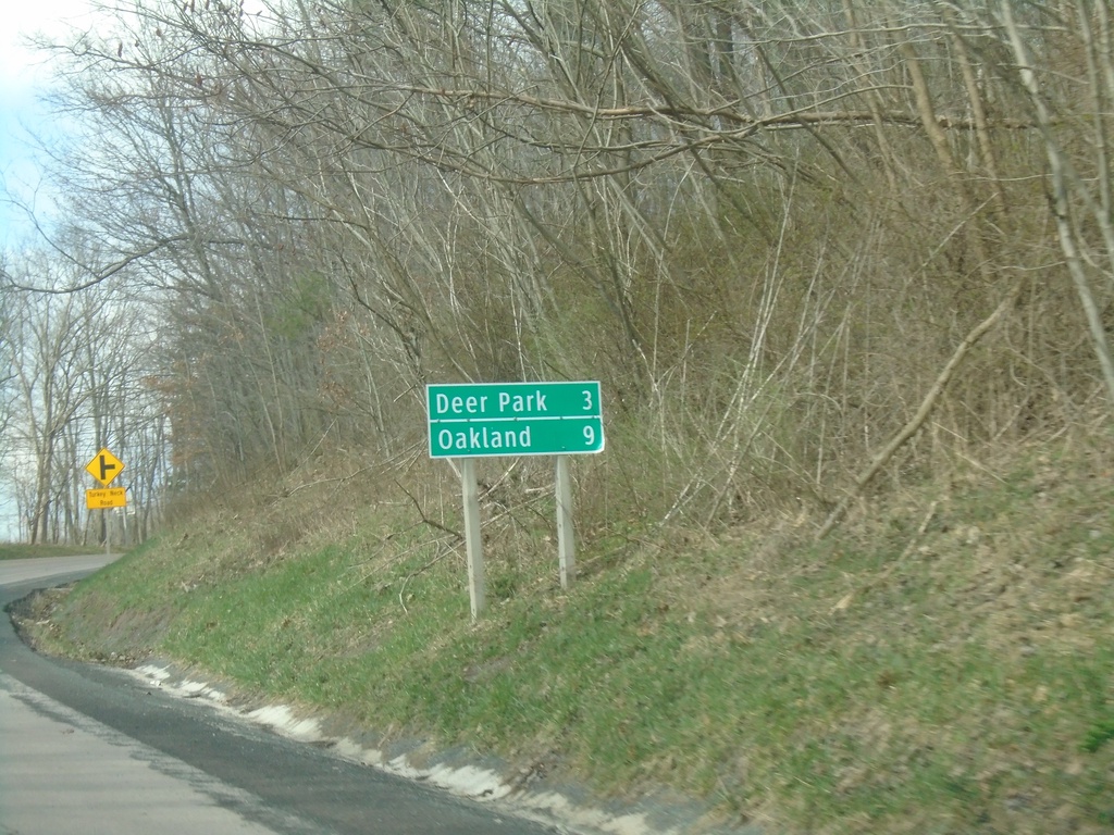
MD-135 West - Distance Marker
Distance marker on MD-135 west. Distance to Deer Park and Oakland.
Taken 03-29-2024
Swanton
Garrett County
Maryland
United States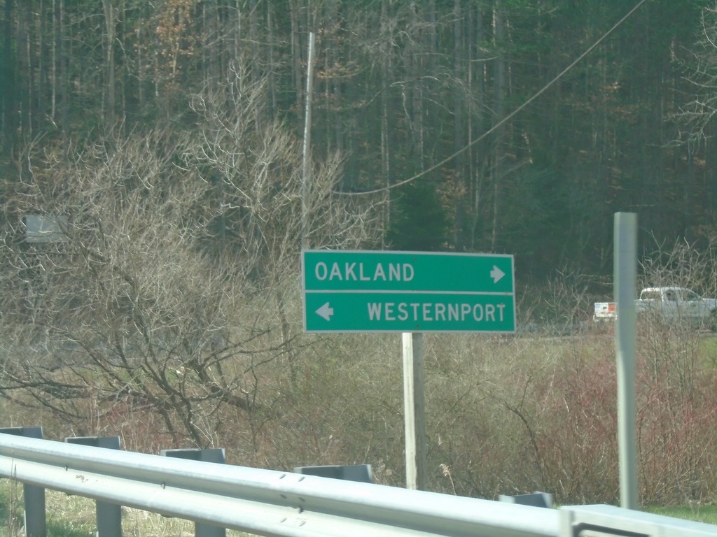
MD-495 South at Swanton Hill Road
MD-495 South at Swanton Hill Road. Turn left for Swanton Hill Road east to Westernport; right for MD-495 south to Oakland.
Taken 03-29-2024
 Swanton
Garrett County
Maryland
United States
Swanton
Garrett County
Maryland
United States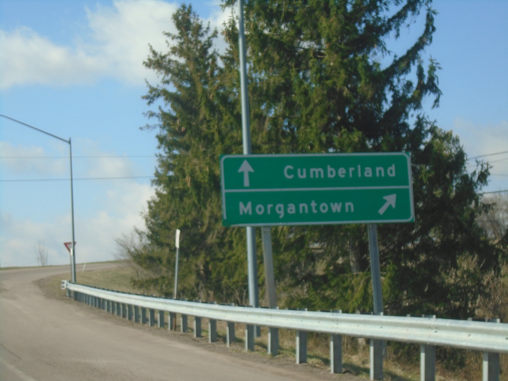
MD-495 South at I-68/US-40/US-219
MD-495 South at I-68/US-40/US-219. Merge right for I-68/US-40 West/US-219 South to Morgantown (WV). Continue over freeway for I-68/US-40 East/US-219 North to Cumberland.
Taken 03-29-2024

 Grantsville
Garrett County
Maryland
United States
Grantsville
Garrett County
Maryland
United States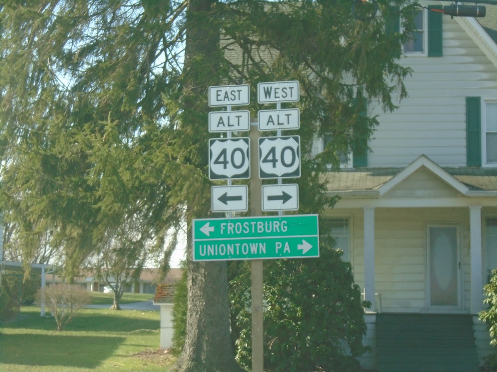
End MD-669 South at US-40 Alternate
End MD-669 South at US-40 Alternate in Grantsville. Use US-40 ALT west to Uniontown, PA; use US-40 ALT east to Frostburg.
Taken 03-29-2024

 Grantsville
Garrett County
Maryland
United States
Grantsville
Garrett County
Maryland
United States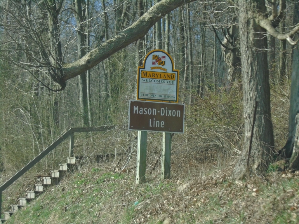
MD-669 South - Maryland Welcomes You
Maryland Welcomes You on MD-669 South. At the Maryland/Pennsylvania state line. This boundary is the Mason-Dixon Line.
Taken 03-29-2024
Grantsville
Garrett County
Maryland
United States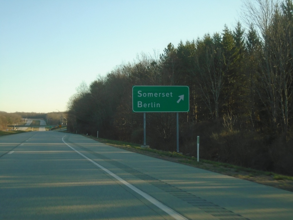
US-219 South - Berlin/Somerset Interchange
US-219 South at Berlin/Somerset Interchange
Taken 03-28-2024
Somerset
Somerset County
Pennsylvania
United States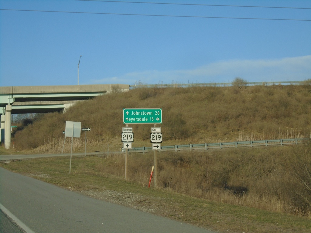
PA-281 North at US-219 Interchange
PA-281 North at US-219 interchange. Use US-219 South to Meyersdale; US-219 North to Johnstown.
Taken 03-28-2024
 Somerset
 County
Pennsylvania
United States
Somerset
Somerset County
Pennsylvania
United States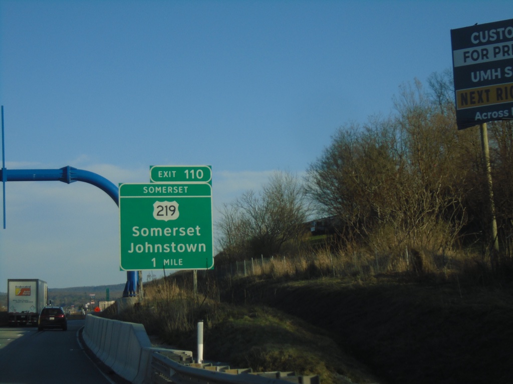
I-70/I-76 East - Somerset Interchange
I-70/I-76 East approaching Exit 110 (Somerset Interchange) - US-219/Somerset/Johnstown.
Taken 03-28-2024

 Somerset
 County
Pennsylvania
United States
Somerset
Somerset County
Pennsylvania
United States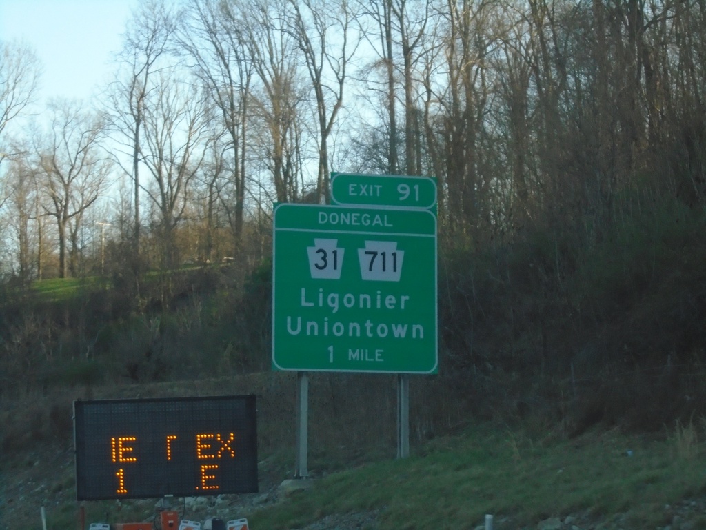
I-70/I-76 East - Donegal Interchange
I-70/I-76 East approaching Exit 91 (Donegal Interchange) - PA-31/PA-711/Ligonier/Uniontown.
Taken 03-28-2024

 Acme
Westmoreland County
Pennsylvania
United States
Acme
Westmoreland County
Pennsylvania
United States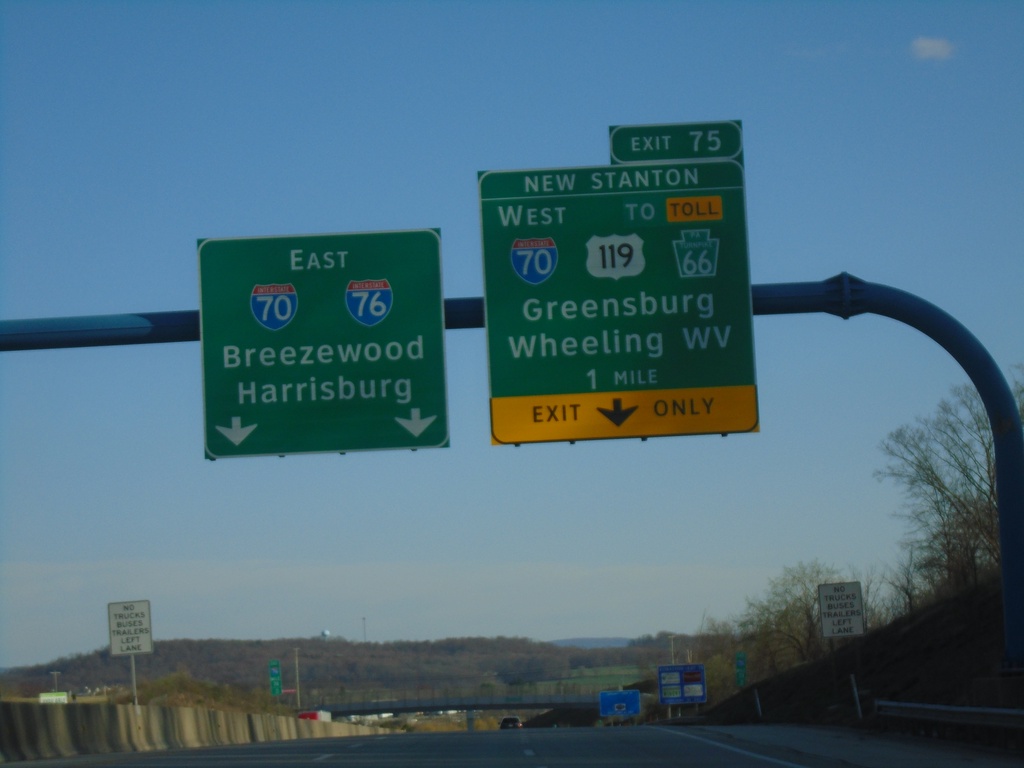
I-76 East - New Stanton Interchange
I-76 east approaching Exit 75 (New Stanton Interchange) - I-70/To US-119/To Toll PA-66/Greensburg/Wheeling, WV. I-70/I-76 continue eastbound to Breezewood and Harrisburg.
Taken 03-28-2024

 New Stanton
Westmoreland County
Pennsylvania
United States
New Stanton
Westmoreland County
Pennsylvania
United States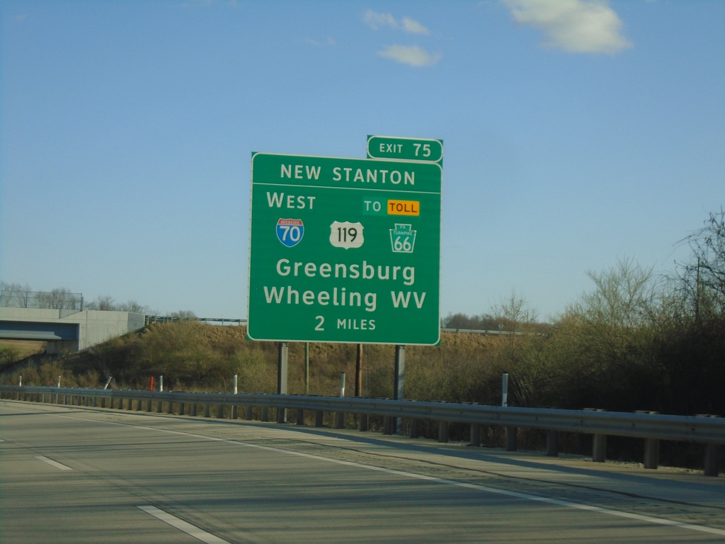
I-76 East - New Stanton Interchange
I-76 East approaching Exit 75 (New Stanton Interchange) - I-70/To US-119/To Toll PA-66/Greensburg/Wheeling, WV. I-70 joins I-76 eastbound to Breezewood.
Taken 03-28-2024
New Stanton
Westmoreland County
Pennsylvania
United States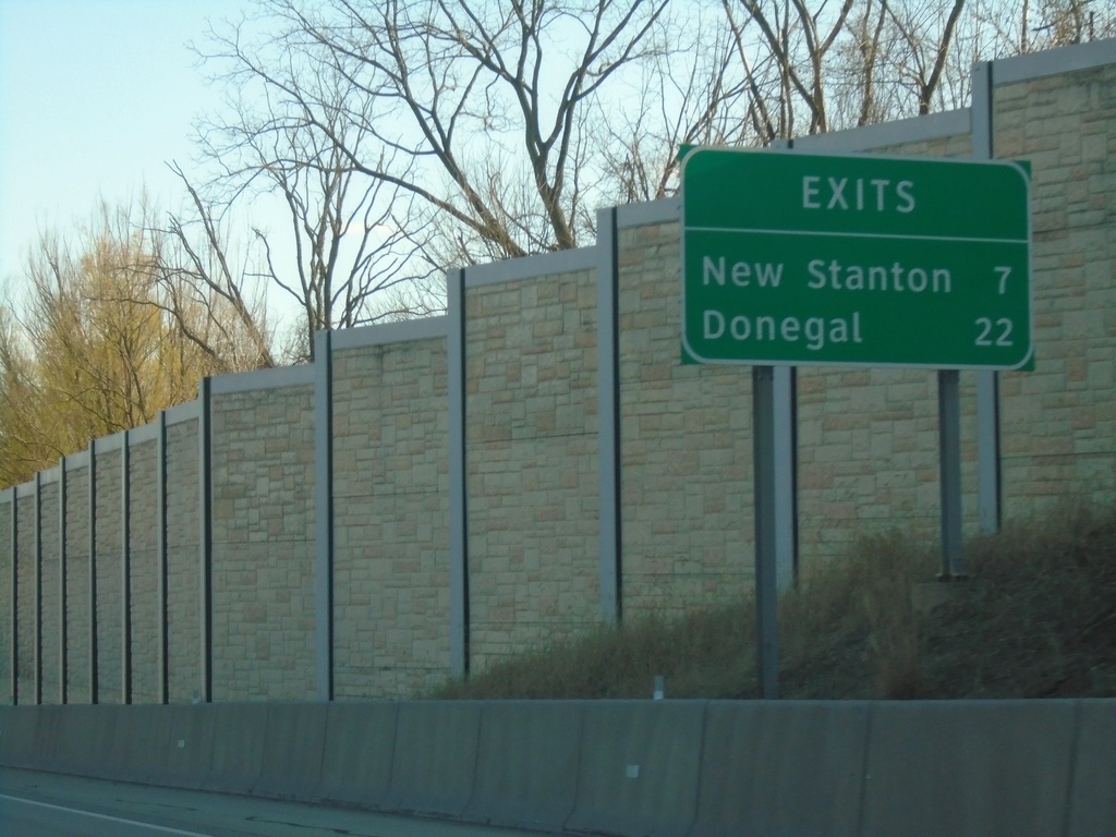
I-76 (Pennsylvania Turnpike) - Next Exits
Distance marker on I-76/Pennsylvania Turnpike. Distance to New Stanton and Donegal exits.
Taken 03-28-2024
Irwin
Westmoreland County
Pennsylvania
United States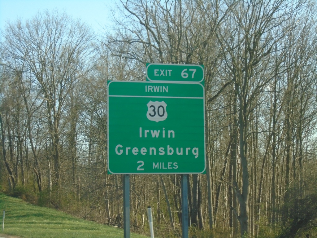
I-76 East - Exit 67 (Irwin Interchange)
I-76 East approaching Exit 67 (Irwin Interchange) - US-30/Irwin/Greensburg.
Taken 03-28-2024
 Irwin
Westmoreland County
Pennsylvania
United States
Irwin
Westmoreland County
Pennsylvania
United States