Signs Tagged With Big Green Sign
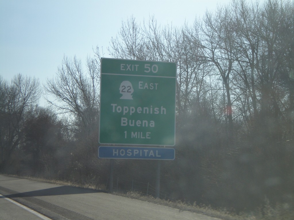
I-82 East - Exit 50
I-82 east approaching Exit 50 - WA-22 East/Buena/Toppenish.
Taken 01-22-2008


 Zillah
Yakima County
Washington
United States
Zillah
Yakima County
Washington
United States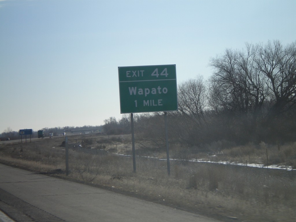
I-82 East - Exit 44
I-82 east approaching Exit 44 - Wapato.
Taken 01-22-2008
Wapato
Yakima County
Washington
United States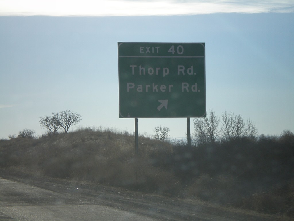
I-82 East - Exit 40
I-82 east at Exit 40 - Thorp Road/Parker Road.
Taken 01-22-2008
Wapato
Yakima County
Washington
United States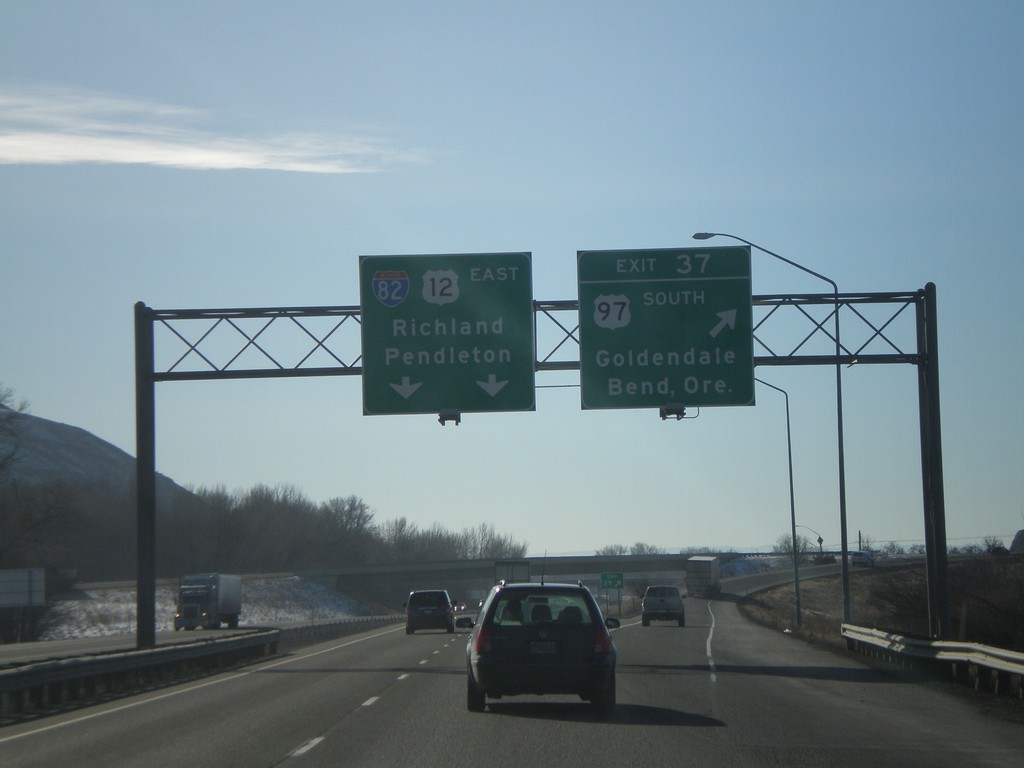
I-82 East - Exit 37
I-82 east at Exit 37 - US-97 South/Goldendale/Bend, Ore. US-97 joins I-82 west to I-90 near Ellensburg. I-82/US-12 overhead to Richland and Pendleton.
Taken 01-22-2008
 Yakima
 County
Washington
United States
Yakima
Yakima County
Washington
United States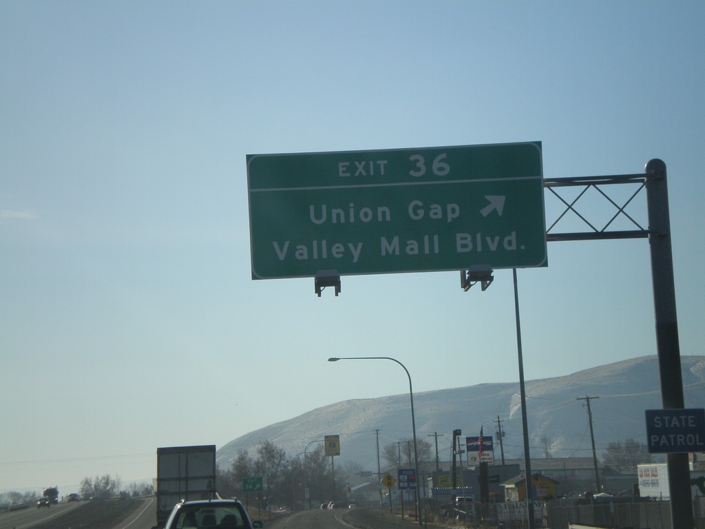
I-82 East - Exit 36
I-82 east at Exit 36 - Union Gap/Valley Mall Blvd.
Taken 01-22-2008
Union Gap
Yakima County
Washington
United States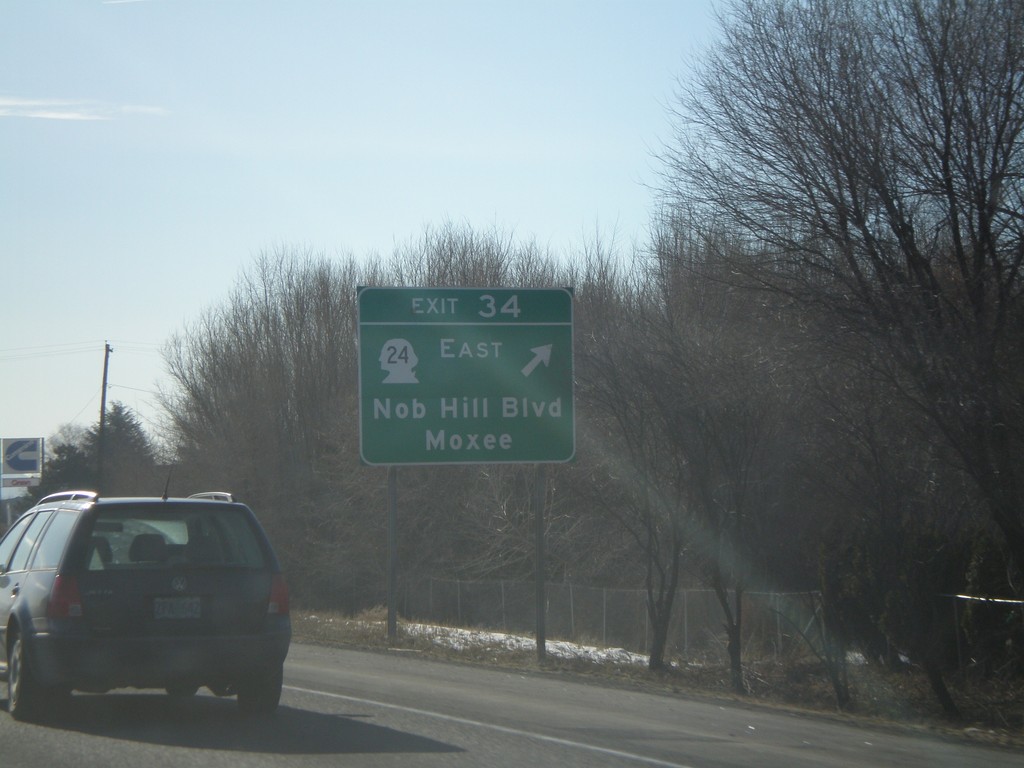
I-82 East - Exit 34
I-82 east at Exit 34 - WA-24 East/Nob Hill Blvd./Moxee.
Taken 01-22-2008
 Yakima
 County
Washington
United States
Yakima
Yakima County
Washington
United States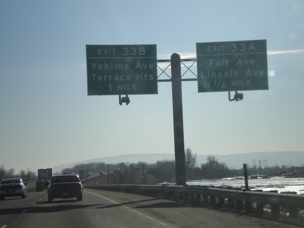
I-82 East - Exits 33A and 33B
I-82 east approaching Exit 33A - Fair Ave./Lincoln Ave. and Exit 33B - Yakima Ave./Terrace Heights.
Taken 01-22-2008
Yakima
Yakima County
Washington
United States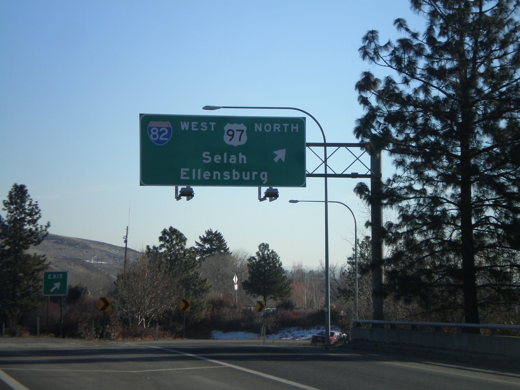
US-12 East at I-82/US-97
US-12 east at I-82 West/US-97 North to Selah and Ellensburg. US-12 east joins I-82 east here to Richland.
Taken 01-22-2008
Yakima
Yakima County
Washington
United States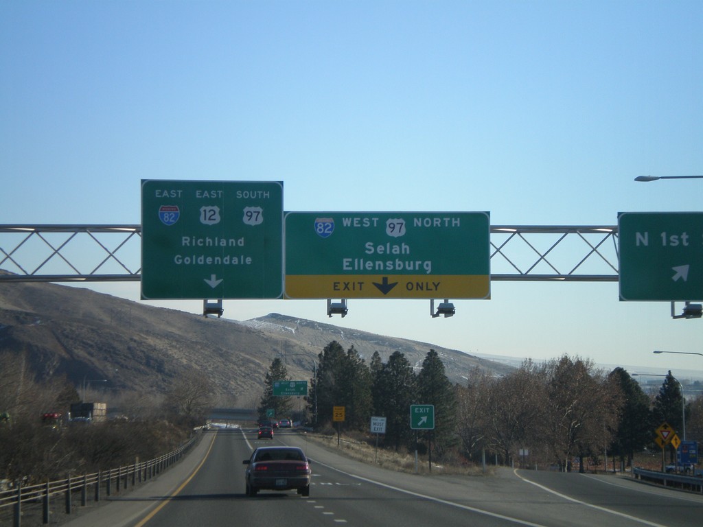
US-12 East at N 1st St - Approaching I-82/US-97
US-12 east at N 1st St exit. Approaching I-82 junction.
Taken 01-22-2008
Yakima
Yakima County
Washington
United States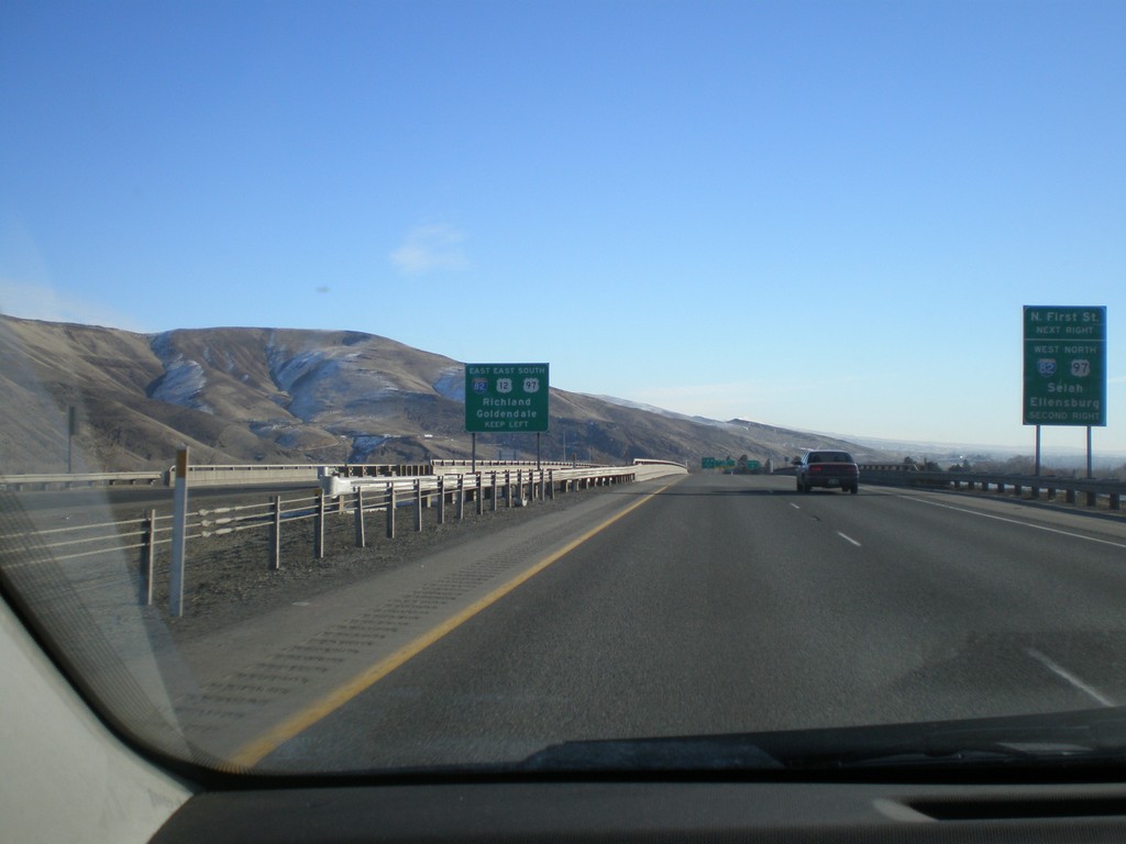
US-12 East Approaching I-82/US-97
US-12 east approaching I-82 - north to Selah and Ellensburg - south to Goldendale and Richland.
Taken 01-22-2008
Yakima
Yakima County
Washington
United States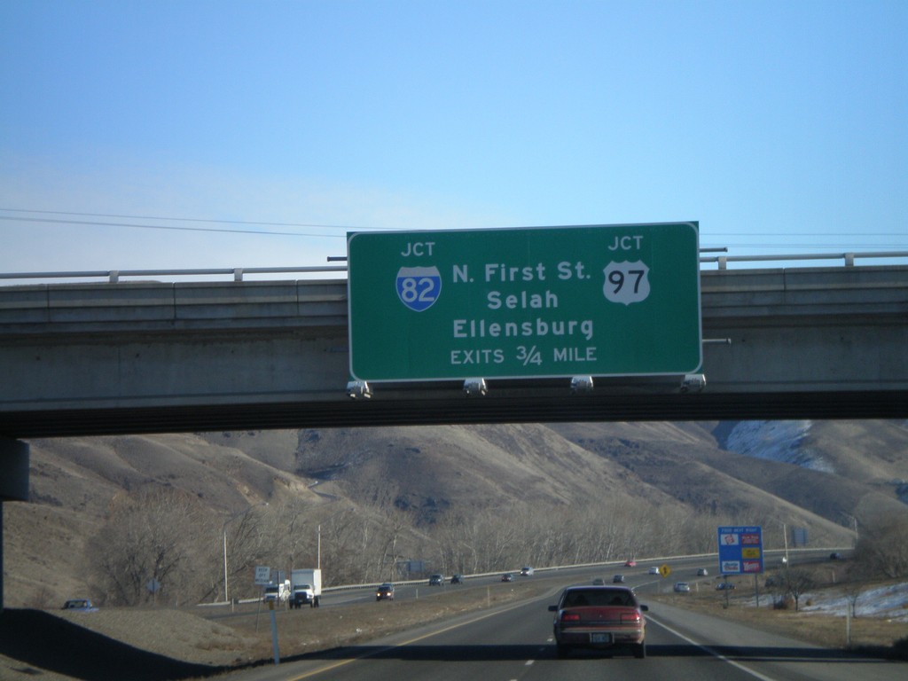
US-12 East Approaching I-82/US-97
Advance signs for I-82/US-97 junction on US-12 east.
Taken 01-22-2008
Yakima
Yakima County
Washington
United States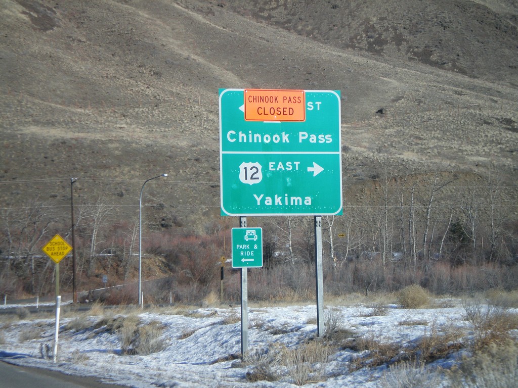
US-12 East at WA-410
US-12 east at WA-410 West/Chinook Pass. Chinook Pass was closed when this was taken.
Taken 01-22-2008
 Naches
Yakima County
Washington
United States
Naches
Yakima County
Washington
United States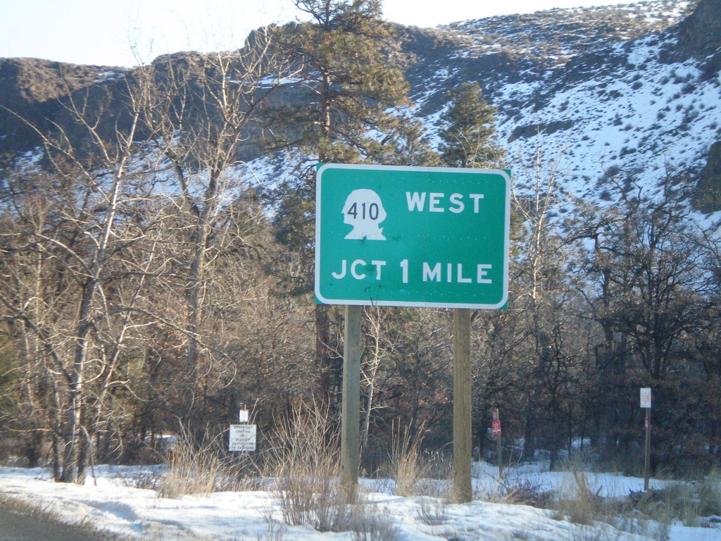
US-12 East Approaching WA-410
US-12 east approaching WA-410 west.
Taken 01-22-2008
Tieton
Yakima County
Washington
United States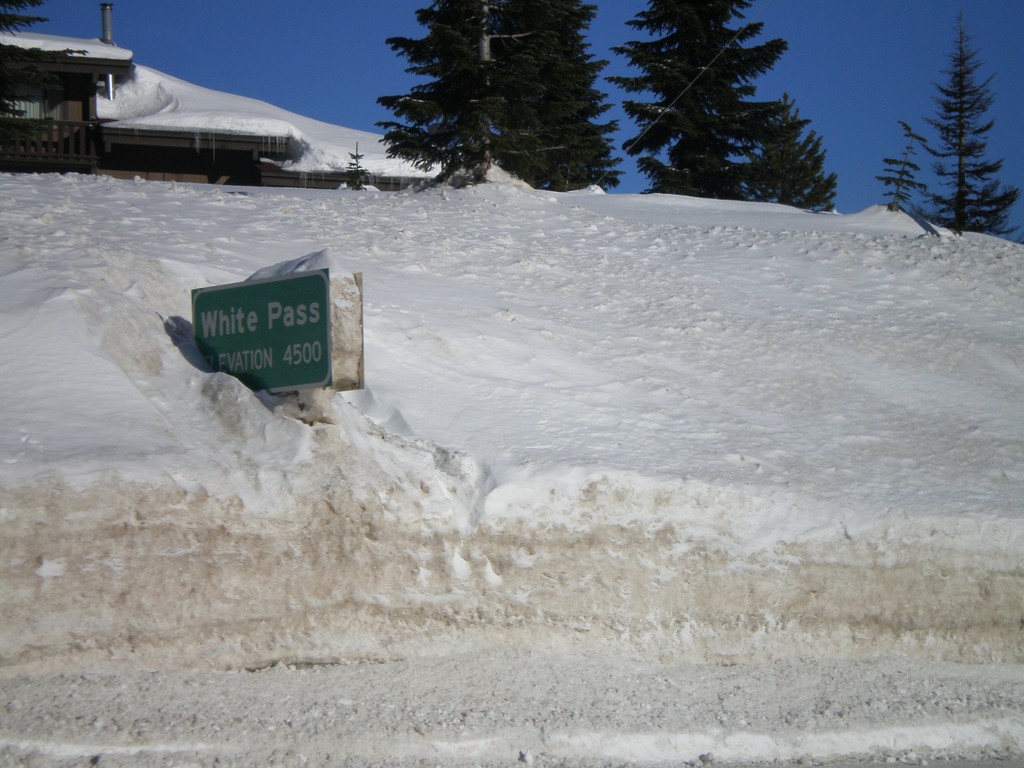
US-12 East - White Pass
US-12 east at White Pass (Elev. 4500 Ft) - the summit of US-12 in the Cascades.
Taken 01-22-2008
Naches
Yakima County
Washington
United States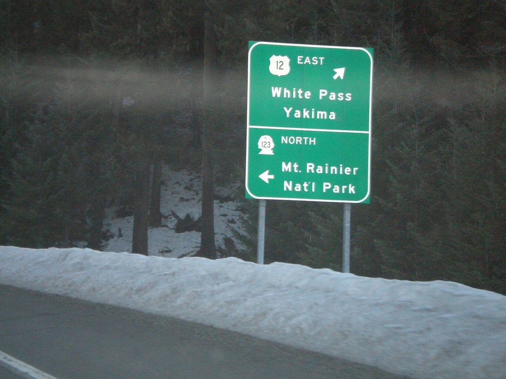
US-12 East at WA-123 North
US-12 east at WA-123 North to Mt. Ranier National Park.
Taken 01-22-2008
 Randle
Lewis County
Washington
United States
Randle
Lewis County
Washington
United States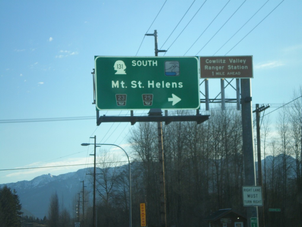
US-12 East at WA-131 South
US-12 east at WA-131 South to Mt. St. Helens.
Taken 01-22-2008
 Randle
Lewis County
Washington
United States
Randle
Lewis County
Washington
United States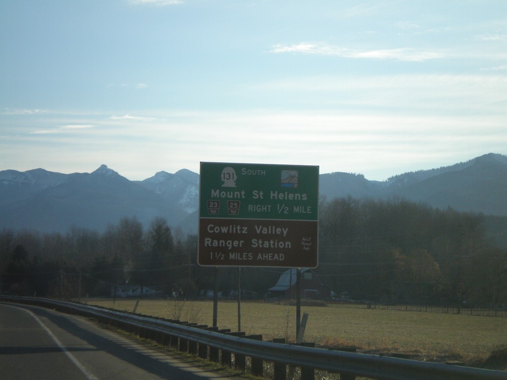
US-12 East Approaching WA-131
US-12 east approaching WA-131 south to Mt. St. Helens.
Taken 01-22-2008
Randle
Lewis County
Washington
United States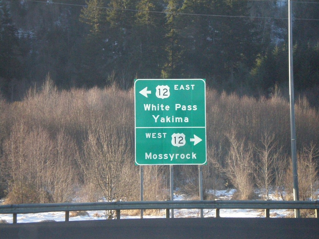
End WA-7 South at US-12
End WA-7 south at US-12 East to White Pass/Yakima, and US-12 West to Mossyrock.
Taken 01-22-2008
 Morton
Lewis County
Washington
United States
Morton
Lewis County
Washington
United States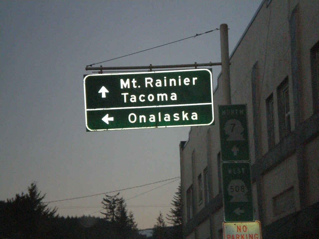
WA-7 North at WA-508 West to Onalaksa
WA-7 north to Mt. Ranier and Tacoma and WA-508 west to Onalaska.
Taken 01-21-2008
 Morton
Lewis County
Washington
United States
Morton
Lewis County
Washington
United States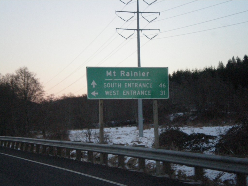
Mt. Rainier NP Access on US-12 East at WA-7
US-12 east approaching WA-7 north. Use WA-7 for Mt. Rainer West Entrance. Continue on US-12 east for Mt. Rainier South Entrance.
Taken 01-21-2008
Morton
Lewis County
Washington
United States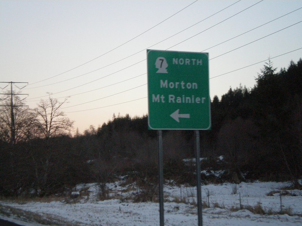
US-12 East At WA-7 North
US-12 east at WA-7 North/Morton/Mt. Ranier.
Taken 01-21-2008
Morton
Lewis County
Washington
United States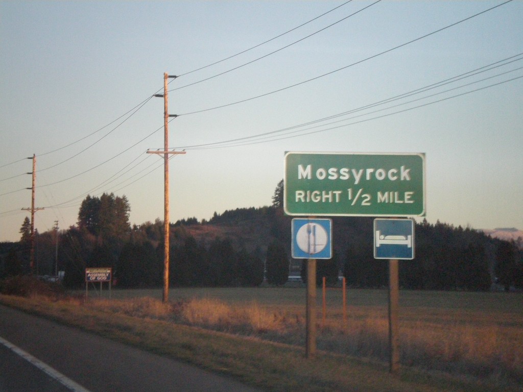
US-12 East Approaching Mossyrock Jct.
US-12 east approaching Mossyrock.
Taken 01-21-2008
Mossyrock
Lewis County
Washington
United States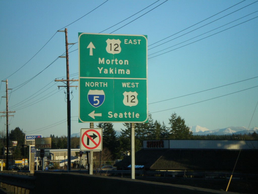
US-12 East at I-5 North Exit 68 Onramp
US-12 east at I-5 North/US-12 West to Seattle. US-12 west joins I-5 north to Centralia.
Taken 01-21-2008
 Chehalis
Lewis County
Washington
United States
Chehalis
Lewis County
Washington
United States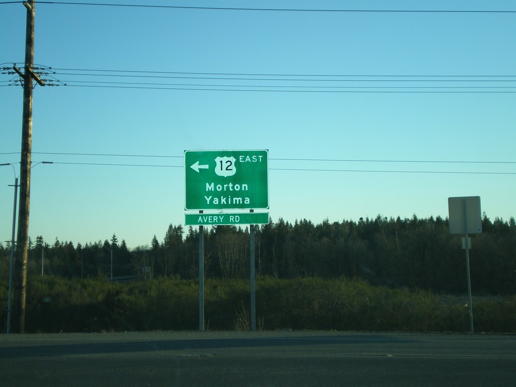
I-5 South at US-12
I-5 South/US-12 East at Exit 68 offramp. Turn left for US-12/Morton/Yakima.
Taken 01-21-2008
Winlock
Lewis County
Washington
United States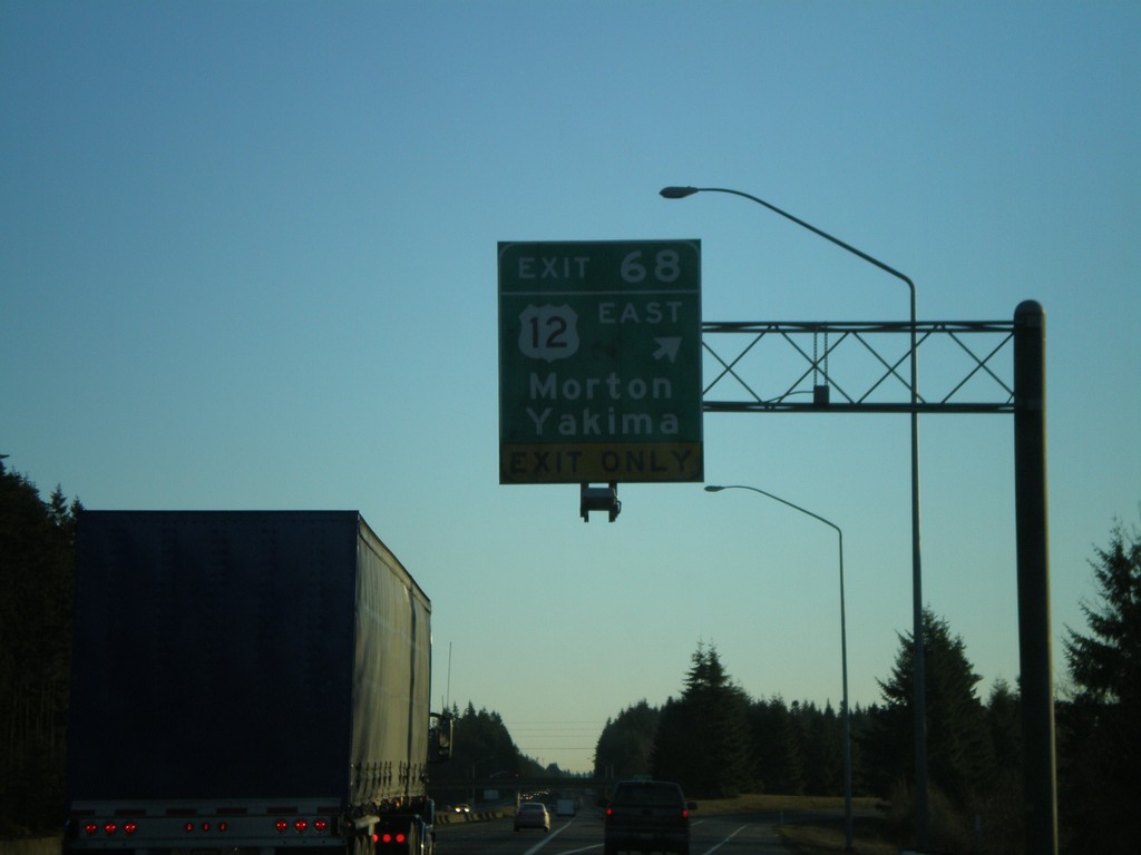
I-5 South - Exit 68
I-5 south at Exit 68 - US-12 East/Morton/Yakima.
Taken 01-21-2008
Napavine
Lewis County
Washington
United States