Signs Tagged With Big Green Sign
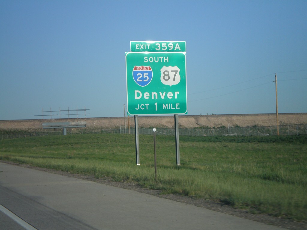
I-80 West Exit 359A
I-80 west approaching Exit 359A, I-25/US-87 South/Denver, 1 mile.
Taken 05-27-2007


 Cheyenne
Laramie County
Wyoming
United States
Cheyenne
Laramie County
Wyoming
United States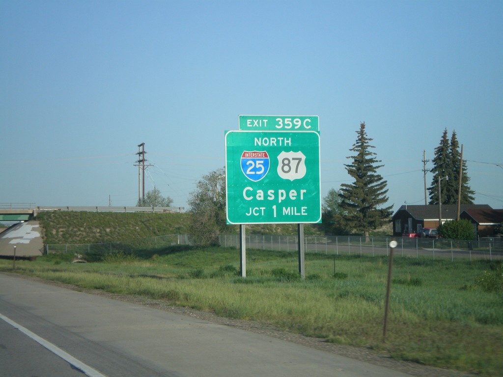
I-80 West Exit 359C
I-80 west approaching Exit 359C, I-25/US-87 North/Casper, 1 mile.
Taken 05-27-2007
Cheyenne
Laramie County
Wyoming
United States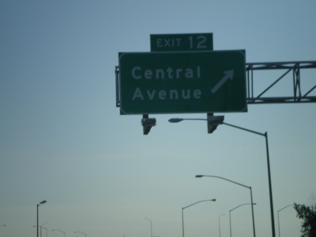
I-25 North - Exit 12
I-25 north at Exit 12, Central Ave.
Taken 05-27-2007
 Cheyenne
Laramie County
Wyoming
United States
Cheyenne
Laramie County
Wyoming
United States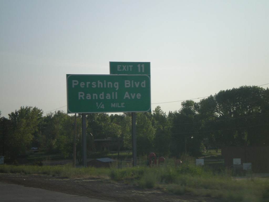
I-25 North - Exit 11
I-25 north approaching Exit 11, Pershing Blvd./Randall Ave., 1/4 mile.
Taken 05-27-2007
Cheyenne
Laramie County
Wyoming
United States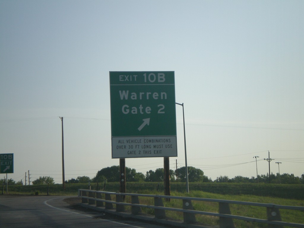
I-25 North - Exit 10B
I-25 north at Exit 10B, Warren Gate 2.
Taken 05-27-2007
Cheyenne
Laramie County
Wyoming
United States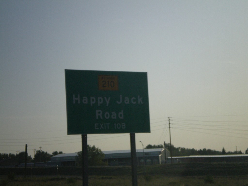
I-25 North - For WY-210 Use Exit 10B
WY-210/Happy Jack Road, use Exit 10B on I-25 north.
Taken 05-27-2007
 Cheyenne
Laramie County
Wyoming
United States
Cheyenne
Laramie County
Wyoming
United States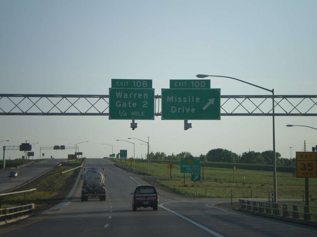
I-25 North - Exits 10D and 10B
I-25 north at Exit 10D, Missile Drive, approaching Exit 10B, Warren Gate 2.
Taken 05-27-2007
Cheyenne
Laramie County
Wyoming
United States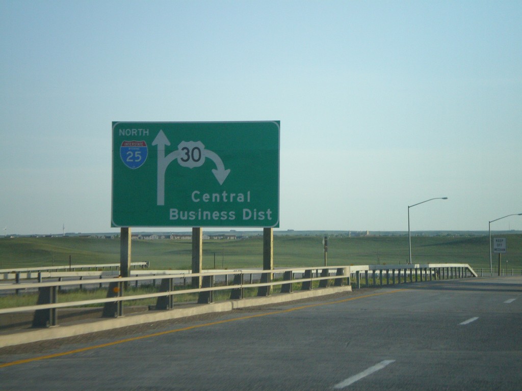
I-25 North - Exit 9 Diagram
Diagram for Exit 9 US-30 interchange, on I-25 north.
Taken 05-27-2007
 Cheyenne
Laramie County
Wyoming
United States
Cheyenne
Laramie County
Wyoming
United States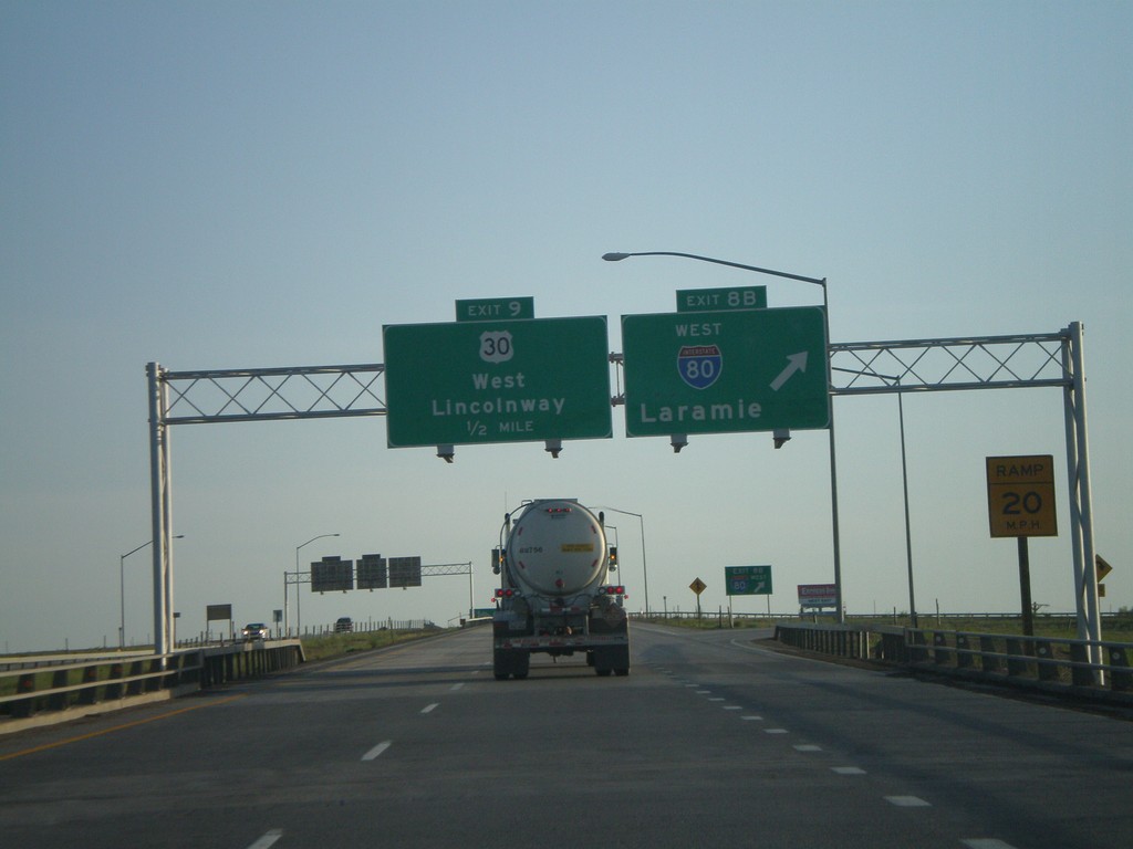
I-25 North - Exits 8B and 9
I-25 north at Exit 8B, I-80 West/Laramie, approaching Exit 9, US-30/West Lincolnway.
Taken 05-27-2007
Cheyenne
Laramie County
Wyoming
United States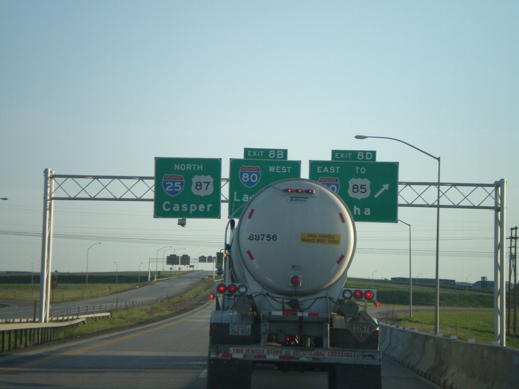
I-25 North - Exits 8D and 8B
I-25 North at Exit 8D, I-80 East/To US-85/Omaha, approaching Exit 8B, I-80 West/Laramie.
Taken 05-27-2007
Cheyenne
Laramie County
Wyoming
United States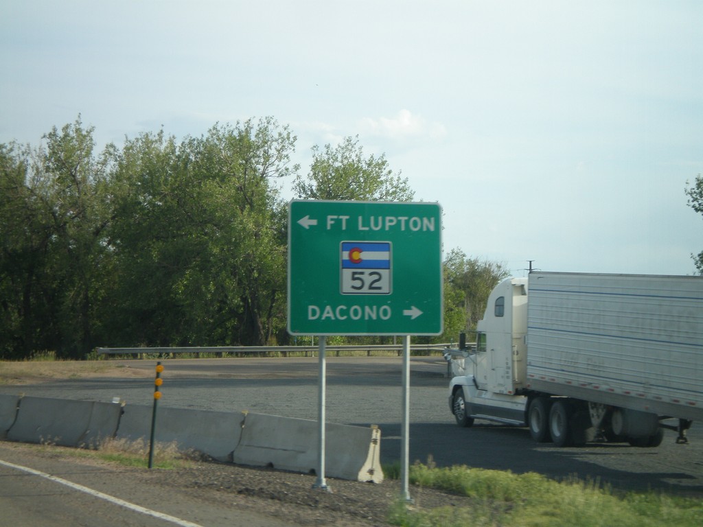
US-85 South at CO-52
US-85 south offramp at CO-52 to Fort Lupton and Dacono.
Taken 05-26-2007
 Fort Lupton
Weld County
Colorado
United States
Fort Lupton
Weld County
Colorado
United States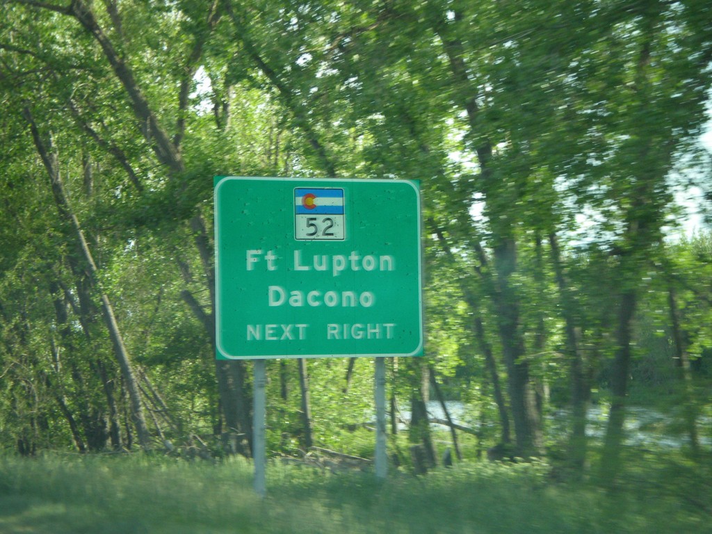
US-85 South Approaching CO-52
US-85 south approaching CO-52 to Fort Lupton and Dacono.
Taken 05-26-2007
Fort Lupton
Weld County
Colorado
United States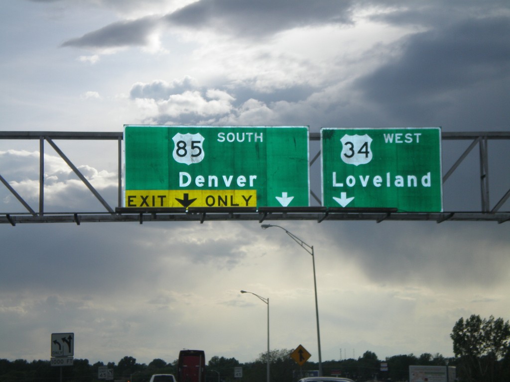
US-85 South at US-34
US-85 South to Denver at US-34 West to Loveland.
Taken 05-26-2007
 Garden City
Weld County
Colorado
United States
Garden City
Weld County
Colorado
United States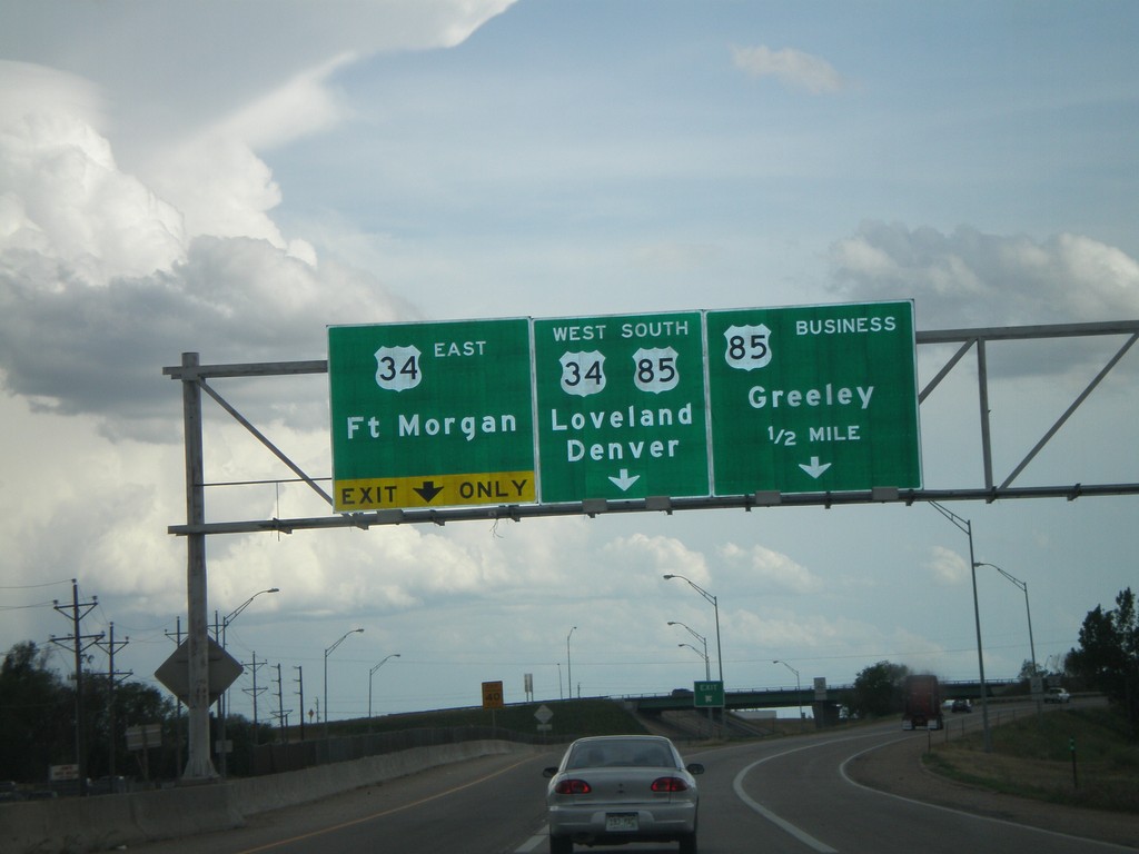
US-85 South Approaching US-85 Business and US-34
US-85 South/US-34 West to Loveland and Denver at US-34 east to Fort Morgan and Bus. US-85 North to Greeley.
Taken 05-26-2007
 Greeley
Weld County
Colorado
United States
Greeley
Weld County
Colorado
United States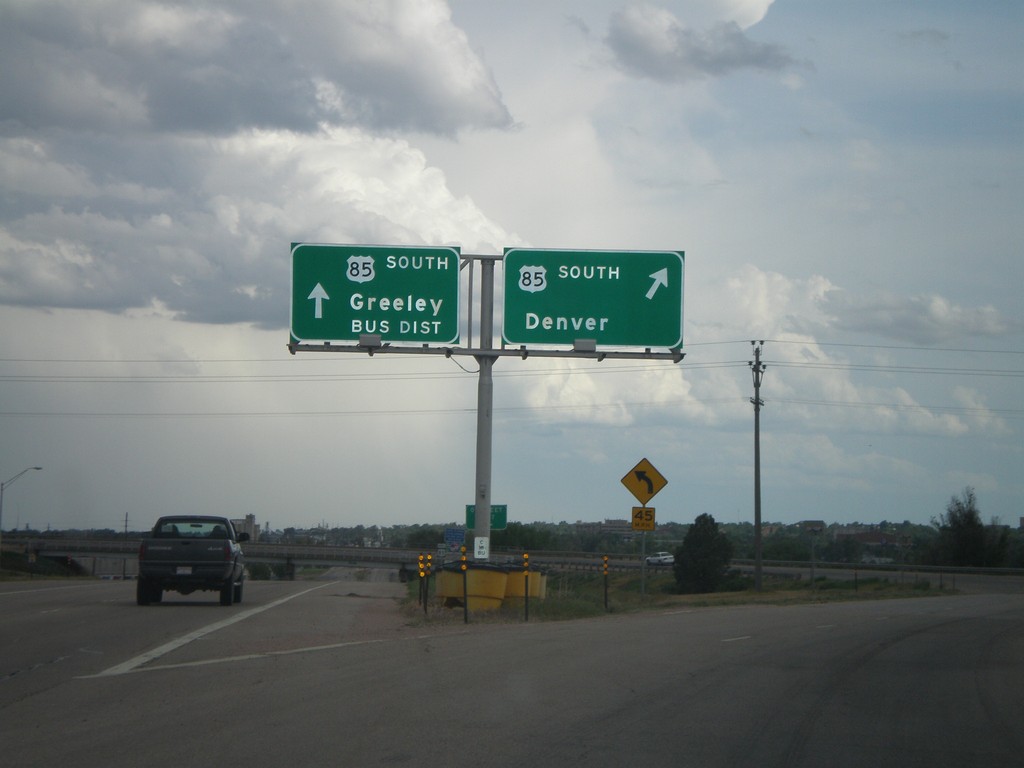
US-85 South at Greeley Bypass
US-85 south to Denver at Bus. US-85 south to Greeley.
Taken 05-26-2007
Greeley
Weld County
Colorado
United States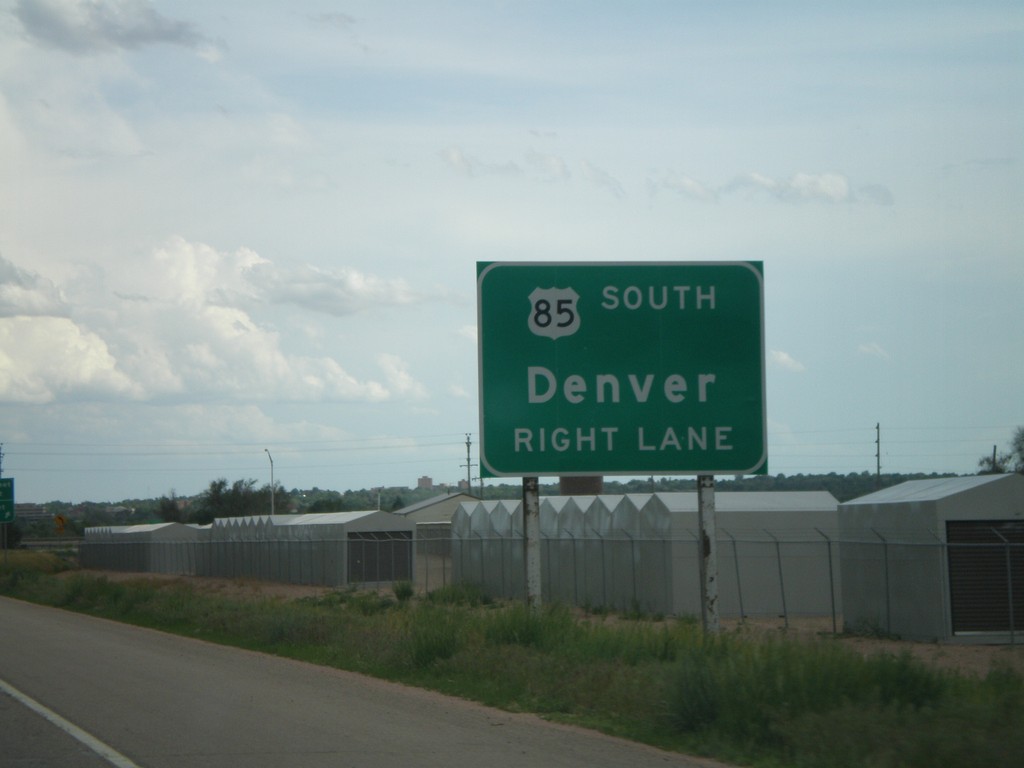
US-85 South Approaching Greeley Bypass
US-85 south at Bus. US-85 south approaching the Greeley Bypass.
Taken 05-26-2007
Greeley
Weld County
Colorado
United States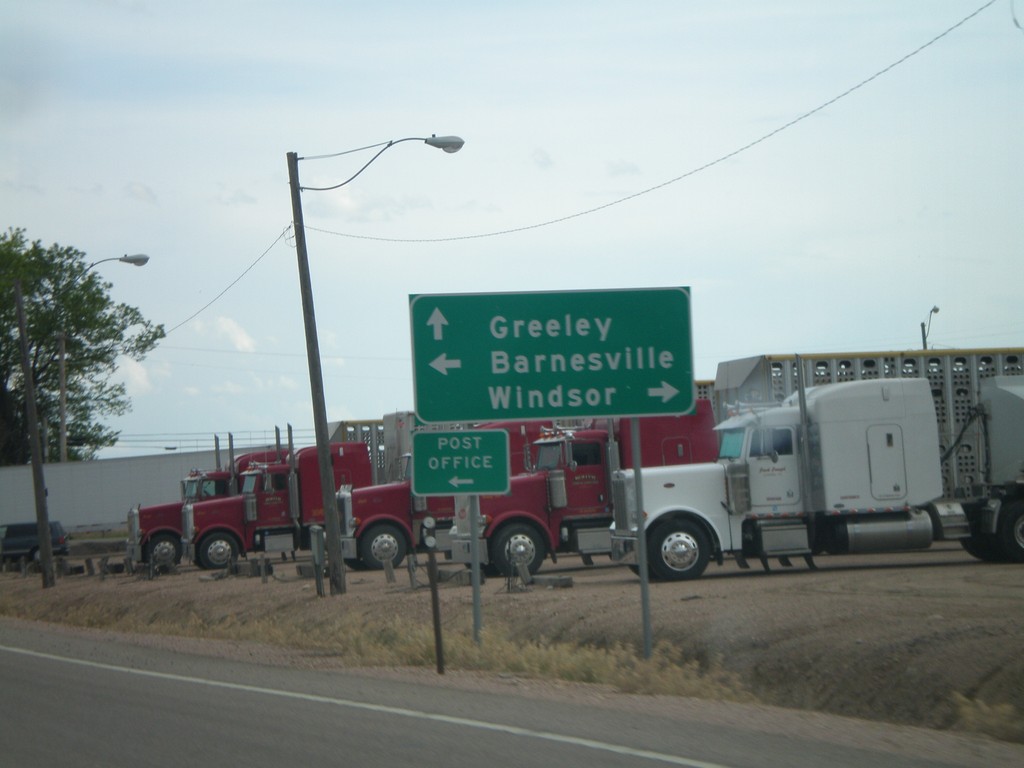
US-85 South Approaching CO-392
US-85 south approaching CO-392 to Barnesville and Windsor.
Taken 05-26-2007
 Lucerne
Weld County
Colorado
United States
Lucerne
Weld County
Colorado
United States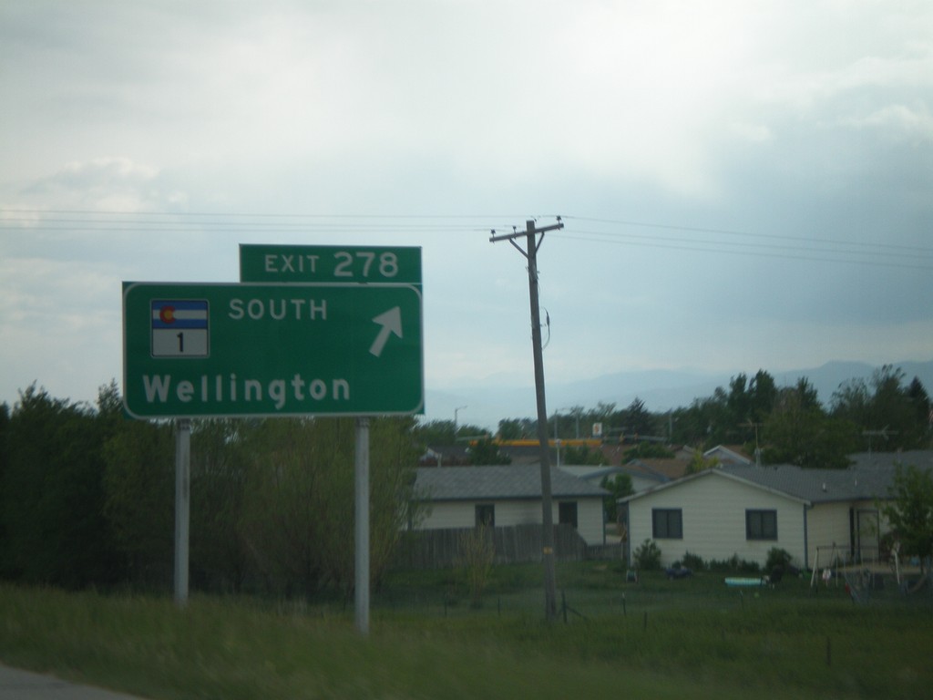
I-25 South - Exit 278
I-25 south at Exit 278, CO-1 South/Wellington.
Taken 05-26-2007
 Wellington
Larimer County
Colorado
United States
Wellington
Larimer County
Colorado
United States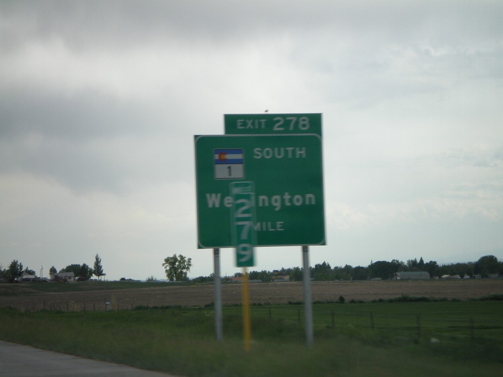
I-25 South - Exit 278
I-25 south approaching Exit 278, CO-1 South/Wellington, 1 mile.
Taken 05-26-2007
Wellington
Larimer County
Colorado
United States
I-25 North - Exit 288
I-25 north approaching Exit 288, Buckeye Road.
Taken 05-26-2007
Carr
Weld County
Colorado
United States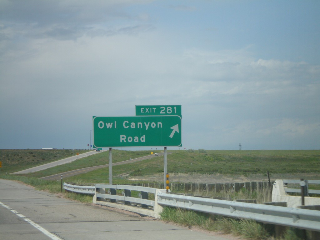
I-25 North - Exit 281
I-25 north at Exit 281, Owl Canyon Road.
Taken 05-26-2007
Wellington
Larimer County
Colorado
United States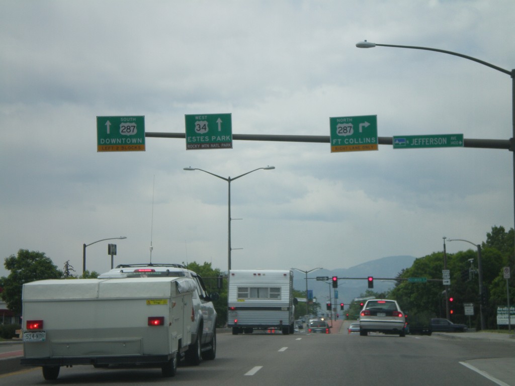
US-34 West at US-287
US-34 west at US-287 north to Fort Collins.
Taken 05-26-2007
 Loveland
Larimer County
Colorado
United States
Loveland
Larimer County
Colorado
United States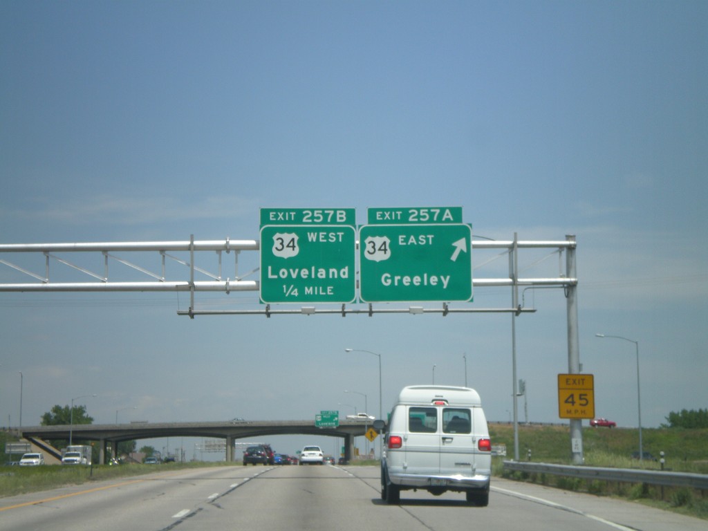
I-25 North - Exits 257A and 257B
I-25 north at Exit 257A, US-34 East/Greeley, approaching Exit 257B, US-34 West/Loveland.
Taken 05-26-2007
Johnstown
Larimer County
Colorado
United States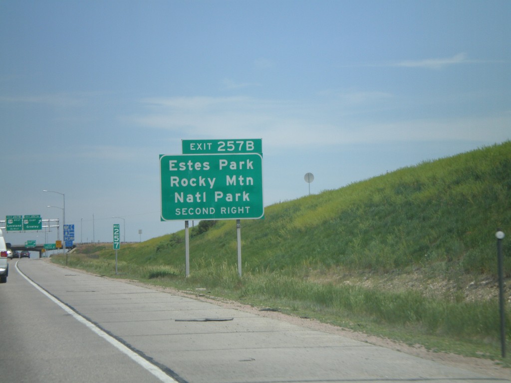
I-25 North - Exit 257B
I-25 north approaching Exit 257AB. Use Exit 257B (US-34 West) for Estes Park and Rocky Mountain National Park.
Taken 05-26-2007
Loveland
Larimer County
Colorado
United States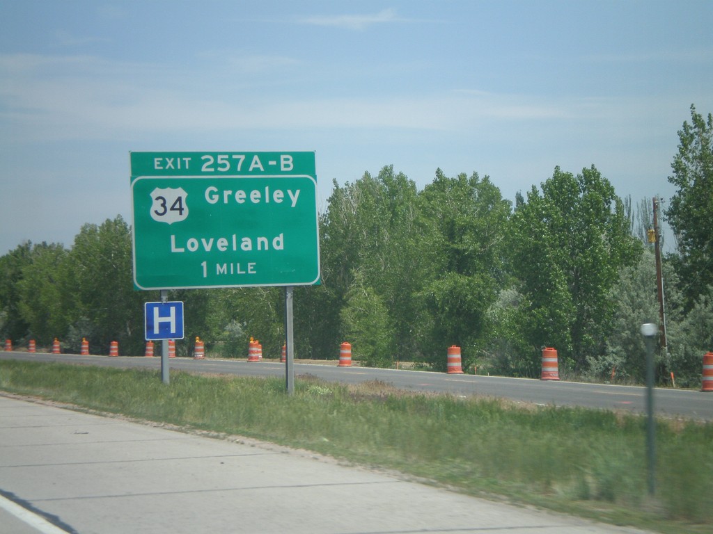
I-25 North - Exit 257A-B
I-25 north approaching Exit 257AB, US-34/Greeley/Loveland, 1 mile.
Taken 05-26-2007
Johnstown
Larimer County
Colorado
United States